Solar Grand Solar Minimum part deux

TxGal

Day by day
Well, this one is a little different from the Oppenheimer Ranch Project:

Cosmic Dust May Be The Cosmic Catastrophe KEY - How Does It Affect Our Planet’s Climate? Superflare? - YouTube

Cosmic Dust May Be The Cosmic Catastrophe KEY - How Does It Affect Our Planet’s Climate? Superflare?
2,503 views - Premiered 7 hours ago

View: https://youtu.be/ajS0jjlXFlo
Run time is 8:27

Synopsis provided:

Dust in ice cores leads to new knowledge on the advancement of the ice before the ice age. What the implications mean are discussed in this video. We may have found the super flare trigger! Dust in ice cores leads to new knowledge on the advancement of the ice before the ice age https://bit.ly/35Maxae
How much dust falls on Earth each year? https://bit.ly/35LnbGL
Be Glad You Don’t Have to Dust in Space! https://bit.ly/3qlTdT6
Dust from a giant asteroid crash caused an ancient ice age https://bit.ly/2UmZaTN
Dust from a giant asteroid crash caused an ancient ice age https://bit.ly/3xQAZLQ
Cosmic dust https://en.wikipedia.org/wiki/Cosmic_...
GETTING DUSTY IN THE NAME OF SCIENCE https://bit.ly/3zQwJ0N
Could Earth be fried by a ‘superflare’ from the sun? https://bit.ly/3d5eQ4v
Storm Warning: Solar Outburst Could Scramble Earth's Communications https://bit.ly/3qnXOEn
Novae and Supernovae https://bit.ly/2STbMSw
5,200 tons of space dust falls on Earth each year, study finds https://bit.ly/2SUl8NQ
What Dust From Space Tells Us About Ourselves https://bit.ly/3wU8AET
Cosmic Dust Analyzer (CDA) https://go.nasa.gov/3xNYQvP FULL HIGH RESOLUTION DATA SET
https://bit.ly/35OxgCM
 

TxGal

Day by day
Freezing Summer Lows Invade West Virginia, as "Dramatic" Cool-Down and "Polar Change" looms for New Zealand - Electroverse

1984-today-e1624522853795.jpg
Articles Extreme Weather GSM

FREEZING SUMMER LOWS INVADE WEST VIRGINIA, AS “DRAMATIC” COOL-DOWN AND “POLAR CHANGE” LOOMS FOR NEW ZEALAND
JUNE 24, 2021 CAP ALLON

The inhabitants of planet earth have been reduced to the status of slaves — and while this isn’t necessarily anything new, the unquestioning compliance to authority is still sickening to watch.

People are told they have no choice but to perform menial daily tasks (that they wouldn’t ordinarily chose to do) for a very limited monetary return of which as much as 70+ percent then gets handed over the rulers on high (in the form of taxes) — THIS IS NOT FREEDOM!

The fears of the masses are also being exploited, and their thoughts and subconscious manipulated.

As a whole, and despite all of our technological advancements, the world is more primitive today than it was in decades past. Scientific discovery, for example, was once progressing at a prodigious speed, but not anymore.

Science and technical advancements depend on the empirical habit of thought, which is struggling in today’s strictly regimented society of lockdowns, forced vaccinations, climate fear-mongering, and the tactical funding of specific research with the goal not to discover something new but to merely support an established narrative.

Catastrophic Anthropogenic Global Warming (CAGW), for example, isn’t a genuine threat to the human race — but if a populace isn’t weighed down with fear and the needlessly-tough struggles of daily life then they will inevitably find the free-time and inclination to educate themselves, not in the strict academic sense, because the facts of academia are forever changing, but in a way that is akin to personal enlightenment, or a state of wakefulness to what’s really going on around them.

Keeping the masses scared and preoccupied, and therefore stupefied, keeps the few on high in power.

If you are one of those that lose sleep over CAGW and/or you were first in line to get vaccinated, then you are one of the indoctrinated — your blind compliance to the illogical bleats of authority is harming our society, and you are complicit in the erosion of the few freedoms we have left.

It’s time you took the red pill.


SUMMER IN WEST VIRGINIA BRINGS FREEZING TEMPERATURES

The calendar may say summer but the thermometer and low humidity hinted at winter in the Canaan Valley, with its reading of 31F (-0.6C) on Wednesday — one of the coldest readings in the Lower 48 for the day.

It was a cool, crisp morning on the third full day of summer in Washington and across the Mid-Atlantic.

And 125 miles west of the nation’s capital, it felt actually like winter.

A weather station on the floor of Canaan Valley in West Virginia registered a morning low of 31F (-0.6C) — one of the instruments coldest June measurements ever.

Furthermore, a low of 57F (13.9C) was logged at Washington’s Reagan National Airport, while 49F (9.4C) was registered at Dulles International — the lowest temperature readings at those sites for the date in almost 3 decades (since 1992).

The heat in the west has been garnering mainstream attention, as their blatant obfuscation and support of the AGW party rolls on; but in reality, the majority of the North American continent has been suffering record-breaking COLD this week:


GFS 2m temp anomalies (C) for June 21 [tropicaltidbits.com].

The Guardian et al have been keenly running EOTW headline after EOTW headline as the far west broils; however, and as hinted at above, by completely sidestepping the record cold currently engulfing central and eastern regions, the MSM (lapdogs of the elites) are once again showing their true colors, blatantly conspiring to keep the masses in a perpetual state of “climate fear”.


Looking again at the weather models, these anomalous summer chills aren’t expected to lift anytime soon.

Below are the forecast temperature anomalies for Saturday, June 26:

June-26.png

GFS 2m temp anomalies (C) for June 26 [tropicaltidbits.com].

And here’s Sunday, June 27:

June-27.png

GFS 2m temp anomalies (C) for June 27 [tropicaltidbits.com].

Does this look like “catastrophic global warming” to you?

How about this:


“DRAMATIC” COOL-DOWN AND “POLAR CHANGE” LOOMS FOR NEW ZEALAND

New Zealand has just suffered its coldest night of 2021 — but this is “just a taster” of what’s to come, with forecasters warning of a “polar change” which is set to bring a “dramatic” temperature drop next week.

According to MetService data, Rotorua and Hamilton both dropped below the freezing mark on Thursday morning, while Taupo shivered through 1C, Napier saw 2C, while Gisborne and Whitianga logged lows of 3C.

Additionally, Ashburton, Timaru, Christchurch and Oamaru were all under 3C, simultaneously.

While the above mentioned lows were an impressive feat, Weather Watch is warning that they’re a mere a precursor for a polar southerly that’s “about to hack New Zealand’s temperatures back”.

“It may be warmer than average going into this weekend but the start of next week will be a very different story,” said head forecaster Philip Duncan.

“A southerly will move in on Monday and Tuesday from the polar region and will dramatically cut back daytime highs, especially in the south and east of both main islands.”

Duncan says he also expecting snow across the South Island, and highs of just 5-7C (41-44.6F) in towns and cities across the lower half of the country.

The surge of freezing air is set to arrive next week, with NIWA meteorologist Ben Noll warning that it will bring “snow to low levels and icy, strong southerly winds”.

Wrap up New Zealand.

Winter is here, and it’s setting up to be a doozy.

The COLD TIMES are returning, the mid-latitudes are REFREEZING, in line with the great conjunction, historically low solar activity, cloud-nucleating Cosmic Rays, and a meridional jet stream flow (among other forcings).

Both NOAA and NASA appear to agree, if you read between the lines, with NOAA saying we’re entering a ‘full-blown’ Grand Solar Minimum in the late-2020s, and NASA seeing this upcoming solar cycle (25) as “the weakest of the past 200 years”, with the agency correlating previous solar shutdowns to prolonged periods of global cooling here.

Furthermore, we can’t ignore the slew of new scientific papers stating the immense impact The Beaufort Gyre could have on the Gulf Stream, and therefore the climate overall.


Prepare accordinglylearn the facts, relocate if need be, and grow your own.
 

TxGal

Day by day
A Novel Look at Global Hurricane Data Reveals No Trend - Electroverse

c12345-e1624608195866.png

Articles

A NOVEL LOOK AT GLOBAL HURRICANE DATA REVEALS NO TREND
JUNE 25, 2021 CAP ALLON

Experienced data analyst, 10-year Wall Street veteran, and self-proclaimed “Mrs. Smarty Pants”, Zoe Phin of phzoe.com takes a look at the alarmists’ claim that “increasing CO2 emissions are leading to more frequent and intense hurricanes”.

Phin has already dealt with this re Atlantic hurricanes (linked here), and she found no trend.

Today, she analyzes the global data.
It is definitely true that the number of detected hurricanes has increased, writes Phin on her blog.
This is due to better sensing technology.

But aside from detection, there is also a matter of how one counts the frequency of hurricanes.

Does it make sense to count a 6-hour Category 3 storm the same as a 42-hour Category 3 storm?


“Storm 1” and “Storm 2” are bot classified as Category 3, but the Cat3 status is unequal in time.

No! It’s doesn’t make sense. Such a thing would be misleading. But that is exactly what climate alarmists do.

A better thing to do, continues Phin, would be to count the hours spent in certain wind speed categories.

And this is exactly what she did.

So, below are the results from the best hurricane data in the world.

[Note, 10yr CMA means 10-Year Centered Moving Average]

Category 1 is cyclic/no-trend:


Category 2 had increased, but dropped during the past 25 years:


Category 3 had increased, but dropped during the past 25 years; while Category 4 is cyclic/no-trend:

c4.png


And Category 5 has actually DECREASED:


Featured below is the combined data for category 1,2,3,4,5 hurricanes.

Overall, it reveals no trend — just natural, cyclic motions:


Zoe Phin’s results will come as no surprise to those privy to the actual data, rather than just the bleats of the IPCC and their propagandizing MSM lapdogs — and a host of other leading scientists have reached the same conclusions: that is, that hurricanes have not been getting stronger or more frequent.

For example, here’s Klotzbach et al (2018):


And here’s NOAA’s Dr. Ryan Maue, who cites Dr. Roger Pielke Jr. re global cyclone activity since 1970:


The alarmists’ claim is that greenhouse gases create more energy for hurricanes, writes Phin.

Well, she asks, where exactly is all that extra energy for hurricanes?


The COLD TIMES are returning, the mid-latitudes are REFREEZING, in line with the great conjunction, historically low solar activity, cloud-nucleating Cosmic Rays, and a meridional jet stream flow (among other forcings).

Both NOAA and NASA appear to agree, if you read between the lines, with NOAA saying we’re entering a ‘full-blown’ Grand Solar Minimum in the late-2020s, and NASA seeing this upcoming solar cycle (25) as “the weakest of the past 200 years”, with the agency correlating previous solar shutdowns to prolonged periods of global cooling here.

Furthermore, we can’t ignore the slew of new scientific papers stating the immense impact The Beaufort Gyre could have on the Gulf Stream, and therefore the climate overall.


Prepare accordinglylearn the facts, relocate if need be, and grow your own.
 

TxGal

Day by day
Yesterday, Greenland GAINED a Record-Breaking Amount of Snow and Ice - Electroverse

SMB_curves_LA_EN_20210624-1.png

Articles Extreme Weather GSM

YESTERDAY, GREENLAND GAINED A RECORD-BREAKING AMOUNT OF SNOW AND ICE
JUNE 25, 2021 CAP ALLON

Following on from late-May’s historic SMB gains, Greenland has now posted huge GROWTH during a time when it would ordinarily be losing snow and ice.

Looking below at the official numbers, courtesy of the Danish Meteorological Institute (DMI), it is revealed that single day gains of 4 gigatons were logged yesterday, June 24 — astonishing for the time of year: never before in recorded history has Greenland GAINED this much snow and ice this late into the season.


[DMI]

Using the daily output from a weather forecasting model, combined with a model that calculates the melt of snow and ice, the DMI calculate the “surface mass budget” (SMB) of the ice sheet.

Crucial to the survival of a glacier is its SMB, which is the difference between accumulation and ablation (sublimation and melting). The budget takes into account the balance between snow that is added to the ice sheet vs melting snow and glacier ice that runs off into the ocean.

The budget is totaled over the course of a season, from September 1 to August 31.

Last season’s SMB totaled 349bn tonnes, which was “normal,” according to the DMI.

Changes in this mass-balance control a glacier’s long-term behavior, and are its most sensitive climate indicators.

Ice sheets can also lose ice by the breaking off (aka “calving”) of icebergs from its edge, but that is not included in this type of budget. Calving events usually occur when an ice sheet is expanding, not shrinking. In addition, an icebergs that breaks off a glacier aren’t “lost” to the ocean, they continue existing like some island extension of the sheet.

On the back of substantial SMB gains over the past few years, the Greenland Ice Sheet looks set to continue that trend in 2021. And despite decades of doom-and-gloom prophecies, the sheet is currently GAINING record-smashing amounts of “mass” — a whopping 4 gigatons yesterday alone (June 24, 2021).

An accumulation this large has never been documented at this time of year–at least not since DMI records began back in 1981. Growth of this magnitude would be considered healthy in November through February, let alone in late-June.

According to climate alarmists, the Greenland ice sheet should have melted into oblivion by now.

Yet here we are, posting record-breaking GAINS:


[DMI]

Since September, 2020 –the official start of the season– SMB spikes above the 2/2.5 gigaton daily average have been a regular occurrence.

Spikes above 5 Gts mark have also been commonplace.

Back in early-November, the sheet gained a whopping 10 Gts in a single day.

And then we have late-May’s historic, off-the-charts accumulation of 12+ Gts:


This season’s gains continue the impressive growth trend witnessed since 2016 (which coincides with the cooling of Earth’s terrestrial temperature):

2016-17
For the 2016-17 SMB season, the Greenland ice sheet gained 544 billion tonnes of ice (compared to the 1981-2010 average of 368bn tonnes) .

This is the fifth highest in books dating back to 1981 (with the highest being the 619bn tonnes gained in 1995-96 — solar minimum of cycle 22).

2017-18:
The DMI calculated a total SMB of 517bn tonnes for the 201-18 season.

This is almost 150bn tonnes above the 1981-2010 average, and puts it just behind the 2016-17 season as the sixth highest on record (by contrast, the lowest SMB in the record was 2011-2012 with just 38bn tonnes).

2018-19 + 2019-20:
DMI estimates that the surface of the ice sheet gained 169bn tonnes during 2018-19.

And while this is on the low end, it still falls within the 1981-2010 average–and comfortably above 2011-12’s paltry 38bn tonnes.

The 2019-20 SMB lookes to have reversed the lower gains of 2018-19, with 349bn tonnes added to the sheet.

These were levels very close to the 1981-2010 average of 368bn tonnes.

The DMI described the year as “normal,” and the gains look to have gotten things back on track to the post 2016 trend of growth.

Also note: the period 2003-2011 saw ice sheet losses on Greenland average 234bn tonnes each year. Since then though, the tide has clearly turned, the trend is changing to one of growth: climate is cyclic, after all — never linear.

NORTHERN HEMISPHERE SNOW MASS

Furthermore, the Total Snow Mass for the Northern Hemisphere chart (shown below) reveals that accumulating snow continued to track well-above the 1982-2012 average this season.

At its peak (early-March) northern hemisphere snow was sitting at some 500+ gigatons above the norm (another “impossible” real-world reality according to the IPCC: “Milder winter temperatures will decrease heavy snowstorms”).


[FMI]

This is how glaciers form.

This is how ice ages begin.

Ocean currents are also stalling.

This all points to cooler times ahead.

Don’t say you weren’t warned.

The COLD TIMES are returning, the mid-latitudes are REFREEZING, in line with the great conjunction, historically low solar activity, cloud-nucleating Cosmic Rays, and a meridional jet stream flow (among other forcings).

Both NOAA and NASA appear to agree, if you read between the lines, with NOAA saying we’re entering a ‘full-blown’ Grand Solar Minimum in the late-2020s, and NASA seeing this upcoming solar cycle (25) as “the weakest of the past 200 years”, with the agency correlating previous solar shutdowns to prolonged periods of global cooling here.

Furthermore, we can’t ignore the slew of new scientific papers stating the immense impact The Beaufort Gyre could have on the Gulf Stream, and therefore the climate overall.


Prepare accordinglylearn the facts, relocate if need be, and grow your own.
 

TxGal

Day by day
The Oppeneheimer Ranch Project has a new podcast out:

Monsoon Arrives Early - Record Hailstone - Miami Condo Collapse Mystery - Ancient Human Discoveries - YouTube

Monsoon Arrives Early - Record Hailstone - Miami Condo Collapse Mystery - Ancient Human Discoveries
3,995 views
Premiered 7 hours ago

View: https://youtu.be/f7mo0HrTOzo
Run time is 20:43

Synopsis provided:

South Texas April hailstorm sets record for largest hailstone in the state https://bit.ly/2SZHIVl
'Tornado Alley' is expanding: Southern states = more twisters than before https://bit.ly/3gVxqP2
Severe weather sweeps Plains, Midwest as heat builds again in West https://fxn.ws/3h9SvE7
Edmonton activates extreme weather response for historic heat wave https://bit.ly/3qs0j8x
What is a heat dome? Deadly hot weather descends on Pacific Northwest https://on.natgeo.com/3xVnY3P
Zonal vs Meridional Flow http://bit.ly/2AQEWop
Dangerous Heatwave in the West; Severe Weather and Flooding in the Southern Plains to the Great Lakes https://www.weather.gov/
Total Accumulated Precipitation https://bit.ly/2T5UC3S
Collapsed Miami condo had been sinking into Earth as early as the 1990s, researchers say https://bit.ly/35U8nWk
Surfside condo had been sinking since 1990s, FIU professor says https://bit.ly/2UGnm3R
Earth’s Mantle Provides New Clues To Explain Indonesia’s Explosive Volcanoes https://bit.ly/3gYVHna
Worldwide Volcano News https://bit.ly/3y58XgJ Solar Science Here https://www.solarham.net/
and more
 

TxGal

Day by day
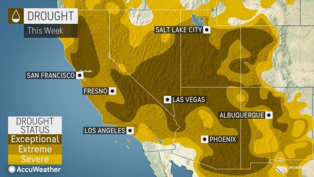
Another Bogus Climate Report blames Global 'Cooling' on Global 'Warming' - Electroverse

ozone-sun.jpg

Articles Extreme Weather GSM Volcanic & Seismic Activity

ANOTHER BOGUS CLIMATE REPORT BLAMES GLOBAL ‘COOLING’ ON GLOBAL ‘WARMING’
JUNE 26, 2021 CAP ALLON

Despite a ban on ozone depleting gases –such as CFC and HCFC refrigerants, and recent reports that the ozone hole is diminishing– a new study from an international team of scientists claims that global warming is leading to greater ozone losses.

The research argues that extremely low winter temperatures high in the atmosphere over the Arctic are becoming more frequent and more extreme because of climate patterns associated with global warming.

In a perfect example of what George Orwell called Doublethink the AGW party is claiming that global ‘warming’ can also mean global ‘cooling’ — i.e. that your CO2 emissions (i.e. your existence) are responsible for ALL things climate; even the stark cooling we’ve witnessed since 2016.

The paper goes on, stating that these extreme low temperatures are said to be causing reactions with the remaining ozone depleting chemicals and leading to greater ozone losses.


The new study by UMD, the Alfred Wegener Institute’s Helmholtz Centre for Polar and Marine Research, and the Finnish Meteorological Institute has been published in the journal Nature Communications.

Ross Salawitch, professor in the UMD Department of Atmospheric and Oceanic Science, the Department of Chemistry and Biochemistry, and the Earth System Science Interdisciplinary Center, said: “We’re in a kind of race between the slow and steady decline in CFCs, which take 50 to 100 years to go away, and climate change, which is causing polar vortex temperature extremes to become colder at a rapid pace.

“The increasingly cold temperatures, Salawitch continues, “create conditions that promote ozone depletion by CFCs. So, even though these compounds are slowly going away, Arctic ozone depletion is on the rise as the climate changes.”

New data from the study showed the coldest Arctic polar vortex temperatures and the highest ozone losses on record in 2020, beating the previous records set nine years ago in 2011 (some sort of solar minimum correlation is highly likely here–not that the researches dare touch the possibility that a natural phenomenon could be behind their findings).

According to these scientists, the chlorine is normally non-reactive within the Arctic polar vortex but clouds provide the right conditions for the chlorine to change form and react with bromine and sunlight to destroy ozone.

The story is similar above the Antarctic, too.

The European Union’s Earth observation program announced at the end of 2020 that the ozone hole over Antarctica had swelled to its largest size and deepest level in at least 15 years, to become among the most notable ever recorded.

Clare Nullis, of the warm-mongering WMO, explains that the ozone hole begins to expand every August –at the start of the Antarctic spring– and reaches a peak around October.

“The air has been below minus 78 degrees Celsius, and this is the temperature which you need to form stratospheric clouds — and this is quite a complex process,” said Nullis at a U.N. briefing in October, 2020. “The ice in these clouds triggers a reaction which then can destroy the ozone. So, it’s because of that that we are seeing the big ozone hole this year.”

But these findings contradict the absurd consensus that global warming is causing the global cooling, and again they go against the so-called ‘science’ behind the international accord (the Montreal Protocol) devised to phase out those ozone-depleting substances (OSDs)–such as CFC and HCFC refrigerants .

OSDs have been on the decline since their peak in 2000 (shown below), and the holes growing above the poles a full 2+ decades later shows the correlation between OSDs and ozone isn’t there. It simply doesn’t play that reduced OSDs are all of a sudden having an unprecedented impact on the ozone layer. No, the mechanism here appears to be natural, and likely associated in some way with the historically low solar activity Earth has been receiving over the past decade+.


Past and predicted levels of controlled gases in the Antarctic atmosphere, quoted as equivalent effective stratospheric chlorine (EESC) levels, a measure of their contribution to stratospheric ozone depletion.

These findings also confirm what NASA has been saying for years — that the upper atmosphere is cooling:


The formation of stratospheric ozone is initiated by ultraviolet (UV) radiation coming from the Sun.

As a result, an increase in the Sun’s radiation output increases the amount of ozone in Earth’s atmosphere.

The Sun’s radiation output and sunspot number vary over the well-documented 11-year solar cycle. Observations over several solar cycles since the 1960s show that global total ozone levels vary by 1 to 2% between the maximum and minimum of a typical cycle.

However, ‘global’ total ozone levels aren’t necessarily what we’re interested in here. Evidence suggests that ozone depletion during times of low solar activity is far greater above the poles than elsewhere on the planet. This is a phenomenon we’re seeing today, at both the Antarctic and Arctic.

This could well be the true cause of Polar Amplification.

Climate alarmists of course love to claim that CO2 is disproportionately warming the Arctic, but they have no agreed-upon mechanism as to how this could occur.

It is fantasy.

On the other hand, a positive correlation between decreasing solar activity and ozone depletion above the Arctic fits very well, as does the negative correlation between ozone depletion and rising surface temps.

There is another key forcing to factor into all this, and that is volcanic eruptions.

Explosive volcanic eruptions inject sulfur gases directly into the stratosphere, causing new sulfate particles to be formed. The particles initially form in the stratosphere downwind of the volcano and then spread throughout the hemisphere or globally as air is transported by stratospheric winds.

One method of detecting the presence of volcanic particles in the stratosphere uses observations of the transmission of solar radiation through the atmosphere. When large amounts of new particles are formed in the stratosphere over an extensive region, solar transmission is measurably reduced (as are terrestrial temperatures).

The eruptions of Mt. Agung (1963), El Chichón (1982), and Mt. Pinatubo (1991) are the most recent sizable examples of sulfur injections that temporarily reduced solar transmission. Chile’s Calbuco volcanic eruption (2015) is another– this stratospheric injection played a role in enhancing the size of the ozone hole back in 2015:


Average ozone concentrations over the southern hemisphere during October 1-15, 2015, when the Antarctic ozone hole for that year was near its maximum extent. The red line shows the boundary of the ozone hole.

At its maximum size, the 2015 hole was the fourth-largest ever observed. It was in the top 15% in terms of the total amount of ozone destroyed. Only 2006, 1998, 2001 and 1999 had more ozone destruction, whereas other recent years (2013, 2014 and 2016) ranked near the middle of the observed range.

2020’s hole appears even larger that 2015’s, clear indication that factors other than ODSs are key to ozone depletion above the poles — namely, surprise-surprise, solar and volcanic activity.

Unfortunately, the U.N. and its fraudulent little offshoot –the WMO– remains chained to the Montreal Protocol.

Clare Nullis concludes that despite these expanding holes, experts still believe the ozone layer is slowly recovering after adoption of the accord in 1987, and she urges nations to stick to the measures, citing climate projections that indicate that the ozone layer will return to 1980 levels in 2060.


They must think we’re idiots; but I worry, as a collective, that we are.


“If you want a picture of the future, imagine a boot stamping on a human face—for ever.”
George Orwell, 1984

Enjoy your weekend!

BONUS: RECORD-BREAKING “POLAR BLAST” ON COURSE FOR NEW ZEALAND

New Zealand’s chill of winter is set to truly arrive over the next few days, as a “polar blast” invades the nation of the back of weak and wavy meridional jet stream flow.

The big freeze will arrive this weekend with conditions deteriorating further Monday through Wednesday.

Record breaking lows and snows are expected to impact both islands.


“Snow is possible to sea level in parts of Southland, Fiordland and Otago, with heavy snow on the ranges and hilltops,” reads a recent WeatherWatch statement.

“Wind chill may be the main problem for many southern farmers, with livestock exposed to sub-zero daytime temperatures in the wind around Southland and Otago and potentially Canterbury’s high country.”

The snow won’t be restricted to the just South Island, reports nzherald.co.nz, with Waiouru, the Desert Rd, Ohakune, Taihape and National Park also set to receive anomalous accumulations of global warming goodness.

Areas spared from the snow should still brace for potentially record-breaking low temperatures.

“Both islands are impacted by the cold, starting Monday in Southland and peaking in Northland by Wednesday morning,” continues the WeatherWatch forecast, with the mercury in the central North Island predicted to plunge to below -6C (21.2F) Tuesday night — an astonishing feat, particularly given that winter is just getting started.

Stay tuned for updates.

The COLD TIMES are returning, the mid-latitudes are REFREEZING, in line with the great conjunction, historically low solar activity, cloud-nucleating Cosmic Rays, and a meridional jet stream flow (among other forcings).

Both NOAA and NASA appear to agree, if you read between the lines, with NOAA saying we’re entering a ‘full-blown’ Grand Solar Minimum in the late-2020s, and NASA seeing this upcoming solar cycle (25) as “the weakest of the past 200 years”, with the agency correlating previous solar shutdowns to prolonged periods of global cooling here.

Furthermore, we can’t ignore the slew of new scientific papers stating the immense impact The Beaufort Gyre could have on the Gulf Stream, and therefore the climate overall.


Prepare accordinglylearn the facts, relocate if need be, and grow your own.
 

TxGal

Day by day
Our Beloved Friend and Author - Ice Age Now

Our Beloved Friend and Author
June 26, 2021 by Dan Hammer

It is with a heavy heart that I must make this post. I just learned that our friend Robert Felix has passed away on June 10th. He was a great friend and brought so many of us together. Nothing that I can write here will be able to do justice to the person that has been part of our lives for so many years. I am thankful that I was able to meet him and his wife over the Memorial Day weekend. Please take a moment to share your memories of our friend and I will do my best to get the comments approved for everyone to see. Thank you so much for being part of this site over the years. I know Robert enjoyed being able to share this thoughts and communicate with everyone here.

RIP my friend. I will miss you.
Sincerely,

Dan – Your long time friend and site admin.

06/26/2021 9:25PM CDT: I will attempt to reach out to Robert’s wife to find out what his wishes were for the site. I do have the ability to keep the site running if that is the wish. Also, until I can speak with her, I have disabled the ordering of products from the store that require shipping. I have left the two digital products online.
 

TxGal

Day by day
Adapt 2030 has a new podcast out:

Against All Odds - YouTube

Against All Odds
8,419 views
Jun 26, 2021

View: https://youtu.be/fE3_x5K9QOw
Run time is 13:21

Synopsis provided:

Agricultural prices continue upward with no signs of slowing, even periphery crops like sunflower are nearing double pricing. More volcanic eruptions adding more particulates into the atmosphere and the strongest tornado ever recorded in the Czech Republic. To feed our world moving forward will be against all odds.
 

TxGal

Day by day
Was a Solar Storm to blame for THOUSANDS of UK Racing Pigeons "Vanishing into Thin Air" last Weekend? - Electroverse

pigeons-e1624869259108.jpg

Articles GSM

WAS A SOLAR STORM TO BLAME FOR THOUSANDS OF UK RACING PIGEONS “VANISHING INTO THIN AIR” LAST WEEKEND?
JUNE 28, 2021 CAP ALLON

Bird handlers are devastated after THOUSANDS of homing pigeons vanished into thin air during a race across the UK.

Some 9,000 set off from Peterborough, Cambs, on Saturday on a journey to the North East that should take no more than three hours — but over half were still missing as by the time night drew in.

“We’ve seen one of the very worst ever racing days in our history,” pigeon hobbyist Richard Sayers wrote in a Facebook post after approx. 5,000 of the Peterborough racing birds failed to make the 170-mile round-trip flight.

The avian competitors, part of 250,000 pigeons released in approximately 50 racing events across Britain last weekend, remain unaccounted for. In fact, of the 250,000 only 10% returned on time, and tens of thousands have been reported missing across the country.


Ian Evans, of the Royal Pigeon Racing Association, said: “We became aware quite quickly that something very unusual was happening.

“I have never heard of anything like this.

“On the face of it the weather conditions were good. But in the event, thousands of birds simply didn’t return. Something happened that disrupted their navigational abilities. We believe it may have had something to do with solar wind activity.”

The Association is holding urgent talks with the UK Met Office to obtain reports on any unusual solar activity

Richard Sayers and his fellow Peterborough bird-racing enthusiasts came to the same conclusion: “Most of the breeders I’m talking to are blaming the atmospheric conditions — possibly a solar storm above the clouds that created static in the atmosphere — but no one really knows.”

While a solar storm would indeed be possible of creating electrical disturbances throughout the atmosphere, including to the geomagnetic field that these birds use to navigate, there haven’t been any storms of late.

In fact, the sun has been oddly quiet in recent weeks — solar wind fluctuations have been small, and any CME’s that have been fired-off have missed earth.

However, Evans and Sayers were on the right track.

Earth’s magnetosphere is losing strength. This is due to 1) an ongoing magnetic excursion/reversal, and 2) the historically low solar activity we’re seeing — as a result of these two factors, our planet’s magnetic poles are wandering which, in turn, is throwing-off the onboard navigation systems of certain animals.

Increased lightening and changing animal behavior are some of the key indications we laymen can see on the ground –given that the official pol shit/field strength data is largely hidden, and only released, at best, every 4 or 5 years– and another example of this concerns the beach Tasmanian pilot whales of 2020 (linked below).

Earth’s magnetic field is failing as we race towards the next geomagnetic excursion.


Evans added that the losses weren’t just been confined to the UK: “We’ve had reports of heavy losses in Portugal and in Belgium as well … We are obviously hoping that the majority of these birds find their way home given time.”

SIGNS OF THE POLE SHIFT

Since 1850 Earth’s magnetic field has been weakening. At the turn of the millennium it then began reducing exponentially, at more than 10% per decade — this drop off is extreme and concerning, and here’s why.

Earth’s magnetic field protects us from space radiation. Our shields going down is very bad news for all life on our planet, and could possibly even lead to the next mass extinction.

For the past 100-or-so years, both north and south poles have been rapidly headed towards the equator (shown below), and their pace is increasing: The south pole is now off the Antarctic continent and making a beeline for Indonesia, and the north pole is shifting across the Arctic circle towards Siberia–it too headed for Indonesia, where the pair are likely to meet within the next few years/few decades.

This “meeting” will lead to one of two eventualities: 1) a full flip will take place (aka a “reversal” where the magnetic poles switch places), or 2) a “snap-back” will occur where the poles quickly return to their original starting points (aka an “excursion”).

View: https://youtu.be/mhYdYD2CsnA
Run time is 0:20

However, it is not the shifting poles that will cause the main problem–though it is certainly one of the problems.

No, the biggest concern is the waning magnetosphere that comes as a result of a pole shift.

As the magnetic field weakens on Earth more cosmic radiation enter the planet’s atmosphere–and not only cosmic rays, but the entire broad spectrum of radiation is increasing.

It is during times of solar minimum that we see maximum cosmic radiation bombarding the planet, and given that we’ve recently suffered the deepest solar minimum of the past 100+ years, this too has contributed to diminution of the magnetic field, and so confusion to the onboard navigation systems of certain animals.

Also, notice this summer, when just standing in the sun for even a few minutes — it is hellish.

That’s because we’re of the historically low solar activity we’re experiencing in combination with a reduced magnetic field. You’re feeling the effects of that influx of radiation on your skin — and, unfortunately, this is only set to increase for the rest of our lives–or until the reversal/excursion takes place.

View: https://youtu.be/rxo6L255Pp0
Run time is 0:09

Magnetic excursions and full-blown reversals have been responsible for some of the largest mass extinctions on the planet, including the Younger Dryas event which eliminated up to 65% of the world’s megafauna.

This modern magnetic excursion/reversal is going to continue as the the sun also slips into its next grand minima cycle. These two events occurring simultaneously are unlikely to be coincidental, and they will accentuate the rush towards the next ice age.

Many scientists have been wondering what transpires to kick-off the ice age cycle. Well, we’re likely looking at it: the poles are rapidly shifting, as the Earth’s magnetic shield is weakening, plus we’re entering a Grand Solar Minimum.

Cycles upon cycles are aligning.

We all appear be living through the commencement of the next Cosmic Catastrophe here on Earth.


Prepare accordinglylearn the facts, relocate if need be, and grow your own.
 

TxGal

Day by day
Heavy Snow Hits New Zealand, as Antarctic Air "Opens the Freezer Door" to much of the Southern Hemisphere - Electroverse

NZ-snow-June-28-e1624875123806.jpg

Extreme Weather GSM

HEAVY SNOW HITS NEW ZEALAND, AS ANTARCTIC AIR “OPENS THE FREEZER DOOR” TO MUCH OF THE SOUTHERN HEMISPHERE
JUNE 28, 2021 CAP ALLON

The MSM continues to both cherry-pick the few regions of the world experiencing anomalous heat AND sidestep the brutal cold and snow sweeping nations such as New Zealand and Argentina. These corrupted lapdogs of the elites are also ignoring Earth’s overall temp –if such a thing can be calculated– which, according to official datasets, has been lingering at and often a bit below the multidecadal average ALL YEAR.

Headlines such as “global warming is scary” –posted by newsnetnebraska.org on June 27– are ill-informed bandwagon jumping-at best, and agenda-driving propaganda-at worst.

Our planet is cooling.

This is a fact.

Global warming is a Brothers Grimm fairy tale.

ALL Air New Zealand flights in and out of the country’s southernmost airports –including Queenstown– have been cancelled as a “polar blast” threatens to engulf the entire Pacific island nation.

Twenty-six flights had so far been cancelled over the coming two days, reports nzherald.co.nz, with the airline now working through recovery flights for stranded passengers.

A heavy snow watch is in force for two-thirds of New Zealand, stretching from the deep south to the center of the North Island, with the worst set to hit late-Monday through Tuesday.

View: https://twitter.com/MetServiceWARN/status/1409283116166955012


A southern Otago highway is already closed due to heavy snow with motorists being told to find another route.

While ‘road snowfall warnings’ are now in place for the Napier-Taupo Rd, Desert Rd and Remutaka Hill Rd in the north along with a number of alpine passes in the south.


Image

MetService has said the cold front will sweep northwards up the country through Monday, opening the freezer door to all of New Zealand — the mercury is already nosediving as Antarctic air touches down in the south, which is bringing snow to sea level and powerful winds packed with a -20C (-4F) windchill.

The Service added that the severe gales bringing bitterly cold conditions across much of the South Island will cause stress to livestock, and that thick settling snow is expected to compound the misery.

Snow on the Crown Range summit on Monday morning. Photo / George Heard
Snow on the Crown Range summit on Monday morning [George Heard].

NIWA Weather is also warning of the potentially record-breaking shot of polar cold, confirming in a statement that temperatures will indeed plummet to -20C (-4F).

The agency’s principal scientist Chris Brandolino said there will be a “big punch of cold air” from the heart of the icy continent with the South Island bearing the brunt of the storm, conditions which he described as “brutal”.

View: https://twitter.com/NiwaWeather/status/1409235081470697475


Even Wellington, the nation’s capital, will experience negative wind chills of around -5C (23F) on Tuesday.

While the freeze will persist well into the week, with hard frosts forecast in Auckland on Wednesday.

Brutal Antarctica air is currently blasting the South American continent, too.

Following on from the past few week’s of historic cold and snow, further polar outbreaks have ridden unusually-far north on the back of a low solar activity-induced meridional jet stream flow, and are sweeping the South American nations of Argentina, Chile, Paraguay, Uruguay, Bolivia, Brazil and Peru.

Looking at the latest GFS run, these polar outbreaks won’t abate anytime soon:

gfs_T2ma_samer_fh6-78.gif

GFS 2m Temp Anomalies (C) for June 28 – July 1 [tropicaltidbits.com].

And below is a wider look at those polar air masses escaping the Antarctic continent:


GFS 2m Temp Anomalies (C) for June 28 [tropicaltidbits.com].

This is the ‘catastrophic global warming’ the obfuscating MSM is drumming on about — they are extrapolating the pocket of “oranges” and “reds” located in the Western US as being indicative of the rest of the planet; when in reality, record COLD is engulfing the majority of the CONUS, all of New Zealand, and much of South America–to name just three locales.


The COLD TIMES are returning, the mid-latitudes are REFREEZING, in line with the great conjunction, historically low solar activity, cloud-nucleating Cosmic Rays, and a meridional jet stream flow (among other forcings).

Both NOAA and NASA appear to agree, if you read between the lines, with NOAA saying we’re entering a ‘full-blown’ Grand Solar Minimum in the late-2020s, and NASA seeing this upcoming solar cycle (25) as “the weakest of the past 200 years”, with the agency correlating previous solar shutdowns to prolonged periods of global cooling here.

Furthermore, we can’t ignore the slew of new scientific papers stating the immense impact The Beaufort Gyre could have on the Gulf Stream, and therefore the climate overall.


Prepare accordinglylearn the facts, relocate if need be, and grow your own.
 

Publius

TB Fanatic
Freezing Summer Lows Invade West Virginia, as "Dramatic" Cool-Down and "Polar Change" looms for New Zealand - Electroverse

1984-today-e1624522853795.jpg
Articles Extreme Weather GSM

FREEZING SUMMER LOWS INVADE WEST VIRGINIA, AS “DRAMATIC” COOL-DOWN AND “POLAR CHANGE” LOOMS FOR NEW ZEALAND
JUNE 24, 2021 CAP ALLON

The inhabitants of planet earth have been reduced to the status of slaves — and while this isn’t necessarily anything new, the unquestioning compliance to authority is still sickening to watch.

People are told they have no choice but to perform menial daily tasks (that they wouldn’t ordinarily chose to do) for a very limited monetary return of which as much as 70+ percent then gets handed over the rulers on high (in the form of taxes) — THIS IS NOT FREEDOM!

The fears of the masses are also being exploited, and their thoughts and subconscious manipulated.

As a whole, and despite all of our technological advancements, the world is more primitive today than it was in decades past. Scientific discovery, for example, was once progressing at a prodigious speed, but not anymore.

Science and technical advancements depend on the empirical habit of thought, which is struggling in today’s strictly regimented society of lockdowns, forced vaccinations, climate fear-mongering, and the tactical funding of specific research with the goal not to discover something new but to merely support an established narrative.

Catastrophic Anthropogenic Global Warming (CAGW), for example, isn’t a genuine threat to the human race — but if a populace isn’t weighed down with fear and the needlessly-tough struggles of daily life then they will inevitably find the free-time and inclination to educate themselves, not in the strict academic sense, because the facts of academia are forever changing, but in a way that is akin to personal enlightenment, or a state of wakefulness to what’s really going on around them.

Keeping the masses scared and preoccupied, and therefore stupefied, keeps the few on high in power.

If you are one of those that lose sleep over CAGW and/or you were first in line to get vaccinated, then you are one of the indoctrinated — your blind compliance to the illogical bleats of authority is harming our society, and you are complicit in the erosion of the few freedoms we have left.

It’s time you took the red pill.


SUMMER IN WEST VIRGINIA BRINGS FREEZING TEMPERATURES

The calendar may say summer but the thermometer and low humidity hinted at winter in the Canaan Valley, with its reading of 31F (-0.6C) on Wednesday — one of the coldest readings in the Lower 48 for the day.

It was a cool, crisp morning on the third full day of summer in Washington and across the Mid-Atlantic.

And 125 miles west of the nation’s capital, it felt actually like winter.

A weather station on the floor of Canaan Valley in West Virginia registered a morning low of 31F (-0.6C) — one of the instruments coldest June measurements ever.

Furthermore, a low of 57F (13.9C) was logged at Washington’s Reagan National Airport, while 49F (9.4C) was registered at Dulles International — the lowest temperature readings at those sites for the date in almost 3 decades (since 1992).

The heat in the west has been garnering mainstream attention, as their blatant obfuscation and support of the AGW party rolls on; but in reality, the majority of the North American continent has been suffering record-breaking COLD this week:


GFS 2m temp anomalies (C) for June 21 [tropicaltidbits.com].

The Guardian et al have been keenly running EOTW headline after EOTW headline as the far west broils; however, and as hinted at above, by completely sidestepping the record cold currently engulfing central and eastern regions, the MSM (lapdogs of the elites) are once again showing their true colors, blatantly conspiring to keep the masses in a perpetual state of “climate fear”.


Looking again at the weather models, these anomalous summer chills aren’t expected to lift anytime soon.

Below are the forecast temperature anomalies for Saturday, June 26:

June-26.png

GFS 2m temp anomalies (C) for June 26 [tropicaltidbits.com].

And here’s Sunday, June 27:

June-27.png

GFS 2m temp anomalies (C) for June 27 [tropicaltidbits.com].

Does this look like “catastrophic global warming” to you?

How about this:


“DRAMATIC” COOL-DOWN AND “POLAR CHANGE” LOOMS FOR NEW ZEALAND

New Zealand has just suffered its coldest night of 2021 — but this is “just a taster” of what’s to come, with forecasters warning of a “polar change” which is set to bring a “dramatic” temperature drop next week.

According to MetService data, Rotorua and Hamilton both dropped below the freezing mark on Thursday morning, while Taupo shivered through 1C, Napier saw 2C, while Gisborne and Whitianga logged lows of 3C.

Additionally, Ashburton, Timaru, Christchurch and Oamaru were all under 3C, simultaneously.

While the above mentioned lows were an impressive feat, Weather Watch is warning that they’re a mere a precursor for a polar southerly that’s “about to hack New Zealand’s temperatures back”.

“It may be warmer than average going into this weekend but the start of next week will be a very different story,” said head forecaster Philip Duncan.

“A southerly will move in on Monday and Tuesday from the polar region and will dramatically cut back daytime highs, especially in the south and east of both main islands.”

Duncan says he also expecting snow across the South Island, and highs of just 5-7C (41-44.6F) in towns and cities across the lower half of the country.

The surge of freezing air is set to arrive next week, with NIWA meteorologist Ben Noll warning that it will bring “snow to low levels and icy, strong southerly winds”.

Wrap up New Zealand.

Winter is here, and it’s setting up to be a doozy.

The COLD TIMES are returning, the mid-latitudes are REFREEZING, in line with the great conjunction, historically low solar activity, cloud-nucleating Cosmic Rays, and a meridional jet stream flow (among other forcings).

Both NOAA and NASA appear to agree, if you read between the lines, with NOAA saying we’re entering a ‘full-blown’ Grand Solar Minimum in the late-2020s, and NASA seeing this upcoming solar cycle (25) as “the weakest of the past 200 years”, with the agency correlating previous solar shutdowns to prolonged periods of global cooling here.

Furthermore, we can’t ignore the slew of new scientific papers stating the immense impact The Beaufort Gyre could have on the Gulf Stream, and therefore the climate overall.


Prepare accordinglylearn the facts, relocate if need be, and grow your own.


I live in West Virginia and I have been to Canaan Vally a few times and Black Water Falls is right around the corner from the Canaan Vally resort.
Yes We have seen some rather cool temps with night time lows down into lower 40F range and in the last few days getting more rain with more night time lows down into the low 60's to upper 50's.
We're almost into July and expecting much higher temp's, but no telling what the weather will really be.
I remember the year 2008 the sun went blank for most of the year and the next year (2009) in the last week August the temp went down to 40F and it had everyone worried as it's not supposed to get that cold at that time of year.
 

TxGal

Day by day
Ice Age Now - The next ice age could begin any day

Invitation to Make a Difference
June 27, 2021 by Dan Hammer

Dear Ice Age Now Family,

I was hoping we could do something to make the best of a terrible situation. I am posting this message as an invitation to make a difference. In honor of Robert Felix, my request is that each visitor to this site do something in the next week that makes a difference to someone else. Commit an act of random kindness. It could be something simple as saying something nice to a stranger. It could be helping an elderly neighbor with a task. It could even be something like going to an animal shelter and spending time with our forgotten pets. Maybe you could help at a soup kitchen or donate to a random GoFundMe campaign. Do something unexpected that will brighten the day of someone (or something) else. Robert was an extremely kind individual, and I think it would be wonderful to honor his memory by doing something kind as a tribute to the man who brought us so much enjoyment over the years.

What are your thoughts? If you participate in this challenge, please share your stories. Perhaps your actions will inspire someone else.

Thanks for listening.
Dan
 

TxGal

Day by day
Record-Breaking Cold and Snow Sweep South America - Electroverse


gfs_nh-sat5_t2anom_1-day-4-e1624956112914.png

Extreme Weather GSM

RECORD-BREAKING COLD AND SNOW SWEEP SOUTH AMERICA
JUNE 29, 2021 CAP ALLON

While the MSM seemingly revels in the unprecedented heat lingering over the NW U.S./SW Canada, a far-more widespread temperature anomaly is currently engulfing a part of our planet: in South America.

Anomalous bursts of heat are always possible during low solar activity — we have explained this phenomenon many times before:

A reduction in solar output weakens the jet streams. This loss of energy changes their flow from a straight ZONAL flow to a wavy MERIDIONAL one, which then, in turn, and depending on which side of the jet you’re on, either pulls Tropical heat unusually-far north, or drags polar cold anomalously-far south (click the link below for more).


And while states like Washington and provinces such as British Columbia are feeling the affects of being under a violently kinking jet stream flow, it is a different story across the rest of the United States.

Central regions are currently residing above the jet stream flow, and are so open to an usual summer chill as polar air gets dragged anomalously-far south.

The GFS reveals the pattern below, which shows the temperature departures forecast for Tuesday, June 29.

Note the 16-20C below the norm on the cards for states such as New Mexico and northern Texas. These departures will –and already have– delivered record cold to these locales for the time of year.

gfs_T2ma_us_4-1.png

GFS 2m Temperate Anomalies for June 29 [tropicaltidbits.com].

The obfuscating MSM doesn’t care for balance or impartiality — much like today’s scientific consensus.

When their masters say “bark” the MSM compete to see who can bark the loudest; and when the elites say “jump” each media outlet scrambles to leap the highest, they see who can please master the most by composing the most climate-catastrophe-laden prose.

What’s going on is clear for all to see–for all those whose brain is their own, that is; unfortunately though, the propaganda and indoctrination wielded by those on high is powerful and intoxicating, and many people –the majority of people– stumble through life devoid of even a single original thought, without even the genesis of a question against the orchestrated narrative and reality that has been built around them.

Sheep is an appropriate term.

RECORD COLD AND SNOW SWEEP SOUTH AMERICA

While vast areas of anomalous cold are peppering our planet –such as in the central plains of the United States, northern Canada, and central Russia– outside of Antarctica there is no area experiencing such a chilly departure from the norm as the South American continent.

Thanks to a powerful Antarctic air mass, nations such as Argentina, Uruguay, Paraguay, Bolivia, and Brazil are suffering an extreme and unprecedented chill, with historic snowfall to match.

As reported by metsul.com, whose primary focus is on Brazil: “One of the strongest polar air masses in recent years is beginning to drop the temperature in Rio Grande do Sul … and the cold will intensify … The coverage of the polar air mass will be very large in South America, reaching many countries on the continent.”

Metsul goes on to warn that “intense frosts” will continue to impact practically all states in the Center-South of Brazil, in the South, Center-West and Southeast as temperatures plummet further: “significant damage” is expected to the regions’ agriculture.

Snow is even predicted for southern Brazil, even outside of the country’s high plains — a very rare occurrence.

“All numerical models analyzed by MetSul indicate the occurrence of snow in southern Brazil in this polar cold event,” continues the article, and note that each of the American, Canadian, German and WRF models ALL see snow for southern Brazil this week (below was the Metsul GFS run).


North American GFS model, snow projection [Metsul].

The projected snow brings back the recent memories of 2013 and 2020 when the states of southern Brazil logged their first significant snow in 60 years:


The cold spell has also impacted Argentina.

Incredibly rare flakes have been reported in the provinces of Buenos Aires and Santa Fe this week, with the capital’s observatory registered a daily high of just 8.5C (47.3F) on June 27 June, followed by record overnight lows.

Unprecedented cold has invaded much of the 2.78 million km² nation of late.

Below are a few fallen benchmarks from yesterday, June 28 (courtesy of @maxiviale on Twitter):

Mendoza Aero: -4.0C (24.8F)
Mendoza Obs: -4.4C (24F)
Saint Martin: -3.9C (25F)
San Rafael: -6.9C (19.6F)
Malargüe: -11.7C (10.9F)
Uspallata: -10.6C (12.9F)
San Carlos: -7.6C (18.3F)

Argentina’s big freeze has been persisting for weeks.

As I reported on June 17, “heavy snowfall has surprised residents of several areas of the interior of Argentina, including in the city of Córdoba which was blanketed in snow for the first time in 14 years … and only the seventh time in the past 100+ years”:


This is a truly wide-reaching and extensive Antarctica blast.

And it isn’t expected to shift anytime soon…


GFS 2m Temperate Anomalies for June 29 – July 2 [tropicaltidbits.com].

…yet the MSM is silent.

They’re happy to pick on some anomalous heat in Siberia, yet sidestep the record cold and snow in S. America.

The obfuscation is clear.

Reject the politicized dogma of the day; instead prepare for the collapse of the system (pick and chose your external straw that breaks the camels back–there are a myriad to chose from) — and start by growing your own.

RECORD COLD CARIBBEAN

There have been numerous tropical cold records toppled over the past few weeks.

One of which occurred on the Caribbean island of Saba (Netherlands).

The mercury there tumbled to 22.3C (72.1F) — the island’s lowest temperature ever recorded in the month of June.

TODAY’S TEMPERATURE ANOMALY

Forecast Image
[climatereanalyzer.org].

The COLD TIMES are returning, the mid-latitudes are REFREEZING, in line with the great conjunction, historically low solar activity, cloud-nucleating Cosmic Rays, and a meridional jet stream flow (among other forcings).

Both NOAA and NASA appear to agree, if you read between the lines, with NOAA saying we’re entering a ‘full-blown’ Grand Solar Minimum in the late-2020s, and NASA seeing this upcoming solar cycle (25) as “the weakest of the past 200 years”, with the agency correlating previous solar shutdowns to prolonged periods of global cooling here.

Furthermore, we can’t ignore the slew of new scientific papers stating the immense impact The Beaufort Gyre could have on the Gulf Stream, and therefore the climate overall.


Prepare accordinglylearn the facts, relocate if need be, and grow your own.
 

TxGal

Day by day
Winter Storm "Wreaks Havoc" in Cape Town, South Africa, as Greenland logs yet more Record-Breaking GAINS - Electroverse


Greenland-summer-chill-e1624961051320.jpg

Extreme Weather GSM

WINTER STORM “WREAKS HAVOC” IN CAPE TOWN, SOUTH AFRICA, AS GREENLAND LOGS YET MORE RECORD-BREAKING GAINS
JUNE 29, 2021 CAP ALLON

A powerful winter storm kicked-up from Antarctica has engulfed the South African city of Cape Town –among other locales– delivering anomalously-low temperatures, flooding rains and heavy snows.

The intense cold front made landfall on Sunday night, reports ewn.co.za, and brought along with it heavy downpours, frigid temperatures, rough sea conditions, and strong winds.

Authorities are busy monitoring areas prone to flooding, after the South African Weather Service (SAWS) issued a “level 5” warning for cold and rain.

Drivers in and around Cape Town have been urged to be extra cautious following numerous road accidents after the districts of Belleville and Woodstock were flooded.

While localized flooding has also been noted in multiple other areas, including in Gugulethu, Khayelitsha, Philippi, and Lwandle.

The cold and wet weather is set to persist over the coming days.

Two additional polar fronts are predicted to hit the province before the end of the week.

Residents have been advised to call for help if needed, concludes the ewn.co.za article.

View: https://twitter.com/SAWeatherServic/status/1409428320765218818


Predictably, the MSM is paying little attention to South Africa’s chill — cold-waves are usually classed as “weather” after all, whereas heat-waves are almost always portrayed as evidence of “catastrophic global warming”.

More predictably still, the fleeting mention SA’s cold weather does receive in the MSM is in relation to the virus.

“Cold weather and ‘zero understanding’ of virus behaviour is fuelling Covid-19 spread,” reads a Sunday Times headline dated June 29, which goes on to fearmonger and claim that the nation’s “vaccination programme needed to begin in earnest before May” as “it is going to be a very bleak July in Gauteng — far worse than the previous two waves.”

ESKOM WARNS OF POWER OUTAGES AS FIRST OF THREE COLD FRONTS HITS WESTERN CAPE

The severe weather conditions are expected to lead to electrical faults across the Western Cape, Eskom –South African’s electricity utility– warned on Monday.

The cold front –the first of three forecast for the province this week– has “put the network at risk” and will “potentially leave customers with prolonged periods without electricity”, warned the power utility.

“Unfortunately, these conditions also affect the restoration efforts of technical teams out in the field.”

As reported by sowetanlive.co.za, SAWS is warning of a low pressure system shifting along the west coast that is bringing with it cold and rain to coastal regions as well as wind speeds of up to 100km/h for parts of the Northern Cape and Central Karoo.

Average wind speeds between 60km/h to 80km/h could be expected along the west coast.

Warnings were also issued for many other regions, with “power interruptions and localized infrastructure damage expected over the West Coast, Cape winelands, Central Karoo, Namakwa district, Northern Cape, and the Sarah Baartman, Chris Hani, Joe Gqabi and Raymond Mhlaba districts of the Eastern Cape,” said the weather service.

Another powerful cold front is expected to arrive on Wednesday evening.

And the third on Thursday morning, bringing more cold and heavy precipitation–which SAWS says will be settling as snow over South Africa’s higher elevations.


GREENLAND LOGS YET MORE RECORD-BREAKING GAINS

Following on from late-May’s historic SMB gains, Greenland has been posting huge GROWTH in late-June.

Looking below at the official figures –courtesy of the Danish Meteorological Institute (DMI)- it is revealed that a single day gain of 3 gigatons was logged yesterday, June 28 — astonishing for the time of year, and just with the unprecedented gains logged on June 24, never before in recorded history has Greenland GAINED this much snow and ice this late into the season.


[DMI]

An accumulation this large has never been documented at this time of year–at least not since DMI records began back in 1981. Growth of this magnitude would be considered healthy in November through February, let alone in late-June.

According to the climate alarmists, the Greenland ice sheet should have melted into oblivion by now — yet here we are, posting record summer GAINS which in turn are pushing this year’s balance above the 1981-2010 mean:

SMB_curves_LA_EN_20210628.png

[DMI]

For a more detailed explanation of Greenland’s Surface Mass Balance (SMB) and how the budget of the Ice Sheet is calculated, click the link below:


CORONAL MASS EJECTION (CME) UPDATE

NOAA analysts have modeled a CME that left the sun on June 27:


Their conclusion is that it will likely miss Earth: “However, due to a moderate level of uncertainty, there is a possibility of weak influences from the flanking edge of the CME on July 1”.

These influences could cause something of a surprise –similar to what we saw last month (see link below)— given the state of Earth’s ever-waning magnetosphere due to the ongoing magnetic excursion + Grand Solar Minimum.


Prepare grow your own.

The COLD TIMES are returning, the mid-latitudes are REFREEZING, in line with the great conjunction, historically low solar activity, cloud-nucleating Cosmic Rays, and a meridional jet stream flow (among other forcings).

Both NOAA and NASA appear to agree, if you read between the lines, with NOAA saying we’re entering a ‘full-blown’ Grand Solar Minimum in the late-2020s, and NASA seeing this upcoming solar cycle (25) as “the weakest of the past 200 years”, with the agency correlating previous solar shutdowns to prolonged periods of global cooling here.

Furthermore, we can’t ignore the slew of new scientific papers stating the immense impact The Beaufort Gyre could have on the Gulf Stream, and therefore the climate overall.


TxGal

Day by day
Adapt 2030 has a new podcast out:

Excuses for Grain Losses & Food Price Increases Across the Planet - YouTube

Excuses for Grain Losses & Food Price Increases Across the Planet
12,181 views
Premiered Jun 28, 2021

View: https://youtu.be/RgNv0zbeGyU
Run time is 11:53

Synopsis provided:

Russia increases yet again its export tax on all grains as the EU wants to decrease production to meet green goals turning the bloc into a net cereal importer, but that leaves many countries on the planet to buy grain. Brazil in a super drought as rivers dry out and grain barges become grounded until the next rainy season.
 

TxGal

Day by day
Cold Outbreak blasts Australia and New Zealand (electroverse.net)


Queens-Airport-snow-2-e1625042416210.jpg

Extreme Weather GSM

“COLD OUTBREAK” ON COURSE FOR SE AUSTRALIA, AS NEW ZEALAND TOWNS REGISTER THEIR FIRST SNOWFALL IN A DECADE
JUNE 30, 2021 CAP ALLON

Another “cold outbreak is looming” across Australia’s south east, local forecasters have warned.

“It’s all happening across the next few days across the nation with a cold outbreak looming for the south east,” said Sky News Weather meteorologist Alison Osborne.

“A cold air mass is on its way, a burst of polar air, that will sweep over Victoria and the through southern New South Wales,” added Osborne.


[Sky News Australia — Weather]

A low-pressure trough in western Queensland is pushing moisture not just over inland areas but to the coast, linking up with showers in the state’s southeast to bring lots of wet weather.

“We’re going to see substantial falls, many areas of southeastern Queensland are looking at comfortably more than a month’s worth of rainfall from this event,” Sky Weather’s Rob Sharpe said.

“Some of the drought-affected areas could even see double that July average just in this one event.”

It’s getting colder in Melbourne this week as that cold polar air barrels through.

Daytime highs will struggle to 10-12C (50-53.6F) by the time the weekend rolls around–readings below the seasonal norm; while overnight lows will tumble to just 4-5C (39.2-41F)–significantly below the average

Showers and shivers will be also a feature in Adelaide, with highs plunging to 12C (53.6F) on Friday, and lows of 5C (41) by Saturday.


A Canadian expat, who recently moved Down Under from one ‘the coldest cities in the world’, has complained of Australia’s “freezing weather”.

Isabelle Mae has been living on the South Coast of New South Wales since the beginning of 2020 after relocating from Winnipeg, Manitoba.

“I moved from the third coldest city in the world in the middle of Canada to Australia,” she said: “Why is it so cold? We’re so cold. Okay, it’s 10C (50F) but the houses are not well insulated here.”

Most Australian houses aren’t built for the cold.

One Aussie explained to the Daily Mail: “Australian houses have surprisingly terrible insulation. And most houses don’t have double glazed windows.”

These concerns come after millions of Australians weathered a record-breaking cold start to winter this year.

Australia’s east coast shivered through the longest May cold streak in half a century, with temperatures plunging to single digits in major cities.

The chill, caused by icy polar air riding up from Antarctica on the back of a weak and wavy meridional jet stream flow, lead to many areas suffering well-below freezing cold — lows of -7.5C (18.5F) were logged at Glen Innes in Northern NSW, while Perisher, located in the state’s Alpine region, touched –9.5C (14.9F).

Australia's east coast shivered through the longest May cold streak in half a century, with temperatures plunging to single digits in major cities (stock image of a frosty paddock near a small country town of Tumut in New South Wales)
Australia’s east coast shivered through the longest May cold streak in half a century, with temperatures plunging to single digits in major cities (NSW).

NEW ZEALAND BATTERED BY ANTARCTIC AIR — TARANAKI TOWNS SEE THEIR FIRST SNOWFALL IN A DECADE

Flights have been cancelled, highways shut and essential services disrupted as an Antarctic polar blast engulfs New Zealand, bringing heavy snow, powerful waves and icy temperatures.

Auckland
reported its coldest temperature of the year so far, and edged closer to surpassing the below freezing mark — a feat which has only been recorded eight times in the past 55 years, reports stuff.co.nz.

The city awoke to frosty conditions and a low of 0.2C (32.F) on Wednesday morning, as the big chill experienced around the whole of the country continued to take hold.

A low of 1C (33.8F) was logged at Auckland Airport–far below the average minimum temperature of 8.7C (47.6F) for the time of the year, and the lowest reading for 3 years (the last time the Auckland Airport weather station dropped below 1.3C (34.3F) was June 30, 2018).

The cold weather also impacted other North Island locales — a minimum of -2.1C (35.8F) was felt in Hamilton, -1.6C (29.1F) in Rotorua and -0.6C (30.9F) in New Plymouth.

Whangārei also experience its coldest morning of the year, waking up to a chilly 2C (35.6F).

The North Island capital city of Wellington was lashed by the worst tidal storms in years, with authorities asking some coastal residents to be ready to evacuate, as large swells were forecast over the next 24 hours.

Violent hailstorms have also battered parts of Wellington, and a state of emergency has been declared for southern and eastern areas of the city, with dozens of flights and ferry services cancelled, and schools shut.

The cold polar winds have delivered a blanket of snow to South Island cities such as Christchurch, Dunedin and Queenstown, reports reuters.com.


Queenstown Airport blanketed in snow.

Te Anau in the South Island during the polar blast.
Snow in Gisborne.

The past few days has seen a fierce shot of Antarctic cold barrel across ALL of New Zealand, leading the MetService to issue a range of severe weather warnings and watches.

The South Island has seen some unusually heavy snowfall — the Taranaki towns of Stratford and Midhirst, for example, have witnessed snowfall for the first time in 10 years.

After waking up to snow on Tuesday, a Taranaki school principal made the call to have her first-ever snow day. Wendy Single was driving to work when she realized the roads were too treacherous for families to get there:

Weather conditions impact significantly on SH3 in Taranaki
Snow on SH3 in Taranaki.

Stratford mayor Neil Volzke said the town looked “beautiful” covered in snow, adding that the morning’s snow was the thickest he could remember, and it was settling on the roofs of homes, and on the trees.

“It doesn’t snow in the town often,” he said, “and when it does it’s usually sleety stuff, but this is thick, big flakes.”

The last time it snowed in the region was in August, 2011.

“It was quite surreal,” said local resident Miranda Egarr.

Snowy south Taranaki.

The frigid conditions are set to continue, with MetService forecasting chilly days across the region for the week.

SUNSPOT AR2835 AND ELLERMAN BOMBS

Bombs are going off around sunspot AR2835 — Ellerman Bombs.

Philippe Tosi photographed dozens of them on June 29 from his backyard observatory in Nîmes, France.

A handful of the bomb-flashes are circled below:


Ellerman bombs [Philippe Tosi].

Ellerman bombs are magnetic explosions about one-millionth as powerful as true solar flares, explains Dr Tony Philips over at spaceweather.com.

They are named after physicist Ferdinand Ellerman who studied the tiny blasts in the early 20th century.

Of course, “tiny” is relative; a single Ellerman bomb releases about 1026 ergs of energy, equal to about 100,000 World War II atomic bombs.

So, why are these explosions happening?

This magnetic map of AR2835 provides the answer:


Blue/green is magnetic north (+). Red/yellow is magnetic south (-) [NASA/SDO].

Note the ragged mixture of yellow and green around the periphery of the sunspot’s primary core.

These are magnetic fields of opposite polarity bumping together — such a mixture is explosive.

If this mixing continues, we could soon see a real solar flare. Sunspot AR2835 has a ‘delta-class’ magnetic field, meaning it harbors energy for strong M-class solar flares.

Stay tuned for updates.

The COLD TIMES are returning, the mid-latitudes are REFREEZING, in line with the great conjunction, historically low solar activity, cloud-nucleating Cosmic Rays, and a meridional jet stream flow (among other forcings).

Both NOAA and NASA appear to agree, if you read between the lines, with NOAA saying we’re entering a ‘full-blown’ Grand Solar Minimum in the late-2020s, and NASA seeing this upcoming solar cycle (25) as “the weakest of the past 200 years”, with the agency correlating previous solar shutdowns to prolonged periods of global cooling here.

Furthermore, we can’t ignore the slew of new scientific papers stating the immense impact The Beaufort Gyre could have on the Gulf Stream, and therefore the climate overall.


Prepare accordinglylearn the facts, relocate if need be, and grow your own.
 

TxGal

Day by day
The below is an important article, I believe.

This past winter we had the extremely unusual February freeze here. For two weeks straight it was bitterly cold in the 30s, and we spent an entire week below freezing. This summer, when we would normally be in a dry/drought period and laying out 1K+ feet of garden hoses to our stock ponds to pump well water in them to keep the pond levels up, we have had roughly a near-solid month of rainfall. Truthfully, I am growing more concerned by the day for the upcoming winter, and preparing accordingly. This is not our normal weather pattern, by far....we aren't just having a few days here and there of odd weather, those fluctuations would be normal. We are having weeks-plus solid of unusual weather....and it keeps happening. The upcoming winter could be downright ugly.


Global Warming NOT to blame for Northwest's Heatwave (electroverse.net)

AGW-fraud-3.jpg

Articles Extreme Weather GSM

ACCUWEATHER METEOROLOGIST: GLOBAL WARMING NOT TO BLAME FOR NORTHWEST’S HEATWAVE
JUNE 30, 2021 CAP ALLON

Record heat has been felt across the the Pacific Northwest this week, which has led the MSM and their placard-brandishing, sandal wearing EOTW groupies to draw the connection to ‘global warming’ aka ‘the climate crisis’ aka ‘terrifying terra firma broiling’.

However, AccuWeather Meteorologist Joe Lundberg is on the record as saying that AGW isn’t to blame here.

Risking a backlash from his bosses, and from those faceless elites on high, Lundberg very reasonably states: “I just think that right now we’re seeing a very unusual pattern across most of the northern hemisphere where there’s a lot of extremes.”

Lunberg sees erratic jet streams as the main culprit here, which, as Electroverse has been saying for years, are weakening due to historically low solar activity — and while Lunberg doesn’t touch on solar output, he does reference a “big upper level trough that’s in the Aleutians”.

Right now, weather patterns across the country are very unusual, explains Lundberg: “Downstream, there’s a massive upper level ridge that’s in the Northwest, that’s why they’re seeing the record heat there.

“And then downstream along the eastern seaboard, we’re also seeing another upper level ridge.

“But not everyone’s getting this heat,” adds Lundberg — far from it, “across the deep south, for example, it’s actually cooler than average and looks like its gonna stay that way for the foreseeable future.”

Latest GFS runs see temperature departures some 16-20C below the seasonal average across vast regions, particularly in New Mexico:


GFS 2m Temp Anomalies (C) for June 30 [tropicaltidbits.com].

This is the ‘calamatous earth-baking syndrome’ the likes of the WP and BBC keep bleating on about.

There is only-ever one side of the climate story corrupted institutions such as these report on: heat.

Even as I’m writing this, the BBC has released an article entitled: “Canada Weather: Dozens dead as heatwave shatters records“; but when you delve into the story, the excess deaths they speak of were in the elderly and/or those that had underlying health conditions, where “heat is often a contributing factor” — in other words, the BBC has taken it upon themselves to assign the deaths to the heat.

Also according to the BBC’s obfuscating claptrap of a story, “climate change is expected to increase the frequency of extreme weather events, such as heatwaves”, which is all well and good when it comes to pushing an agenda like CAGW, but as Tony Heller points out on his blog realclimatescience.com, history and science don’t support such a claim.

This week in 1901, New York was shut down as extreme heat brought “death and much suffering”:


And if ‘global warming’ is such a new and unprecedented phenomenon, then what caused the deadly European heatwave of 1911, which ran 70 days from July to September and killed more than 40,000 people in Paris alone, mostly babies:


The deadliest heatwaves in history coincide with Solar Minimums.

This correlation serves as yet another example of how low solar activity-induced meridional jet stream flows can screw with Earth’s weather patterns — a setup we’re seeing now.

During these times of reduced solar output the jet streams weaken and revert to a wavy flow, and, depending on which side of the jet stream you find yourself on, you’ll either experience unusual heat pulled up from the Tropics or anomalous cold dragged down from the Arctic (for more the mechanisms, click the link below).


We don’t know how good we’ve currently got it.

Fossil fuel powered air conditioning keeps millions of people alive during heatwaves.

Fossil fuel powered heaters keep millions-more warm during the harsh winter months.

We saw what the failure of the grid meant in Texas in February, when 702 people perished in the record cold:


The elites want you to feel guilty about surviving the elements, and they are manipulating reality and the data in order to paint your mere existence as being a burden for the planet to bear.

This is an evil ploy, and one that is causing the gullible masses to push the self-destruct button.

Our society is crumbling, but not due to any external climactic force.

People are panicking over a phony crisis, and are tossing the baby out with the bathwater — sure, we need to clean up our act and prevent multinational corporations from dumping plastics and toxic chemicals into the oceans, and from polluting the planet, but fossil fuels aren’t a pollutant, they are essential to our survival.

We need fossil fuels, particularly given the climatic reality that is on the horizon…

The COLD TIMES are returning, the mid-latitudes are REFREEZING, in line with the great conjunction, historically low solar activity, cloud-nucleating Cosmic Rays, and a meridional jet stream flow (among other forcings).

Both NOAA and NASA appear to agree, if you read between the lines, with NOAA saying we’re entering a ‘full-blown’ Grand Solar Minimum in the late-2020s, and NASA seeing this upcoming solar cycle (25) as “the weakest of the past 200 years”, with the agency correlating previous solar shutdowns to prolonged periods of global cooling here.

Furthermore, we can’t ignore the slew of new scientific papers stating the immense impact The Beaufort Gyre could have on the Gulf Stream, and therefore the climate overall.


Prepare accordinglylearn the facts, relocate if need be, and grow your own.
 
Last edited:

TxGal

Day by day
Canada weather: Dozens dead as heatwave shatters records - temperature hits 49.6C (121.3F) -- Earth Changes -- Sott.net

Canada weather: Dozens dead as heatwave shatters records - temperature hits 49.6C (121.3F)

BBC
Wed, 30 Jun 2021 12:28 UTC

cool
Dozens of people have died in Canada amid an unprecedented heatwave that has smashed temperature records.

Police in the Vancouver area have responded to more than 130 sudden deaths since Friday. Most were elderly or had underlying health conditions, with heat often a contributing factor.

Canada broke its temperature record for a third straight day on Tuesday - 49.6C (121.3F) in Lytton, British Columbia.

The US north-west has also seen record highs - and a number of fatalities.


Experts say climate change is expected to increase the frequency of extreme weather events, such as heatwaves. However, linking any single event to global warming is complicated.

(There's a BBC clip that I can't copy over here)

View: https://youtu.be/eC4vQREhxrs
Run time is 3:21

View: https://youtu.be/w1Z4dTBnpZU
Run time is 2:07

The heat over western parts of Canada and the US has been caused by a dome of static high-pressure hot air stretching from California to the Arctic territories. Temperatures have been easing in coastal areas but there is not much respite for inland regions.

Before Sunday, temperatures in Canada had never passed 45C.

British Columbia Premier John Horgan said the hottest week the province had ever experienced had led to "disastrous consequences for families and for communities".

The number of heat-related fatalities is likely to rise as some areas say they have responded to sudden death incidents but have yet to collate the numbers.

In Vancouver alone, heat is believed to have been a contributing factor in the unexpected deaths of 65 people since Friday.

"I've been a police officer for 15 years and I've never experienced the volume of sudden deaths that have come in in such a short period of time," police sergeant Steve Addison said. Three or four a day is the normal number.

He said people were arriving at relatives' homes and "finding them deceased".

Dozens of officers have been redeployed in the city, while the increased volume of emergency calls has created a backlog and depleted police resources.

British Columbia Chief Coroner Lisa Lapointe said 100 more deaths than normal had been reported in the period from Friday to Monday.

The tiny village of Lytton, about 155 miles (250 km) east of Vancouver - and not much further south than London - has recorded all of Canada's recent record highs.

Resident Meghan Fandrich said it had been "almost impossible" to go outside.

"It's been intolerable," she told the Globe & Mail newspaper. "We're trying to stay indoors as much as possible. We're used to the heat, and it's a dry heat, but 30 [degrees] is a lot different from 47."

Many homes in British Columbia do not have air conditioning as temperatures are usually far milder during the summer months.

One Vancouver resident told AFP news agency that hotels seemed to be sold out, as people flocked there for air-conditioning, adding: "I've never seen anything like this. I hope it never becomes like this ever again."

The country's weather service, Environment Canada, has issued heat warnings for the provinces of British Columbia and Alberta, along with areas of Saskatchewan, the Northwest Territories and Manitoba.

Jodi Hughes, weather anchor at Global News Calgary, told the BBC that firefighters were extremely concerned at the possibility of wild fires, possibly sparked by thunderstorms that could occur as the weather pattern changes.
 

TxGal

Day by day
2 dead after floods and heavy rain in Western Texas - El Paso gets twice as much rain in a day as first 6 months of the year -- Earth Changes -- Sott.net

2 dead after floods and heavy rain in Western Texas - El Paso gets twice as much rain in a day as first 6 months of the year

Richard Davies
Floodlist
Wed, 30 Jun 2021 11:52 UTC

Floods swept away vehicles in Presidio County,
© Presidio County Sheriffs Office
Floods swept away vehicles in Presidio County, Texas, USA, June 2021.

Two people have died in western Texas as a result of heavy rain and flooding in the region that began 27 June 2021. Flooding was also reported in neighbouring Chihuahua state of Mexico, where at least 5 people had to be rescued.

Presidio County Sheriff's Office said deputies found the body of a man in a vehicle that was dragged by flood waters of Alamito Creek. An empty parked vehicle was also swept away in the same area.

Meanwhile El Paso Fire Department search and rescue teams found a body in the Franklin Mountains following heavy rainfall across the area. Fire officials said the woman was hiking and fell down the mountain and was swept away by rushing water.

View: https://youtu.be/FHTplaKNDP0

Run time is 5:15

Areas around El Paso have seen flash flooding since 27 June. Dozens of cars were stranded on flooded roads.

National Weather Service, El Paso said El Paso International Airport recorded 1.82 inches / 46.22 mm of rain in 24 hours to 28 June, which twice as much rain in one day as the first 6 months of the year.

Roads were also flooded across the border in Ciudad Juárez and other parts of Chihuahua state of Mexico. The city of Chihuahua reported 32 incidents of flooding, 5 rescues and 6 buildings or structures damaged.

Social Media

EPPD Academy 6/28, video courtesy Alex Dominguez pic.twitter.com/YEe1IpchN3
— EL PASO POLICE DEPT (@EPPOLICE) June 29, 2021
 

TxGal

Day by day
French town hit by freak June hailstorm - up to 60 centimetres of accumulated hail -- Earth Changes -- Sott.net

French town hit by freak June hailstorm - up to 60 centimetres of accumulated hail

The Local France
Tue, 29 Jun 2021 15:32 UTC

Sapeurs-pompiers des Vosges

A French town has been hit by a freak hailstorm that left locals clearing drifts of ice in the streets with shovels and snow ploughs.

The hail struck the town of Plombières-les-Bains in the Vosges mountains on Tuesday morning.

Romain Munier, head of communications for the local emergency services, told French media: "There were up to 60 centimetres of accumulated hail" while in the wider area, "up to 10 millimetres of water accumulated in six minutes".

Locals were pictured clearing the street of ice with shovels and snow ploughs after the storm passed and the fire and rescue crews for the Vosges area said they had received 56 callouts in total.

View: https://youtu.be/mKfbZfxfdSE
Run time is 2:31

View: https://twitter.com/timbaland57/status/1409881345741012994

Large areas of France are on weather alert for storms until Thursday, as a 'cold drop' passes over the country leading to extremely unsettled weather.

View: https://twitter.com/chematierra/status/1409881422584758272
Run time is 0:12

In most areas, however, the storms will be confined to heavy rain and thunder.

In neighbouring Switzerland, the Swiss news agency ATS reported giant hailstones up to seven centimetres wide in the canton of Lucerne.

In the canton of Fribourg, the police and fire brigade were called 300 times, including to rescue a class of 16 children and two adults caught in the hail.

Six of the children and one adult were taken to hospital.

At least five people were injured in the German-speaking Swiss cantons, including a cyclist who suffered head injuries from hailstones, according to ATS, whilst in Germany severe flooding has hit parts of the country including Stuttgart.
 

rolenrock

Senior Member
I Wonder if there is enough time to start re-doing the house as an underground/buried dwelling. Warm in the winter, cool in the summer. Hogan.
Ancient Solution to an eternal problem.

I would say go for it, there's no better time to do it than right now. Building materials will just get more expensive and time to prepare will be shorter if you wait.
 

Windwood

Contributing Member
TxGal, I'm with you! The hurricanes last year were terrible, the February ice/snow storm was devastating and I, too, am concerned about the upcoming winter. We have now had well over 20" of rain over the past 5 weeks. It has been much cooler than normal for the Gulf coast, and while I am grateful for the cooler weather, I wonder what does this mean for winter. Will it be much cooler too? I am trying to prepare the best I can for colder weather. Bought some new turtlenecks and ordered a new coat. It seems ridiculous to be thinking of coats now, but I'm afraid when I might actually need it, there won't be any to be had. Also extra weatherstriping and such just hoping we can be ready whatever gets thrown our way (like last February).
 

TxGal

Day by day
Adapt 2030 has a new podcast out:

Avoid the Cold in Record Heat - YouTube

Avoid the Cold in Record Heat
12,035 views
Premiered 19 hours ago

View: https://youtu.be/1-_AEGbWlBE
Run time is 10:29

Synopsis provided:

Incredible heat records broken as the new Eddy Grand Solar Minimum intensifies, but at the same time all time record ice gain on Greenland and well outside the norm cold events through June that never made any front page. Balance would be nice, so here is what wasnt reported, get out the hand warmers.
 

TxGal

Day by day
New NASA Study: Satellites See Cooling in the Upper Atmosphere - Electroverse

NLC-NASA-1-e1625128479369.gif

Articles Extreme Weather GSM

NEW NASA STUDY: SATELLITES SEE COOLING IN THE UPPER ATMOSPHERE
JULY 1, 2021 CAP ALLON

NASA satellites have revealed that the mesosphere –the layer of the atmosphere some 30-50 miles above our heads– is COOLING and contracting.

Using decades of data and a number of satallites, a team at NASA have identified a cooling mesosphere.

“We had to put together three satellites’ worth of data,” said Scott Bailey, atmospheric scientist at Virginia Tech in Blacksburg, head of the new research, published in the Journal of Atmospheric and Solar-Terrestrial Physics.

“You need several decades to get a handle on these trends and isolate what’s happening,” continued Bailey, who goes on to blame the usual “greenhouse gas emissions” for the observed changes –well how else would they have obtained funding– however, Bailey also mentions “solar cycle changes, and other effects”.

Together, the satellites provided about 30 years of observations, indicating that the summer mesosphere over Earth’s poles is cooling four to five degrees Fahrenheit and contracting 500 to 650 feet per decade.

NLC-NASA.gif

These AIM images span June 6-June 18, 2021, when the Northern Hemisphere noctilucent cloud season was well underway. The colors — from dark blue to light blue and bright white — indicate the clouds’ albedo, which refers to the amount of light that a surface reflects compared to the total sunlight that falls upon it. Things that have a high albedo are bright and reflect a lot of light. Things that don’t reflect much light have a low albedo, and they are dark [NASA/HU/VT/CU-LASP/AIM/Joy Ng].

This cooling and contracting hasn’t come as a surprise.

For years, “models have been showing this effect,” said Brentha Thurairajah, a Virginia Tech atmospheric scientist who contributed to the study. “It would have been weirder if our analysis of the data didn’t show this,” she added.

NASA’s groupthink (aka consensus) goes like this:

Since the mesosphere is much thinner than the part of the atmosphere we live in, the impacts of increasing greenhouse gases, such as carbon dioxide, differ from the warming we experience at the surface.

“Down near Earth’s surface, the atmosphere is thick,” said James Russell, a study co-author and atmospheric scientist at Hampton University in Virginia. “Carbon dioxide traps heat just like a quilt traps your body heat and keeps you warm.”
In the lower atmosphere, there are plenty of molecules in close proximity, and they easily trap and transfer Earth’s heat between each other, maintaining that quilt-like warmth.

That means little of Earth’s heat makes it to the higher, thinner mesosphere. There, molecules are few and far between.
Since carbon dioxide also efficiently emits heat, any heat captured by carbon dioxide sooner escapes to space than it finds another molecule to absorb it. As a result, an increase in greenhouses gases like carbon dioxide means more heat is lost to space — and the upper atmosphere cools. When air cools, it contracts, the same way a balloon shrinks if you put it in the freezer.


The layers of Earth’s atmosphere [NASA].

Crucially, these decreasing temperatures in the upper atmosphere are beginning to penetrate the lower atmospheric layers (such as the troposphere–where us humans reside) — a fact NASA is sidestepping.

Since 2016, global tropospheric temperatures have been falling off the proverbial cliff.

The two charts below show the calculated linear annual global temperature trend for the last 5, 10, 20, 30, 50, 70 or 100 yr period.

The first chart shows the satellite temperature trends for the top-cited UAH and RSS datasets:


Diagram showing the latest 5, 10, 20 and 30 yr linear annual global temperature trend, calculated as the slope of the linear regression line through the data points, for two satellite-based temperature estimates (UAH MSU and RSS MSU). Last month included in analysis: January 2021.

The second chart shows the surface temperature record for the GISS, NCDC, and HadCRUT4:


Diagram showing the latest 5, 10, 20, 30, 50, 70 and 100 yr linear annual global temperature trend, calculated as the slope of the linear regression line through the data points, for three surface-based temperature estimates (HadCRUT4 and GISS + NCDC). Last month included in analysis: January 2021.

Note the stark cooling trend observed by all five datasets over the past five years.

The likes of NASA can blame a cooling mesosphere on increasing CO2 emissions till the fluffer-doodling cows come home, but how do they explain a cooling troposphere — it goes against their entire hypothesis…?

‘Global warming’ dogma is the cornerstone of every bit of climate research –the powers that be couldn’t possibly have a natural atmospheric phenomenon occurring without blaming humans someway, somehow– but low solar activity, as the lead research of this new paper himself admits, is a cause — and it is the leading cause.

This observed and ongoing temperature drop was entirely predicted by those who study the Sun, but I’m sure it has come as a complete surprise for all those on the fact-lacking diet of AGW propaganda.

A first, the sheeple said such a temperature drop was impossible due to ever-increasing CO2 emissions.

Now, they are saying the drop doesn’t represent climate as it is only 5 years.

By the time these parroting no-nothings acknowledge a cooling trend, it will already be well-upon us — it will take the grand failure of harvests for the penny to drop — it will take empty grocery store shelves and government rationing — and even then, they will still believe that is was “catastrophic global heating” what did it…

NOCTILUCENT CLOUDS (NLCS)

One way a cooling mesosphere can be spotted on the ground is via the prevalence of noctilucent clouds (NLCs)–aka night-shining clouds.

These past few weeks, NLCs have been spilling of the Arctic Circle to cover more than half of Europe…


NLCs over Paris, France on June 19, 2021 [Bertrand Kulik].

…as well as North America:


Video of NLCs just outside Calgary, Alberta on June 26 [Harlan Thomas].

Noctilucent clouds are frosted meteor smoke.

They form in summer, when the mesosphere has all three ingredients to produce the clouds: water vapor, very cold temperatures, and dust from meteors that burn up in this part of the atmosphere.

For NLCs to form, extremely cold temperatures –as low as -150F– are required.

This frosted meteor smoke is always more prevalent during solar minimum conditions, explains Dr Tony Phillips, when there is less solar energy heating the extreme upper atmosphere — and, with the Sun still struggling to escape the grip of its deepest solar minimum of the past 100+ years, this goes a long to explaining these low latitude sightings.

There has been a steady long-term upward trend to NLCs:


(a) SBUV merged seasonal average IWC (ice water content) values for three different latitude bands: 50N-64N (purple triangles), 64N-74N (green crosses) and 74N-82N (blue squares). The solid lines show multiple regression fits to the data for the periods 1979-1997 and 1998-2018. (b) SBUV merged seasonal average IWC values for 50S-64S, 64S-74S, and 74S-82S. The solid lines show fits for the periods 1979-1997 and 1998-2018 [source].

Not all that long ago, NLCs were confined to the Arctic, but in recent years they’ve been spreading unusually-far south with sightings in London, Paris, Rome and Los Angeles as record cold penetrates the mesosphere.

As discussed above, this cooling in the mesosphere is now penetrating the lower atmosphere.

It’s a runaway train from here.

Next stop, Little Ice Age…


The COLD TIMES are returning, the mid-latitudes are REFREEZING, in line with the great conjunction, historically low solar activity, cloud-nucleating Cosmic Rays, and a meridional jet stream flow (among other forcings).

Both NOAA and NASA appear to agree, if you read between the lines, with NOAA saying we’re entering a ‘full-blown’ Grand Solar Minimum in the late-2020s, and NASA seeing this upcoming solar cycle (25) as “the weakest of the past 200 years”, with the agency correlating previous solar shutdowns to prolonged periods of global cooling here.

Furthermore, we can’t ignore the slew of new scientific papers stating the immense impact The Beaufort Gyre could have on the Gulf Stream, and therefore the climate overall.


Prepare accordinglylearn the facts, relocate if need be, and grow your own.
 

TxGal

Day by day
Record cold sweeps the South American continent (electroverse.net)

frost-corn-3.jpg

Crop Loss Extreme Weather GSM

RECORD COLD STRIKES BRAZIL: HEAVY FROSTS RAVAGE SUGARCANE, COFFEE AND CORN CROPS
JULY 1, 2021 CAP ALLON

Record cold is engulfing large swathes of the South American continent this week, ravaging the region’s crops, lowering yields and spiking prices.

Thanks to a powerful Antarctic air mass, nations such as Argentina, Uruguay, Paraguay, Bolivia, and BRAZIL are suffering an extreme and unprecedented chill, with historic snowfall to match.

Heavy frosts have been reported in Brazil’s sugarcane, coffee and corn fields.

The country registered extremely low temperatures on Wednesday, June 30, according to analysts and weather agencies — all the way from the southernmost state of Rio Grande do Sul to the northern part of São Paulo.

As reported by riotimesonline.com, “São Paulo city registers record low temperatures, expects further drops”.

“It has been a long time since we saw this kind of frosts in Brazil,” said meteorologist Marco Antonio dos Santos.

Heavy frosts have been widespread, from the smaller coffee fields in Paraná, to the vast arabica crops in São Paulo state (Brazil’s second largest coffee producer, after Minas Gerais).

There were also reports of frosts and freezes in the sugarcane fields of São Paulo–a region that accounts for over 60 percent of sugar output in the country.

“For sugarcane, the impact is more severe (than for coffee),” explained Celso Oliveira, a local meteorologist.

“When hit by frosts, cane stops to grow and this reduces the sugar content,” explained Oliveira. “Hence mills harvest before the ideal time,” he continued, as they try to reduce losses and start crushing sooner.

Sizable corn losses have also been noted as the extreme cold persists in area such as Paraná–Brazil’s second-largest cereal producer, weather specialists said.

“Significant losses look likely,” tweeted Arlan Suderman, Chief Commodities Economist for StoneX Group, who added: “Some corn is still pollinating in the region due to late planting.

“(A) small crop gets smaller,” lamented Suderman.

View: https://twitter.com/ArlanFF101/status/1409853342524743688

Unfavorable conditions earlier in the season lead to South American corn going into the fields late this year.

Late planting means you run the risk of key development stages for the fledgling crops coinciding with the onset of the cooler months of winter. This year, record early-season cold is exposing the young crops to frosts — as a result, analysts are fearing the worst, and are predicting heavy crop losses ahead.

“The market is worried about contract breaches; crop losses will be higher than 60% in the state of Paraná,” Victor Martins, hedge advisor at Hedgepoint Global Markets, told Agricensus.

“There is no widespread talk of higher imports as yet, but I do not rule out rising Argentinian imports,” Martins said as Brazil strives to plug holes in its domestic corn supply.

View: https://twitter.com/jcmadaloz/status/1397976227516923912
Run time is 0:42

“Atmospheric conditions are still favorable for the occurrence of frosts in almost all regions,” read a statement by Simepar, Paraná’s official weather agency, as the polar air mass responsible for this big big freeze continues its steady march up the continent, to even include central regions of Brazil.

Further frosts are expected to close the week, reports reuters.com — a forecast backed-up by the latest GFS run:


GFS 2m Temp Anomalies (C) for July 1 [tropicaltidbits.com].

“Atmospheric conditions are still favorable for the occurrence of frosts in almost all regions,” read a statement by Simepar, Paraná’s official weather agency, as the polar air mass responsible for this big big freeze continues its steady march up the continent, to even include central regions of Brazil.

Clearly visualized above, the record cold isn’t just confined to Brazil but stretches across the majority of the 17.84 million km² South American continent (making it a far-more widespread temperature anomaly than the one currently gripping the Pacific Northwest — but cold isn’t conducive to the AGW catastrophe -in the eyes of the MSM- and so goes unreported).

View: https://twitter.com/Mike_IL_Ag_Econ/status/1410273373909835779

The COLD TIMES are returning, the mid-latitudes are REFREEZING, in line with the great conjunction, historically low solar activity, cloud-nucleating Cosmic Rays, and a meridional jet stream flow (among other forcings).

Both NOAA and NASA appear to agree, if you read between the lines, with NOAA saying we’re entering a ‘full-blown’ Grand Solar Minimum in the late-2020s, and NASA seeing this upcoming solar cycle (25) as “the weakest of the past 200 years”, with the agency correlating previous solar shutdowns to prolonged periods of global cooling here.

Furthermore, we can’t ignore the slew of new scientific papers stating the immense impact The Beaufort Gyre could have on the Gulf Stream, and therefore the climate overall.


Prepare accordinglylearn the facts, relocate if need be, and grow your own.
 

northern watch

TB Fanatic
Philippine volcano belches dark plume, villagers evacuated
A small volcano near the Philippine capital has belched a dark plume of steam and ash into the sky in a brief explosion
By JIM GOMEZ Associated Press
1 July 2021, 07:06

In this image made from video from Philippine Institute of Volcanology and Seismology - Department of Science and Technology, a plume of steam and ash is seen from Taal Volcano, Batangas province, Philippines on Thursday July 1, 2021. A tiny volcano

Image Icon
The Associated Press
In this image made from video from Philippine Institute of Volcanology and Seismology - Department of Science and Technology, a plume of steam and ash is seen from Taal Volcano, Batangas province, Philippines on Thursday July 1, 2021. A tiny volcano near the Philippine capital belched a plume of steam and ash into the sky in a brief explosion Thursday, prompting an alert level to be raised due to heightened risks to nearby villages. (Philippine Institute of Volcanology and Seismology - Department of Science and Technology via AP)

MANILA, Philippines -- A small volcano near the Philippine capital belched a dark plume of steam and ash into the sky in a brief explosion Thursday, prompting officials to start evacuating thousands of villagers from high-risk areas.

Government experts said magmatic materials came into contact with water in the main crater of Taal Volcano in Batangas province, setting off the steam-driven blast with no accompanying volcanic earthquake. They said it’s unclear if the volcanic unrest could lead to a full-blown eruption.

“It’s just one explosive event; it’s too early to tell,” Renato Solidum of the Philippine Institute of Volcanology and Seismology said at a news conference. Three smaller steam-driven emissions occurred Thursday night, he said.

The agency raised the alarm at 1,020-foot (311-meter) Taal, one of the world’s smallest volcanoes, to the third of a five-step warning system, meaning “magma is near or at the surface, and activity could lead to hazardous eruption in weeks.”

Alert level 5 means a life-threatening eruption that could endanger communities is underway.

Mark Timbal, a spokesman for the government’s disaster-response agency, said officials started to pre-emptively evacuate residents from five high-risk villages. Up to 14,000 residents may have to be moved temporarily away from the restive volcano, he said.

Officials reminded people to stay away from a small island in a scenic lake where Taal is located and is considered a permanent danger zone along with a number of nearby lakeside villages.

The ABS-CBN network broadcast videos of some residents with their belongings in cars and motorcycles forming a line at a gasoline station. Residents said they did not feel any tremors but reported a volcanic sulfur smell.

Batangas Gov. Hermilando Mandanas said evacuation camps, trucks, food packs and face masks were ready in case the volcanic unrest escalated and more people needed to be moved to safety. There were concerns that crowding in evacuation camps might spread the coronavirus in a region that has seen a spike in cases in recent months.

Taal erupted in January last year, displacing hundreds of thousands of people and sending clouds of ash to Manila, about 65 kilometers (40 miles) to the north, where the main airport was temporarily shut down.

The Philippines lies along the Pacific “Ring of Fire,” a region prone to earthquakes and volcanic eruptions. A long-dormant volcano, Mount Pinatubo, blew its top north of Manila in 1991 in one of the biggest volcanic eruptions of the 20th century, killing hundreds of people.

Philippine volcano belches dark plume, villagers evacuated - ABC News (go.com)
 

TxGal

Day by day
Electroverse Extreme Weather % Western Australia Cold

Western Australia Cold

Extreme Weather GSM

WESTERN AUSTRALIA SHIVERS THROUGH ONE OF ITS COLDEST STARTS TO WINTER ON RECORD
JULY 2, 2021 CAP ALLON

Swathes of Australia have registered an unusually cold month of June, particularly Western Australia.

Perth
–capital and largest city of the state of Western Australia— is shivering through one its coldest starts to winter on record following the invasion of a string of polar cold fronts tossed-up from Antarctica.

Data from the warm-mongering Bureau of Meteorology (BOM) show the mean temperature for June –a combination of maximums and minimums– was just 12.9C (55.2F) — a reading which makes this the second coldest June ever recorded, and the coldest for 26 years–since 1995 (solar minimum of cycle 22).

Bureau climatologist Yanhui Blockley said the anomalously-low mean was driven by a powerful cold air mass in late June that was dragged up from the Antarctic.

“[It] brought a period of not just cold nights,” said Blockley, “but daytime temperatures in the mid-teens.”

The mass of cold polar air led to a string of record-breaking nights where the registered lows were among the coldest on record for the city — Perth Airport, for example, dropped to 0.5C (32.9F) on June 21, its lowest mark since 2015.

Freezing lows were felt elsewhere across the state, with towns in the Central Wheatbelt, and Great Southern regions all regularly plunging into sub-zero territory (C) throughout the month.

Many regions –too many to list here– also experienced their coldest June average maximum temperatures on record, these included the Wheatbelt town of Dalwallinu, the World Heritage Site of Shark Bay, and the eastern Wheatbelt town of Lake Grace.

Frost covers grass in a park with the sun rising behind trees in the distance.

In June, the Perth metro recorded 5 consecutive nights where temps dropped below 5C [Rachael Lehr].

With regards to rainfall –a hot topic Down Under– despite a dry June, overall figures for the year are “looking healthy”, reports abc.net.au.

Year to date rainfall stats for Western Australia show it’s been an average to above-average year for most of the state; but those cunning climate alarmists have all bases covered: the flooding that occurred in Western Australia’s north this month –where a heavy cloud band released nearly a years’ worth of rain in the space of hours over the town of Exmouth– is just as much a sign of CAGW as the drought-conditions in Southwest.

A map showing rainfall figures in June, with much of Perth and southern WA below average
WA recorded well below-average rainfall for June, whilst the east logged well above-average precipitation — both of which are signs of ‘Cataclysmic Terra-Firma Broiling’ according to the placard-brandishing morons of extremist organizations such as XR.

The Southwest can expect a change for the wetter through the weekend, according to the BOM, as June’s unusual polar chill persists into July:

View: https://twitter.com/BOM_WA/status/1410825869271175175
Run time is 0:34

ANTARCTIC FRONT ON COURSE FOR THE EAST THIS WEEKEND

The likes of Victoria, in eastern Australia, will see a brutal cold front smash into the state this weekend, bringing icy air, strong winds and wintry storms.

Temperatures across Victoria will take a serious tumble beginning Friday, July 1, with many towns and cities set to struggle to double figures (C).

BOM forecaster Hannah Marsh said “very cold air” will hit later on Friday and run into the weekend, at least.

She said the cold front was moving over Victoria’s western border on Friday morning, and would hit parts of western and central Victoria by the afternoon.

“We’ve got a cold front associated with a deep low pressure system that is currently in the Southern Ocean and will move into the Bass Strait this weekend — with it comes some very cold air,” Marsh said.

Marsh added that the peak of the cold air would hit on Saturday with the mercury in Melbourne and Geelong, for example, registering highs of barely 12C (53.6F) after an overnight low of 4-5C (39.2-41F).

While areas in central parts of the state won’t even reach double figures.

View: https://twitter.com/BOM_au/status/1410840118827626496
Run time is 1:40

Heavy snow is forecast for locales some 1,500m (4,900ft) above sea level on Friday, which will lower to 800m (2,600ft) later in the day, and then drop below 700m (2,300ft) on Saturday.

Given the severity of the looming freeze, showers and strong north-westerly winds, a warning has been issued for sheep graziers, with the areas likely to be worst affected being north central and south west districts, parts of the Mallee, Wimmera, Northern Country, North East, Central, West and South Gippsland, and East Gippsland.

“There is a risk of losses of lambs and sheep exposed to these conditions,” the Bureau of Meteorology warned.


GFS 2m Temp Anomalies (C) July 3 – July 5 [tropicaltidbits.com].

The COLD TIMES are returning, the mid-latitudes are REFREEZING, in line with the great conjunction, historically low solar activity, cloud-nucleating Cosmic Rays, and a meridional jet stream flow (among other forcings).

Both NOAA and NASA appear to agree, if you read between the lines, with NOAA saying we’re entering a ‘full-blown’ Grand Solar Minimum in the late-2020s, and NASA seeing this upcoming solar cycle (25) as “the weakest of the past 200 years”, with the agency correlating previous solar shutdowns to prolonged periods of global cooling here.

Furthermore, we can’t ignore the slew of new scientific papers stating the immense impact The Beaufort Gyre could have on the Gulf Stream, and therefore the climate overall.


Prepare accordinglylearn the facts, relocate if need be, and grow your own.
 

TxGal

Day by day
Good grief! And we're looking at another 2-4"+ of rainfall starting today and going through the weekend. Hay producers are way behind on getting hay in.

Rare Cold to hit Texas, as USDA Crop Loss Figures sound Alarm Bells (electroverse.net)

Fourth-of-July-Cookout-e1625220123654.jpg

Crop Loss Extreme Weather GSM

RARE SUMMER COLD FRONT MEANS A CHILLY FOURTH OF JULY FOR TEXAS, AS LATEST USDA CROP FIGURES SOUND THE ALARM BELLS AND SEE PRICES “EXPLODE HIGHER”
JULY 2, 2021 CAP ALLON

Before I get onto the meat & potatoes of the article (or should that be the corn & soybeans), an Earth-facing coronal mass ejection (CME) left the sun on June 29 and is now fast-approaching — ETA: Saturday, July 3.

It’s only a minor CME, according to analysis by NOAA, and the resulting impact should be minor as well — but given our planet’s ever-waning magnetic field (due to the ongoing magnetic excursion/reversal), who knows what it might deliver…
High-latitude auroras are likely, with geomagnetic storms also a strong possibility.

We were hit by a similar shock wave Wednesday, June 30 — an event which was not in the forecast

As explained by Dr Tony Phillips of spaceweather.com, a low-amplitude interplanetary shock wave hit Earth’s magnetic field during the early hours of June 30:


The event sparked mid-summer auroras over Canada:


[Harlan Thomas of Alberta, Canada].

We don’t know where this shock wave came from, writes Dr Phillips.

It might be the early arrival of the June 27 CME, originally expected July 1st.

Or perhaps a different stealthy CME that flew under the radar when it left the sun.

Either way, it is a sign of the times as even minor solar perturbations continue to have a larger and larger impact on Earth’s weakening magnetosphere.

An X-flare will hit soon enough.

And when it does, you’d best be prepare for life off the grid.


RARE SUMMER COLD FRONT MEANS A CHILLY FOURTH OF JULY FOR TEXAS

North Texans can expect a colder-than-normal holiday weekend, thanks to a rare July cold front, reports dallasnews.com.

Such fronts are rare during the summer because temperatures typically are too hot for cooler air to push its way into the region, but given the historically low solar activity we’re been experiencing in recent years and its known impacts on the jet streams, this year’s polar invasion comes as no real surprise.

The Dallas-Fort Worth area generally sees its first triple-digit temperatures of the year in late-June/early-July — but not this year. The stark cold front is expected to move in Friday and bring with it a chance for rain.

Highs on Friday will be in the mid 80s, and while that may seen toasty to some, that’s a full 10-14C below the norm for the time of year, according to KXAS-TV (NBC5) chief meteorologist Rick Mitchell.

The Pacific Northwest’s heat may be garnering ALL the propagandizing MSM headlines, but a monster negative temperature anomaly has been holding over central regions for well-over a week now, which is expected to persist for at least the next 10 days.

Here’s Tuesday, July 6:


GFS 2m Temperature Anomalies (C) for July 6 [tropicaltidbits.com].

Wednesday, July 7:


GFS 2m Temperature Anomalies (C) for July 7 [tropicaltidbits.com].

And Monday, July 12:


GFS 2m Temperature Anomalies (C) for July 12 [tropicaltidbits.com].

The negative anomaly currently engulfing South America is also holding strong, to the detriment of local farmers:


If you are one of the ill-informed that falls for the factual-contortions of the MSM, and believes that the Pacific Northwest’s heat is somehow indicative of the rest of the planet (i.e. global warming) then you are mistaken.

According to the Climate Change Institute at the University of Maine, the average temperature on planet is –as of today, July 2– a mere 0.2C above the 1979-2000 base — hardly signs of an imminent fiery doom, and nowhere near the ‘plucked from thin-air’ tipping point temperature threshold of 2C below pre-industrial levels.

Furthermore, this reading (of +0.2C) is among the warmest temperature anomalies seen all year — negative anomalies have actually been the dominating feature in recent months.

This is your catastrophic anthropogenic global warming:

Forecast Image
[climatereanalyzer.org].

LATEST USDA CROP FIGURES SOUND THE ALARM BELLS

Consistent cold isn’t good for crops. According to latest USDA figures, the situation in 2021 is looking far worse than their original projections foresaw, and the commodity markets are climbing as a result.

Grains have “exploded higher” after the initial release of the USDA Stocks and Acreage Reports this week.
There were some big surprises in the report.

Arlan Suderman, Chief Commodities Economist at of StoneX gives us the rundown:

“The prices literally exploded higher after the reports’ release,” said Suderman — this was in response to a “smaller acreage than expected for corn and soybeans … The corn acreage came in at 92.7 million acres … that was about 1.1 million acres below what the trade expected (which was already low).”

Soybean acres were an even bigger surprise, continued Suderman, which came in at 87.55 million acres with the trade expecting 88.95 million acres.

“Stocks being less than expected for corn, soybeans and wheat (have sent) the markets off to the races,” he said.

Corn stocks are currently estimated to be at 4.11 billion bushels, which is down a whopping 18% when compared to the same time of last year — this is despite a 2% increase in planting acreage on 2020.

Looking forward, Suderman sees roll-on implications for July’s crop reports.
Expect higher prices moving ahead.

Watch out for inflation, too — the insidious thief.

The COLD TIMES are returning, the mid-latitudes are REFREEZING, in line with the great conjunction, historically low solar activity, cloud-nucleating Cosmic Rays, and a meridional jet stream flow (among other forcings).

Both NOAA and NASA appear to agree, if you read between the lines, with NOAA saying we’re entering a ‘full-blown’ Grand Solar Minimum in the late-2020s, and NASA seeing this upcoming solar cycle (25) as “the weakest of the past 200 years”, with the agency correlating previous solar shutdowns to prolonged periods of global cooling here.

Furthermore, we can’t ignore the slew of new scientific papers stating the immense impact The Beaufort Gyre could have on the Gulf Stream, and therefore the climate overall.


Prepare accordinglylearn the facts, relocate if need be, and grow your own (the USDA also reported that 93 percent of all corn acres planted this year in the U.S. are biotech varieties (aka GMO) — you don’t want to be pumping this garbage into your body).
 

TxGal

Day by day
Santa Catarina, Brazil logs its third consecutive day of rare Snow (electroverse.net)

rare-snow-Brazil-e1625223633218.jpg

Extreme Weather GSM

SANTA CATARINA, BRAZIL LOGS ITS THIRD CONSECUTIVE DAY OF RARE SNOW AND SUB-ZERO COLD
JULY 2, 2021 CAP ALLON

Santa Catarina recorded snowfall in Urupema and Sao Joaquim on Wednesday — the third consecutive day of the rare phenomenon, which also included unusually chilly sub-zero temperatures.

Santa Catarina is the southernmost state of Brazil.

Temperatures across the state have plunged to a record-challenging -7.5C (18.5F), and beyond, this week, and heavy snow has been registered.

According to the Information Center of Environmental Resources and Hydrometeorology of Santa Catarina (Epagri / Ciram), this is the first year since 2000 that snow has been recorded on three consecutive days.

As reported by riotimesonline.com, plunging temperatures and favorable humidity levels have brought substantial accumulations of snow to the towns and cities located in and around the Santa Catarina Mountains:

View: https://twitter.com/g_uss_/status/1410357591893544960

Locals have been waking to find their cars, lawns, and roads blanketed under layers of global warming goodness as a violent Antarctic front continues to dominate South America’s weather.

Bone-chilling lows have accompanied the snow — cold which sank thermometers to a record-challenging -3.9C (25F) in Bom Jardim da Serra, -3.45C (25.8F) in Urupema, -2.13C (28.2F) in Urubici, and -1.6C (29.1F) in São Joaquim, according to Epagri / Ciram data.


GFS 2m Temp Anomalies (C) [tropicaltidbits.com].

The Antarctic continent has been holding unusually cold this year — some 10C colder than normal, in fact:


In recent months, this exceptional chill has escaped the icy continent with increasing regularity, and has invaded the southern hemisphere land masses of Australia, Southern Africa, as well as South America:


As a result of Antarctica’s anomalous chill —which saw a low of -81.7C (-115F) recently logged— the continent’s ice sheet has been growing exponentially since late-February, to rise comfortably above the 1979-1990 average:


[NSIDC]

Antarctica is home to 90% of the Earth’s freshwater; therefore, if you’re one the poor sods duped by the IPCC and their MSM lapdogs into believing sea level rise is threatening our existence, then look no further than the Antarctic — the picture painted there is a wholly unalarming one — the continent’s ice is expanding, and easily off-setting the comparatively small losses observed at its northern cousin, the Arctic.

The COLD TIMES are returning, the mid-latitudes are REFREEZING, in line with the great conjunction, historically low solar activity, cloud-nucleating Cosmic Rays, and a meridional jet stream flow (among other forcings).

Both NOAA and NASA appear to agree, if you read between the lines, with NOAA saying we’re entering a ‘full-blown’ Grand Solar Minimum in the late-2020s, and NASA seeing this upcoming solar cycle (25) as “the weakest of the past 200 years”, with the agency correlating previous solar shutdowns to prolonged periods of global cooling here.

Furthermore, we can’t ignore the slew of new scientific papers stating the immense impact The Beaufort Gyre could have on the Gulf Stream, and therefore the climate overall.


Prepare accordinglylearn the facts, relocate if need be, and grow your own.
 

TxGal

Day by day
Fair use cited (there is a video at the link I can't bring over):

Frequent rainfall has hay farmers behind their usual output this time of year (kbtx.com)

Frequent rainfall has hay farmers behind their usual output this time of year

By Andy Krauss
Published: Jul. 1, 2021 at 10:58 PM CDT|Updated: 8 hours ago

BRYAN, Texas (KBTX) - Hay farmers across the Brazos Valley are behind on their crop harvest this year due to all the rain the region has had over the last couple months.

It’s been a difficult first half of 2021 for hay farmers like Bruce Faust. The frequent rainfall has made it hard on him and his Somerville farm to keep pace with his standard crop yield in years past.

“Basically by this time of the year, I would have 4,000 to 5,000 bales of hay baled,” Faust said. “I don’t have maybe 1,200 bales baled. I usually take care of somewhere between 1,200 and 1,500 acres of hay, and I’ve only probably done about 250 so far this year.”

Faust says the rain is a problem because the wet ground is bad for the hay. If the hay gets all wet, it needs time to dry before farmers can do anything with it.

“You want it to be as dry as possible, and it takes four to five days of dry weather to cure the hay to get it baled,” Faust said. “Once it’s put in the bale, you’re fine.”

In a good year, Faust says he will bale anywhere from 8,000 to 10,000 rolls of hay. It will take him about two to three weeks to get caught up, but that’s all weather permitting, he says. The forecast, in the near future at least, isn’t doing him any favors on that front.

“You’re looking at seven to eight days of wet weather,” Faust said. “Here we need to be baling and cutting hay, and once it does stop raining, it still takes that extra four to five days to dry out before you can start doing something. You can’t just go because it’s not raining. If the ground is wet, you have to stop.”

Randy Britten is having the same problems on his farm in Bryan. He says he’s about 1,000 rolls and 6,000 to 8,000 square bales behind. Like Faust, he’s still on his first cut when he should be on his second. But the outlook isn’t all bad.

“It can be disastrous or it can be bountiful,” Britten said. “It’s just kind of a day-by-day situation right now, but yes, we can catch up. The rain has been a little on the overwhelming side as far as producing hay this year.”

Less hay to sell will obviously be hard on Faust’s and Britten’s bottom lines, but it could also have negative impacts on cattle across the Brazos Valley.

“Rule of thumb that I’ve been taught, it takes three bales of hay per cow per year in this area, but you always wanted to have that one extra bale of hay, so basically four bales of hay per cow per year,” Faust said. “Right now, I probably don’t have enough to give you one bale.”

While it’s still unclear if all the problems stemming from the rain will ultimately lead to a hay shortage by the end of the year, both farmers agree the quality of the hay will be much lower than usual.

“That means cattle feeders are probably going to have to add some protein supplements in order to boost the low-quality hay,” Britten said.

Copyright 2021 KBTX. All rights reserved.
 

TxGal

Day by day
Earth's Temperature Fell BELOW the 30-Year Baseline in June (electroverse.net)

UAH_LT_1979_thru_June_2021_v6-1.jpg

Articles GSM

DESPITE MSM LIES AND EXAGGERATIONS, EARTH’S AVERAGE TEMPERATURE FELL BELOW THE 30-YEAR BASELINE IN JUNE
JULY 3, 2021 CAP ALLON

The Version 6.0 global average lower tropospheric temperature (LT) anomaly for June, 2021 has come in at -0.01 deg. C BELOW the 30-year baseline, DOWN from the May, 2021 value of +0.08 deg. C, and DOWN substantially (approx. 0.5C deg. C) from where we were around a year ago.

That’s right, despite the mainstream media’s incessant EOTW ramblings re the Pacific Northwest’s heat, Earth’s average temperature actually dropped below the 30-year baseline in the month of June.

A continuation of this downward trend is probable over the coming months (with the odd bump along the way–climate is cyclic, after all) as low solar activity, and all the complex, poorly-understood mechanisms attached, continue to cool our planet’s atmospheric layers: from the mesosphere down.

According to the 15x NASA/NOAA AMSU satellites that measure every square inch of the lower troposphere (where us humans reside), planet Earth was actually warmer back in 1983:


[UAH]

This is a sizable shift in the climate.

The drop doesn’t appear to be a temporary dip below baseline –as we’ve seen in the past (most recently in 2018)– no, this time we are holding here, and the signs of cooling are all around us:


Below I’ve listed some takeaways from June’s UAH data, courtesy of former NASA scientist Dr Roy Spencer:

The Antarctic region (poleward of 60 S latitude) logged -1.25C below the 30-year baseline in June — this made it the icy continents second coldest June in the 43-year satellite record (behind the -1.34C logged in 2017).

In contrast, the USA Lower 48 saw an anomaly of +1.44C — its warmest June reading in the 43 year satellite record (ahead of +1.15 deg. C in 1988), and up from the -0.41C registered in the previous month, May–but this dramatic “flip” (seen from May to June) serves as evidence of a low solar activity induced meridional jet stream flow and the swings between extremes, and not the failed anthropogenic global warming hypothesis (see link below).


The cooling trend observed by NASA in the upper atmosphere over the past few years has now begun to permeate down the atmospheric layers to the global lower atmosphere:


And with the impacts of 2016-17’s record-strong El Nino now fully faded, and effects of the moderate 2019-20 event also having dissipated (both clearly noticeable in the below chart), the cumulative reduction in activity through solar cycles 23 and 24 is now finally impacting our global temperature datasets — and not just regional ones; no, I’ll say it again: the record cooling of the thermosphere and mesosphere has now worked its way down to the troposphere (aka the global lower atmosphere):


[UAH]

Heatwaves and cold snaps are merely “weather”.

The “bigger picture” is what the climate alarmists tell us to look at, and the bigger picture reveals GLOBAL COOLING.

Enjoy your weekend.

Prepare for the cold — Grow Your Own — I’m off out to seed save from my Chantenay carrots:


The COLD TIMES are returning, the mid-latitudes are REFREEZING, in line with the great conjunction, historically low solar activity, cloud-nucleating Cosmic Rays, and a meridional jet stream flow (among other forcings).

Both NOAA and NASA appear to agree, if you read between the lines, with NOAA saying we’re entering a ‘full-blown’ Grand Solar Minimum in the late-2020s, and NASA seeing this upcoming solar cycle (25) as “the weakest of the past 200 years”, with the agency correlating previous solar shutdowns to prolonged periods of global cooling here.

Furthermore, we can’t ignore the slew of new scientific papers stating the immense impact The Beaufort Gyre could have on the Gulf Stream, and therefore the climate overall.


Prepare accordinglylearn the facts, relocate if need be, and grow your own.
 

TxGal

Day by day
Heads up! There is a new podcast on Adapt 2030, something about Vice News or something similar shutting down news about the GSM. I've tried to post it, but each time my screen goes blank. I'm going to run a scan to be sure there isn't a virus involved.

Please use due caution if you try to view it.
 

TxGal

Day by day
Record Cold Sweeps Massachusetts, + the Sun Fires-Off its first X-Flare in 4 years (electroverse.net)

X-class-solar-flare.jpg

Articles Extreme Weather GSM

RECORD COLD SWEEPS MASSACHUSETTS, + THE SUN FIRES-OFF ITS FIRST X-FLARE IN 4 YEARS
JULY 4, 2021 CAP ALLON

Just days after Boston hit a scorching 100F, the city has gone and set a new record low-max, on Saturday, July 3 — further evidence of the swings between extremes we expect during times of low solar activity.

The high temperature in Boston touched a mere 60F on Saturday — this busted the city’s previous low for the date: the 61F from way back in 1914 (the Centennial Minimum/solar minimum of cycle 14).

Tracking the solar cycle, NOAA
Tracking the solar cycles [NOAA].

Back on that same date –July 3, 1914– Worcester also logged its all-time low temperature for the day (also of 61F) — but that benchmark was shattered Saturday by a daytime a high that reached just 57F.

Hartford and Providence narrowly missed-out on suffering their coldest July 3rd’s of all-time — both cities registered 62F on Saturday, with the records being 61F and 60F, respectively–both also set in 1914.

“It must’ve been a really cold day on July 3, 1914 across New England,” said NWS meteorologist, Torry Gaucher.

View: https://twitter.com/NWSBoston/status/1411312561119666179

Temperatures will fall again into the mid-50s Saturday night, with scattered showers and embedded downpours forecast through Sunday morning, reports the bostonglobe.com — but the weather should improve late Sunday.

THE SUN FIRES-OFF ITS FIRST X-FLARE IN 4 YEARS

Now, Solar Cycle 25 has really begun.

On July 3, new sunspot AR2838 produced the first X-class solar flare since September, 2017.

NASA’s Solar Dynamics Observatory observed the intense ultraviolet flash:


The July 3 explosion registered X1.5.

Even though the flash was not Earth-facing, a pulse of X-rays still managed to ionize the top of our atmosphere, causing a shortwave radio blackout over the Atlantic Ocean, reports Dr Tony Phillips — mariners, aviators, and amateur radio operators may have noticed unusual propagation effects below 30 MHz just after 14:29 UT.

Solar flares are giant explosions on the sun that send energy, light and high speed particles into space. These flares are often associated with solar magnetic storms known as coronal mass ejections (CMEs).

X-flares are the strongest kind of solar flare.

They are typically responsible for the deepest radio blackouts and the most intense geomagnetic storms.


X1.5 logged on Jul 3.

This was the first X-flare of young Solar Cycle 25.

Many more are in the offing.

During the previous solar cycle (Solar Cycle 24) the sun produced 49 of them.

Forecasters believe that Solar Cycle 25 should be at least that active. We can therefore expect dozens more X-flares as the sun ramps up to its next Solar Maximum, expected ~2024/25–and given our ever-waning magnetosphere (due to the ongoing magnetic excursion), the impact is expected to be magnified.


As quickly as sunspot AR2838 appeared, however, it is already gone — on July 4 it rotated over the sun’s northwestern limb where it will spend the next two weeks transiting the farside of the sun:


[NASA]
Run time is 0:16

If AR2828 manages to hold itself together, it will re-appear on the Earthside in late July — look out for some belated fourth of July fireworks then…

stay tuned for updates.

You should all be preparing for a grid down scenario.
It could happen at anytime, but particularly during this ramp up to SC25.

July 3 was a warning shot.


Prepare accordinglylearn the facts, relocate if need be, and grow your own.
 

TxGal

Day by day
Adapt 2030 has a new podcast out:

The Elephant in the Sun and Shattering Infrastructure - YouTube

The Elephant in the Sun and Shattering Infrastructure
10,369 views
Jul 4, 2021

View: https://youtu.be/UZaQdqrRu_8
Run time is 11:47

Synopsis provided:

With the Sun's magnetic field stepping down, our Earth's will need to do the same to balance electromagnetically, you will see more landslides, sinkholes, mud volcanoes and Earth cracks which will break infrastructure. Grow seasons will shrink as jet streams move to different locations. Here are some examples. Peak of wave one is Oct 2024.
 

TxGal

Day by day
Taal Volcano Emits Highest-Ever Levels of SO2, VEI 4-6 Eruption Imminent (electroverse.net)

Taal-volcano.jpg

GSM Volcanic & Seismic Activity

TAAL VOLCANO EMITS HIGHEST-EVER LEVELS OF SO2 — BIG ERUPTION IMMINENT (VEI 4-6)
JULY 5, 2021 CAP ALLON

The highest-ever levels of volcanic sulfur dioxide (SO2) gas emissions and tall, steam-rich plumes were recorded venting from the Taal volcano’s main crater over the weekend (Luzon, the Philippines).

On Saturday, July 3, the Philippine Institute of Volcanology and Seismology (DOST-PHIVOLCS) said sulfur dioxide (SO2) emissions averaged 14,699 tonnes over the course of the day — an all-time high; while upwelling in the Main Crater Lake generated steam plumes that rose 2,500 meters above the Volcanic Island.

In an update on Sunday, July 4, PHIVOLCS said that Taal’s SO2 venting had increased to 22,628 tonnes over a 24hr period — another new all-time high.

View: https://twitter.com/deji_of_lagos/status/1411943792069038080

The agency added that a number of “strong and very shallow” low frequency volcanic earthquakes associated with magmatic degassing have been recorded beneath the eastern part of the Volcano Island.

On Sunday, the Taal Volcano Network recorded 17 volcanic earthquakes, including 1 volcanic tremor event having a duration of 45 minutes, 16 low frequency volcanic earthquakes, and low-level background tremor that has persisted since 8 April 2021.

SO2 venting has continued into Monday, July 5:

View: https://twitter.com/PTVph/status/1411945420092100610

Sulfur dioxide can cause irritation to the respiratory system.

As a result, thousands are being evacuated from the Taal Volcano Island, as well as from the high-risk regions of Bilibinwang, Banyaga, Agoncillo, Buso-buso, Gulod, eastern Bugaan, Laurel, and Batangas Province.

View: https://twitter.com/IOM_Philippines/status/1411948052420567045

The public is also reminded that the entire Taal Volcano Island is a Permanent Danger Zone (PDZ), and entry into the island, along with the high-risk areas, is prohibited.

ERUPTION IMMINENT

The Taal volcano has an explosive and catastrophic history peppered with VEI 2, 3, and 4 eruptions, and scrolling down the eruptive history over at volcano.si.edu, there’s even a VEI 6 in there.

The most recent VEI 4 occurred in January, 2020.

This eruption displaced hundreds of thousands of people and lead to the closure of Manila Airport.
Volcanologists are expecting another eruption of this magnitude, imminently.

Authorities have raised the alert level accordingly, suggesting that magma is at or near the volcano’s surface.
A VEI 6 isn’t off the table either.

Such an eruption would bring about the instant cooling of planet Earth due to the sunlight-blocking particulates ejected high into the stratosphere–this would exacerbate the stark cooling we’ve already witnessed since 2016:


Life before the eruption was peaceful, say Luzon island locals, and their harvests abundant — but that feels like a long time ago now. Taal volcano –and the miseries brought-about by COVID restrictions– have suppressed the islands’ once carefree spirit.

View: https://twitter.com/cnnphilippines/status/1411872728617930756
Run time is 2:03

View: https://twitter.com/ABSCBNNews/status/1410521404215156740
Run time is 0:04

UPTICK

Seismic and Volcanic activity has been correlated to changes in the Sun.

The recent global uptick in earthquakes and volcanic eruptions is likely attributed to the drop-off in solar activity, coronal holes, a waning magnetosphere, and the increase in Cosmic Rays penetrating silica-rich magma.

Taal is no different.

Checking back with the volcano’s eruptive history over at volcano.si.edu, we can see that recent high-level eruptions (VEI 3+) have ALL coincided with solar minimums; that is, 2020, 1965, 1911, 1754, 1716, with VEI 3s being an almost constant occurrence during the Maunder Minimum (1645-1715), particularly at the onset.

Taal could be the ‘big one’, the one that send global temperatures off a cliff, which in turn will bring about the mass failure of our mono-cropping ways, globally.

Stay tuned for updates.


The COLD TIMES are returning, the mid-latitudes are REFREEZING, in line with the great conjunction, historically low solar activity, cloud-nucleating Cosmic Rays, and a meridional jet stream flow (among other forcings).

Both NOAA and NASA appear to agree, if you read between the lines, with NOAA saying we’re entering a ‘full-blown’ Grand Solar Minimum in the late-2020s, and NASA seeing this upcoming solar cycle (25) as “the weakest of the past 200 years”, with the agency correlating previous solar shutdowns to prolonged periods of global cooling here.

Furthermore, we can’t ignore the slew of new scientific papers stating the immense impact The Beaufort Gyre could have on the Gulf Stream, and therefore the climate overall.


Prepare accordinglylearn the facts, relocate if need be, and grow your own.
 
Top