Solar Grand Solar Minimum part deux

Seeker22

Has No Life - Lives on TB
Winter Storm Uri caused at least $600 million in agricultural losses across Texas -- Earth Changes -- Sott.net

Winter Storm Uri caused at least $600 million in agricultural losses across Texas

Paul Schattenberg
Texas A&M University
Tue, 02 Mar 2021 07:08 UTC
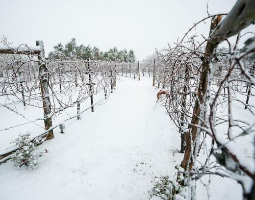
Snow-covered Texas grapevines
© Sam Craft/Texas A&M AgriLife Communications
Snow-covered Texas grapevines.

Winter Storm Uri caused at least $600 million in agricultural losses across Texas, according to preliminary data from Texas A&M AgriLife Extension Service agricultural economists.

"A large number of Texas farmers, ranchers and others involved in commercial agriculture and agricultural production were seriously affected by Winter Storm Uri," said Jeff Hyde, AgriLife Extension director, Bryan-College Station. "Freezing temperatures and ice killed or harmed many of their crops and livestock as well as causing financial hardships and operational setbacks. And the residual costs from the disaster could plague many producers for years to come."

AgriLife Extension estimates that the following sectors were among the state's biggest agricultural losses by commodity:
  • Citrus crops, at least $230 million
  • Livestock, at least $228 million
  • Vegetable crops, at least $150 million
Another agricultural sector that experienced significant losses was the green industry. AgriLife Extension, in collaboration with the Texas Nursery and Landscape Association, developed and distributed a loss assessment survey to more than 4,000 nursery, greenhouse and other green industry-related businesses requesting input on the type and extent of losses encountered. It will be several weeks before there is sufficient data to provide an assessment of those losses.

Agricultural Losses

"The data we used to determine these agricultural losses came from farmers, ranchers and other commercial producers throughout the state as well as others involved in or supporting production agriculture in Texas," said Mark Waller, associate head of Texas A&M University's Department of Agricultural Economics.

Waller said the agency can currently only provide a general range of loss or estimated overall loss for the state's agricultural sectors.

"There are still many as yet unknown and lingering effects of Winter Storm Uri," he said. "What we can say is these figures are conservative and we expect more losses as a long-term effect of this disaster."

The Texas agricultural sector that suffered one of biggest overall losses from Winter Storm Uri was the citrus industry, said Luis Ribera, AgriLife Extension economist, Bryan-College Station. He said citrus producers in the Rio Grande Valley lost virtually all of their Valencia orange crop and more than 60% of their grapefruit crop.

"Even more citrus crops would have been lost had many not been harvested before the storm," he said.

Ribera said the AgriLife Extension estimate for citrus losses came out to around $230 million and was based primarily on losses in the Rio Grande Valley during the storm.

"That estimate also included longer-term losses from next year's crops, but it did not include the cost of citrus plants that could die or remain badly damaged by the freeze and have to be replaced," he said. "If they must be replaced, it will be several years before those new citrus trees are able to bear fruit, so the losses could be much more."

Juan Anciso, AgriLife Extension horticulturist based at the Texas A&M AgriLife Research and Extension Center in Weslaco, said about 200 acres of lemons and limes produced in South Texas were destroyed completely because those plants were more sensitive to cold weather than other types of citrus.

"If those producers choose to replant, it will be three to five years before those new plants will begin to yield fruit," Anciso said.

Ribera said while the effects of the storm likely will impact grapefruit availability and prices in the future, it probably won't have a significant impact on orange prices due to large supplies available from Florida and California.

Other Crops Blasted By Freezing Weather

Along with their citrus losses, Rio Grande Valley and other South Texas producers also suffered some significant losses in terms of both cold- and warm-season vegetable crops.

Cool-season vegetable crops like leafy greens, beets, cabbage and celery were lost. There were also warm-season crops of potatoes and watermelons planted for early harvest devastated by the freezing weather.

Samuel Zapata, AgriLife Extension economist, Weslaco, said there were notable vegetable losses throughout the area.

"The main vegetable crop damage we saw was to onions, then to leafy greens, including spinach, collard greens and kale, and then to watermelons," he said.

Zapata said a low estimate based on losses from sales of those and other vegetable crops in that part of the state alone would be at least $150 million.

"Working with the Texas International Produce Association, we estimated a loss of more than $42 million in sales of onions, more than $27 million in sales of leafy greens, more than $20 million in sales of watermelons and more than $15 million in sales of cabbage," he said. "We also estimated at least another $42 million in additional vegetable and herb sales losses for these large vegetable crop-producing areas. Of course, producers lost vegetable crops in other areas of the state as well, so we determined the $150 million figure to be a minimum."

Zapata said sugarcane is another major South Texas crop that took a hit.

"According to the sugar industry, minor damage is expected to the 2020-2012 sugarcane crop given that most of it was already harvested before Uri," he said "However, a significant drop in yields is expected for next year's crop as pretty much all cane plants were destroyed and producers will have to start over. It is too early to know the magnitude of the damage."

According to Mark Welch, an AgriLife Extension economist in grain marketing, Bryan-College Station, corn and grain sorghum crops planted in South Texas and the state's Coastal Bend before the storm will need to be replanted.

"The most significant grain crop at risk during the storm was wheat, especially wheat that had started to grow," he said. "But wheat that was still in a dormant state likely survived and will produce."

He also noted there were statewide losses of livestock grazing materials such as oats, rye grass and triticale, which were included in the estimate.

Livestock Losses Will Likely Linger

Livestock losses include not only cattle, sheep and goats and their offspring that died or were badly injured during the freeze, but also damage to the livestock industry infrastructure, said David Anderson, AgriLife Extension livestock economist, Bryan-College Station.

Anderson noted the livestock loss estimate also included initial poultry losses and costs related to bird loss, damage to housing facilities and increased heating costs to keep the animals warm.

"Beef cattle losses include estimated value of death losses, additional feed use, lost winter small grain grazing, lost weights and feed efficiency in feedlots, and losses due to delayed marketing," he said. "Sheep and goat losses include estimated death losses, and dairy losses include cattle death loss, lost milk production and the value of milk dumped due to transportation problems and processing delays."

Texas Agriculture Commissioner Sid Miller said some Texas dairy operations were losing as much as $8 million a day because trucks were unable to pick up and deliver milk for processing.

Anderson, who collaborated with Justin Benavidez, AgriLife Extension economist, Amarillo, said the overall livestock loss for Winter Storm Uri is estimated to be around $228 million.

"A rancher will typically feed two or more round bales per cow during winter, so if hay isn't available, they still have to purchase some type of supplemental feed — and all this is costly," Benavidez said. "You also have to consider any physical damage to the operation as well as additional costs such as extra fuel or electricity to run heaters to keep the animals warm."

Benavidez also noted that because the storm hit during calving season, many newborn cattle were not able to survive the cold. Many lambs and kids were also lost due to the freezing weather.

"However, those overall livestock losses could have been far worse had it not been for the quick action by ranchers before the temperatures reached freezing," Benavidez said.

Anderson noted that livestock producers who lost animals to the storm in effect not only lost a single generation, but also potential subsequent generations of their offspring.

"It will take some time before many producers are able to replace their livestock," he said. "And when they do, it's going to be costly."

Green Industry Losses Pervasive Statewide

Extended freezing temperatures killed or badly damaged landscape plants, shrubs and trees in nurseries, garden centers and greenhouses throughout the state. They also froze sales of landscaping and gardening tools and supplies.

"The green industry will experience increased labor, fertilizer and other costs as part of the price of replacing the plant material that was lost during the winter storm," said Marco Palma, horticultural marketing expert in the Department of Agricultural Economics.

Palma said AgriLife Extension and the Texas Nursery and Landscape Association, TNLA, are awaiting responses from their statewide-loss assessment survey before venturing an estimate of green industry losses.

"It will take some weeks before we get a full picture of the immediate losses, but they will easily be in the tens of millions and probably in the hundreds of millions of dollars," he said.

Amy Graham, president and CEO of TNLA, said survey results will be helpful to estimate losses and identify potential assistance programs for stakeholders.

"The green industry has had severe damage, especially in some of the larger metropolitan areas such as Houston, Dallas, San Antonio and Austin," she said. "We have a lot of nursery plant growers in East Texas and quite a few of them have reported total losses. In some cases, complete greenhouses collapsed. In other instances, plants died because there was no propane for heating greenhouses."

Graham said while the green industry will be able to recover and provide replacements for some of these plants, there likely will be a shortage of landscaping trees for some years to come.

"Another consideration is that growers won't be able to determine the extent of the damage, including root damage, to a large number of their plants until we get warmer weather," she said.

Assistance For Agricultural Producers

"While assistance for producers should soon be on the way from the December 2020 COVID stimulus, it's still too early to tell if the federal government will provide additional targeted assistance in the form of direct disaster relief," said Bart Fischer, director of Texas A&M's Agricultural and Food Policy Center.

However, he said, there are a number of existing programs in place that producers can access, depending upon the problems encountered. By far, the most popular tool is the Federal Crop Insurance Program. For crops with no crop insurance, there is the Noninsured Crop Disaster Assistance Program (NAP) available through the local Farm Service Agency (FSA).

"The Livestock Indemnity Program and the Emergency Assistance for Livestock, Honeybee and Farm-raised Fish Program reimburse producers for a portion of the value of livestock, poultry and other animals killed or badly injured by a natural disaster or loss of feed," Fischer said. "And the Tree Assistance Program provides cost-share assistance to rehabilitate, replant or clean up damage to orchards and vineyards if trees, vines or shrubs were killed or seriously damaged in a disaster. This is different from NAP or Federal Crop Insurance as these typically cover the crop loss and not plant loss. Producers can reach out to their local FSA office for additional information."

For information on disaster preparation, assistance and recovery from winter storms, AgriLife Extension offers a number of educational materials through the Texas Extension Disaster Network website.

Comment: See also:

We have many wild animals that died because of this storm. People found dead deer for days. Frozen stiff. Many animals just couldn't do that wind chill for as long as they would have needed to. This is a critter with enough fat on it to endure some brutal cold, but they just couldn't get through this storm. If this is what is going to be the new normal for South Texas, this is grave news, indeed.
 

nomifyle

TB Fanatic
Ice Age Farmer Video 15 minutes

View: https://www.youtube.com/watch?v=bvq-yAakQpQ&t=0s


Governments are moving rapidly to remove your right to raise animals completely. The UK has confirmed via FOIA the gassing of people's backyard chickens around a poultry facility in Kent. Colorado's PAUSE act will destroy their meat industry. And livestock registration is rolling out around the world. There is a war on Animal Agriculture. Yes, factory farms are abhorrent, and we must rapidly move to a decentralized, regenerative food system--but rather than support this, governments are pointing at disgusting CAFOs and saying, "We must END ALL ANIMAL AGRICULTURE." They are precluding the solution, so that they take total control of food production. Christian breaks it down AND explains why we cannot allow this to happen.

I quit watching his videos awhile back because its scary and depressing. However, Pinball Prepper recommended this one. This one is scary and depressing. Some of this is being considered in a couple of states already.

They want to register everything we own, sown to backyard bees. cats, dogs, any animal. There is a place that in the UK came in and gassed everyone's chickens because of potential bird flu. I've lived a long life, they'd have to kill me first.

Also, I'm looking at all the cold weather happening right now and wondering if it will make its way back to Louisiana.

God is good all the time

Judy
 

TxGal

Day by day
The Oppenheimer Project has a new podcast out:

Iceland Fagradalsfjall Volcano Update - Magma Intrusion Update - Seismic Swarm & Inflation Breakdown - YouTube

Iceland Fagradalsfjall Volcano Update - Magma Intrusion Update - Seismic Swarm & Inflation Breakdown
2,915 views • Premiered 9 hours ago

View: https://youtu.be/uzxAuOjbliY
Run time is 8:39

Synopsis provided:

Fagradalsfjall volcano update: Likelihood of volcanic eruption near Fagradalsfjall increases by the day http://bit.ly/2OSsyyo
Reykjanes peninsula - earthquakes https://bit.ly/3rprWPn
Strong earthquakes west of Grindavík village and update on magma dyke movements http://bit.ly/3qC2wNi
Magma dyke seems to have stopped close to Nátthagi valley south of Fagradalsfjall mountain http://bit.ly/3l9KEIy
One of the most destructive vol- canic eruptions in the history of Ice- land began in the early morning of January 23, 1973, near the Nation's premier fishing port, the town of Vestmannaeyjar (Vést-mun- ayar), on Heimaey (Háme-a-ay), the only inhabited isle in the Vestmannaeyjar volcanic archipelago. https://pubs.usgs.gov/gip/heimaey/hei...
GPS time series for Reykjanes https://bit.ly/3rPmbuI
1973 Iceland Volcanic Eruption https://bit.ly/3bJZ0fH
New eruption fissure in Eyjafjallajökull 2010, Iceland. https://bit.ly/3laIcRS
Fagradalsfjall Data https://s.si.edu/3vuMlVM HISTORICAL ICELANDIC ERUPTIONS
http://bit.ly/3crJoMP
 

TxGal

Day by day
And another from Oppenheimer:

Etnas 12th Paroxysm - ‘Absolutely Historic’ Snow Totals Forecast For This Weekend In Several States - YouTube

Etnas 12th Paroxysm - ‘Absolutely Historic’ Snow Totals Forecast For This Weekend In Several States
5,277 views • Premiered 7 hours ago

View: https://youtu.be/DiDbSdZnajM
Run time is 9:12

Synopsis provided:

‘Absolutely historic’ snow totals forecast for this weekend in several states http://bit.ly/3teTurk
Winter's Not Done Yet: Chance Of Snow Next Week In PA http://bit.ly/2PZooWh
Second winter: Anchorage gets up to 18 inches of fresh snow http://bit.ly/3tiRGgH
'Impossible travel conditions' as spring storm delivers historic snow and severe storms http://cnn.it/3qHETD3
Snow reported in far west Las Vegas valley neighborhoods http://bit.ly/3bIjDIV
Season’s biggest snowstorm drops more than a foot of snow in some parts of Anchorage http://bit.ly/3rMUkek
GFS Model Total Sow US http://bit.ly/3qJiJQS
GFS Model Total Snow Europe https://bit.ly/332e83w
Mauna Loa volcano (Big Island, Hawaii): earthquake beneath SE flank http://bit.ly/3qI5boH
Etna volcano update: Powerful lava fountains generate massive ash plume over Sicily http://bit.ly/3rKQXEH
Fagradalsfjall volcano http://bit.ly/38yh7mC
Reykjanes peninsula - earthquakes https://bit.ly/3rprWPn
Reykjanes Inflation/Deformation https://bit.ly/2OvsSTY Worldwide Volcano News http://bit.ly/2v9JJhO
and more
 

TxGal

Day by day
'Historic' Snowstorm to Pummel Wyoming, Colorado | AccuWeather

'Historic' snowstorm to pummel Wyoming, Colorado

By Alex Sosnowski, AccuWeather senior meteorologist & Meghan Mussoline, AccuWeather meteorologist
Published Mar. 12, 2021 11:09 AM CST | Updated Mar. 13, 2021 5:39 AM CST

A turbulent weekend of weather is about to unfold, with thunderstorms possible in Denver prior to the start of the snow.
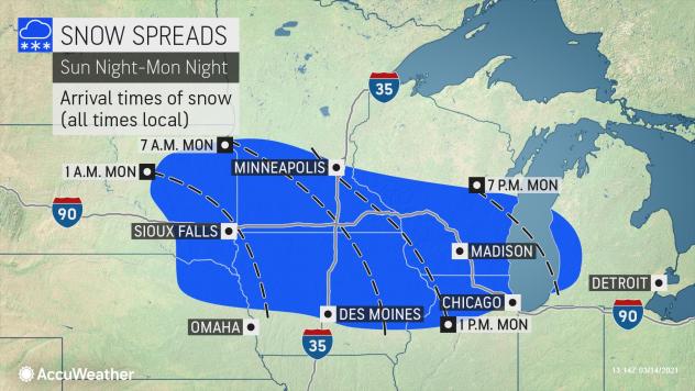
Only a few days are left in winter, but that won’t stop Mother Nature from pulling out all of the stops in the last stretch of the season in the central and southern Rockies. A developing storm that AccuWeather meteorologists have been monitoring since last week will take aim at parts of Colorado, Wyoming and Nebraska this weekend with a potentially historic snowfall that could bring travel to a standstill.

AccuWeather forecasters say that Cheyenne, Wyoming, will be in the storm’s bull’s-eye and could potentially pick up the biggest snowstorm in the city’s recorded history. Denver may not set a new snowstorm record, but the Mile High City is still expected to be buried under hefty snowfall — and the hardest-hit areas could be left digging out from waist-deep snow with an AccuWeather Local StormMax™ of 60 inches predicted.

Winter storm warnings were plastered across southeastern parts of Wyoming and northern Colorado, and winter storm watches extended farther east across southwestern South Dakota and western Nebraska on Friday. An avalanche watch was also posted for the Front Range mountains in Colorado. The wintry blast could feel all the more shocking because it is following closely behind springlike weather in some places like Denver, where temperatures averaged nearly 20 degrees above normal earlier this week.

page-20-1.jpg


Colorado Gov. Jared Polis announced on Thursday that he activated the Colorado National Guard to respond to search and rescue requests through the state's Emergency Operations Center from 12 p.m. Friday until 12 p.m. Monday.

"I urge you to stay home if it’s going to snow hard in your area, so you don’t need them to rescue you," Polis said. Colorado State Patrol echoed that motorists should stay off of the roads amid what a trooper referred to as “Snowmaggedon” or “Snowpocalypse” in a video recorded and sent out on Twitter. He went on to explain, “It’s much better this way,” and quipped, “You know what’s better than driving in the snow? Literally anything.”

The zone from Cheyenne, Wyoming, located in southeastern parts of the state, down to Fort Collins and Boulder, located west of Denver, is facing the heaviest snowfall totals of 24 to 36 inches. Cheyenne could easily eclipse its old record for the heaviest snowstorm in history, which stands at 25.6 inches set from Nov. 19 to 21 in 1979.

page-21-1.jpg


The National Weather Service office in Cheyenne, Wyoming, noted in a tweet that the snowstorm will be "VERY impactful” and "possibly historic” and later tweeted a warning on the bitter cold that will settle in by Sunday morning, which will be all the more extreme with wind factored in. It could feel like the single digits as heavy snow continues to pile up early Sunday. The NWS added, "Be sure to protect your newborn livestock!”

Denver is still in line for a massive storm, but totals will come in lower than locations farther west with a prediction of 12 to 24 inches, with 12-18 more likely than 18-24 inches at this point. That would not set the Mile High City up for a top-five snowstorm, but it could put a top-10 snowstorm in contention. Since weather records began in Denver back in 1881, nine snowstorms have unleashed more than 20 inches of snow -- and three of those major storms dropped more than 30 inches.

"We have noticed a slight northward shift with the upper-atmospheric part of the storm in the Four Corners region of Colorado, Utah, Arizona and New Mexico, and that is usually a signal that the heaviest snow may end up just north of Denver," Chief On-Air Meteorologist Bernie Rayno said.

There are other factors that may prevent a 2-foot snowfall in Denver and other parts of eastern Colorado in general.

page-22-1.jpg


"There will probably be some wintry mix or even rain for a time during the first phase of the storm and then dry air may sweep in quickly toward the middle part of the storm and may shut down heavy snow in Denver," AccuWeather Senior Meteorologist Mike Doll said.

Farther north, this is projected to be a big storm for Casper, Wyoming, with 1-2 feet projected.

And as the system heads eastward across the Nebraska border, a top-five snowfall may be in the making for Scottsbluff. The fifth-biggest single snowstorm on record for the western Nebraska city was 17.8 inches on Oct. 27-29, 2009. AccuWeather is projecting from 1 to 2 feet of snow to fall there.

(note: audio clip here that I can't bring over, please go to the website to listen

AccuWeather forecasters expect snow to come down at rates of 1 to 3 inches per hour at the height of the storm across southern Wyoming and northern Colorado Saturday into Sunday, with the potential to immobilize travel. Thunder and lightning could occur in the most intense snow bands. Visibility will be dangerously reduced, and portions of I-25, I-70, I-76 and I-80 could be shut down as a result.

The snow will also be heavy and wet in nature, leading to the potential for tree limbs and power lines to come crashing down under the weight of snowfall. Power outages are likely to occur. The heavy snow may not only be difficult to shovel and plow but can stress flat or shallow pitched roofs to the point of damage and failure.

MicrosoftTeams-image-6.jpg


"Snowfall of this intensity will not only lead to whiteout conditions but may strand motorists on the roads and force major highways to be closed," Rayno said.

The storm is shaping up to be the biggest of the winter season for the western United States, and while it will be impactful, it could prove beneficial in one aspect: boosting snow levels in the mountains and rain in lower elevations as soil conditions range from abnormally dry to that of exceptional drought in Colorado and much of the West, according to the latest report from the United States Drought Monitor.

Blizzard conditions are possible in Wyoming and perhaps in portions of western Nebraska and southwestern South Dakota as the storm reaches peak intensity. Gusts could reach as high as 30 mph as the snowstorm first gets underway on Saturday then increase to as high as 40 mph Saturday night and up to 50 mph on Sunday.

3SB.jpg


Even though winds may fall short of official blizzard criteria in much of Colorado, a mere breeze can cause some blowing snow, trees to sway under the weight of snow and trigger power outages. A blizzard is a winter storm that produces visibility under 1/4 of a mile in snow or blowing snow with sustained or gusty winds of 35 mph or greater for three consecutive hours or more.

As the storm pulls away later Sunday and Sunday night, winds from the northwest are expected to increase and may lead to more widespread blowing and drifting snow in Colorado.

Due to the risk of power outages from the storm, people should locate flashlights and batteries and make sure generators are in working order and fueled ahead of the storm. It is also a good time to review operating procedures for generators like avoiding indoor use, including in a garage or basement.

SunSnap12Mar9a.jpg


Snowfall amounts will dwindle farther to the south in eastern Colorado with Colorado Springs forecast to pick up 6-12 inches and Pueblo most likely in the 1- to 3-inch snowfall range.

Any shift in that track may cause the heaviest snow to shift farther to the south or north. As a result, people in southern Colorado and western Kansas, as well as northern Wyoming and western South Dakota, should monitor the storm's progress.
 

TxGal

Day by day
More info on crop losses due to winter storm (fair use cited):

Texas Farmers Tally Up the Damage From a Winter Storm ‘Massacre’ - The New York Times (nytimes.com)

Texas Farmers Tally Up the Damage From a Winter Storm ‘Massacre’

The state’s agriculture sector has lost an estimated $600 million or more. Crop and livestock damage could mean shortages and higher prices beyond Texas.

Gerardo Portillo, a vegetable farmer at Little Bear Produce in Edinburg, Texas, assessed which crops damaged by the cold last month could be cut back and regrown and which would need to be started again from seed.

Gerardo Portillo, a vegetable farmer at Little Bear Produce in Edinburg, Texas, assessed which crops damaged by the cold last month could be cut back and regrown and which would need to be started again from seed.Credit...Amy Scott for The New York Times

By Kim Severson
  • Published March 4, 2021Updated March 5, 2021
Texas farmers and ranchers have lost at least $600 million to the winter storm that struck the state last month, according to an assessment issued this week by economists at the Texas A&M AgriLife Extension Service.

Damage and disruption from the bitter blast of cold and snow, which farmers are calling “the St. Valentine’s Day massacre,” is likely to cause some gaps on grocery shelves in the eastern part of the country and push prices higher, especially on crops like sweet Texas onions that were just about to be harvested, leafy greens that would have headed for the East Coast and even cabbage, which this year might not be the St. Patrick’s Day sale item it often is.

The storm also caused a severe shipping and processing bottleneck that continues to challenge the food-supply chain. Truck drivers were stuck for days waiting to load or unload produce. Processing plants had no power. Dairies were forced to dump 14 million gallons of milk, said Sid Miller, the Texas commissioner of agriculture.

In a state that sells $25 billion worth of agricultural products each year and has more farms and ranches than any other, the damage is spread far and wide. The storm killed newborn calves, acres of newly planted watermelons and nearly the entire crop of Valencia oranges.

“We all know it’s possible. This is what we sign up for,” said April Flowers, who watched grapefruit freeze solid on the trees her family grows on 6,500 acres in the Rio Grande Valley. “It still doesn’t prepare you for when it does happen. It’s gut-wrenching."

Citrus took the biggest blow. This year’s lemon and lime crops are gone. The grapefruit harvest in the Rio Grande Valley was about halfway finished when the cold came, said Dale Murden, a citrus grower and president of Texas Citrus Mutual, a trade group. The freeze rendered the fruit that remained on the trees useless for anything but juicing, but many of the juice-processing plants were shut down because they had no power.

The loss is at least $230 million, but that doesn’t include the financial hits growers will feel over the next few years. The ice killed many trees that were just a year or two old, and damaged older ones that were beginning to bud. That means replanting, and less fruit during future harvests.

Oranges froze on the trees in the Rio Grande Valley in mid-February, rendering them good only for juicing and leaving growers with a big financial loss.

Oranges froze on the trees in the Rio Grande Valley in mid-February, rendering them good only for juicing and leaving growers with a big financial loss. Credit...Amy Scott for The New York Times

The livestock industry was the second-hardest hit by the storm, suffering $228 million in losses, according to the Texas A&M report, which was released on Tuesday. Water tanks froze, feedlots and dairies ran out of feed, and some grain-rich grazing fields were damaged.

Poultry operations lost heat, which led to the death of chicks and left hatcheries with eggs that won’t hatch. Many calves, lambs and kids had just been born. The number that froze to death has yet to be counted.

“It was around the clock, all hands on deck, trying to keep the animals alive,” Mr. Miller said.

He pointed to other animal deaths in the state’s $1.3 billion exotic species business. More than 125 species of what are commonly called “Texotics” — including wildebeests and blackbuck antelopes — live on thousands of ranches in the Hill Country and across South Texas, where they are bred, displayed for sightseers and hunted for sport.

“We have a lot of exotic game from India and Africa that don’t tolerate the cold,” Mr. Miller said. “Thousands and thousands are dead.”

Vegetable growers are still trying to assess which crops will need to be completely replanted and which can be saved. The Texas A&M report estimated the loss to those farmers at $150 million.

The fight against the deep freeze, which hurt both large growers and those with smaller urban farms, was waged differently from place to place, depending on the amount of cold and snow a region received, the duration of the cold and how well people who knew the freeze was coming could prepare.

The state’s two worst-hit growing regions — the Rio Grande Valley, at the southernmost point of Texas, and an area north of Laredo known as the winter garden region — were preparing to harvest winter crops like onions, cabbage and spinach, and were starting to plant spring crops like watermelon.

The state’s 1,500 acres of chipping potatoes in the Rio Grande Valley are gone. Bok choy and other green crops were destroyed or severely damaged, along with peaches, strawberries, wine grapes and berries.

Jody Wiggins, whose company in southern Texas grows several million watermelons a year, said that at least two thousand acres of plants were lost and that planting was delayed on several thousand more, which will push back the harvest. Other crops will face similar delays.

“There are going to be days when people go the grocery store and don’t see things on the shelf between now and the end of May,” Mr. Wiggins said.

Swiss chard once destined to be sold under the Little Bear brand looked as if it had melted in the sun after a deep freeze hit Texas in mid-February.

Swiss chard once destined to be sold under the Little Bear brand looked as if it had melted in the sun after a deep freeze hit Texas in mid-February.Credit...Amy Scott for The New York Times

The onion crop is of particular concern. The first sweet spring onions that are harvested beginning in March are intended to supply cooks who have been relying on storage onions all winter.

The freeze hurt mature onions whose bulbs were partly above ground and stressed others, forcing some onions to grow what is called a seeder at the center. The seeders hollow out the onions and reduce yields.

As much as half of the first fresh crop of spring onions may be gone, said Juan Anciso, a professor and extension service vegetable specialist with Texas A&M University. The loss could be about $42 million.

Cabbage from Texas makes up about 30 percent of the total U.S. supply. The crop wasn’t wiped out, but it was damaged enough to reduce supplies, which could lead to higher prices in March.

The state’s $2 billion horticulture industry, which provides landscaping plants and millions of young vegetable starts and fruit trees, suffered significant losses, too.

“A lot of stuff took it on the chin for sure,” said Larry Stein, a professor and extension horticulturist at Texas A&M.
Bret Erikson is a vice president of J&D Produce, in Edinburg, one of the largest vegetable growers in the state. Its produce, sold under the Little Bear brand, is shipped throughout Texas and to stores along the Eastern Seaboard.

About 2,000 acres were planted when temperatures dropped to 21 degrees on Feb. 15 and ice covered the fields. When things warmed up, the company found that some plants, like beets and herbs, could be salvaged, or cut back and regrown. Others are gone.

“The Swiss chard got creamed,” Mr. Erikson said. “It totally melted after the sun came out. The field looked like a kid’s finger painting. It’s hard to see that as a grower. These are kind of like your children.”

Like other growers and packers, the company’s owners have been trying to help workers who lost wages because vegetables couldn’t be harvested and the packing sheds were shut down. The company had about 800 people in those jobs, he said, and have been trying to keep them working.
 

TxGal

Day by day
March Rains Sound Alarm of Crop Loss in Brazil Soybean Belt - Bloomberg

March Rains Sound Alarm of Crop Loss in Brazil Soybean Belt
By Fabiana Batista
March 5, 2021, 4:00 PM GMT+6 Updated on March 5, 2021, 8:45 PM GMT+6

  • Half of Mato Grosso crop will be ready for harvesting in March
  • Some farmers start to report losses due to wet conditions
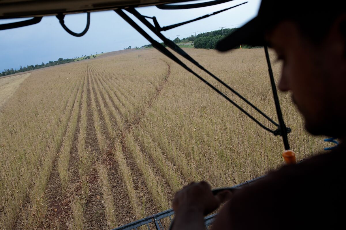
A farmer harvests soybeans in Brazil, on Feb. 24.

A farmer harvests soybeans in Brazil, on Feb. 24. Photographer: Patricia Monteiro/Bloomberg

Soybean farmers in Brazil’s major growing regions are starting to worry about losing their crops as torrential rains threaten harvests of the world’s largest producer.

Silvesio de Oliveira is one such grower. He lives in Tapurah in the heart of Brazil’s soybean belt in top-producing Mato Grosso state -- where the situation is the most severe. Oliveira has harvested 85% of the 1,350 hectares (3,336 acres) planted despite the deluge, but for the past week he has been unable to enter his soaked fields to finish the job. He already lost 100 hectares.

“Heavy rain and wind dropped the plant to the ground,” Oliveira said in an interview. “Since I couldn’t harvest it, the beans rotted.”

About half the soybean crops in Mato Grosso are close to maturity or ready for harvest, but downpours are keeping farmers from taking the beans out of the fields. The state accounts for a quarter of the South American nation’s soybean output.

“We already have many regions reporting quality losses,” Fernando Cadore, head of farming group Aprosoja in Mato Grosso, said in an interview. “There are a lot of soybeans ready, but they haven’t been harvested for 10 days amid rains.”

Brazil’s annual soybean output is forecast to be between 130 million and 131 million metric tons, down from an earlier estimate of 134 million, since farmers can’t access fields to pick beans, weather forecaster Rural Clima said Friday in a report. The weather has also affected Goias, Tocantins, Para and Maranhao states, with cloudy conditions reducing bean weight, meteorologist Marco Antonio dos Santos said in the report.

“Production can be cut further if rains continue, which is what is predicted,” he said.

Potential losses in Brazil could add fuel to surging soybean prices that have already been bolstered recently by weather concerns in South America. Soybean futures in Chicago have climbed 55% in the past year. Only a quarter of Brazil’s crop had been collected as of the end of February, the lowest level in a decade, according to consulting firm AgRural. The excessive rainfall may also worsen the delay of Brazil’s soybean shipments, which may shift some demand to the U.S., the world’s second-largest producer.

Crop Losses

Even with many weather woes -- from dry weather delaying seeding and hurting development of early varieties to the excess rain that subsequently prolonged the crop-development cycle -- Brazil has had isolated crop losses. That has kept market forecasters still calling for record soybean production for the country’s crop season.

Frequent rains are still predicted for the oil-seed fields in March, amplifying weather risks. Half of Mato Grosso’s soy-growing area will be ready for reaping this month and the continual downpours may prevent beans from being gathered in time to avoid damage, according to Daniele Siqueira, an analyst at AgRural. That could mean a smaller crop.

“So far it is impossible to measure,” she said in an interview, adding the risk is also seen on a smaller scale in other states.

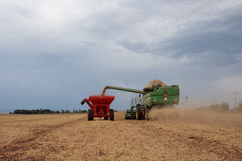
A Soybean Harvest As Delays Hamper Shipments

Soybean harvest at a farm in Brazil, on Feb. 24.
Photographer: Patricia Monteiro/Bloomberg

Heavy rainfall will return to Mato Grosso after a partial easing on Friday and Saturday, according to Somar Meteorologia. The pattern may persist in the second 10-day period of March.

“The forecast is quite wet in Mato Grosso through this weekend, but it does ease up a bit next week through the end of the month,” said Don Keeney, senior agricultural meteorologist at Maxar. Those improvements will allow producers to ramp up harvesting a bit, he said.

“Not a complete wide-open opportunity, but conditions should definitely improve a bit.”

Better weather is just what Oliveira needs, with the farmer’s last 100 hectares of soybeans ready to be gathered from his soggy fields.

“I will lose it too if don’t harvest it in four or five days,” he said.

(Updates with report from weather forecaster Rural Clima in the sixth paragraph)
 

TxGal

Day by day
Texas citrus industry sees at least $230 million in losses due to February’s winter storm | Flavor (sacurrent.com)

Texas citrus industry sees at least $230 million in losses due to February’s winter storm
Posted By Nina Rangel on Tue, Mar 9, 2021 at 12:56 pm

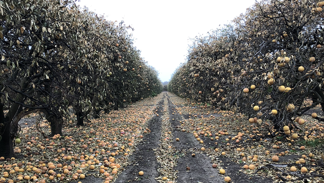
Millions in dollars' worth of grapefruit litter grove floors following last month's cold snap. - NINA RANGEL
  • Nina Rangel
  • Millions in dollars' worth of grapefruit litter grove floors following last month's cold snap.
Citrus lovers beware: grapefruit prices are about to skyrocket.

Preliminary data from economists with the Texas A&M AgriLife Extension Service shows that last month’s devastating winter storm caused at least $230 million in damage to the state’s citrus industry. Many growers will likely lose next year’s crop

Texas is the third-largest U.S. citrus producer behind Florida and California. Thousands of groves are located in and around South Texas' Rio Grande Valley.

“The data we used to determine these agricultural losses came from farmers, ranchers and other commercial producers throughout the state as well as others involved in or supporting production agriculture in Texas,” Mark Waller, associate head of Texas A&M University’s Department of Agricultural Economics, told the Glen Rose Reporter.

Millions in dollars' worth of grapefruit litter grove floors following last month's cold snap. - NINA RANGEL
  • Nina Rangel
  • Millions in dollars' worth of grapefruit litter grove floors following last month's cold snap.
Waller told the Reporter that agency economists expect more losses as a long-term effect of the cold snap that swept the state — Texas’ second-worst freeze since 1899.

The South Texas citrus industry suffered severe losses from the combination of excessively low temperatures and wind during the storm. If temperatures drop below 28 degrees Fahrenheit for more than five hours, citrus fruits begin to freeze inside and can't be taken to market.

Roughly 200 acres of lemons and limes were completely destroyed, and industry reports estimate that nearly all of the Valencia orange crop will be lost, as the varietal requires a late-season harvest, Texas A&M AgriLife Extension Service officials told the Reporter. About half of the state’s grapefruit crop was still on the trees when the storm blew in, which will likely affect grapefruit availability and prices in the future.

A small silver lining: orange prices will likely remain unchanged, due to large supplies available from Florida and California, according to the report.
 

TxGal

Day by day
Fair use cited:

Winter storm has continued impact on East Texas citrus growers (ktre.com)

Winter storm has continued impact on East Texas citrus growers
Last month’s freezing temperatures and ice harmed many crops including citrus.

(note: there's a video here I can't bring over, please go to the link to view it)

By Jeremy Thomas | March 12, 2021 at 9:45 AM CST - Updated March 12 at 8:12 PM

JASPER COUNTY, Texas (KTRE) - Last month’s winter storm continues to impact many facets of life, including for citrus farmers. Freezing temperatures and ice harmed many crops including citrus.

The Texas A&M AgriLife Extension estimates at least $230 million in losses with Citrus crops. East Texas agriculturalists say while about 95 percent of that accounts for the state’s commercial growers in the Rio Grande Valley, local producers were impacted right here in the Pineywoods.

For more than a decade, you could find Jasper County resident James Cowan tending to his citrus orchard of more than 100 fruit trees, including satsumas.

“Had a real good season through the year,” Cowan said. “Actually thought I would lose the crop sooner than that with the two hurricanes that passed by. Had a real bountiful crop probably around 5,000 pounds of fruit this year.”
Cowen said he’s experienced weather-related setbacks before but nothing like last month’s winter storm. He says he did all he could to cover and provide heat to his fruit trees.

“Whoever thought you’d get six degrees in East Texas,” he said. “I never even experienced six degrees in Colorado snow skiing.”

“We have a lot of homeowners that have these trees and if they weren’t protected then they were susceptible to loss,” Jasper County Extension Agent Brock Fry said. “While those plants are very personal to the people, it has less of an economic impact to our state’s economy. “So, what we’re doing right now is waiting and seeing to see how much of a loss we have home plants as well as our small acres farms. So it is kind of a sit and wait game right now, and it’ll also impact the local growers and how much they’re able to provide for the local produce for local people.”

Fry said in East Texas, those homeowners and small acreage citrus farms will not know the extent of the damage until close to the summer months.

“They’re a little nervous that they have lost all their production,” he said. “They’ve probably lost all their production maybe for this year and for several years. This could impact for several years. It all depends upon the hours it was below 21 degrees.”

“What happens is whenever you get to those freezing temperatures, the moisture in the trees expand and they end up busting cells,” Cowan explained. A lot of times you don’t know the extent of the damage until you get into your summer months because it’s like if you picture having a straw made up of 10 straws, fluid is coming through those 10 straws but now seven our eight of them don’t work. You still have some fluid that’s keeping things green at this point. But once you get into the summer months where the demand for moisture is greater then, it’s going to have a hard time to survive. The tree will let you know if it dies completely or whether you have some buds that you’re able to grow back from.”

Cowan said there is still hope that he may be able to graft some trees for continued growth.

“It’ll be a setback, but it’s all enjoyable,” Cowan said. “It’s the fruits of the labor, to say. It’s enjoyable to see people that you give or sell fruit to that enjoy the fruit.”

Fry said those who were impacted by the winter storm should contact their local United States Department of Agriculture Farm Service Agency. To find a USDA Farm Service Agency office near you, click here.

Copyright 2021 KTRE. All rights reserved.
 

TxGal

Day by day
Fish kill events caused by 2021 winter storm affecting tourism in Texas (kxxv.com)

Fish kill events caused by 2021 winter storm affecting tourism in Texas
Nearly 4 million fish lost

(Video here, not sure it will copy over; run time is 1:57)
blob:https://assets.scrippsdigital.com/a986339f-1b3b-4ae8-a998-b711abae506c

By: Brittany Defran
Posted at 8:59 PM, Mar 11, 2021
and last updated 9:03 AM, Mar 12, 2021

The loss of nearly four million fish along the coast of Texas is heavily impacting recreational fishers.

The fish are accustomed to relatively warm temperatures. However, experts say the sudden drop in temperatures during Winter Storm Uri caused major fish kill events.

“The numbers that TPWD [Texas Parks & Wildlife] does estimate is close to four million fish across the full Texas coast,” said Bob Stokes, president of the Galveston Bay Foundation, which works to conserve fish habitats in the region.

Temperatures tend to change a lot fast in more shallow waters, which is typically what you see along the coast.

”The faster that temperature drops, the less capable many of these fish species are at handling that physiologically,” explained Kirk Winemiller, Ecology and Conservation Biology professor at Texas A&M University.

The Galveston Bay area was able to squeeze by without much damage to their waters, only losing about 100 game fish.

”The reason there is that our waters frankly just have a bigger bay system. It’s a bigger bay system, and it takes longer for the water to cool down or heat up,” said Stokes.

According to Texas Parks & Wildlife, the Texas coast has become a top fishing destination for tourists. The fish kills are now discouraging those recreational activities.

The winter storm took out 61 species. The largest group lost was the spotted seatrout, followed by the black drum.

”The problem is maybe for one or two years, fishing just may not be as good as it was, and that may be enough to discourage quite a number of recreational fishers,” said Winemiller.

The last time the Texas coast experienced such an extreme fish kill like this was in the 80s when almost 32 million fish were killed.

“You know the fish stocks did recover fairly quickly in the 1980s from a series of winter fish kills,” Winemiller added.

The last recovery took about two to three years. Texas Parks & Wildlife is recommending fishers practice capture and release as much as they can as fish stocks attempt to recover.
 

TxGal

Day by day
Earth’s cyclical geomagnetic pole reversals affect all manner of atmospheric, evolutionary, and tectonic phenomena - Ice Age Now

Earth’s cyclical geomagnetic pole reversals affect all manner of atmospheric, evolutionary, and tectonic phenomena
March 13, 2021 by Robert

May radically reduce Earth’s human population … via crop failures, shortened growing-seasons, famine and disease.
__________

Earth’s cyclical geomagnetic pole reversals affect all manner of atmospheric, evolutionary, and tectonic phenomena
Lloyd Martin Hendaye

Though correlation remains conjectural, Ice Age Now’s long-standing hypothesis that Earth’s cyclical geomagnetic pole reversals affect all manner of atmospheric, evolutionary, and continental-crust phenomena is playing well.

Approximately 12,000 years from the last such inflection-point (the Gothenburg event, succeeding Mungo 24-K YBP), Earth’s geomagnetic field now wanders-and-weakens once again.

MagneticReversals-andGlaciation.jpg


Nearing the end of a 140-year “amplitude compression” rebound from the 500-year Little Ice Age that ended the 12,550-year Holocene Interglacial Epoch in AD 1350, global volcanism conjoined with periodic 102-kiloyear Pleistocene glaciations portends a major climatological chill-phase making nonsense of agenda-driven Global Climate Models’ (GCMs) fatuous blather over fifty years.

Without citing either the Little Ice Age Dalton Minimum c. 1790 – 1830 or Indonesia’s Tambora super-volcano “year without a summer” (1816), economist and hedge-fund manager Martin Armstrong warned in November 2019 that “It is global cooling, not warming, we should fear the most. ‘Climate change’ (Luddite/Mathusian sociopaths) may get their wish to radically reduce Earth’s human population … via crop failures, shortened growing-seasons, famine and disease.”

In Dante, ten ditches of Malébolge (Inferno’s 8th Circle) comprise levels of degradation from “panderers and seducers” to Falsifiers, Imposters, Schismatics, Thieves. From UEA’s Phil Jones to UPenn’s scrofulous Michael Mann, the chasm gapes.
 

TxGal

Day by day
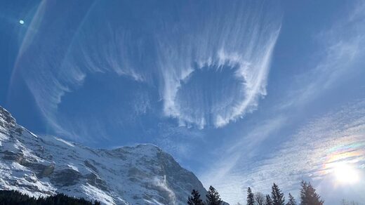
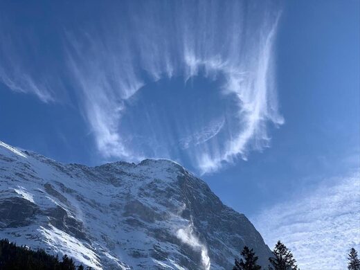
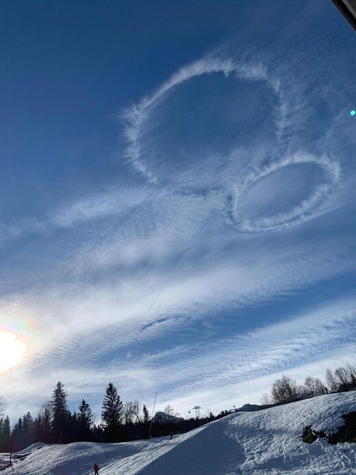
Our cooling atmosphere: Curious circular clouds appear over Swiss Alps alongside an iridescent cloud -- Earth Changes -- Sott.net

Our cooling atmosphere: Curious circular clouds appear over Swiss Alps alongside an iridescent cloud

Strange Sounds
Sat, 13 Mar 2021 12:00 UTC

circle cloud alps
© 20min.ch

These mysterious cylindrical clouds over the Swiss Alps aren't natural... But, of course, scientists have no clues how they may have formed...


Comment: There are scientific explanations for how these kinds of clouds form, but what is notable is that they're not a common sight and their appearance points to an atmosphere that is undergoing significant cooling; and this is just one of an increasing number of examples.


How did these eerie cylindrical clouds formed in the sky over the Eiger in the Swiss Alps? via

The eerie sky formation hovered over the Eiger, a 3,967-metre (13,015 ft) mountain of the Bernese Alps.

This picture shows the two mysterious cylindrical clouds in the sky over the Swiss Alps on March 10, 2021. via 20min.ch

One of the two cloud ring disappeared after a few minutes. However, the second drifted about 15 minutes in the sky.

circle cloud alps
© 20min.ch

One of the weird circle cloud floated over Grindelwald for about 15 minutes. via 20min.ch

A MeteoNews specialist confirmed that such a phenomenon is NOT NATURAL.

In the area of the sighting, there is a military airport. Did jets formed those two distinct circles?


Comment: As noted above, it's more likely that this is a natural, albeit unusual, occurrence.


When an aircraft is flying at supersonic speed, it can be particularly difficult to follow it from the ground and with the naked eye. Moreover, condensation trails do not appear until a few seconds after it has passed. In calm weather, traces may remain visible for up to 15 minutes.

circle cloud alps
© 20min.ch

I saw and heard 2 military jets flying over Bern, my hometown, on Wednesday...

The military airport of Meiringen confirms that flights took place at the time in question, but didn't want to say more... [20min]
 

northern watch

TB Fanatic
Earth’s cyclical geomagnetic pole reversals affect all manner of atmospheric, evolutionary, and tectonic phenomena - Ice Age Now

Earth’s cyclical geomagnetic pole reversals affect all manner of atmospheric, evolutionary, and tectonic phenomena
March 13, 2021 by Robert

May radically reduce Earth’s human population … via crop failures, shortened growing-seasons, famine and disease.
__________

Earth’s cyclical geomagnetic pole reversals affect all manner of atmospheric, evolutionary, and tectonic phenomena
Lloyd Martin Hendaye

Though correlation remains conjectural, Ice Age Now’s long-standing hypothesis that Earth’s cyclical geomagnetic pole reversals affect all manner of atmospheric, evolutionary, and continental-crust phenomena is playing well.

Approximately 12,000 years from the last such inflection-point (the Gothenburg event, succeeding Mungo 24-K YBP), Earth’s geomagnetic field now wanders-and-weakens once again.

MagneticReversals-andGlaciation.jpg


Nearing the end of a 140-year “amplitude compression” rebound from the 500-year Little Ice Age that ended the 12,550-year Holocene Interglacial Epoch in AD 1350, global volcanism conjoined with periodic 102-kiloyear Pleistocene glaciations portends a major climatological chill-phase making nonsense of agenda-driven Global Climate Models’ (GCMs) fatuous blather over fifty years.

Without citing either the Little Ice Age Dalton Minimum c. 1790 – 1830 or Indonesia’s Tambora super-volcano “year without a summer” (1816), economist and hedge-fund manager Martin Armstrong warned in November 2019 that “It is global cooling, not warming, we should fear the most. ‘Climate change’ (Luddite/Mathusian sociopaths) may get their wish to radically reduce Earth’s human population … via crop failures, shortened growing-seasons, famine and disease.”

In Dante, ten ditches of Malébolge (Inferno’s 8th Circle) comprise levels of degradation from “panderers and seducers” to Falsifiers, Imposters, Schismatics, Thieves. From UEA’s Phil Jones to UPenn’s scrofulous Michael Mann, the chasm gapes.
The Aztecs thought Hell was a very cold place, not a hot place as the Europeans thought.
 

Seeker22

Has No Life - Lives on TB
Post #3033: He pointed to other animal deaths in the state’s $1.3 billion exotic species business. More than 125 species of what are commonly called “Texotics” — including wildebeests and blackbuck antelopes — live on thousands of ranches in the Hill Country and across South Texas, where they are bred, displayed for sightseers and hunted for sport.

“We have a lot of exotic game from India and Africa that don’t tolerate the cold,” Mr. Miller said. “Thousands and thousands are dead.”

Upthread, I talked about dead deer. This is what I meant. These animals are very expensive and we lost lots of them. Native species died as well.

I do not believe this storm was a freak one off- I think it is our new normal.
 
Last edited:

TxGal

Day by day
Cheyenne, Wyoming BURIED in Blizzard! - Live Video - Ice Age Now

Cheyenne, Wyoming BURIED in Blizzard! – Live Video
March 14, 2021 by Robert

7:30 AM March 14th – “Snow continues to fall over the area with blizzard to near blizzard conditions in spots,” says the National Weather Service.

Cheyenne-Blizzard-14-Mar-21-1024x592.png


“Strong winds will continue today with heavy snowfall resulting in whiteout conditions. Travel has become extremely dangerous if not impossible with heavy snow and whiteout conditions. Do not travel at all today! Stay posted for the latest updates!”

View: https://youtu.be/HdR8jFcDEHY

Run time is showing as 3:30:40, which doesn't seem to make sense (and I can't watch it if it's that long! I've watched bits of it throughout, lots of snow)
 

TxGal

Day by day
Stevens Pass - Snowiest February in 20 years - More snow on the way - Ice Age Now

Stevens Pass – Snowiest February in 20 years – More snow on the way
March 14, 2021 by Robert

Major problems keeping the roads open because TOO MUCH SNOW.
___________

Here on the west coast, 518″ snow so far this year at Stevens Pass ski area, says reader Oly.

https://www.stevenspass.com/the-mountain/mountain-conditions/weather-report.aspx

152″ base and they’ve had major problems keeping the roads open because TOO MUCH SNOW. Snowiest February in 20 years and more snow on the way this weekend.

Stevens-Pass-Weather-15-19-Mar-2021.png

Stevens Pass ski area lies about 82 miles east of Seattle.
 

TxGal

Day by day
From the Oppenheimer Ranch Project:

Millions Under Winter Storm Advisories as Blizzards and Severe Weather Move Across the US - Iceland - YouTube

Millions Under Winter Storm Advisories as Blizzards and Severe Weather Move Across the US - Iceland
4,342 views • Premiered 3 hours ago

View: https://youtu.be/1aX-zgNUe2s
Run time is 15:54

Synopsis provided:

As massive storm slams the West, flooding, tornadoes, hail possible http://fxn.ws/3bLscmw
Heavy snow and possibly blizzard conditions are expected to envelop the central Rockies and central High Plains https://bit.ly/3ezpAdf
Millions under winter storm advisories as blizzards move across the US http://cnn.it/3bNkp7L
Heavy snow expected to last until this afternoon http://bit.ly/3qJ4gEp
Along the CO/WY border we've got 22" and it's still coming down hard, a 25 mph wind and 6 foot drifts. https://bit.ly/3bMsI3z
Power Outage US https://poweroutage.us/
Big snowfall forecast for southern Minnesota Sunday night http://strib.mn/3lgF0nY
Significant Wintry Travel Hazards in High Plains; Heavy Rain and Storms Shift to the Mississippi Valley https://www.weather.gov/
GFS Model Total Snow US http://bit.ly/3cz8CsC
GFS Total Snow Europe https://bit.ly/332e83w Hawaii Volcano Watch — “By failing to prepare, you are preparing to fail.” – Benjamin Franklin http://on.doi.gov/3vn97ib
Reykjanes peninsula - earthquakes https://bit.ly/3rprWPn
Magma dyke seems to have stopped close to Nátthagi valley south of Fagradalsfjall mountain https://bit.ly/3l9KEIy
Worldwide Volcano News http://bit.ly/2v9JJhO
and more
 

northern watch

TB Fanatic
Chinese capital Beijing reels under heavy sandstorms
By Reuters Staff
MARCH 14, 20216:39 PM UPDATED 3 HOURS AGO

BEIJING (Reuters) - The Chinese capital Beijing was shrouded in thick brown dust on Monday morning as a result of heavy winds blowing in from Inner Mongolia and other parts of northwestern China.

The China Meteorological Administration announced a yellow alert on Monday morning, saying that the sandstorms had spread from Inner Mongolia into the provinces of Gansu, Shanxi and Hebei, which surrounds Beijing.

Beijing’s official air quality index reached a maximum level of 500 on Monday morning, with floating particles known as PM10 reaching 2,000 micrograms per cubic metre in some districts.

Readings of PM2.5, smaller particles that infiltrate the lungs, were also approaching 300 micrograms per cubic metre, far higher than China’s standard of 35 micrograms.

Beijing faces regular sandstorms in March and April as a result of its proximity to the massive Gobi desert as well as deforestation throughout northern China.

Beijing and surrounding regions have been suffering from relatively high levels of pollution in recent weeks, with the city also shrouded in smog during the opening of parliament starting on March 5.

Reporting by Beijing newsroom and David Stanway; Editing by Michael Perry

Chinese capital Beijing reels under heavy sandstorms | Reuters
 

TxGal

Day by day
"Historic and Crippling" Winter Storm Rips through the Central United States: "PLEASE STAY HOME" - Electroverse

Wyoming-Snow-e1615801262856.jpg


“HISTORIC AND CRIPPLING” WINTER STORM RIPS THROUGH THE CENTRAL UNITED STATES: “PLEASE STAY HOME”
MARCH 15, 2021 CAP ALLON

A violent WINTER storm is continuing to blast parts of Colorado, Wyoming, Utah, Nebraska and others with as much as 4 feet of mid-March SNOW — usatoday.com has reported the conditions as “Historic and Crippling.”

Cheyenne, Wyoming
saw insane accumulations this weekend, annihilating the city’s previous 2-day snowfall record which had stood since 1979. According to the National Weather Service (NWS), the old benchmark had been bested before 12pm Sunday when 25.8 inches (66 cm) had already settled–with half the day left to run!

View: https://twitter.com/NWSCheyenne/status/1371165139106295811

Snow continued falling across the state Sunday evening and throughout the night — the NWS warned that some areas of WY could wake to 50 inches (1.27 meters) of global warming goodness Monday morning, along with wind gusts of up to 60 mph.

The inclement weather forced officials in Casper to suspend snowplow operations, reports ktvq.com.

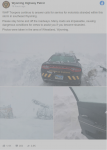
Wyoming Highway Patrol, as well as other state and county authorities, are warning people to stay off the roads.

WHP said roads and many major highways are impassable at this point, including I-25 and I-80.

1615814483623.png

To the south, many regions of Colorado had received 30 inches (76 cm) of snow by noon Sunday.

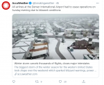
A foot had fallen in Denver, closing the airport (see below), with more on the way.

View: https://twitter.com/DENAirport/status/1371234670961164289

The Colorado Department of Transportation reported a myriad of highway closures, including much of Interstate 70 that runs east to west across the state. And the Colorado Avalanche Information Center has set the avalanche risk as high, warning of “very dangerous avalanche conditions” in what is already assured of being the U.S.’s deadliest avalanche season on record.

In addition, more than 30,000 customers are currently without power in Colorado alone.

Looking northeast, Nebraska’s State Patrol have asked people across the western part of the state to “PLEASE STAY HOME” in order to avoid dangerous blizzard conditions:

View: https://twitter.com/NSP_TroopE/status/1371201919239196679

Remember: “historic and crippling” snow in the year 2021 was considered an impossibility under the original global warming theory (let alone historic and crippling March snow). But unwilling to do the honorable thing –i.e. drop the failed hypothesis and formulate anew– proponents of CAGW have instead colluded to shift the key foundations of the theory to suit this “unexpected” reality. The likes of the IPCC –and their dutiful lapdogs across the MSM– are trusting that we all forget the decades of failed “fire and brimstone” prophesies, and instead now lap-up their latest host of embarrassing unscientific explain-aways.

View: https://twitter.com/JWSpry/status/1371357132684107778

Record-breaking cold and snow IS NOT caused by anthropogenic global warming, but the scam won’t stop–its job is almost done. The powers-that-be appear confident that reality and facts can continue to be rewritten, and that their carefully orchestrated societal pressures and controlling groupthink will prevail in keeping their fraudulent narrative intact.
CAGW shouldn’t be looked upon as “bad science” anymore — it is the work of agenda-driven charlatans.

I can’t believe the bored, placard-brandishing, noisy-minority among us are this easily duped — you are all pawns, sheep, useful idiots –every one of you– and your grandchildren will remember you as such…

ELSEWHERE

This month is the anniversary of the Great Quebec Blackout–a power outage caused by the strongest geomagnetic storm of the Space Age:


And in Iceland, the volcano-seismic unrest continues around Fagradalsfjall mountain.

A strong 5.4M earthquake occurred yesterday March 14, 2021 at 2:15 pm local time.

The shaking was widely felt, and even captured on webcam:

View: https://twitter.com/twinderseis/status/1371108759028826112
Run time is 0:10

The COLD TIMES are returning, the mid-latitudes are REFREEZING in line with the great conjunction, historically low solar activity, cloud-nucleating Cosmic Rays, and a meridional jet stream flow (among other forcings).

Both NOAA and NASA appear to agree, if you read between the lines, with NOAA saying we’re entering a ‘full-blown’ Grand Solar Minimum in the late-2020s, and NASA seeing this upcoming solar cycle (25) as “the weakest of the past 200 years”, with the agency correlating previous solar shutdowns to prolonged periods of global cooling here.

Furthermore, we can’t ignore the slew of new scientific papers stating the immense impact The Beaufort Gyre could have on the Gulf Stream, and therefore the climate overall.


Prepare accordinglylearn the facts, relocate if need be, and grow your own.
 

northern watch

TB Fanatic
China’s worst sandstorm in a decade blankets Beijing, cancels hundreds of flights

Rebel News
March 15 2021


China’s worst sandstorm in a decade blankets Beijing, cancels hundreds of flights

AP Photo/Andy Wong

China is experiencing its worst sandstorm in a decade, as skyscrapers across Beijing appear to be blanketed in a sea of dust and sand.

On Monday, China’s capital and a broad swath of the country’s north were enveloped in the sandstorm, prompting the cancellation of hundreds of flights.

Fox News reports that skyscrapers in the centre of Beijing dropped out of sight amid the terrible weather. Over 400 flights out of the capital’s two main airports were canceled before noon.

Such storms normally occur in the springtime, when the sands from the western deserts blow eastwards and affect regions as far as Japan. China has taken measures to deal with the intensity of the storms by planting greenery, but the expansion of cities and China’s ever-growing industries have placed undue pressure on its environment.

According to China's National Meteorological Center, the sand and dust is anticipated to affect 12 provinces and regions from Xinjiang to as far north as Heilongjiang, as well as the northeastern port city of Tianjin.

"This is the most intense sandstorm weather our country has seen in 10 years, as well as it covering the broadest area," said the centre.

Although it is unclear if the sandstorm is related to China’s ongoing poor air quality, it hasn’t helped matters either, as Beijing continues to choke from smog. Residents are advised to wear protective face masks to lessen the effects of air pollution.

According to Fox News, the communist party has pledged to reduce the nation’s carbon emissions by 18 per cent over the next five years. China continues to depend heavily on coal power plants to provide electricity for its more than 1.398 billion residents.

China’s worst sandstorm in a decade blankets Beijing, cancels hundreds of flights - Rebel News
 

TheSearcher

Are you sure about that?
China’s worst sandstorm in a decade blankets Beijing, cancels hundreds of flights

Rebel News
March 15 2021


China’s worst sandstorm in a decade blankets Beijing, cancels hundreds of flights

AP Photo/Andy Wong

China is experiencing its worst sandstorm in a decade, as skyscrapers across Beijing appear to be blanketed in a sea of dust and sand.

On Monday, China’s capital and a broad swath of the country’s north were enveloped in the sandstorm, prompting the cancellation of hundreds of flights.

Fox News reports that skyscrapers in the centre of Beijing dropped out of sight amid the terrible weather. Over 400 flights out of the capital’s two main airports were canceled before noon.

Such storms normally occur in the springtime, when the sands from the western deserts blow eastwards and affect regions as far as Japan. China has taken measures to deal with the intensity of the storms by planting greenery, but the expansion of cities and China’s ever-growing industries have placed undue pressure on its environment.

According to China's National Meteorological Center, the sand and dust is anticipated to affect 12 provinces and regions from Xinjiang to as far north as Heilongjiang, as well as the northeastern port city of Tianjin.

"This is the most intense sandstorm weather our country has seen in 10 years, as well as it covering the broadest area," said the centre.

Although it is unclear if the sandstorm is related to China’s ongoing poor air quality, it hasn’t helped matters either, as Beijing continues to choke from smog. Residents are advised to wear protective face masks to lessen the effects of air pollution.

According to Fox News, the communist party has pledged to reduce the nation’s carbon emissions by 18 per cent over the next five years. China continues to depend heavily on coal power plants to provide electricity for its more than 1.398 billion residents.

China’s worst sandstorm in a decade blankets Beijing, cancels hundreds of flights - Rebel News

Geeze... Somebody has GOT to photoshop Matt Damonnn in there in his spacesuit... Looks like Mars, cold, red sandstorm.
 

TxGal

Day by day
Adapt 2030 has a new podcast out:

What Happens When Volcanic Ash Begins to Fall Globally ? - YouTube

What Happens When Volcanic Ash Begins to Fall Globally ?
17,065 views • Mar 16, 2021

View: https://youtu.be/DfeTuP3HCHM
Run time is 6:47

Synopsis provided:

Etna ashfall making its way to the Great Lakes in the USA, Pinatubo awakens again, Iceland readies for massive eruption and lumber prices reach all time record high so if you do want to build a greenhouse, its going to cost far more money.
 

TxGal

Day by day
More NOAA Lies, Major March Snowstorm buries the Alps under 10 Feet, and Finland fears this Winter's Record Snow won't melt in the Summer - Electroverse


noaa_wallpaper_800x600-e1615891780115.jpg


MORE NOAA LIES, MAJOR MARCH SNOWSTORM BURIES THE ALPS UNDER 10 FEET, AND FINLAND FEARS THIS WINTER’S RECORD SNOW WON’T MELT IN THE SUMMER
MARCH 16, 2021 CAP ALLON

All-time cold-records continue to fall as the Grand Solar Minimum continues to intensify, despite what NOAA is telling us.

MORE NOAA LIES

February was a month of historic cold, across large parts of the planet.

Even NOAA –with their crafty, data-fudging & UHI-ignoring ways– have recently revealed that last month was an exceptionally chilly Feb, although you wouldn’t get that impression if you all you had access to was their absurd “percentiles” map (shown below)–you know, the one that routinely does the rounds across the MSM:

February-2021-Global-Temperature-Percentiles-Map.png


But when circumventing NOAA’s obfuscation, and breaking down the agency’s data, it is revealed that North America actually suffered its coldest February since 1994 (the start of solar minimum of cycle 22), while the contiguous U.S. saw its chilliest Feb since 1989, and its 19th coldest in record books dating all the way back to 1895.

Oceania witnessed its coldest February since 2012; in fact, the entire Southern Hemisphere saw its chilliest month of Feb since 2012.

All of central and northern Asia froze.

While large parts of Africa, Southern Asia, and South America also experienced a colder-than-average month.
NOAA’s “departures from average map” (shown below)–you know, the map that isn’t readily picked up by the MSM–gives a far better indication of the state of play in February, 2021:

February-2021-Global-Departures-from-Average-Map.png


And below I’ve included a direct comparison of the maps (in a slideshow) to help demonstrate NOAA’s blatant obfuscation. Note: the two maps use the exact same data yet they give wildly differing impressions of the month (see the “whiting out” on the percentiles map where there is clearly “blue” on the departure map):

  • February-2021-Global-Departures-from-Average-Map-1.png
  • February-2021-Global-Temperature-Percentiles-Map.png

MAJOR MARCH SNOWSTORM BURIES THE ALPS

The snow is “dumping down” across the European Alps, reports inthesnow.com.

The heavy snowfall has been widespread, but currently the largest totals have been reported in the French and Swiss Alps where many ski resorts have already posted as much as 1.22 meters (4 feet) of global warming goodness with the situation expected to intensify further as the week progresses — totals nearing 3 meters (10 feet) are forecast today, March 16:

View: https://twitter.com/ASKMeteo/status/1371735074748633089

The avalanche danger is currently very high: level 4 on the scale to 5 in many areas.

A lot of resorts closed early in anticipation storm which is bringing strong winds as well as record-busting snow.
Most access roads have also been shut.

This week’s “dumping down” over the Alps will only add to already above average snowfall witnessed across the Northern Hemisphere this season (the below chart only runs to March 14):


[Finnish Meteorological Institute]

FINLAND FEARS THIS WINTER’S RECORD SNOWFALL WON’T MELT IN THE SUMMER

Parts of Finland have received so much snow this winter that it is feared the designated snow-dump areas won’t melt during the course of the summer, reports hs.fi — many metropolitan areas have received more pow-pow than they have for at least a decade.

The region of Uusimaa, for example, located in the south of the country, received 1.7x more snow than it did last year, reports foreca.fi.

In Herttoniemi, eastern Helsinki, the snow dump area currently stands at 20 metres (65 feet) high.

While in Maununneva, a north-western neighborhood of the Finnish capital, trucks have transported some 16,000 loads of snow to its dump area, said Tero Koppinen, of the Helsinki City Construction Services (Stara):


Snow dump area at Maununneva — the mountain is not expected to melt during the summer.
PHOTO: JUHANI NIIRANEN / HS

The designated dump pile in Espoo, Vanttila has been nicknamed “the Alps” by the locals.

Koppinen has estimated that the snow there is also unlikely to melt during the summer. He explained that while the mountain may melt to a certain extent as temperatures creep up, the setup will likely also cause “glaciation,” where the weight of the top layers of snow causes the lower layers to condense and gradually turn into ice.

The COLD TIMES are returning, the mid-latitudes are REFREEZING in line with the great conjunction, historically low solar activity, cloud-nucleating Cosmic Rays, and a meridional jet stream flow (among other forcings).

Both NOAA and NASA appear to agree, if you read between the lines, with NOAA saying we’re entering a ‘full-blown’ Grand Solar Minimum in the late-2020s, and NASA seeing this upcoming solar cycle (25) as “the weakest of the past 200 years”, with the agency correlating previous solar shutdowns to prolonged periods of global cooling here.

Furthermore, we can’t ignore the slew of new scientific papers stating the immense impact The Beaufort Gyre could have on the Gulf Stream, and therefore the climate overall.


Prepare accordinglylearn the facts, relocate if need be, and grow your own.
 

TxGal

Day by day
Blizzard Warning for Texas and Oklahoma Panhandles - In Mid-March - Ice Age Now

Blizzard Warning for Texas and Oklahoma Panhandles – In Mid-March
March 16, 2021 by Robert

…BLIZZARD WARNING IN EFFECT FROM 1 AM TO 7 PM CDT WEDNESDAY… warns the National Weather Service. “Travel treacherous and potentially life-threatening.”

* WHAT…Blizzard conditions expected. Total snow accumulations between 1 to 4 inches. Winds gusting as high as 60 mph.
* WHERE…The Oklahoma Panhandle and northwestern two thirds of the Texas Panhandle.
* WHEN…From 1 AM to 7 PM CDT Wednesday.
* IMPACTS…Visibilities may drop below 1/4 mile due to falling and blowing snow. Whiteout conditions are expected and will make travel treacherous and potentially life-threatening.

A Blizzard Warning means severe winter weather conditions are expected or occurring. Falling and blowing snow with strong winds are likely. This will lead to whiteout conditions, making travel extremely dangerous. Do not travel. If you must travel, have a winter survival kit with you and notify a friend or family of your plans. If you get stranded, stay in your vehicle.

Target Area:
Carson
Dallam
Deaf Smith
Gray
Hansford
Hartley
Hutchinson
Lipscomb
Moore
Ochiltree
Oldham
Palo Duro Canyon
Potter
Randall
Roberts
Sherman

Meanwhile, our government is doing everything in its power to destroy our energy industry – and our very lives – in its misguided attempt to fight ‘global warming.’

https://alerts.weather.gov/cap/wwac...TX.AMAWSWAMA.d3d00a02f1f0851228c35479a5a7e726
 

TxGal

Day by day
Greenland ice sheet has melted multiple times in the past - with no help from humans - Ice Age Now

Greenland ice sheet has melted multiple times in the past – with no help from humans
March 16, 2021 by Robert

New study shows clearly that global warming has happened naturally before – with no help from humans. That should be good news. However, that good news has been twisted 180 degrees to warn us about “humanity’s out-of-control warming of the planet.” In fact, the study found “multiple” times when the earth has been warmer than today, again, with no help from humans.
_________

Ancient Plants Buried a Mile Under Greenland’s Ice Are a Grim Warning From The Past,” reads the headline on sciencealert.com.

The evidence comes from an ice core sample excavated in 1966 – more than 50 years ago – in the secret Cold War military base Camp Century in northwestern Greenland. The plan was to dig a system of tunnels to hide hundreds of nuclear weapons. (The plan failed because the ice was too unstable.)

Included in the core were several meters of silty ice and frozen sediment from the bottom of the 1.4-kilometer (0.87-mile) ice core. This sediment was packed in cookie jars – yes, cookie jars! – and moved from freezer to freezer, finally ending up in Denmark where it languished in cold storage, almost forgotten.

It was only rediscovered in 2018 when scientists at the University of Copenhagen were preparing to move the samples to a new freezer. When they realized what was in the jars, they mobilized a team to study the ancient dirt.

“What we discovered was delicate plant structures – perfectly preserved. They’re fossils, but they look like they died yesterday. It’s a time capsule of what used to live on Greenland that we wouldn’t be able to find anywhere else,” said geologist Andrew Christ of the University of Vermont, one of the team of international scientists.

Twigs-and-leaves-from-Greenland-ice-cores.jpg

Twigs and leaves preserved in soil beneath the Greenland Ice Sheet. Andrew Christ and Dorothy Peteet, CC BY-ND

The twigs and leaves in the samples suggest that, at least once within the last million years, and multiple times in the few million years prior, Greenland’s ice sheet melted long enough during periods of warmth that significant vegetation – perhaps even a forest – was able to take root and thrive.

They were warm periods like those we are currently experiencing due to climate change, said Christ.

“Our study shows that Greenland is much more sensitive to natural climate warming than we used to think – and we already know that humanity’s out-of-control warming of the planet (emphasis added) hugely exceeds the natural rate,” Christ said.

Similar articles in other publications display the same convoluted logic.

Scientists stunned by fossils found deep beneath Greenland’s ice sheet,” reads the headline on cnet.com. “The implications of the discovery could be huge for studies on climate change, given that analysis of Greenland’s ice sheet could help scientists predict how it will behave as temperatures rise and the ice melts as a result of human activity.” (emphasis added)

Scientists’ climate warning after ‘grave’ rediscovery from secret Cold War military base,” reads the headline on news.sky.com. A ‘grave’ rediscovery?

Same with Yahoo.com. “Ancient leaves preserved under a mile of Greenland’s ice – and lost in a freezer for years – hold lessons about climate change,” reads the headline on yahoo.com.

“How old were these plants?” asks yahoo.

“Over the last million years, Earth’s climate was punctuated by relatively short warm periods, typically lasting about 10,000 years, called interglacials, when there was less ice at the poles and sea level was higher. The Greenland ice sheet survived through all of human history during the Holocene, the present interglacial period of the last 12,000 years, and most of the interglacials in the last million years.”

Greenland-ice-sheet-today-compared-to-multiple-earlier-times.jpg

Greenland ice cover today as compared to multiple previous times

“(This) research shows that at least one of these interglacial periods was warm enough for a long enough period of time to melt large portions of the Greenland ice sheet, allowing a tundra ecosystem to emerge in northwestern Greenland.

“This means the region melted entirely, and stayed melted long enough for cosmic rays to form those isotopes, and for vegetation to grow and take them up, with moss and maybe even trees thriving.”

“Radiocarbon dating and luminescence dating – estimating the time since the sediment was last exposed to light – placed that melting to within the last million years.”

Previous work on another ice core, GISP2, extracted from central Greenland in the 1990s, showed that the ice had also been absent there within the last million years, perhaps about 400,000 years ago. (I mention the GISP ice cores in “Not by Fire but by Ice.”)

So let me end with this:

This new study clearly shows that global warming has happened – naturally – many times before with absolutely no help from humans.

I find it incredible that these so-called ‘scientists’ can twist such good news into a catastrophic warning about “humanity’s out-of-control warming of the planet.”

Ancient leaves preserved under a mile of Greenland's ice – and lost in a freezer for years – hold lessons about climate change
The yahoo.com article (though wrong-headed) is – by far – the most comprehensive article of the lot.)
Ancient Plants Buried a Mile Under Greenland's Ice Are a Grim Warning From The Past
Scientists stunned by fossils found deep beneath Greenland's ice sheet
_____________

The actual scientific study, entitled “A multimillion-year-old record of Greenland vegetation and glacial history preserved in sediment beneath 1.4 km of ice at Camp Century,” was published in the journal Proceedings of the National Academy of Sciences on Monday, March 16, 2021.

A multimillion-year-old record of Greenland vegetation and glacial history preserved in sediment beneath 1.4 km of ice at Camp Century
 

TxGal

Day by day
"Polar Spring" to hit Europe as UK Met Office warns of 2000-mile wide "Arctic Dome," plus the 45 Volcanoes Currently Erupting - Electroverse

sun-volcano-freeze-crop.jpg


“POLAR SPRING” TO HIT EUROPE AS UK MET OFFICE WARNS OF 2000-MILE WIDE “ARCTIC DOME,” PLUS THE 45 VOLCANOES CURRENTLY ERUPTING
MARCH 17, 2021 CAP ALLON

The growing season is shortening.

Spring is springing later and later each year as the Grand Solar Minimum continues its intensification. I am expecting a freeze here in central Portugal, a full 45 days AFTER the last average frost date.

“POLAR SPRING” TO HIT EUROPE AS UK MET OFFICE WARNS OF 2000-MILE WIDE “ARCTIC DOME”

Snow and ice are forecast to blast Europe this week — the UK Met Office has warned of a 2,000-mile wide “Arctic dome” —whatever the hell that is– engulfing the continent, with few nations spared.

gfs_asnow_eu_65-13.png

GFS Total Snowfall (cm) March 17 to April 2 [tropicaltidbits.com].

Spring will officially start on Saturday, March 20, but in Spain it will feel more like a return to winter, reports elpais.com — the country is expecting the mercury to plunge below -10C (14F) across its higher elevations, with additional rare March low-level snow falling in places like Burgos, León, Soria, Valladolid, and even Madrid.


Settling snow in Burgos, Spain on March 8 [TOMÁS ALONSO / EUROPA PRESS]

In the UK, Scotland’s coldest winter for at least a decade 10 years will drag on in what the Weather Outlook has dubbed a three-week “polar spring”. Below the Scottish border, Northumberland, Cumbria, Liverpool and Manchester are also all set to suffer spring snow, according to Netweather, who see up to an 85% chance of settling flakes. Even the southern cities of London, Bath and Kent could also see snow, forecasters have warned — temperatures in the South East are set to hit unseasonable lows of -5C (23F).

Central Europe is on for something of a spring burial, with the Alps adding to the 3 meters (10 feet) of snow they’ve already suffered this week. Record-smashing totals will also hit Scandinavia and the Balkans. North Africa is also on fore rare, heavy late-March flurries.

Snow across the Northern Hemisphere is also holding some 500 Gigatons above the 1982-2012 average:


[FMI]

THE 45 VOLCANOES CURRENTLY ERUPTING

Volcanic eruptions are one of the key forcings driving Earth into its next bout of global cooling. Particulates fired above 10km –and so into the stratosphere– shade sunlight and reduce terrestrial temperatures. The smaller particulates from an eruption can linger in the upper atmosphere for years, or even decades+ at a time.

Today’s worldwide volcanic uptick is thought to be tied to low solar activity, coronal holes, a waning magnetosphere, and the influx of Cosmic Rays penetrating silica-rich magma.

Below is a list of today’s continuing eruptions, data courtesy of volcano.si.edu. Not included in the list are the myriad of mountains merely rumbling and readying for an eruption — the most notable exclusion is Fagradalsfjall, Iceland which has been enduring “a seismic crisis” since late Feb 2021 (50,000 quakes in just 20 days) as well as continued inflation (see video below the list). Fagradalsfjall is of concern because we have no data on it, no eruption has been detected in the area during the last 10,000 years, at least–the volcano may well be capable of producing a VEI 6+ stratospheric eruption which would cool the planet almost overnight.

VolcanoCountryEruption Start Date
RaungIndonesia2021 Jan 21
Sarychev PeakRussia2021 Jan 7
MerapiIndonesia2020 Dec 31
Soufriere St. VincentSaint Vincent and the Grenadines2020 Dec 27
KilaueaUnited States2020 Dec 20
LewotoloIndonesia2020 Nov 27
SinabungIndonesia2020 Aug 8
LangilaPapua New Guinea2020 Aug 1
KarymskyRussia2020 Apr 1
KlyuchevskoyRussia2019 Apr 9
SangayEcuador2019 Mar 26
TinakulaSolomon Islands2018 Dec 8 (in or before)
KarangetangIndonesia2018 Nov 25
Barren IslandIndia2018 Sep 25
NyamuragiraDR Congo2018 Apr 18
KadovarPapua New Guinea2018 Jan 5
Nevado del RuizColombia2017 Dec 18
Ol Doinyo LengaiTanzania2017 Apr 9
AiraJapan2017 Mar 25
SabancayaPeru2016 Nov 6
EbekoRussia2016 Oct 20
Nevados de ChillanChile2016 Jan 8
MasayaNicaragua2015 Oct 3
TofuaTonga2015 Oct 2
PacayaGuatemala2015 Jun 7 ± 1 days
VillarricaChile2014 Dec 2 ± 7 days
SaundersUnited Kingdom2014 Nov 12
ManamPapua New Guinea2014 Jun 29
SemeruIndonesia2014 Apr 1 ± 15 days
EtnaItaly2013 Sep 3
HeardAustralia2012 Sep 5 ± 4 days
BezymiannyRussia2010 May 21 (?)
ReventadorEcuador2008 Jul 27
IbuIndonesia2008 Apr 5
PopocatepetlMexico2005 Jan 9
SuwanosejimaJapan2004 Oct 23
NyiragongoDR Congo2002 May 17 (?)
FuegoGuatemala2002 Jan 4
BaganaPapua New Guinea2000 Feb 28 (in or before)
SheveluchRussia1999 Aug 15
ErebusAntarctica1972 Dec 16 (in or before) ± 15 days
StromboliItaly1934 Feb 2
DukonoIndonesia1933 Aug 13
Santa MariaGuatemala1922 Jun 22
YasurVanuatu1774 Jul 2 (in or before) ± 182 days

View: https://youtu.be/I9JMPGeju5s
Run time is 5:21

The COLD TIMES are returning, the mid-latitudes are REFREEZING in line with the great conjunction, historically low solar activity, cloud-nucleating Cosmic Rays, and a meridional jet stream flow (among other forcings).

Both NOAA and NASA appear to agree, if you read between the lines, with NOAA saying we’re entering a ‘full-blown’ Grand Solar Minimum in the late-2020s, and NASA seeing this upcoming solar cycle (25) as “the weakest of the past 200 years”, with the agency correlating previous solar shutdowns to prolonged periods of global cooling here.

Furthermore, we can’t ignore the slew of new scientific papers stating the immense impact The Beaufort Gyre could have on the Gulf Stream, and therefore the climate overall.


Prepare accordinglylearn the facts, relocate if need be, and grow your own.
 

northern watch

TB Fanatic
‘Major’ severe storm outbreak with potential ‘long-track, intense tornadoes’ underway in South

The Weather Service has declared an exceptionally rare “high risk” of severe thunderstorms on Wednesday. The threat shifts into Southeast and southern Mid-Atlantic on Thursday.

By Matthew Cappucci and Jason Samenow
Washington Post
March 17, 2021 at 1:12 p.m. PDT

An extremely dangerous severe weather outbreak is ongoing Wednesday across the South, with potential violent, long-track tornadoes, destructive winds and large, damaging hail. This threat will shift to the Southeast and southern Mid-Atlantic on Thursday.

imrs.php


The National Weather Service Storm Prediction Center declared a very rare Level 5 out of 5 “high risk” of severe thunderstorms highlighting the exceptional intensity and widespread nature of the anticipated outbreak. “A Major Severe Weather Outbreak is Forecast,” says the headline on the center’s website.

Multiple tornadoes had already been observed in Mississippi and Alabama through early afternoon Wednesday, some damaging.

Over 40 million Americans from Texas to Georgia are at risk of severe weather on Wednesday, including nearly 1.5 million residing in the top-tier high-risk zone, which spans extreme northeast Louisiana, central Mississippi and western Alabama, and includes Birmingham and Tuscaloosa, Ala., and Jackson, Miss.

It’s the first time since 2012 that a high risk of severe weather has been declared during March by the Storm Prediction Center. “A significant tornado outbreak, with long-track, intense tornadoes is expected to begin this afternoon across parts of Louisiana and Arkansas,” it writes, “and then spread eastward and peak this evening into tonight across Mississippi and Alabama.”

The risk of severe weather shifts east on Thursday, when a level 4 out of 5 moderate risk of dangerous storms blankets the Carolinas and Georgia. The potential exists for more strong tornadoes. Areas threatened include Charlotte, Raleigh, N.C., and Savannah, Ga. Over 50 million residents face an elevated storm threat Thursday from Florida to Pennsylvania.

The latest

imrs.php


A look at the weather map at 2:15 p.m. CDT illustrates how widespread the tornado threat is across Alabama. (GR2 Analyst)
Across western and central Alabama and central and eastern Mississippi, a “particularly dangerous situation” tornado watch, the most severe kind, was in effect until 7 p.m. local time. The watch described the potential for “numerous tornadoes” and the likelihood that a few would be intense. A second particularly dangerous situation tornado watch was issued for northern Louisiana, southeast Arkansas, and western Mississippi until 6 p.m. local time.

Mid-afternoon a tornado watch was added for southeast Louisiana, including New Orleans, in effect until 9 p.m. local time.
A half dozen tornado warnings were in effect over Alabama just after 3 p.m. local time, where weather satellite and radar showed storms erupting. Additional tornado warnings dotted northern Louisiana. These warnings covered Tuscaloosa and the north side of Birmingham.

The Storm Prediction Center highlighted specific zones in northwest Louisiana and much of Mississippi and south central Alabama primed for the development of strong tornadoes.

A tornado which touched down in Wayne County, Mississippi damaged homes around midday and was captured on video:

Additional footage of observed tornadoes was obtained in Alabama in Selma, (west of Montgomery), northern Autauga County (northwest of Montgomery), Livingston (near the border with Mississippi, and northeast of Meridian), and Butler (near the border with Mississippi, and southeast of Meridian).

The Selma storm appeared to produce a large tornado near Cooper, Al.; there were at least two occasions when radar suggested two tornadoes on the ground simultaneously.

An atmosphere primed with destructive potential in a vulnerable zone

imrs.php


A model simulation of where the greatest overlap of atmospheric energy and spin will be found. That's where tornadoes are most probable. (WeatherBell)

Seven tornado watches covered large parts of the South Wednesday afternoon from eastern Oklahoma to eastern Alabama. Multiple rounds of severe weather were possible in the region into the evening.

The tornado threat will continue past dark in Alabama, especially in western and northern parts of the state. Alabama and parts of neighboring states are known for their vulnerability to tornadoes; the danger escalates at night. Research has shown that nighttime tornadoes are 250 percent more likely to result in deaths.

“The area of the American South, which contains the … Tennessee River [Valley], has the highest percentages of nocturnal tornadoes, nocturnal fatalities, and number of nocturnal killer events,” Walker Ashley, a meteorology professor at Northern Illinois University, wrote in a study in 2008.

The storms are predicted to hit an area with high levels of poverty and flimsy construction, including large numbers of mobile homes, which are particularly vulnerable in tornadoes.

“What bothers me most about the upcoming Southeast severe weather event … Poverty*. Mix this with an overnight event. It’s a recipe for fatalities,” tweeted Stephen Strader, a professor of geography and hazards experts at Villanova University.

Alabama Gov. Kay Ivey (R) issued a state of emergency, which freed up money and resources to be more quickly distributed in the event disaster ensues, as well as activated the state’s emergency management agency. The order also temporarily relaxed the enforcement of covid-19 restrictions to allow the prioritization of sheltering from severe weather. A number of schools across the South canceled classes Wednesday ahead of the ominous threat.

Strong to violent tornadoes possible

imrs.php


A model simulation of storm fuel. Values over 1,000 indicate the potential for severe weather; over 2,000 suggests potentially volatile storms. (WeatherBell)

Danger brewed Wednesday afternoon, where clusters of storms formed as a warm front lifted northward. The atmosphere reloaded behind a northward advancing warm front, with a mild, sultry air mass spreading over the region and spiking the risk for severe storms.

imrs.php


Percent chance of tornadoes within 25 miles of any location. (NWS SPC)

At the border of central Mississippi and Alabama, the Storm Prediction Center highlighted a small area which has a 45 percent chance of a tornado occurring within 25 miles of any location. Such a high tornado chance is exceptionally rare and, historically, has only been predicted in some of the most extreme outbreaks.

“Significant severe thunderstorms and tornadoes are likely with strong or violent long-tracked tornadoes possible,” wrote the National Weather Service in Jackson, Miss. “Some thunderstorms will produce damaging wind gusts and destructive hail up to baseball size or larger.”

Surrounding the high-risk zone is a Level 4 out of 5 moderate risk, which encapsulates much of eastern Arkansas, northeast Louisiana, and the remainder of Mississippi and Alabama. Memphis, Little Rock and Huntsville, Ala., are in the moderate zone.

Wednesday’s storm timeline

imrs.php


A high-resolution model simulation of the storms that could threaten the Deep South today. (WeatherBell)

Supercells or rotating thunderstorms began erupting midday, and several began producing tornadoes as the afternoon wore on. Some supercell structures may persist for six hours or more, some producing “tornado families” of multiple twisters. That risk will continue into the night.

Even for storms during the daytime, indications suggest storm updrafts will be elongated and highly tilted, meaning storms won’t exhibit the visual cues sometimes associated with tornadoes. They’ll also move very quickly, and low cloud bases and overcast skies will make it difficult to see a tornado until it’s on one’s doorstep, making the threat especially dangerous.

imrs.php

An annotated look of what to expect by late afternoon into the evening hours. (WeatherBell/Matthew Cappucci/The Washington Post)

Storms won’t finally clear Mississippi to the east until after midnight, and will still target Alabama into the wee hours of Thursday morning. Georgia could be affected by the storms, in a moderated state, during the predawn hours.

Thursday’s risk

imrs.php


The Storm Prediction Center's outlook for severe weather on Thursday. (NOAA/SPC)

The broken band of storms will redevelop and fill back in late Thursday morning while racing east through the Carolinas, bringing the risk of wind and additional tornadoes. The Storm Prediction Center is bullish on the tornado potential, drawing a large Level 4 out of 5 moderate risk area. Any supercells that form ahead of the main line will be especially problematic.

“The more substantial risk will be from widespread damaging winds, as well as tornadoes — including possibility for a few strong/significant tornadoes during the afternoon and into the early evening,” wrote the Storm Prediction Center.

Raleigh, Charlotte and Wilmington, N.C., Charleston and Columbia, S.C. and Savannah, Ga. are all in the moderate risk area.
A few renegade storms are even possible as far north as north-central Virginia and southern Maryland on Thursday and into Friday morning, and could pose the risk of an isolated gust of damaging wind or a brief spin-up tornado.

Afterward, storms will exit the coast, with more tranquil weather building into the Lower 48 until the end of next week.

Tornado preparedness

imrs.php


An EF4 tornado decimated parts of Tuscaloosa, Ala., on April 27, 2011. (Dusty Compton/AP) (Dusty Compton)
Over the next two days, numerous tornado watches and warnings are expected to be issued.

A watch means conditions are favorable for tornadoes and that residents should be prepared to take action. If a tornado warning is issued, it means weather radar is indicating a tornado and/or a twister has been spotted and shelter should be sought immediately.

The safest play during a tornado is to be at the lowest level of a strong building, preferably underground. Put as many walls between yourself and outside as possible and stay away from windows. Mobile homes and vehicles do not offer protection from a tornado. Meteorologists and emergency responders advise mobile home residents identify a safe place to shelter ahead of time. Options may include a public tornado shelter or the home of friends or relatives.

“You can’t stay in a mobile home during a tornado warning,” wrote Birmingham broadcast meteorologist James Spann in a blog post early Wednesday. “Know where you are going, and how to get there quickly. If there is no community shelter nearby, go to a business like a gas station, convenience store, or restaurant that is open 24/7.”

In a Facebook broadcast early Wednesday, Spann urged residents to have multiple ways of receiving tornado warnings, stressing sirens, which can only be heard outside, are inadequate.

The surest way to receive a warning, he said, was through a NOAA weather radio, because it operates even when cellular service drops.

Assuming cellular service is available, smartphone apps are another method, he said. He advised making sure wireless emergency alerts were turned on, which will automatically sound a shrill beep if a tornado warning is issued.

When sheltering, Spann suggested wearing a helmet to protect your head and hard-sole shoes “in case you have to walk over a tornado debris field.”

He also stressed residents should carry a bullhorn to assist first responders in finding them in case they became trapped.

Severe thunderstorm outbreak with high risk of tornadoes for South, Southeast - The Washington Post
 
Last edited:

TxGal

Day by day
Record snowfall in Wyoming, Colorado, Wisconsin, Minnesota, Texas... - Ice Age Now

Record snowfall in Wyoming, Colorado, Wisconsin, Minnesota, Texas…
March 17, 2021 by Robert

You know it’s really bad when even the liquor stores are closed.
…………………….
Wyoming and Colorado just received record snowfalls over the …
Wyoming and Colorado just received record snowfalls over the weekend and you may be reading this while stuck at home. Reports of snow accumulations are crazy with Denver getting well over 24 inches and Cheyenne over 30 inches. Casper got its fair share, too with well over 2 foot. …
…………………….
Record March snowfall; Warmer weather ahead late this week
KTTC – The storm system that produced record snowfall in the area on Monday has moved on to the east, but it has left behind extensive…
…………………….
Mankato topped state in snowfall
Mankato Free Press – Record snowfall in and around Mankato (Minnesota) canceled schools, snarled traffic and created other headaches Monday. A foot of snow fell in …
…………………….
Parts of Wyoming, Colorado, still snarled by record blizzard
Minneapolis Star Tribune … blizzard pummeled the region with record snowfall. Crews didn’t expect to reopen some highways for another day, though a portion of Interstate …
…………………….
Faiveley Buys Stake in Williams Selyem
Spanish winery narrowly escapes destruction after record snowfall crushes their …
…………………….
Madison’s record snowfall for March 15 is 7 inches in 1959. Photos: Remembering the Great Ice Storm of 1976 …
…………………….
Amp spotlight: How Texas-based agencies are weathering the storm
In Austin, which saw record snowfall, sleet and sub-zero temperatures, the storm left some agencies with no choice but …
…………………….
FOMC decision: we’re going to see a lot of volatility no matter what: Sheila Bair
… in the aftermath of a blizzard that pummeled the region with record snowfall. Crews didn’t expect to reopen some highways for another day, though a …
…………………….
Denver digging out from weekend snowstorm
… closed Tuesday for a second day and many roads were still impassable in the aftermath of a blizzard that pummeled the region with record snowfall.
…………………….
Rapid Snow Melt as Temperatures Warm – Record Snowfall at Cheyenne, WY – Paul Douglas
Record Snowfall at Cheyenne, WY …
…………………….
Parts of Wyoming, Colorado, still snarled by record blizzard | National News | nptelegraph.com
… closed Tuesday for a second day and many roads were still impassable in the aftermath of a blizzard that pummeled the region with record snowfall.
…………………….
Record snowfall in Denver is over, but it’s still gonna be chilly and slick – Flipboard
Even liquor stores were closed… It is officially coming down out there.
…………………….
Cheyenne, Casper received record snowfall in latest storm – WyoToday.com
A late March 14th image of record snowfall in front of National Weather Service office in Cheyenne. NWS photo. Cheyenne had its biggest snowfall …
…………………….
NWS Riverton on Twitter: “âš ï¸All-Time Record Snowfall in Casper, WYâš ï¸ This snowstorm could …
All-Time Record Snowfall in Casper, WY – This snowstorm could be a top-3 all-time snowfall for Casper, WY. Here is a look at where the current …
 

TxGal

Day by day
Prophetic Photos of Frozen Apartment Building in Russia + this Week Delivered one of the Biggest Snowstorms in U.S. History - Electroverse

V-1-1-e1616066123548.jpg


PROPHETIC PHOTOS OF FROZEN APARTMENT BUILDING IN RUSSIA + THIS WEEK DELIVERED ONE OF THE BIGGEST SNOWSTORMS IN U.S. HISTORY
MARCH 18, 2021 CAP ALLON

According to the decades of dogmatic proclamations handed down by the AGW cabal, weather-related deaths should be rising exponentially as catastrophic global warming ravages the planet; however, as with most things “alarmist” the data simply doesn’t bear out the fear-mongering.

Figures compiled by injuryfacts.nsc.org (from data provided by NOAA) reveal that the number of direct and indirect injuries from weather events decreased 49% from 2015 to 2019 in the United States, with the number of direct and indirect weather related deaths decreasing 19% over the same period.

In addition, and even more telling, the weather event that caused the most deaths in 2019 was “winter weather” which resulted in 144 fatalities, verses just the 83 for heat-related deaths. Winter weather also accounted for the second-highest number of injuries, at 441, with tornadoes taking the top spot that year, with 545 (note, there is no sign of heat-related injuries on the list).

The data only runs through 2019.

It will be interesting to see the impact the cold blasts of 2020 and 2021 have had.

PROPHETIC PHOTOS OF FROZEN APARTMENT BUILDING IN RUSSIA

The mass of polar cold that hit northern Asia back in December, 2020 has persisted ever-since.

The Arctic has effectively migrated south this winter, and parked itself over Siberia (and at times North America).

Below is the JRA-55 Global Temperature Anomalies map for the year-to-date, which reveals the mercury across planet Earth stands at just 0.10C above the 1990-2020 average (data courtesy of Ryan Maue of NOAA).

Also revealed by the dataset is the descended Arctic: note the pocket of anomalous warmth that has encompassed the Arctic circle in 2021, and, simultaneously, the big freeze endured by the lower-latitudes:


Also spot how well the pattern fits with NASA’s Maunder Minimum Reconstruction Map (shown below).

Simply put, low sunspot activity during a Grand Solar Minimum plays a significant role in producing extreme “ice-age” type cold weather events across the Northern Hemisphere while, paradoxically, at the same time causes Arctic regions to become warmer — as mentioned above, this chimes perfectly with what we’re seeing today.


Temp change between 1780 (a year of normal solar activity) and 1680 (a year within the depths of the Maunder Minimum) — NASA.

This year’s setup has resulted in transcontinental Russia, Mongolia, and Kazakhstan all suffering their coldest winters on record. The mercury in these nations has held below -50C (-58F) for extended periods of time–temps which are among the coldest ever recorded in the northern hemisphere.

The Russian town of Vorkuta regularly sees lows of -52C (-61F), it is the coldest town in Europe (as well as the easternmost one).

Photographer Arseniy Kotov was exploring the old mining town when he came across an abandoned apartment building that had frozen over, both inside and out.

The images are a prophetic glimpse of the coming cooling epoch; as solar activity declines, the magnetic reversal speeds up, and the AMOC slows down. In the coming years, this could be an eerily familiar scene in many towns and cities above the 45th parallel:


You can find more of Kotov’s work on his website and Instagram.
Prints of Kotov’s work are also available for purchase at Galleri Artsight.


THIS WEEK DELIVERED ONE OF THE BIGGEST SNOWSTORMS IN U.S. HISTORY

A historic blizzard struck the Central United States in mid-March, delivering a record 4+ feet (1.3+ meters) of snow to many states–and the numbers are still rising…

The snowstorm is widely regarded as one of the biggest-ever to hit Colorado, and it left some 54,000 residents in the dark on Sunday, according to poweroutage.us.

Denver suffered its second-largest snow dump in 75 years of record-keeping when 27.1 inches (69 cm) accumulated.
While a site atop Windy Peak in the Laramie Range logged a historic 52 inches (1.32 meters), according to NWS data.
The storm also buried Cheyenne, Wyoming under 30.8 inches (78 cm) — the city’s most significant snowfall ever.

View: https://twitter.com/brendonme/status/1371300343733121024
Run time is 0:17

The COLD TIMES are returning, the mid-latitudes are REFREEZING in line with the great conjunction, historically low solar activity, cloud-nucleating Cosmic Rays, and a meridional jet stream flow (among other forcings).

Both NOAA and NASA appear to agree, if you read between the lines, with NOAA saying we’re entering a ‘full-blown’ Grand Solar Minimum in the late-2020s, and NASA seeing this upcoming solar cycle (25) as “the weakest of the past 200 years”, with the agency correlating previous solar shutdowns to prolonged periods of global cooling here.

Furthermore, we can’t ignore the slew of new scientific papers stating the immense impact The Beaufort Gyre could have on the Gulf Stream, and therefore the climate overall.


Prepare accordinglylearn the facts, relocate if need be, and grow your own.
 
Top