packyderms_wife
Neither here nor there.
For those of you of the praying kind we could use some prayers, the electrical system here in central Iowa is still "fragile" after the August 10th derecho. There are areas of the state that are still on "temporary" power structures and will be through next summer.

 www.iowachase.com
Winter Storm to Impact Iowa Thursday & Friday
By Zach Sharpe
January 13, 2021 at 11:30 am
A long duration winter storm will impact the upper Midwest Thursday into Friday. An area of light rain and snow will move across the state early Thursday morning and will continue east through the early afternoon hours. This will bring the possibility of light snowfall accumulations.
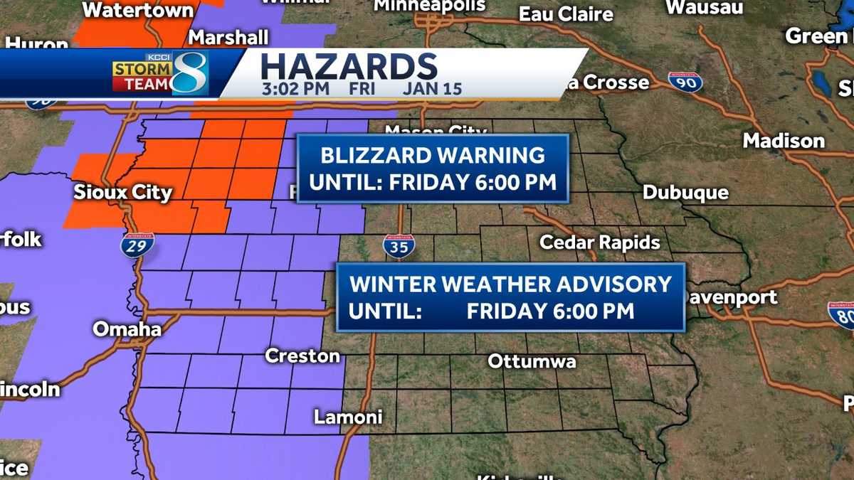
As the system continues to deepen, snow will continue to wrap around the system from late Thursday afternoon through Friday afternoon. The main concern with this system will be the high winds. While snowfall totals could range from 4 to 6 inches in northern Iowa, wind gusts of 30 to 40-mph will significantly reduce the visibility.

Due to some uncertainty between the different models, impacts will still continue to be pinpointed down throughout the day Wednesday and even into Thursday morning. Winter weather advisories are warnings are expected to be issued, but have not been issued yet due to the uncertainties that still exist. For those who have travel plans for Thursday and Friday across the state of Iowa, and points north, continue to keep a close eye on the latest forecast.

Winter Storm to Impact Iowa Thursday & Friday - ISCN
A long duration winter storm will impact the upper Midwest from Thursday into Friday. Moderate snowfall and high winds will create issues.
Winter Storm to Impact Iowa Thursday & Friday
By Zach Sharpe
January 13, 2021 at 11:30 am
A long duration winter storm will impact the upper Midwest Thursday into Friday. An area of light rain and snow will move across the state early Thursday morning and will continue east through the early afternoon hours. This will bring the possibility of light snowfall accumulations.
As the system continues to deepen, snow will continue to wrap around the system from late Thursday afternoon through Friday afternoon. The main concern with this system will be the high winds. While snowfall totals could range from 4 to 6 inches in northern Iowa, wind gusts of 30 to 40-mph will significantly reduce the visibility.
Due to some uncertainty between the different models, impacts will still continue to be pinpointed down throughout the day Wednesday and even into Thursday morning. Winter weather advisories are warnings are expected to be issued, but have not been issued yet due to the uncertainties that still exist. For those who have travel plans for Thursday and Friday across the state of Iowa, and points north, continue to keep a close eye on the latest forecast.
")