Solar Grand Solar Minimum part deux

TxGal

Day by day
Heavy Snow Shuts Down Gillette, "Cold and Stormy Winter" Forecast For Canada, "Scientific Misconduct", + The Upshot of Demonizing Carbon - Electroverse

demon-carbon.jpg

Articles Extreme Weather GSM

HEAVY SNOW SHUTS DOWN GILLETTE, “COLD AND STORMY WINTER” FORECAST FOR CANADA, “SCIENTIFIC MISCONDUCT”, + THE UPSHOT OF DEMONIZING CARBON
OCTOBER 15, 2021 CAP ALLON

HEAVY SNOW SHUTS DOWN GILLETTE, WYOMING

It may only be mid-October, but heavy snowfalls are shutting down towns and cities in the Mountain West.

Through Tuesday and Wednesday, a total of 13.8 inches of early-season snow buried the downtown area of Gillette, Wyoming, according to the National Weather Service (NWS) Rapid City.

As reported by county17.com, the storm forced the City of Gillette, Campbell County School District, Gillette College, Campbell County, and many small businesses to shut down on Wednesday. It also led to the implementation of Level 1 and Level 2 snow emergencies for the first time in a year and a half.

“It was a really good storm for Gillette,” said NWS meteorologist Em Wong. “The 13.8 inches is way more than the monthly average for downtown Gillette (which stands at 3.7 inches).”

This is already the city’s sixth snowiest October in recorded history–with still half of the month to go.
Campbell County received a whopping 18 inches.

And a number of daily snowfall records fell in and around the Gillette area, points out Wong.


Kids enjoying a snow day [Jessica Joy Jackson-Meade].

A “COLD AND STORMY WINTER” IS FORECAST FOR CANADA

Many Canadians can expect a cold and stormy winter, according to AccuWeather’s latest winter forecast. A La Nina event has surfaced for the second consecutive year over region 3.4 of the Pacific Ocean, stated NOAA in a recent news release.

Last winter, the month of February brought with it record low temperatures to much of Canada. And AccuWeather is suggesting that t a similar setup will hit again this winter, particularly across the western half of the country, due to “an amplified polar jet stream” (a phenomenon tied to spells of low solar activity–such as we’re experiencing now).

“The upcoming winter is expected to be fairly stormy from southern British Columbia through the Canadian Rockies,” said AccuWeather meteorologist Brett Anderson. “Abundant snowfall is expected throughout much of ski country from the coastal range of British Columbia through the Rockies of western Alberta.”

In central Canada, La Nina, combined with the polar vortex, could result in very frigid conditions.

“I believe we may see at least three extreme blasts of bitterly cold air dropping down into the southern Prairies this winter,” added Anderson. During those events, he expects temperatures to dip below -30C (-22F).

Also, average temperatures in the southern Prairies could hold as much as 2C below the winter average.

Ontario and Quebec can expect more snow, according to the forecast; however, eastern Canada is expected to experience above-average temperatures, at least at first: “The greatest threat for powerful coastal storms in Atlantic Canada will come in February,” Anderson said. “The clash of advancing cold air from the west with the warm waters of the northwest Atlantic may lead to some rapidly developing storms with a lot of wind and heavy precipitation from the Maritimes to Newfoundland.”

With regards the second half of October, heavy snow is forecast to persist:


GFS Total Snowfall (inches) Oct 15 – Oct 31 [tropicaltidbits.com].

HOW CLIMATE CHANGE COULD EFFECT BICYCLE USE

In another example of ‘if you’re study supports climate change we’ll pony up the dough’ comes this absurd waste of everybody’s time, effort and dignity: According to a new study PUBLISHED in the Journal of Transport Geography titled “How does weather affect bikeshare use?”, global warming could soon change the way people use their bicycles.

I…

Just…

Don’t have it in me…

Basically though, the ‘researchers’ have concluded that terrifying terra firma broiling (aka AGW) will likely see the use of bikeshare services increase slightly in colder climates and decrease slightly in warmer areas — money well spent!

“SCIENTIFIC MISCONDUCT”

And finally, and for all those still blindly believing in ‘the science’ comes the news that some of the world’s largest publishers have come together to tackle what they call ‘the growing problem of image manipulation in scientific papers’.

These publishers have developed a three-tier classification system that editors can use to flag suspicious content, and detailed instructions on how to deal with doctored images.

A working group of representatives from eight publishers, including Elsevier, JAMA, Wiley and Springer Nature, as well as industry group STM, based in The Hague, the Netherlands, has created the guide, which was published on preprint server OSF on Sept 9 (J. van Rossum et al. Preprint; 2021). The publishers say that it should be used as part of a screening process before publication, or to address issues raised about published articles.

The guide lists three categories of manipulation, ranging from level one — in which images have been “beautified” in a way that does not affect a paper’s conclusions — to level three, which includes “severe image manipulation, with unequivocal evidence of obfuscation or fabrication”. Each level has a list of examples and actions for editors to take.

Image-integrity specialists welcome the guidelines, but say they are overdue: “They will not prevent science misconduct, but they provide stronger scrutiny both at the submission stage, as well as after publication,” says Elisabeth Bik, a research-integrity consultant based in California.

THE UPSHOT OF DEMONIZING CARBON

Multinational conglomerates own the politicians, and in turn the world.

Among many other feats, these seemingly unstoppable entities have successfully demonized carbon, the building blocks of all known life — a tremendously malevolent achievement. What this demonizing has done is to drive the energy sectors out of favor–not just from the viewpoint of ideologically-hamstrung politicians, but also in terms of the money flow.

Over the past decade, the money just hasn’t been entering gas, coal and oil stocks, investors haven’t been buying into these ‘scourges of the planet’; and as a result, the companies themselves haven’t been able to properly reinvest in infrastructure.

This is a key component of today’s global energy crisis — a crisis I believe is no accident.

In conjunction with the cripplingly-cold winter of 2021-22 –which depleted coal and gas supplies– as well as the abject failure that has been renewables, this orchestrated energy shortage appears to be another canary in the coal mine, a further sign that The Great Reset is in play. Exactly how dark these coming years get remains unclear, but please heed the warnings: From the release of a man made virus to vaccine mandates, from lockdowns to empty supermarket shelves, from spiraling inflation to a crippling energy shortage — the only guarantee in all this is that tough times lie ahead. I just pray that the masses aren’t tempted to relinquish the few freedoms we have left in return for the phony promise of future prosperity–aka build back better.

Enjoy your weekend.

I’m off out to build a new fence for my goats — the buggers keep escaping (any tips on keeping them in would be appreciated).

The COLD TIMES are returning, the mid-latitudes are REFREEZING, in line with the great conjunction, historically low solar activity, cloud-nucleating Cosmic Rays, and a meridional jet stream flow (among other forcings).

Both NOAA and NASA appear to agree, if you read between the lines, with NOAA saying we’re entering a ‘full-blown’ Grand Solar Minimum in the late-2020s, and NASA seeing this upcoming solar cycle (25) as “the weakest of the past 200 years”, with the agency correlating previous solar shutdowns to prolonged periods of global cooling here.

Furthermore, we can’t ignore the slew of new scientific papers stating the immense impact The Beaufort Gyre could have on the Gulf Stream, and therefore the climate overall.


Prepare accordinglylearn the facts, relocate if need be, and grow your own.
 

northern watch

TB Fanatic
Oat Rally Reaches Records Amid Drought; Severe dry weather hurts supply, driving up prices for breakfast staple and alternative-milk ingredient

Friday, October 15, 2021, 7:00 AM ET
Wall Street Journal
By Hardika Singh

Drought has roiled power markets and lifted lumber prices. Now it is hitting breakfast.

Oat futures have climbed to all-time highs thanks to the severe dry weather that has parched big growing regions, including North Dakota and the Canadian prairies. At around $6.30 a bushel on Thursday, oat futures are more than twice as expensive as they were this time last year and the year before
.

Much of the rise into record territory has come over the past three months while farmers harvested oats that were sown earlier in 2021. Prices normally fall this time of year as the new crop hits the market, according to analytics firm Gro Intelligence.

But this year’s high prices for competing crops, such as wheat and corn, prompted U.S. farmers to plant roughly 13% less acreage with oats, according to U.S. Department of Agriculture data. Between that reduction and the dry weather, the agency expects the smallest oat crop on record.

Hot weather has slashed farmers’ bushels grown per acre. In some places, even the crops that grew failed to produce, pushing farmers to abandon oats or cut it as feed for livestock, said Clair Keene, an extension agronomist at North Dakota State University.

Similar conditions have reduced yields in parts of North America’s main oat-growing region, which stretches from Alberta and Saskatchewan in Canada down to Wisconsin and Iowa.

“There is an average number of oat acres planted in 2021 but fewer acres harvested,” Dr. Keene said.

The surge in oat prices is the latest climb in agricultural commodities and other materials that analysts say could pinch consumers’ wallets by lifting food and beverage prices. Supply chain bottlenecks, rising demand and severe weather have pushed up prices for other raw materials, raising investors’ worries about persistent inflation.

The meager oat crop coincides with consumers’ growing embrace of plant-based milk products. Oats’ share of the alternative milk category jumped from 0% to 14% between 2018 and 2020, a JPMorgan Chase & Co. note said.

“Two decades ago, soy varieties were dominant, then almonds took over, and now oats are having their day,” wrote analysts led by Ken Goldman, JPMorgan’s managing director of equity research.

Higher prices could hit milk makers, bakers, breakfast eaters and farmers who need oats to cook or as feed for livestock and poultry.

“Supplies will be tight,” said Jack Scoville, a grains analyst with Chicago trading firm Price Futures Group in a note. “There will not be much in the way of high quality oats for consumers to buy in the coming year.”

Oatly Group AB, which went public in May at a $10 billion valuation, said it has secured enough supply for 2021 and 2022.

“We will see how the harvest is doing in Canada; I think we all know it’s been quite a drought situation there,” said Christian Hanke, Oatly’s chief financial officer, during its second-quarter earnings report.

Bigger companies often buy oats from intermediaries, who get them from farmers, instead of trading futures contracts. Cutting the exchange out of the equation can make getting oats easier, said Mark O’Brien, a commodities trader at Cannon Trading Co., who is trading a few oats contracts for his clients.

Some of the recent jump in futures prices might have stemmed from thin trading in the relatively small market, said Oliver Sloup, vice president at Blue Line Futures.

Some analysts expect oat production to rebound with improving weather but say that could take awhile.

“The situation is pretty tight and won’t loosen up for at least a year,” Mr. Scoville said.

Oat Rally Reaches Records Amid Drought - WSJ
 
Last edited:

TxGal

Day by day
Woke up to a chilly morning here in the northern Brazos Valley - 41 at 0715.

Martinhouse, how is it this morning up your way?
 

Martinhouse

Deceased
Just woke up so I don't know what my morning low temp was. So I called my sister up the road and she had 42 at 7 AM.

I've fed the cats and am sitting here now just waitin' for the teakettle to boil. Zzzzzzzzz...slept over nine hours straight.....guess I might be caught up from a couple of three and a half and four hour nights and from yesterday which wore me out from shopping, unloading, sanitizing and putting it all away. Later I'll post about shopping on the grocery price and shortage thread.
 

TxGal

Day by day
Beijing Suffers Lowest October Temperature in Half a Century as City Freezes 20-Days Earlier Than Normal, + Rare Spring Blizzards Batter Argentina - Electroverse

spring-snow-argentina-e1634560988525.jpg

Extreme Weather GSM

BEIJING SUFFERS LOWEST OCTOBER TEMPERATURE IN HALF A CENTURY AS CITY FREEZES 20-DAYS EARLIER THAN NORMAL, + RARE SPRING BLIZZARDS BATTER ARGENTINA
OCTOBER 18, 2021 CAP ALLON

BEIJING SUFFERS LOWEST OCTOBER TEMPERATURE IN HALF A CENTURY AS CITY FREEZES 20-DAYS EARLIER THAN NORMAL

A fierce cold wave has plunged temperatures across China to unprecedented levels for the month of October, increasing the heating demand on already stretched energy sector.

According to the municipal meteorological authority, a low of -0.2C (31.6F) was registered at 6:44 AM Sunday morning in China’s capital, Beijing — the lowest October temperature logged by a city observatory since 1969, reports xinhua news agency.

Moreover, Beijing’s first freeze of the season came a full 20-days earlier than the average (of November 8). As a result, local meteorologist have expressed concerns that central and eastern China’s early chill could be a harbinger of a brutal winter to come. Such an event would heap added pressure on depleted coal and gas reserves, and compound the global energy crisis.

Sunday’s cold wave hit fast and hard, driving temperatures down some 10C in a matter of hours–particularly in the provinces of Hebei, Shandong, Henan, Anhui and Jiangsu where residents jokingly likened the rapid cool-down to the “quick-freeze mode” of a fridge.

The municipal heating systems have commenced ahead of schedule in cities across Northeast China. Mohe, located on the northeastern tip of China’s territory, started its eight-month heating season on September 17–two days earlier than last year which itself was considered a brutally cold winter for the region.

Rare October snows have accompanied the rare October lows: On Saturday, during the National Day holiday, flakes were reported on mountain peaks across the north. Snow also settled on Mount Baiyun, near Luoyang, over the weekend–a locale that doesn’t usually welcome its first snow until late November or early December.

Looking ahead, the cold wave is expected ease, but only slightly — the mercury is set to hold some 4-6 C colder than average for many, according to the national meteorological observatory, with temperatures along the middle- and lower-reaches of the Yangtze River are forecast to hold 7-8 C colder.

This is backed-up by the latest GFS runs (shown below), which see further unusual cold and early-season snow hitting large parts of Asia:


GFS Total Snowfall (cm) Oct 18 – Nov 3 [tropicaltidbits.com].

A Beijing-based expert told the Global Times that the continent’s cold wave was being caused by “the westerly”, a wind which brings cold and dry air from Siberia to China. This pattern occurs every season, but it arrived much earlier this year amid “atmospheric circulation anomalies” — in other words, the jet streams went ‘out-of-whack’ and drove Arctic air anomalously-far south for the time of year (a phenomenon associated to low solar activity, such as the historically low output we’re experiencing now):


As you’d expect, China’s early-season freeze has driven up heating and power demand — a huge challenge for the country, and indeed the world, which was already scrambling to restock coal and gas reserves before winter-proper descends:


RARE SPRING BLIZZARDS BATTER ARGENTINA

Heavy snow has walloped Ushuaia and other areas of Tierra del Fuego over the weekend, with the Antarctica air mass responsible forecast to stretch as far north as Brazil by Tuesday.

Severe blizzards have battered large swathes of southern Argentina since Saturday, October 16 — the flakes have proved persistent, too, still falling at the time of writing (Monday, October 18).

As reported by metsul.com, the rare mid-October snow has “whitened the Argentine province of Tierra del Fuego.”

According to data from the Ushuaia airport, heavy snow was falling through Saturday and Sunday, with the mercury holding around the freezing mark — meteorologist Nacho Lopez Amorim, from the National Weather Service, described the snowfall for the second half of October as “impressive”.

View: https://twitter.com/metsul/status/1449426914150699015
Run time is 0:08

Looking ahead, the mass of icy air will advance northwards up the eastern coast of Argentina this week, where it is expected to enter southern Brazil Tuesday and Wednesday — as a result, low temperature watches and warnings have been extended across Brazil’s Rio Grande do Sul into the weekend.

As seen around the Arctic in the northern hemisphere (most notably in Asia, Europe and the Western U.S.), Antarctica’s powerful jets, responsible for holding the continent’s polar air in place, have weakened — this, in turn, has allowed an outflow of frigid air to engulf not only South America, but also South Africa, Australia and New Zealand.

“This explains the high frequency of cold fronts (in recent weeks),” concludes the metsul.com article.

From earlier in the year:


Thank you for all the goat fence tips last week. I’ll pool all of your suggestions together and work on a solution.
And apologies today’s article landed a little late. I had to sort an issue with our solar.


The COLD TIMES are returning, the mid-latitudes are REFREEZING, in line with the great conjunction, historically low solar activity, cloud-nucleating Cosmic Rays, and a meridional jet stream flow (among other forcings).

Both NOAA and NASA appear to agree, if you read between the lines, with NOAA saying we’re entering a ‘full-blown’ Grand Solar Minimum in the late-2020s, and NASA seeing this upcoming solar cycle (25) as “the weakest of the past 200 years”, with the agency correlating previous solar shutdowns to prolonged periods of global cooling here.

Furthermore, we can’t ignore the slew of new scientific papers stating the immense impact The Beaufort Gyre could have on the Gulf Stream, and therefore the climate overall.


Prepare accordinglylearn the facts, relocate if need be, and grow your own.
 

TxGal

Day by day
China coal prices hit record highs as strong cold winds approach from northern regions where temperatures colder than normal -- Earth Changes -- Sott.net

China coal prices hit record highs as strong cold winds approach from northern regions where temperatures colder than normal

The Daily Star (Bangladesh)
Sun, 17 Oct 2021 18:09 UTC

Fishermen sail a boat past a power plant of the State Development and Investment Corporation outside Tianjin, China on October 14.
© REUTERS
Fishermen sail a boat past a power plant of the State Development and Investment Corporation outside Tianjin, China on October 14.

China's energy crisis deepened on Friday as cold weather swept into much of the country and power plants scrambled to stock up on coal, sending prices of the fuel to record highs.

Electricity demand to heat homes and offices is expected to soar this week as strong cold winds move down from northern China. Forecasters predict average temperatures in some central and eastern regions could fall by as much as 16 degrees Celsius in the next 2-3 days.

Shortages of coal, high fuel prices and booming post-pandemic industrial demand have sparked widespread power shortages in the world's second-largest economy. Rationing has already been in place in at least 17 of mainland China's more than 30 regions since September, forcing some factories to suspend production and disrupting supply chains.


The most-active January Zhengzhou thermal coal futures hit a record high of 1,669.40 yuan ($259.42) per tonne early on Friday. The contract has risen more than 200 per cent year to date.

The three northeastern provinces of Jilin, Heilongjiang and Liaoning - among the worst hit by the power shortages last month - and several regions in northern China including Inner Mongolia and Gansu have started winter heating, which is mainly fueled by coal, to cope with the colder-than-normal weather.

Beijing has taken a slew of measures to contain coal price rises including raising domestic coal output and cutting power to power-hungry industries and some factories during periods of peak demand. It has repeatedly assured users that energy supplies will be secured for the winter heating season.

But power shortages are expected to continue into early next year, with analysts and traders forecasting a 12 per cent drop in industrial power consumption in the fourth quarter as coal supplies fall short and local governments give priority to residential users.

Earlier this week, China in its boldest step in a decades-long power sector reform said it would allow coal-fired power prices to fluctuate by up to 20 per cent from base levels from October 15, enabling power plants to pass on more of the high costs of generation to commercial and industrial end-users.

Source: Reuters
 

Martinhouse

Deceased
Summerthyme, our weather this fall isn't all that hilarious. It's actually somewhat warmer than we had the first years I was here in Arkansas in the late '70s and most of the '80s. I'm not looking forward to more of those kinds of winters! They certainly were not what I'd call hilarious. Being from Minnesota and having moved to escape the cold and snow, I swore all those first years that I didn't move far enough south, that maybe I should have chosen the Yucatan Peninsula!

If I make it through this coming winter, I'll probably be fantasizing about Panama.
 

TxGal

Day by day
Scandinavia Receives Feet Of Early-Season Snow, Flurries Hit South Korea Ahead of Schedule, + Global Collapse - Electroverse

snow-scan-oct-2-e1634637198154.png

Extreme Weather GSM

SCANDINAVIA RECEIVES FEET OF EARLY-SEASON SNOW, FLURRIES HIT SOUTH KOREA AHEAD OF SCHEDULE, + GLOBAL COLLAPSE
OCTOBER 19, 2021 CAP ALLON

SCANDINAVIA RECEIVES FEET OF EARLY-SEASON SNOW

Winter is striking early in Scandinavia with subzero temperatures and heavy snow sweeping the region.

Lapland, Finland registered around 20cm (8 inches) of snow over the weekend. While accumulations were more than double that in other locales: in Kittilä, for example, a whopping 48cm (1.6 feet) was logged.

Looking ahead, there is much more where that came from — so much more in fact, that Finland’s all-time October snow dump record is under threat (currently the 60cm set in Inari back in 1967), plus: “Snowiest October on record seems highly likely,” reads a recent @TheSnowDreamer tweet:

View: https://twitter.com/TheSnowDreamer/status/1450066973845508096

Commencing Wednesday, the next powerful low-pressure front will descend from the Arctic, dumping another foot of global warming goodness over vast swathes of Finland and driving nighttime temperatures below freezing, even in the south.

According to Yle Meteorologist Joonas Koskela, a sunny but brisk start to the week is about to give way to blizzard conditions.

“It is not unheard of, but there is quite an unusual amount of snow in the current forecasts for October,” said Koskela, who also sees rare lows of -20C (-4F) sweeping northern locales, including Lapland, in the coming days.

Sweden also registered a foot of snow over the weekend–an event that prompted the country’s weather service to issue a class one warning for the north. And as with Finland, additional early-season and record-challenging flurries are forecast well into next week.

Also note, both Finland and Sweden have registered exceptional October cold this morning (Tues, Oct 19):

View: https://twitter.com/mikarantane/status/1450358246787723267

FLURRIES HIT SOUTH KOREA AHEAD OF SCHEDULE

The first snow of the season fell on South Korea’s Mount Seorak on Tuesday, October 19 — earlier than the climatological average and a full 15 days earlier than last year, reports yna.co.kr.

Flakes began falling at 10 AM around Jungcheong Shelter, according to park officials, which sits at an elevation of 1,676m (5,500 ft) above sea level,

The nation was hit by an unseasonable cold snap over the weekend, continues the yna.co.kr article, with many parts of the country experiencing record low temperatures for mid-October on Sunday and Monday morning.

Cold wave alerts are still in affect for the majority of South Korea.

GLOBAL COLLAPSE

This orchestrated global collapse appears to entering a new level: a quickening. Exactly how/when modern society falls is still unclear, but we’re now far enough down the road that I don’t ask is this is all in my head? nearly as much as I used to.

The elites themselves are telling us that the end is nigh, but they have distorted the catastrophe and are offering up false hope: Give up affordable energy and the planet will be saved, they say; Accept our needles and your life will be extended, is the subtext–and the gullible 80% have fallen for it, ALL of it.

Reality exists in the human mind and nowhere else, and in turn paradigms can be constructed that suppress the masses.
“Power is in tearing human minds to pieces and putting them together again in new shapes of your own choosing.”
George Orwell, 1984

‘They’ even have the 80% dabbling in doublethink. Staying with Orwell: “Doublethink means the power of holding two contradictory beliefs in one’s mind simultaneously, and accepting both of them.” Examples in today’s world include global warming = global cooling; and relinquishing medical autonomy = freedom.

Sometimes I think the brainwashed dolts deserve what’s coming. But then I remember that I was once one of them, and not all that long ago. Awaking to the evil and control at play here is a long and arduous journey, and not everyone is working off the same page. But what I won’t stand for is silencing tactics, proclamations that the science is settled, nor the handing over of all critical thinking to a small subset of people so that you don’t have to bother evaluating data and discovering facts for yourself. Such degrading ideals need combating. They are dangerous. They are the workings of the elites. They will be the end of us.

Work on self-sufficiency each and every day.

Reject the baseless notion that CO2 is destroying the planet.

Refuse to hand over your body to needless and proven-dangerous pharmaceuticals (and I’m not just talking about the vaccine).

The strong and awake will survive this.

The 80% will not.

The COLD TIMES are returning, the mid-latitudes are REFREEZING, in line with the great conjunction, historically low solar activity, cloud-nucleating Cosmic Rays, and a meridional jet stream flow (among other forcings).

Both NOAA and NASA appear to agree, if you read between the lines, with NOAA saying we’re entering a ‘full-blown’ Grand Solar Minimum in the late-2020s, and NASA seeing this upcoming solar cycle (25) as “the weakest of the past 200 years”, with the agency correlating previous solar shutdowns to prolonged periods of global cooling here.

Furthermore, we can’t ignore the slew of new scientific papers stating the immense impact The Beaufort Gyre could have on the Gulf Stream, and therefore the climate overall.


Prepare accordinglylearn the facts, relocate if need be, and grow your own.
 

TxGal

Day by day
Many volcanoes erupting:

Volcanoes Today - summary of volcanic activity world-wide / VolcanoDiscovery

Volcanoes Today, 20 Oct 2021: Fuego volcano, Karymsky, Reventador, Piton de la Fournaise, Sangay, La Palma, Nevados de Chillán, Aso
Wed, 20 Oct 2021, 11:00
11:00 AM | BY: VN

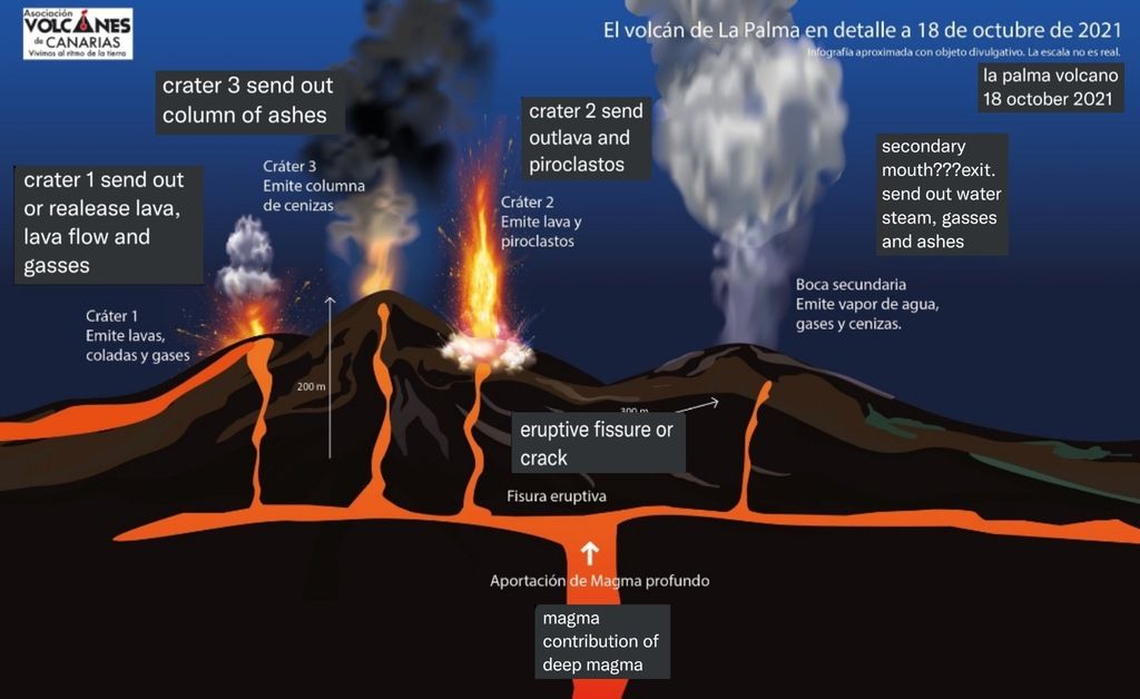
Cartoon showing the different activity at the vents of La Palma at the moment (image: Volcanes de Canarias)

Cartoon showing the different activity at the vents of La Palma at the moment (image: Volcanes de Canarias)

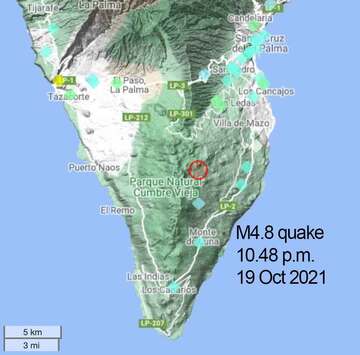
Location of this evening's 4.8 quake at La Palma

Location of this evening's 4.8 quake at La Palma

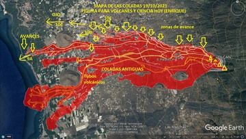
Latest map of lava flows on La Palma as of 19 Oct afternoon (image: VolcanesyCienciaHoy / facebook)

Latest map of lava flows on La Palma as of 19 Oct afternoon (image: VolcanesyCienciaHoy / facebook)

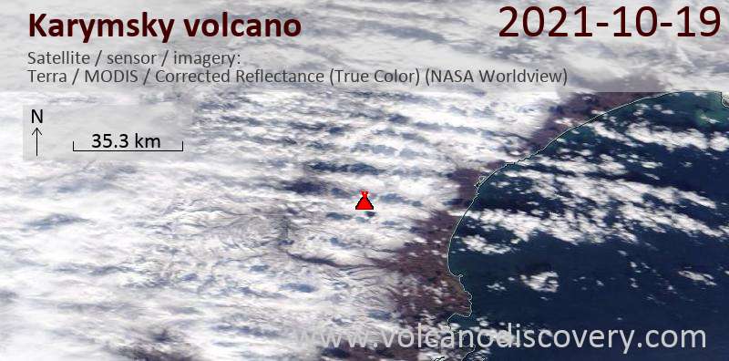
Satellite image of Karymsky volcano on 20 Oct 2021

Satellite image of Karymsky volcano on 20 Oct 2021

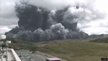
Explosion from Aso's Nakadake crater this morning (image: screenshot of RKK video)

Explosion from Aso's Nakadake crater this morning (image: screenshot of RKK video)

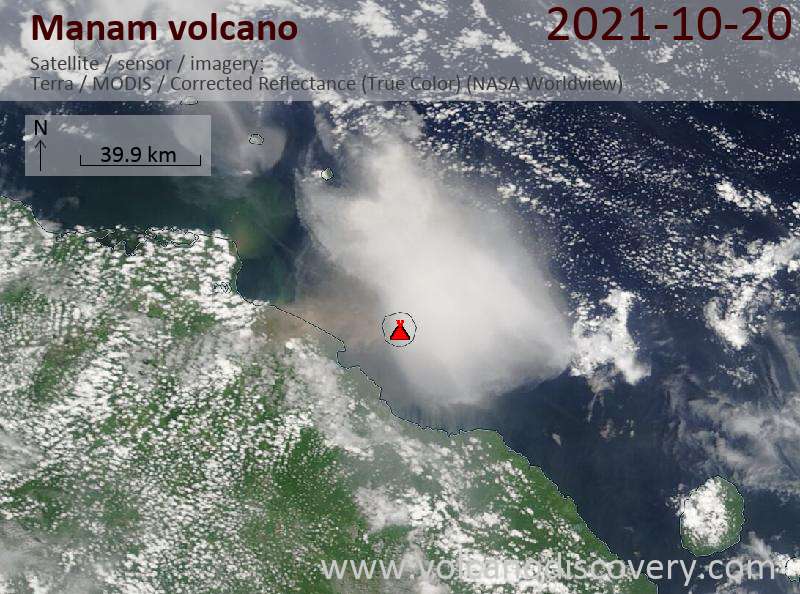
Satellite image of Manam volcano on 20 Oct 2021

Satellite image of Manam volcano on 20 Oct 2021

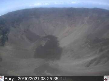
Piton de la Fournaise volcano's summit crater seen from the east this morning (image: OVPF)

Piton de la Fournaise volcano's summit crater seen from the east this morning (image: OVPF)

La Palma (Canary Islands (Spain)): Explosive activity continues. Volcanic Ash Advisory Center (VAAC) Toulouse warned about a volcanic ash plume that rose up to estimated 10000 ft (3000 m) altitude or flight level 100 and is moving at 10 kts in W direction.

The full report is as follows: ERUPTION AT 20210919/1410Z ONGOING ASH EMISSION OBS VA DTG:20/0900Z to 10000 ft (3000 m)
...20 Oct:
Volcanes de Canarias (link to twitter) published a simplified sketch to illustrate the current arrangements of vents at the eruption site, to help to better understand how the activity is different at each vent. Ultimately, this is a function of how gasses, present as bubbles inside the magma as well as still in solution in it, separate from the liquid magma column when it rises to the surface, and might form different regimes within the system:
For example, if gas bubbles form a type of conduit within the magma column, aggregating along a specific area, they likely will erupt as gas jets with little liquid and more ash, something typically observed at the upper vents. Areas at the margins of the main column might be largely degassed on the other hand; these will form liquid, but lower fountains or entirely effusive vents.
... [read more]
...19 Oct:
The strongest-so-far quake, a magnitude 4.8 event at 39 km depth, occurred at 10.48 p.m. on Tuesday evening under the island. Whether it is an indication of another pulse magma going to fuel the eruption remains to be seen, but a possible scenario, in which case activity should be picking up even more in the near future.
...19 Oct:
Activity has remained intense this afternoon and evening. It seems that a new pulse of magma has arrived, increasing the output of lava. At the vent, lava fountains and vigorous spattering produce dense ash clouds and feed the northern lava flow field, which is active at many fronts with varying intensity.
The lava fronts furthest have advanced 350 meters since yesterday, and are located just a few hundred meters east of the main junction of La Laguna.
... [read more]

Karymsky (Kamchatka): Explosive activity continues. Volcanic Ash Advisory Center (VAAC) Tokyo warned about a volcanic ash plume that rose up to estimated 14000 ft (4300 m) altitude or flight level 140 and is moving at 50 kts in E direction.
The full report is as follows: VA AT 20211020/0100Z FL140 EXTD E OBS VA DTG:20/0100Z to 14000 ft (4300 m)

Aso (central Kyushu, Japan): A strong explosion occurred this morning, at around 11:43 local time, from the volcano.
During a phase of intense steam emissions, suddenly an explosion occurs that sends a large column of ash to several kilometers height as well as a dense, ground-hugging circular base surge that almost reaches the visitors'center. On the following embedded video, large ballistic projectiles can be seen ejected from the center of the explosion and landing in several hundred meter distance as well.
... [read more]

Suwanose-jima (Ryukyu Islands): Volcanic Ash Advisory Center Tokyo (VAAC) issued the following report: ERUPTED AT 20211020/0719Z OVER FL060 EXTD SE OBS VA DTG:20/0720Z

Manam (Papua New Guinea): Explosive activity continues. Volcanic Ash Advisory Center (VAAC) Darwin warned about a volcanic ash plume that rose up to estimated 50000 ft (15200 m) altitude or flight level 500 and is moving at 10 kts in NW direction.
The full report is as follows: VA TO FL500 AND FL350. LOW LEVEL PLUME TO FL180 to 50000 ft (15200 m)

Semisopochnoi (United States, Aleutian Islands): Volcanic Ash Advisory Center Anchorage (VAAC) issued the following report: OCNL ERUPTIONS.

Fuego (Guatemala): Volcanic Ash Advisory Center Washington (VAAC) issued the following report: VA NOT SEEN IN SAT.

Nevado del Ruiz (Colombia): Mild explosive activity continues from the volcano. The Volcanic Ash Advisory Center (VAAC) Washington reported intermittent emissions of volcanic ash plumes.
The full report is as follows: sporadic emissions of volcanic ash

Sangay (Ecuador): Explosive activity continues. Volcanic Ash Advisory Center (VAAC) Washington warned about a volcanic ash plume that rose up to estimated 20000 ft (6100 m) altitude or flight level 200 .
The full report is as follows: VA SEEN IN SAT. to 20000 ft (6100 m)

Reventador (Ecuador): Explosive activity continues. Volcanic Ash Advisory Center (VAAC) Washington warned about a volcanic ash plume that rose up to estimated 15000 ft (4600 m) altitude or flight level 150 .
The full report is as follows: FRQ VA EMS OBSD to 15000 ft (4600 m)

Sabancaya (Peru): Explosive activity continues. Volcanic Ash Advisory Center (VAAC) Buenos Aires warned about a volcanic ash plume that rose up to estimated 24000 ft (7300 m) altitude or flight level 240 and is moving at 10 kts in W direction.
The full report is as follows: INTERMITTENT EMISSION OF VA to 24000 ft (7300 m)

Nevados de Chillán (Central Chile): Volcanic Ash Advisory Center Buenos Aires (VAAC) issued the following report: SPORADIC EMISSION OF VA

Piton de la Fournaise (La Réunion): The seismic crisis started at 4:33 am local time (12:33 am UTC) on 18 Oct 2021 stopped, the volcano observatory reported yesterday evening. The magma intrusion that took place at shallow depths beneath the Plaine des Osmondes in the northeastern part of the caldera no longer seems to be progressing.
Apart from a small magnitude M1.9 earthquake at 10:51 (local time) located 1.4 km below sea level, no earthquake of magnitude above 0.5 has been recorded at the volcano yesterday. This means that the recent magma intrusion is no longer moving, but it is only a matter of time until a new one starts, possibly then followed by an eruption.
It is also possible that the recent magma intrusion resumes at any time.
 

TxGal

Day by day
'Double-Dip' La Niña = Brutal Northern Hemisphere Winter, + Record-Breaking Hail Pounds Australia - Electroverse

ENSOblog_subsurface_equatorial_pacific_ocean_temp_anomalies_20211012_1400_0.gif

Extreme Weather GSM

‘DOUBLE-DIP’ LA NIÑA = BRUTAL NORTHERN HEMISPHERE WINTER, + RECORD-BREAKING HAIL POUNDS AUSTRALIA
OCTOBER 20, 2021 CAP ALLON

‘DOUBLE-DIP’ LA NIÑA = BRUTAL NH WINTER

La Niña has returned to the Pacific Ocean, and threatens a brutally cold and snowy northern hemisphere winter. This event is referred to a ‘double-dip’ La Niña because similar conditions formed last year, too.

It has an 87 percent chance of lingering until February 2022, said NOAA in a statement.

Very briefly, La Niña is characterized by unusually cold ocean temperatures in the Equatorial Pacific (region 3.4). The climate pattern tends to generate colder, snowier winters across much of North America, Europe and Asia, and a wetter, stormier summer in Australia.

Concentrating on the United States, the northwest is set to suffer an anomalously cold winter with high snowfall totals to boot.

Bob Larson, expert senior meteorologist for Accuweather, said: “The snowfall forecast for New York City is, on average, 29.8 inches, but our prediction is up to 32 inches” — in my mind, these are conservative estimates.

Last winter’s La Niña unleashed record-cold temperatures in February, 2021 – the coldest in record history for many locales. During that month, the average temperature for the contiguous U.S. was just 30.6F–3.2F below the multidecadal average, while unprecedented snow totals battered many states.

Bob Larson, expert senior meteorologist for Accuweather, told DailyMail.com that the northeast will have a warmer winter, but be prepared for above average snowfall. 'The snowfall forecast for New York City is, on average, 29.8 inches, but our prediction is up to 32 inches, Larson said. (Pictured is a snow storm that hit Brooklyn on Feb. 1, 2021
A powerful snow storm that hit Brooklyn on Feb 1, 2021.

View: https://twitter.com/NOAAClimate/status/1448679090064605184

The first signs of La Niña are expected to appear as early as next week, continued Larson.

“There is already evidence of this pattern and in a week to 10 days, we will see a storm slamming into the West Coast that will stay in northern California,” he said. “This could be a preview of what we could see this winter due to la Niña.”

Although La Niña will technically be present as of next week, it isn’t predicted to be at its strongest until after January, as occurred last winter. Keep an eye on that monthly UAH temperature chart (linked in the sidebar) moving into the New Year. We should see a plunge back down below the 1990-2020 average by the end of Q1–to levels lower than what we saw in early 2021:


RECORD-BREAKING HAIL POUNDS AUSTRALIA

Freak storms across the eastern/northern of Australia have damaged buildings and pounded cities with hail the size of grapefruit.

On Tuesday afternoon, a hailstone with a 16cm (6.3 inches) diameter fell in Yalboroo, Queensland — the largest ever recorded in Australia.

Forecaster Dean Narramore from the Bureau of Meteorology (BoM) told the ABC that the “dangerous thunderstorm” lashed the Yalboroo area north of Mackay leading to multiple reports of giant hail.

While many of the stones measured 12 to 14cm (4.7 to 5.5 inches) in diameter, Narramore said a “very impressive” image had been sent to the BoM’s Queensland office allowing them to verify the 16cm (6.3 inches) reading:

View: https://twitter.com/BOM_au/status/1450589437986058244

“We are talking grapefruit-sized hail,” added Narramore.

View: https://twitter.com/weatherzone/status/1450404117621272581

Giant hail is defined as any hailstone greater than 5cm (2 inches) in diameter. It is a rare, destructive phenomenon and can only form under specific environmental conditions — the giant hail begin life as regular-sized stones but powerful updrafts keep the ice in the air longer than normal which allows time for more and more rain droplets to accumulate.

“Straight through the tin,” Narramore said “I have seen a couple of photos of cars where the hail has gone straight through the windshield. Once you get about 15cm-size hailstones you will start seeing this really bad damage.”

A spokesperson for the Insurance Council of Australia said they were currently talking to their members who have a large number of policyholders in Queensland.

Last year the Halloween hailstorm that struck Ipswich in Queensland caused $1.05bn in damage.

AND FINALLY

I don’t have time to delve into the report linked HERE and outlined below, but if anyone in the know wants to comment, please do so. What do we think: more conspiracy hogwash or a concerning development worth investigating further?
Latest UK PHE Vaccine Surveillance Report figures on Covid cases show that doubly vaccinated 40-70 year olds have lost 40% of their immune system capability compared to unvaccinated people. Their immune systems are deteriorating at around 5% per week (between 2.7% and 8.7%). If this continues then 30-50 year olds will have 100% immune system degradation, zero viral defence by Christmas and all doubly vaccinated people over 30 will have lost their immune systems by March next year.

The COLD TIMES are returning, the mid-latitudes are REFREEZING, in line with the great conjunction, historically low solar activity, cloud-nucleating Cosmic Rays, and a meridional jet stream flow (among other forcings).

Both NOAA and NASA appear to agree, if you read between the lines, with NOAA saying we’re entering a ‘full-blown’ Grand Solar Minimum in the late-2020s, and NASA seeing this upcoming solar cycle (25) as “the weakest of the past 200 years”, with the agency correlating previous solar shutdowns to prolonged periods of global cooling here.

Furthermore, we can’t ignore the slew of new scientific papers stating the immense impact The Beaufort Gyre could have on the Gulf Stream, and therefore the climate overall.


Prepare accordinglylearn the facts, relocate if need be, and grow your own.
 

TxGal

Day by day
Here's one from Oppenheimer, discusses volanic activity among other things:

Sierra Snow Continues - Volcanic Uptick Worldwide As Predicted - Columbus Did Not Discover America - YouTube

Sierra Snow Continues - Volcanic Uptick Worldwide As Predicted - Columbus Did Not Discover America
2,866 views
Premiered 8 hours ago

View: https://youtu.be/j90A4Zu7140
Run time is 23:37

Synopsis provided:

'Biggest snow producer' so far hits Tahoe https://bit.ly/3ncCZuf
Sierra Snow Impacts Travel in Northern California https://bit.ly/3G8W6hu
Western KELOLAND blanketed in snow Wednesday https://bit.ly/3pmMo5b
Yes, that’s snow you’re seeing in Upstate NY weather forecasts https://bit.ly/3E4SY4D
Snow tire shortage expected as winter approaches https://bit.ly/3DXexUD
GFS Model Total Snow US https://bit.ly/3pmMOIN
Wet Weather Pattern in the West; Severe Storms in the Eastern U.S. https://www.weather.gov/
Record-breaking hail hits central Queensland https://bit.ly/3pBIFkD
‘Like snow’: freak hail storms batter Australia’s east coast https://bit.ly/3C2OuLc
SCANDINAVIA RECEIVES FEET OF EARLY-SEASON SNOW, FLURRIES HIT SOUTH KOREA, + GLOBAL COLLAPSE https://bit.ly/3vvIDLS
BEIJING SUFFERS LOWEST OCTOBER TEMPERATURE IN HALF A CENTURY, 20-DAYS EARLIER THAN NORMAL, + RARE SPRING BLIZZARDS IN ARGENTINA https://bit.ly/3jmnVci
Earthquakes Rock Oregon’s Largest Volcano https://bit.ly/2Z6ryfx
L:atest quakes near Mount Hood volcano: past 7 days https://bit.ly/3E55DEF
Worldwide Volcano News and Updates https://bit.ly/3y58XgJ
La Palma, Canary Islands: eruption Sep 2021 https://bit.ly/3AfB7pX
LIVE: La Palma Volcano Eruption in the Canary Islands https://bit.ly/3iEB6Fl
Latest quakes near La Palma volcano: 24 hours, Thursday, Oct 21, 2021 https://bit.ly/3hLpMXk
Mt. Aso in southwest Japan erupts, no injuries reported https://bit.ly/3C3uvfs
Spectacular Huge Eruption of Mount Aso in Kumamoto, Kyushu, Japan https://bit.ly/3lW1exx
Manam Volcano Volcanic Ash Advisory: VA TO FL500 AND FL350. LOW LEVEL PLUME TO FL180 to 50000 ft (15200 m) https://bit.ly/3B3twKN
Manam Volcano Details https://volcano.si.edu/volcano.cfm?vn...
and more
 

TxGal

Day by day
Oh my gosh, Manam's eruption at 50K ft is way up there on the VEI chart:

Arctic Blast Brings October Snow to the UK, + Manam Volcano Pops to 50,000ft - Electroverse

Manam-Oct-2021.jpg

Extreme Weather GSM Volcanic & Seismic Activity

ARCTIC BLAST BRINGS OCTOBER SNOW TO THE UK, + MANAM VOLCANO POPS TO 50,000FT
OCTOBER 21, 2021 CAP ALLON

ARCTIC BLAST BRINGS OCTOBER SNOW TO THE UK

Just in time for the COP26 summit (aka “Climate-Con”), October snow is settling in the northern UK.

The month of October started mild across much of Britain with temperatures regularly rising above 20C. But the winds have now changed and brutal Arctic air is being funneled into the home nations–as well as into northern, central and eastern Europe.

Early-season snow was falling in Braemar, Scotland at around 8:30 PM on Wednesday evening.

The Aberdeenshire village is no stranger to cold weather, making headlines in February this year after shivering through a record-breaking low of -23C (-9.4F) and being buried by an unprecedented 70cm (28 inches) of snow.

Yesterday’s flakes were far more conservative, but still managed to shock many locals:

View: https://twitter.com/Alonso2012F/status/1450907453634326536
Run time is 0:09

Scotland’s transition from 20C to freezing lows and early snows has indeed been stark, but we’ve been here before…

The fall of 2008 was another very strange one for the UK. The beginning of October saw days in the low 20s (C), yet by the end of the month snow was settling. A similar setup occurred in the mid-90s, too. Unsurprisingly, at least for those who track the activity of the sun, both 2008 and 1995/6 were years in or around solar minimums, just as the year 2021 is.


Solar Cycles 19 – 24, including a forecast for 25.

See also:


Looking ahead, further masses of polar lows and early snows will descend into the UK and mainland Europe as the calendar approaches November, although it is very mess setup — the models are forever changing:


GFS 2m Temperature Anomalies (C) Oct 25 [tropicaltidbits.com].

The winter of 2021-22 is setting up to be truly brutal:


MANAM VOLCANO POPS TO 50,000FT

On Wednesday, October 20 Papa New Guinea’s highly active Manam Volcano produced another stratospheric eruption, continuing its uptick which began in 2010.

A thick volcanic ash plume rising to at least 50,000 feet (15.2 km) was registered by the Volcanic Ash Advisory Center (VAAC) Darwin at 11:43 local time on October 20 via HIMAWARI-8 satellite imagery.

View: https://twitter.com/CIMSS_Satellite/status/1450876816776962048
Run time is 0:03

View: https://twitter.com/andyprata/status/1450757451079307267
Run time is 0:10

Such as high-level eruption is noteworthy because particulates ejected to altitudes above 32,800 ft (10 km) –and into the stratosphere– often linger, where they have a direct cooling effect on the planet.

Volcanic eruptions are one of the key forcings driving Earth into its next bout of global cooling, with their worldwide uptick tied to low solar activity, coronal holes, a waning magnetosphere, and the influx of Cosmic Rays penetrating silica-rich magma.


Manam eruption, October 20.

BACKGROUND

Stratovolcano: 1807 m / 5,928 ft
Papua New Guinea: -4.08°S / 145.04°E
Current status: ERUPTING (4 out of 5)

Manam volcano, located 13 km off the northern coast of New Guinea near Bogia town, is one of Papua New Guinea’s most active volcanoes.

It has one of the longest records of historic eruptions in the SE Pacific region. The larger eruptions of Manam produce pyroclastic flows and sometimes lava flows. Both have repeatedly reached the coast and affected populated areas.

The volcano’s current ongoing eruptive phase technically began back on June 29, 2014 and it has already registered a “4” on the Volcanic Explosivity Index (VEI). Manam’s eruptive history is peppered with VEI 2s and 3s, but it also has two previous confirmed VEI 4s, from 2004 and 1919 — see volcano.si.edu for more.

Eruption list: ongoing since Aug 2010 (31 July 2015: large vulcanian explosion), 2000-2004 (small subplinian eruptions), 1974-1999, 1965-66, 1963-64, 1963, 1962, 1961, 1959-60, 1959, 1956-58, 1954, 1953, 1946-47, 1936-39, 1932-34, 1926-28, 1925, 1924?, 1923, 1922, 1920-21, 1919, 1917, 1909-14?, 1907?, 1904, 1904, 1901-02?, 1899, 1887-95, 1885, 1884?, 1887, 1830, 1700, 1643, 1616 — for more see VolcanoDiscovery.com.

ASO VOLCANO ALSO ERUPTS

Southern Japan’s Aso volcano also erupted in spectacular fashion on Wednesday, October 20.

The Japan Meteorological Agency (JMA) raised the warning level for Mount Aso to three on a scale of five, warning hikers and residents to avoid the mountain at all costs.

NHK national television aired footage of a massive smoke column above the volcano — the smoke rose as high as 11,480 ft (3.5 km) above the crater, with pyroclastic flows streaming some 0.8 miles (1.3 km) down the mountain’s western slope.

View: https://twitter.com/BNONews/status/1450659650563710976
Run time is 1:14

A volcano erupted in the southern island of Kyushu in Japan, blasting ash several miles into the sky and prompting officials to warn against the threat of lava flows Japanese volcano spews plumes of ash, people warned away pic.twitter.com/LpDqbS8tjE
— Reuters (@Reuters) October 20, 2021

The explosion fired-off volcanic rocks as far as 2,950 ft (900 m) and ashfalls were detected in several towns in the Kumamoto and neighboring Miyazaki prefectures, while some structural damage has also been reported, namely to roads.

Mount Aso has repeatedly erupted in recent decades, sometimes fatally — the mountain’s 1953 eruption (solar minimum of cycle 18) killed six and injured more than 90, and another one five years later killed 12.

The COLD TIMES are returning, the mid-latitudes are REFREEZING, in line with the great conjunction, historically low solar activity, cloud-nucleating Cosmic Rays, and a meridional jet stream flow (among other forcings).

Both NOAA and NASA appear to agree, if you read between the lines, with NOAA saying we’re entering a ‘full-blown’ Grand Solar Minimum in the late-2020s, and NASA seeing this upcoming solar cycle (25) as “the weakest of the past 200 years”, with the agency correlating previous solar shutdowns to prolonged periods of global cooling here.

Furthermore, we can’t ignore the slew of new scientific papers stating the immense impact The Beaufort Gyre could have on the Gulf Stream, and therefore the climate overall.


Prepare accordinglylearn the facts, relocate if need be, and grow your own.
 

jed turtle

a brother in the Lord
GLOBAL COLLAPSE

This orchestrated global collapse appears to entering a new level: a quickening. Exactly how/when modern society falls is still unclear, but we’re now far enough down the road that I don’t ask is this is all in my head? nearly as much as I used to.

The elites themselves are telling us that the end is nigh, but they have distorted the catastrophe and are offering up false hope: Give up affordable energy and the planet will be saved, they say; Accept our needles and your life will be extended, is the subtext–and the gullible 80% have fallen for it, ALL of it.

Reality exists in the human mind and nowhere else, and in turn paradigms can be constructed that suppress the masses.
“Power is in tearing human minds to pieces and putting them together again in new shapes of your own choosing.”
George Orwell, 1984

‘They’ even have the 80% dabbling in doublethink. Staying with Orwell: “Doublethink means the power of holding two contradictory beliefs in one’s mind simultaneously, and accepting both of them.” Examples in today’s world include global warming = global cooling; and relinquishing medical autonomy = freedom.

Sometimes I think the brainwashed dolts deserve what’s coming. But then I remember that I was once one of them, and not all that long ago. Awaking to the evil and control at play here is a long and arduous journey, and not everyone is working off the same page. But what I won’t stand for is silencing tactics, proclamations that the science is settled, nor the handing over of all critical thinking to a small subset of people so that you don’t have to bother evaluating data and discovering facts for yourself. Such degrading ideals need combating. They are dangerous. They are the workings of the elites. They will be the end of us.

Work on self-sufficiency each and every day.

Reject the baseless notion that CO2 is destroying the planet.

Refuse to hand over your body to needless and proven-dangerous pharmaceuticals (and I’m not just talking about the vaccine).

The strong and awake will survive this.

The 80% will not.

worth repeating...
 

TxGal

Day by day
Ice Age Farmer posted a new podcast yesterday. I think it's elsewhere in the forum, but probably should be here, too.

ALERT: No Energy, No Fertilizer, No Food. Holodomor 2.0? - YouTube

ALERT: No Energy, No Fertilizer, No Food. Holodomor 2.0?
51,308 views
Premiered Oct 20, 2021

View: https://youtu.be/JWFEjdtxLmg
Run time is 12:35

Synopsis provided:

German farmers are unable to find fertilizer. Italian farmers are facing 6x costs for drying grains. Propane is exploding in the US. As the energy crisis spill over into food production, it has immediate impacts -- but the true cost may come next season as fertilizer shortages push yields worldwide down under 50%. Against the backdrop of already strained food production and a supply chain in cascading failure, there is only one question: who gets to eat in 2022 ?
 

TxGal

Day by day
13+ Dead Due To Heavy Snow in India, Scots Shoveling, "Mount Washington Looks Like The North Pole", Record-Smashing Snow Headed for U.S., + The Country's Largest Oil Hub Is Running Dry - Electroverse

energy-snow-e1634899720716.jpg

Articles Extreme Weather GSM

13+ DEAD DUE TO HEAVY SNOW IN INDIA, SCOTS SHOVELING, “MOUNT WASHINGTON LOOKS LIKE THE NORTH POLE”, RECORD-SMASHING SNOW HEADED FOR U.S., + THE COUNTRY’S LARGEST OIL HUB IS RUNNING DRY
OCTOBER 22, 2021 CAP ALLON

13+ DEAD DUE TO HEAVY SNOWFALL IN INDIA

At least 13 people have died in Uttarakhand, India after heavy, early-season snowfall battered the mountainous region, local officials said on Thursday.

The dead include three porters working for the Indo-Tibetan Border Police (ITBP) who were posted along the India-China border in Uttarkashi district, and ten trekkers. While an additional six others remain missing, reports hindustantimes.com.

District disaster officer Devendra Patwal said rescue teams spotted five of the bodies near Lamkhaga Pass on Thursday morning.

“The bodies will soon be airlifted from the spot,” he said. “The rescue workers managed to rescue one of the trekkers who was found alive there. He has been shifted to the army hospital in the district.”

View: https://youtu.be/vusXUTH8dvQ
Run time is 1:00

“Over 65 tourists are (still) trapped in higher reaches of Bageshwar,” said Shikha Suyal, another disaster management officer.

“We have sent three rescue teams from the district along with one helicopter and one NDRF (National Disaster Response Force) team from Dehradun to rescue the tourists.”

Rescue workers taking an injured trekker rescued from Lamkhaga Pass to hospital on Thursday (HT Photo)
Rescue workers take an injured Lamkhaga Pass trekker to hospital on Thursday.

In neighboring Nepal, heavy snow and whiteout conditions caught-out a group of trekkers on the Mera Peak summit, too.
Details are sketchy, but according to explorersweb.com, one person, a porter, is known to have died, while another person is still missing.

Initial rescue efforts were hampered by inclement weather: helicopters had to turn back, as did a group of volunteers who attempted to trek up the mountain on Wednesday.

SCOTS SHOVELING SNOW

Photographs show Scots out shoveling snow as the UK enjoyed its first plummeting temperatures and settling snow of the season–just in time for ‘Climate-Con’ which is due to commence next week.

Scots in Aberdeenshire and Moray suffered anomalous Arctic cold and unusually-early snowfall this week as a weak and wavy meridional jet stream flow (linked to the historically low solar activity we’ve been experiencing) transported a polar air mass over the UK.

Snow on the A939 Cockbridge to Tomintoul road
Scots suffer plummeting temps and snow [PETER JOLLY NORTHPIX]

With temperatures continuing to drop, snow is expected to fall across western Scotland on Halloween — a rare phenomenon last seen 13 years ago, in 2008 (solar minimum of cycle 24).

Looking at the latest GFS run (shown below), snow is even expected as far south as central England as the calendar flips to November:


GFS Total Snowfall (cm) Oct 22 – Nov 7 [tropicaltidbits.com].

“MOUNT WASHINGTON LOOKS LIKE THE NORTH POLE”

Winter has arrived early on Mount Washington.

My NBC 5 is reporting that the mountain suffered hurricane-force winds more than 5 inches of snow overnight Wednesday — according to the article: “Mount Washington looks like the North Pole now with stunning snowfall and frigid temperatures.”

Mount Washington October
Early Season Polar Plunge hits Mt Washington on Oct 18/19.

Meteorologist Jay Broccolo said: “We’re starting to see snowdrifts build-up against the doors … you can hear the wind blowing through the doors … winter’s definitely back.”

RECORD-SMASHING SNOW HEADED FOR U.S.

This season’s early freeze isn’t just confined to higher elevations of Washington State. Far from it. Much of the Western United States bracing for an Arctic blast of record-challenging proportions.

In California, for example, a powerful winter storm is headed towards Lake Tahoe in the Sierra Nevada Mountains.

The storm is expected to dump heavy rain and record-breaking accumulations of October snow.

The National Weather Service (NWS) in Reno is forecasting three systems that will impact the region starting today (Fri, Oct 22) with the “main event” hitting Sunday through Tuesday which is forecast to drop well-over 3 feet of heavy, wet snow on the mountains in the basin.

“After digging through all of the probabilistic guidance, this event is shaping up to be one for the record books,” the service said. “Saturday morning may be a good day to clean those drains and gutters ahead of the storm,” they added in a special statement.

For that main event, the service said that after checking with the books, none of the late October reanalyses were this wet (between 1979 and 2009).

By Monday night into Tuesday morning, snow levels are expected to fall to 5,000 feet, well below lake level: “As the system evolves and becomes colder, we’re talking about feet of heavy, wet snow in the high Sierra. The Tahoe Basin could receive 3-plus feet of snow.”

Checking in with the latest GFS runs, the NWS’s projected totals could even be on the conservative side:

gfs_asnow_namer_fh0-384-2.gif

GFS Total Snowfall (inches) Oct 22 – Nov 7 [tropicaltidbits.com].

Shifting our attention to the east, the models are also picking up on some debilitating falls across the Northeast around November 6 (though this forecast is in the unreliable time frame, and so should be taken with a pinch of salt–but it’s certainly something to keep an eye on).

THE COUNTRY’S LARGEST OIL HUB IS RUNNING DRY

Given the climatic event hitting this weekend, it will be doubly-concerning to hear that there may soon be no physical oil at all in the largest U.S. commercial storage facility–a scenario which analysts expect to lead to a “superspike” in the price.

In a note predicting the near-term dynamics of the oil market, JPMorgan’s Natasha Kaneva writes that in a world of pervasive natural gas and coal shortages, which are forcing the power sector to increasingly turn to oil, ‘Cushing Oil Storage’ may be just weeks away from being “effectively out of crude.”

The bank’s conclusion: “If nothing were to change in the Cushing balance over the next two months, we might expect front WTI spreads to spike to record highs.”

U.S. Oil Hub Emptying to Levels Last Seen When Crude Cost $100

Today’s spiraling global crisis begins with Europe’s catastrophic handling of its energy needs.

As JPMorgan notes, the heating season of 2021-2022 is opening with record high global gas prices, even well-before the chill of winter hits. This is due in no small part to the historically cold winter of 2020-2021 which depleted reserves, while the blind ‘fingers-crossed’ reliance on failing renewables is another key factor. The situation is so dire that JPM says “finding even 1 bcf of spare capacity is becoming increasingly difficult.”

The good news is that Russian domestic gas storage is at 97% full — this potentially allows for 4-10 bcm of additional shipments to Europe. However, Russia is not currently planning to ship additional gas until Nord Stream 2 is fully authorized, at least.

This particular aspect of the shortages is political, of course. And given the gullible ‘green’-hamstrung politicians of the West, who, in placating those noisy yet clueless activists, have destroyed their citizens access to affordable energy, Putin will soon have them bent over a barrel and paying extortionate prices out of desperation.

As JPM notes, echoing what Goldman said earlier this week, “without additional Russian volumes, the winter weather premium currently embedded in the European natural gas price cannot significantly diminish.”

In short, even higher natural gas prices are on the cards, especially if the winter is cold, reports oilprice.com.

So, given these record coal and gas prices, power sectors and energy intensive industries are turning to oil. Reuters quoted Saudi Arabia’s Minister of Energy Prince Abdulaziz bin Salman who confirmed that users switching from gas to oil could account for demand of 500,000-600,000 barrels per day (bpd), adding that the world was now waking up to shortages in the energy sector.

“People all of a sudden woke up to the reality that they are running out of everything: they are ran out of investments, they ran out of stocks and they ran out of creativity in trying to be attending to real solution that address real issues,” Prince Abdulaziz told the CERA Week India Energy Forum.

Abdulaziz said the potential switch depended on how severe winter weather would be:


Cushing crude storage fell to 31.2 mb last week, and because operational tank bottoms are likely 20-25% of capacity, JPM predicts that “we could be just weeks away from Cushing being effectively out of crude,” adding that “if nothing were to change in the Cushing balance over the next two months, we might expect front WTI spreads to spike to record highs—a ‘super backwardation’ scenario.”

If JPM’s prediction is correct, it would prompt the bank to hike its Q1 2022 price target to $95 from $77.5/bbl, which would in turn have a catastrophic impact on the price of oil.

This, at least to me, is increasingly looking like a controlled demolition of society. Perhaps we peasants got too opinionated…? Maybe we were found to be abusing the few freedoms we had…? Or was it that those back-alley whispers of revolution grew a little too loud…? But whatever the reason, the future is looking decidedly Totalitarian, and cold.

For a more detailed look at this intensifying energy crisis, check out the oilprice.com article in full (by ZeroHedge).

The COLD TIMES are returning, the mid-latitudes are REFREEZING, in line with the great conjunction, historically low solar activity, cloud-nucleating Cosmic Rays, and a meridional jet stream flow (among other forcings).

Both NOAA and NASA appear to agree, if you read between the lines, with NOAA saying we’re entering a ‘full-blown’ Grand Solar Minimum in the late-2020s, and NASA seeing this upcoming solar cycle (25) as “the weakest of the past 200 years”, with the agency correlating previous solar shutdowns to prolonged periods of global cooling here.

Furthermore, we can’t ignore the slew of new scientific papers stating the immense impact The Beaufort Gyre could have on the Gulf Stream, and therefore the climate overall.


Prepare accordinglylearn the facts, relocate if need be, and grow your own.
 

TxGal

Day by day
Suspicious Observers has a new podcast out:

Warning for USA, Astronomy Has Changed, Space Weather | S0 News Oct.22.2021 - YouTube

Warning for USA, Astronomy Has Changed, Space Weather | S0 News Oct.22.2021
28,902 views
Oct 22, 2021

View: https://youtu.be/05ze4ttBD1E

Run time is 5:11

Synopsis provided: Daily Sun, Earth and Science News! Just Click our Name for More!

Synopsis from me - about halfway through he talks about more fresh water entering the ocean and the Beaufort Gyre changes...this is important.
 

TxGal

Day by day
Oppenheimer Ranch Project has a new podcast out:

Colorado Snowpack Is Off The Charts! - Record Hailstone Confirmed In Australia - Volcanic Uptick - YouTube

Colorado Snowpack Is Off The Charts! - Record Hailstone Confirmed In Australia - Volcanic Uptick
2,920 views
Premiered 8 hours ago

View: https://youtu.be/kMJkqbS4cgk
Run time is 13:03

Synopsis provided:

Rain, snow forecast for Lake Tahoe could be record breaking https://bit.ly/3jtr4r2
California Ski Resort Expecting Enough Snow - It's Opening 2 Weeks Early https://bit.ly/2ZjZJkd
West Coast braces for simultaneous 'bomb cyclone' and 'atmospheric river' https://cnn.it/3poPENA
Damaging winds, large hail, tornadoes possible Sunday: Here's the timeline of storms in the St. Louis area https://bit.ly/2XDeWfj
GFS Model Total Snow US https://bit.ly/2XGwiIm
Here's why Colorado's early snowpack numbers are off the charts https://bit.ly/2ZacqxA
Heavy Precipitation and Strong Winds in the West; Locally Severe Weather in the Central Plains https://www.weather.gov/
Record-Breaking 6.3″ Hailstones Battered Australia This Week https://bit.ly/3m5YkpQ
Insane Hailstorm Strikes, Guy Freaks Out https://bit.ly/3m8piNU
13+ DEAD DUE TO HEAVY SNOW IN INDIA, SCOTS SHOVELING, “MOUNT WASHINGTON LOOKS LIKE THE NORTH POLE”, RECORD-SMASHING SNOW HEADED FOR U.S., + THE COUNTRY’S LARGEST OIL HUB IS RUNNING DRY https://bit.ly/2ZewHBY
ARCTIC BLAST BRINGS OCTOBER SNOW TO THE UK, + MANAM VOLCANO POPS TO 50,000FT https://bit.ly/2XFQES0
Worldwide Volcano News https://bit.ly/3y58XgJ GOES X-RAY FLUX https://bit.ly/2SKPqSV
and more
 

TxGal

Day by day
Ice Age Farmer's video from above (not 100% GSM, but the food supply is so messed up anyone planning for the GSM weather events is going to be challenged further):

CEO: Food Prices to Explode NOW; FBI/NSA warn of Cyberattacks on Food & Water Systems | ice age farmer

View: https://youtu.be/IBy16KTdJOI

Run time is unknown, it's in Premiere status right now

Synopsis provided:

As a billionaire supermarket CEO says food prices will skyrocket +10% in the NEXT 60 DAYS, the NSA/FBI/CISA are warning of Cyberattacks on food production and municipal water/wastewater systems. Our food and water are under relentless attack across all vectors: financial, cyber, supply chain, fertilizer shortages, nat gas prices are conspiring to create a perfect storm within the systems that feed most people. Only those who seek to grow and raise their own food will be unaffected by the storm ahead. Get ready.
 

TxGal

Day by day
Untimely snow damages apple orchards in South Kashmir -- Earth Changes -- Sott.net

Untimely snow damages apple orchards in South Kashmir

Aatif Qayoom
Rising Kashmir
Sat, 23 Oct 2021 11:39 UTC

SNOW

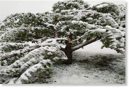
The untimely snowfall that started from Friday night in Kashmir has come not just too early in the season but also as a blight on the valley's apple orchards.

Reports reached Rising Kashmir from south Kashmir's Shopian district said the orchards haves suffered extensive damage caused to apple trees due to the heavy snow that accumulated on leaves and branches.

View: https://youtu.be/5JCotc-ilhI
Run time is 1:26

View: https://youtu.be/sVjI1eoDdII
Run time is 0:44

View: https://youtu.be/DGsFDEWnCXU
Run time is 2:01
 

TxGal

Day by day
Volcanoes Today - summary of volcanic activity world-wide / VolcanoDiscovery

Volcanoes Today, 23 Oct 2021: Etna volcano, Fuego, Reventador, Sangay, Yasur, La Palma, Nevados de Chillán, Nevado del Ruiz
Sat, 23 Oct 2021, 19:00
19:00 PM | BY: VN

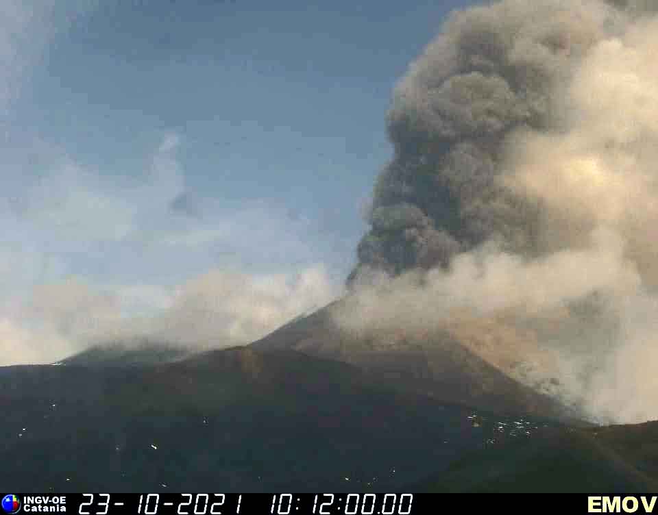
Etna volcano near the end of this morning's paroxysm (image: Montagnola webcam of INGV Catania)

Etna volcano near the end of this morning's paroxysm (image: Montagnola webcam of INGV Catania)

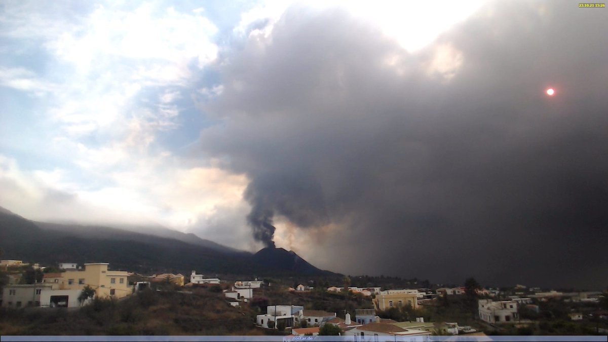
Ash plume rising today from La Palma, drifting south and southeast (image: Volcanes de Canarias @VolcansCanarias / twitter)

Ash plume rising today from La Palma, drifting south and southeast (image: Volcanes de Canarias @VolcansCanarias / twitter)

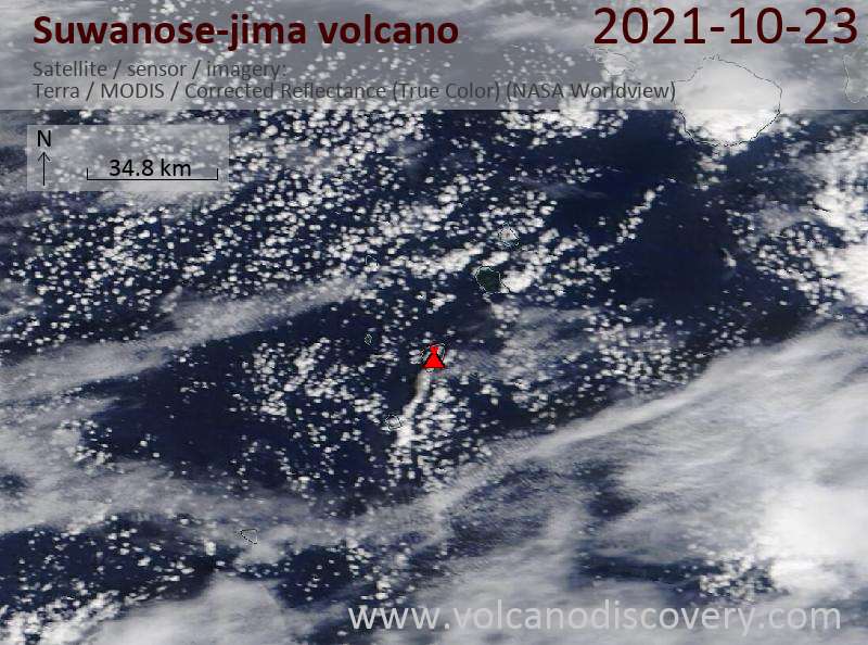
Satellite image of Suwanose-jima volcano on 23 Oct 2021

Satellite image of Suwanose-jima volcano on 23 Oct 2021

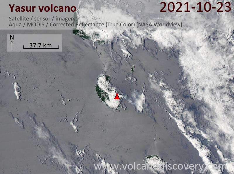
Satellite image of Yasur volcano on 23 Oct 2021

Satellite image of Yasur volcano on 23 Oct 2021

Etna (Sicily, Italy): A strong paroxysm is in progress at the volcano. As suspected already last night by the presence of intermittent strombolian activity and the slowly rising tremor, this activity continued to evolve gradually throughout the night and early this morning.
Tremor reached high levels at 7.40 a.m., followed by a strong increase of explosive activity at the SE crater from 10.15 a.m.
... [read more]

La Palma (Canary Islands (Spain)): Activity continues with strong ash emissions and lava effusion from the vents, similar to previous days.
The overall advance of the lava flow fronts has slowed down, fortunately. In the last 24 hours, only 3.24 hectares have covered additionally by lava flows. The total affected area stands now at 850 hectares, and the flow field is at its maximum 2,900 m wide.
... [read more]

Suwanose-jima (Ryukyu Islands): Volcanic Ash Advisory Center Tokyo (VAAC) issued the following report: ERUPTED AT 20211023/1726Z FL070 EXTD SW OBS VA DTG:23/1730Z

Yasur (Tanna Island, Vanuatu): Explosive activity continues. Volcanic Ash Advisory Center (VAAC) Wellington warned about a volcanic ash plume that rose up to estimated 4000 ft (1200 m) altitude or flight level 040 and is moving at 05 kts in N direction.
The full report is as follows: ONGOING LOW-LEVEL ASH EMSSIONS. to 4000 ft (1200 m)

Fuego (Guatemala): Explosive activity continues. Volcanic Ash Advisory Center (VAAC) Washington warned about a volcanic ash plume that rose up to estimated 15000 ft (4600 m) altitude or flight level 150 .
The full report is as follows: VA EMS OBS IN STLT AND SUMMIT WEBCAM to 15000 ft (4600 m)

Nevado del Ruiz (Colombia): Explosive activity continues. Volcanic Ash Advisory Center (VAAC) Washington warned about a volcanic ash plume that rose up to estimated 20000 ft (6100 m) altitude or flight level 200 .
The full report is as follows: VA EMS OBS IN STLT AND SUMMIT WEBCAM to 20000 ft (6100 m)

Sangay (Ecuador): Volcanic Ash Advisory Center Washington (VAAC) issued the following report: VA NOT OBS IN SAT.

Reventador (Ecuador): Explosive activity continues. Volcanic Ash Advisory Center (VAAC) Washington warned about a volcanic ash plume that rose up to estimated 16000 ft (4900 m) altitude or flight level 160 .
The full report is as follows: CONTG VA EMS OBS IN WEBCAM. to 16000 ft (4900 m)

Sabancaya (Peru): Explosive activity continues. Volcanic Ash Advisory Center (VAAC) Buenos Aires warned about a volcanic ash plume that rose up to estimated 24000 ft (7300 m) altitude or flight level 240 and is moving at 10 kts in SE direction.
The full report is as follows: INTERMITTENT EMISSIONS to 24000 ft (7300 m)

Nevados de Chillán (Central Chile): Explosive activity continues. Volcanic Ash Advisory Center (VAAC) Buenos Aires warned about a volcanic ash plume that rose up to estimated 13000 ft (4000 m) altitude or flight level 130 and is moving at 20 kts in NE direction.
The full report is as follows: SPORADIC PUFF to 13000 ft (4000 m)
 

TxGal

Day by day
Adapt 2030 has a new podcast out:

Sunken Shipwrecks Re-emerge (Forecast Cali Ark Storm East Coast Nor'easter) - YouTube

Sunken Shipwrecks Re-emerge (Forecast Cali Ark Storm East Coast Nor'easter)
14,763 views
Premiered Oct 24, 2021

View: https://youtu.be/7MaTtvzEotA
Run time is 9:07

Synopsis provided:

Sunken Shipwrecks Reemerge after Iwo Jima volcano erupts raising beaches, record hail size Australia, California Ark Storms and East Coast Nor'easter. Massive wind damage Europe flattening crops.
 

TxGal

Day by day
This is the full article of the posting northern watch made yesterday:

More U.S. Ski Resorts Open Early as "Superstorm" Hits, "Cold Wave Conditions" Already Sweeping India, + La Niña To Deepen The Global Energy Crisis With A Brutal Winter - Electrovers

Heavy-Snow-2-e1635154886276.jpeg

Articles Extreme Weather GSM

MORE U.S. SKI RESORTS OPEN EARLY AS “SUPERSTORM” HITS, “COLD WAVE CONDITIONS” ALREADY SWEEPING INDIA, + LA NIÑA TO DEEPEN THE GLOBAL ENERGY CRISIS WITH A BRUTAL WINTER
OCTOBER 25, 2021 CAP ALLON

Studying the JET STREAM has long been an indicator of the weather to come, and to study the jet stream attention must turn to the SUN.

When solar activity is HIGH the jet stream is tight and stable and follows somewhat of a straight path. But when solar activity is LOW that meandering band of air flowing 6 miles above our heads becomes weak and wavy, it effectively buckles which diverts frigid Polar air to atypically low latitudes and replaces it with warmer tropical air.

As is the case in North America right now (shown below), the jet stream has reverted from a Zonal flow to a Meridional flow and is currently driving unseasonably cold weather into much of the continent leading to record-breaking snowfall:


GFS Total Snowfall (inches) Oct 25 – Nov 10 [tropicaltidbits.com].

Here is a look at the CONUS as the calendar flips to November:


GFS 2m Temperature Anomalies (C) Nov 2 – Nov 4 [tropicaltidbits.com].

MORE U.S. SKI RESORTS OPEN EARLY AS “SUPERSTORM” HITS

California’s Mammoth Mountain ski area has announced it is opening around a month earlier than normal as a major winter storm descends into Western North America.

While the lower elevations of California are set for drought-easing bursts of torrential rain, higher up the state’s ski areas will be measuring snowfall in the feet as record-busting October accumulations roll through.

As reported by inthesnow.com, Mammoth has moved its opening date forward from the (already early) November 13 to this Friday, October 29, in time for Halloween weekend. While elsewhere, Keystone has become the third Colorado ski area to open for the 21-22 season, with Wolf Creek the first (on the 16), followed by Arapahoe Basin (on the 17).

Most other ski regions in North America have reported heavy snow and/or cold weather in the past few days meaning the season is also expected to start imminently in New England, the Midwest and also across the border up in Western Canada, continues the inthesnow.com article.

To give you an idea of how just substantial the snowfall has already been, Colorado’s snowpack was standing at 346% above the median on October 20, with some regions a whopping 1,680% above the norm:


CO snow [9news.com/KUSA]

As revealed by the latest GFS forecast (scroll up), there’s plenty more early-season snow to come.

COLD WAVE CONDITIONS AND HEAVY SNOW ARE ALREADY SWEEPING INDIA

Meteorologists have predicted a harsh winter across India this year, particularly in the north where ‘cold wave conditions’ have already begun, reports sambadenglish.com.

Regional Met Center data reveals that as many as 13 locales in the state of Odisha have logged minimum temperatures below 20 degree Celsius in the last 24 hours, highly unusual for the month of October.

In addition, heavy early-season snow has also been pounding the higher elevations of India of late. As reported by hindustantimes.com, two people were killed after the vehicle they were travelling in became stranded in deep snow on Sinthan Pass in south Kashmir’s Anantnag district — adding to the 13+ that perished late last week.

All this doesn’t bode well for India’s winter season which is expected to hold colder than normal due, in part, to a La Niña emerging in region 3.4 of the Pacific. As explained by Todd Crawford, Director of Meteorology at Atmospheric G2, La Niña is a weather phenomenon that forms when equatorial trade winds strengthen to bring colder and deep water up from the bottom of the sea — the pattern is known to deliver harsher-than-normal winters to the Northern Hemisphere.

Furthermore, a weakened jet stream –linked to low solar activity– is primed to exaggerate the chill by funneling colder Arctic air masses into northeast Asia, as well as the NH as a whole (as discussed above).

LA NIÑA TO DEEPEN THE GLOBAL ENERGY CRISIS WITH A BRUTAL WINTER

With a La Niña building, national weather agencies have started issuing warnings of the frigid winter ahead which threatens to worsen the world’s ongoing energy crisis.

According to Bloomberg, several nations (including China, the top energy consumer) are grappling with surging fuel prices, power shortages and/or curbs on supply to heavy industry — coal and gas prices are already elevated and a bitter winter will add heating demand that’ll likely spur further gains.

“We are expecting temperatures to be colder than normal this winter across northeastern Asia,” said Renny Vandewege, a vice president of weather operations at data provider DTN.
“Weather forecast data is a critical component of predicting how much energy load will be required.”
Here’s the outlook for some key Asian nations (data compiled by Bloomberg):

CHINA

Temperatures plunged early last week across most of eastern China, and are already colder than usual in some northern areas, according to the country’s National Climate Center.

Provinces including Heilongjiang, Shaanxi and Shanxi began the winter heating season between four and 13 days earlier than in previous years. Local government-controlled systems –typically powered by coal or gas– are fired up to warm residents’ homes in many areas.

This reality of course jars with the anthropogenic global warming narrative, but in a ridiculous attempt to square those decidedly round pegs, Zhi Xiefei, atmospheric science professor at Nanjing University of Information Science & Technology, recently said that extreme cold weather conditions could happen more regularly as a result of global warming — that’s right, we have more Orwellian doublethink to contend with: “Cold waves could lead to greater temperature drops, but unusual warm events could also appear,” added Zhi which, if you actually think about it, is the equivalent of saying nothing.

The climate center expects the country to enter La Niña conditions this month, the official Xinhua News Agency said Saturday.

JAPAN

Japan will likely see lower than normal temperatures next month, according to the Japan Meteorological Agency.

The nation, which has been relatively insulated from the energy crisis, is staying vigilant after last year’s deep freeze that saw wholesale power prices spike — utilities were caught without enough fuel as demand surged, forcing them to buy costly spot liquefied natural gas shipments.

The trade ministry has already been meeting with major power, gas and oil firms to prepare for the winter months.

SOUTH KOREA

South Korea will see colder weather in the first half of winter, thanks, in part, to the effects of La Nina, according to the country’s meteorological administration.

The country saw its first snow of the season earlier than the climatological average and 15 days earlier than last year amid an unusually cold October:


The nation’s government is already taking steps to bolster fuel supply and mitigate the impact of higher prices.
Fuel taxes and LNG import tariffs will be temporarily lowered, Vice Finance Minister Lee Eog-weon said Friday.

INDIA

As touched on above, temperatures in India are expected to fall hard this winter season, to as low as 3C (37F) in northern locales by January and February.

In addition to La Niña, there are also indications that the “polar vortex” –modern buzzwords used to explain-away outbreaks of record breaking cold during this time of supposed catastrophic global warming– could be weaker than normal at the start of winter, which would lead to frigid air spilling south.

This setup is what we expect to see during bouts of low solar output.

Things are progressing exactly as predicted.

Prepare.

The COLD TIMES are returning, the mid-latitudes are REFREEZING, in line with the great conjunction, historically low solar activity, cloud-nucleating Cosmic Rays, and a meridional jet stream flow (among other forcings).

Both NOAA and NASA appear to agree, if you read between the lines, with NOAA saying we’re entering a ‘full-blown’ Grand Solar Minimum in the late-2020s, and NASA seeing this upcoming solar cycle (25) as “the weakest of the past 200 years”, with the agency correlating previous solar shutdowns to prolonged periods of global cooling here.

Furthermore, we can’t ignore the slew of new scientific papers stating the immense impact The Beaufort Gyre could have on the Gulf Stream, and therefore the climate overall.

This image has an empty alt attribute; its file name is Solar-Cycle-25-NASA-full.png


This image has an empty alt attribute; its file name is GSM-and-Sunspots-1024x398.png


Prepare accordinglylearn the facts, relocate if need be, and grow your own.
 
Top