Solar Grand Solar Minimum part deux

TxGal

Day by day

Winter-like snow in Minneapolis
October 19, 2020 by Robert

Shocks Minnesotans.

Minnesota snow before Anchorage first snow

Traffic cameras Friday morning made parts of the metro look like the middle of winter, but the snow largely melted as soon as it hit the ground, Jennifer Mayerle reports.

Video:
Winter-Like Snow Shocks Minnesotans

Run time is 1:38
 

TxGal

Day by day

Volcanic Upticks in Iceland and Russia
October 19, 2020 by Robert

Scientists concerned: “this is an anomaly”
_____________

Excerpts:

Almost all of the climate-cooling volcanic eruptions of the past correlate with low solar activity. Worryingly, the Sun is currently going through its deepest solar minimum of the past 100+ years and, looking forward, NASA has revealed the next cycle (25) could be “the weakest of the past 200 years” — a return to Dalton Minimum conditions.

The Dalton Minimum (1790-1830) was a period of historically low solar activity that also included the famine-inducing eruption of Mt. Tambora, in 1815.

Tambora’s eruption was one of Earth’s most powerful of the past 2,000 years, and it compounded the terrestrial cooling already occurring due to low solar activity. This unfortunate combination resulted in some of the harshest climatic conditions of the modern era — 1816 is also known as “the year without a summer”.

See which volcanoes have scientists concerned (this is worthwhile reading; a very informative article):

Volcanic Upticks in Iceland and Russia have Scientists Concerned: "this is an anomaly" - Electroverse
 

TxGal

Day by day

a380-engine-parts-greenland_78090-1-e1602758898349.jpg


LOST 2017 AIRBUS ENGINE FOUND UNDER 12-FEET! OF GREENLAND ICE
OCTOBER 15, 2020 CAP ALLON

Four hours into a September 2017 Air France flight from Paris to Los Angeles, one of the aircraft’s four engines spontaneously exploded.

“Is there a problem?” read the message from air traffic controllers to the pilots. The question was initially met by confusion, but after a photo taken on a passenger’s phone (shown below) was hurried to the cockpit by a flight attendants, an problem was indeed discovered.


Missing front portion of the Airbus A380.

The front portion of an engine had fallen off, and had plummeted more than 11 kilometres to the frozen Greenland ice sheet below.

The plane, an Airbus A380, made an emergency landing in Canada two hours later, and thankfully no one was injured. But regulators warned the incident could have played out much differently if debris from the explosion had hit the aircraft instead of plunging to the ground.

THE SEARCH

The ordeal set French authorities on a mission to find the lost engine pieces and pinpoint the root cause of the problem, requiring investigators to survey miles of terrain made perilous by crevasses in Greenland’s ice sheet, brutal snowstorms, limited daylight hours, and the constant threat of polar bear attacks. Within just days of the incident, helicopters were dispatched and investigators were scouring the pure white landscape for signs of the engine.

After a week and three unsuccessful search flights, the terrain was already buried under a fresh layers of snow. With months of harsh winter weather ahead, investigators decided to resume their search the following spring.

Spring, 2018 soon rolled around and an additional team of investigators had joined the effort on foot, wielding ground penetrating radar–a device that looks like a lawnmower and is commonly used by archaeologists searching for buried artifacts.

However, their extensive efforts over the spring and summer failed –in part because the radars weren’t searching deep enough below the icy surface: the ice had grown too thick and was masking the debris– and with another brutal winter looming, the search was once again put on pause.

That winter it discovered that one of the investigators had developed a four-wheeled robot called FrostyBoy (shown below) used to map crevasses.

The robot, designed by a Mr Lines, was tapped by the BEA to help the recovery effort, and ended up being the lynchpin for the entire project.


“Frostyboy” robot designed by Mr Lines to map crevasses.

While searching for cracks, the rover’s sensors picked up an abnormal reading, revealing the robot had –by pure happenstance– rolled over the engine fan’s exact resting place.

“We’re ridiculously lucky that it happened the way it happened,” Mr Lines said of FrostyBoy’s chance detection. It gave his robot, a project he worked on while pursing his PhD at Dartmouth, a small but bizarre claim to fame.

However, the job was far from done.

THE DIG

In June, 2019, Mr Lines and a team of Icelandic mountain guides flew by helicopter to the excavation site in SW Greenland.

It was quickly discovered that retrieving the front section of the engine presented its own set of problems.

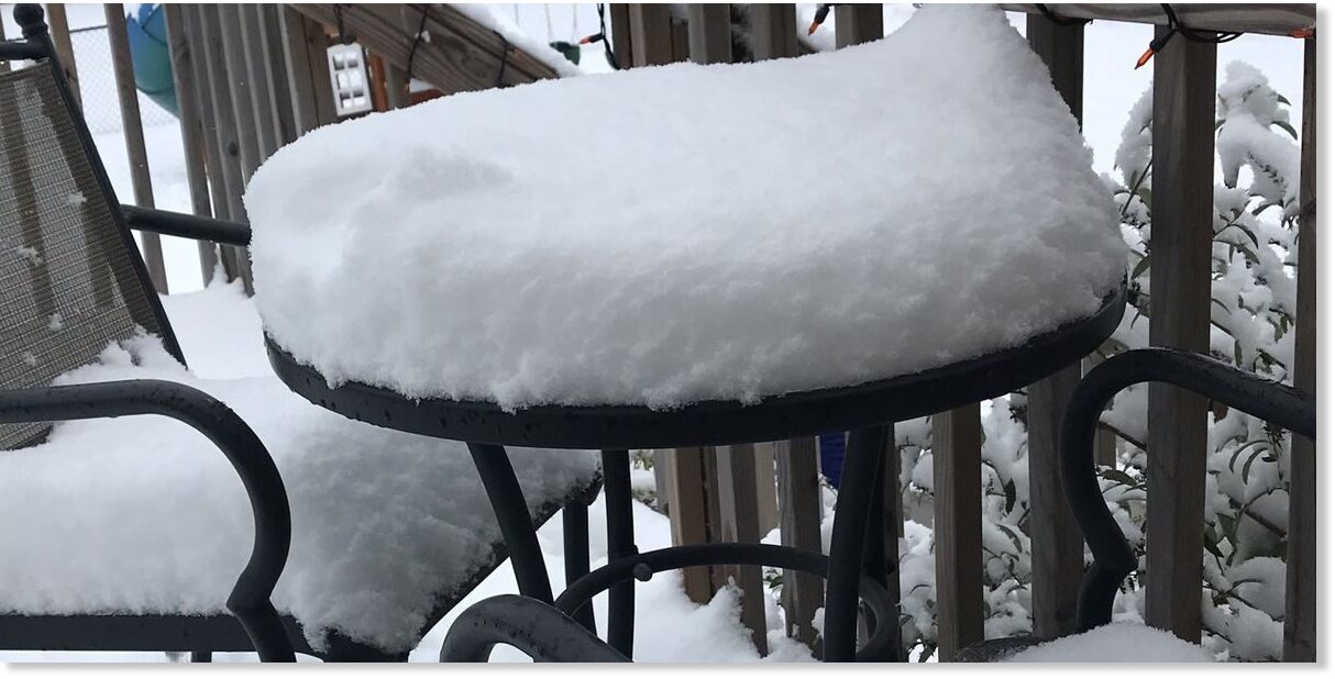
In less than two years, the fan hub fragment had been buried by a staggering 12-feet (almost 4-meters) of compacted snow. During the 2017-18 and 2018-19 seasons, the Greenland Ice Sheet gained 686 billion tonnes of snow and ice (DMI), which added to the whopping 544 billion tonnes gained in 2016-17 (the fifth highest in record books dating back to 1981), and was then followed up by the 349bn tonnes added last year. [Note, these totals don’t account for the annual losses due to the breaking off, or “calving”, of icebergs from the ice sheet’s edge. However, it must be stressed that calving events usually occur when an ice sheet is EXPANDING, not shrinking; and furthermore, icebergs breaking off a glacier aren’t necessarily “lost” to the ocean, they continue existing, like some island extension of the sheet].

For more:


Mr Line and his dig team constructed a small dome-shaped tent to shelter than from the severe winds during their three-day-long excavation effort.

At night, they slept with rifles next to their sleeping bags as a precaution for polar bear attacks. The population of the Arctic bears, it turns out, is actually on the rise: “The number of polar bears has quintupled in the past 50 years from about 5,000 to about 25,000 today,” writes Dr. Jay Lehr. Zoologist Dr. Susan Crockford goes even further, writing in 2019 that approximately 39,000 polar bears exist in the wild today.

The first few metres of snow and ice above the engine fan shovelled out easily, but Mr Lines used a chain saw to hack apart the thick, compacted layers of frost further down.

The crew carved a ramp into the excavation site so that a sleigh operated by a pulley system could be used to shuttle about 20 metric tons of snow out of the pit.

“We had a lot of sunshine because the sun doesn’t really set [at that time of year],” Mr Lines said; “So we just worked through the night, and then went to bed for a few hours and then woke up and just started digging again.”

Finally, on day three, the tips of the engine’s fan blades came into view.

a380-engine-parts-greenland_78090.jpg


An industrial heater was used to melt ice away from the fan before the makeshift pulley system hauled it out to surface level. And in footage of the excavation (shown below), Mr Lines and the rest of the crew whoop and applaud as a helicopter airlifts the giant fan fragment, which was still largely intact, out of the ice.

View: https://youtu.be/zPcSU0A1G9w


GH_Frosty_Boy_APL_3528.jpg

The dig team celebrating their efforts (as well as Greenland’s staggering amount of ice growth?–perhaps not…).

The battered piece of debris later proved vital in understanding what actually went wrong on the 2017 Air France flight.

Investigators determined that it wasn’t a maintenance issue, as previously thought, and that the engine failed because of a phenomenon called “cold dwell fatigue,” which caused the metal in the engine’s fan to fail far sooner than anticipated — a material which is extremely common across the aerospace industry, and highlights an area for improvement which could prevent incidents such as this happening again in the future.

Perhaps even more crucially though, the search and dig also revealed that ice and snow are building at tremendous levels on the Greenland Ice Sheet, with recent years, as discussed above, looking to have reversed the naturally occurring trend of loss.

The COLD TIMES are returning, the mid-latitudes are REFREEZING, in line with historically low solar activity, cloud-nucleating Cosmic Rays, and a meridional jet stream flow.

Both NOAA and NASA appear to agree, if you read between the lines, with NOAA saying we’re entering a ‘full-blown’ Grand Solar Minimum in the late-2020s, and NASA seeing this upcoming solar cycle (25) as “the weakest of the past 200 years”, with the agency correlating previous solar shutdowns to prolonged periods of global cooling here.

Also, we can’t ignore the slew of new scientific papers stating the immense impact The Beaufort Gyre could have on the Gulf Stream, and therefore the climate overall.


Prepare accordinglylearn the facts, relocate if need be, and grow your own.
 

TxGal

Day by day

sun-ice-4.jpg


ACCORDING TO THE MSM, GLOBAL WARMING COULD STILL MAKE IT TOO COLD TO GROW CITRUS FRUITS IN SOUTHEAST U.S.
OCTOBER 16, 2020 CAP ALLON

As reported by a myriad of mainstream news outlets, including www.wltx.com, “[global warming] doesn’t necessarily make growing cold-sensitive plants any easier in the Southeast US”.

Reporter Alex Calamia decided to plant a Mandarin in the WLTX garden. Calamia chose the ‘Owari Satsuma’ variety because of its cold tolerant and early ripening properties.

“The Midlands has a history of getting too cold on occasion for even this citrus variety,” explained Calamia, “so I decided it’d be a great indicator of how warm our winters are getting.”

The reporter delved into the weather books for Columbia, South Carolina (which date back to 1888) hoping to prove his point. And while the adjusted temperature data does indeed appear to show a warming trend, this trend is explained by increasing solar output, the Ubran Heat Island (UHI) effect, and NOAA/NASA data-manipulation — in fact, it is probable that the the latter two are now the sole drivers of modern anthropogenic global warming.

Calamia, no doubt oblivious to the UHI effect, continued: “Despite recent decades being warmer than in years past, the frequency of arctic outbreaks does not have a clear decrease. I looked deeper into the record book for Columbia and noticed the frequency of arctic outbreaks in the early 1900s are similar to today’s numbers. Citrus would not have been much more difficult to grow 100 years ago than today,” concludes Calamia.

cold-south.jpg

WLTX uses mornings below 15F to depict Arctic outbreaks. As is visible (even with the skewing UHI effect), Columbia, SC has returned to a climate similar to the first half of the 20th century.

Once again, a raw and unadjusted dataset reveals nothing unprecedented is going on with our climate. The above data, as touched on above, correlates well with changes in solar activity, ocean currents, and the jet stream.

Calamia appeared disappointed/confused by the conclusion drawn, and he cuts the article short thereafter. He probably had one eye on the weather forecast, which reveals North America is set for its sixth and then seventh Arctic blasts of the season as we progress through October:

gfs_T2ma_namer_fh54-348.gif

GFS 2m Temp Anomalies (C) Oct 16 – Oct 28 [tropicaltidbits.com].

You best pick those Owari’s early Calamia.

The COLD TIMES are returning, the mid-latitudes are REFREEZING, in line with historically low solar activity, cloud-nucleating Cosmic Rays, and a meridional jet stream flow.

Both NOAA and NASA appear to agree, if you read between the lines, with NOAA saying we’re entering a ‘full-blown’ Grand Solar Minimum in the late-2020s, and NASA seeing this upcoming solar cycle (25) as “the weakest of the past 200 years”, with the agency correlating previous solar shutdowns to prolonged periods of global cooling here.

Furthermore, we can’t ignore the slew of new scientific papers stating the immense impact The Beaufort Gyre could have on the Gulf Stream, and therefore the climate overall.


Prepare accordinglylearn the facts, relocate if need be, and grow your own.
 

TxGal

Day by day

snow-Slovakia-2.jpeg


COLD, SNOW, AND EPIC FLOODING: “THE WEATHER IN SLOVAKIA IS REMINISCENT OF THE APOCALYPSE”
OCTOBER 17, 2020 CAP ALLON

Heavy October snow has buried parts of Slovakia, while nonstop rain has led to evacuations in others: “the weather in Slovakia could not be worse,” reports www.cas.sk.

It may only be mid-October, but the winter tires are already required across the higher elevations of the landlocked central European country.

Mountain passes, such as Kľak and Čertovica, are currently covered in snow:

View: https://www.facebook.com/watch/?v=765589964007077


The situation at Čertovica recently.

Disruptive snow was also reported on the mountain passes of Fačkovské sedlo near Kľačna, and Homôlka near ValaskáI Belá, according to www.cas.sk.

“Roads are impassable, the police call on drivers to be extra careful,” said Trenčín regional police spokesman Pavol Kudlička.

Additional accumulations are in the forecast, particularly for the districts of Banská Bystrica, Brezno, Detva, Zvolen, Poltár, Revúca and Rimavská Sobota. The Slovak Hydro-meteorological Institute (SHMÚ) has issued multiple “first-degree” warnings for further snowfall.


Compilation of the recent early-season snowfall in Slovakia [topky.sk].

At lower-lying regions, where the precipitation fell as rain, flooding has been an issue. As reported by www.topky.sk, the situation is “critical” and firefighters have had to evacuate dozens of people from their flooded homes.


[Source: FB / HaZZ Presidium, TASR / František Iván, Slovak Police].


Flooding in Slovakia [source: facebook.com/severe.weather.slovakia].

According to www.teraz.sk, at least 13 districts are on the highest flood warning alert, with both the rain and snow forecast to persist into next week.


Snow Warnings

In addition, the chill Slovakia has been suffering of late won’t shift anytime soon. In fact, the anomalous cold is only forecast to intensify as a meridional jet stream flow drives Arctic air over the majority of the European continent:


GFS 2m Temp Anomalies for Oct 20 [tropicaltidbits.com].

The COLD TIMES are returning, the mid-latitudes are REFREEZING, in line with historically low solar activity, cloud-nucleating Cosmic Rays, and a meridional jet stream flow.

Both NOAA and NASA appear to agree, if you read between the lines, with NOAA saying we’re entering a ‘full-blown’ Grand Solar Minimum in the late-2020s, and NASA seeing this upcoming solar cycle (25) as “the weakest of the past 200 years”, with the agency correlating previous solar shutdowns to prolonged periods of global cooling here.

Furthermore, we can’t ignore the slew of new scientific papers stating the immense impact The Beaufort Gyre could have on the Gulf Stream, and therefore the climate overall.


Prepare accordinglylearn the facts, relocate if need be, and grow your own.
 

TxGal

Day by day

10-18-RNE-RNC-daily-maximum-snows-1-e1603095157542.jpg


GREAT FALLS SMASHES SNOWFALL RECORD
OCTOBER 19, 2020 CAP ALLON

Great Falls, Montana set a new daily snowfall record over the weekend as a three-day storm dumped nearly a foot of the white stuff on the city. The Arctic continues to descend south. Prepare for the cold.

Officially, the Electric City received 4.9 inches on Saturday –smashing the record of 1.7 inches set back in 1961– and then another 4.7 inches had accumulated by noon Sunday. Snow totals since Friday night topped 10.5 inches, according to the National Weather Service (NWS) and as reported by greatfallstribune.com, with a further 2 inches expected Sunday night.

These totals have embarrassed the official forecasts, which as late as Fri, Oct 16 were calling for weekend totals of just 2 inches in Great Falls.

View: https://twitter.com/thom_g_bridge/status/1317495043087761408


On Saturday alone, 10+ inches of snow was reported from Choteau to Fairfield. Snowfall of 10+ inches also was registered west of Helena near MacDonald Pass–when Friday forecasts called for just 4 inches in the region.

View: https://twitter.com/KristenInbodyMT/status/1317915714695524353


“It’s that time of year,” said Paul Nutter, a meteorologist with the NWS, no doubt trying to downplay the surprise falls and utterly useless forecasts.

View: https://twitter.com/enygma/status/1317827438840197120


Snow records also tumbled in many other towns and cities across Montana and South Dakota: in addition to Great Falls’ 4.9 inches, Sunday accumulations of 5.2 inches and 1.7 inches in Billings, MT and Rapid City, SD, respectively, also broke all-time daily records.


Source: weathernationtv.com.

View: https://twitter.com/WeatherNation/status/1317782477738446849


Looking forward, Winter Weather Advisories remains in effect for many through Monday morning. The NWS also warned residents of Great Falls to be prepared for the possibility of icy roads by Monday morning with freezing rain in the forecast. Daytime temperatures will remain in the 20s.

Then, after a very brief reprieve, a third round of heavy, potentially record-busting snow is expected beginning Wednesday evening, according to Nutter — a prediction backed-up by the GFS (shown below).

Prepare.


GFS Total Snowfall — Oct 19 to Oct 29 [tropicaltidbits.com].

Another almost continent-spanning blast of Arctic cold will accompany the snow — North America’s eight such blast of the season (and we’re still in October).


GFS 2m Temp Anomalies — Oct 23 to Oct 29 [tropicaltidbits.com].

The COLD TIMES are returning, the mid-latitudes are REFREEZING, in line with historically low solar activity, cloud-nucleating Cosmic Rays, and a meridional jet stream flow.

Both NOAA and NASA appear to agree, if you read between the lines, with NOAA saying we’re entering a ‘full-blown’ Grand Solar Minimum in the late-2020s, and NASA seeing this upcoming solar cycle (25) as “the weakest of the past 200 years”, with the agency correlating previous solar shutdowns to prolonged periods of global cooling here.

Furthermore, we can’t ignore the slew of new scientific papers stating the immense impact The Beaufort Gyre could have on the Gulf Stream, and therefore the climate overall.


Prepare accordinglylearn the facts, relocate if need be, and grow your own.
 

TxGal

Day by day

empty-shelves-e1603102247254.jpg


“WE’RE OUT OF CORN” — MSM BLAMES COVID, SCIENCE REVEALS DIMINISHING SOLAR ACTIVITY IS THE CAUSE
OCTOBER 19, 2020 CAP ALLON

Corn is the latest grocery item to reportedly suffer from a “coronavirus-related shortage” — and serving as anecdotal evidence of the bare supermarket shelves, a number of chains in both Portugal and the UK haven’t had any stocked for months.

The MSM is blaming COVID-19 (the current king of the scapegoats) for today’s corn shortages with the official party li(n)e stating: “retailers burned through their inventories in the spring as the pandemic led to consumers stockpiling large amounts of shelf-stable goods”. We’re told, according to the reports, that “big canning companies tried to get farmers to plant more corn, but growers had already made their plans for the year.”

As always though, mainstream reporting is packed with half-truths and obfuscation with the sole aim of advancing agendas. The facts clearly reveal that the issues behind today’s GLOBAL corn shortage predate the pandemic: the problems are tied to a cooling climate, and the evidence speaks for itself…

CORN PREVENT PLANTINGS

Prevent planting is the failure to plant an insured crop by the final planting date. During the USA’s 2019 growing season, the corn acres prevented from being planted soared past the previous record (set in 2013) by nearly 8 million acres to reach a new record of 11.4 million acres.

Historic flooding and cold were blamed.

South Dakota led the nation with more than 2.9 million prevent plant corn acres and was followed by Illinois and Minnesota at more than 1 million acres each. The map shown below highlights preliminary state-level corn prevent plantings in 2019:


Since then, the USDA has actually tightened its corn balance sheet.

As recently reported by brownfieldagnews.com, the official numbers have retroactively been whittled down even further. The year known as “the harvest from hell” and “noplant-19” was even worse than official figures let on, and now, in 2020, the prevented plantings have continued.

According to an article from agweb.com, 2019 was very bad but for many farmers, 2020 is the second straight year they’ve dealt with prevent plant.

“Where I farm, 50% is prevent plant this year,” said Ben Longlet, a farmer in Arthur, North Dakota. That’s partly because some of Longlet’s crop didn’t get harvested until the spring. Even then, ground conditions weren’t great and machinery got stuck: “We had about 50% of our corn left out over winter.”

Longlet said cold spring planting weather didn’t cooperate either: “We kept getting rain and it really just pushed our spring planting back to the point where it was. We just had to throw in the towel because the planting conditions were never right.”

USDA said in August that there are 9.3 million acres of prevent plant in 2020.

Yet we’re supposed to blame COVID for the corn shortages…?

WHAT THE SCIENCE SAYS

The pandemic is a cover for many a thing. However, food shortages are perhaps the most worrying. As hinted at above, a number of supermarket chains across Europe haven’t stocked canned corn for months now, and a myriad of reports from the U.S. suggest the same thing is going on there.

So, if it isn’t COVID that’s causing bare grocery store shelves, then what is it?

In their 2020 paper, scientists E. Ray Garnett and Madhav L. Khandekar ask: “Is Diminishing Solar Activity Detrimental to Canadian Prairie Agriculture?

Their answer won’t come as a surprise to those who follow the activity of the sun, but when delving down into the pair’s findings it is astonishing to see how far AGW dogma has drifted from the science.

The below paragraphs are lifted from the paper’s eye-opening abstract:

During the grain growing months of May-July, the mean temperature on the Canadian prairies has cooled down by 2ºC in the last 30 years. The cooling appears to be most certainly linked to diminishing solar activity as the Sun approaches a Grand Solar Minimum in the next decade or so. This cooling has led to a reduction in Growing Degree Days (GDDs) and has also impacted the precipitation pattern. The GDDs in conjunction with mean temperature and precipitation are important parameters for the growth of various grains (wheat, barley, canola etc.) on the prairies.

In this study, we investigate the impact of declining GDDs and associated temperature and precipitation patterns on Prairie grain yields and quality. Our analysis shows that there has been a loss of about 100 GDDs over the time frame of 1985-2019. The loss in GDDs is also linked to some of the large scale Atmosphere-Ocean parameters like the Pacific Decadal Oscillation (PDO), North Pacific Index (NPI) and Arctic Oscillation (AO). Our analysis suggests grain yield and quality could be significantly impacted in the coming years as solar activity continues to diminish.


The paper goes on to reference both the Maunder and Dalton Minimums, and the human struggles witnessed then. It also mentions Svensmark et al., 2017’s proposition that “increased ionization produced by cosmic rays (during low solar activity) leads to growth aerosols into cloud condensation nuclei. This mechanism suggests increased cloud cover as the sun enters a grand solar minimum” — I see this as being one of the main drivers of the cooling and also the observed increase in localized precipitation.

I cannot put this any clearer.

Unpreventable and large-scale food shortages are on the horizon. Shortages that have next to nothing to do with the activity of us humans, less with the mildest flu pandemic in history.

No, the cause of this coming global famine is a REFREEZING of the mid-latitudes as the Arctic effectively descends south: the COLD TIMES are returning in line with historically low solar activity, cloud-nucleating Cosmic Rays, and a meridional jet stream flow.

Both NOAA and NASA appear to agree, if you read between the lines, with NOAA saying we’re entering a ‘full-blown’ Grand Solar Minimum in the late-2020s, and NASA seeing this upcoming solar cycle (25) as “the weakest of the past 200 years”, with the agency correlating previous solar shutdowns to prolonged periods of global cooling here.

Furthermore, we can’t ignore the slew of new scientific papers stating the immense impact The Beaufort Gyre could have on the Gulf Stream, and therefore the climate overall.


Prepare accordinglylearn the facts, relocate if need be, and grow your own.
 

TxGal

Day by day

snow-alps-2020-e1603107582274.jpg

THIRD! AUTUMN SNOWFALL EVENT LEAVES EUROPE’S ALPINE GLACIERS IN “GREAT SHAPE”
OCTOBER 19, 2020 CAP ALLON

A THIRD snowfall event in the Alps has left glacier ski areas boasting amazing snow conditions, particularly given it’s still only mid-October.

As reported by snow-forecast.com, European glaciers received a foot of snow to start last week following similar falls a week before and even bigger accumulations the week prior to that. And once those clouds had finally parted, stunning wintry scenes under deep blue skies were revealed at ski areas such as Austria’s Stubai Glacier:


Austria’s Stubai Glacier on Oct, 14.

As of October 14, a total of 14 glacier ski areas had already opened their doors for the 2020-21 ski season — close to a record for this early in the season. And now, as of this past weekend, Tignes and Les 2 Alpes along with 4 other resorts have been added to the list. Tignes reported 6 additional inches in recent days, taking its snow cover right down to resort level.

However, and as depressingly concluded by snow-forecast.com, the great glacier conditions and growing number of open ski areas is coinciding with a reported rise in COVID infections. As a result, restrictions on the slopes are gradually being rolled-out — just the latest infringement on our social liberties during what the science reveals is the mildest flu pandemic in history.

With regards to Europe’s snowfall, much more is expected before the month of October is through. Latest GFS runs show parts of Scandinavia will be buried this week with both the Alps and Pyrenees copping their FOURTH Arctic blasts of the season starting Mon, Oct 26:


GFS Total Snowfall for Oct 20 – Oct 31 [tropicaltidbits.com].

The COLD TIMES are returning, the mid-latitudes are REFREEZING in line with historically low solar activity, cloud-nucleating Cosmic Rays, and a meridional jet stream flow.

Both NOAA and NASA appear to agree, if you read between the lines, with NOAA saying we’re entering a ‘full-blown’ Grand Solar Minimum in the late-2020s, and NASA seeing this upcoming solar cycle (25) as “the weakest of the past 200 years”, with the agency correlating previous solar shutdowns to prolonged periods of global cooling here.

Furthermore, we can’t ignore the slew of new scientific papers stating the immense impact The Beaufort Gyre could have on the Gulf Stream, and therefore the climate overall.


Prepare accordinglylearn the facts, relocate if need be, and grow your own.
 

TxGal

Day by day
TxGal, WOW! You've sure brought us all up to date here! This is where I should say "Thanks. I think!"

Once again, I've looked at all these new posts and dragged out the shopping list.

You're welcome, I'm still working on it! I'll likely be posting later tomorrow rather than in the morning. I'm still catching up on reading myself. There's so much going on in many threads, it's just crazy.

We're forecasted at the moment to have a sharp cold front next week. Lows look to be in the 30s! Dang, there goes the cherry tomatoes, we have a ton of flowers on them. I'll pick the green ones to ripen inside, but can't do much about the rest. Time to dust off the blankets...people and garden blankets!
 

Martinhouse

Deceased
TxGal, I'm only showing one day for us here in the 30s.....a 37 overnight low on Oct. 27.

Could this be one of those cold fronts that stretches north and south and the bottom of it reaches you before the center part hits me here in north central Arkansas?

My greenhouse project came to a screeching halt when my nephew had to stay home and supervise the schooling of his kids. I do understand what's happened, but I have a ton of expensive materials lying in my yard and a greenhouse that is basically a roof only and it is getting COLD out there! By now I should be opening my living room door every sunny afternoon to let some very warm air into the house, but so far this year I sure can't do that.

I feel so very let down. Like once again I trusted someone and was disappointed. I think I will have to see if I am able to staple up some plastic sheeting without help, so I can get some heat build-up out there. I haven't been able to get it cleaned out and sure haven't been able to plant my kale and broccoli bedding plants! And those weren't cheap this year either! Once they are planted there is no way I'm letting them get trampled from the permanent side panels being built and installed! It's a good thing I'm as angry about it as I am or I'd probably have to cry a lot! (: There were lots of flowers, as well, that never got planted because of the summer work and those things weren't any less expensive than this fall's kale and broccoli plants!
 

TxGal

Day by day
The Oppenheimer Ranch Project has a new podcast out:

View: https://www.youtube.com/watch?v=9mpO1wzq1lE


7.5 Magnitude Hits Alaska - Small Tsunami Recorded - Record Snow Coming Everywhere! - GSM MUCH?
5,654 views • Premiered 13 hours ago

Run time is 13:15

Synopsis provided:

Tsunami warning reported magnitude 7.5 earthquake @ Sand Point https://fxn.ws/35cga0Q
Small tsunami mag 7.5 earthquake that prompted evacuation orders https://cnn.it/2H6i5fB
Truck stuck on mountain road ‘isn’t going anywhere any time soon’ https://bit.ly/35iZswM
Two rounds of snow could hit Colorado this week https://bit.ly/37mGjN3
GFS Model Total Snow https://bit.ly/34eN6X6
Temperatures Well Above Normal in the Southwest & California; Snow Possible in the Northern Plains https://www.weather.gov/
Unofficial Record Breaking Temps Around The World http://bit.ly/2q7qHcT
SNOWFALL ANALYSIS FROM THE LAST 24 HOURS https://www.weather.gov/crh/snowfall
THIRD! AUTUMN SNOWFALL EVENT LEAVES EUROPE’S ALPINE GLACIERS IN “GREAT SHAPE” https://bit.ly/2IHfNnj
Greenland Surface Conditions http://bit.ly/2KXO5DF
Total Snowmass For The Northern Hemisphere http://bit.ly/2lAFomU
Space Weather News https://spaceweathernews.com/
Tsunami Advisory https://www.tsunami.gov/
Felt earthquake 3 km north-east of Húsavík town last night https://icelandgeology.net/?p=8743
Chief Science Officer for Pfizer Says “Second Wave” Faked on False-Positive COVID Tests, “Pandemic Is Over” https://bit.ly/3jeq1Z4
Nazca Lines: Archaeologists discover 2,000-year-old cat figure in Peru https://cnn.it/2TavPs0
Driver of the largest mass extinction in the history of the Earth identified https://bit.ly/37umpQe
 

TxGal

Day by day

NOAA – La Niña cooling flip has occurred
October 20, 2020 by Robert

‘The Northern Hemisphere winter of 2020/21 is shaping up to be a doozy,” says reader Martin Siebert.

The latest CFSv2** forecast for region 3.4 of the central equatorial Pacific Ocean reveals that a flip from the recent El Niño setup (warming) to a La Niña one (cooling) has occurred.

CFSV2 FORECASTS LA NIÑA (COOLING) INTO 2021

La Niña’s are usually associated with cooler global average temperatures, droughts in the southern U.S., and anomalously wet conditions in Australia.

CFSv2 Forecasts La Niña (cooling) into 2021 - Electroverse
 

TxGal

Day by day

“It will be as if we skipped past the rest of fall and jumped into winter”
October 19, 2020 by Robert

Washington – “WINTER-LIKE CONDITIONS POSSIBLE LATE THIS WEEK”
– National Weather Service

“Saturday night through Monday: This will be the coldest part of the next seven days. It`s possible that the cold will set new temperature records. The NBM guidance indicates high spread, which is not surprising, but single digit low temperatures are not out of the question for Sunday and Monday mornings if there is snow on the ground. High temperatures look to be in the 30s! If these temperatures verify, it will be as if we skipped past the rest of fall and jumped into winter. /SVH”

Thursday to Friday morning: Decent cold advection behind the front ushers in temperatures 8 to 14 degrees below normal for much of the region. This will be just the beginning of the cold as temperatures will just continue to drop heading into next weekend.

As the next system approaches on Friday, cloud cover and precipitation chances move in from the northwest corner of our forecast area Friday morning. RC

…WINTER-LIKE CONDITIONS POSSIBLE LATE THIS WEEK…

Friday to Monday: A robust system is projected to drop in from the north this period, bringing with it the potential for winter precipitation and very cold temperatures for this time of year.

NOAA forecast discussion for Washington State: National Weather Service Text Product Display
 

TxGal

Day by day
TxGal, I'm only showing one day for us here in the 30s.....a 37 overnight low on Oct. 27.

Could this be one of those cold fronts that stretches north and south and the bottom of it reaches you before the center part hits me here in north central Arkansas?

My greenhouse project came to a screeching halt when my nephew had to stay home and supervise the schooling of his kids. I do understand what's happened, but I have a ton of expensive materials lying in my yard and a greenhouse that is basically a roof only and it is getting COLD out there! By now I should be opening my living room door every sunny afternoon to let some very warm air into the house, but so far this year I sure can't do that.

I feel so very let down. Like once again I trusted someone and was disappointed. I think I will have to see if I am able to staple up some plastic sheeting without help, so I can get some heat build-up out there. I haven't been able to get it cleaned out and sure haven't been able to plant my kale and broccoli bedding plants! And those weren't cheap this year either! Once they are planted there is no way I'm letting them get trampled from the permanent side panels being built and installed! It's a good thing I'm as angry about it as I am or I'd probably have to cry a lot! (: There were lots of flowers, as well, that never got planted because of the summer work and those things weren't any less expensive than this fall's kale and broccoli plants!

More a bit later, but our forecast last I saw was that next Tues - Thursday we're dipping down into the 30s, and at least one night looks to break freezing. This is not good. Livestock don't have their winter coats yet.
 

TxGal

Day by day

china-cold-tibet-e1603193610216.jpg

JUST 5,000 YEARS AGO, NORTHERN CHINA’S FROZEN TIBETAN PLATEAU WAS HOME TO TROPICAL SPECIES
OCTOBER 20, 2020 CAP ALLON

Spanning 1 million square miles, Northern China’s Tibetan Plateau is both massive and inhospitable — winter temperatures here routinely plunge below -40 degrees Fahrenheit. However, new research reveals this wasn’t always the case and that “climate change” is far from a new phenomenon.

Recent analysis of a group of ancient animals in the bovid family (that includes cattle, bison, and even rhinoceroses) reveals this icy part of the world may have once been temperate — even tropical.

The findings, published Monday in the journal Proceedings of the National Academy of Sciences, suggest the ancestors of traditionally tropical species, including gaur and Sumatran rhinos, once called this plateau home and may have only migrated south in later years due to a warming climate.


The new study suggests the Sumatran rhino (above) is the direct descendants of ancient bovids that roamed the now frozen Tibetan Plateau some 5,000 years ago.

The zooarchaeologists behind the study used a different method to animal identification than that used in the past. Previously, scientists tentatively recognized the Tibetan yak as colonizing this particular region during the time period in question, by looking at physical features alone. However, the new study took a different approach, and instead deciphered the remains’ DNA.

Using a mix of whole-genome and mitochondrial DNA analysis on specimens dating back about 5,200 years, the researchers homed in on which modern bovid species the remains most closely matched. This DNA dissection quickly revealed that the animals in question were almost identical to present-day low-latitude tropical rainforest gaurs (similar to bison) and Sumatran-like rhinoceroses.

“Up to now, there has been no record that gaurs once inhabited relatively high latitudes in northern China, especially in the higher-altitude [plateau,]” explain the authors. “[But] our systematic [ancient] DNA dissection revealed that the present-day low-latitude tropical rainforest gaurs and Sumatran-like rhinoceroses once rambled over northern Asia.”

The researchers point out that modern-day gaurs and Sumatran rhinos wouldn’t last long on the frozen Tibetan plateau today. However, it appears the region’s ancient climate would have been much more to their liking — by studying paleoclimate data from the period, the zooarchaeologists discovered that the environment would have actually been warm and moist.

Lifted directly from the study’s abstract: “This highlights the intimate connection among climate change, the geographical distribution of wildlife, and human hunting behavior in northwest China during that period.”

So, as short a time as 5,000 years ago what are now the inhospitable frozen plateaus of northern China were so warm and wet that bovid roamed them.

These findings serve as further proof that climate is cyclic, never linear, and also that natural mechanisms alone are capable of producing violent and swift climatic swings — no human CO2 emissions required.

Alarmists, please get over yourselves.

The COLD TIMES are returning, the mid-latitudes are REFREEZING, in line with historically low solar activity, cloud-nucleating Cosmic Rays, and a meridional jet stream flow.

Both NOAA and NASA appear to agree, if you read between the lines, with NOAA saying we’re entering a ‘full-blown’ Grand Solar Minimum in the late-2020s, and NASA seeing this upcoming solar cycle (25) as “the weakest of the past 200 years”, with the agency correlating previous solar shutdowns to prolonged periods of global cooling here.

Furthermore, we can’t ignore the slew of new scientific papers stating the immense impact The Beaufort Gyre could have on the Gulf Stream, and therefore the climate overall.


Prepare accordinglylearn the facts, relocate if need be, and grow your own.
 

TxGal

Day by day

PG-Oct-Snow-e1603188607103.jpg


PRINCE GEORGE, CANADA: RECORD LOW TEMPERATURES SET TO FOLLOW UNUSUALLY EARLY SNOWFALL
OCTOBER 20, 2020 CAP ALLON

The GRAND SOLAR MINIMUM, and its resulting atmospheric phenomena, have delivered unusually early snowfall to British Columbia of late, and now they threaten record low temperatures this week.

As reported by cbc.ca, winter has come to Prince George earlier than usual, with snow accumulations northwards of 15cm (6 inches) in some areas.

Looking ahead, Environment Canada is predicting further heavy flurries in the northern city for most of the week, with nighttime temperatures sinking to as low as –13C (8.6F) and daytime temperatures rising to just –4C (24.8F). The weather books reveal that this is in stark contrast to previous years, where the average low is –1C (30.2F) and the average high around 8C (46.4F).

“We’re not getting as much melting [of the snow] happening,” Environment Canada’s senior meteorologist Carmen Hartt told CBC.

Hartt said the current snowy weather across British Columbia is part of the La Niña global atmospheric phenomenon. La Niña is the periodic cooling of ocean surface temperatures in the central and east-central equatorial Pacific, it represents the cool phase of the El Nino/Southern Oscillation (ENSO) cycle. Hartt said that such a setup leads to colder winters.

View: https://twitter.com/MizzzAlia/status/1318248586635743232


Canada, as a whole, has also been seeing heavy snow of late.

“It’s all due to that Arctic air that’s been pushing down, and it is expected to continue to push down this week,” explained Hartt — a persistence that increases during times of low solar activity, such as we’re suffering now.

Click below for more:


On Monday, Prince George started clearing snow and ice from the roads and sidewalks–far earlier than is usual. In addition, after the heavy snow last Friday, the city also closed some parks and outdoor recreational facilities.

As reported by pgdailynews.ca, the gates at the entrances to Connaught Hill are closed to vehicular traffic. The outdoor public washrooms at Duchess and Lheidli T’enneh Memorial Parks are also closed, as is Masich Place Stadium, including the track.

View: https://twitter.com/miss__marly/status/1318214260145582080


View: https://twitter.com/CityofPG/status/1318235545902907392


On the other side of the coin, the kids aren’t complaining:

View: https://twitter.com/Kellymjohansen/status/1318259972094918657


And neither is the Prince George Caledonia Nordic Ski Club where the surprise early season snow has proved great for business, increasing new season memberships by 154%–even amid the COVID-19 pandemic.

“It looks like we’re going to enter into an amazing season with all the snow,” said the company’s general manager Angela LeFebvre: “It’s going to be a very busy year.”

LeFebvre will be happy to know further flurries are in the latest GFS run (shown below). Impressive October accumulations will cover B.C. throughout the rest of the week, and then another blast of heavy, early, and potentially record setting snow will begin burying the province on Monday, October 26.

Also worth noting is how far south the snowline drops, with the state of Texas, even central regions, in line for a few flakes by October 27 (the models may well be overdoing it here, but be sure to stay tuned for updates).


gfs_asnow_namer_fh18-384.gif

GFS Total Snowfall (inches) Oct 20 – Nov 5 [tropicaltidbits.com].

Environment Canada meteorologist Carmen Hartt concluded with this little nugget: “Our [climate] normals are getting colder”.

Indeed, the COLD TIMES are returning, the mid-latitudes are REFREEZING, in line with historically low solar activity, cloud-nucleating Cosmic Rays, and a meridional jet stream flow.

Both NOAA and NASA appear to agree, if you read between the lines, with NOAA saying we’re entering a ‘full-blown’ Grand Solar Minimum in the late-2020s, and NASA seeing this upcoming solar cycle (25) as “the weakest of the past 200 years”, with the agency correlating previous solar shutdowns to prolonged periods of global cooling here.

Furthermore, we can’t ignore the slew of new scientific papers stating the immense impact The Beaufort Gyre could have on the Gulf Stream, and therefore the climate overall.


Prepare accordinglylearn the facts, relocate if need be, and grow your own.
 

TxGal

Day by day

arctic-sea-ice-extent-Oct-18-1-e1603181119378.jpeg


ANTARCTIC SEA ICE EXTENT CURRENTLY ABOVE 1981-2010 AVERAGE BY 276,000 KM2
OCTOBER 20, 2020 CAP ALLON

By volume, Antarctica contains 90% of Earth’s ice — and volume is a far better metric to judge the state of an ice sheet than sea ice extent. But the AGW party loves its sea ice datasets –no doubt because they show a decline in the Arctic since the early 1980s– so, let’s play their game.

Over the course of a year, the extent of sea ice around the southern pole comfortably eclipses its northern cousin’s. At maximum winter extent, the Antarctic averages 3,000,000+ km2 more than the Arctic.

Looking at official government data from the National Snow & Ice Data Center (NSIDC), this year’s Antarctic sea ice extent grew rapidly in August to levels above the 1981-2010 average, and it has held there ever since.

The latest data-point –from day 292 (or Oct 18)– reveals that extent is currently standing at 18.388 million km2 compared with the 1981-2010 ‘day 292’ average of 18.112 million km2 — by my crude calculations, that’s 276,000 km2 more:


Source: NSIDC.

In addition, the NSIDC data also reveals that today’s extent is greater than that on the same date in 1979, as well as on the same date in every year of the 1980s and 1990s (barring 1980, 1998, and 1999):


Source: NSIDC.

These are the official figures.

If Anthropogenic Global Warming and “Polar Amplification” is a thing, then why aren’t its impacts being felt in Antarctica? Clearly, as demonstrated above, the opposite is occurring — how alarmists can square these numbers with their decidedly round AGW hole is baffling to me, or perhaps it just serves as another example of the power of political manipulation.

The science, that we are constantly instructed to follow, reveals that ice on planet Earth is NOT melting — the average is actually showing signs of increasing / growing / expanding / surging / multiplying / snowballing / accumulating — pick any synonym you like, so long as it stands for “make greater in size, amount, or degree”.

I’m sick of the lies; lies made a thousands times worse by the climatic reality that is actually fast-barreling towards us: the COLD TIMES are returning, the mid-latitudes are REFREEZING; in line with historically low solar activity, cloud-nucleating Cosmic Rays, and a meridional jet stream flow.

Both NOAA and NASA appear to agree, if you read between the lines, with NOAA saying we’re entering a ‘full-blown’ Grand Solar Minimum in the late-2020s, and NASA seeing this upcoming solar cycle (25) as “the weakest of the past 200 years”, with the agency correlating previous solar shutdowns to prolonged periods of global cooling here.

Furthermore, we can’t ignore the slew of new scientific papers stating the immense impact The Beaufort Gyre could have on the Gulf Stream, and therefore the climate overall.


Prepare accordinglylearn the facts, relocate if need be, and grow your own.
 

northern watch

TB Fanatic

china-cold-tibet-e1603193610216.jpg

JUST 5,000 YEARS AGO, NORTHERN CHINA’S FROZEN TIBETAN PLATEAU WAS HOME TO TROPICAL SPECIES
OCTOBER 20, 2020 CAP ALLON

Spanning 1 million square miles, Northern China’s Tibetan Plateau is both massive and inhospitable — winter temperatures here routinely plunge below -40 degrees Fahrenheit. However, new research reveals this wasn’t always the case and that “climate change” is far from a new phenomenon.

Recent analysis of a group of ancient animals in the bovid family (that includes cattle, bison, and even rhinoceroses) reveals this icy part of the world may have once been temperate — even tropical.

The findings, published Monday in the journal Proceedings of the National Academy of Sciences, suggest the ancestors of traditionally tropical species, including gaur and Sumatran rhinos, once called this plateau home and may have only migrated south in later years due to a warming climate.


The new study suggests the Sumatran rhino (above) is the direct descendants of ancient bovids that roamed the now frozen Tibetan Plateau some 5,000 years ago.

The zooarchaeologists behind the study used a different method to animal identification than that used in the past. Previously, scientists tentatively recognized the Tibetan yak as colonizing this particular region during the time period in question, by looking at physical features alone. However, the new study took a different approach, and instead deciphered the remains’ DNA.

Using a mix of whole-genome and mitochondrial DNA analysis on specimens dating back about 5,200 years, the researchers homed in on which modern bovid species the remains most closely matched. This DNA dissection quickly revealed that the animals in question were almost identical to present-day low-latitude tropical rainforest gaurs (similar to bison) and Sumatran-like rhinoceroses.

“Up to now, there has been no record that gaurs once inhabited relatively high latitudes in northern China, especially in the higher-altitude [plateau,]” explain the authors. “[But] our systematic [ancient] DNA dissection revealed that the present-day low-latitude tropical rainforest gaurs and Sumatran-like rhinoceroses once rambled over northern Asia.”

The researchers point out that modern-day gaurs and Sumatran rhinos wouldn’t last long on the frozen Tibetan plateau today. However, it appears the region’s ancient climate would have been much more to their liking — by studying paleoclimate data from the period, the zooarchaeologists discovered that the environment would have actually been warm and moist.

Lifted directly from the study’s abstract: “This highlights the intimate connection among climate change, the geographical distribution of wildlife, and human hunting behavior in northwest China during that period.”

So, as short a time as 5,000 years ago what are now the inhospitable frozen plateaus of northern China were so warm and wet that bovid roamed them.

These findings serve as further proof that climate is cyclic, never linear, and also that natural mechanisms alone are capable of producing violent and swift climatic swings — no human CO2 emissions required.

Alarmists, please get over yourselves.

The COLD TIMES are returning, the mid-latitudes are REFREEZING, in line with historically low solar activity, cloud-nucleating Cosmic Rays, and a meridional jet stream flow.

Both NOAA and NASA appear to agree, if you read between the lines, with NOAA saying we’re entering a ‘full-blown’ Grand Solar Minimum in the late-2020s, and NASA seeing this upcoming solar cycle (25) as “the weakest of the past 200 years”, with the agency correlating previous solar shutdowns to prolonged periods of global cooling here.

Furthermore, we can’t ignore the slew of new scientific papers stating the immense impact The Beaufort Gyre could have on the Gulf Stream, and therefore the climate overall.


Prepare accordinglylearn the facts, relocate if need be, and grow your own.

5000 years ago!, it not that long ago relative speaking
 

TxGal

Day by day

Parts of central Iowa walloped by up to 9 inches of early snow Monday

Philip Joens
Des Moines Register
Tue, 20 Oct 2020 18:35 UTC

Heavy snow fell across parts of Iowa on October 19th.
© WSFA 12 News/Ryan York
Heavy snow fell across parts of Iowa on October 19th.

What was supposed to be a dusting of snow Monday morning turned into a full-blown central Iowa snowstorm.

Forecasts called for flurries and about an inch of snow in the metro, one day after the season's first measurable snowfall. Instead, an intense snow squall dropped up to nine inches in northern Polk County.

"Things just came together in the right fashion to produce the heavy snow that we're seeing across central Iowa right now," National Weather Service Meteorologist Jeff Zogg said early Monday afternoon.

View: https://youtu.be/0QGz-274EcQ


Flurries started in the metro at about 8:30 a.m. and picked up through the morning. It was around 11:45 a.m. when many central Iowans received a "Snow Squall Warning" alert on their cell phones. The message from the NWS warned of whiteout conditions and icy roads and ended emphatically, urging drivers to "Slow down!"

According to the weather service, "a snow squall is an intense short-lived burst of heavy snowfall that leads to a quick reduction in visibilities and is often accompanied by gusty winds."

View: https://twitter.com/cyyork/status/1318243192840593408


View: https://twitter.com/NWSDesMoines/status/1318236536152985600


The weather service started issuing snow squall warnings nationwide in November 2018. The first warnings of its kind were issued in December 2019 for an area in eastern Iowa, including Iowa City.

Up until Monday, those were the only snow squall warnings ever issued in Iowa.

The warning ended at 12:45 p.m., by which point Polk City was reporting 9 inches of snow, according to the NWS. Ankeny got 8 inches and Grimes got 6, while the Des Moines International Airport reported 1.2 inches on the city's south side.

Snow squall caused dangerous road conditions, car crashes

View: https://youtu.be/mc4PMV8Ubws


Ankeny Police Sgt. Corey Schneden said officers responded to 14 crashes, none of which were serious, and three cars in a ditch between 11 a.m. and 1:45 p.m.

Schneden said he thought drivers were caught off guard by the storm, which limited visibility to less than one-quarter of a mile in the area. He said the roads returned to good condition shortly after the system moved out of the area.

The Iowa State Patrol responded to 31 weather-related crashes and 24 calls to assist motorists in the metro area, according to Iowa State Patrol Sgt. Alex Dinkla, who said troopers switched to their winter uniforms Thursday but are always prepared for bad weather.

"This early on, to have a snow event, it's kind of odd and unusual," Dinkla said. "But having said that, you get around Halloween, sometimes you have great conditions for trick-or-treating and you can get wintry conditions."

Between midnight and 12:30 p.m., the Des Moines Police Department responded to three crashes with injuries and six crashes with property damage only, said spokesman Sgt. Paul Parizek.

"We are prepared for blizzards even if they happen in July," he said.
 

TxGal

Day by day
The Oppenheimer Ranch Project has a new podcast out:

View: https://www.youtube.com/watch?v=UN-J1buvPrU


Twin Cities Set For Record Snow - Alps Surprised By Early Snow - 20 cm Of Snow Coming To Alberta
2,083 views • Premiered 6 hours ago

Run time is 24:37

Synopsis provided:

Twin Cities set for record snow with 7 inches possible Tuesday https://bit.ly/2IKZbep
Alps surprised by early snowfall, Swiss town sees new record https://fxn.ws/3o5P9F7
Up to 20 cm of snow coming to Alberta, plus record breaking cold? https://yhoo.it/2IKZqpP
Colorado's record-breaking wildfires "climate change is here and now" https://cbsn.ws/2TgGvoM
The One Canned Food That's Suddenly in Short Supply https://bit.ly/31sGRNF
GFS Model Total Snow https://bit.ly/3mjFARl
Earthquake on Reykjanes peninsula – update at 14:26 UTC https://bit.ly/3kk9Uuh
The Orionid meteor shower peaks Tuesday night into Wednesday morning https://bit.ly/34iLA6G
NASA mission will touch down on asteroid Bennu today https://cnn.it/3kvdPop
Watch NASA's OSIRIS-REx try to collect an asteroid sample at 5PM ET The space agency will broadcast a simulation of the mission. https://engt.co/37n8Kut
Orionids, one of the best meteor showers of the year, peaks tonight https://cbsn.ws/3dJElYo
Astronomers claimed galaxy was 98% dark matter. They were wrong. https://bit.ly/3dK8Ugq
‘Flesh banquets’ of China’s Cultural Revolution remain unspoken, 50 years on https://bit.ly/2Hhv8us
 

TxGal

Day by day

Snow-NH-Day-294-2020-e1603270930548.png


NORTHERN HEMISPHERE SNOW MASS ABOVE AVERAGE + GREENLAND ICE SHEET’S ASTONISHING GAINS CONTINUE
OCTOBER 21, 2020 CAP ALLON

Following on from one of its snowiest winters on record in 2019-20 comes the first 2020-21 data-points from the Finnish Meteorological Institute (FMI). What they clearly reveal is that the Northern Hemisphere is at it again, continuing the trend of growth observed in recent years.

Despite decades of doom-and-gloom prophecies and fear-mongering claptrap, the Northern Hemisphere continues to GAIN “snow mass” at a rate comfortably above the 1982-2012 average:


[FMI: globalcryospherewatch.org].

Furthermore, the latest data point (from Oct, 16) has yet to include the record-breaking accumulations across the Rockies and Northern Plains over the weekend, as well as the “unusually” early falls witnessed in western Canada, and the recent dumps in the European Alps.

Monday’s “surprise” 9 inches of snow in central Iowa also isn’t included in the plotted points above. According to official NWS forecasts, Des Moines was set to receive “light flurries.” Indeed, the light flurries hit at about 8:30 a.m., but then conditions in the metro quickly intensified as the morning progressed. It was around 11:45 a.m. when central Iowans received a “Snow Squall Warning” alert on their cell phones. The message from the NWS warned of whiteout conditions and icy roads and ended emphatically, urging drivers to “Slow down!”

By the end of the day, the squall had dropped three-quarters of a foot in northern Polk County.

View: https://twitter.com/NWSDesMoines/status/1318236536152985600


Data from Rutgers Global Snow Lab backs-up the wintry start to the season.

Feel free to compare daily snow cover to previous years for yourself over at climate.rutgers.edu — but to my eye, the NH hasn’t had this widespread of a covering on “Day 294” since the dataset began back in 1999:


[climate.rutgers.edu].

GREENLAND

Also awaiting to be plotted on the FMI chart are the monster GAINS witnessed on the Greenland Ice Sheet over the past 5 days. Across the island, this season’s trend is continuing –even increasing– the flip to growth that began back in 2016 (more on that here).

Looking at the latest data (shown below) coming from the Danish Meteorological Institute (DMI), this year’s growth, although astonishing, should come as no surprise to those who track the activity of the sun.


[DMI]

This is how glaciers form.

This is also how ice ages begin.


I look forward to hearing the alarmists’ spin on these remarkable GAINS.


[DMI]

I expect climate alarmists will either lie about Greenland or ignore it altogether and instead concentrate on the Arctic. Temperatures around the northern pole do indeed appear to be increasing, slightly — however, and as I’ve retyped, regurgitated, and reexplained many a time on Electroverse: Grand Solar Minimum’s play a significant role in producing extreme “ice-age” type cold weather events while, paradoxically, at the same time causing regions like Alaska and the northernmost Arctic (among others) to warm — this aligns perfectly with what we’re seeing today, and also neatly ties-in with NASA’s ‘Maunder Minimum Temperature Reconstruction Map’:


Temp change between 1780 (a year of normal solar activity) and 1680 (a year within the depths of the Maunder Minimum) — NASA.

While the Arctic warms, the mid-latitudes –where the majority of us humans reside and grow our crops– cools. The AGW cabal wants us to believe that all that polar cold simply ups and vanishes, but science is no magic trick–the Arctic chill has to go somewhere, and a weak & wavy meridional jet stream flow (caused by historically low solar activity) is diverting it south. This explains why continents like the North America appear immune to global warming, it’s why they’re showing a cooling trend in recent years.

Don’t fall for bogus political agendas.

The COLD TIMES are returning, the mid-latitudes are REFREEZING in line with historically low solar activity, cloud-nucleating Cosmic Rays, and a meridional jet stream flow.

Both NOAA and NASA appear to agree, if you read between the lines, with NOAA saying we’re entering a ‘full-blown’ Grand Solar Minimum in the late-2020s, and NASA seeing this upcoming solar cycle (25) as “the weakest of the past 200 years”, with the agency correlating previous solar shutdowns to prolonged periods of global cooling here.

Furthermore, we can’t ignore the slew of new scientific papers stating the immense impact The Beaufort Gyre could have on the Gulf Stream, and therefore the climate overall.


Prepare accordinglylearn the facts, relocate if need be, and grow your own.
 

TxGal

Day by day

gfs_asnow_namer_44-1-e1603275894742.png


RECORD OCTOBER LOWS/SNOWS THREATEN MAJORITY OF NORTH AMERICA AS ARCTIC AIR PREPARES TO PLUNGE SOUTH
OCTOBER 21, 2020 CAP ALLON

The models are in, and the models are grim. Latest GFS runs reveal a record-smashing setup will engulf ≈90% of the North American continent beginning Friday.

This looks BIG.

Prepare.


Intense polar cold looks set to return to the Rockies and Northern Plains before the week is out. By next Tuesday, new record October lows should have been set all the way from the western coastline to the Great Lakes:


GFS 2m Temp Anomalies (C) Oct 26 thru Oct 28 [tropicaltidbits.com].

For many, it will feel as though the Arctic has descended south for the week as temperature departures sink as much as 20C below the seasonal average.

The freeze is expected to linger into the Halloween weekend.


GFS 2m Temp Anomalies (C) Oct 26 thru Oct 28 [tropicaltidbits.com].

In addition, mind-boggling amounts of snow are set to accompany the cold.

On Tues, Oct 27 and into Wed, Oct 28 regions as far south as central Texas are forecast substantial accumulations, with neighboring New Mexico bracing for something a wintry burial–in the month of October!


GFS Total Snowfall (inches) Oct 21 – Oct 31 [tropicaltidbits.com].

Western Canada will receive yet another dumping, as will the eastern provinces of Ontario, Quebec, and Newfoundland — but taking a closer look at those southern totals (shown below), the U.S. states of Oklahoma, Kansas, Colorado, Wyoming, Nebraska, the Dakotas, Montana, Idaho and Washington are all set to join TX and NM in building record-smashing early-season snow:


GFS Total Snowfall (inches) Oct 21 – Oct 31 [tropicaltidbits.com].

Feet of global warming goodness could blanket the mountain states:


GFS Total Snowfall (inches) Oct 21 – Oct 31 [tropicaltidbits.com].

With the south, as discussed above, also copping a rare October blast:


GFS Total Snowfall (inches) Oct 21 – Oct 31 [tropicaltidbits.com].

It must be stressed that the models could-well be overdoing it.

However, the dates in question are nearing the reliable time-frame, certainly close enough for these forecasts to be taken seriously. Heavy accumulations such as these, before the month of October is even through, should serve as a wake-up call for those yet to prepare. They will also add to what is an above average Northern Hemisphere 2020-21 snowpack season:


The COLD TIMES are returning, the mid-latitudes are REFREEZING in line with historically low solar activity, cloud-nucleating Cosmic Rays, and a meridional jet stream flow.

Both NOAA and NASA appear to agree, if you read between the lines, with NOAA saying we’re entering a ‘full-blown’ Grand Solar Minimum in the late-2020s, and NASA seeing this upcoming solar cycle (25) as “the weakest of the past 200 years”, with the agency correlating previous solar shutdowns to prolonged periods of global cooling here.

Furthermore, we can’t ignore the slew of new scientific papers stating the immense impact The Beaufort Gyre could have on the Gulf Stream, and therefore the climate overall.


Prepare accordinglylearn the facts, relocate if need be, and grow your own.
 

TxGal

Day by day
That article above is no joke.

We're now forecasted to have 4 consecutive nights into the 30s, with 20mph winds out of the NNW. This forecast is for Monday night into Friday morning with at least one night having a 50% chance of precip. This one may qualify as a 'Blue Norther.' My gosh, it's too early for this!

Needless to say, we'll be getting in more hay, another protein tub, and adding bedding for the poultry. Guess it'll be time to put plywood sheets up against the north side of their housing to block wind. I'm really glad we keep that on had given the wood shortages of late.
 

TxGal

Day by day

1,100 crashes, spinouts during October snowstorm in Minnesota - largest early storm in state history with 9 inches dumped

Minnesota.cbslocal.com
Tue, 20 Oct 2020 11:01 UTC

snow

The Minnesota State Patrol says hundreds of crashes have happened so far during Tuesday's snowstorm, which may be one for the record books.

Between 11 a.m. and 8:30 p.m., there have been 493 crashes on Minnesota roads. Forty-eight of those crashes resulted in injuries, including one serious injury near Motley. There have been 614 vehicle spinouts and 22 jackknifed semi-trucks.

This storm system, which has dropped up to 9 inches of snow in parts of metro, is Minnesota's largest early season storm in recorded history. It's also the second largest October snowfall, with the historic 1991 Halloween blizzard coming in first.

View: https://youtu.be/idgpDTlmu_U


View: https://youtu.be/h2yuQCi_jO4
 

TheSearcher

Are you sure about that?

gfs_asnow_namer_44-1-e1603275894742.png


RECORD OCTOBER LOWS/SNOWS THREATEN MAJORITY OF NORTH AMERICA AS ARCTIC AIR PREPARES TO PLUNGE SOUTH
OCTOBER 21, 2020 CAP ALLON

The models are in, and the models are grim. Latest GFS runs reveal a record-smashing setup will engulf ≈90% of the North American continent beginning Friday.

This looks BIG.

Prepare.


Intense polar cold looks set to return to the Rockies and Northern Plains before the week is out. By next Tuesday, new record October lows should have been set all the way from the western coastline to the Great Lakes:


GFS 2m Temp Anomalies (C) Oct 26 thru Oct 28 [tropicaltidbits.com].

For many, it will feel as though the Arctic has descended south for the week as temperature departures sink as much as 20C below the seasonal average.

The freeze is expected to linger into the Halloween weekend.


GFS 2m Temp Anomalies (C) Oct 26 thru Oct 28 [tropicaltidbits.com].

In addition, mind-boggling amounts of snow are set to accompany the cold.

On Tues, Oct 27 and into Wed, Oct 28 regions as far south as central Texas are forecast substantial accumulations, with neighboring New Mexico bracing for something a wintry burial–in the month of October!


GFS Total Snowfall (inches) Oct 21 – Oct 31 [tropicaltidbits.com].

Western Canada will receive yet another dumping, as will the eastern provinces of Ontario, Quebec, and Newfoundland — but taking a closer look at those southern totals (shown below), the U.S. states of Oklahoma, Kansas, Colorado, Wyoming, Nebraska, the Dakotas, Montana, Idaho and Washington are all set to join TX and NM in building record-smashing early-season snow:


GFS Total Snowfall (inches) Oct 21 – Oct 31 [tropicaltidbits.com].

Feet of global warming goodness could blanket the mountain states:


GFS Total Snowfall (inches) Oct 21 – Oct 31 [tropicaltidbits.com].

With the south, as discussed above, also copping a rare October blast:


GFS Total Snowfall (inches) Oct 21 – Oct 31 [tropicaltidbits.com].

It must be stressed that the models could-well be overdoing it.

However, the dates in question are nearing the reliable time-frame, certainly close enough for these forecasts to be taken seriously. Heavy accumulations such as these, before the month of October is even through, should serve as a wake-up call for those yet to prepare. They will also add to what is an above average Northern Hemisphere 2020-21 snowpack season:


The COLD TIMES are returning, the mid-latitudes are REFREEZING in line with historically low solar activity, cloud-nucleating Cosmic Rays, and a meridional jet stream flow.

Both NOAA and NASA appear to agree, if you read between the lines, with NOAA saying we’re entering a ‘full-blown’ Grand Solar Minimum in the late-2020s, and NASA seeing this upcoming solar cycle (25) as “the weakest of the past 200 years”, with the agency correlating previous solar shutdowns to prolonged periods of global cooling here.

Furthermore, we can’t ignore the slew of new scientific papers stating the immense impact The Beaufort Gyre could have on the Gulf Stream, and therefore the climate overall.


Prepare accordinglylearn the facts, relocate if need be, and grow your own.

Those models are astonishing. And it takes a lot to astonish me these days.
 

ktrapper

Veteran Member
The weather is calling for as cold as -11 Sunday night for us at our locale in MT. Seems a bit early for those temps. We are beginning our second winter there so still learning the temperature curves. We will see how cold it gets at our elevation, 6400 feet.
 

TheSearcher

Are you sure about that?
The weather is calling for as cold as -11 Sunday night for us at our locale in MT. Seems a bit early for those temps. We are beginning our second winter there so still learning the temperature curves. We will see how cold it gets at our elevation, 6400 feet.

-11 Fahrenheit or Celsius? Farggin' cold, either way. :shkr:
 

TxGal

Day by day
Adapt 2030 has a new podcast out:

View: https://www.youtube.com/watch?v=msA1X0L1PsY


Timelines of Civilization Are Off by 2500 Years (1054)
7,707 views • Premiered 4 hours ago

Run time is 14:45

Synopsis provided:

Timelines for our civilization are off at least 2500 years. The Kingdom of Ghana controlling trade routes across Northern Africa to the Red Sea in an era with "no water" according to mainstream academia. Lakes and ricers flowed across Africa al little as 500 years ago, meaning the 3000 years as desert condition is off substantially. More importantly is how fast do these continental changes occur turning desert into a growing zone for grain crops.
 

northern watch

TB Fanatic
Adapt 2030 has a new podcast out:

View: https://www.youtube.com/watch?v=msA1X0L1PsY


Timelines of Civilization Are Off by 2500 Years (1054)
7,707 views • Premiered 4 hours ago

Run time is 14:45

Synopsis provided:

Timelines for our civilization are off at least 2500 years. The Kingdom of Ghana controlling trade routes across Northern Africa to the Red Sea in an era with "no water" according to mainstream academia. Lakes and ricers flowed across Africa al little as 500 years ago, meaning the 3000 years as desert condition is off substantially. More importantly is how fast do these continental changes occur turning desert into a growing zone for grain crops.

The following is used in the Timelines of Civilization Are Off by 2500 Years (1054)

ancient_lakes_of_the_sahara.jpg
 
Top