Solar Grand Solar Minimum part deux

TxGal

Day by day
The Oppenheimer Ranch Project has a new podcast out:

View: https://www.youtube.com/watch?v=ZTrFyUQsKhc


Denver Records The Worst Air Quality In The World + Critical Fire Weather Conditions - Snow Forecast
1,705 views • Premiered 6 hours ago

Run time is 22:44

Synopsis provided:

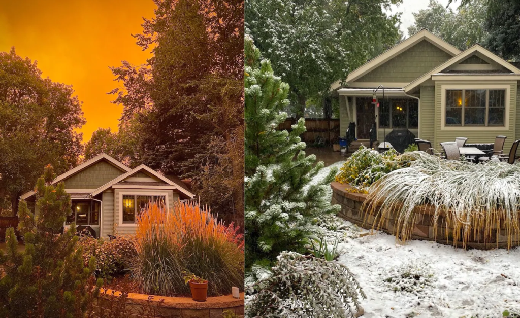
Did Denver really have the worst air quality in the world Saturday? https://bit.ly/3js875O
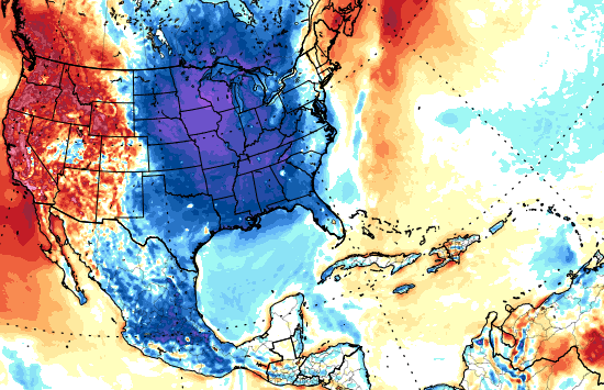
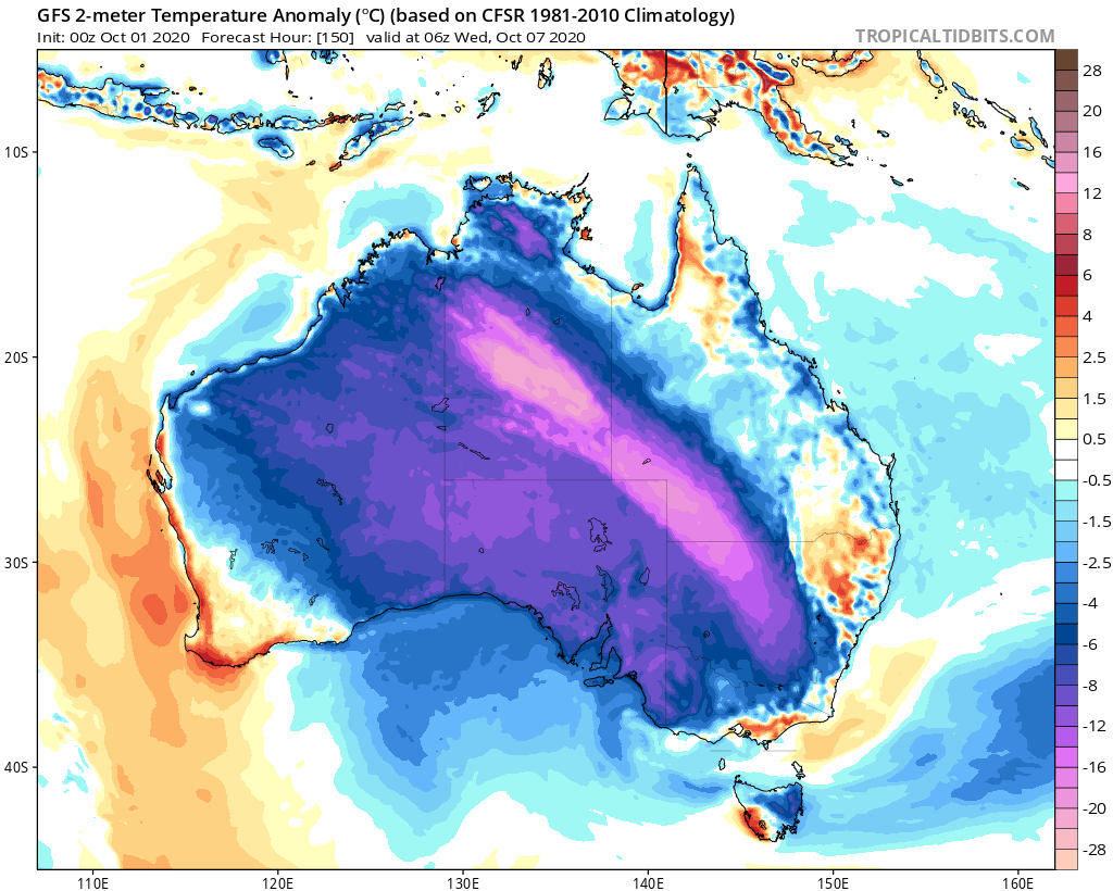
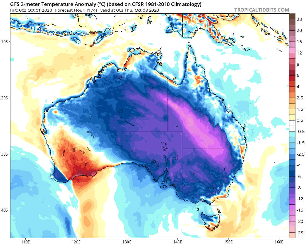
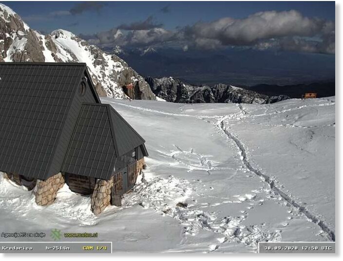
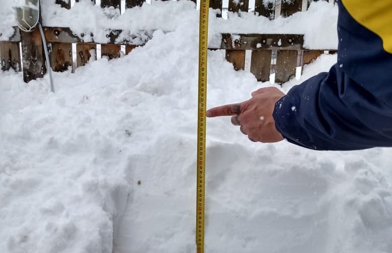
GFS Model US Total Snow https://bit.ly/36kbisU GFS
Model Europe Total Snow https://bit.ly/3ifZcTQ
Critical Fire Weather Conditions for California and the Plains; Wet and Stormy Across the East https://www.weather.gov/
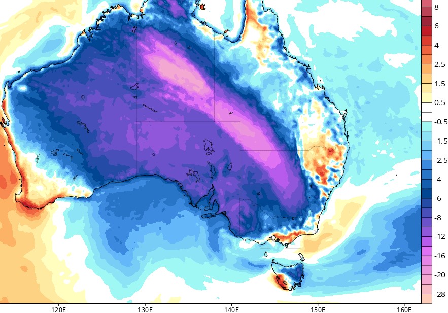
Spring snow falls on New Zealand https://bit.ly/2HF1KhD
Hawaii’s Kilauea Volcano Is Turning Into A Deadly Crater Lake https://bit.ly/3jh734K
Worldwide Volcano News http://bit.ly/2v9JJhO
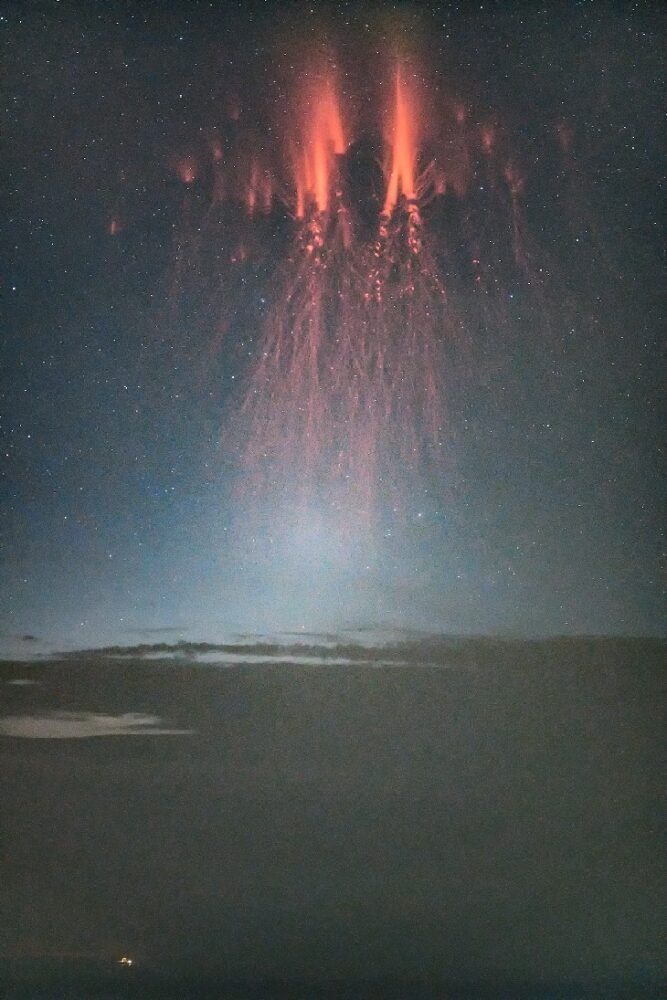
Strongest solar storm of the season continues https://bit.ly/2HHMl0a https://spaceweathernews.com/
NORTHERN LIGHTS MAY BE VISIBLE IN WYOMING AND CASPER NEXT TWO NIGHTS https://bit.ly/30jqB0O
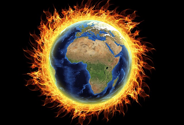
Volcanic ash could help reduce carbon dioxide associated with climate change https://bit.ly/3cFitgk
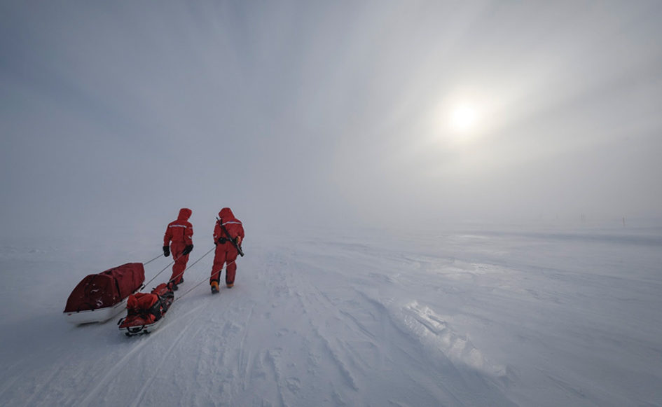
Antarctica could melt 'irreversibly' due to climate change, study warns https://bit.ly/2EJAldi
The hysteresis of the Antarctic Ice Sheet https://go.nature.com/2SaEk5R
Antarctic Ice Data https://go.nasa.gov/2Gn35Jc
Buried lakes of liquid water discovered on Mars https://bbc.in/30jpgY8
Scientists Precisely Measure Total Amount of Matter & Dark Energy in the Entire Universe https://bit.ly/2GnjRba
Hot mic...PA Gov Wolf and Rep Ullman masks = political theater PLEASE SUBSCRIBE NOW!! https://bit.ly/3kWSHXO
Looking up: Mars, the fiery gem of the night https://bit.ly/3l4TIgF
 

TxGal

Day by day

fear-e1601462575494.jpg


“WE HAVE 500 DAYS TO AVOID CLIMATE CHAOS”
SEPTEMBER 30, 2020 CAP ALLON

Fear is a powerful weapon. The threat of an impending “climate catastrophe” has been used to control the global population for decades. It’s time we all woke up.

In the 1960s and 1970s warnings of Ozone Depletion, Killer Acid Rain, crop-ending droughts, and even an impending Ice Age permeated the newspapers of the day, threats intentionally crafted to keep the sheep scared and compliant. Then, by the time 1980s rolled round, the controlling elites had honed this craft into perhaps the greatest controlling measure ever devised the history of mankind, and they were ready to unleash it on the masses. They realized that blaming the people for any looming catastrophe added exploitable layers to the fear: layers of guilt, of division, and of potential taxation. The name of the controlling measure was Catastrophic Anthropogenic Global Warming (CAGW).

NASA’s James Hansen’s Congressional testimony in 1988 set the ball rolling, or at least can be credited with bringing he hoax to the attention of politicians. Hansen linked human CO2 emissions to rising global temperatures and projected three ‘warming scenarios’ moving into the future (click here for how well he did — spoiler: he didn’t do very well).


Wasting no time in rolling out Project Fear, the UN and its corrupted MSM lapdogs ran with Hansen’s testimony and quickly began peddling-out their own scientifically-baseless doomsday scenarios. An AP headline from as early as 1989 read: “Rising seas could obliterate nations: U.N. officials.” The article detailed a U.N. environmental official warning that entire nations would be wiped off the map if the world failed to reverse warming by 2000 — a prediction which, unless it inexplicably passed me by, never materialized.

Science told us the Arctic would be completely free of summer ice by 2009, by 2013, by 2015, by 2016, by 2018, and now by… 2050…? with mainstream publications never questioning the mounting pile of FAILED prophesies. Al Gore is king of the bullshitters, but the majority of modern politicians have accepted the ruse, too –they’ve had to in order to obtain votes– however, some do push it further than others and as a result blindly subject their future selves to ridicule and forced retraction when their predictions are inevitably proven wrong.

Back in May, 2014, French foreign minister Laurent Fabius, during a joint appearance with then U.S. Secretary of State John Kerry, claimed “we have 500 days to avoid climate chaos.” Fabius’s ludicrous comments were made during the early drafting of the Paris Climate Deal, a deal which gained 195 signatories and eventually became effective as of November 2016–around 60 days AFTER France’s foreign minister’s deadline for disaster.

But Fabius certainly isn’t alone. Recent history is littered with examples of expired doomsday dates. There are long lists compiled on blog posts across the web, there are catalogs documenting thousands upon thousands of failed climate predictions from politicians, scientists, and journalists alike, but this reality is never exposed by the bought-out and utterly corrupted MSM. The science is settled after-all, and the fact that every dire climate prediction of the past 30+ years has been wrong is seemingly completely irrelevant.

We humans are sheep though.

We are easily herded.

The few anti-authoritarians among us have an increasingly hard job because modern avenues for revolt are being shutdown. So-called “FactCheckers” are filtering speech across the internet: they and they alone decide what’s true and so are in complete control of the narrative (on all topics, from AGW to COVID, to BLM). No wonder today’s protests are increasingly returning to the old school methods of feet on the street and megaphones. Perhaps its time to get offline and join them.
 

TxGal

Day by day

Rare September Snowfall Near Rome
September 30, 2020 by Robert


Snow rarely ever falls this early in the Lazio region.

Cervara_di_Roma_cropped.png

Cervara di Roma – Photo courtesy Wikipedia

Snow fell on the hills and mountains in the greater Rome area and in the Lazio region as temperatures plummeted over the weekend, reports Italian newspaper Corriere della Sera.

Snowfalls were recorded at Monte Livata (near Subiaco), Cervara di Roma, Ciociaria, Campocatino and Forca d’Acero, in the area of S. Donato Valcomino, where Lazio meets the Abruzzo region.

Perched among the Simbruini mountains along the border between the regions of Lazio and Abruzzo, Cervara di Roma is located about 70 km (43.6 miles) from Rome.

At an altitude of 1,050 meters (3,444 ft) above sea level, Cervara is the highest historic center in the province of Rome.

September snow falls near Rome
 

TxGal

Day by day

Italy’s coldest September in 50 years
September 30, 2020 by Robert

Over the weekend, temperatures in Italy plunged suddenly by between 10 and 15 degrees, resulting in the country’s coldest September in 50 years and leading to snowfalls much earlier than usual, Italian media reports.

The cold has been particularly intense in Milan and Turin which recorded 5°C and 4°C degrees respectively on the night of Sunday 27 September.

Temperatures also dropped steeply elsewhere – to below 10°C degrees in Tuscany – while hill towns in the central Lazio area witnessed snow over the weekend.

Italy's coldest September in 50 years
 

TxGal

Day by day
The Oppenheimer Ranch Project has a new podcast out:

View: https://www.youtube.com/watch?v=8laJdg96gpA


Grímsfjall Volcano & Bárðarbunga Increased Hydrothermal Activity And Ground Heat - Warnings Raised
2,629 views • Premiered 7 hours ago

Run time is 7:53

Synopsis provided:

Increasing hydrothermal activity and ground heat in Bárðarbunga volcano + Grímsfjall volcano moved to yellow warning for air traffic https://icelandgeology.net/
Grímsvötn https://volcano.si.edu/volcano.cfm?vn...
Bárðarbunga https://volcano.si.edu/volcano.cfm?vn...
A webcam has been put up looking over the Bárðarbunga volcano https://bit.ly/33RzeRc
Tiny Crystals Behind Unexpected Violent Volcanic Eruptions https://bit.ly/36gUfYC
 

TxGal

Day by day

false.jpg


DR LEE GERHARD: “IPCC CLAIMS ARE FALSE”
SEPTEMBER 30, 2020 CAP ALLON

Dr Lee Gerhard: “I never fully accepted or denied the anthropogenic global warming concept until the furore started after NASA’s James Hansen’s wild claims in the late 1980s. I went to the [scientific] literature to study the basis of the claim, starting with first principles. My studies then led me to believe that the claims were false.”

Dr Gerhard is a retired geologist from the University of Kansas. He obtained a B.S. in Geology in 1958, an M.S. in Paleontology minor. in 1961, and a Ph.D. in Geology in 1964. Gerhard believes that climate change has been a natural phenomenon driven by natural processes for 4.5 billion years. But that cultural pressures now exist to identify a human cause for current trends.

As Peter Flawn, President Emeritus of the University of Texas, writes, “All geologists early in their careers are introduced to solving problems through multiple working hypotheses — of deriving solutions from the data rather than, as is common among some social scientists, settling upon a solution consistent with the reigning theory and supporting it with data selectively chosen.” Gerhard adds “that although many geologists have expressed concern about the paucity of data supporting supposed human-driven climate change, scientific tests to falsify the hypothesis have been lacking.”

In 2001, Dr Gerhard was listed as an expert reviewer of the previous two IPCC reports. He considers his stance on Earth’s climate objective and based on science, aspects he feels IPCC reports routinely lack.

“Some argue that the Arctic is melting, with the warmest-ever temperatures. One should ask, ‘How long is ever?’ The answer is since 1979. And then ask, “Is it still warming?” The answer is unequivocally ‘No.’ Earth temperatures are cooling,” says Gerhard. He states that the global temperature changes naturally all of the time, in both directions and at many scales of intensity: “The warmest year in the U.S. in the last century was 1934” with the cooling observed after 1998 “absolutely falsifying claims that human carbon dioxide emissions are a controlling factor in Earth temperature. During the last 100 years, temperature has both risen and fallen, including the present cooling. All the changes in temperature of the last 100 years are in normal historic ranges, both in absolute value and, most importantly, rate of change.”

Furthermore: “Voluminous historic records demonstrate the Medieval Climate Optimum (MCO) was real and that the ‘hockey stick’ graphic (crafted by Michael Mann) that attempted to deny that fact was at best bad science. The MCO was considerably warmer than the end of the 20th century.”

Mann’s ‘hockey stick’ was the basis for the IPCC’s conclusion that “there is discernible human impact on climate.” However, and in a first step toward restoring the rigor of science in the global climate debate, a committee of the National Academy of Sciences back in 2006 presented the results of its directed study of the science behind the infamous graph. The Academy’s report identified the failure of the hockey stick to model climate beyond the past 400 years, as evidenced by its inability to reflect the medieval climate optimum. The optimum has been extensively documented by recorded human history and proxies, but cannot be explained by computer models based on equations that assume that greenhouse gases dominate climate change. These same models predict massive increases in Earth’s atmospheric temperature because of the additions of a small percentage of human-derived carbon dioxide.


Michael Mann’s Hockey Stick graph (for more on the deception, click here).

The IPCC needed to remove the MCO from the historical record books because the period blew apart their global warming theory: any forcing other than CO2 able to cause terrestrial warming is an inconvenient spanner in the works, and so, with the help of Mann, the panel completely erased every one of them from history in one clean swipe. A brazen plan, particularly given the extensive data, records and proxies out there demonstrating that the MCO did indeed occur. These same natural records also prove the existence of the cyclic and preceding Roman-era warm event, and the very same data, records and proxies are on show again today during our modern warming event. Climate, it turns out, is driven mainly by the Sun and the impact solar activity has on the oceans: ironically, it is the IPCC that are the true climate deniers.


Dr. Tim Ball’s temperature graph for the past 1,000 years is generally considered much closer to the actual reality.

I’m sick of the lies — lies made a thousands times worse by the climatic reality that is actually fast-barreling towards us: the COLD TIMES are returning, the mid-latitudes are REFREEZING, in line with historically low solar activity, cloud-nucleating Cosmic Rays, and a meridional jet stream flow.

Both NOAA and NASA appear to agree, if you read between the lines, with NOAA saying we’re entering a ‘full-blown’ Grand Solar Minimum in the late-2020s, and NASA seeing this upcoming solar cycle (25) as “the weakest of the past 200 years”, with the agency correlating previous solar shutdowns to prolonged periods of global cooling here.

Furthermore, we can’t ignore the slew of new scientific papers stating the immense impact The Beaufort Gyre could have on the Gulf Stream, and so the climate overall.


Prepare for the COLDlearn the facts, relocate if need be, and grow your own.
 

TxGal

Day by day

gfs_T2ma_namer_7-1-e1601542310939.png


UNITED STATES BRACING FOR ITS FIFTH ARCTIC OUTBREAK OF THE SEASON AS THE GRAND SOLAR MINIMUM INTENSIFIES
OCTOBER 1, 2020 CAP ALLON

I think it’s the fifth Arctic outbreak — I’ve genuinely lost count. Regardless though, the United States (and much of the North American continent as a whole) is set for yet another teeth-chattering blast of early-season cold.

Closely following Monday’s Arctic front, another mass of polar cold will have engulfed the central and eastern U.S. starting this evening, Thurs, Oct 1.

Then by tomorrow, temperature departures will have plunged some 4C to 12C below the seasonal average across two-thirds of the CONUS:

gfs_T2ma_us_fh-54-84.gif

GFS Temp Anomalies: Sept 28 – Oct 4 [tropicaltidbits.com].

The anomalous cold will last right through the weekend, and will also infect Mexico and large swathes of eastern Canada:

gfs_T2ma_namer_7.png

GFS Temp Anomalies: Oct 2 [tropicaltidbits.com].

Alaska and the far-northern latitudes will, once again, hold above average, but this a setup fully expected during a Grand Solar Minimum:

Maunder_Minum_Temperature_Change_NASA_GISS_2001.png

Temp change between 1780 (a year of normal solar activity) and 1680 (a year within the depths of the Maunder Minimum) — NASA.

Out of season snow will accompany the chill.

Initially, Canada will bear the brunt of the snowfall, but by mid-October heavy accumulations will bury the higher elevations of the Mountain States — and just look at the early-season powder building on Greenland:

gfs_asnow_namer_65-1.jpg

GFS Total Snowfall: Oct 1 – Oct 16 [tropicaltidbits.com]. In addition, the GFS could be kicking out a huge snowstorm descending into the U.S. around Oct 19 (stay tuned for updates).

Greenland’s totals will add to an already impressive start to the season, which in turn comes off the back of a record breaking summer of 2020:


This is how GLACIERS build.

This is also how ICE AGES begin.

The COLD TIMES are returning, the mid-latitudes are REFREEZING, in line with historically low solar activity, cloud-nucleating Cosmic Rays, and a meridional jet stream flow. Both NOAA and NASA appear to agree, if you read between the lines, with NOAA saying we’re entering a ‘full-blown’ Grand Solar Minimum in the late-2020s, and NASA seeing this upcoming solar cycle (25) as “the weakest of the past 200 years”, with the agency correlating previous solar shutdowns to prolonged periods of global cooling here.

Furthermore, we can’t ignore the slew of new scientific papers stating the immense impact The Beaufort Gyre could have on the Gulf Stream, and therefore the climate overall.


Prepare for the COLDlearn the facts, relocate if need be, and grow your own.
 

TxGal

Day by day

Aussie-chill.jpg


“INCREDIBLE” POLAR BLAST SET TO ENVELOPE THE ENTIRE AUSTRALIAN CONTINENT
OCTOBER 1, 2020 CAP ALLON

A powerful and potentially record-smashing mass of Antarctic is making a beeline for Australia. Temperatures are set to sink well-below average for the time of year, and yet more rare late-season snow is expected.

I can’t quite believe what the latest GFS runs are kicking out — the model, now comfortably within the reliable time-frame, is forecasting multiple bands of nation spanning “light pinks” beginning this weekend:


GFS 2m Temp Anomalies: Oct 4 to Oct 9 [tropicaltidbits.com].

These colors indicate temperature departures of as much as 24C (yes, that’s 24 degrees Celsius!) below the seasonal average — temps that pose a serious threat to livestock and young, tender crops across the country.

The worst of the cold looks set to hit on October 6, 7, and 8 (shown below).

Take precautionary measures if need be:

oct-6.png

oct-7.png

oct-8.png


Rare October snow is forecast on the peaks of the Stirling Range, located in southern Western Australia, with Bureau of Meteorology (BOM) forecaster Steph Bond saying the best chance of flurries would be late Friday night.

Heavy snow is also forecast to return to the Aussie Alps to the southeast, and even the island state of Tasmania could record some exceptionally rare late-season flurries.

Here’s footage of a troop of Kangaroos in the snow for your viewing pleasure:

View: https://twitter.com/nowthisnews/status/1310852563655208960


This weekend’s incredible wave of Antarctic cold is arriving hot-on-the-heels of last week’s historic blast which saw many regions record “unprecedented spring snow” and their “coldest September temperatures ever”:


Polar outbreaks such as these are only expected to increase and intensify moving forward, as the Grand Solar Minimum continues its ramp-up. Historically low solar activity is weakening the jet streams –in both hemispheres– reverting the streams’ usual tight ZONAL flows to weak and wavy MERIDIONAL ones. These wavy flows ship polar cold to mid-latitudes and replaces it with warmer tropical air (for more, click the link below):


Wrap up Australia.

The COLD TIMES are returning, the mid-latitudes are REFREEZING, in line with historically low solar activity, cloud-nucleating Cosmic Rays, and a meridional jet stream flow. Both NOAA and NASA appear to agree, if you read between the lines, with NOAA saying we’re entering a ‘full-blown’ Grand Solar Minimum in the late-2020s, and NASA seeing this upcoming solar cycle (25) as “the weakest of the past 200 years”, with the agency correlating previous solar shutdowns to prolonged periods of global cooling here.

Furthermore, we can’t ignore the slew of new scientific papers stating the immense impact The Beaufort Gyre could have on the Gulf Stream, and therefore the climate overall.


Prepare for the COLDlearn the facts, relocate if need be, and grow your own.
 

TxGal

Day by day

Atlanta-Georgia-1024x538-1-e1601551587187.jpg


ATLANTA, GEORGIA JUST SUFFERED ITS COLDEST END TO SEPTEMBER IN OVER 40 YEARS
OCTOBER 1, 2020 CAP ALLON

From September 15 through the end of the month, Atlanta’s average high temperature was a just smidge over 75 degrees: the last time we had an average high that cool was in 1979, reports fox5atlanta.com.

Georgia’s capital city is evidence of how “low” the recent Arctic blasts have been descending: riding anomalously-far south on the back of a meridional jet stream flow, multiple and persistent waves of polar cold have all-but eliminated fall, we’ve skipped the season altogether, and vast swathes of the country are experiencing winter-like conditions far earlier than normal.

The calendar may have only just flipped to October, but the United States is already on for its fifth intense Arctic blast since the beginning of September:


The scientific community once understood the basic mechanisms and forcings involved in the onset of spells of global cooling –such as those visible again now– but as they clash with the modern politicized dogma (AGW) they’ve conventionally been forgotten.

The below screenshot is from a 1975 “science mag” article — it explains the meridional jet stream flow, which is exaggerated under times of low solar activity, and also the impacts this has on northern hemisphere temperatures:


In addition to aspects of science being conveniently forgotten, let’s also take a closer look at those NH temps.

Note the stark drop from around 1940 to 1967 (when the graph ends):


Then spot how modern NASA graphs have erased this cooling:

image-14.png


A logical explanation for this tampering doesn’t exist. Therefore, it can only be assumed that naturally occurring fluctuations in the temperature records got in the way of the global warming theory, and that they simply needed erasing.

Oh don’t act all shocked, NASA and NOAA have been cooking the books in support of the IPCC’s hokey “consensus” for decades now:


I’m sick of the lies — lies made a thousands times worse by the climatic reality that is actually fast-barreling towards us: the COLD TIMES are returning, the mid-latitudes are REFREEZING, in line with historically low solar activity, cloud-nucleating Cosmic Rays, and a meridional jet stream flow.

Both NOAA and NASA appear to agree, if you read between the lines, with NOAA saying we’re entering a ‘full-blown’ Grand Solar Minimum in the late-2020s, and NASA seeing this upcoming solar cycle (25) as “the weakest of the past 200 years”, with the agency correlating previous solar shutdowns to prolonged periods of global cooling here.

Furthermore, we can’t ignore the slew of new scientific papers stating the immense impact The Beaufort Gyre could have on the Gulf Stream, and so the climate overall.


Prepare for the COLDlearn the facts, relocate if need be, and grow your own.
 

Martinhouse

Deceased
I've been extremely lucky in the 43 years that I've lived here, in that fire ants have never "found" my place. I agree about hoping colder weather kills them off or at least slows them down, But I sure wouldn't mind it if the chiggers decided to back off as well!
 

Martinhouse

Deceased
Robert Felix at iceagenow,com has just posted a short article with a graph that shows we could be descending into a real ice age.

It sure did give me the creeps! Sure am glad that a lot of my family no longer lives ini Minnesota and Wisconsin!
 

TxGal

Day by day
Here's what Martinhouse mentioned at Ice Age Now....just wow!:


Now Descending Into An Ice Age – Video
October 1, 2020 by Robert

See the green dot at the far left side of this graph? That’s where we are today, already descending, I fear, into a major glaciation.

Ice-Age-Now-precession-and-orbit-by-the-numbers-Jan-Theart.png

Ice Age Now precession and orbit by the numbers – Jan Theart

Each bright green dot represents a time when our orbit was the same as now.

Every time – I mean, every time – the orbit was similar to today, temperatures on our planet had either already begun a major descent, or were about to.

Each red line represents major cooling.

You can see four times in the last 400,000 years when our planet has been even warmer than today, (so much for man-made global warming!) and many, many periods of major cooling.

I think you will soon see a fat red line (major cooling) added to the right-hand side of the graph.

You may want to look at the above graph, created by Jan Theart, as you watch the video.

View: https://youtu.be/vihTBZncvJM

Run time is 2:33

Please keep in mind that the numbers you will see on the video are referring to degrees C.
 

TxGal

Day by day

Spain – Unusual winter stamps for September
October 1, 2020 by Robert

That’s winter, as in WINTER.

Up to half a meter of snow in high altitudes, while the meteorological station of Cogulla, in Cerler registered the minimum for the country on Sunday with -5.9 degrees.

The Cogulla meteorological station, located in Cerler, at 2,300 meters, registered the minimum in the country on Sunday at -5.9 degrees.

Torla was the second coldest with -1.9 (in Cebollar, at 1,900 m) and Panticosa, the third, with -1.1 (in Petrosos, at 1,850). Among the top ten places, the 2 degrees of Benabarre also stand out, as this station is located in a population center.

At the Aemet meteorological station in Sarrios, in the Formigal ski resort, 25 centimeters accumulated on Saturday.

Above 2,800 meters, the snow will not go away, says Joan María Vendrell, he guard of refuge Góriz (Fanlo) refuge, who on Saturday took out his skis near this shelter at 2,200 meters in the Ordesa y Monte Perdido National Park. At a similar altitude is Respomuso (Sallent de Gállego), which in this episode has reached 55 cm.

Not at the beginning of winter, but at the beginning of autumn

“We are at the beginning of autumn, nobody thinks that we are in winter.” The delegate of the State Meteorological Agency in Aragon thus referred to the precipitous change in weather this weekend. After the passage of the storm ‘Odette’, with up to half a meter of snow in high altitudes, Rafael Requena clarified that the unusual “is not that the snow appears in September, a month ago it did in the summits and it was August, the unusual thing is the quantity and the thermal contrast “.
La tormenta 'Odette' deja estampas invernales inusuales para un mes de septiembre

https://pbs.twimg.com/media/Ei6MsVTXgAA1Pit?format=jpg&name=medium

https://pbs.twimg.com/media/Ei6MsgWWsAISE5O?format=jpg&name=medium

https://pbs.twimg.com/media/Ei6MsrIWsAIEaHQ?format=jpg&name=medium

https://pbs.twimg.com/media/Ei6Ms3vWsAEK86Z?format=jpg&name=medium
 

TxGal

Day by day

Record cold in Northern Ireland
October 1, 2020 by Robert


Not just for one town, but for all of Northern Ireland.

Saturday night was the coldest September night on record for Northern Ireland, the Met Office has confirmed.

Katesbridge, in County Down, fell to a chilly -3.7C.

The hamlet is (supposedly) well known for often recording the island of Ireland’s highest and lowest temperature.

Even so – a record is still a record.

Katesbridge records NI's coldest September night
 

TxGal

Day by day

Nat Gas Prices Set To Soar – Cold Blast To Strike Eastern US Next Week
October 1, 2020 by Robert

This comes just one week after “scores of locations in interior New England and western New York set record lows in the 20s and 30s,” according to The Washington Post.

The so-called “chill” even reached the Mid-Atlantic, “where Washington observed lows in the 40s on four straight days in September for the first time since 1950.”

8 to 15 degrees below normal

28 Sep 2020 – The ten-day outlook shows a cold airmass will encompass all U.S. Plains, Midwest, Southeast, and Northeast, where temperatures could hover 8 to 15 degrees below normal through the first week of October.

Nat Gas Prices Set To Soar As First Cold Blast To Strike Eastern US Next Week
 

TxGal

Day by day

‘Man-made’ global warming is a United Nations fraud, like covid, says geologist
October 1, 2020 by Robert

What have I been doing about these frauds? “I’ve spoken out, thereby making myself unemployable,” says Dr Roger Higgs. “My conscience demanded it.”

Climate- and sea-level change by Sun not CO2

Goal: My goal is to establish the truth about climate- and sea-level change and man’s effect on them, if any.

This is unlike the opportunistic new field of ‘climate science’, mostly computer modellers studying only the last 150 years (emphasis added), whose careers DEPEND on public belief that current warming is by man-made CO2 rather than our Sun’s 1937-2004 greatest surge in 10,000 years.

WHO AM I? A 66-years-old published independent geologist (sedimentologist) with a geology doctorate (University of Oxford 1982-86) and 35 years’ worldwide geological consulting experience.

I’m now in my 5th year of full-time, unpaid, self-funded (hence unbiased) literature research, integrating ALL scientific aspects of climate change, including geology, geophysics, archaeology, oceanography, meteorology, glaciology, astrophysics, palaeoclimatology, and ‘climate science’ (mainly computer modelling of climate, with a strong vested interest (job preservation & publication history) in blaming CO2).

I began this quest for climate truth in 2015, fully expecting to verify what the IPCC, the media and governments were saying (shouting) about CO2 being a supposed ‘pollutant’.

How wrong I was.

My ResearchGate project comprises about 30 brief and readily understood contributions, mostly ‘Technical Notes’ (usually 1 to 5 pdf slides, convenient for laptop viewing and projecting) and one-page conference abstracts, spanning 2016-2020 (click on ‘Project Log’ above). I generally add a new contribution every few weeks. These items summarise my conclusions and predictions to date.

MY HOPE in choosing prestigious and non-political ResearchGate as a platform for my climate contributions is to inform other scientists (PROPER, impartial scientists, without vested interests), especially university educators, who will then begin the task of explaining to the general public that for decades they and their children have been misinformed: in fact global warming (which will end ~2050) has nothing to do with CO2; and the ‘97% of scientists’ who claim that ‘The science is settled’ are just CLIMATE Scientists.

Gratifyingly my list of ResearchGate ‘Followers’ and weekly ‘Reads by Institution’ indicate many university lecturers among my readers.

Climate change is a multi-trillion-dollar fraud
Dr Roger Higgs

Climate has ALWAYS changed; ask any geologist. Climate is controlled by three factors: Earth’s orbital characteristics (Milankovitch); the Sun’s variations (Svensmark); and to a minor short-term degree by super-volcanic eruptions. Man can do NOTHING about climate.

See entire article:
Climate change is a multi-trillion-dollar fraud - Ice Age Now
 

TxGal

Day by day

New Zealand – Snowfalls to sea level
October 1, 2020 by Robert

North Island Snow: Desert Rd warning as wintry conditions hit highway

After two days of a wintry bomb cyclone, heavy snow and ice is still affecting southern highways, with a number of roads closed across Otago and Fiordland.

North Island Snow: Desert Rd warning as wintry conditions hit highway

Spring storm brings snow to New Zealand's beaches and travel chaos
—-
Some very chilly nights coming up! Widespread frost expected as many places go sub-zero. Here’s a look at some hourly temps around the South Island overnight tonight!

View: https://twitter.com/i/status/1310782664740274176

— MetService (@MetService) September 29, 2020
 

TxGal

Day by day
The Oppenheimer Ranch Project has a new podcast out:

View: https://www.youtube.com/watch?v=KRlanoIs0fk


Cosmic Ray Maximum Confirmed = Record Hail Size - Record Lighting Duration Confirmed By The Science
1,907 views • Premiered 8 hours ago

Run time is 8:44

Synopsis provided:

These Scientists Say Cosmic Ray Radiation Has Effect on Climate Change https://bit.ly/3n9n5A7
First day of October brings hail https://bit.ly/34fCyWJ
Cosmic Ray Maximum https://bit.ly/3kfM82Y
Record Hailstorms and Hailstones in the U.S. https://bit.ly/2ERKkNL
What the hail? Colorado sets state record for biggest hailstone http://bit.ly/2H6fTRJ
Cosmic Rays Increase Hail Size and Duration https://bit.ly/2EQI2hS
START OF LIGHTNING EXPLAINED: HAIL AND COSMIC PARTICLES https://bit.ly/3liCNaz
Mystery of how lightning forms solved http://dailym.ai/34fDtXb
World record longest lightning flash of 440 miles confirmed https://bit.ly/3ikgjUn
Record-breaking lightning as long as Kansas spotted https://on.natgeo.com/3nkFCcW
700km lightning bolt, longest ever recorded https://bit.ly/30qoqsm
Storms to bring hail, damaging winds to southeast Qld and northern NSW https://bit.ly/3igrPjO
Fall storms in Ontario produce EF-1 tornado, hail, waterspouts https://bit.ly/34iNiDO
Hail storm hits Mid-Michigan https://bit.ly/3nebpMG
Hail wallops apple production in Karnali https://bit.ly/34kLZEn
Thunder, hail, waterspouts, and cold air funnels dominate forecast https://bit.ly/3cNLA0Q
 

TxGal

Day by day

Earliest snow EVER in Monmouth County, NJ
October 2, 2020 by Robert

At least not not in the last 127 years. (When recordkeeping began at this location.)

2 Oct 2020 – According to NOAA and the Center For Weather & Climate, the Freehold weather station has not recorded accumulating snow in the first two weeks of October in the past 127 years, since 1893.

The earliest accumulating snow recorded in Monmouth County happened on October 20, 1940, when the Freehold area got an inch of snow.

“It’s hard to be optimistic about this upcoming winter,” writes Lou Russo. “Let’s all remember that it’s 2020, and that means anything can happen!

The Earliest Snow Ever In Monmouth County
 

TxGal

Day by day

spain-snpw-e1601629491211.jpg


ANOTHER “WINTER” SNOWSTORM BLANKETS THE SPANISH MOUNTAINS
OCTOBER 2, 2020 CAP ALLON

The Arctic is heating-up, slightly. However, I see four key points the MSM are failing to tell you: 1) rising Arctic temps are entirely natural and have occurred during every previous spell of otherwise “global” cooling, 2) the warming is likely linked to low solar activity and a change in the jet streams, oceans, and ozone, 3) this polar heating is skewing the temperature record which is important because 4) the mid-latitudes (where the majority of us humans reside) are actually cooling, and this cooling is largely/easily “hidden” by an anomalously-warm Arctic region.

Cooling is bad for life on earth.

Cooling has proved disastrous for every known human civilization of the past.

A sharp descent from spells of constant and reliable warmth (such as the modern maximum we’ve just enjoyed) inevitability leads to crop failure, civil unrest, war, and famine.

Of late, both hemispheres have been suffering out-of-season cold and heavy snow as polar conditions have invaded the mid-latitudes. The seasons of spring and fall have largely gone missing in 2020, with winter now extending into spring as well as delivering an abrupt end to summer.

Today, the impacts of the Grand Solar Minimum are seen in Spain.

Across the higher elevations of the Iberian Peninsula as much as half a meter (1.64 ft) of snow has accumulated — totals that would be at home after a powerful winter storm, not least one in late-Sept/early-Oct. And along with the early snow, the Cogulla weather station, located in Cerler (which sits at an elevation of 2,300m), also registered a teeth-chattering low of -5.9C (21F).

“We are at the beginning of autumn, nobody thinks that we are in winter,” said Rafael Requena of the State Meteorological Agency. Referring to the half a meter of snow, Requena added that after the summer he’d just witnessed, September snow no longer strikes him as odd: “a month ago it [snowed] in the summits and it was August, the unusual thing is the quantity and the thermal contrast.”

As reported by heraldo.es, since last Friday, the first snow plows have already been seen, herds of sheep and cattle are rushing down from their summer pastures, and on the slopes some folks have even taken to skiing.

At the higher elevations the snow will now not go away, warns the guard of the Góriz refuge Joan María Vendrell: it is here to stay for the season.

This is how glaciers build.

This is also how ice ages begin.


The COLD TIMES are returning, the mid-latitudes are REFREEZING, in line with historically low solar activity, cloud-nucleating Cosmic Rays, and a meridional jet stream flow.

Both NOAA and NASA appear to agree, if you read between the lines, with NOAA saying we’re entering a ‘full-blown’ Grand Solar Minimum in the late-2020s, and NASA seeing this upcoming solar cycle (25) as “the weakest of the past 200 years”, with the agency correlating previous solar shutdowns to prolonged periods of global cooling here.

Furthermore, we can’t ignore the slew of new scientific papers stating the immense impact The Beaufort Gyre could have on the Gulf Stream, and therefore the climate overall.


Prepare for the COLDlearn the facts, relocate if need be, and grow your own.
 

TxGal

Day by day

Red jellyfish sprites and green ghosts captured over Corsica

Spaceweather.com
Fri, 02 Oct 2020 02:59 UTC

Red jellyfish sprites and green ghosts taken on September 10, 2020 over Corsica
© Christophe SUAREZ
Red jellyfish sprites and green ghosts taken on September 10, 2020 over Corsica.

Christophe Suarez of Genoa, Italy, wasn't trying to photograph sprites when he pointed his camera at a distant thunderstorm on Sept. 10th. But this magnificent specimen was too big to miss.

"I was shooting a thunderstorm across the Ligurian Sea almost 400 km away over the island of Corsica," says Suarez. "Suddenly this jellyfish sprite appeared!" Its red form stretched 100 km high, nearly touching the edge of space.

Note the slightly-green caps on top of the sprite. These are a newly discovered phenomenon called "Green Ghosts." When sprites intersect Earth's airglow layer 96-97 km high, they can excite oxygen atoms, producing an aurora-like glow.

Green Ghosts were discovered just one year ago by Hank Schyma, a Houston Texas-based storm chaser better known to his fans as Pecos Hank. Only a handful of Green Ghosts have ever been photographed, so this is an area of cutting edge research.

Comment: Recently discovered atmospheric electrical phenomenon 'Green Ghost' captured over West Texas

With the surge in sightings of red sprites in recent years (which are still considered 'rare' by some) it seems the electrical nature of our weather and changing atmosphere is becoming more apparent:
For more, check out SOTT radio's: Behind the Headlines: Earth changes in an electric universe: Is climate change really man-made?
 

TxGal

Day by day
Adapt 2030 has a new podcast out (not 100% sure about it, but he does talk about out of season cold and snow):

View: https://www.youtube.com/watch?v=fBDiV5CthIU


A Pattern Emerges Do You See It (1048)
9,053 views • Oct 2, 2020

Run time is 10:50

Synopsis provided:

The interconnectedness of stock markets going off line, universal basic income in Switzerland unveiled as food insecurity hits New Jersey in the USA. Crop losses continue mounting across the planet as both hemispheres experience extreme out of season cold and deep snows. Its apparent now the shift is here.
 

TxGal

Day by day
The Oppenheimer Ranch Project has a new podcast out:

View: https://www.youtube.com/watch?v=7qL-2luesRo


Early October Snow Falls in Michigan's Upper Peninsula - Tropical Storm Gamma - Grand Solar Minimum
2,772 views • Premiered 7 hours ago

Run time is 17:11

Synopsis provided:

Michigan has its first snow, and more on the way https://bit.ly/3ldlqaL
Persimmon Seeds Suggest Shoveling Snow This Winter https://bit.ly/3jtmirr
TROPICAL STORM GAMMA https://bit.ly/3jlXGRr
12 NEW WILDFIRES IN BRIDGER-TETON IN THREE DAYS https://bit.ly/2EVOZyl
Fire danger to remain high in Colorado, but snow is on the horizon https://bit.ly/3ikorEA GFS
Model Total Snow US https://bit.ly/3ngAzdc
Very Warm & Dry For Much of the West; Locally Heavy Rainfall for Parts of Florida https://www.weather.gov/
GFS Model Total Snow Europe https://bit.ly/332e83w
Sheveluch volcano (Kamchatka, Russia): new lava dome https://bit.ly/3nlvUaj
Researchers Find Ilopango Mega-eruption Caused A Maya Armageddon https://bit.ly/34jMzlR
NASA rocket launch could be visible from N.J., other eastern U.S. states https://bit.ly/3juhy54
66 Million Years of Earth’s Climate Changes Revealed in Unprecedented Detail From Ocean Sediments https://bit.ly/3lamuwk
New Study Reports NYC Is Sinking, Sea Levels Defy Alarmist Predictions https://bit.ly/36sWeJu
Modern Grand Solar Minimum will lead to terrestrial cooling https://bit.ly/3gEVpi6
‘Forest bathing’ may be the next best wellness practice you never heard of https://bit.ly/3jrP380
Mars and the moon are meeting in the sky TONIGHT, as the Red Planet makes its closest approach to Earth in years http://dailym.ai/3nbYoD6
Cover Photo - Heavy #snowfall today 2nd October in Pas De La Casa, Andorra, #Pyrenees! https://twitter.com/StormchaserUKEU/s...
 

TxGal

Day by day

snow-MC-NJ-e1601715503727.jpg


MONMOUTH COUNTY, NJ RECEIVES ITS EARLIEST SNOW EVER (IN 127 YEARS OF RECORD KEEPING)
OCTOBER 3, 2020 CAP ALLON

Monmouth County, NJ is one of many regions in the U.S. copping yet another early blast of winter. More than two-thirds of the CONUS is currently suffering temps 4C to 14C below the norm, and now even some all-time, record-busting, early-season SNOW has been added to the mix.

Monmouth County hasn’t received accumulating snow this early in the season since record-keeping began some 127 years ago.

According to NOAA data, the Freehold weather station hasn’t actually recorded settling snow within the first 19 days of October since books were started in 1893, with the earliest being the inch received on Oct 20, 1940.

However, the year 2020 is the official start of the Grand Solar Minimum, according to many scientists, and on Friday, Oct 2 the record books were rewritten as the fifth Arctic blast of the season enveloped two-thirds of the United States, and delivered Monmouth its earliest settling snowfall EVER.

The mid-latitudes are descending into the next mini ice age — a cyclical phenomenon and one returning in line with historically low solar activity, cloud-nucleating cosmic rays, and a meridional jet stream flow (to name a few mechanisms). A warming Arctic is only further proof of the phenomenon, and it adds another level of threat, too — the Beaufort Gyre.

Historically, the far northern latitudes have always warmed during spells of otherwise “global” cooling. A heating Arctic is the event of a wavy jet stream and ozone depletion (among other things) — and while it is a real and measurable phenomenon, alarmists are using it to skew the global temperature record and effectively mask the cooling occurring at the lower latitudes — cooling which should be visible to most by now.

Using NASA’s Maunder Minimum Temperature Reconstruction Map (shown below), it is revealed that while Earth’s overall temperature trends colder during a times of low solar activity, not ALL regions experience the chill — some areas of the planet actually warm during spells of otherwise “global” cooling: the Arctic, Alaska, and S. Greenland/N. Atlantic to name a few.

Maunder_Minum_Temperature_Change_NASA_GISS_2001.png

Temp change between 1780 (a year of normal solar activity) and 1680 (a year within the depths of the Maunder Minimum) — NASA.

The official AGW party line is that “Polar Amplification” is the cause for this anomalous warming at the poles — it claims the difference in temperature between the polar regions and the mid-latitudes fuels the jet stream, and that disproportionately warming poles is reducing that temperature difference, weakening the jet stream winds to favor a wavier flow.

However, at least two insurmountable issues arise with this theory: 1) why is the Arctic warming faster than everywhere else? (the science doesn’t have an answer for this), and 2) why isn’t the same phenomenon occurring at the southern pole? (the science states that “because the Earth’s polar regions are warming more quickly than the rest of the world, the temperature contrast that drives jet streams has decreased” — contradicting this, satellite data reveals that sea ice extent around the southern pole has actually GROWN over the past 40+years, and also shows that temperatures across the continent have had no real trend).

For more a detailed look click the link below:


And as reminder of what a hot mess the anthropogenic global warming theory is, check out the MSM’s best attempts at injecting baseless fear into us all:


According to a myriad of separate studies, everywhere is warming twice as fast as everywhere else. These “studies” clearly aren’t based in science, and are instead designed to promote fear.

Humans flock like sheep and birds, subconsciously following a minority of individuals. It has been found it takes a minority of just 5% to influence a crowd’s direction — and that the other 95% follow without even realizing it. We favor obedience and dumb conformity over critical-thought and solitary self-assertion. We can be steered off a cliff, if the 5% desired it so.

AGW, COVID, and BLM spring to mind.

Wake up, step back, and question everything.

The COLD TIMES are returning, the mid-latitudes are REFREEZING, in line with historically low solar activity, cloud-nucleating Cosmic Rays, and a meridional jet stream flow.

Both NOAA and NASA appear to agree, if you read between the lines, with NOAA saying we’re entering a ‘full-blown’ Grand Solar Minimum in the late-2020s, and NASA seeing this upcoming solar cycle (25) as “the weakest of the past 200 years”, with the agency correlating previous solar shutdowns to prolonged periods of global cooling here.

Furthermore, we can’t ignore the slew of new scientific papers stating the immense impact The Beaufort Gyre could have on the Gulf Stream, and therefore the climate overall.


Prepare for the COLDlearn the facts, relocate if need be, and grow your own.
 

TxGal

Day by day

Heavy early snow on Triglav mountain in Slovenia

JL Flanner
Total Slovenia News
Wed, 30 Sep 2020 20:00 UTC


The Triglav Lodge at Kredarica

The photo above is from the webcam set up at Triglav Lodge at Kredarica, the highest mountain hut in Slovenia and the highest meteorological station in the country.

You can check on the current conditions, as see images from many other webcams in the hills and mountains of the country here.

View: https://youtu.be/bJa8Ha_CXfI


snow
snow
snow
snow
snow
 

TxGal

Day by day

Ice and Fire in Argentina
October 3, 2020 by Robert

Two feet of snow and far below freezing in some areas, temperatures up to 43°C in others.

Meteorología de la República Argentina

Ice, cold and snow:

PATAGONIA – Snowflakes 50 to 60 cm (2 ft) of snow in Ushuaia, Tierra del Fuego. With temperatures below zero, it differs from the North Argentina, registering thermal contrasts of + 40°C. View: https://twitter.com/MetRAnoticias/status/1311758272173682689?s=20


RÍO NEGRO | Snow in Bariloche. The phenomenon even spread to the city center. The cities of Patagonia showed temperatures below -8°C (17.6°F) in the morning.
See video: View: https://twitter.com/MetRAnoticias/status/1312086969409843200?s=20


Fire:

CORRIENTES |Another province joined the fires in the middle of #drought and temperatures of up to 43°C (109°F). Coastal region, Córdoba and San Luis with new outbreaks and difficult to control. View: https://twitter.com/MetRAnoticias/status/1311818585568804865?s=20
 

TxGal

Day by day
The Oppenheimer Ranch Project has a new podcast out:

View: https://www.youtube.com/watch?v=fhdMIhlrvzA


NJ RECEIVES EARLIEST SNOW IN 127 YEARS? - ATLANTA, GEORGIA COLDEST SEPT IN OVER 40 YEARS - GSM MUCH?
2,324 views • Premiered 5 hours ago

Run time is 32:38

Synopsis provided:

Fall foliage faltering under 'extreme drought' conditions https://cnn.it/3lcMKWU
What’s going on with hazy skies in Southwest Colorado? https://bit.ly/3cWADtV
ATLANTA, GEORGIA JUST SUFFERED ITS COLDEST END TO SEPTEMBER IN OVER 40 YEARS https://bit.ly/3l9zkLd
MONMOUTH COUNTY, NJ RECEIVES ITS EARLIEST SNOW EVER? Probably FAKE NEWS TAKE HEED https://bit.ly/2F1QjQg
VOLCANO WATCH: How Big Was That Earthquake? https://bit.ly/3n9pWsK
Textbooks and Geoscientists May Be Wrong https://bit.ly/34r1ISt
health/covid-india-children.html https://nyti.ms/3cUYla2
Epidemiology and transmission dynamics of COVID-19 https://bit.ly/2EXphJF
The secretive group at the center of the nation's largest vaccine trials https://cnn.it/3lcKj6M
Data and Safety Monitoring Board Guidelines https://bit.ly/36vp5gg
Archeologists unearthed 59 sealed sarcophagi in Egypt https://bit.ly/3cUYrOW
Rocket carrying radish seeds, meats and cheeses – and a $23M toilet https://bit.ly/2SqkKCE
Chandra X-ray Observatory https://bit.ly/34gct9O https://bit.ly/33RzeRc
 

TxGal

Day by day

snow-argentina-1-e1601804732973.jpg
Extreme Weather GSM
ARGENTINA HOLDS 8C TO 16C BELOW AVERAGE AS 2 FEET OF SNOW BURIES USHUAIA PROVINCE
OCTOBER 4, 2020 CAP ALLON

The out-of-season cold and snow currently blasting BOTH HEMISPHERES is intensifying: North America, western/northern Europe, central/eastern Asia, and practically ALL of Australia have now been joined by Argentina

The South American nation of Argentina measures 2,175 miles long and lies between 21°S and 55°S. Despite its impressive latitude spanning length, the country has been completely engulfed by a powerful Antarctic blast.

Looking at the latest GFS run (shown below), Argentina is set to suffer temperature departures as much as 16C below the seasonal average on Sunday, Oct 4:


GFS 2m Temp Anomalies for Sun, Oct 4 [tropicaltidbits.com].

This latest freeze began late last week as a polar front gripped the entire nation on Friday and Saturday (also worth noting is the stark thermal contrast to the north).

Arg-Fri-crop.jpg

GFS 2m Temp Anomalies for Fri, Oct 2 [tropicaltidbits.com].

Arg-Sat-crop-1.jpg

GFS 2m Temp Anomalies for Sat, Oct 3 [tropicaltidbits.com].

A freeze this deep would cause problems in winter — but as we’ve witnessed on the European Alps these past few weeks, unprepared farmers are being taken by surprise as they find their herds and cattle descending the mountains far sooner than usual to escape the out-of-season cold and snow. In some cases, the animals have been stranded by snowdrifts and have actually required rescuing:


Late last week, Argentina’s anomalous cold was accompanied by as much as 60cm (2ft) of snow, with the province of Ushuaia appearing the worst hit:


PATAGONIA: 60cm of snow [twitter].

View: https://twitter.com/MetRAnoticias/status/1311696448145289217


Bariloche –located in the Río Negro province– also received an impressive early season dusting, with the snow even spreading to the city center, according to Meteorología de la República Argentina on Twitter:

View: https://twitter.com/MetRAnoticias/status/1312086969409843200


“Cities of the Patagonia had minimum temperatures lower than -8C (17.6F) in the morning,” reads a section of the tweet.

Rare early-October “nieve” (snow) also fell in the town of Atilio Viglione, located in the central province of Chubut:

View: https://twitter.com/Geografia_Afic/status/1311722419929915392


Nieve was even reported across the provinces of Mendoza and Neuquén “in the midst of the cold air that invaded the country at the beginning of the October”:

View: https://twitter.com/MetRAnoticias/status/1312485651707617280


The COLD TIMES are returning, the mid-latitudes are REFREEZING, in line with historically low solar activity, cloud-nucleating Cosmic Rays, and a meridional jet stream flow.

Both NOAA and NASA appear to agree, if you read between the lines, with NOAA saying we’re entering a ‘full-blown’ Grand Solar Minimum in the late-2020s, and NASA seeing this upcoming solar cycle (25) as “the weakest of the past 200 years”, with the agency correlating previous solar shutdowns to prolonged periods of global cooling here.

Furthermore, we can’t ignore the slew of new scientific papers stating the immense impact The Beaufort Gyre could have on the Gulf Stream, and therefore the climate overall.


Prepare accordinglylearn the facts, relocate if need be, and grow your own.
 

TxGal

Day by day
What is the run time on this video, please?

Here's what I found:

Why Was 536 A.D The Worst Year In History? | Catastrophe | Timeline
908,248 views • Jun 24, 2017

Run time is 49:37

Synopsis provided:

A devastating volcanic eruption in A.D. 535 leads to the emergence of new nations and religions. Written records from China, Italy, Palestine and many other countries suggest a huge catastrophe blighted the world in 535AD. But the cause of it has been uncertain. Was it a comet? An asteroid? A volcano? Archaeologist David Keys reveals the latter is to blame for the Dark Ages of famine and plague that shaped the world order of today.
 

TxGal

Day by day

October 4, 2020 by Robert

3 Oct 2020 – The effects of storm Álex are felt at low elevations with snow thicknesses up to 25 cm.

The mercury dropped to 5C below zero in Cerler, the coldest temperature in Spain on Saturday, followed by Torla with minus 2.1C, and Panticosa with minus 1.8C, according the State Meteorological Agency (Aemet).

Along with this strong cooling, the Huesca Pyrenees has registered snowfalls ranging from 8cm in the Casa de Piedra Refuge at 1,600 meters to 30 cm (1 ft) in the Refuge from Bachimaña at 2,200 meters.

The snow complicated travel in the Somport port (N-330) between Canfranc station and Candanchú and on the N-330b, in Candanchú, to the point of prohibiting passage of heavy vehicles, according to the Pirineos-Valle del Ebro Traffic Management Center.

For access to the Panticosa Spa road (A-2606), the use of chains or winter tires was mandatory between kilometers 7 and 10, between 10 a.m. and 10:50 a.m, but reopened at 12:30.

At the moment, chains or winter tires are mandatory at the port of Portalet, specifically between Anayet and the French border. Snow has also complicated travel on the road from Escarrilla to the top of Portalet.

Cerler registra la temperatura mínima de España con 4,8 grados bajo cero en una jornada con nieve en el Pirineo

https://www.diariodelaltoaragon.es/foto/5/785339/369f/2020/10/03
 
Top