Solar Grand Solar Minimum part deux

TxGal

Day by day

Trump calling for more icebreakers
July 4, 2020 by Robert

“Trump memo demands new fleet of Arctic icebreakers be ready by 2029,” reads the headline.

President Trump ordered a review of the country’s requirements for icebreaking capabilities in the Arctic and Antarctic regions, with the goal of getting a fleet in place by 2029, according to a memo released Tuesday.

Coast-Guard-Cutter-Healy-1024x609.jpg

Coast Guard cutter Healy. Congress and the president have agreed to fund a new icebreaker to patrol the Arctic Ocean. (NyxoLyno Cangemi/U.S. Coast Guard)

The memo was directed at the Defense, State, Commerce and Homeland Security departments, as well as the Office of Management and Budget.

Much of it directs work already in progress — including building a fleet of at least three heavy icebreakers — but says the remaining ships not under contract should be reviewed for what can be done to maximize their utility in the frozen poles.
See more:

Trump memo demands new fleet of Arctic icebreakers be ready by 2029
 

TxGal

Day by day

co21.jpg


WHY CARBON DIOXIDE CAN’T CAUSE WARMING IN THE ATMOSPHERE, BY PROFESSOR EMERITUS OF GEOLOGY AT WESTERN WASHINGTON UNIVERSITY
JULY 5, 2020 CAP ALLON

A take on why carbon dioxide can’t cause warming in the atmosphere, by D.J. Easterbrook, Professor Emeritus of Geology at Western Washington University.

Evidence-Based Climate Science (Second Edition),” 2016:

ABSTRACT

A greenhouse gas is a gas that absorbs and emits infrared radiation.

The primary greenhouse gases in the atmosphere are water vapor, carbon dioxide, methane, nitrous oxide, and ozone. Atmospheric carbon dioxide (CO2) is a nontoxic, colorless, odorless gas.

Water vapor accounts for by far the largest greenhouse effect (90–85%) because water vapor emits and absorbs infrared radiation at many more wavelengths than any of the other greenhouse gases, and there is much more water vapor in the atmosphere than any of the other greenhouse gases. CO2 makes up only a tiny portion of the atmosphere (0.040%) and constitutes only 3.6% of the greenhouse effect. The atmospheric content of CO2 has increased only 0.008% since emissions began to soar after 1945. Such a tiny increment of increase in CO2 cannot cause the 10°F increase in temperature predicted by CO2 advocates.

Computer climate modelers build into their models a high water vapor component, which they claim is due to increased atmospheric water vapor caused by very small warming from CO2, and since water vapor makes up 90–95% of the greenhouse effect, they claim the result will be warming.

The problem is that atmospheric water vapor has actually declined since 1948, not increased as demanded by climate models. If CO2 causes global warming, then CO2 should always precede warming when the Earth’s climate warms up after an ice age. However, in all cases, CO2 lags warming by ∼800 years. Shorter time spans show the same thing–warming always precedes an increase in CO2 and therefore it cannot be the cause of the warming.

Simply put, the IPCC have it wrong, yet they are prideful, insecure, in denial, defensive, and refuse to be vulnerable. On top of that, and as with most political organizations, money and agendas have corrupted them to the core.

Reject the UN’s scaremongering, anti-scientific conclusions.

Accept the Sun holds all the keys to Earth’s climate.

And acknowledge the next solar-driven cooling cycle has already begun.

Cold, unlike warmth, is detrimental to life and biodiversity on our planet — and we humans aren’t immune to these plunges in temperature.

As revealed by historical documentation and the GISP2 Ice Core data (below), each great civilization of the past reached its peak during a spike in temperature, but then quickly faded in-correlation with the sharp and prolonged spell of cooling that followed:


The Sun has just entered it’s next cyclical shutdown. The next 400-or-so year Grand Solar Minimum cycle (the “Eddy” Minimum) is upon us, and our modern civilization will fare just a badly as those great, ancient empires of the past.

Look around you, today.

You must notice the cracks already appearing?

You must sense something is coming?

Prepare according learn the facts, relocate if need be, and grow your own.

The COLD TIMES are returning in line with historically low solar activity, cloud-nucleating Cosmic Rays, and a meridional jet stream flow.

NASA appears to agree, if you read between the lines, with their forecast for this upcoming solar cycle (25) seeing it as “the weakest of the past 200 years,” with the agency correlating previous solar shutdowns to prolonged periods of global cooling here.

Solar-Cycle-25-NASA-full.png


GSM-and-Sunspots.png
 

TxGal

Day by day

Sea ice extent in Antarctica greater now than in 1980
July 5, 2020 by Robert

Also larger concentration of sea ice than in 1980.

Larger-concenration-of-Antarctic-sea-ice-in-Jun-2020-than-Jun-1980.png

Larger concentration of sea ice in Antarctica in Jun 2020 than Jun 1980


Sea ice extent now is 700,000 sq km (270,272 sq miles) greater than in 1980.

In case you’re having a hard time reading the numbers, here they are:

Sea ice extent in June 2020 = 13.2 million sq km
Sea ice extent in June 1980 = 12.5 million sq km

Sea ice concentration in June 2020 = 10.6 million sq km
Sea ice concentration in June 1980 = 9.6 million sq km

That’s enough extra ice to entirely cover Maryland, Delaware, West Virginia, South Carolina, Virginia, Indiana, Ohio and all six New England states. Oh, and throw in Washington, D.C. for good measure. (Which might be a good idea.)

Do you think the mainstream media will give you even a hint of this?
 

TxGal

Day by day

Antartica-e1594024203525.jpg


DESPITE THE LIES, THE SPIN, AND THE PROPAGANDA, ANTARCTIC SEA ICE IS GROWING — BOTH EXTENT AND CONCENTRATION GREATER NOW THAN IN 1980
JULY 6, 2020 CAP ALLON

The UN and their scraggly little offshoot, the IPCC, are at it again — obfuscating data in order to push their fraudulent catastrophic global warming agenda.

According to the IPCC, and picked up the usual AGW propaganda rags such as the Guardian: “the South pole is warming three times faster than rest of the world.”

The Guardian article dated June 30, 2020 continues in predictably befogging fashion: “Dramatic change in Antarctica’s interior in past three decades a result of effects from tropical variability working together with increasing greenhouse gases.”

But, 1) the MSM have a habit of claiming everywhere is warming faster than everywhere else:


And 2), the actual data reveals quite the opposite re Antarctica.

As @Harry_Hardrada recently pointed out on Twitter, there was a larger extent and concentration of Antarctic Sea Ice in June 2020 than back in June 1980:

View: https://twitter.com/Harry_Hardrada/status/1279056888261488640


A closer look:


Robert Felix over at iceagenow.com dives into the data, adding that sea ice extent today stands at 700,000 sq km (270,272 sq miles) greater than in 1980.

And in case you’re having a hard time reading the numbers, Felix breaks them down for you:

Sea ice extent in June 2020 = 13.2 million sq km
Sea ice extent in June 1980 = 12.5 million sq km
Sea ice concentration in June 2020 = 10.6 million sq km
Sea ice concentration in June 1980 = 9.6 million sq km

Fact-checked!

That’s enough extra ice to entirely cover Maryland, Delaware, West Virginia, South Carolina, Virginia, Indiana, Ohio and all six New England states. Oh, and throw in Washington, D.C. for good measure. (Which might be a good idea.)

If you read the likes of the Guardian then you deserve to be misinformed.

The earth isn’t warming, any longer. The Sun’s Grand Solar Maximum is over, and our star is now once again shutting down, effectively — in turn, the COLD TIMES are returning, the glaciers are re-advancing, all in line with historically low solar activity, cloud-nucleating Cosmic Rays, and a meridional jet stream flow.

Even NASA appear to agree, if you read between the lines, with their forecast for this upcoming solar cycle (25) seeing it as “the weakest of the past 200 years,” with the agency correlating previous solar shutdowns to prolonged periods of global cooling here.


Prepare accordinglylearn the facts, relocate if need be, and grow your own.
 

TxGal

Day by day

Ireland's total grain output in 2020 to drop by 100 million euros after driest spring since 1847

William Kellett
Agriland
Wed, 17 Jun 2020 07:19 UTC

Crop harvest

Outputs from the cereal sector in Ireland are expected to reduce by at least €100 million this year, following the effects of the prolonged drought.

That's according to Teagasc, which forecasts that total grain output this year will "drop from the normal 2.3 million tonnes to under 1.9 million tonnes".

Teagasc says that the drought has "severely affected crops in the eastern half of the country".

Straw yields are also predicted to reduce - by nearly 25%. Teagasc says that 1.6 million fewer (straw) bales will be available in the country this year.

The drought is also affecting livestock farmers, with grass growth severely affected in these areas.

Teagasc says that many of these farmers are already feeding some of their winter forage stocks - to supplement grazed grass and concentrates. Consequently, it says, there will likely be a higher demand for forages this autumn with knock-on effects for prices for feedstocks such as straw.

Records Broken

Records were broken at many Met Éireann stations in the east of the country. This spring was reportedly the driest since records began in 1837 at the Phoenix Park. There was less than 10mm of rain, just 15% of normal, recorded for May at Dublin Airport. This followed just 23% of normal rain for April.

Michael Hennessy, head of Teagasc Crops Knowledge Transfer, said that the drought had hit at least one month earlier than in 2018. This affected crop growth much earlier in the plants' growth cycle, thereby reducing yield much earlier in the season.
Crops further south are less affected by drought, but the recent rains are needed in these areas too. Farmers with beans and potatoes and other later-harvested crops will certainly welcome this rain, as it will help to maintain or increase the yield potential.
Shay Phelan, Teagasc potato specialist, said: "Potatoes got off to a great start this year. However, early frost damage was quickly compounded by very dry conditions - forcing farmers to irrigate crops much earlier than normal.

Irrigating Potatoes

"Irrigation is a huge cost for farmers. Each pass is estimated to cost €250/ha. There's a huge cost in terms of man-hours to actually carry out the operation.

"Most fields will need six to seven irrigation passes this year - not only to maintain quality but also to maintain acceptable yields," he added.

"Most farmers do not have sufficient irrigation capacity to cover all of their potato crops. They are encouraged to concentrate their efforts to adequately irrigate a smaller number of fields, rather than cover the entire area with an insufficient amount of water."

Conor O'Callaghan, a Teagasc advisor in Dublin, said: "The loss of income to tillage farmers will be severe in many cases. These farmers have substantial financial commitments, including employees' wages, loan repayments and other overheads. We can't forget that this is their family income for the entire year."
 

TxGal

Day by day

Temperatures drop below freezing in Queensland as snow blankets parts of Australia

Kylie Stevens
Daily Mail Australia
Mon, 06 Jul 2020 02:39 UTC

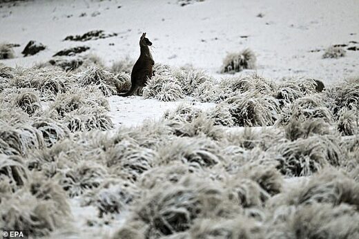
A kangaroo (pictured) shivered through  freezing conditions in Wadbiliga National Park near Nimmitabel in the NSW region of Monaro on Saturday
© EPA
A kangaroo (pictured) shivered through freezing conditions in Wadbiliga National Park near Nimmitabel in the NSW region of Monaro on Saturday

Parts of Australia have shivered through their coldest night of the year so far as temperatures plummeted below 0C.

It was a chilly start to the working week, with most capital cities across the nation still in the single digit temperatures at 8am on Monday.

South-east Queensland shivered through a second consecutive morning of freezing temperatures after 30 towns across the region recorded their coldest temperatures of the year on Sunday.

Residents in the state's Southern Downs region felt the the biggest brunt of the winter chill on Monday, where Applethorpe woke up to a frosty -2.1C while Warwick recorded -1.1C.

Wellcamp Airport recorded -1.4C at 5.20am, while further north the mercury dropped to 0.5C in Kingaroy.

Brisbane airport dropped to a low of 7C, while the CBD was slightly warmer at 8.1C, two degrees lower than average.

The city is expected to remain partly cloudy before warming up to a top of 22C later on Monday.

On Sunday, temperature hit a low of -0.1C in Toowoomba, its coldest morning since August 2015.

But it the highest minimum temperatures were still recorded in the Darling Downs and Granite Belt districts, according to the Bureau of Meteorology.

Forecaster Peter Markworth told Daily Mail Australia the chilly temperatures are the result of cool burst coming up from the south, but will warm up as the week progresses.

It was a wet weekend for Australia's alpine regions, bringing widespread snow falls.

In New South Wales, Thredbo and Perisher saw 15cm drop on Sunday.

Nearby Wadbilliga National Park was also blanketed in snow as the native wildlife shivered through the freezing conditions.

In Victoria, Mount Buller saw 10cm of snowfall.

Elsewhere across the the country, sunny Sydney will reach a high of 18C, Melbourne will see light showers and a top of 14C while Adelaide will be a cloudy 15C.

After waking up to a chilly and foggy 0C, Canberra will be mostly sunny before reaching a top of 13C.

It will be a wet start to the week with rain in Hobart (13C) and Perth (19C) while Darwin will be a sunny 32C.
http://www.addthis.com/bookmark.php
 

TxGal

Day by day

Winter thunderstorm unleashes 313,000 lightning strikes around the south west coast of Western Australia

Aja Styles
Brisbane Times
Mon, 06 Jul 2020 11:46 UTC

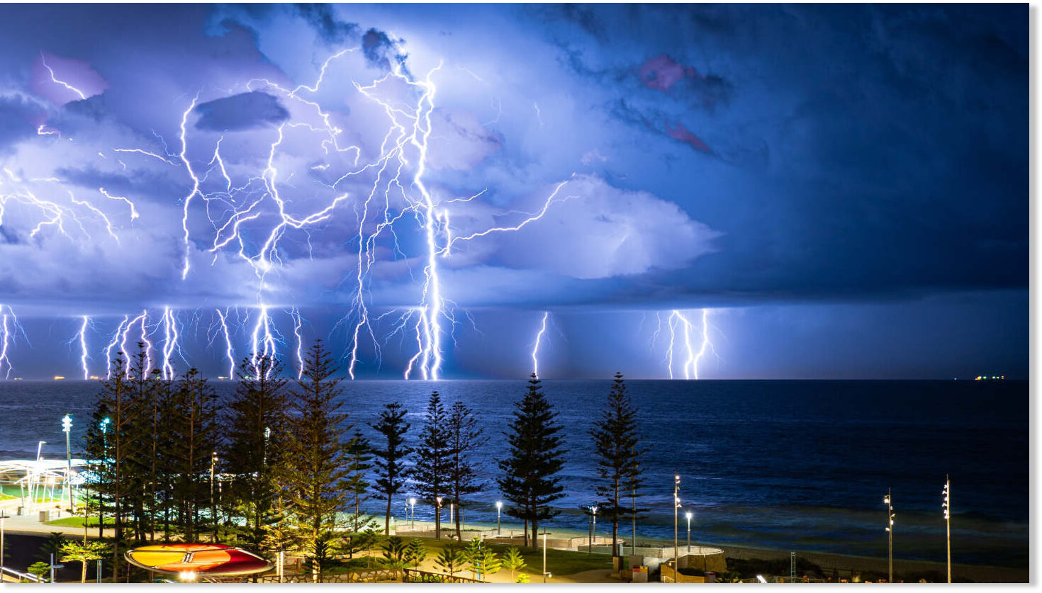
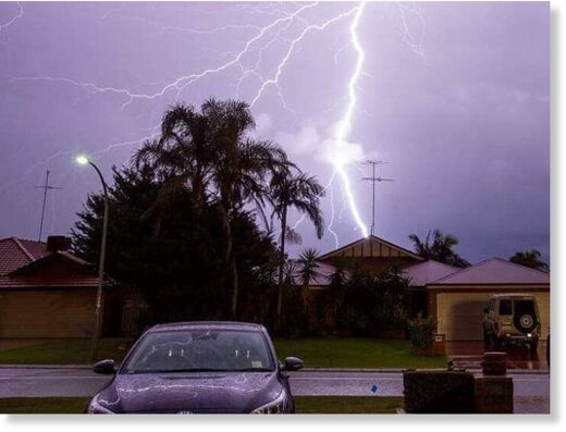
Perth photographer Steve Yanev's shot of lightning over Scarborough, titled 'Glorious Nature at its Best'.
© Steve Yanev
Perth photographer Steve Yanev's shot of lightning over Scarborough, titled 'Glorious Nature at its Best'.

Perth residents witnessed an amazing display from 22,000 lightning strikes off the coast as the weekend drew to a close, but those in the South West saw a cracking 313,000 strikes across all of Sunday.

Steve Yanev saw the impending storm and wasted no time grabbing his camera and heading for the coast.

The Perth photographer and avid thunderstorm chaser eyed the Scarborough car park as the best vantage point and wasn't disappointed.

"There were many lightning strikes but it took an hour so to capture this shot," he said.

"I particularly like the lightning rods breaking through the clouds and others being seemingly cut in half by parts of the clouds. Beautiful and powerful."

The end result was a photo Yanev decided to title 'Glorious Nature at its Best' - a vista of dark skies over a churning ocean, eerily illuminated by arcs of lightning streaking down from the clouds while Scarborough's foreshore looms in the foreground.

View: https://youtu.be/ybZG7EqHzU4


View: https://youtu.be/xklHRH_hnuA


Weatherzone meteorologist Tom Hough said cloud and ground strikes within 50 kilometres of Perth reached almost 22,000, and of those 250 were ground strikes mainly over the city.

"A band of storms that was off the coast began to impact the coast by around 6pm local time and that fizzled out by 9pm," he said.

The line of storms stretching from Bunbury up to Lancelin hit after 7pm, with 53,000 strikes recorded up to 100 kilometres away from Perth, of which "a large proportion would have been offshore".

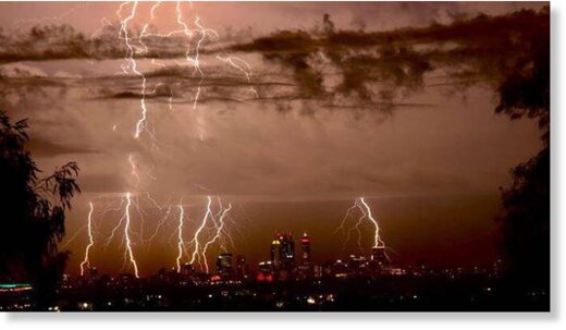
Lightning lights up Perth’s skies
© Devon-Daliah McNeill
Lightning lights up Perth’s skies

Lightning crack over a Perth home.
© Perth Weather Live
Lightning crack over a Perth home.

In the state's south, lightning struck about 313,000 times within a 300-kilometre radius south of Mandurah, starting early Sunday morning.

Elders Weather reported one storm that struck Bunbury at 4pm caused a burst of heavy rain, wind gusts up to 72km/h and a temperature drop of five degrees in under an hour.

"Over the South West there's still a band of thunderstorms inland that pertains to the same weather system that is affecting Perth," Mr Hough said.

He said Perth could expect more showers into the evening that could be locally heavily as the low end system began easing, with only a brief chance of showers in the South West going into Tuesday.
 

TxGal

Day by day
Adapt 2030 has a new podcast out:

View: https://www.youtube.com/watch?v=BjKh99Abm7g


How Bad Will the Siberian Arctic Wildfires Get in 2020 (1009)
916 views • Jul 6, 2020

Run time is 10:06

Smoke from Siberian wildfires set to drift over Alaska and northern Canada as the fire season gets underway in Russia. How bad will it get this year, not sure, but based on areas up in smoke since 2003, there is a good amount of information to make an informed guess in 2020, the year of unusual.
 

Martinhouse

Deceased
TxGal, thanks for all the links.

It's getting where I can hardly listen to DuByne anymore. It might be my imagination, but it seems his sing-song sarcastic tone is getting worse in his podcasts and for me it just ruins listening to him at all. Sarcasm is probably the wrong word to describe how he sounds to me now but I can't think of another. I don't remember him sounding like this when I first discovered his You Tube podcasts. Has he changed or is it just me?
 

Carlyblue

Veteran Member
TxGal, thanks for all the links.

It's getting where I can hardly listen to DuByne anymore. It might be my imagination, but it seems his sing-song sarcastic tone is getting worse in his podcasts and for me it just ruins listening to him at all. Sarcasm is probably the wrong word to describe how he sounds to me now but I can't think of another. I don't remember him sounding like this when I first discovered his You Tube podcasts. Has he changed or is it just me?
It's not you. I have a very hard time listening to him too! Can't really give a reason, he just irritates me.
 

mecoastie

Veteran Member
Locally here in So ME I was told by a farmer that his first cutting of hay was off by almost 40% due to the dry weather. It was great for making hay but not so great for growing it.
 

TxGal

Day by day

Arctic Ocean periodically ice-free 6000 to 7000 years ago
July 6, 2020 by Robert

But let’s not forget, there was no human-produced CO2 6000-7000 years ago.
__________________

Arctic Ocean periodically ice-free 6000 to 7000 years ago

Solar cycles, ocean currents, and volcanic heat are affecting Earth’s energy balance all the time, and always have.

Interested

1980 lies at the end-point of a well-known 30-year global cooling period which ran from about the mid-1940s to the mid-1970s.

During those three decades, some 20% of all the manmade CO2 ever produced (up to date), was emitted into the atmosphere.

Warming alarmists who maintain CO2 is the principal climate driver cannot reconcile the emission of nearly 100 gigatonnes of manmade CO2 coinciding with a corresponding period of cooling.

According to Alekseev et al. 2016 (and as you might expect after that 30 years of cooling) there was actually more Arctic sea ice in 1980 than at ANY other time during the 20th century.

So using that particular date as a starting point is useful if your aim is to accentuate the appearance of recent warming.
In any event, the Arctic ice cap is an intermittent feature. It comes and goes over millennia, and even over decades.

American nuclear submarines surfaced at an almost ice-free North Pole in 1959 and 1962. And yet by the 1999, the same region was an almost impenetrable field of sea ice.

Research into beach ridges on the northern coastline of Greenland show that 6000-7000 years ago the Arctic Ocean must have been periodically ice free all the way to the north pole for long periods of time.

But let’s not forget, there was no human-produced CO2 6000-7000 years ago.

Interestingly, according to the Danish Meteorological Institute, from 2006 to 2019 Arctic sea ice volume remained essentially constant (in fact a very slight rise may have occurred).

Once again, during this 13-year period around 20% of all the CO2 ever produced by humans was emitted into the atmosphere – and yet it had no effect on the Arctic ice cap.

So the volume of Arctic sea ice is irrelevant as far as human-induced ‘climate change’ is concerned. It comes and goes irrespective of our CO2 emissions. It’s clearly a natural variation.

Antarctic ice data is more difficult to track down but it’s understood that southern hemisphere sea ice increased strongly in the 40 years up to 2014, when it suddenly and inexplicably declined. (During that 40 years about 60% of all the CO2 ever produced by humans was emitted into the air. Yet the Antarctic sea ice grew.)

But in attempting to explain that sudden reduction in sea ice in recent years, it should be remembered that Western Antarctica and the West Antarctic Peninsula were only very recently discovered to be the home of the largest volcanic province on Earth.

In 2017 University of Edinburgh scientists identified 138 volcanoes, some as tall as 3,800 metres, buried under the ice. An increase in activity in this enormous volcanic province would doubtless be a significant factor affecting water temperature and sea ice.

So, this is why I and so many like me think it’s important that we set aside human CO2 from time to time and take a good look at the bigger picture.

Solar cycles, ocean currents, and volcanic heat are affecting Earth’s energy balance all the time, and always have.
Human influence, by comparison, is trivial and difficult even to detect.

None of the apocalyptic predictions of climate alarmism have eventuated. Not one.

The much-vaunted climate emergency therefore has no basis in science.
 

TxGal

Day by day

Arctic sea ice controlled by solar cycles
July 6, 2020 by Robert

Thanks to solar cycles, sea ice is now recovering slowly in the Northern Hemisphere.

Arctic-sea-ice-extent-mid-Jun-2020-1024x768.png

Chart from Danish Meteorological Institute

Ocean and Ice Services | Danmarks Meteorologiske Institut

Ocean and Ice Services | Danmarks Meteorologiske Institut

Thanks to J.H. Walker for these links

“This chart show the effects of Solar Induced climate change from the high sea ice level stand at the end of the Solar Cycle 20 cool-sun period though the three High Output cycles SC21, SC22 and SC23,” says J.H. “With the effect of the modern Grand Solar Minimum only just commencing with lagging temperature effects.”
 

TxGal

Day by day

Japan-Volcano-e1594048900933.jpg


NISHINO-SHIMA VOLCANO, JAPAN ERUPTS TO 27,230 FT (8.3 KM) — ITS HIGHEST SINCE 2013 (VIDEO)
JULY 6, 2020 CAP ALLON

The worldwide volcanic uptick associated with the next Grand Solar Minimum is continuing. We can now add Nishino-shima volcano to the list after its ongoing effusive-explosive, high-level eruptions which started in mid-June.

Nishino-shima volcano (Volcano Islands, Japan) awoke last December after a two-or-so year quiescence. And now, on the back of June’s string of 12,000 ft vulcanian-strombolian-type eruptions and active lava flows on its northern slopes, the volcano has ejected a very dense ash plume to an altitude of 27,230 ft (8,300 m).

Today, July 6, both the Japan Meteorological Agency (JMA) and HIMAWARI-8 satellite data have confirmed the July 4 eruption, which is considered to be the highest ash plume of the volcano since 2013.

http://instagr.am/p/CCJ_kEGjVYA/ View: https://www.instagram.com/p/CCJ_kEGjVYA/?utm_source=ig_embed


View: https://twitter.com/CopernicusEU/status/1280136340353552385


In addition to the Sun-blocking plume of ash, a warning bulletin was issued stating that “ballistic impacts of volcanic bombs would be experienced as far as 2.5 km away from the crater.”

And looking forward, volcanodiscovery.com states that “lava flows and explosions will continue as activity at the volcano continues at high levels.”

Volcanic eruptions are one of the key forcings driving Earth into its next bout of global cooling. Their worldwide uptick has been linked to low solar activity, coronal holes, a waning magnetosphere, and the influx of Cosmic Rays penetrating silica-rich magma.

EVERY powerful, climate-altering volcanic eruption of the past can be tied to low solar activity. Worryingly, the Sun is currently going through its deepest solar minimum of the past 100+ years, and looking forward, NASA has revealed the next cycle (25) will likely be “the weakest of the past 200 years” — a return to Dalton Minimum conditions.

The Dalton Minimum (1790-1830) was a solar-driven period of global cooling that included the famine-inducing eruption of Mt. Tambora in 1815. The eruption was the one of the most powerful of the past 2,000 years, and resulted in some of the harshest climatic conditions of the modern era: 1816’s “the year without a summer” — click below for more:


The COLD TIMES are returning in line with historically low solar activity, volcanic eruptions, cloud-nucleating Cosmic Rays, and a meridional jet stream flow.

Even NASA appear to agree, if you read between the lines, with their forecast for this upcoming solar cycle (25) seeing it as “the weakest of the past 200 years,” with the agency correlating previous solar shutdowns to prolonged periods of global cooling here.


Prepare accordinglylearn the facts, relocate if need be, and grow your own.
 

TxGal

Day by day

Summer suddenly turned chilly in southern Norway - FOOT of snow with -7.2C temperatures

NewsinEnglish.no
Mon, 06 Jul 2020 17:54 UTC

snow Norway

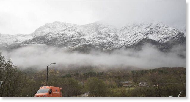
After an unusually warm June, Norway's July summer holidays got off to an extremely chilly start over the weekend. Strong winds, heavy rain, hail and even some snow caught many tourists by surprise.

Slippery roads and as much as 30 centimeters of snow in the mountains prompted warnings from state highway officials that motorists shouldn't drive over mountain passes without snow tires on their vehicles. One mountain lodge, Sognefjellshytta, reported a new record low temperature for July of minus-7.2C late Saturday night, and so did several other weather stations in the mountains of Southern Norway.

View: https://youtu.be/3JzVQiuB7r4


The strong winds also forced cancellation of all cruise ferries between Southern Norway and Denmark, not long after they finally were allowed to run again when Corona-related travel restrictions were eased. The gales and high seas also prompted state meteorologists to issue small craft warnings and urge all boatowners to remain in port.

The weather turned bad all over Norway, with temperatures expected to stay low all week from north to south. A new high-pressure system was due to move in over the weekend that could bring better weather "in a week or two," meteorologist Kristian Gislefoss told state broadcaster NRK, "but if not, we'll continue to have unstable weather and what we often call a typical Norwegian summer."
 

Melodi

Disaster Cat
Following our unusually warm dry Spring, in Ireland we are now having washouts and heavy winds; and unseasonably cool temperatures - I have my space heater on low beside me.
 

TheSearcher

Are you sure about that?
Following our unusually warm dry Spring, in Ireland we are now having washouts and heavy winds; and unseasonably cool temperatures - I have my space heater on low beside me.

Given the news upthread about Norway dropping to well below freezing (on a dime, I might add!) that seems about right. Stay warm, ma'am.
 

Melodi

Disaster Cat
Thanks, we are, the stove downstairs is lit but that's mostly for hot water; our plumbing needs fixing to make the radiators work and right now, it isn't worth it to try to get someone strange in the house with me still isolating (or semi-isolating, we have one friend that I visit now).

They were predicting the heat would be back this weekend but I just saw a "severe weather alert on Twitter about a tropical storm moving as one of the fastest ever recorded that is supposed to race from Burmuda a couple of days ago to hit Ireland and the UK on Wednesday?

No other confirmation yet, the current forecast was rain and wet tomorrow and clearing Wednesday but I now have my doubts...

But we will try to stay warm and dry - actually, in this 200-year-old "Little Ice Age" house, it is slightly more comfortable to be a bit chilly and next to a fire or heater than too hot like it was three weeks ago with no air conditioning (and high humidity).
 

Martinhouse

Deceased
Looks like there will be a really long Ice Age Farmer podcast on starting at 8 PM tonight. It runs 1:46:35 and is titled "Marjory Wildcraft: 3 Part System to Grow Your Own Food."

I can't tell if she is interviewing him or he is interviewing her. Nearly two hours worth here.....not so sure I can sit that long when I have so much to do. Maybe tomorrow will be a rainy afternoon and I can watch it then if I don't have to disconnect because of rough weather.
 

TxGal

Day by day
Thanks, Martinhouse, I'll try to keep an eye out for it. If not, I'll try to post it tomorrow....we've been having a day here trying to get our new fridge repaired. Good grief, there must be a disturbance in the force!! Thank heavens we have a little mini fridge.
 

Martinhouse

Deceased
Oh, TxGal, how I wish I had a mini-fridge! I've been using a cooler for two or three weeks now and it isn't doing a very good job. All I'm keeping in it is my mayo and some cottage cheese, and I'm pretty sure I need to toss the big huge jar of mayo. This will be the second big one I'll have lost. I bought some pints of it at the store a couple days ago, so if the cooler lets me down again I won't lose so much. Actually, once the cottage cheese is gone, I may just give up and forget the cooler. I can't deal with moving stuff and getting ready to replace the fridge until the greenhouse roof project is done, and it will be easier for me if I just forget about mayo until the fridge is replaced.

I'm lucky that the freezer compartment still works. At least I can keep ice trays and a little meat and some butter in it and I scrape the frost out of it once a week and things are doing okay. Can't complain.....I've had this fridge for a very long time. Lived here 42 years and have had only two refrigerators in all that time, which is pretty good considering how crummy things are made nowadays. I wouldn't mind a mini-fridge but the little freezer compartments don't seem very good on them. I gave away the one I had some time back because it just didn't do what I needed it to do.

Most of our predicted rain has fizzled out on us again and it's going to be hot. The greenhouse roof won't be much delayed after all, but I will have to start watering.

I put down more patio block sidewalk today. Not very much, but it takes me a long time moving those blocks two at a time on a little rolling cart and having to take lots of breaks. But it sure is nice to have a clean place to walk! Maybe by the time I'm done, my body can stop being the Arkansas chigger residential palace. I think my count of chigger bites has not fallen under two dozen in the last three to four weeks! My sister assures me that there are ce-ment chiggers (that's the southern pronunciation!) and driveway chiggers, too, so I'll just have to hope for the best.
 
Last edited:

hummer

Veteran Member
Oh, TxGal, how I wish I had a mini-fridge! I've been using a cooler for two or three weeks now and it isn't doing a very good job. All I'm keeping in it is my mayo and some cottage cheese, and I'm pretty sure I need to toss the big huge jar of mayo. This will be the second big one I'll have lost. I bought some pints of it at the store a couple days ago, so if the cooler lets me down again I won't lose so much. Actually, once the cottage cheese is gone, I may just give up and forget the cooler. I can't deal with moving stuff and getting ready to replace the fridge until the greenhouse roof project is done, and it will be easier for me if I just forget about mayo until the fridge is replaced.

I'm lucky that the freezer compartment still works. At least I can keep ice trays and a little meat and some butter in it and I scrape the frost out of it once a week and things are doing okay. Can't complain.....I've had this fridge for a very long time. Lived here 42 years and have had only two refrigerators in all that time, which is pretty good considering how crummy things are made nowadays. I wouldn't mind a mini-fridge but the little freezer compartments don't seem very good on them. I gave away the one I had some time back because it just didn't do what I needed it to do.

Most of our predicted rain has fizzled out on us again and it's going to be hot. The greenhouse roof won't be much delayed after all, but I will have to start watering.

I put down more patio block sidewalk today. Not very much, but it takes me a long time moving those blocks two at a time on a little rolling cart and having to take lots of breaks. But it sure is nice to have a clean place to walk! Maybe by the time I'm done, my body can stop being the Arkansas chigger residential palace. I think my count of chigger bites has not fallen under two dozen in the last three to four weeks! My sister assures me that there are ce-ment chiggers (that's the southern pronunciation!) and driveway chiggers, too, so I'll just have to hope for the best.
Martinhouse....years ago I picked up a small LP frig at a RV place, where they sold rev's. You might check and see if they still do. Probably have to be ordered??? Anyway, just a thought.
 

Martinhouse

Deceased
Thanks for the idea, Hummer, but my house is all electric plus there is no way I could handle the tanks of LP to operate that type of fridge.

I'm a pretty low-maintenance kind of person and I'll do just fine with a cooler until it's time to trade out my bad fridge for an operating one that my nephew has said he will give me.

I am thinking of making a very small cooler myself out of 1" foil-backed foam insulation and lots of Gorilla tape. I have several of those little blue ice packs and I can custom make a small cooler to size according to my specific needs and then I won't be trying to keep too much cooler cold when I don't need as much space as my present cooler has. Something that would hold maybe two six packs of soda might be a good size for me. Plenty of space in it for a pint of mayo, a pound of butter, and a couple of little blue-ice packs. It's just a matter of taking the time to do it.
 

TxGal

Day by day
Here's the Ice Age Farmer podcast Martinhouse mentioned above:

View: https://www.youtube.com/watch?v=lJwbUScUWFs


Marjory Wildcraft: 3-Part System for Food Security - Grow Your Own Food - Ice Age Farmer Podcast
8,629 views • Premiered 11 hours ago

Run time is 1:46:34

Marjory Wildcraft joins Christian to explore a 3-part system to quickly grow abundant food for your family. Marjory brings deep experience in organic farming, permaculture, agroforestry, indigenous teachings together with her unique perspective as founder of The Grow Network (grownetwork.com), where 150,000+ individuals share their own experiences in food production. We also discuss why animals are absolutely VITAL to a self-sufficient homestead. Join us, and start growing ridiculous amounts of delicious, nutritious food today!
 

TxGal

Day by day
The Oppenheimer Ranch Project has a new podcast out:

View: https://www.youtube.com/watch?v=9LAcFIy9Hl8


Certified Megaflash Lightning Extremes + Hail = GSM Update - Cosmic Ray Maximum - Magnetic Excursion
3,304 views • Premiered 6 hours ago

Run time is 5:35

Cosmic Ray Modern Maximum https://bit.ly/386upWf
Known Magnetic Excursions https://bit.ly/2DeaJnL
Grand Minimums And Global Temps https://bit.ly/2O3IUko
Grand Minimums and Empire Collapse https://bit.ly/3e3s3J2
Space Weather News Space Weather News http://solen.info/solar/images/swind.png http://www.solen.info/solar/images/el... https://services.swpc.noaa.gov/images...
UAH Global Temps https://bit.ly/3iAH88n https://www.solarham.net/
New WMO Certified Megaflash Lightning Extremes for Flash Distance (709 km) and Duration (16.73 seconds) recorded from Space https://bit.ly/2VPVkjR
Cosmic rays increases hail size and duration - Lightning inception by large ice particles, GSM much? https://bit.ly/2C8KoXU
 

TxGal

Day by day

snow-SA-e1594116592513.jpg

SEVERE COLD WEATHER WARNINGS ISSUED ACROSS SOUTH AFRICA: “A SIGNIFICANT AMOUNT OF SNOW” SET TO FALL IN SIX PROVINCES THIS WEEK
JULY 7, 2020 CAP ALLON

SA WEATHER WARNING:

Very cold conditions are expected from Thursday this week, including snowfall over the mountains. This extreme wintry weather is forecast to continue through the weekend.

Emergency services are on standby.


According to the SAWX, a brutally cold weekend is on the cards for most South Africans:

“A significant amount of snowfall, even disruptive in parts, looks very likely from Thursday night or the early hours of Friday morning for the Western Cape, Eastern Cape, Northern Cape, KwaZulu-Natal, and even in Lesotho. Snowfall is also possible for the high-grounds on the border of the Free State and Mpumalanga.”


Anton Bredell, the Western Cape’s Local Government, Environmental Affairs and Development Planning MEC has said: “The latest weather warnings by the South African Weather Services indicate the next severe winter storm is on the way and expected to make landfall from Thursday evening.”

Bredell adds: “Very cold conditions are expected in the province, including snowfall over the mountains. These conditions are expected to continue to Saturday.”

All-time cold-records could be broken.

Stay tuned for updates.

The COLD TIMES are returning, to both hemispheres, in line with historically low solar activity, cloud-nucleating Cosmic Rays, and a meridional jet stream flow.

Even NASA appear to agree, if you read between the lines, with their forecast for this upcoming solar cycle (25) seeing it as “the weakest of the past 200 years,” with the agency correlating previous solar shutdowns to prolonged periods of global cooling here.


GSM-and-Sunspots.png


Prepare accordinglylearn the facts, relocate if need be, and grow your own.
 

TxGal

Day by day

Verkhoyansk-summer-snow.jpg


“THE ARCTIC IS ON FIRE, AND WE SHOULD ALL BE TERRIFIED” — FACT CHECK: IT’S CURRENTLY SNOWING IN VERKHOYANSK
JULY 7, 2020 CAP ALLON

Ill-informed headlines like “The Arctic Is On Fire, and We Should all Be Terrified” are STILL being published, even as Verkhoyansk –the town at the heart of the media’s latest heat-induced tizzy– suffers rare summer snowfall.

End of the World articles serve-only as far-left propaganda, they shouldn’t be considered news. They work to terrify the many into accepting and pushing a twisted, fear-driven socialist agenda.

They’re also utterly one-sided, and impervious to facts.

Facts like those published in the siberiantimes.com on Tues, July 7 — a publication that it’s been said knows a thing or two about Siberia. “Topsy-turvy summer swings from Saudi-heat to the freezer in Arctic north,” reads the ST subtitle. And, according to the article, “abnormally cold weather has been recorded in the north of Yakutia with residents of Verkhoyansk district waking up to fresh summer snow on July 5.”

Verkhoyansk-snow-2.jpg

Scenes from the Republic of Sakha, Russia on July 5.


Siberia’s anomalous cold — July 5 [tropicaltidbits.com]

Never reported by the MSM is the fact that this region of the planet regularly experiences drastic swings in temperature. The mercury regularly lingers below -50C in winter, and likewise above 30C in summer — Verkhoyansk has long held the record for having the greatest temperature range on Earth.

Yakutsk, the world’s coldest city (and located near Verkhoyansk), has a highest recorded temperature of 38.4C which was observed on July 17, 2011. Tellingly, that reading only-just pipped the previous all-time record high of 38.3C set back on July 15, 1942.

Over the past 3 days alone, the mercury has dropped from a balmy 27C to a bone-chilling sub-zero in Verkhoyansk. This plunge prompted a group of residents to post a video of themselves warmly dressed stood around a fire.

“Where is our plus 38C?”, reads the video’s caption:

View: https://youtu.be/A8-VfGmNP3s


The media-controlled western world needs to wake-up from its trance.

There is far more to behold and discover than what we’re fed on TV.

The Arctic is not on fire. It’s bloody snowing, in July. And serving as proof that you’re only being fed one-side of the story (heat), go search for these FACTS across the MSM. You won’t find them. Stories of cold and snow don’t fit the narrative, and so are all-too often swept under the rug.

Verkhoyansk-snow-3.jpg

“The Arctic Is On Fire, and We Should all Be Terrified”.

Looking forward, temperatures across Siberia are expected to rise again over the weekend. But then another continent-wide bout of anomalous cold will engulf the majority of Russia by the end of next week — returning summer snow and sub-zero temperatures to Verkhoyansk–temps as much as 16C below the seasonal norm.

The COLD TIMES are returning in line with historically low solar activity, cloud-nucleating Cosmic Rays, and a meridional jet stream flow.

Even NASA appear to agree, if you read between the lines, with their forecast for this upcoming solar cycle (25) seeing it as “the weakest of the past 200 years,” with the agency correlating previous solar shutdowns to prolonged periods of global cooling here.


Prepare accordinglylearn the facts, relocate if need be, and grow your own.
 

TxGal

Day by day

Major outbreak of noctilucent clouds (NLCs) over Europe

Spaceweather.com
Tue, 07 Jul 2020 04:24 UTC

Noctilucent Clouds on July 5, 2020 @ Budapest, Hungary
© Viktor Veres Noctilucent Clouds on July 5, 2020 @ Budapest, Hungary

Last night, July 5-6, a major outbreak of noctilucent clouds (NLCs) blanketed Europe. Electric-blue tendrils of frosted meteor smoke rippled over almost every European capital from Scandinavia to the Adriatic. "It was the most phenomenal display of NLCs I've seen in my life," says Viktor Veres, who photographed the outbreak from Budapest, Hungary.

"I was just getting ready for dinner when one of my friends, Alex, cried 'NLC party time!'," says Veres. "The electric-blue clouds were almost directly overhead. I sprinted to the car (partially dressing in the street) and drove up Gellért Hill for a view of the clouds over the most famous sights of Budapest--the Danube River, Chain Bridge, Buda Castle, and Parliament. And, yes, my dinner got cold."

Paris was also "overcast" by noctilucent clouds. "They were very bright," reports Bertrand Kulik, who shot them floating above the Eiffel Tower:

Noctilucent clouds on July 5, 2020 @ Paris
© Bertrand Kulik Noctilucent clouds on July 5, 2020 @ Paris

"The shapes of the noctilucent waves were out of this world!" he says.

NLCs are Earth's highest clouds. Seeded by meteoroids, they float at the edge of space 83 km above the ground. The clouds form during summer when wisps of water vapor rise up to the mesosphere, allowing water to crystallize around specks of meteor smoke. This summer, record cold temperatures in the mesosphere are boosting their production.

Last night's mega-display in Europe comes on the heels of a 4th of July sighting in southern California at the same latitude as Los Angeles. It seems that everyone should be alert for noctilucent clouds. Dusk and dawn are the best times to look; here's why.
 

Martinhouse

Deceased
The forecast 15% chance of 06" of rain just put two full inches of rain in a Walmart oil change pan. Not sure how to adjust that to consider that the sides are tapered, but I'm pretty sure it's a good deal more than .06"

How 'bout that?!!!!! (: (: (:

And here I thought I'd be spending the rest of the evening watering my garden areas. Silly me.

Most of the outer half of my greenhouse has the polycarbonate panels on it. The rest, or at least most, should be up by this time tomorrow. Then, once the rear door is repaired or rebuilt, and then rehung, I can keep the whole thing closed against kitties and various other critters, and start cleaning it out so it's ready for some sort of late planting. I think I still might have time for some okra and sweet potatoes since it won't be outdoors.

I wonder how much more heat will build in there in the winter with the clear panels on the roof instead of the translucent greenhouse plastic?
 

Faroe

Un-spun
The forecast 15% chance of 06" of rain just put two full inches of rain in a Walmart oil change pan. Not sure how to adjust that to consider that the sides are tapered, but I'm pretty sure it's a good deal more than .06"

How 'bout that?!!!!! (: (: (:

And here I thought I'd be spending the rest of the evening watering my garden areas. Silly me.

Most of the outer half of my greenhouse has the polycarbonate panels on it. The rest, or at least most, should be up by this time tomorrow. Then, once the rear door is repaired or rebuilt, and then rehung, I can keep the whole thing closed against kitties and various other critters, and start cleaning it out so it's ready for some sort of late planting. I think I still might have time for some okra and sweet potatoes since it won't be outdoors.

I wonder how much more heat will build in there in the winter with the clear panels on the roof instead of the translucent greenhouse plastic?
A greenhouse in Winter, is one of my favorite places to be. :)
 

Martinhouse

Deceased
Faroe, I love it out there when the sun is shining and it's cold outside. It might get to 80 for a little while in the afternoons if it's sunny, even in January. I try to always have a few flowers planted out there.....they seem more beautiful in the winter when the rest of the world is mostly brown. And the smell of green growing things can make a winter day wonderful, even if just for a couple of hours.

Any time the temp gets to 80, I open the doors into the living room to let the moist heat into the house. Very welcome in chilly wintertime.

The only drawback to the winter greenhouse is that when it's warm enough to enjoy being out there, there's too much glare to be able to read, sew, knit, etc.. But it's still worth being out there just to soak up the warm!
 

TxGal

Day by day

A foot of snow in Norway and record cold
July 7, 2020 by Robert

Temperatures down to a record low for July of -7.cC (19F). (I think that means for the entire month of July.)
________

Norway’s July summer holidays got off to an extremely chilly start over the weekend, with strong winds, heavy rain, hail and even snow, catching many tourists by surprise.

Slippery roads and as much as 30 cm (12 inches) of snow in the mountains prompted warnings from state highway officials that motorists shouldn’t drive over mountain passes without snow tires. One mountain lodge, Sognefjellshytta, reported a new record low temperature for July of minus-7.2C late Saturday night, and so did several other weather stations in the mountains of Southern Norway.

The weather turned bad all over Norway, with temperatures expected to stay low all week from north to south.

Summer suddenly turned chilly
 

TxGal

Day by day

bears-thriving-e1594204649972.jpg

HUDSON BAY SEA ICE COVER SAME AS THAT OF THE 1980S
JULY 8, 2020 CAP ALLON

On the back of the recent revelation that both Antarctic Sea Ice extent and concentration are greater now than in 1980, vast swathes of its northern counterpart appear to be following suit.

As originally reported on July 6 on zoologist Susan Crockford’s website, polarbearscience.com, Hudson Bay sea ice cover in June 2020 tracked the early-summers of the 1980s — a decade widely regarded as the good old days for Western Hudson Bay polar bears.

As of the end of June 2020, writes Crockford, very concentrated ice (9/10-10/10) more than 1 metre thick still covered most of the bay and there was still no open water near Churchill along the west coast down into James Bay:


Crockford goes on to perform a direct comparison between the last week of June, 2020 and the last week of June, 1986 and 1980.

To do this, the chart above needs to be converted to black and white (as that’s all that the was available in the 1980s). These charts are a little harder to interpret, explains Crockford, but the overall pattern can still be determined — just note that those stippled areas (dots close together) represent open water.

Here’s the same chart as above –the final week of June, 2020– converted to b&w:


Here is the chart for the same week in June, 1986:


And here’s that same week in 1980:


The charts reveal that this year’s Hudson Bay sea ice cover is very similar to those early-summers of the good old days, the 1980s — a fact you wont hear repeated from polar bear activists still busy promoting the false claim that polar bear numbers are declining in line with Arctic sea ice.

With regards to the bears in the Western Hudson Bay region specifically, 2020’s extensive sea ice means they will likely not come ashore until the end of July or even early August, as they did back in the 1980s (and in 2015 and 2019).

Polar bears rely on sea ice to hunt and store energy for the summer and autumn, when food can be scarce. The date when the bears travel ashore is a key factor in their survival.

The WWF is still citing global warming, and the loss of sea ice habitat, as the greatest threat to polar bears. According to their official website, arcticwwf.org, “sea ice now melts earlier in the spring and forms later in the autumn in the bears’ southern range, like Hudson Bay and James Bay in Canada. And as a result, as the bears spend longer periods without food, their health declines.”

However, the WWF, as with the majority of environmental bodies, are out of touch with the data. They rely on emotions and scaremongering, facts are a hindrance and there use seen as a climate deniers ploy to DESTROY THE PLANET.

But those pesky facts are revealing a new trend — WH polar bears are now residing on the ice later and later into the year and, as a result, are gaining plentiful weight to survive those barren summer/autumn months — and their numbers are rising.

Also worth nothing, Polar Bears International’s Steven Amstrup’s widely-publicized predictions regarding both Arctic sea ice and polar bear survival have been proved catastrophically-wrong.

For Amstrup’s infamous 2007 forecast to have come to pass there would have to be no polar bears at all living in Hudson Bay right now, not least this thriving population of fat, healthy bears moving onshore as late as they did in the 1980s.

Amstrup’s dire predictions have gone the same way as all the many others, yet the man’s scientific views are somehow still highly-regarded, and his nonsense still circulates those AGW-propaganda rags such as The Guardian et al.

Again though, the ruse is clear to those with open eyes, the mainstream media —and the directions they receive from on high— are governing the narrative, not the facts on the ground: explore.org.

The COLD TIMES are returning in line with historically low solar activity, cloud-nucleating Cosmic Rays, and a meridional jet stream flow.
Even NASA appear to agree, if you read between the lines, with their forecast for this upcoming solar cycle (25) seeing it as “the weakest of the past 200 years,” with the agency correlating previous solar shutdowns to prolonged periods of global cooling here.


Prepare accordinglylearn the facts, relocate if need be, and grow your own.
 

TxGal

Day by day

cold-NZ-July-e1594198530644.jpg

ANTARCTIC BLAST TO DELIVER ADDITIONAL HEAVY SNOW TO NEW ZEALAND’S SOUTH ISLAND, CENTRAL-NORTH ISLAND
JULY 8, 2020 CAP ALLON

Temperatures up and down New Zealand have taken a plunge this week in line with an all-encompassing strong southerly flow. The flow is also delivering heavy, disruptive snow to levels as low as 300 m (984 ft).

Substantial low-level snow had already blanketed the Southland region of New Zealand as of Wednesday morning, and there’s more in store for the South Island and the Central-North Island as the evening draws in.

MetService has warned that heavy snow will accumulate from mid-afternoon Wednesday to 600m in the Taihape area and down to 300m on Wednesday evening about Banks Peninsula. Additional snow to 300m in Southland and Otago is also expected.

sheep-snow-1.jpg

Te Anau Farmer feeds his sheep after early Wednesday morning snow [stuff.co.nz].

Strong, cold southerly winds are succeeding in holding the mercury well-below average across the country.

“It’s to do with the origin of the air,” explains MetService meteorologist Angus Hines. “We have that almost due southerly flow across the country.”

View: https://twitter.com/NiwaWeather/status/1280399903265443840

Antarctic Blast.

The New Zealand Transport Agency is encouraging motorists to keep a close eye on weather conditions and road updates before venturing out.


Parts of State Highway 94 was being closed to all two-wheel drive-vehicles because of dangerous conditions on the Gorge Hill on Wednesday morning [stuff.co.nz].

The COLD TIMES are returning in line with historically low solar activity, cloud-nucleating Cosmic Rays, and a meridional jet stream flow.

Even NASA appear to agree, if you read between the lines, with their forecast for this upcoming solar cycle (25) seeing it as “the weakest of the past 200 years,” with the agency correlating previous solar shutdowns to prolonged periods of global cooling here.


Prepare accordinglylearn the facts, relocate if need be, and grow your own.
 

TheSearcher

Are you sure about that?
That polar-perspective map on the New Zealand story is disturbing. It's like a frozen amoeba spreading out over the southern hemisphere. I mean, look at South America, too. Hammered.
 

Martinhouse

Deceased
I'm sure the GSM will deal badly with the southern hemisphere just like it is here in the "top half" of the world. but also remember that this is July and so they are in their mid-winter. It is their "January" right now. It may be more extreme than they are used to, but it is an extreme winter, not winter in summer.

I've always read that seasons are generally milder in the southern hemisphere because there is a more moderating water surface to land surface ratio. I wonder if that will still be true during a GSM?
 
Top