WEATHER DERECHO - Significant Thunderstorm Wind Threat This Afternoon for Southern WI and Northern/Central Illinois

Red Baron

Paleo-Conservative
_______________
:siren:

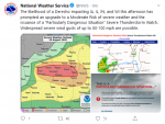
The NWS Storm Prediction Center's severe weather forecast has significantly deteriorated since yesterday.

Now a widespread, long lasting severe wind event (Derecho) is forecast.

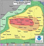
The SPC Day 1 forecast is being upgraded from an Enhanced to a Moderate Risk.

A rare PDS "Particularly Dangerous Situation" Thunderstorm Watch has been issued.

Stand by for more details.
 
Last edited:

Red Baron

Paleo-Conservative
_______________
:siren:

1597077945642.png

URGENT - IMMEDIATE BROADCAST REQUESTED
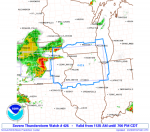
Severe Thunderstorm Watch Number 426
NWS Storm Prediction Center Norman OK
1125 AM CDT Mon Aug 10 2020

The NWS Storm Prediction Center has issued a

* Severe Thunderstorm Watch for portions of
Eastern Iowa
Northern Illinois
Far northwest Indiana
Far southern Wisconsin
Lake Michigan

* Effective this Monday morning and evening from 1125 AM until
700 PM CDT.

...THIS IS A PARTICULARLY DANGEROUS SITUATION...

* Primary threats include...
Widespread damaging winds and scattered significant gusts to 100
mph likely

Isolated large hail events to 1.5 inches in diameter possible
A couple tornadoes possible


SUMMARY...A derecho will rapidly progress across eastern Iowa and
northern Illinois this afternoon. Widespread severe wind gusts, some
of which should reach 80-100 mph are anticipated along the track of
the bow. Brief tornadoes are also possible.

The severe thunderstorm watch area is approximately along and 85
statute miles north and south of a line from 20 miles west southwest
of Cedar Rapids IA to 75 miles south southeast of Racine WI. For a
complete depiction of the watch see the associated watch outline
update (WOUS64 KWNS WOU6).

PRECAUTIONARY/PREPAREDNESS ACTIONS...

REMEMBER...A Severe Thunderstorm Watch means conditions are
favorable for severe thunderstorms in and close to the watch area.
Persons in these areas should be on the lookout for threatening
weather conditions and listen for later statements and possible
warnings. Severe thunderstorms can and occasionally do produce
tornadoes.

&&


Red Baron

Paleo-Conservative
_______________
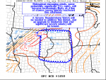
This product is issued before a watch. Lots of weather porn details,
1597078179630.png

Mesoscale Discussion 1450
NWS Storm Prediction Center Norman OK
1042 AM CDT Mon Aug 10 2020

Areas affected...Portions of northern/eastern IA...southern
WI...northern/central IL...and far northeastern MO

Concerning...Severe potential...Severe Thunderstorm Watch likely

Valid 101542Z - 101715Z

Probability of Watch Issuance...95 percent

SUMMARY...Widespread damaging winds, some potentially significant
(75+ mph), will become increasingly likely as a line of storms moves
quickly eastward this afternoon. A Severe Thunderstorm Watch will be
needed to address this threat, and an upgrade to Moderate Risk (for
significant severe/damaging winds) will be issued with the upcoming
1630Z update to the Day 1 Convective Outlook.


DISCUSSION...A compact MCS moving into central IA as of 1540Z has
recently produced numerous severe/damaging wind gusts. Recent radar
trends suggest this system has already become very well organized,
with the development of an 80-100+ kt rear-inflow jet only a couple
thousand feet off the surface per KDMX velocity data. The airmass
downstream of this MCS into eastern IA, southern WI, and
northern/central IL is already quite unstable, with MLCAPE of
2000-2500 J/kg present per 15Z mesoanalysis estimates. Additional
diurnal heating of this airmass is expected to yield very strong to
potentially extreme instability by this afternoon
, with MLCAPE
potentially reaching the 3500-5500 J/kg range by peak heating.
Recent VWPs from the KDMX radar show sufficient mid-level flow
(around 30-35 kt) to support the continued intensity of the ongoing
MCS.

Additional storms have recently formed across parts of north-central
into northeastern IA along a weak cold front. Current expectations
are for the MCS in central IA to eventually merge with the new
development in north-central/northeastern IA. Result of this will
likely be a large, very well organized bow echo producing widespread
severe and damaging wind gusts across parts of eastern IA into
southern WI, and northern/central IL.
The forecast combination of
very strong to extreme instability with adequate deep-layer shear
downstream of the ongoing MCS strongly suggests that a swath of
potentially significant severe wind gusts of 75+ mph is becoming
increasingly likely this afternoon across parts of these areas. A
new Severe Thunderstorm Watch will be needed downstream of the
current watch in central IA within the next hour or two. An upgrade
to Moderate Risk for numerous significant severe/damaging wind gusts
will be issued with the 1630Z update of the Day 1 Convective
Outlook.

..Gleason/Grams.. 08/10/2020


Southside

Has No Life - Lives on TB
I used to sail out of Burnham Harbor, downtown, Chicago. Saw a Dericho once. Lowered the lake level in Burnham at least 3 feet. It was quite the mess when it came flowing back over.


Southside
 

Red Baron

Paleo-Conservative
_______________
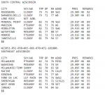
Extreme dew points in southern WI contributing to the instability.

A dew point (DP) over 70F is considered "tropical".

Dew Point.PNG
 

Loretta Van Riet

Trying to hang out with the cool kids.
These things get my attention. I believe the last one to cut through DuPage county IL was 2010 and it was as if a sideways tornado blew through! Many downed trees and loss of power for about 6 days.
 

Cacheman

Ultra MAGA!
136,000 customers out of power in Iowa. Increasing reports of 100MPH winds. Many reports of wind damage in Des Moines area.

Screenshot_2020-08-10 99 mph winds, severe thunderstorms moving through central Iowa; 81,000 M...png

Just updated on Weather Channel, power out to 205,000 customers.

Midway IA at 112MPH
 
Last edited:

Melodi

Disaster Cat
I think it is the same system, but I'm not sure; Packy (Packaderm's wife) just posted their neighbor's house was damaged (probably a tornado) and their tree is now through the roof of Packy's garage.

Everyone is OK though, and the house itself is probably OK too.
 

Red Baron

Paleo-Conservative
_______________
136,000 customers out of power in Iowa. Increasing reports of 100MPH winds. Many reports of wind damage in Des Moines area.

View attachment 213713

Just updated on Weather Channel, power out to 205,000 customers.

Midway IA at 112MPH

A measured 99 mph wind gust at Marshalltown, IA airport!

1597084069133.png

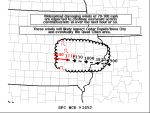
Mesoscale Discussion 1452
NWS Storm Prediction Center Norman OK
1214 PM CDT Mon Aug 10 2020

Areas affected...Portions of central/eastern IA into far
northwestern IL

Concerning...Severe Thunderstorm Watch 425...426...

Valid 101714Z - 101845Z

The severe weather threat for Severe Thunderstorm Watch 425, 426
continues.

SUMMARY...Widespread damaging winds of 70-100 mph are expected to
continue eastward across central/eastern Iowa over the next hour or
so.
These winds will likely impact Cedar Rapids/Iowa City, and
eventually the Quad Cities area.

DISCUSSION...A small but potent bow echo will continue rapidly
eastward across eastern IA in the next hour or so. The apex of this
bow is moving eastward around 55-60 kt, and the potential for
widespread damaging winds remains apparent. A recent measured severe
wind gust of 99 mph was reported at the Marshalltown ASOS associated
with this bow, and a couple other gusts up to 100 mph have also been
noted. Current expectations are for this bow echo to maintain its
intensity across eastern IA, with 2500-3000 J/kg of MLCAPE present
downstream. A swath of 70-100+ mph wind gusts producing destructive
damage appears likely to impact the Cedar Rapids/Iowa City area
within the next hour, eventually reaching the Quad Cities area
around 1800-1830Z.

..Gleason.. 08/10/2020


SouthernBreeze

Has No Life - Lives on TB
Prayers going up for Packy. Has anyone heard anything from Meemur? I'm praying for her, too, and all our members who are experiencing this storm system.
 

Red Baron

Paleo-Conservative
_______________
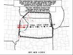
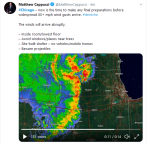
An update on the PDS Severe Thunderstorm Watch. Chicago is in the crosshairs at around 3:30 pm CDT.

1597085203282.png

Mesoscale Discussion 1455
NWS Storm Prediction Center Norman OK
0136 PM CDT Mon Aug 10 2020

Areas affected...Portions of far eastern IA into southern WI and
northern IL...including the Chicago metro

Concerning...Severe Thunderstorm Watch 426...

Valid 101836Z - 102030Z

The severe weather threat for Severe Thunderstorm Watch 426
continues.

SUMMARY...The potential for widespread and destructive damaging wind
gusts of 70-100+ mph and perhaps a tornado or two will continue
as a
line of storms moves quickly eastward across northern Illinois. This
line will likely impact the Chicago metro area around 2000-2030Z (3
to 3:30 PM CDT).

DISCUSSION...The bow echo over eastern IA has developed a comma head
structure on its northern flank and very large rear-inflow jet, with
measured wind gusts of 97 and 112 mph recently reported in the
vicinity of Cedar Rapids IA.
The 17Z sounding from DVN observed
steep 700-500 mb lapse rates of 8.5 C/km. These lapse rates combined
with strong heating of a very moist low-level airmass is supporting
3000-3500 J/kg of MLCAPE downstream of the bow. The 25 kt of
effective bulk shear also observed on the 17Z sounding is somewhat
marginal for storm organization. Regardless, with the bow echo
already very well developed/organized, confidence remains high that
a swath of widespread, destructive damaging winds of 70-100+ mph
will sweep eastward across northern IL and vicinity over the next
hour or two
. If the current fast eastward motion of the bow (around
60 kt) holds steady, then the widespread damaging wind threat will
increase across the Chicago metro area by 2000-2030Z (3 to 3:30 PM
CDT). In addition to the substantial straight-line wind threat, some
increase in the tornado threat may be developing on the northern
flank of the bow, where mid-level rotation has recently been noted.
Other cells have also formed ahead of the line across far southern
WI and northern IL along a weak warm front, and this convection will
pose a threat for isolated large hail, damaging winds, and perhaps a
tornado or two.

..Gleason.. 08/10/2020


psychgirl

Has No Life - Lives on TB
We (central Indiana) got round 1 early this morning. Thunder and lightening show around oh, 8am-? It was a good long soaker too. M
It’s muggy and hotter than blazes with the sun shining now. Gross gross gross.

More storm warnings for tonight with possibly damaging winds. 8-10 pm range they said. Warnings and watches have been up all day.
I hope it clears this muggy crap out!
 

Blacknarwhal

Let's Go Brandon!
We (central Indiana) got round 1 early this morning. Thunder and lightening show around oh, 8am-? It was a good long soaker too. M
It’s muggy and hotter than blazes with the sun shining now. Gross gross gross.

More storm warnings for tonight with possibly damaging winds. 8-10 pm range they said. Warnings and watches have been up all day.
I hope it clears this muggy crap out!

A little north of you around the South Bend region, they're saying no dice on losing the muggy for most of the week, sadly.

Though it does look like the storms will just be storms and not the rippers they described previously.
 

Cacheman

Ultra MAGA!
Storm will be here in my part of SC WI in minutes, tornado warnings the past hour just to the south of me. Steady thunder and not a leaf moving (yet). Just went to town to get Brandy while the getting was good (last minute preps you know) and fire station looks to be ready to go. We're on the northern fringe so won't be nearly as intense
 

Cacheman

Ultra MAGA!
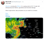
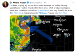
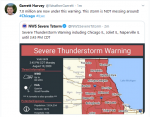
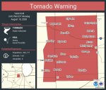
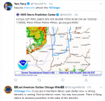
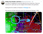
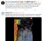
Tornado warning just posted for Chicago's western suburbs and I don't think I've ever seen one that covers an area this large before.

EfFcuq1UYAE0Vom.jpg
 
Last edited:

Millwright

Knuckle Dragger
_______________
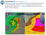
Nasty looking storm.

 
Top