
You are using an out of date browser. It may not display this or other websites correctly.
You should upgrade or use an alternative browser.
You should upgrade or use an alternative browser.
WEATHER Severe Weather for the Week of April 1st, 2024
- Thread starter packyderms_wife
- Start date

packyderms_wife
Neither here nor there.
Current Map | U.S. Drought Monitor.
US Drought Report, it's an interactive map.

 www.fireweatheravalanche.org
Wildfire map... never thought I'd be posting this one weekly.
www.fireweatheravalanche.org
Wildfire map... never thought I'd be posting this one weekly. 

 www.star.nesdis.noaa.gov
GOES Sat imagery... you can select different filter views, for dust, smoke, ash, etc
www.star.nesdis.noaa.gov
GOES Sat imagery... you can select different filter views, for dust, smoke, ash, etc
US Drought Report, it's an interactive map.
Wildfire Map: Track Live Fires, Smoke, & Lightning | Map of Fire
Track wildfires & smoke across the US. Monitor fire spread, intensity, and lightning strikes. Stay informed with real-time updates on Map of Fire.
www.fireweatheravalanche.org
GOES Imagery Viewer - NOAA / NESDIS / STAR
Near real-time publication of GOES-East and GOES-West images from NOAA/NESDIS/STAR
packyderms_wife
Neither here nor there.
My part of central Iowa is finally out of the Extreme Drought conditions stage... we're now back to Moderate after a couple days of off and on again rain storms.
I hear tell that La Nina will be making a return come June... we shall see.
There are some interesting weather threads on the main in case you missed them.
I hear tell that La Nina will be making a return come June... we shall see.
There are some interesting weather threads on the main in case you missed them.
packyderms_wife
Neither here nor there.
RT 10:40 - Max Velocity
In this weather forecast, we are breaking down A HUGE storm that is about to bring BIG problems to the United States. This storm will bring severe weather, including large hail, damaging winds, and tornadoes. Additionally, a winter storm will impact the Northeast USA! Find the latest details of the weather across the United States in our latest weather forecast.
For tomorrow.

Reed is always jacked up about any hint of a storm.
Here's how a PHD analyzes a potential outbreak.
Runtime 34:41
View: https://youtu.be/o2bgWnapUWY
Here's how a PHD analyzes a potential outbreak.
Runtime 34:41
LIVE EMERGENCY UPDATE on severe weather outbreak likely Monday-Tuesday!
Night storms.
Bad, bad deal.
WUnderground timeline has it ramping up from 3-6PM here and going til midnight.
Their 10 day forecast is usually fairly accurate for us.
Peeps to the NE will be dealing with it after midnight.
Bad, bad deal.
WUnderground timeline has it ramping up from 3-6PM here and going til midnight.
Their 10 day forecast is usually fairly accurate for us.
Peeps to the NE will be dealing with it after midnight.
ShadowMan
Designated Grumpy Old Fart
Soooo what happened to spring?!?  We're coming to the end of our current weekend storm here in the SoCal mountains. Got about a foot of snow from this one at our 5,600 ft level. Very wet heavy slop. Might get another inch or so today, but that should be it for now. Another storm expected next weekend but will probably (hopefully) be only rain.
Just started our indoor seeds for early spring planting....if it ever really arrives. Dang things actually started sprouting within TWO DAYS!! I guess they are in a hurry to get going too.
We're coming to the end of our current weekend storm here in the SoCal mountains. Got about a foot of snow from this one at our 5,600 ft level. Very wet heavy slop. Might get another inch or so today, but that should be it for now. Another storm expected next weekend but will probably (hopefully) be only rain.Just started our indoor seeds for early spring planting....if it ever really arrives. Dang things actually started sprouting within TWO DAYS!!
I guess they are in a hurry to get going too.SouthernBreeze
TB Fanatic
We're hoping to be able to avoid the severe spring storms this year. April is our peak tornado month. NE MS.
They have stretched out the "Enhanced" area from yesterday. Post 5

Hail outlook.
Pretty good indicator of bad storms. I'm about to start shuffling equipment to get everything under cover later.

Pretty good indicator of bad storms. I'm about to start shuffling equipment to get everything under cover later.

They've pushed arrival here to 6PM with a straight up on the rain graph, fairly short duration, .76" rain.
It will hit hard and fast and blow thru quick.
Just my uneducated interpretation,
We've got that pre-storm feeling in the air.
76F, 126.39% humidity, heavy overcast.
No green sky or anything like that yet, but I can see it as a maybe.
The gaggle of storm chasers are not doing much, yet.

 zoomradar.com
A few staged here...not streaming tho.
 livestormchasing.com
It will hit hard and fast and blow thru quick.
Just my uneducated interpretation,
We've got that pre-storm feeling in the air.
76F, 126.39% humidity, heavy overcast.
No green sky or anything like that yet, but I can see it as a maybe.
The gaggle of storm chasers are not doing much, yet.
ZoomRadar – Interactive Weather For Your Website
ZoomRadar is one of the fastest updating interactive radars on the web, aggregating local Level 2 Doppler radars from all across the US
A few staged here...not streaming tho.
Live Storm Chasing
Watch live feeds as storm chasers try to see if their target verifies. Tornadoes, hurricanes, blizzards, and floods - we've got it all and more, live on our site and available as video on demand.
They've added a moderate blob over us in the Severe T-storm forecast.

Auto-updating overview.

packyderms_wife
Neither here nor there.
LIVE STREAM - Max Velocity
In this live stream, we are breaking down ongoing severe weather in the United States. This severe weather event could bring significant damaging winds, large hail, and tornadoes. This is a live weather channel.
Day2 Outlook - Big upgrade to MODERATE RISK. 15% tornado risk.

Day 2 Convective Outlook
NWS Storm Prediction Center Norman OK
0100 PM CDT Mon Apr 01 2024
Valid 021200Z - 031200Z
...THERE IS A MODERATE RISK OF SEVERE THUNDERSTORMS ACROSS A LARGE
PORTION OF OHIO...AND INCLUDING ADJACENT PARTS OF SOUTHEASTERN
INDIANA...NORTHERN KENTUCKY...AND WESTERN WEST VIRGINIA...
...SUMMARY...
A potentially substantial severe weather outbreak -- possibly
including a few significant/long-track tornadoes -- is evident for
Tuesday afternoon and evening, with highest probability centered
over the Ohio vicinity, and extending southward across the Tennessee
Valley. Some severe risk exists as far south as the Gulf Coast, and
as far east as western portions of Virginia and the Carolinas.
...Synopsis...
While a positively tilted upper trough moves across the central
third of the country Tuesday, a more compact/energetic short-wave
feature is expected to dig aggressively/quickly southeastward across
the Upper Midwest, gradually evolving into a closed low as it does.
By Wednesday morning, the deepening low is progged to reside over
the Illinois vicinity.
At the surface, a low initially over the Missouri vicinity is
progged to deepen as the upper system digs southeastward, shifting
northeastward across the Midwest through the day, and then occluding
northward into Lower Michigan overnight. A cold front associated
with the low will sweep across the Mid Mississippi and Lower Ohio
Valley through the day, and the Lower Mississippi/Tennessee/Upper
Ohio Valleys overnight, crossing central/southern Appalachian Crest
late. Meanwhile, a warm sector should expand as far north and east
as central and northeast Indiana/northern Ohio/western Pennsylvania,
though limited in northward progress to West Virginia/northern
Virginia/Maryland by persistent/slow-to-retreat cold-air damming
over the Northeast.
...Ohio and Tennessee Valleys...
Widespread thunderstorms -- including some degree of all-hazards
severe risk -- will likely be spreading rapidly eastward across the
Ohio Valley area at the start of the period. This convection should
reach the central Appalachians by late morning/midday, but -- though
potentially having some impact on destabilization potential across
the MDT and ENH risk areas -- should largely shift far enough east
to allow warm-sector destabilization to commence.
As the surface low deepens and crosses Illinois and eventually moves
into Indiana, and the cold front advances across the Mid Mississippi
and Lower Ohio Valleys, storm redevelopment is expected to occur
during the afternoon. While evolution/storm mode remains somewhat
difficult to discern -- in part due to earlier storms -- some mix of
cellular and cluster/linear mode is expected to evolve. Given the
ample destabilization expected in combination with very
strong/veering deep-layer flow, all-hazards severe potential is
evident, including very large hail, strong/damaging winds, and
several significant tornadoes.
The greatest risk, which will include potential for a couple of
intense/long-track tornadoes, should begin across Indiana, and the
spread across Ohio through the afternoon and evening, potentially
reaching as far east as western portions of West Virginia and far
western Pennsylvania into the evening. Eastward advance of the risk
into central Pennsylvania will likely remain limited, but otherwise
threat may spread into western portions of Virginia and the
Carolinas late.
...Florida/Georgia/southeastern Alabama and perhaps into the western
Carolinas...
Thunderstorm development is expected to increase late in the period
from the Florida Panhandle northeastward, ahead of the advancing
cold front. With indications of potentially cellular mode with this
convection, concerns for a very late-period increase in tornado
potential exist, given background shear profiles supportive of
updraft rotation. While somewhat uncertain at this point, have
expanded 5% tornado probability substantially eastward/southeastward
to include this potential.
..Goss.. 04/01/2024
packyderms_wife
Neither here nor there.
First severe thunderstorm warnings are up for Oklahoma. I'll be in and out today, got video to edit, and taxes to finish... stay safe everyone.
packyderms_wife
Neither here nor there.
LIVE STREAM - Ryan Hall y'all
LIVE - Tornado Outbreak Coverage With Storm Chasers On The Ground - Live Weather Channel...
Sigh... I guess I'd rather have a Winter Storm Watch than tornadoes, but it's APRIL for crying out loud! I'm past ready for Spring!
Stay safe, everyone!
Summerthyme
Stay safe, everyone!
Summerthyme
Last edited:


20+ chasers out, right now.
No active warnings, just watch boxes.
No active warnings, just watch boxes.
patriotgal
Veteran Member
Supposed to hit North central Arkansas at 10 tonight. All day it has felt like it was going to do something any minute. Have caught myself constantly looking out the front window. No idea what I am expecting to see.
packyderms_wife
Neither here nor there.
Tornadoes in Oklahoma and Missouri. I’m on my phone do cant post stuff.
| Start | Warning End | Phenomena | Warning Summary - Tornado HQ | Warning Counties | Warning States | Map |
|---|---|---|---|---|---|---|
| 13 minutes ago | 19 minutes from now | tornado | At 758 PM CDT, a severe thunderstorm with strong low level rotation that could produce a tornado at any time was located 7 miles southeast of Bartlesville, moving east at 50 mph. show me the full warning | Nowata / Washington | OK | show me |
| 23 minutes ago | 4 minutes from now | tornado | At 748 PM CDT, a severe thunderstorm capable of producing a tornado was located near Joshua, moving east at 35 mph. show me the full warning | Johnson | TX | show me |
| 26 minutes ago | 4 minutes from now | tornado | At 744 PM CDT, a severe thunderstorm capable of producing a tornado was located over Buffalo, moving east at 50 mph. show me the full warning | Dallas / Laclede / Polk | MO | show me |
| 28 minutes ago | 4 minutes from now | tornado | At 743 PM CDT, a severe thunderstorm capable of producing a tornado was located 5 miles west of Ochelata, moving northeast at 55 mph. show me the full warning | Osage / Washington | OK | show me |
tornado hq - tornado tracker and current tornado warnings
In a tornado warning? Use our tornado tracker map to see if a tornado might be headed your way.
www.tornadohq.com

It was a fizzle for us.
One more band headed this way and no pretty colors in in.
Tomorrow may be a different story up nawth.
One more band headed this way and no pretty colors in in.
Tomorrow may be a different story up nawth.
And heading my way...was up at midnight could hear the wind from a distance and now at 4am mild gusts
We have been warned of power outages due to the wind and rain..snowy conditions
Getting the dog out soon and thankfully starting today on 12 days off staycation
Will update if anything exciting across the border
FYI I am living in southern Ontario small town outside of London Ontario
We have been warned of power outages due to the wind and rain..snowy conditions
Getting the dog out soon and thankfully starting today on 12 days off staycation
Will update if anything exciting across the border
FYI I am living in southern Ontario small town outside of London Ontario
Public Severe Weather Outlook (PWO)

PUBLIC SEVERE WEATHER OUTLOOK
NWS STORM PREDICTION CENTER NORMAN OK
0341 AM CDT TUE APR 02 2024
...Severe thunderstorms expected over parts of the Ohio Valley this
afternoon...
* LOCATIONS...
Ohio
Kentucky
Eastern Indiana
Western West Virginia
Tennessee
Northern Alabama
Northeast Mississippi
Northwest Georgia Georgia
* HAZARDS...
Several tornadoes, a few intense
Scattered damaging winds, some hurricane force
Scattered large hail, some baseball size
* SUMMARY...
A potentially substantial severe weather outbreak -- possibly
including a few significant/long-track tornadoes -- is
anticipated this afternoon and evening, with the highest
probability centered over the Ohio Valley. Severe risk exists as
far south as the Gulf Coast, and as far east as western portions
of Virginia and the Carolinas.
Preparedness actions...
Review your severe weather safety procedures for the possibility
of dangerous weather today. Stay tuned to NOAA Weather Radio,
weather.gov, or other media for watches and warnings. A tornado
watch means that conditions are favorable for tornadoes to form
during the next several hours. If a tornado warning is issued for
your area, move to a place of safety, ideally in a basement or
interior room on the lowest floor of a sturdy building.
&&
..Bentley.. 04/02/2024

patriotgal
Veteran Member
Nothing Burger for us. No rain no nuthin'. Now they are talking rain on eclipse day.
I'm thinking it's just a wee bit chilly for things to really spin up into nasty storms.
Hopefully
The SPC has to play a more conservative hand for warnings.
The chasers are in the loop and have good insight. They spend their own money to go out and maybe get some footage that will sell.
If they aren't stacking up, then it's an indication that chances aren't as great as the SPC is saying.
SouthernBreeze
TB Fanatic
Right now in NE MS, at 10 am, the temp is 74 degrees with the humidity at 79% and the dew point at 67. It could get bad later on today.
BUT WAIT...There's more.
Already starting to call next Sunday.

Already starting to call next Sunday.
packyderms_wife
Neither here nor there.
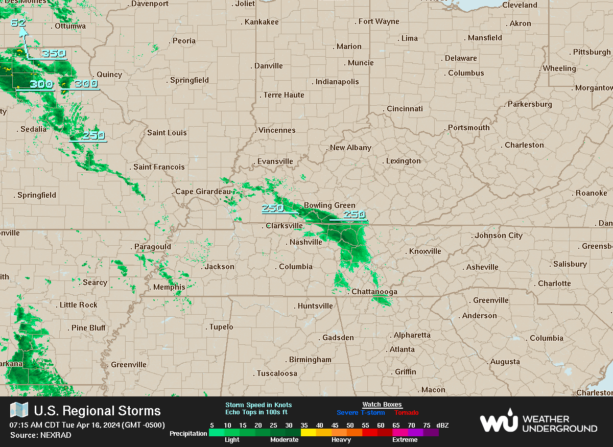
Meanwhile in Iowa it’s snowing!

SouthernBreeze
TB Fanatic
Our high today is supposed to be 80, but after the storm system passes, our high tomorrow is only 61 with frost for two nights.
Two nights in a row very heavy rain, big gully washers and many of them not just all at once when it comes no is sleeping it's coming down that hard.
Yesterday I needed to go into town to buy supplies to make dinner and I live in a mountainous area and seeing piles of leaves, soil and gravel washed out into the road it's going to take a little cleanup by road crews. After last night just wow and the weather service is showing more rain on the way.
Yesterday I needed to go into town to buy supplies to make dinner and I live in a mountainous area and seeing piles of leaves, soil and gravel washed out into the road it's going to take a little cleanup by road crews. After last night just wow and the weather service is showing more rain on the way.