Solar Grand Solar Minimum part deux

TxGal

Day by day
I just walked outside to run an errand. A dry cool front is blowing through. Mid-June on the Texas Gulf Coast, and a cool northwest wind is blowing by. It feels great, but it also feels very, very weird. Our climate is getting chaotic, it's undeniable.

That's our weather, too, up here in the Brazos Valley. Sure is a relief after the last week or so with temps hovering near 100 and high humidity. Next week we're going back to that. I agree, it's wonderful today, but weird.
 

BenIan

Veteran Member
I'm waiting for a June snowfall along the Gulf Coast at some point to REALLY get peoples attention.
 

TxGal

Day by day
Here's a new podcast from Ice Age Farmer:


View: https://www.youtube.com/watch?v=0MPCfTEtXhk


GRAND SOLAR MINIMUM: Chinese HOARD Grains after Cold Kills Wheat - Growing Zones Shifting!
6,912 views
•Jun 10, 2020

Run time is 17:54

Brutal cold temperatures damaged wheat in the main production area of China -- enough to send locals scurrying into stores to start hoarding supplies! But as they prepare for more crop losses in this deep Solar Minimum, we in the west are scuttling our food supply, and "activists" are moving from urban "protests" to attacks on rural communities and even directly on farms. Defend our farms and start growing food!
 

TxGal

Day by day
The Oppenheimer Ranch Project has two new podcasts out:

View: https://www.youtube.com/watch?v=d-QeJXv6n-A


AR2765 Region Filament Release - possibility of a partially eruptive event - Volcanic Activity Noted
5,473 views
•Premiered 18 hours ago

Run time is 3:07

A 12-14 deg long filament that bisected Region 2765 dissipated between 09/1800-1900 UTC, as observed in NSO/GONG H-alpha imagery. Analysis of the H-alpha and GOES-16 SUVI imagery indicate the possibility of a partially eruptive event - however, most material seemed to be reabsorbed. Analysis continues and we also await updated coronagraph imagery to determine whether a CME. occurred. Since the particles all travel at the speed of light -- 300,000 kilometers per second -- the solar flare energy takes 500 seconds to arrive at Earth -- a little more than eight minutes after it leaves the sun.://www.solarham.net/
Electrovese Opinion https://electroverse.net/upgraded-cor...
IGEPN reported that on 9 June a pyroclastic flows traveled over the southern slopes, as can be seen in the webcam screenshot https://www.volcanodiscovery.com/sang...
Sangay Data https://volcano.si.edu/volcano.cfm?vn...
Explosive activity continues. Volcanic Ash Advisory Center (VAAC) Darwin warned about a volcanic ash plume that rose up to estimated 63000 ft https://www.volcanodiscovery.com/seme...
Semaru Data https://volcano.si.edu/volcano.cfm?vn...
Solar Ham https://www.solarham.net/
 

TxGal

Day by day
and the 2nd:

View: https://www.youtube.com/watch?v=iLxstUp3v6Y


Grand Solar Minimum 101 - Solar Cycle Science - Solar Polar Reversals - THOR NEWS FAUX PAS
3,395 views
•Premiered 6 hours ago

Run time is 12:13

The number of sunspots observed on the "surface" of the Sun varies from year to year. This rise and fall in sunspot counts varies in a cyclical way; the length of the cycle is around eleven years on average. The cyclical variation in sunspot counts, discovered in 1843 by the amateur German astronomer Samuel Heinrich Schwabe, is called "the Sunspot Cycle". https://bit.ly/2XSFmXP
New CMIP6 Data https://bit.ly/2MPXCuu
GISP2 vs History, It's Not A Mystery https://bit.ly/3fcB7vV
Thor News Grand Solar Minimum Turd https://www.youtube.com/watch?v=y7B1Y...
Current "GIANT" sunspot LOL https://www.solarham.net/regions/map.htm
Largest Sunspot in 24 Years Wows Scientists, But Also Mystifies https://bit.ly/3hiGxHC
ISES Solar Cycle Progression https://bit.ly/2WCGxKv
Central England Temps vs Sunspots https://bit.ly/2MK6bXM
Solar Grand Minima Since 1050 https://bit.ly/2AgwjXT
 

TxGal

Day by day
Adapt 2030 also has two new podcasts out:

View: https://www.youtube.com/watch?v=GrWNUd69QHw


Why Your Cost of Living Will Suddenly Become Expensive (Interview Bob Kudla 1/3)
7,718 views
•Jun 10, 2020

Run time is 21:16

Bob Kudla of Trade Genius and David DuByne from ADAPT 2030 talk about the changes in the economy and society that will bring in higher and higher food prices and general cost of living as the Grand Solar Minimum intensifies.
•Dollar Index
•U.S Fed Money Printing
•U.S Treasury Buying Assets
•Assets to protect against inflation
•Loss of global food production
•Food insecurity for 9 million Americans
•Seed shortages
•Evaporating service economy
•Four essential sectors we are being driven to spend our money
•Getting off the centralized control system


View: https://www.youtube.com/watch?v=Sg4v6bVxSv0

Predetermined Mission to Block Food Supplies (Interview Bob Kudla 2/3)
1,272 views
•Jun 11, 2020

Run time is 21:10

Bob Kudla of Trade Genius and David DuByne from ADAPT 2030 talk about the changes in the economy and society that will bring in higher and higher food prices and general cost of living as the Grand Solar Minimum intensifies.
•Brazil / Argentina grain trade
•Argentina peso currency crisis
•Record rice prices globally
•Feudal approach paying tolls for food deliveries
•Grain Shipment security
•Food blockade
•Cryptocurrency
•Decentralized exchanges – DEX
•FedCoin
•Electric bikes for transportation
•Silver bullion
•Dollar Devaluation
•Indoor Vertical agriculture
 

TxGal

Day by day

1591883976736.png

“Upgraded” Coronal Mass Ejection (CME) Inbound — Eyes to the Skies

June 10, 2020 Cap Allon


A dark magnetic filament bisecting sunspot AR2765 erupted on June 9th at 1800 UT. NOAA analysts are examining the event to see if it hurled any material toward Earth, and they’ve just upgraded the threat.

NOAA’s WSA-ENLIL prediction tool shows a burst of high-density plasma hitting Earth on June 13:

CME-June-13.png

You can run the animation yourself over at swpc.noaa.gov.

It reveals that Earth will be engulfed by an intense plasma stream on June 11 which will increase in density throughout the 12th to peak around noon on the 13th.

This is a dense field of plasma, and to handle it NOAA have had to increase the scale on their WSA-ENLIL prediction tool to 20/cm3.

Multiple waves of solar wind look set to combine and then follow the plasma over the coming days, and even a second and possibly third burst of plasma could start arriving from the 17th onward.


Dark magnetic filament bisecting sunspot AR2765 erupting on June 9th at 1800 UT [spaceweather.com]

We should prepare for an uptick in seismic and volcanic activity over the coming days, particularly on the 13th and 14th — however, the solar wind from June 9’s outburst would have taken just 8 minutes to reach Earth and a volcanic uptick was indeed witnessed:


Furthermore, the risk of power-outages and grid-failures as the plasma field hits on the 13th can’t be ignored — remember, we’re being “hit” while our shield (magnetic field) is weakening thanks to the ongoing GSM and pole shift.

Eyes on the skies.

For more on the potential threats CME’s pose, click the link below:


TxGal

Day by day

Astonishing, Record-Breaking Gains Continue across the Greenland Ice Sheet — MSM Silent

June 11, 2020 Cap Allon

The month of June is breaking records across the Greenland ice sheet, and not records for warmth and melt –as the mainstream media have trained you to expect– but new benchmarks for COLD and GAINS.

The SMB gains occurring right now across Greenland are truly astonishing.

Data-driven FACTS reveal vast regions to the south have been GAINING RECORD/NEAR-RECORD LEVELS of snow & ice all month.

Never before in June has the Greenland ice sheet grown by more than 4 Gigatons in a single day (since 1981 when DMI records began), but now the past week has gone and delivered two such days — June 3, and now yesterday, June 10.

In fact, yesterday’s gains actually neared 5 Gts — you can see from the chart below how anomalous that gain is for the time of year:


Blue line (Gt/day): total daily contribution to the SMB from the entire ice sheet. Grey line: mean value from 1981-2010 (DMI).

Greenland’s SMB should be turning negative in mid-June, on a typical year the island should have started losing snow and ice by now — yet it’s currently seeing gains that would be above the norm for any other time of the year, even the depths of winter.

What’s funny is how quick the MSM was to call the beginning of the melt season back at the end of May. They jumped the gun and once again successfully fooled the public into thinking the end was still nigh (as it apparently has been for the past 30+ years).

Greenland’s latest readings leave these rags with serious egg on their faces–although I’m not holding my breath for any retractions…


In addition, this picture of anomalous cold and snow has been the story ACROSS the entire Northern Hemisphere ALL season.

North America is holding onto what was a record-busting year for snowpack, even as it now approaches summer:


[www.ccin.ca]

While the Northern Hemisphere as a whole also just witnessed one of its snowiest winters on record, according to the Finish Meteorological Institute:


Total Snow Mass for the Northern Hemisphere (FMI).

This is how GLACIERS build.

This is also how ICE AGES begin.

The COLD TIMES are returning in line with historically low solar activity, cloud-nucleating Cosmic Rays, and a meridional jet stream flow.

Even NASA agrees, in part at least, with their forecast for this upcoming solar cycle (25) seeing it as “the weakest of the past 200 years,” with the agency correlating previous solar shutdowns to prolonged periods of global cooling here.


Don’t fall for bogus, warm-mongering political agendas — prepare for the COLD learn the facts, relocate if need be, and grow your own.
 

TxGal

Day by day

1591884634331.png

“Intense Cold Front” Expected to Hit ALL of Southern Africa

June 11, 2020 Cap Allon

The South African Weather Service (SAWS) has issued a number of cold warnings as the nation is expected to be hit by an “intense cold front” beginning midday Thursday and lasting through the weekend.

Robert Mulaudzi, the City of Johannesburg’s (CoJ) Emergency Management Services’ (EMS) spokesperson said: “We have noted with concern the warning message from the SAWS that most parts of Gauteng, including the City of Johannesburg, will have significant drops in temperatures from Friday, June going into Saturday, 13 June.”

View: https://twitter.com/SAWeatherServic/status/1269961151439409152


“CoJ EMS will remain on high alert to ensure we are able to respond to any emergency which might occur,” said Mulaudzi.

The significant drop in temperatures means that most residents will be forced to use heating and lighting appliances to try and warm themselves, reports roodepoortrecord.co.za.

“The main focus will be on our 189 informal settlements throughout the city since they are the most vulnerable to fire incidents in cold weather. The heating devices they use are left unattended most of the times,” concluded Mulaudzi.

Latest GFS runs reveal the anomalous-Antarctic-cold will be widespread by Friday, and will sink the mercury some 10-12C below the seasonal average across the majority of Southern Africa:


GFS Temp Anomalies (Friday, June 12).

gfs_T2ma_safr_10.png

GFS Temp Anomalies (Saturday, June 13).

Wrap up SA.

The COLD TIMES are returning in line with historically low solar activity, cloud-nucleating Cosmic Rays, and a meridional jet stream flow.

Even NASA agrees, if you read between the lines, with their forecast for this upcoming solar cycle (25) seeing it as “the weakest of the past 200 years,” with the agency correlating previous solar shutdowns to prolonged periods of global cooling here.


Prepare accordinglylearn the facts, relocate if need be, and grow your own.
 

TxGal

Day by day

Severe damage on melon crops caused by hailstorm in Murcia, Spain

Fresh Plaza
Wed, 10 Jun 2020 08:53 UTC

1591884986056.png

On Monday afternoon, abundant rains accompanied by hail fell in Campo de Cartagena, in Murcia. Damage to crops is considerable, although localized. Torre Pacheco, El Jimenado and Sucina, currently the most important melon-producing areas of Murcia and Spain, are among the most affected.

Proexport, the Association of Producers and Exporters of fruits and vegetables in the Region of Murcia, has posted videos on its social networks of melon plantations in Roldán (in the municipality of Torre Pacheco) which have been damaged by the storm only a few days before the harvest. They show how fields have been flooded and microtunnels have been fully destroyed by the hail.

View: https://www.youtube.com/watch?v=Bn1Ex0z70Ck&feature=youtu.be


View: https://www.youtube.com/watch?v=-v99k1iq5wY&feature=youtu.be


Technicians from Proexport and other producer organizations are conducting assessments on site to evaluate the extent of the damage and quantify the number of hectares affected.

Other crops currently in season, such as stone fruit, have not been affected by this storm, and neither have table grapes, which are grown in other areas and whose harvest will kick off in two weeks.
 

TxGal

Day by day

'Rolling emergency' of locust swarms decimating Africa, Asia and Middle East

Kaamil Ahmed
The Guardian
Mon, 08 Jun 2020 07:15 UTC

1591885219060.png
A farmer’s daughter waves her shawl to chase away swarms of desert locusts in Katitika village, Kitui county, Kenya.
Locust swarms threaten a "rolling emergency" that could endanger harvests and food security across parts of Africa and Asia for the rest of the year, experts warn.

An initial infestation of locusts in December was expected to die out during the current dry season. But unseasonal rains have allowed several generations of locust to breed, resulting in new swarms forming.

Huge swarms of locusts have been causing devastation across swathes of Africa, Asia and the Middle East. Erratic weather conditions and storms have aided their path. As a result, countries have been battling the pests for months to avoid a hunger crisis.

Desert locusts, which live in areas between west Africa and India, cause the most devastation and like to breed in moist conditions. These locusts live for three months. Eggs hatch two weeks after they have been laid, and hoppers become adults after about six weeks.

Adult locusts can eat their body weight every day, and fly up to 150km a day in search of new supplies.

Kenya is experiencing its worst infestation for 70 years, with pastoralists complaining that the vegetation on which their livestock feeds is being wiped out. Ethiopia and Somalia have not seen an outbreak this bad for 25 years. Swarms have also been destroying crops in Uganda, India and Pakistan.

View: https://youtu.be/qJinGSanpBM


Fears that millions of people could be forced into hunger prompted mass control operations earlier in the year, which have had an impact in Kenya and southern Ethiopia. But experts fear rains and insecurity in Somalia and South Sudan could undermine efforts in the east and Horn of Africa.

Keith Cressman, locust forecasting expert for the UN's Food and Agriculture Organization, said that over the coming months locusts are expected to move farther north into Ethiopia and South Sudan. High food prices in South Sudan could compound the threat of hunger.

"Ethiopia's going to be the recipient of swarms from Kenya and then also probably from Yemen so it's going to be busy for the whole year," said Cressman.

Kenneth Kemucie Mwangi, from the Nairobi-based IGAD Climate Prediction and Applications Centre, which monitors 11 countries, said initial reports suggest 2,500 sq km of crop damage in Kenya, largely among marginalised communities.

"A lot of crop areas are in their planting stage and we've already had reports in Turkana [county] that the herbaceous vegetation planted by the community to supplement their diet [has been damaged]. We've had reports of locusts invading farms," he said. "We really need a plan to [help] people because it can really shock the food security of agro-pastoralists who are in marginalised communities."

Lark Walters, food security specialist for the Famine Early Warning Systems Network (Fews Net), said some regional bread basket areas had not yet been hit, but there was still reason for concern.

"Despite the successes of the control measures and the stroke of luck of where desert locusts have or have not entered due to environmental reasons, we do expect the impacts of desert locusts to contribute to the food-insecure population in parts of Ethiopia, parts of Somalia and parts of south-east South Sudan," she said.

Fews Net predicted locusts could damage enough crops to feed 280,000 people for six months in Somalia.

The current locust outbreak originated in Yemen, where breeding conditions created by unseasonable rains combined with ongoing conflict had allowed an almost unchecked outbreak.
Cressman said Yemen had "become a reservoir" that could continue to stoke the crisis because it was still unable to monitor and control locusts. As well as the fighting, heavy rains that were once unusual have become an almost monthly occurrence.

Increasingly unpredictable weather will be crucial to how long the crisis goes on and which places will be affected, he said. Locusts are already moving to the India-Pakistan border.

He said the timing of rain in Sudan could determine whether there was an outbreak in west Africa.

"This is typical for desert locusts. It's not a problem that starts in one place and ends in one place, it's a rolling emergency."

Mwangi said Kenya has been able to successfully limit the outbreak to areas near the border with Ethiopia, where operations have been focused.

He said the crisis had shown the importance of regional coordination in fighting the pests, highlighting how countries such as Kenya, which is not used to locust outbreaks, had to scramble for equipment and resources.

Security threats had also hampered cross-border activity. In one incident, a helicopter monitoring locusts almost sparked a standoff by accidentally crossing into South Sudan from Kenya.

Security threats have prevented Kenya from carrying out cross-border spraying with Somalia, and also prevented the Somali government from conducting some aerial operations.

"The minute a weak link is there, it means swarms are able to lay eggs in areas that cannot be covered and those swarms offer a new generation for a new invasion," said Mwangi.
 

TxGal

Day by day
From our local weather guy an interview with a farmer who grows cotton and corn and was recently hit with a hailstorm. Very interesting what he says about how rare a hailstorm is there:


Thu Jun 11 05:55:00 PDT 2020

From the Ground Up: Hailstorm Wreaks Havoc in Brazos Bottom

Run time is 2:10
 

Martinhouse

Deceased
Weather-related news just gets worser and worserer, doesn't it?

With my own personal efforts, good news finally.

My nephew gave me six blue 55 gallon barrels, cut them in half and drilled drain holes in them. He has all six of my rabbit cages up at his house, ready to install new bottoms on them. He cut in half the five 30 gallon white barrels I had gotten but has not drilled the drain holes yet. He and his kids showed up late morning today and they just left. Boy is 15 or 16, girl just turned nine. With kids' help, nephew reworked the dirt in 23 of the half-barrels in my outdoor container garden. Bad dirt that was removed was put into bottom of new blue containers, then good soil mixed with what remained in original containers. After tomorrow, I'll be able to plant in all of them as there are only eleven more of the containers that need the dirt fixed.

I'll have to make two trips to my small town as the crap fill dirt is available at the Harp's store and I need at least 24 bags and I don't put more than ten or twelve of those heavy bags in my little Toyota truck at one time. I may need a third trip later, as there will be ten more containers to fill when I set up the ten new smaller white containers.

He is also going to bring his leaf blower and clean my roof and patch around the vent pipes and also clean out the gutters.

His little girl is going to trim all the dead weed vines off the garden fence and also finish putting screws in all the holes in the used metal roofing that was used for my new chicken pen roof late last fall.

Looks like a lot of my little picky chores are going to get done, too. He needs outdoor work badly as he took his kids out of school even before the closings, because the boy had leukemia when he was three or four and is very immune compromised. (We keep our distance out in the yard, and the little girl is totally a good sport about it.) These kids are extremely well-behaved because nephew believes in strict discipline like I did with my children, and they are a pleasure to be around.

Well, time to feed the chickens and gather the eggs, so I'll end this too-long post. I just had to share how things are finally going well for me with the chores and projects that need doing. And it's a big plus when I can be happy to have the work for a part of my family who especially needs it.
 
Last edited:

TxGal

Day by day
Adapt 2030 has a new podcast out:

View: https://www.youtube.com/watch?v=neuzFTaMwz8


Plasma Petroglyphs Over Washington D.C and Summer Snow (994)
5,486 views
•Premiered 10 hours ago

Run time is 5:31

Massive plasma discharge over Washington D.C leaving an air glow for a fraction of a second. If the glowing air lasted for seconds or minutes ancient peoples would have left petroglyphs of the event, I found several. Also these same sets of carvings show a micronova from our Sun with Squatter Man, so are we witnessing another repeat of ancient events over the USA Capital?
 

TxGal

Day by day

1591966542808.png
The Changing Jet Stream and Global Cooling

June 12, 2020 Cap Allon


Studying the JET STREAM has long been an indicator of the weather to come. And to study the jet stream attention must turn to the SUN.

When solar activity is HIGH the jet stream is tight, stable, and follows somewhat of a straight path. But when solar activity is LOW that meandering band of air flowing some 6 miles above our heads becomes weak and wavy, it effectively buckles, which has the effect of diverting frigid Polar air to atypically low latitudes and replaces it with warmer tropical air masses.

The jet stream reverts from a Zonal Flow to a Meridional Flow — and, depending on which side of the jet stream you’re on, you’re either in for a spell of unseasonably cold or hot weather, and/or a period of unusually dry or wet conditions.


MJS.jpg


THIS FORCING fully explains why some far-northern latitudes (such as parts of Siberia) have been experiencing pockets of anomalous heat of late, while the lower-latitudes have been dealing with “blobs” of record cold.

It’s a phenomenon long-predicted by those studying the Sun, and one forecast to intensify as the Grand Solar Minimum continues its deepening.

Let’s note all the recent hysteria regarding the anomalous warmth lingering over Siberia. Well, the region’s cold temperatures didn’t simply up and vanish, nor had they been heated by the magic CO2 affect, or escaped Earth’s atmosphere and leaked into space — no, they were merely diverted south on the back of a meridional (wavy) jet stream flow. And it’s THIS that’s the main reason for the lower latitudes experiencing record low temperatures of late.

Residing to the south of Siberia is Mongolia, Kazakhstan, and little town called China. And while Siberia was reportedly melting into oblivion, these regions beneath it were experiencing anomalous, often record-breaking COLD.

And now, coming out of the Siberian Times –who it has been said know a thing or two about Siberia– a “swing” is on the cards, with a recent June 9 article revealing that Siberia’s heat has been followed-up by “June snow, tornadoes and floods”.

Furthermore, and serving as another example of the Changing Jet Stream, the ST article goes on to explain that while snow in the northern mountains melted some two-weeks ahead of schedule, “further south, though, several roads in Khakassia –known to locals as ‘Warm Siberia’ for its mild climate– were blocked by snow.”


Rare June snow in in Khakassia aka ‘Warm Siberia’.

North America is another example.

Because while parts of far-northern Alaska/Canada were experiencing anomalous heat in May, the lower-latitudes beneath them –where the majority of us humans reside– were busy breaking records for all-time COLD:


Earth’s climate is changing alright, there’s little doubt about that.

But it’s the Sun that’s at the wheel, not Man and his puny CO2-excretion.

We’ve known the above outlined mechanisms for decades, as the this article from 1975’s Science Mag would indicate, but as they clash with the modern politicized AGW agenda, they’ve conveniently been forgotten:


The COLD TIMES are returning, the lower-latitudes are REFREEZING, in line with historically low solar activity, cloud-nucleating Cosmic Rays, and a meridional jet stream flow.

Even NASA appears to agree, with their forecast for this upcoming solar cycle (25) seeing it as “the weakest of the past 200 years,” with the agency correlating previous solar shutdowns to prolonged periods of global cooling here.


Don’t fall for bogus, warm-mongering political agendas.

Our future is COLD as the Sun continues its descent into its next Grand Solar Minimum cycle.


Prepare accordinglylearn the facts, relocate if need be, and grow your own.
 

TxGal

Day by day

Parts of northwestern Ontario receive 10 cm of June snow


Doug Diaczuk
tbnewswatch.com
Thu, 11 Jun 2020 20:54 UTC

1591966998153.png
Parts of Northern Ontario woke up to as much as 10 centimetres of snow on Thursday

Snowplows travelling up and down the street and green trees covered in white isn't something you want to wake up to on a June morning, but that's just what greeted several communities in Northwestern Ontario.

Parts of Northwestern Ontario received a rare dumping of June snow, with Pickle Lake seeing as much as 10 centimetres with snow still falling Thursday morning.

"It's not really a great feeling when everyone was wearing shorts a week ago and it was beautiful 20 degree weather and fishing and then looking outside and wondering if we should fire up the skidoo or take the car to work," said Jamie Hussey, clerk treasurer with the municipality of Pickle Lake.

Several trees are down in certain areas due to the heavy wet snow and the municipality is experiencing a power outage town wide due to some trees that are suspected to have fallen on power lines.


Snowplows and loaders had to be brought out to clear municipal streets

© Rachael Oskam
Snowplows and loaders had to be brought out to clear municipal streets

The Municipality of Pickle Lake is currently without power.
© Rachael Oskam
The Municipality of Pickle Lake is currently without power.

Hussey said Hydro One crews have been dispatched from Dryden to get the power back on.

It is not entirely outside the realm of possibility for northern parts of the region to receive snow in June, but Hussey said the amount on the ground took even long-time residents by surprise.

"It is quite unusual to get snow in June," Hussey said. "It has definitely happened before. I've heard from a lot of people who lived here for a very long time that this is probably the most they have seen in June for a long time."


It is not entirely unusual for northern parts
It is not entirely unusual for northern parts of the region to receive snow in June but long-time residents say this is the most they have seen in recent memory.

"It's still falling from the sky right now. It looks like a late September day in Pickle Lake minus the fact that the trees are green and not yellow."

Motorists are advised to use extra caution on area roadways. Pickle Lake had to dispatch its snowplows to clear streets and Hussey said drivers are taking their time.


snow
© Rachael Oskam

"So far we haven't heard of any collisions in town or Highway 599," she said. "Everyone is taking their time and being cautious and we did have to ask our snowplows to go back out this morning. Everything is carrying on as normal despite the fact that we have no power."

Snow is expected to turn to rain later this afternoon in Pickle Lake and temperatures will rise to 10 degrees by Friday afternoon.
 

Windwood

Contributing Member
I second that! I'm in the very, very SW of Louisiana and our low on Thursday morning was 62 degrees, in JUNE! Crazy!
I just walked outside to run an errand. A dry cool front is blowing through. Mid-June on the Texas Gulf Coast, and a cool northwest wind is blowing by. It feels great, but it also feels very, very weird. Our climate is getting chaotic, it's undeniable.
 

TxGal

Day by day

Freezing temps in mid June!

June 12, 2020 by Robert

* IMPACTS…Frost could kill sensitive outdoor vegetation if left uncovered.

National Weather Service Green Bay Wisconsin Fri Jun 12 2020

FROST ADVISORY IN EFFECT FROM MIDNIGHT TONIGHT TO 6 AM CDT SATURDAY…

Vilas-Oneida-Forest-Florence-Northern Marinette County-Lincoln and Langlade Counties

Including the cities of Eagle River, Lac Du Flambeau, Rhinelander, Crandon, Aurora, Commonwealth, Spread Eagle, Niagara, Wausaukee, Merrill, Tomahawk, and Antigo

Clear skies, light winds and temperatures in the upper 20s to mid 30s will result in frost formation.

National Weather Service Watch Warning Advisory Summary
 

TxGal

Day by day

June snow in Northwestern Ontario brings town-wide power outages

June 12, 2020 by Robert

11 June 2020 – Snowplows travelling up and down the street and green trees covered in white isn’t something you want to wake up to on a June morning, but that’s just what greeted several communities in Northwestern Ontario.”

Pickle Lake saw a rare heavy dumping of June snow on Thursday and is currently without power.

Parts of Northwestern Ontario received a rare dumping of June snow, with Pickle Lake seeing as much as 10 centimetres with snow still falling Thursday morning.

Several trees are down in certain areas due to the heavy wet snow and the municipality is experiencing a power outage town-wide due to trees that are suspected to have fallen on power lines.

Hydro One crews have been dispatched from Dryden to get the power back on.

The amount on the ground took even long-time residents by surprise.

“It is quite unusual to get snow in June,” said Jamie Hussey, clerk treasurer with the municipality of Pickle Lake. “It has definitely happened before. I’ve heard from a lot of people who lived here for a very long time that this is probably the most they have seen in June for a long time.”

Looks like a late September day

“It’s still falling from the sky right now. It looks like a late September day in Pickle Lake minus the fact that the trees are green and not yellow.”

Motorists are advised to use extra caution on area roadways.

Parts of Northwestern Ontario receive 10 cm of June snow (5 photos)

A late September day? These photos make it look like a winter day.
https://www.vmcdn.ca/f/files/tbnews...e-lake-snow-1.jpeg;w=960;h=640;bgcolor=000000
https://www.vmcdn.ca/f/files/tbnews...e-lake-snow-4.jpeg;w=960;h=640;bgcolor=000000
https://www.vmcdn.ca/f/files/tbnews...e-lake-snow-3.jpeg;w=960;h=640;bgcolor=000000
https://www.vmcdn.ca/f/files/tbnews...le-lake-snow-5.jpg;w=960;h=640;bgcolor=000000
https://www.vmcdn.ca/f/files/tbnews...le-lake-snow-2.jpg;w=960;h=640;bgcolor=000000
 

TxGal

Day by day
Adapt 2030 has a new podcast out:

View: https://www.youtube.com/watch?v=K8-o6etRz7k


Food Shortages and Skyrocketing Inflation (995)
635 views
•Jun 13, 2020

Run time is 7:37

Vietnam halts rice exports and at the same time exempts food imports from any tariffs. Almost 20% of American households wont pay their mortgages moving forward as spending constrict to bare essentials, which explains Walmart's non-restocking of disposable spending items like bicycles. China countrywide panic buying of wheat and flour.
 

TxGal

Day by day

1592051773796.png
NASA, 2001: “Low Solar Activity = Global Cooling”

June 13, 2020 Cap Allon

It appears scientific objectivity and a quest for the truth were once permitted, perhaps even encouraged in US government agencies.

Back in 2001, NASA researchers found a strong correlation between low solar activity (namely the Maunder Minimum) and global cooling (namely disruptions to the ozone which impact the jet stream).

Many things can reduce the temperature on Earth, asserts the opening lines of a now archived NASA articleso we’re already treading on potentially “content-removing-ground” here Facebook and Twitter, as this logical contention runs against all modern IPCC reports— including an erupting volcano swathing the Earth with bright haze that blocks sunlight, and a drop in solar activity.

From 1650 to 1710, temperatures across much of the Northern Hemisphere plunged when the Sun entered a quiet phase now called the Maunder Minimum. During this period, very few sunspots appeared on the surface of the Sun, and the overall brightness of the Sun decreased slightly.

Europe and North America went into a deep freeze: alpine glaciers extended over valley farmland; sea ice crept south from the Arctic; and the famous canals in the Netherlands froze regularly—an event that is rare today.

A team of NASA scientists, led by Drew Shindell at the NASA Goddard Institute for Space Studies, set out to discover how low solar activity could cause such a dramatic cooling. The researchers’ first task was to create the Maunder Minimum Temperature Map in order to work out exactly how cold it got:


Shindell et al., 2001.

By combining temperature records gleaned from tree rings, ice cores, corals, and the few measurements recorded in the historical record, Shindell and his team clearly illustrate in this image the significant impact the Grand Solar Minimum had — the temperature difference between 1680, a year at the center of the Maunder Minimum, and 1780, a year of normal solar activity, as calculated by a general circulation model, is stark.

Deep blue across eastern and central North America and northern Eurasia illustrates where the drop in temperature was the greatest. Nearly all other land areas were also cooler in 1680, as indicated by the varying shades of blue. The few regions that appear to have been warmer in 1680 are Alaska and the eastern Pacific Ocean (left), the North Atlantic Ocean south of Greenland (left of center), and north of Iceland (top center) — the similarities with today are startling.

However, energy from the Sun decreased only slightly during this time — even in the deepest depths of the Maunder Minimum, solar irradiance hit a low of approx. 1,363 W/m2 from its pre-minimum high of approx. 1,367 W/m2 — not a tremendous difference, so why did temperatures drop so severely across the Northern Hemisphere?

To answer that crucial question, Shindell and his team took the amount of energy coming from the Sun during the Maunder Minimum and entered it into a general circulation model. The model is a mathematical representation of the way various Earth systems—ocean surface temperatures, different layers of the atmosphere, energy reflected and absorbed from land, and so forth—interact to produce the climate.

When the model started with the decreased solar energy and returned temperatures that matched the paleoclimate record, Shindell and his colleagues knew that the model was showing how the Maunder Minimum could have caused the extreme drop in temperatures. The model revealed that the drop in temperature was related to ozone in the stratosphere, the layer of the atmosphere that is between 10 and 50 kilometers from the Earth’s surface. Ozone is created when high-energy ultraviolet light from the Sun interacts with oxygen. During the Maunder Minimum, the Sun emitted less strong ultraviolet light, and so less ozone formed. The decrease in ozone affected planetary waves, the giant wiggles in the jet stream that we are used to seeing on television weather reports.

The change to the planetary waves kicked the North Atlantic Oscillation (NAO)—the balance between a permanent low-pressure system near Greenland and a permanent high-pressure system to its south—into a negative phase. When the NAO is negative, both pressure systems are relatively weak. Under these conditions, winter storms crossing the Atlantic generally head eastward toward Europe, which experiences a more severe winter. (When the NAO is positive, winter storms track farther north, making winters in Europe milder.)

The model results illustrate that the NAO was more negative on average during the Maunder Minimum, and Europe remained unusually cold.

These results matched the paleoclimate record exactly.

The Modern “Eddy” Grand Solar Minimum

With the Sun once again shutting down, relatively, another solar-induced global cooling event is staring us all down.

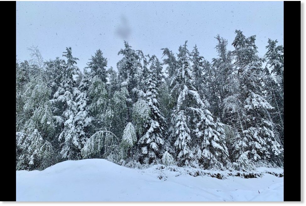
The years between 1650 to 1710 were a tough time to be alive. The Maunder Minimum effectively extended the winter months, delivering what was often an Arctic climate to the mid-latitudes. Summer snow became commonplace, and with the associated frosts came the destruction of many a harvest. Food shortages soon led to civil unrest, which in turn quickly led to famine and the removal of the fragile veil that is society — chaos ensued.


MM-4-1.jpg


Heed the warnings of the past.

Don’t fall for the bogus warm-mongering political agenda of the day — political bodies don’t have your back.

Prepare for the COLD — learn the facts, relocate if need be, and grow your own.

The COLD TIMES are returning, the lower-latitudes are REFREEZING, in line with historically low solar activity, cloud-nucleating Cosmic Rays, and a meridional jet stream flow.

Even our pals NASA appear to agree, with their forecast for this upcoming solar cycle (25) seeing it as “the weakest of the past 200 years”:


TxGal

Day by day

Intense cold front hits South Africa

SAPeople News
Thu, 11 Jun 2020 06:48 UTC

1592052223357.png
Hail in Cape Town at 7am this morning.

As predicted by the South African Weather Service (SAWS), parts of South Africa have been hit by an intense cold front yesterday and today (Wed and Thurs 10-11 June 2020).

Many Capetonians awoke to a scene that looked like snow... but was in fact bucket-loads of hail.

Whilst in other parts of the Western Cape, residents were treated to mountains of actual snow.

SAWS posted a satellite image of the cold front over the central interior of SA this morning. The weather service announced "very cold temperatures" across the western, central and southern parts of the country, and warned of heavy showers still being possible over the Western Cape with snow on the mountains.

View: https://youtu.be/zc1f9VO9C44


Snow Report SA reported that Gydo pass between Ceres and the Koue Bokkeveld, the Theronsberg pass on the R46, and the Bo Swaarmoed pass towards Matroosberg Reserve have been closed to traffic "due to snowfall making the conditions very difficult for driving".

Snow Report and Reenval SA shared the following photos and videos from their (freezing) followers around South Africa:

You can also catch the snow on the webcams at South Africa and Lesotho Webcams | Drakensberg Webcams and https://snowreport.co.za.

View: https://twitter.com/ReenvalSA/status/1271043076744773632
 

TxGal

Day by day

Record June snowfall in northwestern Ontario

June 14, 2020 by Robert

A northwestern Ontario township lost electricity for much of the day Thursday and saw several downed trees after a June snowstorm. The power outage was community-wide.

Pickle Lake, more than seven hours north of Thunder Bay, saw about 10 cm of snow, township clerk-treasurer Jamie Hussey told Global News. Global News called it a record June snowfall.

Record June snowfall brings power outage to part of northwestern Ontario

Thanks to Clay Olson for this link

Note: I posted about this earlier, but at the time didn’t realize that the snowfall had set a new record.
(See https://www.iceagenow.info/june-snow-in-northwestern-ontario-brings-town-wide-power-outages/)
 

TxGal

Day by day

Snow at Mt Baker and Mt Rainier thru Wednesday

June 13, 2020 by Robert

Almost 4 ft of snow possible. In mid June!

__________
Mt. Baker

Saturday
Snow showers. High near 24. Chance of precipitation is 90%. New snow accumulation of 1 to 2 inches possible.

Saturday Night
Snow showers. Low around 22. Chance of precipitation is 80%. New snow accumulation of less than one inch possible.

Sunday
Snow showers. High near 27. Chance of precipitation is 80%. New snow accumulation of 3 to 5 inches possible.

Sunday Night
Snow showers likely before 11pm, then snow likely after 11pm. Mostly cloudy, with a low around 24. Chance of precipitation is 60%. New snow accumulation of less than one inch possible.

Monday
Snow before 2pm, then snow showers after 2pm. Some thunder is also possible. High near 26. Breezy. Chance of precipitation is 100%. New snow accumulation of 8 to 12 inches possible.

Monday Night
Snow showers. Low around 23. Breezy. Chance of precipitation is 100%. New snow accumulation of 6 to 10 inches possible.

Tuesday
Snow showers. Mostly cloudy, with a high near 27.

Tuesday Night
A chance of snow showers before 11pm. Mostly cloudy, with a low around 22.

Wednesday
A chance of snow showers, mainly after 11am. Partly sunny, with a high near 32.

Mt Rainier:

Overnight
Snow showers. Low around 14. Chance of precipitation is 90%. Total nighttime snow accumulation of less than a half inch possible.

Saturday
Snow showers. High near 17. Chance of precipitation is 90%. New snow accumulation of 2 to 4 inches possible.

Saturday Night
Snow showers, mainly before 11pm. Low around 13. Chance of precipitation is 90%. New snow accumulation of 5 to 9 inches possible.

Sunday
Snow showers likely. Partly sunny, with a high near 23. Chance of precipitation is 60%. New snow accumulation of 1 to 2 inches possible.

Sunday Night
A chance of snow showers before 11pm, then snow likely after 11pm. Chance of precipitation is 70%. New snow accumulation of 4 to 8 inches possible.

Monday
Snow before 2pm, then snow showers after 2pm. Some thunder is also possible. High near 20. Windy. Chance of precipitation is 100%. New snow accumulation of 10 to 16 inches possible.

Monday Night
Snow showers. Some thunder is also possible. Low around 16. Breezy. Chance of precipitation is 100%. New snow accumulation of 3 to 5 inches possible.

Tuesday
Snow showers. Partly sunny, with a high near 21.
Tuesday Night
A chance of snow showers before 11pm. Mostly cloudy, with a low around 15.

Wednesday
A chance of snow showers, mainly after 11am. Mostly sunny, with a high near 28.

National Weather Service

National Weather Service

Thanks to Kenneth Lund for these links

“Shouldn’t it be summer by now?” asks Kenneth.
 

TxGal

Day by day
Adapt 2030 has a new podcast out:

View: https://www.youtube.com/watch?v=fYohMplU0m4


Cities have failed the People (Bob Kudla 3/3)
5,975 views
•Jun 13, 2020

Run time is 14:54

Bob Kudla of Trade Genius and David DuByne from ADAPT 2030 talk about the changes in the economy and society that will bring in higher and higher food prices and general cost of living as the Grand Solar Minimum intensifies.

•Desert Greenhouses
•Indoor Farming
•Hunger Gap
•Three Sisters companion planting
•Indoor Vertical agriculture
•Decentralized food production model
 

TxGal

Day by day

1592137601836.png
New Zealand just Recorded its Coldest June Temperature in 5 Years, and there’s more where that came from

June 14, 2020 Cap Allon


The tiny Otago town of Middlemarch registered a record-busting -12.3C (9.9F) this morning, Sunday June 14 — New Zealand’s coldest June temperature since 2015 and Middlemarch’s lowest reading since 2001, according to data from the National Institute of Water and Atmospheric (Niwa).

NZ’s second-coldest spot this morning was the -9.9C (14.2F) a few hundred miles west of Middlemarch in Clyde — a low that has entered the books as that town’s coldest June temp since 1978 (solar minimum of cycle 20).

View: https://twitter.com/NiwaWeather/status/1271916520461885441


The next coldest places, according to Niwa, were Ranfurly at -9C (15.8F), Alexandra at -8.2C (17.2F) and Lauder at -7.9C (17.8F) — lows not matched for decades.

The record cold has meant the heavy low-level snow that fell last weekend has lingered, reports stuff.co.nz.


State Highway 8 covered in snow.

Looking ahead, warmer conditions are expected to push in on Monday and Tuesday –conditions that will no doubt get the AGW cabal banging their hippy drums– but another, this time longer-lasting, Antarctic blast looks set to be whipped-up on Wednesday night and encompass both islands by Thursday.

The COLD TIMES are returning in line with historically low solar activity, cloud-nucleating Cosmic Rays, and a meridional jet stream flow.

Even NASA agrees, in part at least, with their forecast for this upcoming solar cycle (25) seeing it as “the weakest of the past 200 years,” with the agency correlating previous solar shutdowns to prolonged periods of global cooling here.


Prepare for the COLD learn the facts, relocate if need be, and grow your own.
 

TxGal

Day by day

1592137863012.png

Record Cold Engulfs Ontario + Greenland’s Astonishing SMB gains Continue

June 14, 2020 Cap Allon


A slew of Canadian communities, particularly to the east, suffered record low temperatures Saturday morning with the province of Ontario appears to have been worst hit.

Environment and Climate Change Canada have recently released the numbers, and they look bad for those pushing the fiery doom agenda.

A reading of -1.6C (29.1F) was observed at Trimmins Airport, Ontario on Saturday morning; a new all-time record low for the month of June in books dating back to 1955, and one that smashes the previous record of -1C (30.2F) set in 1977 (solar minimum of cycle 20).

In addition, the mercury at nearby Chapleau Airport dropped to -0.4C (31.3F), topping the old all-time record of 0C (32F) set in 1991.

While airports in Sudbury and North Bay smashed their respective all-time record low readings for June.

Sudbury’s temperature sank to 1.4C (34.5F) on Saturday morning, busting the airport’s previous record low of 2.9C (37.2F) set in in 1985 (solar minimum of cycle 21); while North Bay logged a chilly 1.7C (35F), beating-out the previous record low of 2.5C (36.5) set n 1978 (solar minimum of cycle 20).

Record cold engulfed the eastern half of Canada this weekend, as the Grand Soar Minimum continues its intensification.


GFS Temp Anomalies (June 13) — Tropical Tidbits

Furthermore, temperatures are remaining well-below average across much of Greenland–conditions favorable for truly astonishing SMB gains persist.

Latest readings from the Danish Meteorological Institute (DMI) reveal Greenland’s record gains of snow & ice seen over the past 10-or-so days show no sign of abating:


SMB gains, June 13 — polarportal.dk

Never before, in the month of June, has the ice sheet logged gains like this–at least not in the DMI historical data set, which goes back to 1981.

SMB_curves_LA_EN_20200613-2-1.png

SMB gains — polarportal.dk

This is how GLACIERS build.

This is also how ICE AGES begin.

The COLD TIMES are returning in line with historically low solar activity, cloud-nucleating Cosmic Rays, and a meridional jet stream flow.

Even NASA agrees, in part at least, with their forecast for this upcoming solar cycle (25) seeing it as “the weakest of the past 200 years,” with the agency correlating previous solar shutdowns to prolonged periods of global cooling here.


Solar-Cycle-25-NASA-full.png


Prepare for the COLD learn the facts, relocate if need be, and grow your own.
 

TxGal

Day by day

Giant jellyfish sprites recorded over Europe

Spaceweather.com
Sun, 14 Jun 2020 03:05 UTC

1592138369070.png
Red Sprites from MCS storm over Slovakia.

Sprite season is underway in Europe. On June 13th, Czech photographer Daniel Ščerba-Elza recorded these giant jellyfish over a mesoscale convective thunderstorm.

"My camera was set up in the Jeseniky mountains," says Ščerba-Elza. "The sprites were more than 200 km away, across over border with Slovakia." Considering the distances involved, the jellyfish must have been nearly 50 km tall, measured from heads to tentacle-tips.

"The storm was very active," continues Ščerba-Elza. "During my observing session, I observed more than 30 clusters like this."

This kind of hyperactivity may be boosted by Solar Minimum, happening now. During this low phase of the solar cycle. cosmic rays from deep space flood into the inner solar system, allowed in by the sun's weakening magnetic field. Some models hold that cosmic rays help sprites get started by creating conductive paths in the atmosphere. That would make the summer of 2020 a good time to look for jellyfish in the sky.
 

jed turtle

a brother in the Lord

View attachment 203572

Record Cold Engulfs Ontario + Greenland’s Astonishing SMB gains Continue

June 14, 2020 Cap Allon


A slew of Canadian communities, particularly to the east, suffered record low temperatures Saturday morning with the province of Ontario appears to have been worst hit.

Environment and Climate Change Canada have recently released the numbers, and they look bad for those pushing the fiery doom agenda.

A reading of -1.6C (29.1F) was observed at Trimmins Airport, Ontario on Saturday morning; a new all-time record low for the month of June in books dating back to 1955, and one that smashes the previous record of -1C (30.2F) set in 1977 (solar minimum of cycle 20).

In addition, the mercury at nearby Chapleau Airport dropped to -0.4C (31.3F), topping the old all-time record of 0C (32F) set in 1991.

While airports in Sudbury and North Bay smashed their respective all-time record low readings for June.

Sudbury’s temperature sank to 1.4C (34.5F) on Saturday morning, busting the airport’s previous record low of 2.9C (37.2F) set in in 1985 (solar minimum of cycle 21); while North Bay logged a chilly 1.7C (35F), beating-out the previous record low of 2.5C (36.5) set n 1978 (solar minimum of cycle 20).

Record cold engulfed the eastern half of Canada this weekend, as the Grand Soar Minimum continues its intensification.


GFS Temp Anomalies (June 13) — Tropical Tidbits

Furthermore, temperatures are remaining well-below average across much of Greenland–conditions favorable for truly astonishing SMB gains persist.

Latest readings from the Danish Meteorological Institute (DMI) reveal Greenland’s record gains of snow & ice seen over the past 10-or-so days show no sign of abating:


SMB gains, June 13 — polarportal.dk

Never before, in the month of June, has the ice sheet logged gains like this–at least not in the DMI historical data set, which goes back to 1981.

SMB_curves_LA_EN_20200613-2-1.png

SMB gains — polarportal.dk

This is how GLACIERS build.

This is also how ICE AGES begin.

The COLD TIMES are returning in line with historically low solar activity, cloud-nucleating Cosmic Rays, and a meridional jet stream flow.

Even NASA agrees, in part at least, with their forecast for this upcoming solar cycle (25) seeing it as “the weakest of the past 200 years,” with the agency correlating previous solar shutdowns to prolonged periods of global cooling here.


Solar-Cycle-25-NASA-full.png


Prepare for the COLD learn the facts, relocate if need be, and grow your own.
Thanks for keeping this thread going! Helps me maintain my momentum towards prepping for this winter. Greenhouse will be indispensable by fall I think.
 
Top