BRKG Caldor Fire in California

MajorMarv

Contributing Member
The Caldor Fire burned out of control overnight in El Dorado County, prompting evacuations Tuesday in the Sly Park area, Grizzly Flats and Happy Valley.

While the fire was burning south of Highway 50, officials with the Eldorado National Forest said the Sheriff’s Office ordered evacuations midmorning of the Sly Park area, and issued an evacuation advisory at Pollock Pines, both north of the highway.

Earlier, the Sheriff’s Office at 6 a.m. issued mandatory evacuation orders for all roads off of Grizzly Flats and Happy Valley roads, expanding on earlier orders issued around midnight and 3:30 a.m.

Family lives in Pollock Pines. Called Son OK so far.
 

Blacknarwhal

Let's Go Brandon!
I remember the last wildfires turned the sunset a bright red. You could actually look it dead in the eye without pain or adverse effects, and that's bizarre in and of itself.
 

sierra don

Veteran Member
I lived in the area (Pollock Pines) for 22 years, left for North Idaho in 2016. Mrs. sierra-don still lives in Pollock but she is on the other side of Hwy 50 (north side). I'll be talking to her this evening on our nightly phone call and get her and the status on the north side of 50.

The last big fire in that area was in 2014 but it was on the north side of Hwy 50, it was 100,000 acres, took lots of vids and pics of that one. The current fire is on the south side of 50. There is nothing but forest and a very tiny community of Kybers and Sierra At Tahoe ski resort between it and Lake Tahoe.

Lots of smoke here in my area of Idaho, been that way for weeks, closest fire here was about 15 miles down the highway towards town.
 

Nopie

Contributing Member
:rolleyes:
First two days of seeing blue skies and no smoke at our place in over six weeks. So very thankful!
I’m in eastern Shasta County and with the wind starting to pick up, the smoke is clearing. I’m able to blue skies as well. Unfortunately, this wind creates a red flag warning so PG&E is shutting off power in the area tonight so their equipment doesn’t cause any more fires
 

marsh

On TB every waking moment

Northern California fires: Weaverville, Hayfork under evacuation warning due to Monument Fire
Jessica SkropanicDavid BendaRedding Record Searchlight


Note to readers: We’ve made this story free as an important public service.

Several wildfires in Northern California exploded in size and burned in every direction Monday night into Tuesday morning as hot winds pushed flames through dry vegetation.

The Sacramento Valley and surrounding foothills will be under a fire weather watch starting Tuesday night into Wednesday because of north to northeast dry, gusty winds of 25 mph to 35 mph. The National Weather Service said the strongest winds will be along the western edge of the valley and "favorably oriented canyons" in the foothills and mountains.

Meanwhile, Pacific Gas & Electric Co. expanded the areas where it might cut power to prevent trees and branches from being blown into energized power lines and starting fires. The utility sent notices to about 48,000 customers in 18 counties. The majority of those shutoffs — about 39,000 — were expected in Shasta, Tehama and Butte counties, where the nation's largest active wildfire, the month-old Dixie Fire, is still growing and threatening small communities.

Scroll down for more updates.

3:30 p.m. New road closures announced for fire areas
Cal Trans announced two road closures in fire areas Tuesday afternoon.

Due to Monument Fire activity, State Route 299 is closed from approximately 4 miles west of Burnt Ranch to approximately 2.1 miles west of Weaverville, near Oregon Mountain Summit.

Due to McFarland Fire activity, State Route 36 is closed from the junction with State Route 3 to Bowman Road.

11:45 a.m.: Hayfork, Weaverville, Douglas City under evacuation warning
Evacuation warnings have been issued for portions of Hayfork and Weaverville due to the growing threat of the Monument Fire, the Trinity County Sheriff's Office said.

Portions of Douglas City also are under an evacuation warning.

"Area residents and visitors ... if elderly, have medical issues, have small children, or have livestock and pets, need to be prepared to leave the area in case of increased fire activity," the sheriff's office said.

11 a.m.: Morgan Fire more than doubles since Monday
Between the Dixie Fire on the east and the town of Mineral on the west, the lightning-sparked Morgan Fire is burning just east of Highway 89 into Lassen Volcanic National Park's southwest entrance.

It reached between 640-1,000 acres on Tuesday morning, growing at least 340 acres Monday, according to Lassen Volcanic National Park, Cal Fire spokesman David Janssen said.

"Mineral is not at threat at this time," he said. Winds are blowing from southwest, pushing the fire northeast of Mineral.

However winds may reverse direction Tuesday evening, pushing the fire down into the canyon. Firefighters are clearing brush along Highway 89 to create buffers along the road, Janssen said.

10:30 a.m.: Late night evacuations ordered in Tehama County
The Tehama County Sheriff's office issued additional evacuation orders and warnings late Monday night due to McFarland Fire activity.

Mcfarland Fire evacuation map on Tuesday, Aug. 17, 2021: The Tehama County Sheriff's office ordered evacuations for residents in red areas. Yellow regions are under evacuation warnings.


An evacuation order is in place for residents living north of Pettyjohn Road to Highway 36 west, and those west of the Highway 36 and Canon Road intersection to the Tehama/Trinity county line.

The sheriff issued an evacuation warning for those living north of Bowman Road and Highway 36 W, west of Luce Griswold to the Tehama/Trinity county line.
For more information go to Log into Facebook.

Inmate firefighters walk along the Dixie Fire burn area west of Chester on Wednesday night, Aug. 4, 2021.


Antelope Fire in Siskiyou County
Fire size and containment: 56,753 acres and 27% contained as of Tuesday, according to the Klamath National Forest.
Structures destroyed: At least nine destroyed, three damaged
About the fire: This lightning-caused fire is burning in eastern Siskiyou County. It started Aug. 1 in the Antelope Creek drainage in Klamath National Forest.
Evacuations: The Siskiyou County Sheriff's Office issued evacuation orders and warnings for communities near the fire. Check for updates on the agency's Facebook page.
Road, park closures: The National Parks Service on Aug. 16 closed Lava Beds National Monument. Areas west of Road 10 and Forest Service Road 49 are closed to everyone except emergency vehicles.
More:PG&E warns power shutoffs likely for 39,000 Shasta, Butte, Tehama customers
More:California recall: Environmentalists fear a one-time climate change denier could oust Newsom
A smoke plume rises from lightning-ignited fire near Morgan Summit, just east of Highway 89 into the park's southwest entrance. Dixie Fire crews on Monday, Aug. 16, 2021 were trying to contain it. These photos were taken from Childs Meadow looking west at Morgan Mountain.


Morgan Fire in Lassen Volcanic National Park
Fire size and containment: About 640-1,000 acres as of Tuesday morning, according to Lassen Volcanic National Park. from 300 acres Monday morning.
Structures destroyed: None reported as of Tuesday.
About the fire: This fire was ignited by lightning on Aug. 12. It's burning on Morgan Mountain, north of Highway 36, less than 10 miles east of Mineral.


Dixie Fire
Fire size and containment: 604,511 acres and 31% contained as of Tuesday morning, according to the California Department of Forestry and Fire Protection.
About the fire: The fire started July 13 in the Feather River canyon. It's the largest active wildfire in the United States and second largest wildfire in California history, according to Cal Fire. As of Monday, about 15,000 structures were threatened.
Structures destroyed: 1,180 structures, including 630 homes and eight multi-family dwellings.
Evacuations: Orders and warnings are in place for residents of Plumas, Butte, Tehama and Lassen counties. For information on evacuations, go to InciWeb.
Road closures: County Road A21 is closed to southbound traffic from Highway 44. Highway 36 is closed west of Eagle Lake Road. Highway 395 from A25 to Highway 36 at Richmond Road is closed. Highway 44 is closed from the junction of Highway 36 to Highway 89. HWY 395: HWY 395 is currently one-way controlled north and south traffic from Desert Pine to A3 Janesville HWY 44 Hwy 44 is currently open between the 36/44 junction and Old Station 44/89

[See website for more fires, details and videos]
 

MinnesotaSmith

Membership Revoked
I don't understand why it isn't routine in fire-prone areas near buildings in CA to just clear out all foliage above short grass, and keep it that way. Mowing grass is way cheaper than replacing BUILDINGS. Has no one there ever thought of doing this?
 

9idrr

Veteran Member
I don't understand why it isn't routine in fire-prone areas near buildings in CA to just clear out all foliage above short grass, and keep it that way. Mowing grass is way cheaper than replacing BUILDINGS. Has no one there ever thought of doing this?
In last September's Bear Fire, we lost houses in the middle of cleared land, some an acre or more. Fires like these jump roads and rivers. Feel free to come out here and I'll be happy to show you places with 100' clearance that disappeared when a firestorm came through.
 

dioptase

Veteran Member
I just found out this morning that an online gardening buddy of mine had to evacuate from the Caldor fire at 4 am. They did fire mitigation on their house last year (or maybe it was the year before?), required so that they could get/renew house insurance, so here's hoping that they'll have a home to come back to.
 

sierra don

Veteran Member
I don't understand why it isn't routine in fire-prone areas near buildings in CA to just clear out all foliage above short grass, and keep it that way. Mowing grass is way cheaper than replacing BUILDINGS. Has no one there ever thought of doing this?


In the area of the Caldor fire most homes go not have lawns it's all pine and cedar forest. There may be 4000+ people living in and around the fire area but the neighborhoods are small pockets of homes spread throughout the forest. It you happen to live in an area that has a "Green Zone" running behind your property you can not cut or trim anything in the Green Zone.


In the valley down below the guys in this video there are a few hundred homes and you would never know it by what you see here, know people who liver there, been in that area many times.

Ridgeway Dr is just below the guys by about 200 feet that road goes east 3 miles to Jenkinson Road (main road used by the fire fighters) and there are about 50 or so homes along this road.

View: https://twitter.com/i/status/1427690924432367623

Talked to Mrs. sierra about 1/2 hour ago, she rented a small truck and made it 12 miles down the highway to Placerville and is staying at a friends place. She said there was lots of traffic headed west on hwy 50, evacuees getting out of the area.
 
Last edited:

MinnesotaSmith

Membership Revoked
In last September's Bear Fire, we lost houses in the middle of cleared land, some an acre or more. Fires like these jump roads and rivers. Feel free to come out here and I'll be happy to show you places with 100' clearance that disappeared when a firestorm came through.
So, now that Californians have learned (after >2 centuries) that 100' clearance is insufficient for safeguarding buildings from wildfires, they will start clearing foliage out past that to whatever distance is needed. Got it.
 
Last edited:

sierra don

Veteran Member
The county I live in (Bonnery County, Idaho) sends out an email via "nixle.com" of the current status that you should be prepared, it is called READY - SET - GO to alert you when there is a forest fire in you area of the county.

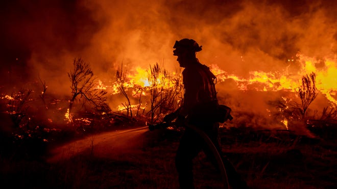
Below are 2 examples of NIXLE.com messages I would receive for any fire in the county that has any chance of spreading.

Below the messages I placed the READY - SET - GO text that shows what you should be doing massed on the current status for your area.

The Sheriff's department are really great at getting us information on just about anything that happens in the county.

I printed myself a copy READY - SET - GO information and keep it posted on a pushpin board at the back door


Advisory: CONT: The following is the current status of evacuation levels related to the Pioneer Fire in Priest River.
Dear sierra don,
Pup Paw Trail, Beaver Pond Trail, Sno-Tika Road, Snow Valley Road, and Bear Paw Road from Hwy 57 to Snow Valley Road will remain in pre-evacuation READY status.

Barrett Road, Whiski Road, West Whiski Road, Moose Crossing, Stone Johnny Road, Cuban Creek Road, and USFS 984 will remain in pre-evacuation SET status.

Saddler Creek Road, and Slippery Slope Road will remain evacuated and closed in the GO status.

Skunk Cabbage Road, Bodie Canyon Road, Kacy Bear Lane, and Mundy Lane will now be in SET status allowing residents to return immediately to their homes. Road closures on these roads will remain in effect. These roads will be open for RESIDENTS ONLY.

Advisory: US Forest Service Link: Trestle Creek Complex Information - InciWeb the Incident Information System. Read the attached flyer for READY, SET, GO information.
Dear sierra don,
US Forest Service Link: Trestle Creek Complex Information - InciWeb the Incident Information System. Read the attached flyer for READY, SET, GO information.


Use this brochure as a guide to prepare for evacuation. Evacuating your private residence is a personal decision.
It is highly recommended that you follow any evacuation orders, especially if you live in an un-defendable environment or have any family members with special needs or medical conditions.
The following are the three levels of evacuation-

READY
-At this level, a plan is in place or developed and you begin to organize any needs in order to evacuate the area if a higher risk-of-life comes.
SET
-At this level you begin doing some of the final actions before eminent threat is present.
GO
-At this level you need to evacuate the immediate area due to an eminent life threat in the area.
-
BE AWARE, BE SAFE
Fill out this section and leave attached to the primary entrance of your home. This will help emergency resources be able to contact you.

Your Contact Info
Name:____________________________________________
___________________________________________________
Physical Address of this residence:
__________________________________________________
___________________________________________________
Number of members in household: _________________
Cell phone or phone where you can be reached at in case of evacuation:
___________________________________________________ Email: ___________________________________________
Bonner County Emergency
Management
1500 Highway 2 STE 101
Sandpoint, ID 83864
208-265-8867
“Like” us on Facebook
Bonner County Sheriff
4001 N. Boyer Rd
Sandpoint, ID 83864
208-263-8417
Your family Your protection Your plan READY, SET, GO EVACUATION PLANNING

-------------------------------------------------------------------------------------------------------------------------

READY -
Aware of a threat in the area. Begin your plan
-Three day supply of water (1 gallon per day, per person)
-Three day supply of non-perishable food
-First aid kit
-Flashlight, battery powered radio and extra batteries
-Important family documents/certificates
-Medications
-Blankets/sleeping bags
-Three days of clothing
-Laptops/cell phones and chargers for
-Outerwear (coats, etc.)
-Any other valuables that can safely and quickly be loaded
Have a plan in place for any livestock, pets, or any other animals. Some evacuation centers may not allow animals (non-service)
Have a plan ready on where you will be evacuating to. Know the routes to them as they are identified.

SET -
Aware the threat is growing. Beginning to implement your plan
- Stay tuned to any local emergency notification systems
-Begin the moving of livestock to their evacuation location
-Beginning staging all necessary supplies in to one area, or load in to vehicle
-Contact any family or friends where you may going to evacuate to
-Be sure that all vehicles are fueled up and ready to go
OUTSIDE- -Clear out gutters and roofs of debris
-Remove flammables from around the exterior of the home
-Turn off any gas lines
-Continue to monitor outside developments; water around the house/structures to help your defendable space.
-Seal any venting or soffits that are potentially traps for embers
INSIDE-
-Remove flammables from the windows
-Shut all windows
-Monitor and be prepared to leave


GO -
Life threat is eminent and you are activating your full evacuation plan.
-ONCE A LEVEL 3 ORDER IS GIVEN, AND YOU ARE EVACUATING, DO NOT WAIT. TRAVELING IN A HEAVY SMOKE AREA IS EXTREMELY DANGEROUS.
-IF SENSIBLE, RUN ANY SPRINKLERS IN YOUR GREEN ZONE
-MAKE SURE THAT DOORS AND WINDOWS ARE CLOSED
-TURN ON AN EXTERIOR LIGHT AND LEAVE IT ON
When leaving the area, be sure to-
-DRIVE WITH HEADLIGHTS ON
-DRIVE SAFELY AND BE AWARE OF THE POTENTIAL OF HEAVIER TRAFFIC.
-BE AWARE OF POTENTIAL FOR MANY EMERGENCY SERVICES VEHICLE AND PERSONNEL IN THE AREA.
-BE AWARE OF ANY ROAD CLOSURES
 

Tundra Gypsy

Veteran Member
We have a home and orchard in Placerville, south of Sly Park and Pollock Pines. Stepson send photo of large billow of smoke from the Caldor Fire...kinda scary. My sister is at the house; and has her car packed and ready to go if she has to evacuate. She did this twice, when she lived in Sonoma County.

sierra don: tell your wife hell-o, and to stay safe! Shouldn't she should be retired about now and headed to Idaho??
 

EYW

Veteran Member
My niece marked herself "safe" from the Caldor Fire on the fire's FB page.

She lives in Kyburz right on 50. Hope she does not have to evacuate as she cares full-time for her severely mentally disabled adult son, and he can be a handful in stress situations.
 

Melodi

Disaster Cat
There are two basic issues going on:

1. This is probably a 20 to 250-year drought (or even longer, these droughts show up in tree rings and other historical data which goes back about 8,000 years now.

2. Before the Europeans settled, the Native Americans (who had contact with tribes who were farmers) knew that these areas just burned every so often, in fact sometimes they intentionally set backfires to encourage them (and provide them with the game and new forest growth).

Sometimes I imagine these fires burned all the way from the Sierras to the sea, but because they were more frequent there tended not to be as hot as the super-high heat and melting firestorms we see today.

A good way to look at it is that 3,000-year-old Redwood trees that need fire for some of their reproduction and had survived for thousands of years are being burned to ashes by the heat of these modern fires.

There was an attempt a couple of decades ago to just "let fires burn" in the "old way", but that failed dramatically with super-high fires burning down nearly everything in their path.
 

West

Senior
Lived in the Sly Park Hills subdivision for a year. Also lived in Pollock Pines, Camino, Placerville, and Coloma.

If the fire makes it to the West side of the Sly Park lake (Jenkins lake) then I would estimate at least 800 custom homes could go with the forest their built in?

BTW, there was a huge logging industry in the area before they killed the industry and the forest was much, much healthier.

IIRC the mill/paper plant in Camino was huge! And the access and thousands of professional forest workers use to help fight the fires. Plus healthy forest with little to no thrash on the ground, created fire suppression bigly. But back in those days we had a standing army (thousands, some with dozers) of local fire fighters that the tax payers did not pay for and they was on call 24/7.

Now days if there's a hundred fighters on this fire that are actually fighting the fire, I'm surprised.
 
Last edited:
Top