WEATHER Severe Weather the Week of April 15th

Status
Not open for further replies.

packyderms_wife

Neither here nor there.
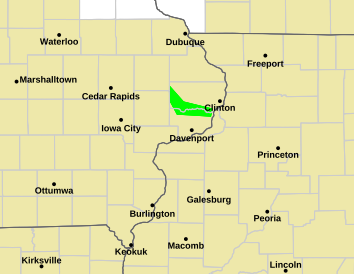
Tornado Warning
IAC031-055-061-105-113-162045-
/O.NEW.KDVN.TO.W.0011.240416T2020Z-240416T2045Z/

BULLETIN - EAS ACTIVATION REQUESTED
Tornado Warning
National Weather Service Quad Cities IA/IL
320 PM CDT Tue Apr 16 2024

The National Weather Service in the Quad Cities has issued a

* Tornado Warning for...
Northwestern Cedar County in east central Iowa...
Southwestern Dubuque County in northeastern Iowa...
Western Jones County in east central Iowa...
Southeastern Delaware County in northeastern Iowa...
Eastern Linn County in east central Iowa...

* Until 345 PM CDT.

* At 320 PM CDT, a severe thunderstorm capable of producing a tornado
was located over Martelle, or 8 miles southwest of Anamosa, moving
north at 70 mph.

HAZARD...Tornado.

SOURCE...Radar indicated rotation.

IMPACT...Flying debris will be dangerous to those caught without
shelter. Mobile homes will be damaged or destroyed.
Damage to roofs, windows, and vehicles will occur. Tree
damage is likely.

* This dangerous storm will be near...
Anamosa, Springville, Langworthy, Viola, Stone City, Wapsipinicon
State Park, and Matsell Bridge Natural Area around 325 PM CDT.
Monticello, Prairieburg, Monticello Municipal Airport, and Jones
County Fairgrounds around 330 PM CDT.
Hopkinton and Buck Creek around 335 PM CDT.
Turtle Creek Park around 340 PM CDT.

PRECAUTIONARY/PREPAREDNESS ACTIONS...

TAKE COVER NOW! Move to a basement or an interior room on the lowest
floor of a sturdy building. Avoid windows. If you are outdoors, in a
mobile home, or in a vehicle, move to the closest substantial shelter
and protect yourself from flying debris.

&&

LAT...LON 4191 9133 4193 9145 4245 9142 4238 9100
TIME...MOT...LOC 2020Z 194DEG 60KT 4200 9137

TORNADO...RADAR INDICATED
MAX HAIL SIZE...<.75 IN

$$

Gunkel
 

packyderms_wife

Neither here nor there.
Tornado Warning
IAC177-MOC045-199-162130-
/O.NEW.KDVN.TO.W.0012.240416T2039Z-240416T2130Z/

BULLETIN - EAS ACTIVATION REQUESTED
Tornado Warning
National Weather Service Quad Cities IA/IL
339 PM CDT Tue Apr 16 2024

The National Weather Service in the Quad Cities has issued a

* Tornado Warning for...
Southeastern Van Buren County in southeastern Iowa...
Scotland County in northeastern Missouri...
Northwestern Clark County in northeastern Missouri...

* Until 430 PM CDT.

* At 338 PM CDT, a severe thunderstorm capable of producing a tornado
was located near Memphis, moving northeast at 45 mph.

HAZARD...Tornado.

SOURCE...Radar indicated rotation.

IMPACT...Flying debris will be dangerous to those caught without
shelter. Mobile homes will be damaged or destroyed.
Damage to roofs, windows, and vehicles will occur. Tree
damage is likely.

* This dangerous storm will be near...
Granger, Arbela, Prospect Grove, Azen, Etna, and Brock around 345
PM CDT.
Cantril, Mount Sterling, and Heath Memorial Conservation Area
around 350 PM CDT.
Lake Sugema Campground around 355 PM CDT.

Other locations in the path of this tornadic thunderstorm include
Keosauqua, Bonaparte, Lacey Keosauqua State Park, Bentonsport/Vernon,
Farmington, Keosauqua Airport, Indian Lake Park, Anson and Van Buren
County Fairgrounds.

PRECAUTIONARY/PREPAREDNESS ACTIONS...

TAKE COVER NOW! Move to a basement or an interior room on the lowest
floor of a sturdy building. Avoid windows. If you are outdoors, in a
mobile home, or in a vehicle, move to the closest substantial shelter
and protect yourself from flying debris.

&&

LAT...LON 4083 9188 4067 9172 4060 9172 4058 9169
4056 9169 4054 9162 4051 9162 4049 9159
4030 9215 4031 9229 4040 9231
TIME...MOT...LOC 2038Z 220DEG 41KT 4041 9215

TORNADO...RADAR INDICATED
MAX HAIL SIZE...<.75 IN

$$

Gibbs
 

packyderms_wife

Neither here nor there.
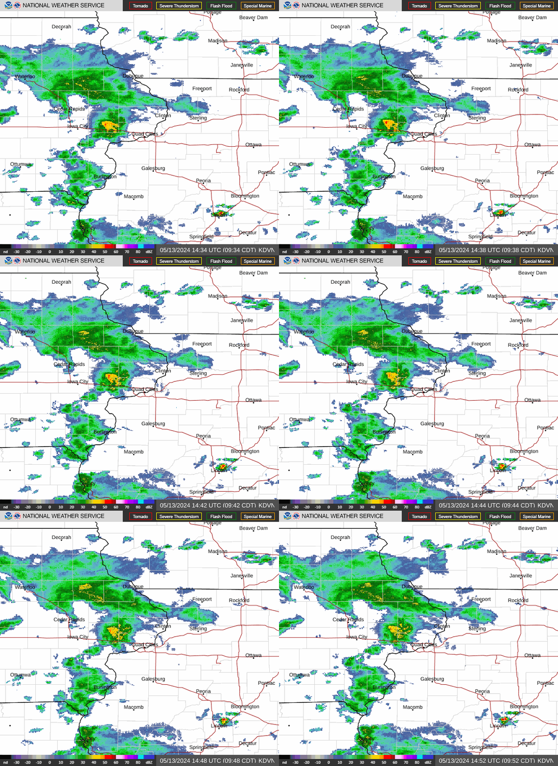
dvn.png


Iowa/Missouri/Illinois

KDVN_loop.gif
 

packyderms_wife

Neither here nor there.
Tornado Warning
IAC091-109-147-151-162130-
/O.NEW.KDMX.TO.W.0005.240416T2048Z-240416T2130Z/

BULLETIN - EAS ACTIVATION REQUESTED
Tornado Warning
National Weather Service Des Moines IA
348 PM CDT Tue Apr 16 2024

The National Weather Service in Des Moines has issued a

* Tornado Warning for...
Northeastern Pocahontas County in northwestern Iowa...
Southwestern Kossuth County in north central Iowa...
Northwestern Humboldt County in north central Iowa...
Southeastern Palo Alto County in northwestern Iowa...

* Until 430 PM CDT.

* At 347 PM CDT, a severe thunderstorm capable of producing a tornado
was located near Rolfe, or 11 miles northeast of Pocahontas, moving
north at 25 mph.

HAZARD...Tornado.

SOURCE...Weather spotters reported funnel cloud. However this
storm has a history of producing a tornado.

IMPACT...Flying debris will be dangerous to those caught without
shelter. Mobile homes will be damaged or destroyed.
Damage to roofs, windows, and vehicles will occur. Tree
damage is likely.

* This dangerous storm will be near...
West Bend around 355 PM CDT.
Rodman around 405 PM CDT.
Whittemore and Cylinder around 415 PM CDT.

Other locations impacted by this tornadic thunderstorm include
Cylinder, West Bend, Rodman, Whittemore, Plover, and Rolfe.

PRECAUTIONARY/PREPAREDNESS ACTIONS...

TAKE COVER NOW! Move to a basement or an interior room on the lowest
floor of a sturdy building. Avoid windows. If you are outdoors, in a
mobile home, or in a vehicle, move to the closest substantial shelter
and protect yourself from flying debris.

&&

LAT...LON 4282 9443 4282 9461 4311 9467 4312 9433
TIME...MOT...LOC 2047Z 184DEG 22KT 4286 9451

TORNADO...RADAR INDICATED
MAX HAIL SIZE...<.75 IN

$$

Fowle
 

packyderms_wife

Neither here nor there.
Tornado Warning
MNC105-162115-
/O.NEW.KFSD.TO.W.0010.240416T2102Z-240416T2115Z/

BULLETIN - EAS ACTIVATION REQUESTED
Tornado Warning
National Weather Service Sioux Falls SD
402 PM CDT Tue Apr 16 2024

The National Weather Service in Sioux Falls has issued a

* Tornado Warning for...
Northeastern Nobles County in southwestern Minnesota...

* Until 415 PM CDT.

* At 402 PM CDT, a severe thunderstorm capable of producing a tornado
was located near Worthington, moving north at 25 mph.

HAZARD...Tornado.

SOURCE...Radar indicated rotation.

IMPACT...Flying debris will be dangerous to those caught without
shelter. Mobile homes will be damaged or destroyed.
Damage to roofs, windows, and vehicles will occur. Tree
damage is likely.

* This tornadic thunderstorm will remain over mainly rural areas of
northeastern Nobles County.

PRECAUTIONARY/PREPAREDNESS ACTIONS...

TAKE COVER NOW! Move to a basement or an interior room on the lowest
floor of a sturdy building. Avoid windows. If you are outdoors, in a
mobile home, or in a vehicle, move to the closest substantial shelter
and protect yourself from flying debris.

&&

LAT...LON 4366 9551 4367 9576 4384 9577 4384 9550
TIME...MOT...LOC 2102Z 182DEG 24KT 4371 9565

TORNADO...RADAR INDICATED
MAX HAIL SIZE...<.75 IN

$$

SG
 

Red Baron

Paleo-Conservative
_______________
IAC087-162200-
/O.CON.KDVN.TO.W.0013.000000T0000Z-240416T2200Z/
HENRY IA-
439 PM CDT TUE APR 16 2024

...A TORNADO WARNING REMAINS IN EFFECT UNTIL 500 PM CDT FOR
SOUTHEASTERN HENRY COUNTY...

AT 439 PM CDT, A CONFIRMED TORNADO WAS LOCATED NEAR SALEM, OR NEAR
MOUNT PLEASANT, MOVING NORTHEAST AT 45 MPH.


HAZARD...DAMAGING TORNADO AND HALF DOLLAR SIZE HAIL.

SOURCE...WEATHER SPOTTERS CONFIRMED TORNADO.

IMPACT...FLYING DEBRIS WILL BE DANGEROUS TO THOSE CAUGHT WITHOUT
SHELTER. MOBILE HOMES WILL BE DAMAGED OR DESTROYED. DAMAGE
TO ROOFS, WINDOWS, AND VEHICLES WILL OCCUR. TREE DAMAGE IS
LIKELY.

THIS TORNADO WILL BE NEAR...
MOUNT PLEASANT, NEW LONDON, MOUNT PLEASANT MUNICIPAL ARPT, AND
HENRY COUNTY FAIRGROUNDS AROUND 445 PM CDT.


PRECAUTIONARY/PREPAREDNESS ACTIONS...

TO REPEAT, A TORNADO IS ON THE GROUND. TAKE COVER NOW! MOVE TO A
BASEMENT OR AN INTERIOR ROOM ON THE LOWEST FLOOR OF A STURDY
BUILDING. AVOID WINDOWS. IF YOU ARE OUTDOORS, IN A MOBILE HOME, OR IN
A VEHICLE, MOVE TO THE CLOSEST SUBSTANTIAL SHELTER AND PROTECT
YOURSELF FROM FLYING DEBRIS.

THIS STORM HAS A HISTORY OF PRODUCING TORNADOES. SEEK SHELTER NOW!

TORRENTIAL RAINFALL IS OCCURRING WITH THIS STORM, AND MAY LEAD TO
FLASH FLOODING. DO NOT DRIVE YOUR VEHICLE THROUGH FLOODED ROADWAYS.
 

Red Baron

Paleo-Conservative
_______________
BULLETIN - EAS ACTIVATION REQUESTED
TORNADO WARNING
NATIONAL WEATHER SERVICE QUAD CITIES IA/IL
451 PM CDT TUE APR 16 2024

THE NATIONAL WEATHER SERVICE IN THE QUAD CITIES HAS ISSUED A

* TORNADO WARNING FOR...
SOUTHEASTERN HENRY COUNTY IN SOUTHEASTERN IOWA...
NORTHERN DES MOINES COUNTY IN SOUTHEASTERN IOWA...
SOUTHEASTERN LOUISA COUNTY IN SOUTHEASTERN IOWA...

* UNTIL 530 PM CDT.

* AT 450 PM CDT, A CONFIRMED TORNADO WAS LOCATED OVER NEW LONDON, OR
NEAR MOUNT PLEASANT, MOVING NORTHEAST AT 45 MPH.

HAZARD...DAMAGING TORNADO AND HALF DOLLAR SIZE HAIL.

SOURCE...WEATHER SPOTTERS CONFIRMED TORNADO.

IMPACT...FLYING DEBRIS WILL BE DANGEROUS TO THOSE CAUGHT WITHOUT
SHELTER. MOBILE HOMES WILL BE DAMAGED OR DESTROYED.
DAMAGE TO ROOFS, WINDOWS, AND VEHICLES WILL OCCUR. TREE
DAMAGE IS LIKELY.

* THE TORNADO WILL BE NEAR...
MOUNT UNION, PLEASANT GROVE, YARMOUTH, AND BIG HOLLOW RECREATION
AREA AROUND 455 PM CDT.
MEDIAPOLIS, MORNING SUN, GARLAND, DODGEVILLE, AND MARSH AROUND 500
PM CDT.
AMBER, KOSSUTH, ELRICK JUNCTION, AND NORTHFIELD AROUND 505 PM CDT.
WAPELLO AND OAKVILLE AROUND 510 PM CDT.

OTHER LOCATIONS IN THE PATH OF THIS TORNADIC THUNDERSTORM INCLUDE NEW
BOSTON, TOOLESBORO AND SNIVELY ACCESS CAMPGROUND.

PRECAUTIONARY/PREPAREDNESS ACTIONS...

TO REPEAT, A TORNADO IS ON THE GROUND. TAKE COVER NOW! MOVE TO A
BASEMENT OR AN INTERIOR ROOM ON THE LOWEST FLOOR OF A STURDY
BUILDING. AVOID WINDOWS. IF YOU ARE OUTDOORS, IN A MOBILE HOME, OR IN
A VEHICLE, MOVE TO THE CLOSEST SUBSTANTIAL SHELTER AND PROTECT
YOURSELF FROM FLYING DEBRIS.

THIS STORM HAS A HISTORY OF PRODUCING TORNADOES. FOR YOUR SAFETY,
SEEK SHELTER NOW
 

packyderms_wife

Neither here nor there.
Tornado Warning
IAC057-087-115-162230-
/O.NEW.KDVN.TO.W.0016.240416T2151Z-240416T2230Z/

BULLETIN - EAS ACTIVATION REQUESTED
Tornado Warning
National Weather Service Quad Cities IA/IL
451 PM CDT Tue Apr 16 2024

The National Weather Service in the Quad Cities has issued a

* Tornado Warning for...
Southeastern Henry County in southeastern Iowa...
Northern Des Moines County in southeastern Iowa...
Southeastern Louisa County in southeastern Iowa...

* Until 530 PM CDT.

* At 450 PM CDT, a confirmed tornado was located over New London, or
near Mount Pleasant, moving northeast at 45 mph.

HAZARD...Damaging tornado and half dollar size hail.

SOURCE...Weather spotters confirmed tornado.

IMPACT...Flying debris will be dangerous to those caught without
shelter. Mobile homes will be damaged or destroyed.
Damage to roofs, windows, and vehicles will occur. Tree
damage is likely.

* The tornado will be near...
Mount Union, Pleasant Grove, Yarmouth, and Big Hollow Recreation
Area around 455 PM CDT.
Mediapolis, Morning Sun, Garland, Dodgeville, and Marsh around 500
PM CDT.
Amber, Kossuth, Elrick Junction, and Northfield around 505 PM CDT.
Wapello and Oakville around 510 PM CDT.

Other locations in the path of this tornadic thunderstorm include New
Boston, Toolesboro and Snively Access Campground.

PRECAUTIONARY/PREPAREDNESS ACTIONS...

To repeat, a tornado is on the ground. TAKE COVER NOW! Move to a
basement or an interior room on the lowest floor of a sturdy
building. Avoid windows. If you are outdoors, in a mobile home, or in
a vehicle, move to the closest substantial shelter and protect
yourself from flying debris.

This storm has a history of producing tornadoes. For your safety,
seek shelter now!

&&

LAT...LON 4125 9120 4124 9111 4121 9107 4117 9104
4116 9103 4117 9101 4116 9099 4110 9095
4107 9095 4105 9094 4101 9095 4086 9145
4094 9153
TIME...MOT...LOC 2150Z 229DEG 37KT 4094 9142

TORNADO...OBSERVED
MAX HAIL SIZE...1.25 IN

$$

Gibbs
 

packyderms_wife

Neither here nor there.
Tornado Warning
ILC067-071-IAC057-111-MOC045-162245-
/O.NEW.KDVN.TO.W.0017.240416T2154Z-240416T2245Z/

BULLETIN - EAS ACTIVATION REQUESTED
Tornado Warning
National Weather Service Quad Cities IA/IL
454 PM CDT Tue Apr 16 2024

The National Weather Service in the Quad Cities has issued a

* Tornado Warning for...
Northern Hancock County in west central Illinois...
Southwestern Henderson County in west central Illinois...
Southwestern Des Moines County in southeastern Iowa...
Lee County in southeastern Iowa...
Central Clark County in northeastern Missouri...

* Until 545 PM CDT.

* At 454 PM CDT, a severe thunderstorm capable of producing a tornado
was located over Argyle, or 10 miles west of Nauvoo, moving
northeast at 40 mph.

HAZARD...Tornado and quarter size hail.

SOURCE...Radar indicated rotation.

IMPACT...Flying debris will be dangerous to those caught without
shelter. Mobile homes will be damaged or destroyed.
Damage to roofs, windows, and vehicles will occur. Tree
damage is likely.

* This dangerous storm will be near...
Fort Madison, Nauvoo, Donnellson, Montrose, Franklin, New Boston,
Summitville, Bluff Park, Galland, and Nauvoo State Park around 500
PM CDT.
West Point, Niota, Sawyer, Fort Madison Municipal Arpt, and
Pollmiller Park around 505 PM CDT.
Pontoosuc around 510 PM CDT.

Other locations in the path of this tornadic thunderstorm include
Dallas City, Denmark, Augusta, Wever, Welter Recreation Area, Iowa
Army Ammunition Plant, Spring Grove, Camp L-Kee-Ta, Burlington, West
Burlington, Middletown, Lomax, Burlington Regional Airport, Des
Moines County Fairgrounds, Starr`s Cave Park and Preserve and
Beaverdale.

PRECAUTIONARY/PREPAREDNESS ACTIONS...

TAKE COVER NOW! Move to a basement or an interior room on the lowest
floor of a sturdy building. Avoid windows. If you are outdoors, in a
mobile home, or in a vehicle, move to the closest substantial shelter
and protect yourself from flying debris.

&&

LAT...LON 4033 9168 4057 9177 4092 9113 4053 9102
TIME...MOT...LOC 2154Z 237DEG 35KT 4054 9158

TORNADO...RADAR INDICATED
MAX HAIL SIZE...1.00 IN

$$

Uttech
 

pauldingbabe

The Great Cat
Map at #14 is auto updating.

This system is curling back around from the west and looks like some peeps may get a second round.


All that warm air out of the gulf is holding that storm.

Ocean temps are a bit high for this time of year. Thanks God there isn't a TS in the gulf right now. Houston would suck that TS up like a spaghetti noodle.
 

packyderms_wife

Neither here nor there.
View: https://www.youtube.com/watch?v=vNWYURU7jRg


LIVE STREAM - Max Velocity

BREAKING Tornado Warning Coverage - Tornadoes Possible - With Live Storm Chase​


In this live stream, we are breaking down upcoming severe weather in the United States. This severe weather event could bring significant damaging winds, large hail, and tornadoes. This is a live weather channel
 

packyderms_wife

Neither here nor there.
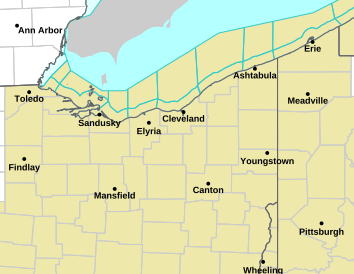
Tornado Warning
OHC033-101-117-172100-
/O.NEW.KCLE.TO.W.0010.240417T2017Z-240417T2100Z/

BULLETIN - EAS ACTIVATION REQUESTED
Tornado Warning
National Weather Service Cleveland OH
417 PM EDT Wed Apr 17 2024

The National Weather Service in Cleveland has issued a

* Tornado Warning for...
Eastern Marion County in north central Ohio...
Morrow County in north central Ohio...
Southeastern Crawford County in north central Ohio...

* Until 500 PM EDT.

* At 417 PM EDT, a severe thunderstorm capable of producing a tornado
was located near Mount Gilead, moving east at 50 mph.

HAZARD...Tornado and quarter size hail.

SOURCE...Radar indicated rotation.

IMPACT...Flying debris will be dangerous to those caught without
shelter. Mobile homes will be damaged or destroyed.
Damage to roofs, windows, and vehicles will occur. Tree
damage is likely.

* This dangerous storm will be near...
Mount Gilead around 420 PM EDT.

Other locations impacted by this tornadic thunderstorm include
Iberia, Shauck, Edison, Caledonia, and Fulton.

PRECAUTIONARY/PREPAREDNESS ACTIONS...

TAKE COVER NOW! Move to a basement or an interior room on the lowest
floor of a sturdy building. Avoid windows. If you are outdoors, in a
mobile home, or in a vehicle, move to the closest substantial shelter
and protect yourself from flying debris.

&&

LAT...LON 4047 8307 4068 8306 4077 8300 4079 8272
4071 8273 4071 8262 4067 8262 4067 8265
4064 8264 4063 8262 4055 8262 4055 8264
4046 8264
TIME...MOT...LOC 2017Z 255DEG 44KT 4057 8290

TORNADO...RADAR INDICATED
MAX HAIL SIZE...1.00 IN

$$

Jaszka
 

packyderms_wife

Neither here nor there.
Tornado Warning
OHC021-097-159-172045-
/O.NEW.KILN.TO.W.0035.240417T2021Z-240417T2045Z/

BULLETIN - EAS ACTIVATION REQUESTED
Tornado Warning
National Weather Service Wilmington OH
421 PM EDT Wed Apr 17 2024

The National Weather Service in Wilmington has issued a

* Tornado Warning for...
East central Champaign County in west central Ohio...
Southern Union County in central Ohio...
Northeastern Madison County in central Ohio...

* Until 445 PM EDT.

* At 421 PM EDT, a severe thunderstorm capable of producing a tornado
was located near Mechanicsburg, moving east at 40 mph.

HAZARD...Tornado.

SOURCE...Radar indicated rotation.

IMPACT...Flying debris will be dangerous to those caught without
shelter. Mobile homes will be damaged or destroyed.
Damage to roofs, windows, and vehicles will occur. Tree
damage is likely.

* Locations impacted include...
Marysville, Plain City, Mechanicsburg, New California, Milford
Center, Woodstock, Unionville Center, Cable, Amity, Rosedale, State
Route 4 at State Route 161, Chuckery, and New Dover.

PRECAUTIONARY/PREPAREDNESS ACTIONS...

TAKE COVER NOW! Move to a basement or an interior room on the lowest
floor of a sturdy building. Avoid windows. If you are outdoors, in a
mobile home, or in a vehicle, move to the closest substantial shelter
and protect yourself from flying debris.

To report severe weather, go to our website at weather.gov/iln and
submit your report via social media, when you can do so safely.

&&

LAT...LON 4009 8368 4017 8367 4027 8325 4005 8325
TIME...MOT...LOC 2021Z 268DEG 35KT 4013 8364

TORNADO...RADAR INDICATED
MAX HAIL SIZE...0.00 IN

$$

McGinnis
 

packyderms_wife

Neither here nor there.
Tornado Warning
ILC061-117-182230-
/O.NEW.KLSX.TO.W.0028.240418T2201Z-240418T2230Z/

BULLETIN - EAS ACTIVATION REQUESTED
Tornado Warning
National Weather Service St Louis MO
501 PM CDT Thu Apr 18 2024

The National Weather Service in St Louis has issued a

* Tornado Warning for...
East central Greene County in southwestern Illinois...
Northwestern Macoupin County in southwestern Illinois...

* Until 530 PM CDT.

* At 501 PM CDT, a confirmed tornado was located near Athensville,
moving east at 30 mph.

HAZARD...Damaging tornado.

SOURCE...Weather spotters confirmed tornado.

IMPACT...Flying debris will be dangerous to those caught without
shelter. Mobile homes will be damaged or destroyed.
Damage to roofs, windows, and vehicles will occur. Tree
damage is likely.

* The tornado will be near...
Palmyra around 510 PM CDT.

PRECAUTIONARY/PREPAREDNESS ACTIONS...

To repeat, a tornado is on the ground. TAKE COVER NOW! Move to a
basement or an interior room on the lowest floor of a sturdy
building. Avoid windows. If you are outdoors, in a mobile home, or in
a vehicle, move to the closest substantial shelter and protect
yourself from flying debris.

&&

LAT...LON 3937 9021 3945 9021 3948 8990 3934 8990
TIME...MOT...LOC 2201Z 270DEG 26KT 3941 9015

TORNADO...OBSERVED
MAX HAIL SIZE...<.75 IN

$$

Pfahler
 

packyderms_wife

Neither here nor there.
Tornado Warning
ILC061-083-182230-
/O.NEW.KLSX.TO.W.0029.240418T2207Z-240418T2230Z/

BULLETIN - EAS ACTIVATION REQUESTED
Tornado Warning
National Weather Service St Louis MO
507 PM CDT Thu Apr 18 2024

The National Weather Service in St Louis has issued a

* Tornado Warning for...
Southwestern Greene County in southwestern Illinois...
Northwestern Jersey County in southwestern Illinois...

* Until 530 PM CDT.

* At 506 PM CDT, a severe thunderstorm capable of producing a tornado
was located near Old Kane, moving east at 25 mph.

HAZARD...Tornado and half dollar size hail.

SOURCE...Radar indicated rotation.

IMPACT...Flying debris will be dangerous to those caught without
shelter. Mobile homes will be damaged or destroyed.
Damage to roofs, windows, and vehicles will occur. Tree
damage is likely.

* This dangerous storm will be near...
Old Kane around 510 PM CDT.

PRECAUTIONARY/PREPAREDNESS ACTIONS...

TAKE COVER NOW! Move to a basement or an interior room on the lowest
floor of a sturdy building. Avoid windows. If you are outdoors, in a
mobile home, or in a vehicle, move to the closest substantial shelter
and protect yourself from flying debris.

&&

LAT...LON 3917 9051 3926 9052 3930 9028 3914 9027
TIME...MOT...LOC 2206Z 270DEG 23KT 3921 9048

TORNADO...RADAR INDICATED
MAX HAIL SIZE...1.25 IN

$$

Pfahler
 

packyderms_wife

Neither here nor there.
Tornado Warning
MSC125-163-182300-
/O.NEW.KJAN.TO.W.0014.240418T2213Z-240418T2300Z/

BULLETIN - EAS ACTIVATION REQUESTED
Tornado Warning
National Weather Service Jackson MS
513 PM CDT Thu Apr 18 2024

The National Weather Service in Jackson has issued a

* Tornado Warning for...
Southwestern Yazoo County in central Mississippi...
Southern Sharkey County in west central Mississippi...

* Until 600 PM CDT.

* At 513 PM CDT, a severe thunderstorm capable of producing a tornado
was located near Onward, or 11 miles south of Rolling Fork, moving
east at 30 mph.

HAZARD...Tornado.

SOURCE...Radar indicated rotation.

IMPACT...Flying debris will be dangerous to those caught without
shelter. Mobile homes will be damaged or destroyed.
Damage to roofs, windows, and vehicles will occur. Tree
damage is likely.

* This dangerous storm will be near...
Holly Bluff around 520 PM CDT.

PRECAUTIONARY/PREPAREDNESS ACTIONS...

TAKE COVER NOW! Move to a basement or an interior room on the lowest
floor of a sturdy building. Avoid windows. If you are outdoors, in a
mobile home, or in a vehicle, move to the closest substantial shelter
and protect yourself from flying debris.

&&

LAT...LON 3273 9093 3286 9087 3283 9050 3262 9056
TIME...MOT...LOC 2213Z 281DEG 25KT 3275 9086

TORNADO...RADAR INDICATED
MAX HAIL SIZE...<.75 IN

$$

86
 

packyderms_wife

Neither here nor there.
Tornado Warning
ILC117-182300-
/O.NEW.KLSX.TO.W.0030.240418T2226Z-240418T2300Z/

BULLETIN - EAS ACTIVATION REQUESTED
Tornado Warning
National Weather Service St Louis MO
526 PM CDT Thu Apr 18 2024

The National Weather Service in St Louis has issued a

* Tornado Warning for...
Northeastern Macoupin County in southwestern Illinois...

* Until 600 PM CDT.

* At 526 PM CDT, a severe thunderstorm capable of producing a tornado
was located near Palmyra, moving east at 25 mph.

HAZARD...Tornado and half dollar size hail.

SOURCE...Radar indicated rotation.

IMPACT...Flying debris will be dangerous to those caught without
shelter. Mobile homes will be damaged or destroyed.
Damage to roofs, windows, and vehicles will occur. Tree
damage is likely.

* This tornadic thunderstorm will remain over mainly rural areas of
northeastern Macoupin County, including the following locations...
Nilwood, Hettick, and Standard City.

PRECAUTIONARY/PREPAREDNESS ACTIONS...

TAKE COVER NOW! Move to a basement or an interior room on the lowest
floor of a sturdy building. Avoid windows. If you are outdoors, in a
mobile home, or in a vehicle, move to the closest substantial shelter
and protect yourself from flying debris.

&&

LAT...LON 3932 9005 3943 9005 3946 8979 3928 8978
TIME...MOT...LOC 2226Z 271DEG 21KT 3937 8998

TORNADO...RADAR INDICATED
MAX HAIL SIZE...1.25 IN

$$

Pfahler
 

packyderms_wife

Neither here nor there.
Tornado Warning
ILC133-163-MOC510-182330-
/O.NEW.KLSX.TO.W.0035.240418T2249Z-240418T2330Z/

BULLETIN - EAS ACTIVATION REQUESTED
Tornado Warning
National Weather Service St Louis MO
549 PM CDT Thu Apr 18 2024

The National Weather Service in St Louis has issued a

* Tornado Warning for...
Northwestern Monroe County in southwestern Illinois...
Northwestern St. Clair County in southwestern Illinois...
Southern St. Louis City in east central Missouri...

* Until 630 PM CDT.

* At 549 PM CDT, a severe thunderstorm capable of producing a tornado
was located over Sappington, moving east at 30 mph.

HAZARD...Tornado.

SOURCE...Radar indicated rotation.

IMPACT...Flying debris will be dangerous to those caught without
shelter. Mobile homes will be damaged or destroyed.
Damage to roofs, windows, and vehicles will occur. Tree
damage is likely.

* This dangerous storm will be near...
St. Louis and East Carondelet around 555 PM CDT.
Cahokia, Columbia, and Dupo around 600 PM CDT.
Cahokia Parks Airport around 605 PM CDT.

Other locations in the path of this tornadic thunderstorm include
East St. Louis, Centreville, Belleville, Alorton, Fairview Heights,
Caseyville and Washington Park.

This also includes Scott Joplin Historic Site.

This includes Interstate 64 in Illinois near exit 9.

PRECAUTIONARY/PREPAREDNESS ACTIONS...

TAKE COVER NOW! Move to a basement or an interior room on the lowest
floor of a sturdy building. Avoid windows. If you are outdoors, in a
mobile home, or in a vehicle, move to the closest substantial shelter
and protect yourself from flying debris.

&&

LAT...LON 3840 8999 3838 9035 3840 9034 3842 9030
3844 9029 3853 9026 3854 9027 3855 9027
3858 9031 3866 9018 3866 9000
TIME...MOT...LOC 2249Z 261DEG 25KT 3852 9038

TORNADO...RADAR INDICATED
MAX HAIL SIZE...<.75 IN

$$
 

packyderms_wife

Neither here nor there.
Tornado Warning
ILC117-135-182330-
/O.NEW.KLSX.TO.W.0033.240418T2245Z-240418T2330Z/

BULLETIN - EAS ACTIVATION REQUESTED
Tornado Warning
National Weather Service St Louis MO
545 PM CDT Thu Apr 18 2024

The National Weather Service in St Louis has issued a

* Tornado Warning for...
Northeastern Macoupin County in southwestern Illinois...
Northwestern Montgomery County in south central Illinois...

* Until 630 PM CDT.

* At 543 PM CDT, a severe thunderstorm capable of producing a tornado
was located near Carlinville, moving east at 25 mph.

HAZARD...Tornado and quarter size hail.

SOURCE...Radar indicated rotation.

IMPACT...Flying debris will be dangerous to those caught without
shelter. Mobile homes will be damaged or destroyed.
Damage to roofs, windows, and vehicles will occur. Tree
damage is likely.

* This dangerous storm will be near...
Raymond around 600 PM CDT.

This includes Interstate 55 in Illinois between exits 60 and 63.

PRECAUTIONARY/PREPAREDNESS ACTIONS...

TAKE COVER NOW! Move to a basement or an interior room on the lowest
floor of a sturdy building. Avoid windows. If you are outdoors, in a
mobile home, or in a vehicle, move to the closest substantial shelter
and protect yourself from flying debris.

&&

LAT...LON 3922 8948 3928 8982 3942 8983 3944 8953
3935 8953 3935 8947
TIME...MOT...LOC 2243Z 275DEG 23KT 3933 8982

TORNADO...RADAR INDICATED
MAX HAIL SIZE...1.00 IN

$$

Pfahler
 

packyderms_wife

Neither here nor there.
Tornado Warning
ILC119-182330-
/O.NEW.KLSX.TO.W.0034.240418T2245Z-240418T2330Z/

BULLETIN - EAS ACTIVATION REQUESTED
Tornado Warning
National Weather Service St Louis MO
545 PM CDT Thu Apr 18 2024

The National Weather Service in St Louis has issued a

* Tornado Warning for...
Southwestern Madison County in southwestern Illinois...

* Until 630 PM CDT.

* At 545 PM CDT, a severe thunderstorm capable of producing a tornado
was located over Granite City, moving east at 30 mph.

HAZARD...Tornado.

SOURCE...Radar indicated rotation.

IMPACT...Flying debris will be dangerous to those caught without
shelter. Mobile homes will be damaged or destroyed.
Damage to roofs, windows, and vehicles will occur. Tree
damage is likely.

* This dangerous storm will be near...
Granite City, Edwardsville, Pontoon Beach, and Madison around 550
PM CDT.
Collinsville, Glen Carbon, Maryville, and South Roxana around 555
PM CDT.
Troy around 605 PM CDT.

This also includes Horseshoe Lake State Park.

This includes the following highways...
Interstate 70 in Illinois near exit 21.
Interstate 55 in Illinois near exit 23.

PRECAUTIONARY/PREPAREDNESS ACTIONS...

TAKE COVER NOW! Move to a basement or an interior room on the lowest
floor of a sturdy building. Avoid windows. If you are outdoors, in a
mobile home, or in a vehicle, move to the closest substantial shelter
and protect yourself from flying debris.

&&

LAT...LON 3866 8976 3866 9018 3872 9021 3873 9021
3875 9018 3877 9017 3880 9012 3882 9011
3889 8983
TIME...MOT...LOC 2245Z 261DEG 25KT 3873 9017

TORNADO...RADAR INDICATED
MAX HAIL SIZE...<.75 IN

$$

CVKING
 

packyderms_wife

Neither here nor there.
Mississippi

Severe Thunderstorm Warning
MSC089-163-190000-
/O.NEW.KJAN.SV.W.0108.240418T2257Z-240419T0000Z/

BULLETIN - IMMEDIATE BROADCAST REQUESTED
Severe Thunderstorm Warning
National Weather Service Jackson MS
557 PM CDT Thu Apr 18 2024

The National Weather Service in Jackson has issued a

* Severe Thunderstorm Warning for...
Southwestern Yazoo County in central Mississippi...
Southwestern Madison County in central Mississippi...

* Until 700 PM CDT.

* At 557 PM CDT, a severe thunderstorm was located over Satartia, or
16 miles southwest of Yazoo City, moving east at 30 mph.

HAZARD...Golf ball size hail and 60 mph wind gusts.

SOURCE...Radar indicated.

IMPACT...People and animals outdoors will be injured. Expect hail
damage to roofs, siding, windows, and vehicles. Expect
wind damage to roofs, siding, and trees.

* This severe thunderstorm will be near...
Bentonia and Tinsley around 605 PM CDT.
Little Yazoo around 610 PM CDT.
Flora around 615 PM CDT.

PRECAUTIONARY/PREPAREDNESS ACTIONS...

For your protection move to an interior room on the lowest floor of a
building.

&&

LAT...LON 3275 9057 3279 9043 3272 9015 3249 9025
3249 9027 3263 9066
TIME...MOT...LOC 2257Z 290DEG 24KT 3265 9055

THUNDERSTORM DAMAGE THREAT...CONSIDERABLE
HAIL THREAT...RADAR INDICATED
MAX HAIL SIZE...1.75 IN
WIND THREAT...RADAR INDICATED
MAX WIND GUST...60 MPH

$$

86
 

packyderms_wife

Neither here nor there.
Tornado Warning
ILC117-182330-
/O.NEW.KLSX.TO.W.0037.240418T2259Z-240418T2330Z/

BULLETIN - EAS ACTIVATION REQUESTED
Tornado Warning
National Weather Service St Louis MO
559 PM CDT Thu Apr 18 2024

The National Weather Service in St Louis has issued a

* Tornado Warning for...
Southeastern Macoupin County in southwestern Illinois...

* Until 630 PM CDT.

* At 559 PM CDT, a severe thunderstorm capable of producing a tornado
was located near Carlinville, moving east at 35 mph.

HAZARD...Tornado.

SOURCE...Radar indicated rotation.

IMPACT...Flying debris will be dangerous to those caught without
shelter. Mobile homes will be damaged or destroyed.
Damage to roofs, windows, and vehicles will occur. Tree
damage is likely.

* This dangerous storm will be near...
Carlinville around 605 PM CDT.

This also includes Beaver Dam State Park.

This includes Interstate 55 in Illinois near exit 44.

PRECAUTIONARY/PREPAREDNESS ACTIONS...

TAKE COVER NOW! Move to a basement or an interior room on the lowest
floor of a sturdy building. Avoid windows. If you are outdoors, in a
mobile home, or in a vehicle, move to the closest substantial shelter
and protect yourself from flying debris.

&&

LAT...LON 3902 9007 3917 8999 3926 9003 3931 8970
3907 8970
TIME...MOT...LOC 2259Z 266DEG 30KT 3921 8992

TORNADO...RADAR INDICATED
MAX HAIL SIZE...<.75 IN

$$

Pfahler
 

Cowgirl4christ

Senior Member
We just got pummeled by hail storm and nearby tornado in Elsberry, MO. My car was totaled about 4 weeks ago from a massive hailstorm that came through St Charles County MO. That tornado missed my workplace by a mile. I just got a new car and then we got this hailstorm today. Didn’t hurt my little Toyota at all.

The tornado was closer to my daughter. They are in a mobile home and were all crowded into a bathroom. She is fine.

It was crazy watching Reed Timmer drive through our town and straight down the two lane road we drive every day.
 

packyderms_wife

Neither here nor there.
Tornado Warning
ILC005-027-119-163-189-190015-
/O.NEW.KLSX.TO.W.0038.240418T2310Z-240419T0015Z/

BULLETIN - EAS ACTIVATION REQUESTED
Tornado Warning
National Weather Service St Louis MO
610 PM CDT Thu Apr 18 2024

The National Weather Service in St Louis has issued a

* Tornado Warning for...
Clinton County in south central Illinois...
Bond County in south central Illinois...
Eastern Madison County in southwestern Illinois...
Northern Washington County in south central Illinois...
Northeastern St. Clair County in southwestern Illinois...

* Until 715 PM CDT.

* At 610 PM CDT, severe thunderstorms capable of producing both
tornadoes and extensive straight line wind damage were located
along a line extending from Livingston to near O`Fallon to near
Millstadt, moving east at 45 mph.

HAZARD...Tornado.

SOURCE...Radar indicated rotation.

IMPACT...Flying debris will be dangerous to those caught without
shelter. Mobile homes will be damaged or destroyed.
Damage to roofs, windows, and vehicles will occur. Tree
damage is likely.

* These dangerous storms will be near...
Belleville, O`Fallon, Swansea, Shiloh, Highland, Mascoutah,
Lebanon, Freeburg, Scott AFB, and Smithton around 615 PM CDT.
Trenton and Sorento around 620 PM CDT.
New Baden, Aviston, Pocahontas, and Reno around 625 PM CDT.
St. Rose, Albers, Jamestown, and New Memphis around 630 PM CDT.

Other locations in the path of these tornadic storms include
Greenville, Breese, Germantown, Woburn, Okawville, Beckemeyer, Beaver
Creek, Carlyle, Mulberry Grove, Tamalco and Boulder.

This also includes Carlyle Lake Recreational Area.

This includes the following highways...
Interstate 70 in Illinois between exits 24 and 52.
Interstate 64 in Illinois between exits 12 and 41.

PRECAUTIONARY/PREPAREDNESS ACTIONS...

TAKE COVER NOW! Move to a basement or an interior room on the lowest
floor of a sturdy building. Avoid windows. If you are outdoors, in a
mobile home, or in a vehicle, move to the closest substantial shelter
and protect yourself from flying debris.

&&

LAT...LON 3839 8915 3840 8999 3865 9001 3865 8976
3889 8983 3892 8971 3900 8970 3900 8959
3903 8959 3903 8925 3898 8926 3874 8925
3874 8914
TIME...MOT...LOC 2310Z 265DEG 39KT 3899 8977 3863 8992 3844 9006

TORNADO...RADAR INDICATED
MAX HAIL SIZE...<.75 IN

$$

CVKING
 
Status
Not open for further replies.
Top