WEATHER Tropical weather

Bridey Rose

Veteran Member
All I got here in NEPA was Debby's tail, but it still rained harder and longer than I've seen this Summer and flooded my basement worse than I've ever had it flood before. Thank God the drains in the basement floor were gulping the excess water, but I'm still afraid to go down there and see the aftermath! Cardboard boxes and water do not mix. No wonder Mom had almost everything down there on pallets.

And I was surprised to learn that the humidity from Debby was so high it started to MELT my Himalayan salt lamps. I noticed they were both in a puddle of dried-up formerly melted salt when I headed out the front door to church this morning.

BAD Debby!
 

Millwright

Knuckle Dragger
_______________
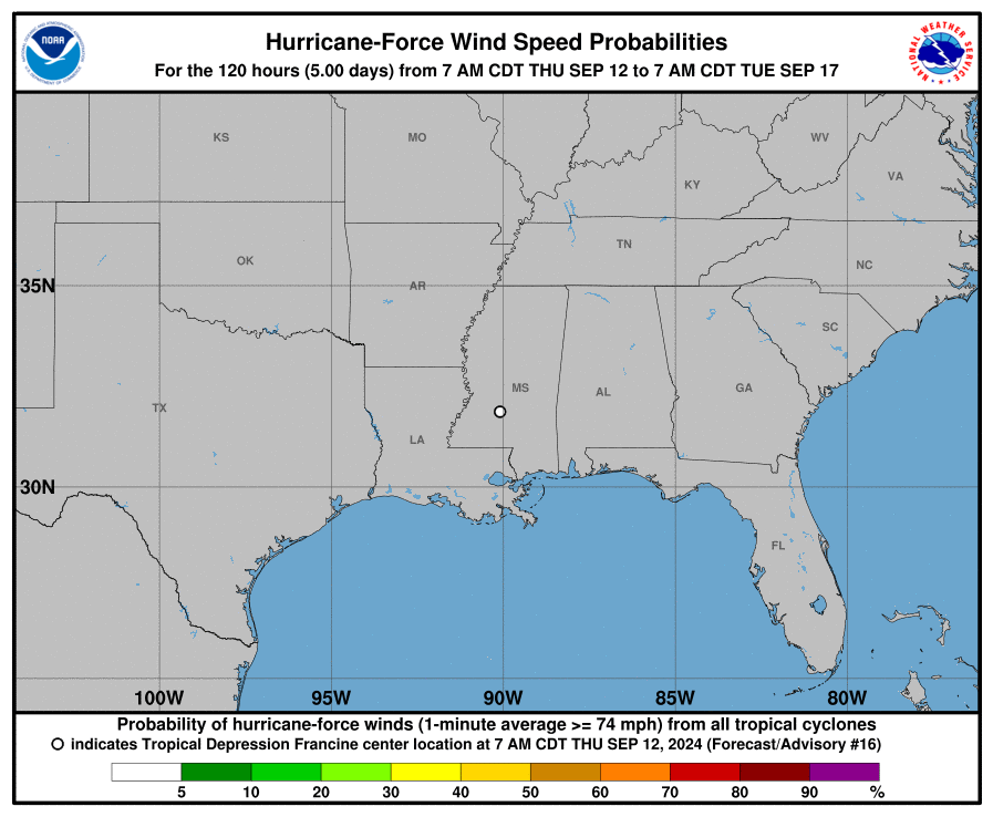
222953_5day_cone_with_line_and_wind.png
 

Millwright

Knuckle Dragger
_______________
...TROPICAL WAVES...

The axis of an eastern Atlantic tropical wave is along 32W-33W
from 05N to 19N, moving west at 5 to 10 kt. No significant
convection accompanies this wave.

A central Atlantic tropical wave is along 47W from 06N to 16N,
moving west at 15 to 20 kt. Scattered moderate to strong
convection is depicted from 08.5N to 13N between 45W to 53W.
Recent ASCAT pass revealed fresh to localized strong cyclonic
winds with this wave.

...MONSOON TROUGH/ITCZ...

The monsoon trough enters the Atlantic off the coast of Africa
near 21N17W and extends 15N23W to 11N54W. Scattered to numerous
moderate to strong convention is noted from 04.5N to 11N between
22W and the coast of Africa.


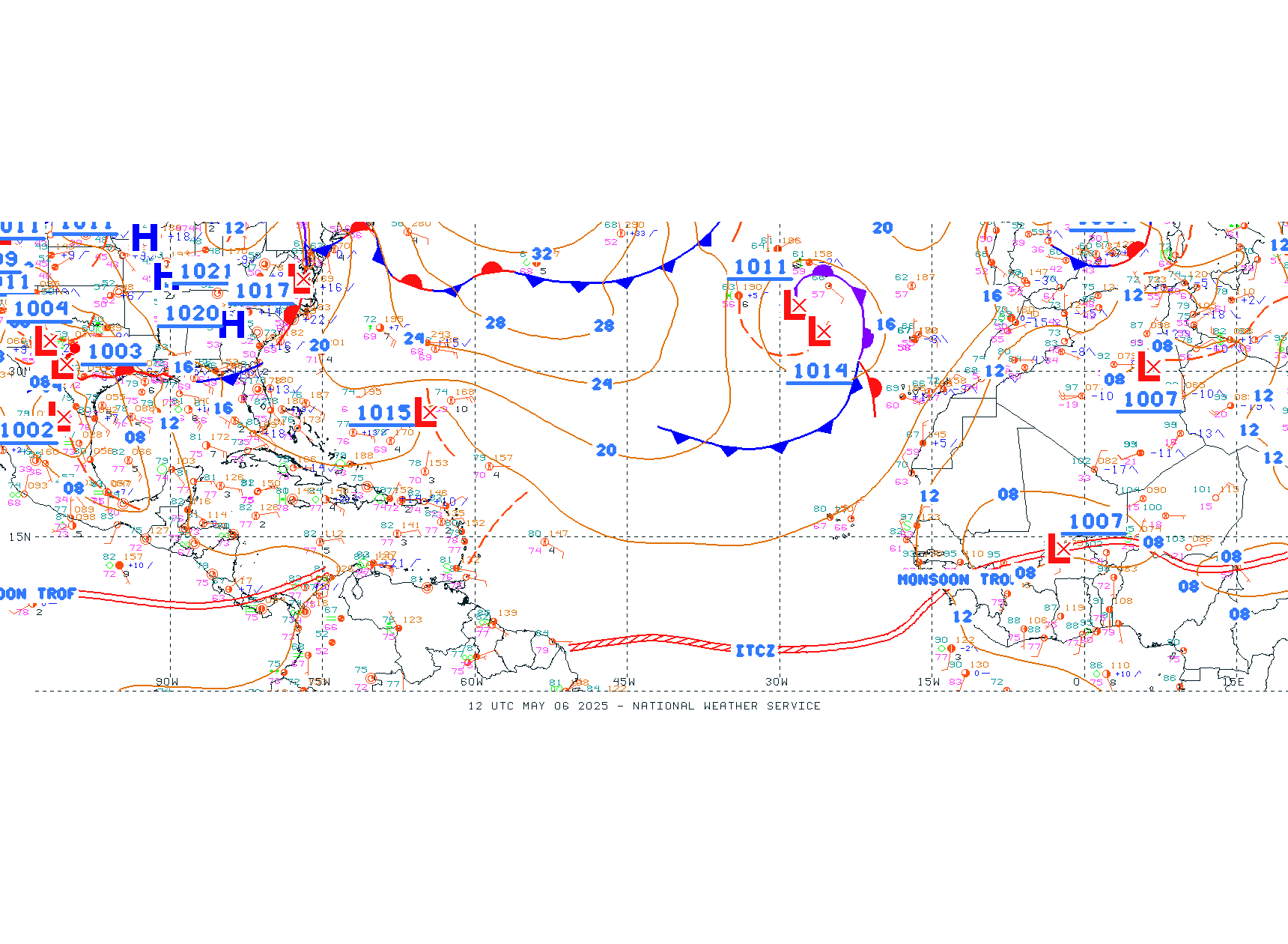
Atl_Tropics.gif


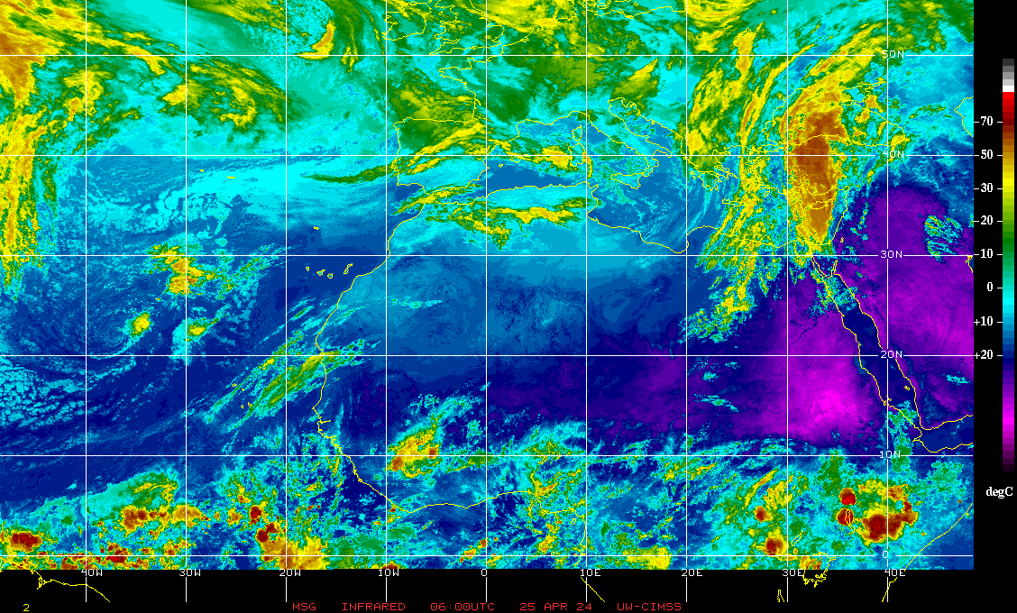
irnm7.GIF
 

packyderms_wife

Neither here nor there.
TTAA00 PHFO DDHHMM

Tropical Weather Outlook
NWS Central Pacific Hurricane Center Honolulu HI
800 AM HST Sun Aug 25 2024

For the central North Pacific...between 140W and 180W:

Active Systems:
The Central Pacific Hurricane Center in Honolulu, Hawaii is issuing
advisories on Hurricane Hone. This system is located about 100
miles southwest of Hilo, Hawaii, or about 250 miles south southeast
of Honolulu, Hawaii, moving west around 8 mph. Interests in Hawaii
should closely monitor this system.

The National Hurricane Center in Miami, Florida is issuing
advisories on Hurricane Gilma, located about midway between the
southern tip of the Baja California peninsula and the Hawaiian
Islands. Gilma is expected to move into the Central Pacific
Hurricane Center's area of responsibility Monday night or early
Tuesday morning.

Elsewhere, no tropical cyclones are expected during the next 7 days.

&&
Public advisories on Hurricane Hone are issued under WMO
header WTPA31 PHFO and under AWIPS header HFOTCPCP1. Forecast
advisories on Hurricane Hone are issued under WMO header
WTPA11 PHFO and under AWIPS header HFOTCMCP1.

Public advisories on Hurricane Gilma are issued under WMO
header WTPZ32 KNHC and under AWIPS header MIATCPEP2. Forecast
advisories on Hurricane Gilma are issued under WMO header
WTPZ22 KNHC and under AWIPS header MIATCMEP2.

$$
Forecaster Vaughan
NNNN
 

Lei

Veteran Member
TTAA00 PHFO DDHHMM

Tropical Weather Outlook
NWS Central Pacific Hurricane Center Honolulu HI
800 AM HST Sun Aug 25 2024

For the central North Pacific...between 140W and 180W:

Active Systems:
The Central Pacific Hurricane Center in Honolulu, Hawaii is issuing
advisories on Hurricane Hone. This system is located about 100
miles southwest of Hilo, Hawaii, or about 250 miles south southeast
of Honolulu, Hawaii, moving west around 8 mph. Interests in Hawaii
should closely monitor this system.

The National Hurricane Center in Miami, Florida is issuing
advisories on Hurricane Gilma, located about midway between the
southern tip of the Baja California peninsula and the Hawaiian
Islands. Gilma is expected to move into the Central Pacific
Hurricane Center's area of responsibility Monday night or early
Tuesday morning.

Elsewhere, no tropical cyclones are expected during the next 7 days.

&&
Public advisories on Hurricane Hone are issued under WMO
header WTPA31 PHFO and under AWIPS header HFOTCPCP1. Forecast
advisories on Hurricane Hone are issued under WMO header
WTPA11 PHFO and under AWIPS header HFOTCMCP1.

Public advisories on Hurricane Gilma are issued under WMO
header WTPZ32 KNHC and under AWIPS header MIATCPEP2. Forecast
advisories on Hurricane Gilma are issued under WMO header
WTPZ22 KNHC and under AWIPS header MIATCMEP2.

$$
Forecaster Vaughan
NNNN
Here on the Big Island we are getting LOTS of rain and winds with gusts up to 65 mph. Power out on a lot of the island. Just came back on here after being out all night. Probably will go out again when a tree blows over. Parks and beaches closed. Lots of roads closing. Landslides are possible. Good day to stay home.
 

Maryh

Veteran Member
Daughter at Kaneohe, Oahu said it was windy when I talked to her this morning. The yacht club had an outrigger race planned from Kailua to the harbor about 25 mi and she said it was too dangerous and was cancelled. The danger was more getting into the boats when they had a change of crew than just being in the canoe.
 

auxman

Deus vult...
From AlertsUSA...

A tropical storm WATCH has been extended from Barra del Tordo, MX to Port Mansfield, TX. Add'l watches/warnings likely for the upper-TX and LA coasts on Monday.
 

Millwright

Knuckle Dragger
_______________

Not on the main, why I missed it.

We generally don't merge threads across different rooms.
 

Millwright

Knuckle Dragger
_______________
Potential Tropical Cyclone Six Discussion Number 3
NWS National Hurricane Center Miami FL AL062024
400 AM CDT Mon Sep 09 2024

Satellite imagery shows that the disturbance is producing
considerable deep convection with cloud tops colder than -70 deg C.
However, the cloud pattern is still in the organizing stage with not
much evidence of banding features at this time. Upper-level outflow
is becoming established over the area. Observations from an Air
Force reconnaissance aircraft, data buoy 42055, and a partial ASCAT
overpass suggest that the system has not yet developed a well-
defined center of circulation. The intensity is held at 45 kt for
this advisory with the assumption of some undersampling of the winds
over the western part of the circulation. However, this could be
generous.

Since the center is still not well defined, the initial motion is a
rather uncertain, but slow, 340/4 kt. During the next day or so,
the system is expected to move along the western side of a mid-level
ridge over the Gulf of Mexico. This motion should keep the core of
the system off the coast of northeastern Mexico and southern Texas
for the next 24-36 hours. Then, a shortwave trough over Texas is
expected to induce a turn toward the northeast with an increase in
forward speed, which would take the center of the system near and
across the northwestern or northern Gulf coast late Wednesday. The
official track forecast has again been nudged eastward in the 48-72
hour period, but not quite as far east as the ECMWF and corrected
consensus model predictions. It should be noted that confidence in
the track forecast is lower than normal since the system lacks a
well-defined center.

Since the system is still not very well-organized and lacks an inner
core structure, only slow strengthening is expected through this
morning. However, the disturbance is expected to soon become better
organized while remaining over very warm waters, with high low- to
mid-tropospheric humidity, and low vertical shear for the next 48
hours. Therefore steady strengthening is likely to begin by later
today. This is also shown by most of the numerical guidance. When
the system nears landfall, the global models show increasing
upper-level westerlies near the northwestern Gulf coast, and this
could lead to stronger vertical wind shear over the cyclone.
Therefore the rate of strengthening could at least level off as the
center nears the coast. The official intensity forecast is similar
to the previous NHC prediction, close to the Decay-SHIPS guidance,
and continues to show the system as a hurricane at landfall.


KEY MESSAGES:

1. The system is forecast to become a tropical storm today as it
moves near the western Gulf of Mexico coast. Tropical Storm Watches
are in effect for northeastern Mexico and extreme southern Texas.

2. The system is forecast to become a hurricane before it reaches
the northwestern Gulf Coast by the middle of the week. While it is
too soon to pinpoint the exact location and magnitude of impacts,
the potential for life-threatening storm surge and damaging winds
are increasing for portions of the Louisiana and Upper Texas
coastlines beginning Tuesday night. Hurricane and Storm Surge
Watches will likely be issued for a portion of that area later
today, and residents should ensure they have their hurricane plan in
place.

3. Potential Tropical Cyclone Six is expected to bring heavy
rainfall and the risk of considerable flash flooding along the coast
of far northeast Mexico, portions of southernmost Texas, southern
Louisiana, and southern Mississippi into Thursday morning. A risk
of flash and urban flooding exists across portions of the Mid-South
from Wednesday into Friday morning.


FORECAST POSITIONS AND MAX WINDS

INIT 09/0900Z 22.2N 94.8W 45 KT 50 MPH...POTENTIAL TROP CYCLONE
12H 09/1800Z 23.0N 95.3W 45 KT 50 MPH...TROPICAL CYCLONE
24H 10/0600Z 24.1N 95.9W 55 KT 65 MPH
36H 10/1800Z 25.2N 95.7W 60 KT 70 MPH
48H 11/0600Z 26.8N 94.8W 65 KT 75 MPH
60H 11/1800Z 28.5N 93.3W 70 KT 80 MPH
72H 12/0600Z 30.7N 91.8W 50 KT 60 MPH...INLAND
96H 13/0600Z 34.9N 90.2W 30 KT 35 MPH...POST-TROPICAL
120H 14/0600Z 37.5N 89.0W 20 KT 25 MPH...POST-TROPICAL

$$
Forecaster Pasch
 

Thinwater

Firearms Manufacturer
Every time there is some crappy little hurricane we get stuck having to listen to the "Climate emergency" idiots yell about "Historic this and historic that" and the liberal use of the word "Unprecedented"

Having to endure them is in many ways worse than the storm because we can fix the storm damage but stupid can't be fixed.
 

BenIan

Veteran Member
I think it’s officially Francine as of this morning. Should I start a dedicated thread? As of now the track is going directly over my house.
 

packyderms_wife

Neither here nor there.
View: https://www.youtube.com/watch?v=lAh1LOqGDC4


LIVE STREAM - Reed Timmer

Live emergency update on the massive blob of convection in the western Gulf of Mexico that is about to become Tropical Storm Francine and eventually a powerful Hurricane Francine on approach to southern Louisiana. A landfall Wednesday into Wednesday night near south-central Louisiana seems most likely, but these storms are always capable of surprises, and anyone from Houston to New Orleans needs to keep an eye on this! We will be activating live storm chase mode for this hurricane. The ceiling for this storm is a category 3+. Stay tuned!
 

Millwright

Knuckle Dragger
_______________
I think it’s officially Francine as of this morning. Should I start a dedicated thread? As of now the track is going directly over my house.

Was waiting for NOAA to officially upgrade after the Teal-2 recon flight.

I format the breakout threads for any given storm with auto-updating graphics at the top of the page, so the latest info will be there when someone refreshes the thread.
 
Top