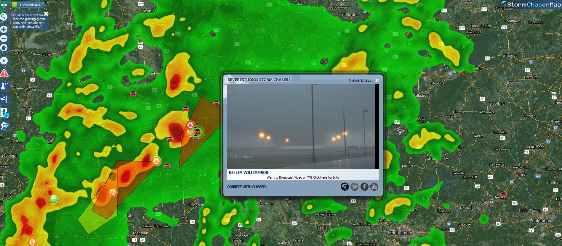
Current Watch Box per NOAA.
Day 1 Convective Outlook
NWS Storm Prediction Center Norman OK
0140 PM CST Sat Mar 13 2021
Valid 132000Z - 141200Z
...THERE IS A MODERATE RISK OF SEVERE THUNDERSTORMS LATE THIS
AFTERNOON AND EVENING ACROSS PARTS OF THE EASTERN TEXAS PANHANDLE...
...SUMMARY...
Numerous severe storms are expected late this afternoon into tonight
across west Texas into western Oklahoma and southwestern Kansas. The
most significant severe weather threat, including the potential for
long-lived supercells capable of producing strong tornadoes is
expected across the eastern Texas Panhandle into portions of the
Texas Big Country through early evening.
...20Z Outlook Update...
Slight adjustments have been made to the categorical and
probabilistic lines, mainly to account for the progression of
synoptic features and associated destabilization.
A narrow corridor of moderate boundary-layer destabilization along
and just ahead of an eastward advancing dryline still appears likely
to become the focus for considerable intense thunderstorm
development late this afternoon and evening across western Texas.
Southerly low-level jet strengthening (40-60 kt around 850 mb)
forecast across parts of the Texas Big Country into the eastern
Texas Panhandle will contribute to substantive further enlargement
of clockwise-curved low-level hodographs by around 00-01Z, along
with a corresponding increase in convective organization and peak in
severe weather potential early this evening.
..Kerr.. 03/13/2021
.PREV DISCUSSION... /ISSUED 1029 AM CST Sat Mar 13 2021/
...Southern High Plains...
No change to the long-track/strong tornado threat driving the MDT in
the eastern TX Panhandle. Primary changes this update are to add a
30 SIG wind area across a portion of western north TX, expand the 5
tor area south along the dryline into the Edwards Plateau region,
and broaden the western gradient of the threat probabilities for a
potentially slower dryline evolution with initial afternoon
development.
A deep closed low near the AZ/UT border will progress east across
the southern Rockies through the end of the period. In association
with an embedded jet streak rotating northeastward around the
eastern periphery of the low, a surface cyclone will deepen as it
ejects north-northeast across the TX Panhandle this afternoon into
southwest KS tonight. The cyclogenesis will draw the surface
warm sector northward across western OK and the TX Panhandle to the
east of a developing dryline, which will focus severe storm
development this afternoon/evening.
Regenerative elevated convection has persisted this morning from
northeast NM northeastward into southwest KS, within the exit region
of the mid-upper jet. Mid-level lapse rates/buoyancy will be
sufficient for a threat of isolated severe hail. Farther south, the
warm sector will spread north today, beneath very steep mid-level
lapse rates of 8-9 C/km. Greater boundary-layer heating is expected
initially from the TX South Plains south, before spreading north
towards late afternoon. A plume of moderate buoyancy with MLCAPE of
1500-2000 J/kg is expected south of the warm front and east of the
dryline at peak heating.
Initial surface-based storm development is expected by early-mid
afternoon along the dryline in the vicinity of I-27 in the TX
Panhandle. These initial storms will move off the dryline and
maintain more discrete character as they encounter a moist,
destabilizing warm sector with strong vertical shear. Given
boundary-layer dewpoints in the low 60s, afternoon temperatures in
the upper 60s to lower 70s, effective bulk shear near 70 kt, and
effective SRH in excess of 250 m2/s2, there will be a few hour
window for a couple of supercells to produce long-track, strong
tornadoes and very large hail centered on the east central/southeast
TX Panhandle.
To the west and south of the discrete supercells, squall line
development is expected by early evening as a Pacific cold front
overtakes the dryline and the stronger height falls/ascent
overspread northwest to west-central TX. Embedded supercell
structures within the line will be capable of producing all hazards.
Effective bulk shear in excess of 60 kt will also support a few hour
window for bowing structures. With 50-60 kt 700-mb flow expected
both ahead of and behind the squall, along with pronounced surging
of the Pacific front, a threat for significant severe wind gusts may
be realized as well. The overall severe threat should largely weaken
with eastward extent during late evening to early overnight as a
result of diminishing buoyancy in western OK towards central
portions of TX.
CLICK TO GET
WUUS01 PTSDY1 PRODUCT
NOTE: THE NEXT DAY 1 OUTLOOK IS SCHEDULED BY 0100Z
CURRENT UTC TIME:
2352Z (5:52PM), RELOAD THIS PAGE TO UPDATE THE TIME
Severe weather, tornado, thunderstorm, fire weather, storm report, tornado watch, severe thunderstorm watch, mesoscale discussion, convective outlook products from the Storm Prediction Center.
www.spc.noaa.gov


 .
.