You are using an out of date browser. It may not display this or other websites correctly.
You should upgrade or use an alternative browser.
You should upgrade or use an alternative browser.
WEATHER Severe Weather the week of June 5th, 2023
- Thread starter packyderms_wife
- Start date
SlipperySlope
Veteran Member
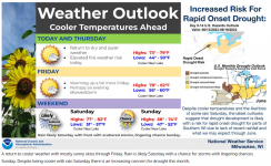
Looks like a good day for the majority of us.
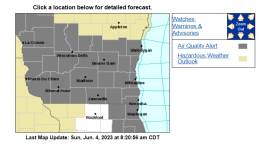
827 AM CDT Sun Jun 4 2023
...AIR QUALITY ADVISORY ISSUED FOR SOUTHERN, EASTERN, AND CENTRAL
WISCONSIN...
The Wisconsin Department of Natural Resources has issued an Air
Quality Advisory for PM2.5 which will remain in effect until
08:00 AM CDT tomorrow morning. This advisory affects people
living in the following counties: Columbia, Dane, Dodge, Fond du
Lac, Green, Green Lake, Iowa, Jefferson, Kenosha, Lafayette,
Marquette, Milwaukee, Ozaukee, Racine, Rock, Sauk, Sheboygan,
Walworth, Washington, Waukesha.
Smoke originating from wildfires in Quebec, Canada is currently
impacting PM2.5 concentrations at the surface across much of the
state. The air quality index is expected to range from the
UNHEALTHY FOR SENSITIVE GROUPS level to the UNHEALTHY level
across the advisory area. In general, the lowest
PM2.5 concentrations are expected to the northwest, while highest
concentrations are expected near north central and northeast
Wisconsin, within and around the Fox River Valley. It is
recommended that people with heart or lung disease, older adults,
and children should avoid prolonged or heavy exertion, while
everyone else should reduce prolonged or heavy exertion.
For more information on current air quality, please see:
Interactive maps
packyderms_wife
Neither here nor there.
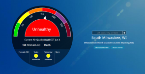
This is the worst I've seen all year.
Not good outside even for healthy adults. Activity outside should be limited.
View attachment 416950
I can still smell the smoke here in Iowa.
packyderms_wife
Neither here nor there.
we are having some of the weirdest weather here in Iowa right now. There are thunderstorms moving from the NE to the SW!!!
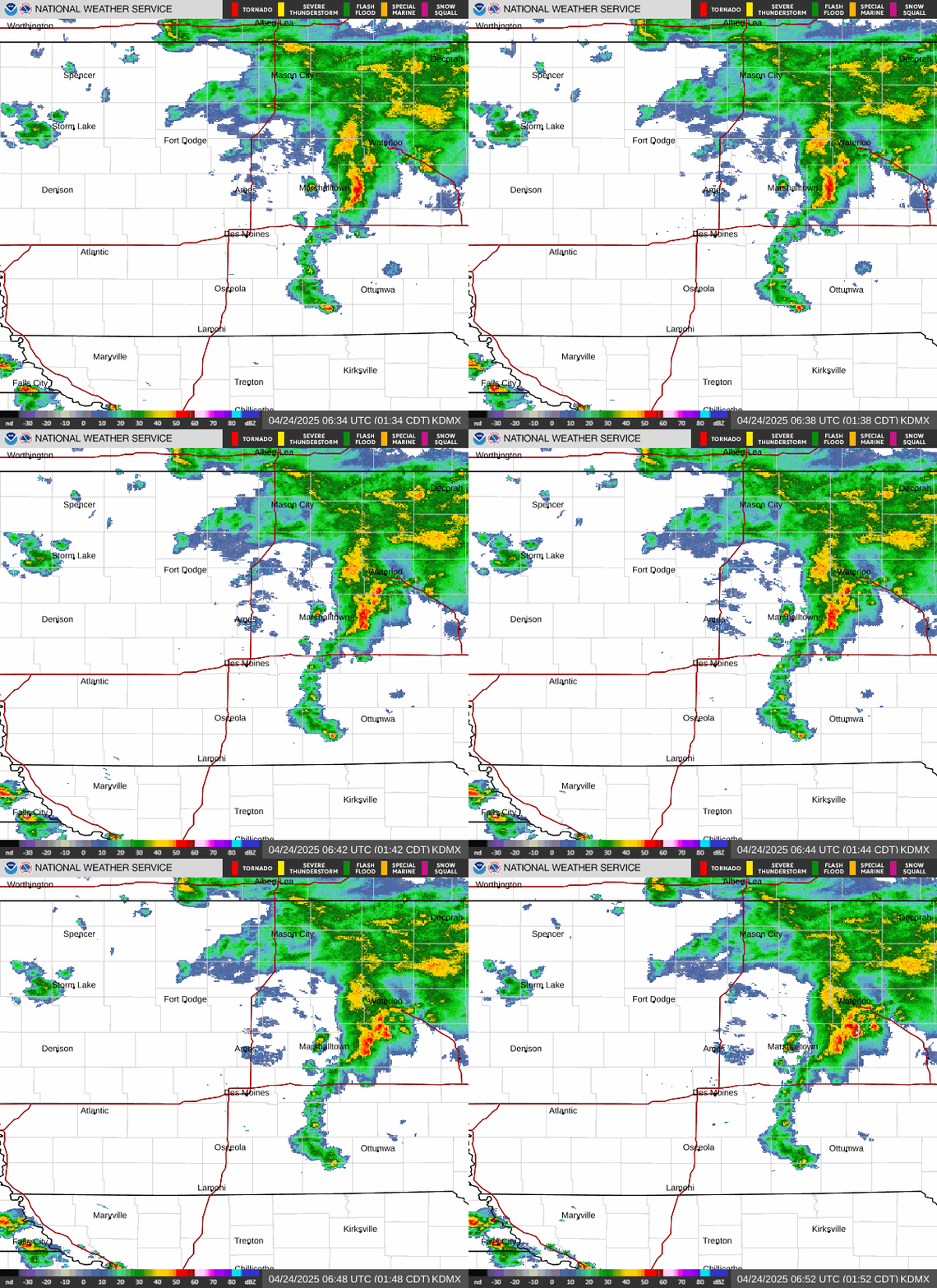

Definitely a funky weather pattern.

 zoomradar.com

 www.trackthetropics.com

ZoomRadar – Interactive Weather For Your Website
ZoomRadar is one of the fastest updating interactive radars on the web, aggregating local Level 2 Doppler radars from all across the US
 zoomradar.com

Live Current and Future Winds « 2023 Hurricane Season - Track The Tropics - Spaghetti Models
 www.trackthetropics.com
packyderms_wife
Neither here nor there.
Got some tornado watch boxes that just popped up on the Kansas/Oklahoma borders.
| Time | Speed | Location | County | State | Lat | Lon | Comments |
|---|---|---|---|---|---|---|---|
| Wind Reports (CSV) (Raw Wind CSV)(?) | |||||||
| Time | Size | Location | County | State | Lat | Lon | Comments |
| Hail Reports (CSV) (Raw Hail CSV)(?) | |||||||
No reports received | |||||||
| 1858 | 100 | 2 ENE Downtown Wichita | Sedgwick | KS | 3769 | 9732 | (ICT) |
| 1915 | 100 | Herington | Dickinson | KS | 3867 | 9694 | (TOP) |
| 1930 | 100 | Oak Ridge | Anderson | TN | 3596 | 8430 | Hail ranging from 1/4 to 1 inch in diameter. (MRX) |
| 1941 | 100 | 3 S Maize | Sedgwick | KS | 3774 | 9747 | (ICT) |
| 1955 | 100 | Powell | Knox | TN | 3603 | 8403 | Hail occurred for about 20 minutes. Along Beaver Ridge heading towards Norwood. At Emory Road and Sharp Road. Reported via spotter/Ham radio. Time is starting time of h (MRX) |
| 1820 | 60 | 2 NW Parkerville | Morris | KS | 3878 | 9669 | Also reported very heavy rainfall with dime to nickel size hail. (TOP) |
| 1823 | UNK | 2 NE Battlefield | Greene | MO | 3713 | 9334 | 8 inch diameter tree limbs brought down by thunderstorm winds. (SGF) |
| 1858 | 58 | Wichita Eisenhower Airp | Sedgwick | KS | 3766 | 9744 | (ICT) |
| 1900 | UNK | Rockwood | Roane | TN | 3587 | 8468 | Few trees down. (MRX) |
| 1923 | 67 | 3 SE Maize | Sedgwick | KS | 3775 | 9742 | (ICT) |
| 1930 | 60 | 2 NE Beattie | Marshall | KS | 3989 | 9639 | (TOP) |
Woke up to yellow air and sky! It's the weirdest color out there... the sun last night set as a hazy, bright red orb... you could look right at it without any problem. The smoke smell is everywhere, and *strong*. Temps have dropped into the high 50s, and there's a strong west/northwest breeze which makes it feel downright chilly.
Still no rain in the forecast, and everything is powder dry...
Summerthyme
Still no rain in the forecast, and everything is powder dry...
Summerthyme
packyderms_wife
Neither here nor there.
Our air quality is 105 here today in central Iowa, that's really, really bad for those who are. unfamiliar with air quality numbers. It is supposedly a clear sunny day out, but the sky is a yellowish grey color.
It's New York Metro so we are all supposed to care.
Didn't see any headlines for us in flyover country.
View: https://twitter.com/ScooterCasterNY/status/1666239102138580994
Didn't see any headlines for us in flyover country.
View: https://twitter.com/ScooterCasterNY/status/1666239102138580994
Ours was 180 most of the day! We actually took breaks from the gardens to go inside and breathe clean air! And kept the little ones inside until it improved in early evening. It's down to 78 at 11 pm.Our air quality is 105 here today in central Iowa, that's really, really bad for those who are. unfamiliar with air quality numbers. It is supposedly a clear sunny day out, but the sky is a yellowish grey color.
Summerthyme
The summer blocking high has arrived right on time. Temps are headed for 100° next week. As the ground dries out, temps will just keep increasing. No real rain in the forecast anymore. It’s summer in Texas! WOOT! (gag)
ainitfunny
Saved, to glorify God.
They say it got to 80 today, But in this shaded house it never got above 61. Gig Harbor, WA
Last edited:
Blacknarwhal
Let's Go Brandon!
We got just a bit of rain today in SW lower MI. But this weekend, they say, will be an even better chance.

Maximum Alert for airborne particulates in Northern State of New York.
AQI = 402
"Avoid all outdoor activity"
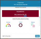

Fire and Smoke Map
Last edited:
packyderms_wife
Neither here nor there.
Welcome to the Dust Bowl part 2
tiredude
Veteran Member
is that 402 literally off the chart?
Maximum Alert for airborne particulates in Northern State of New York.
AQI = 402
"Avoid all outdoor activity"
View attachment 417551
View attachment 417552
Fire and Smoke Map
fire.airnow.gov
packyderms_wife
Neither here nor there.
is that 402 literally off the chart?
good question, they do their air quality alerts differently than here in Iowa for obvious reasons. So glad I don't live in NYC anymore, the air there sucked back in the 80's can only imagine how bad it is now.
packyderms_wife
Neither here nor there.
Air quality is 72, here in central Iowa, this afternoon. It rained last night and again this morning, starting to see patches of blue sky. There's hope people, that this smoke will be going away and soon!
packyderms_wife
Neither here nor there.
RT 9:40 - Ryan Hall y'all xtra
This Cloud Of Smoke Is Controlling Our Weather
In this video we are talking about the wildfires, smoke, and future potential severe weather.packyderms_wife
Neither here nor there.
LIVE STREAM - NWW116
BREAKING NEWS - Possible Hurricane To Impact Later Next Week! Live Discussion...
packyderms_wife
Neither here nor there.
The Weather Is About To Get VERY ACTIVE…
Rt 8:38 - Max VelocityIn this weather forecast, we are breaking down a HUGE storm that will bring severe weather and a huge heatwave to the United States. This will impact states like Texas, Oklahoma, Louisiana, the Midwest, Illinois, Indiana, Iowa, and Arkansas. The transition from La Nina to El Nino is occurring. Large to very large hail, damaging winds, and a couple of tornadoes are possible. A strong tornado is possible, but unlikely. Also, we are breaking down a NASTY storm that is circulating wildfire smoke to Canada. This is degrading air quality in areas like New York, New England, Pennsylvania, New Jersey, and other areas. This is due to the wildfires that are spreading across Canada. New York City looked like Mars today due to all of the wildfire smoke, creating very poor air quality (hazardous air quality). Find the latest details of the weather across the United States in our latest weather forecast
Walrus Whisperer
Hope in chains...
Thank God it hasn't made it's way to west of the Rockies! We have had a very high haze here for 2 or 3 days.Our air quality is 105 here today in central Iowa, that's really, really bad for those who are. unfamiliar with air quality numbers. It is supposedly a clear sunny day out, but the sky is a yellowish grey color.
packyderms_wife
Neither here nor there.
RT 8:01 - Ryan Hall y'all
A Very Dangerous Pattern Is Unfolding...
In this video we are talking about an upcoming multi-day severe weather extravaganza that will be happening on the heels of our infamous death ridge and omega blocking pattern.Wisp-O-Smoke
Contributing Member
View: https://www.youtube.com/watch?v=C7GbNqBiPFg
The Weather Is About To Get VERY ACTIVE…
Rt 8:38 - Max Velocity
In this weather forecast, we are breaking down a HUGE storm that will bring severe weather and a huge heatwave to the United States. This will impact states like Texas, Oklahoma, Louisiana, the Midwest, Illinois, Indiana, Iowa, and Arkansas. The transition from La Nina to El Nino is occurring. Large to very large hail, damaging winds, and a couple of tornadoes are possible. A strong tornado is possible, but unlikely. Also, we are breaking down a NASTY storm that is circulating wildfire smoke to Canada. This is degrading air quality in areas like New York, New England, Pennsylvania, New Jersey, and other areas. This is due to the wildfires that are spreading across Canada. New York City looked like Mars today due to all of the wildfire smoke, creating very poor air quality (hazardous air quality). Find the latest details of the weather across the United States in our latest weather forecast
packyderms_wife
Neither here nor there.
Things are starting to get spicy down south.
View: https://www.youtube.com/watch?v=PagQ30YQ1So
LIVE STREAM - NWW116
LIVE STREAM - NWW116
BREAKING WEATHER - Ongoing Severe Weather OUTBREAK With Tornadoes, Extreme Wind Damage & Large Hail
packyderms_wife
Neither here nor there.
LIVE STREAM - Vince Waelti


