
You are using an out of date browser. It may not display this or other websites correctly.
You should upgrade or use an alternative browser.
You should upgrade or use an alternative browser.
WEATHER Severe Weather the Week of April 15th
- Thread starter packyderms_wife
- Start date
- Status
- Not open for further replies.

packyderms_wife
Neither here nor there.
Current Map | U.S. Drought Monitor.
US Drought Report, it's an interactive map.

 www.fireweatheravalanche.org
Wildfire map... never thought I'd be posting this one weekly.
www.fireweatheravalanche.org
Wildfire map... never thought I'd be posting this one weekly. 

 www.star.nesdis.noaa.gov
GOES Sat imagery... you can select different filter views, for dust, smoke, ash, etc
www.star.nesdis.noaa.gov
GOES Sat imagery... you can select different filter views, for dust, smoke, ash, etc
US Drought Report, it's an interactive map.
FWAC Wildfire Map - Current Wildfires, Forest Fires, and Lightning Strikes near you | Fire, Weather & Avalanche Center
Interactive real-time wildfire map for the United States, including California, Oregon, Washington, Idaho, Arizona, and others. See current wildfires and wildfire perimeters near you using the Fire, Weather & Avalanche Center Wildfire Map.
GOES Imagery Viewer - NOAA / NESDIS / STAR
Near real-time publication of GOES-East and GOES-West images from NOAA/NESDIS/STAR
packyderms_wife
Neither here nor there.
RT 11:19 - Max Velocity
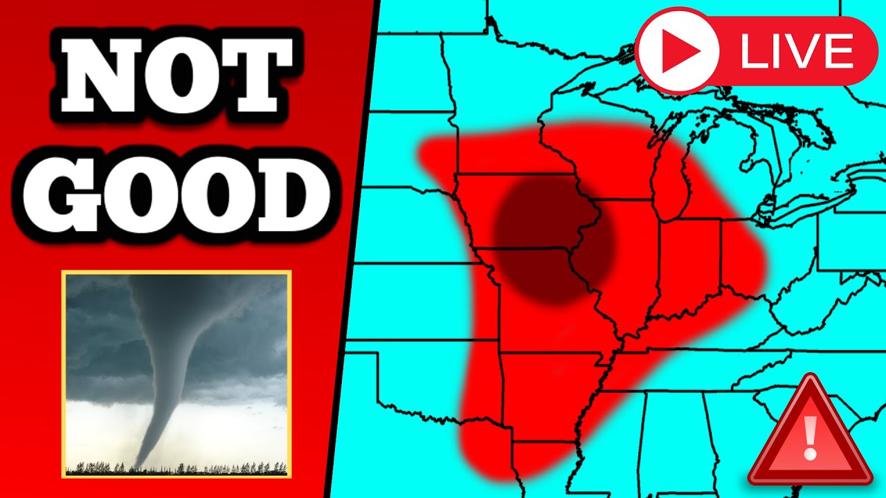
In this weather forecast, we are breaking down a SIGNIFICANT storm that's coming today, tomorrow, AND Tuesday! This will bring a threat for severe weather. Large hail, damaging winds, and tornadoes will all be possible. Find the latest details of the weather across the United States in our latest weather forecast.
6 weeks to hurricane season.
packyderms_wife
Neither here nor there.
LIVE STREAM - MAx Velocity
BREAKING Severe Weather Coverage - Isolated Tornadoes, Damaging Winds, Large Hail - With Live Cams
In this live stream, we are breaking down ongoing severe weather in the United States. This severe weather event could bring significant damaging winds, large hail, and tornadoes. This is a live weather channepackyderms_wife
Neither here nor there.
Praying for rain for my part of the upper midwest, those red flag warnings are unnerving!
packyderms_wife
Neither here nor there.
Our severe weather map, for tonight into tomorrow, is changing by the hour. Central Iowa.
medic38572
TB Fanatic
Over here in Idaho, it got up to 70 yesterday high of 60 today and high of 40 next day or two then finally headed back up to a high in the upper 50s by the end of the week. It was a beautiful day yesterday!The last two days We just went from mild weather to hot with temps in the high 70s and 80s and right now it 10:18PM and it's 70 degrees outside a little warmer then normal for this time of year.
Walbash
Contributing Member
LIVE - Severe Weather Outbreak With Storm Chasers On The Ground - Live Weather Channel...
Not much firing up yet, but they are monitoring.
Chasers are stacking up in SW Kansas.
Not really anything showing in that area, I guess storms will pop up quick when they decide to.

 zoomradar.com
Not really anything showing in that area, I guess storms will pop up quick when they decide to.
ZoomRadar – Interactive Weather For Your Website
ZoomRadar is one of the fastest updating interactive radars on the web, aggregating local Level 2 Doppler radars from all across the US
packyderms_wife
Neither here nor there.
Central Nebraska is looking to be spicy.Chasers are stacking up in SW Kansas.
Not really anything showing in that area, I guess storms will pop up quick when they decide to.
ZoomRadar – Interactive Weather For Your Website
ZoomRadar is one of the fastest updating interactive radars on the web, aggregating local Level 2 Doppler radars from all across the US
Central Nebraska is looking to be spicy.
But they don't expect it to be "severe"...(for now)

packyderms_wife
Neither here nor there.
Yep, that’s not what my local radar map is saying when I zoom out to see Nebraska and Missouri.But they don't expect it to be "severe"...(for now)
Yep, that’s not what my local radar map is saying when I zoom out to see Nebraska and Missouri.
Run Zoomradar, NoDak is kinda sparkly, but not too many pretty colors when you turn off lightning strikes.
packyderms_wife
Neither here nor there.
Tornado Warning
NEC167-161430-
/O.NEW.KOAX.TO.W.0002.240416T1339Z-240416T1430Z/
BULLETIN - EAS ACTIVATION REQUESTED
Tornado Warning
National Weather Service Omaha/Valley Nebraska
839 AM CDT Tue Apr 16 2024
The National Weather Service in Omaha has issued a
* Tornado Warning for...
Northeastern Stanton County in northeastern Nebraska...
* Until 930 AM CDT.
* At 839 AM CDT, a severe thunderstorm capable of producing a tornado
was located 3 miles south of Stanton, or 14 miles southeast of
Norfolk, moving north at 45 mph.
HAZARD...Tornado and quarter size hail.
SOURCE...Radar indicated rotation.
IMPACT...Flying debris will be dangerous to those caught without
shelter. Mobile homes will be damaged or destroyed.
Damage to roofs, windows, and vehicles will occur. Tree
damage is likely.
* This dangerous storm will be near...
Stanton around 845 AM CDT.
PRECAUTIONARY/PREPAREDNESS ACTIONS...
TAKE COVER NOW! Move to a basement or an interior room on the lowest
floor of a sturdy building. Avoid windows. If you are outdoors, in a
mobile home, or in a vehicle, move to the closest substantial shelter
and protect yourself from flying debris.
&&
LAT...LON 4209 9723 4209 9702 4182 9716 4187 9729
TIME...MOT...LOC 1339Z 201DEG 41KT 4190 9720
TORNADO...RADAR INDICATED
MAX HAIL SIZE...1.00 IN
$$
BLB
packyderms_wife
Neither here nor there.
Nebraska
patriotgal
Veteran Member
Have care meeting appt at nursing home this afternoon just when weather is supposed to go nuts. Can't fit more than 1 vehicle under their little covered entrance.
packyderms_wife
Neither here nor there.
I’m on my phone! Tornado on the ground near Perry Iowa, take shelter now!!!
homecanner1
Veteran Member
Yup we awoke to icy chill, crack of lightning and thunder rumble, first spring thunderstorm. Had to turn the heat back on. We are in alert zone all day along with WI and IL

packyderms_wife
Neither here nor there.
BREAKING TORNADO ON THE GROUND IN NEBRASKA - Strong Tornadoes Possible - With Live Storm Chaser
Download Radar Omega! iOS: https://bit.ly/MaxVelocityiOS Android: https://bit.ly/MaxVelocityAndroid #adIn this live stream, we are breaking down upcoming sev...
 www.youtube.com
LIVE STREAM - Max Velocity
packyderms_wife
Neither here nor there.
Tornado Warning
Tornado Warning
NEC119-141-161730-
/O.NEW.KOAX.TO.W.0004.240416T1658Z-240416T1730Z/
BULLETIN - EAS ACTIVATION REQUESTED
Tornado Warning
National Weather Service Omaha/Valley Nebraska
1158 AM CDT Tue Apr 16 2024
The National Weather Service in Omaha has issued a
* Tornado Warning for...
Southeastern Madison County in northeastern Nebraska...
North central Platte County in northeastern Nebraska...
* Until 1230 PM CDT.
* At 1158 AM CDT, a severe thunderstorm capable of producing a
tornado was located 3 miles south of Humphrey, or 16 miles
northwest of Columbus, moving north at 15 mph.
HAZARD...Tornado and quarter size hail.
SOURCE...Weather spotters reported funnel cloud. This storm has a
history of producing tornadoes near Tarnov and Platte
Center.
IMPACT...Flying debris will be dangerous to those caught without
shelter. Mobile homes will be damaged or destroyed.
Damage to roofs, windows, and vehicles will occur. Tree
damage is likely.
* This dangerous storm will be near...
Humphrey around 1205 PM CDT.
PRECAUTIONARY/PREPAREDNESS ACTIONS...
TAKE COVER NOW! Move to a basement or an interior room on the lowest
floor of a sturdy building. Avoid windows. If you are outdoors, in a
mobile home, or in a vehicle, move to the closest substantial shelter
and protect yourself from flying debris.
&&
LAT...LON 4159 9746 4158 9756 4180 9755 4182 9737
TIME...MOT...LOC 1658Z 197DEG 15KT 4164 9751
TORNADO...RADAR INDICATED
MAX HAIL SIZE...1.00 IN
$$
BLB
Tornado Warning
NEC119-141-161730-
/O.NEW.KOAX.TO.W.0004.240416T1658Z-240416T1730Z/
BULLETIN - EAS ACTIVATION REQUESTED
Tornado Warning
National Weather Service Omaha/Valley Nebraska
1158 AM CDT Tue Apr 16 2024
The National Weather Service in Omaha has issued a
* Tornado Warning for...
Southeastern Madison County in northeastern Nebraska...
North central Platte County in northeastern Nebraska...
* Until 1230 PM CDT.
* At 1158 AM CDT, a severe thunderstorm capable of producing a
tornado was located 3 miles south of Humphrey, or 16 miles
northwest of Columbus, moving north at 15 mph.
HAZARD...Tornado and quarter size hail.
SOURCE...Weather spotters reported funnel cloud. This storm has a
history of producing tornadoes near Tarnov and Platte
Center.
IMPACT...Flying debris will be dangerous to those caught without
shelter. Mobile homes will be damaged or destroyed.
Damage to roofs, windows, and vehicles will occur. Tree
damage is likely.
* This dangerous storm will be near...
Humphrey around 1205 PM CDT.
PRECAUTIONARY/PREPAREDNESS ACTIONS...
TAKE COVER NOW! Move to a basement or an interior room on the lowest
floor of a sturdy building. Avoid windows. If you are outdoors, in a
mobile home, or in a vehicle, move to the closest substantial shelter
and protect yourself from flying debris.
&&
LAT...LON 4159 9746 4158 9756 4180 9755 4182 9737
TIME...MOT...LOC 1658Z 197DEG 15KT 4164 9751
TORNADO...RADAR INDICATED
MAX HAIL SIZE...1.00 IN
$$
BLB
packyderms_wife
Neither here nor there.
packyderms_wife
Neither here nor there.
Tornado Warning
NEC037-167-161845-
/O.NEW.KOAX.TO.W.0006.240416T1807Z-240416T1845Z/
BULLETIN - EAS ACTIVATION REQUESTED
Tornado Warning
National Weather Service Omaha/Valley Nebraska
107 PM CDT Tue Apr 16 2024
The National Weather Service in Omaha has issued a
* Tornado Warning for...
Northwestern Colfax County in northeastern Nebraska...
Southeastern Stanton County in northeastern Nebraska...
* Until 145 PM CDT.
* At 107 PM CDT, a severe thunderstorm capable of producing a tornado
was located 4 miles southeast of Leigh, or 17 miles northeast of
Columbus, moving northeast at 15 mph.
HAZARD...Tornado and quarter size hail.
SOURCE...Weather spotters and emergency management reported
two funnel clouds near Leigh.
IMPACT...Flying debris will be dangerous to those caught without
shelter. Mobile homes will be damaged or destroyed.
Damage to roofs, windows, and vehicles will occur. Tree
damage is likely.
* This dangerous storm will be near...
Clarkson and Leigh around 110 PM CDT.
PRECAUTIONARY/PREPAREDNESS ACTIONS...
TAKE COVER NOW! Move to a basement or an interior room on the lowest
floor of a sturdy building. Avoid windows. If you are outdoors, in a
mobile home, or in a vehicle, move to the closest substantial shelter
and protect yourself from flying debris.
&&
LAT...LON 4182 9718 4179 9702 4174 9701 4157 9720
4158 9725 4172 9725
TIME...MOT...LOC 1807Z 222DEG 15KT 4166 9719
TORNADO...RADAR INDICATED
MAX HAIL SIZE...1.00 IN
$$
BLB
Map at #14 is auto updating.
This system is curling back around from the west and looks like some peeps may get a second round.
This system is curling back around from the west and looks like some peeps may get a second round.
packyderms_wife
Neither here nor there.
Tornado Warning
IAC149-193-NEC043-SDC127-161900-
/O.NEW.KFSD.TO.W.0002.240416T1836Z-240416T1900Z/
BULLETIN - EAS ACTIVATION REQUESTED
Tornado Warning
National Weather Service Sioux Falls SD
136 PM CDT Tue Apr 16 2024
The National Weather Service in Sioux Falls has issued a
* Tornado Warning for...
Northwestern Woodbury County in west central Iowa...
Southwestern Plymouth County in northwestern Iowa...
Northwestern Dakota County in northeastern Nebraska...
Southeastern Union County in southeastern South Dakota...
* Until 200 PM CDT.
* At 136 PM CDT, a severe thunderstorm capable of producing a tornado
was located over Jackson In Dakota County, or 8 miles west of Sioux
City, moving north at 25 mph.
HAZARD...Tornado.
SOURCE...Radar indicated rotation.
IMPACT...Flying debris will be dangerous to those caught without
shelter. Mobile homes will be damaged or destroyed.
Damage to roofs, windows, and vehicles will occur. Tree
damage is likely.
* This dangerous storm will be near...
Sioux City, North Sioux City, and Jefferson around 140 PM CDT.
PRECAUTIONARY/PREPAREDNESS ACTIONS...
TAKE COVER NOW! Move to a basement or an interior room on the lowest
floor of a sturdy building. Avoid windows. If you are outdoors, in a
mobile home, or in a vehicle, move to the closest substantial shelter
and protect yourself from flying debris.
&&
LAT...LON 4244 9667 4263 9660 4263 9638 4240 9649
TIME...MOT...LOC 1836Z 198DEG 22KT 4246 9655
TORNADO...RADAR INDICATED
MAX HAIL SIZE...<.75 IN
$$
SG
packyderms_wife
Neither here nor there.
Reed Timmer was in Des Moines/Urbandale Iowa this morning, gobs of photos of him flooding my FB stream as folks took selfies with him.
packyderms_wife
Neither here nor there.
Tornado Warning
IAC167-161945-
/O.NEW.KFSD.TO.W.0006.240416T1922Z-240416T1945Z/
BULLETIN - EAS ACTIVATION REQUESTED
Tornado Warning
National Weather Service Sioux Falls SD
222 PM CDT Tue Apr 16 2024
The National Weather Service in Sioux Falls has issued a
* Tornado Warning for...
South central Sioux County in northwestern Iowa...
* Until 245 PM CDT.
* At 222 PM CDT, a severe thunderstorm capable of producing a tornado
was located near Maurice, or near Sioux Center, moving north at 30
mph.
HAZARD...Tornado.
SOURCE...Radar indicated rotation.
IMPACT...Flying debris will be dangerous to those caught without
shelter. Mobile homes will be damaged or destroyed.
Damage to roofs, windows, and vehicles will occur. Tree
damage is likely.
* This dangerous storm will be near...
Sioux Center around 230 PM CDT.
PRECAUTIONARY/PREPAREDNESS ACTIONS...
TAKE COVER NOW! Move to a basement or an interior room on the lowest
floor of a sturdy building. Avoid windows. If you are outdoors, in a
mobile home, or in a vehicle, move to the closest substantial shelter
and protect yourself from flying debris.
&&
LAT...LON 4292 9638 4317 9632 4315 9605 4291 9613
4291 9626
TIME...MOT...LOC 1922Z 193DEG 25KT 4299 9624
TORNADO...RADAR INDICATED
MAX HAIL SIZE...<.75 IN
$$
SG
packyderms_wife
Neither here nor there.
Tornado Warning
IAC119-167-162000-
/O.NEW.KFSD.TO.W.0007.240416T1938Z-240416T2000Z/
BULLETIN - EAS ACTIVATION REQUESTED
Tornado Warning
National Weather Service Sioux Falls SD
238 PM CDT Tue Apr 16 2024
The National Weather Service in Sioux Falls has issued a
* Tornado Warning for...
Southeastern Lyon County in northwestern Iowa...
Northeastern Sioux County in northwestern Iowa...
* Until 300 PM CDT.
* At 237 PM CDT, a confirmed tornado was located near Sioux Center,
moving northeast at 25 mph.
HAZARD...Damaging tornado.
SOURCE...Law enforcement confirmed tornado. At 235 PM CDT, a
confirmed tornado was reported 2 mile east of Sioux
Center.
IMPACT...Flying debris will be dangerous to those caught without
shelter. Mobile homes will be damaged or destroyed.
Damage to roofs, windows, and vehicles will occur. Tree
damage is likely.
* The tornado will be near...
Hull and Boyden around 240 PM CDT.
Sheldon around 250 PM CDT.
PRECAUTIONARY/PREPAREDNESS ACTIONS...
To repeat, a tornado is on the ground. TAKE COVER NOW! Move to a
basement or an interior room on the lowest floor of a sturdy
building. Avoid windows. If you are outdoors, in a mobile home, or in
a vehicle, move to the closest substantial shelter and protect
yourself from flying debris.
&&
LAT...LON 4305 9624 4331 9612 4329 9586 4323 9585
4300 9599
TIME...MOT...LOC 1937Z 203DEG 24KT 4309 9609
TORNADO...OBSERVED
MAX HAIL SIZE...<.75 IN
$$
SG
packyderms_wife
Neither here nor there.
Just confirmed tornado on the ground near Rockwell City, IA. THIS is a fast moving dangerous tornado TAKE COVER NOW!!!
packyderms_wife
Neither here nor there.
Tornado Warning
IAC025-091-151-162015-
/O.NEW.KDMX.TO.W.0003.240416T1936Z-240416T2015Z/
BULLETIN - EAS ACTIVATION REQUESTED
Tornado Warning
National Weather Service Des Moines IA
236 PM CDT Tue Apr 16 2024
The National Weather Service in Des Moines has issued a
* Tornado Warning for...
Southern Pocahontas County in northwestern Iowa...
Northeastern Calhoun County in west central Iowa...
West central Humboldt County in north central Iowa...
* Until 315 PM CDT.
* At 236 PM CDT, a confirmed tornado was located over Rockwell City,
moving north at 35 mph.
HAZARD...Damaging tornado and quarter size hail.
SOURCE...Weather spotters confirmed tornado.
IMPACT...Flying debris will be dangerous to those caught without
shelter. Mobile homes will be damaged or destroyed.
Damage to roofs, windows, and vehicles will occur. Tree
damage is likely.
* The tornado will be near...
South Twin Lake, North Twin Lake, Twin Lakes, and Twin Lakes State
Park around 240 PM CDT.
Manson around 245 PM CDT.
Pomeroy around 250 PM CDT.
Palmer around 255 PM CDT.
Other locations impacted by this tornadic thunderstorm include
Palmer, Twin Lakes, Twin Lakes State Park, Rockwell City Municipal
Airport, Pomeroy, Gilmore City, and Jolley.
PRECAUTIONARY/PREPAREDNESS ACTIONS...
To repeat, a tornado is on the ground. TAKE COVER NOW! Move to a
basement or an interior room on the lowest floor of a sturdy
building. Avoid windows. If you are outdoors, in a mobile home, or in
a vehicle, move to the closest substantial shelter and protect
yourself from flying debris.
&&
LAT...LON 4237 9448 4235 9470 4268 9484 4277 9443
TIME...MOT...LOC 1936Z 174DEG 29KT 4241 9461
TORNADO...OBSERVED
MAX HAIL SIZE...1.00 IN
$$
Fowle
packyderms_wife
Neither here nor there.
Tornado Warning
IAC119-167-162000-
/O.NEW.KFSD.TO.W.0008.240416T1949Z-240416T2000Z/
BULLETIN - EAS ACTIVATION REQUESTED
Tornado Warning
National Weather Service Sioux Falls SD
249 PM CDT Tue Apr 16 2024
The National Weather Service in Sioux Falls has issued a
* Tornado Warning for...
Southeastern Lyon County in northwestern Iowa...
North central Sioux County in northwestern Iowa...
* Until 300 PM CDT.
* At 248 PM CDT, a severe thunderstorm capable of producing a tornado
was located near Doon, or 11 miles south of Rock Rapids, moving
northeast at 30 mph.
HAZARD...Tornado.
SOURCE...Radar indicated rotation.
IMPACT...Flying debris will be dangerous to those caught without
shelter. Mobile homes will be damaged or destroyed.
Damage to roofs, windows, and vehicles will occur. Tree
damage is likely.
* This tornadic thunderstorm will remain over mainly rural areas of
southeastern Lyon and north central Sioux Counties.
PRECAUTIONARY/PREPAREDNESS ACTIONS...
TAKE COVER NOW! Move to a basement or an interior room on the lowest
floor of a sturdy building. Avoid windows. If you are outdoors, in a
mobile home, or in a vehicle, move to the closest substantial shelter
and protect yourself from flying debris.
&&
LAT...LON 4321 9611 4324 9624 4340 9624 4336 9602
TIME...MOT...LOC 1948Z 203DEG 28KT 4326 9615
TORNADO...RADAR INDICATED
MAX HAIL SIZE...<.75 IN
$$
packyderms_wife
Neither here nor there.
Cedar Rapids area
Tornado Warning
IAC011-019-113-162015-
/O.NEW.KDVN.TO.W.0009.240416T1948Z-240416T2015Z/
BULLETIN - EAS ACTIVATION REQUESTED
Tornado Warning
National Weather Service Quad Cities IA/IL
248 PM CDT Tue Apr 16 2024
The National Weather Service in the Quad Cities has issued a
* Tornado Warning for...
Central Buchanan County in northeastern Iowa...
Northeastern Benton County in east central Iowa...
Northwestern Linn County in east central Iowa...
* Until 315 PM CDT.
* At 247 PM CDT, a severe thunderstorm capable of producing a tornado
was located over Cheney, or near Vinton, moving north at 55 mph.
HAZARD...Tornado.
SOURCE...Radar indicated rotation.
IMPACT...Flying debris will be dangerous to those caught without
shelter. Mobile homes will be damaged or destroyed.
Damage to roofs, windows, and vehicles will occur. Tree
damage is likely.
* This dangerous storm will be near...
Independence, Walker, Quasqueton, Brandon, Rowley, Lime Creek
County Park, Spencers Grove, and Independence Airport around 255
PM CDT.
Winthrop, Wapsipinicon Golf Course, and Buchanan County
Fairgrounds around 300 PM CDT.
Otterville around 305 PM CDT.
Other locations in the path of this tornadic thunderstorm include
Winthrop Golf Course.
This includes Interstate 380 between mile markers 41 and 51.
PRECAUTIONARY/PREPAREDNESS ACTIONS...
TAKE COVER NOW! Move to a basement or an interior room on the lowest
floor of a sturdy building. Avoid windows. If you are outdoors, in a
mobile home, or in a vehicle, move to the closest substantial shelter
and protect yourself from flying debris.
&&
LAT...LON 4255 9161 4249 9161 4214 9190 4217 9203
4262 9195
TIME...MOT...LOC 1947Z 199DEG 49KT 4223 9193
TORNADO...RADAR INDICATED
MAX HAIL SIZE...<.75 IN
$$
Gunkel
Tornado Warning
IAC011-019-113-162015-
/O.NEW.KDVN.TO.W.0009.240416T1948Z-240416T2015Z/
BULLETIN - EAS ACTIVATION REQUESTED
Tornado Warning
National Weather Service Quad Cities IA/IL
248 PM CDT Tue Apr 16 2024
The National Weather Service in the Quad Cities has issued a
* Tornado Warning for...
Central Buchanan County in northeastern Iowa...
Northeastern Benton County in east central Iowa...
Northwestern Linn County in east central Iowa...
* Until 315 PM CDT.
* At 247 PM CDT, a severe thunderstorm capable of producing a tornado
was located over Cheney, or near Vinton, moving north at 55 mph.
HAZARD...Tornado.
SOURCE...Radar indicated rotation.
IMPACT...Flying debris will be dangerous to those caught without
shelter. Mobile homes will be damaged or destroyed.
Damage to roofs, windows, and vehicles will occur. Tree
damage is likely.
* This dangerous storm will be near...
Independence, Walker, Quasqueton, Brandon, Rowley, Lime Creek
County Park, Spencers Grove, and Independence Airport around 255
PM CDT.
Winthrop, Wapsipinicon Golf Course, and Buchanan County
Fairgrounds around 300 PM CDT.
Otterville around 305 PM CDT.
Other locations in the path of this tornadic thunderstorm include
Winthrop Golf Course.
This includes Interstate 380 between mile markers 41 and 51.
PRECAUTIONARY/PREPAREDNESS ACTIONS...
TAKE COVER NOW! Move to a basement or an interior room on the lowest
floor of a sturdy building. Avoid windows. If you are outdoors, in a
mobile home, or in a vehicle, move to the closest substantial shelter
and protect yourself from flying debris.
&&
LAT...LON 4255 9161 4249 9161 4214 9190 4217 9203
4262 9195
TIME...MOT...LOC 1947Z 199DEG 49KT 4223 9193
TORNADO...RADAR INDICATED
MAX HAIL SIZE...<.75 IN
$$
Gunkel
Meemur
Voice on the Prairie / FJB!
Just now getting home and online. There was a tornado on the ground in the southern part of Boone Co., IA about 11:30 this morning. I think it was on the ground about 4 - 5 minutes and then fell apart? I didn't hear anymore about it.
It was clear and sunny when I drove home about 2:30 pm, but now there are extremely tall cumulus clouds moving into my area of Central Iowa. I guess Round 3 of storms is expected later? I've got the weather channel (13.4) on now. I'm trying to catch up.
It looks like it poured earlier and there was significant wind. My yard is littered with tree branches, nothing larger than 2" in diameter, though.
packyderms_wife
Neither here nor there.
Tornado Warning
IAC091-109-147-151-162100-
/O.NEW.KDMX.TO.W.0004.240416T2011Z-240416T2100Z/
BULLETIN - EAS ACTIVATION REQUESTED
Tornado Warning
National Weather Service Des Moines IA
311 PM CDT Tue Apr 16 2024
The National Weather Service in Des Moines has issued a
* Tornado Warning for...
Eastern Pocahontas County in northwestern Iowa...
Southwestern Kossuth County in north central Iowa...
Northwestern Humboldt County in north central Iowa...
Southeastern Palo Alto County in northwestern Iowa...
* Until 400 PM CDT.
* At 310 PM CDT, a confirmed tornado was located near Palmer, or 8
miles southeast of Pocahontas, moving north at 35 mph.
HAZARD...Damaging tornado.
SOURCE...Weather spotters confirmed tornado. Intermittent tornado
touchdowns reported by spotters.
IMPACT...Flying debris will be dangerous to those caught without
shelter. Mobile homes will be damaged or destroyed.
Damage to roofs, windows, and vehicles will occur. Tree
damage is likely.
* The tornado will be near...
Rolfe around 320 PM CDT.
Plover around 330 PM CDT.
Other locations impacted by this tornadic thunderstorm include
Palmer, Bradgate, Pocahontas Municipal Airport, Ottosen, Plover,
Rolfe, Gilmore City, Havelock, and West Bend.
PRECAUTIONARY/PREPAREDNESS ACTIONS...
To repeat, a tornado is on the ground. TAKE COVER NOW! Move to a
basement or an interior room on the lowest floor of a sturdy
building. Avoid windows. If you are outdoors, in a mobile home, or in
a vehicle, move to the closest substantial shelter and protect
yourself from flying debris.
&&
LAT...LON 4260 9446 4257 9466 4291 9480 4297 9434
TIME...MOT...LOC 2010Z 181DEG 31KT 4266 9455
TORNADO...OBSERVED
MAX HAIL SIZE...<.75 IN
$$
Fowle
packyderms_wife
Neither here nor there.
Just now getting home and online. There was a tornado on the ground in the southern part of Boone Co., IA about 11:30 this morning. I think it was on the ground about 4 - 5 minutes and then fell apart? I didn't hear anymore about it.
It was clear and sunny when I drove home about 2:30 pm, but now there are extremely tall cumulus clouds moving into my area of Central Iowa. I guess Round 3 of storms is expected later? I've got the weather channel (13.4) on now. I'm trying to catch up.
It looks like it poured earlier and there was significant wind. My yard is littered with tree branches, nothing larger than 2" in diameter, though.
Put 13.1 on!!!
packyderms_wife
Neither here nor there.
Tornado Warning
IAC043-065-162045-
/O.NEW.KARX.TO.W.0001.240416T2019Z-240416T2045Z/
BULLETIN - EAS ACTIVATION REQUESTED
Tornado Warning
National Weather Service La Crosse WI
319 PM CDT Tue Apr 16 2024
The National Weather Service in La Crosse has issued a
* Tornado Warning for...
Southwestern Clayton County in northeastern Iowa...
Southern Fayette County in northeastern Iowa...
* Until 345 PM CDT.
* At 318 PM CDT, a severe thunderstorm capable of producing a tornado
was located over Aurora, or 9 miles southeast of Oelwein, moving
north at 55 mph.
HAZARD...Tornado.
SOURCE...Radar indicated rotation.
IMPACT...Flying debris will be dangerous to those caught without
shelter. Mobile homes will be damaged or destroyed.
Damage to roofs, windows, and vehicles will occur. Tree
damage is likely.
* This dangerous storm will be near...
Arlington around 325 PM CDT.
Other locations impacted by this tornadic thunderstorm include
Highway 93 And County W 14, Donnan, Volga River State Park, Wadena,
Randalia, Highways 3 And 187, and County Road W 45 And 187.
PRECAUTIONARY/PREPAREDNESS ACTIONS...
TAKE COVER NOW! Move to a basement or an interior room on the lowest
floor of a sturdy building. Avoid windows. If you are outdoors, in a
mobile home, or in a vehicle, move to the closest substantial shelter
and protect yourself from flying debris.
&&
LAT...LON 4264 9199 4292 9196 4292 9143 4264 9155
TIME...MOT...LOC 2018Z 196DEG 58KT 4263 9175
TORNADO...RADAR INDICATED
MAX HAIL SIZE...<.75 IN
$$
Cecava
- Status
- Not open for further replies.