SCI 'Icelandia': Is Iceland the tip of a vast, sunken continent?

Melodi

Disaster Cat
Interesting, now this is something unexpected....
'Icelandia': Is Iceland the tip of a vast, sunken continent?
by Geological Society of America

Earth continents
Credit: Pixabay/CC0 Public Domain
Academics believe they have identified a remarkable geological secret: A sunken continent hidden under Iceland and the surrounding ocean,which they have dubbed "Icelandia."#

An international team of geologists, led by Gillian Foulger, Emeritus Professor of Geophysics in the Department of Earth Sciences at Durham University (UK), believe the sunken continent could stretch from Greenland all the way to Europe.

It is believed to cover an area of ~600,000 km2 but when adjoining areas west of Britain are included in a "Greater Icelandia," the entire area could be ~1,000,000 km2 in size.

If proven, it means that the giant supercontinent of Pangaea, which is thought to have broken up over 50 million years ago, has in fact not fully broken up.

This new theory challenges long-held scientific ideas around the extent of oceanic and continental crust in the North Atlantic region, and how volcanic islands, like Iceland, formed.

The presence of continental—rather than oceanic—crust could also spark discussions about a new source of minerals and hydrocarbons, both of which are contained in continental crust.

The revolutionary new theory was born from an innovative series of expert meetings held in Durham and is included in a dedicated chapter of In the Footsteps of Warren B. Hamilton: New Ideas in Earth Science (published 29 June 2021 by the Geological Society of America), which Professor Foulger has co-written with Dr. Laurent Gernigon of the Geological Survey of Norway and Professor Laurent Geoffroy of the Ocean Geosciences Laboratory, University of Brest (France).

Speaking about the new theory, Professor Foulger said, "Until now Iceland has puzzled geologists, as existing theories that it is built of and surrounded by oceanic crust are not supported by multiplegeological data. For example, the crust under Iceland is over 40 km thick—seven times thicker than normal oceanic crust. This simply could not be explained.

"However, when we considered the possibility that this thick crust is continental, our data suddenly all made sense. This led us immediately to realize that the continental region was much bigger than Iceland itself—there is a hidden continent right there under the sea.


"There is fantastic work to be done to prove the existence of Icelandia but it also opens up a completely new view of our geological understanding of the world. Something similar could be happening at many more places.

"We could eventually see maps of our oceans and seas being redrawn as our understanding of what lies beneath changes."

The research team is now working with collaborators from across the globe on work to test their theory, which will begin once COVID-19 restrictions allow.

This work could involve electrical conductivity surveys, and the collection of zircon crystals in Iceland and elsewhere. Other tests such as seismic profiling and drilling would need millions of pounds to fund, but such is the importance of this work that funding may well be forthcoming.

Professor Foulger is a world-leading geologist whose research has contributed to mapping the geological composition of the seabed in relation to continental land masses.

This work has important legal and political ramifications, as under certain conditions, the United Nations Convention on the Law of the Sea grants coastal states exclusive rights to the non-living resources of their adjacent seabed if scientists can prove that the seabed is a submerged extension of the continental landmass.

Professor Philip Steinberg, Director of IBRU, Durham University's Centrefor Borders Research, noted, "Countries around the world are spending enormous resources conducting subsea geologic research in order to identify their continental shelves and claim exclusive mineral rights there.
"Research like Professor Foulger's, which forces us to rethink the relationship between seabed and continental geology, can have far-reaching impact for countries trying to determine what area of the seabed are their exclusive preserve and what areas are to be governed by the International Seabed Authority as the 'common heritage of humankind."
Explore further
Fragment of continental crust found under southeast Iceland
More information: The chapter, Icelandia, by Foulger, Gernigon, and Geoffroy is part of In the Footsteps of Warren B. Hamilton: New Ideas in Earth Science , DOI: 10.1130/2021.2553(04) , pubs.geoscienceworld.org/books … /130412282/Icelandia
 

Melodi

Disaster Cat
I also found this great "Viking" sea shanty - a great example of the modern sea shanty revival (I've always liked them) and placing the story in the context of an earlier Sea Fairing civilization.

I suspect the original article is going to cause shock, throwing of papers, and fistfights at the next live meeting of the international geographic societies. Sort of like the still unresolved fight between geologists and archeologists about the water erosion on the great Spynix at Giza.


run time 2:03
 

Melodi

Disaster Cat
See, it is so easy to get a controversy going about things on-land! How much more "fun" will the existence of a sunken continent (alleged anyway) in the Mid-Atlantic be for academic food fights and lots of great woo!

I've really got to check with Nightwolf about the edits on my Atlantis FANTASY novel, either this story is going to be "submerged" really quickly by mainstream "science," or there is at least a couple of decades of "troubled waters" in academia - which is probably a good thing.

Almost as good as when they found out (while I was preparing a lecture on it no less) that the megalithic buildings of Northern Europe PREDATED the Greek and Egyptian great monuments by several thousand years.

I spent the first five minutes of the class lecture I was assigned "proving" from the sources in the University library how the Northern Europeans were "obviously" copying, learning, and influenced by the glorious builders of the Greek Bronze Age.

Then I shocked the class with: Everything I just told you is wrong!

And I held up the copy of National Geographic that had come to my Mom's house over Christmas vacation with a photo of Stonehenge and the caption:

Ancient Europe is Older Than We Thought

The new science of modern dating had been born, and sometimes the verdict has been rather cruel to closely-held academic theories.

I just tried to get that cover and the article and it is listed as "access restricted..." but it is by Colin Renfew and was published in 1977.
 

The Mountain

Here since the beginning
_______________
Interesting, now this is something unexpected....
'Icelandia': Is Iceland the tip of a vast, sunken continent?
by Geological Society of America
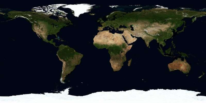
Earth continents
Credit: Pixabay/CC0 Public Domain
Academics believe they have identified a remarkable geological secret: A sunken continent hidden under Iceland and the surrounding ocean,which they have dubbed "Icelandia."#

An international team of geologists, led by Gillian Foulger, Emeritus Professor of Geophysics in the Department of Earth Sciences at Durham University (UK), believe the sunken continent could stretch from Greenland all the way to Europe.

It is believed to cover an area of ~600,000 km2 but when adjoining areas west of Britain are included in a "Greater Icelandia," the entire area could be ~1,000,000 km2 in size.

If proven, it means that the giant supercontinent of Pangaea, which is thought to have broken up over 50 million years ago, has in fact not fully broken up.

This new theory challenges long-held scientific ideas around the extent of oceanic and continental crust in the North Atlantic region, and how volcanic islands, like Iceland, formed.

The presence of continental—rather than oceanic—crust could also spark discussions about a new source of minerals and hydrocarbons, both of which are contained in continental crust.

The revolutionary new theory was born from an innovative series of expert meetings held in Durham and is included in a dedicated chapter of In the Footsteps of Warren B. Hamilton: New Ideas in Earth Science (published 29 June 2021 by the Geological Society of America), which Professor Foulger has co-written with Dr. Laurent Gernigon of the Geological Survey of Norway and Professor Laurent Geoffroy of the Ocean Geosciences Laboratory, University of Brest (France).

Speaking about the new theory, Professor Foulger said, "Until now Iceland has puzzled geologists, as existing theories that it is built of and surrounded by oceanic crust are not supported by multiplegeological data. For example, the crust under Iceland is over 40 km thick—seven times thicker than normal oceanic crust. This simply could not be explained.

"However, when we considered the possibility that this thick crust is continental, our data suddenly all made sense. This led us immediately to realize that the continental region was much bigger than Iceland itself—there is a hidden continent right there under the sea.


"There is fantastic work to be done to prove the existence of Icelandia but it also opens up a completely new view of our geological understanding of the world. Something similar could be happening at many more places.

"We could eventually see maps of our oceans and seas being redrawn as our understanding of what lies beneath changes."

The research team is now working with collaborators from across the globe on work to test their theory, which will begin once COVID-19 restrictions allow.

This work could involve electrical conductivity surveys, and the collection of zircon crystals in Iceland and elsewhere. Other tests such as seismic profiling and drilling would need millions of pounds to fund, but such is the importance of this work that funding may well be forthcoming.

Professor Foulger is a world-leading geologist whose research has contributed to mapping the geological composition of the seabed in relation to continental land masses.

This work has important legal and political ramifications, as under certain conditions, the United Nations Convention on the Law of the Sea grants coastal states exclusive rights to the non-living resources of their adjacent seabed if scientists can prove that the seabed is a submerged extension of the continental landmass.

Professor Philip Steinberg, Director of IBRU, Durham University's Centrefor Borders Research, noted, "Countries around the world are spending enormous resources conducting subsea geologic research in order to identify their continental shelves and claim exclusive mineral rights there.
"Research like Professor Foulger's, which forces us to rethink the relationship between seabed and continental geology, can have far-reaching impact for countries trying to determine what area of the seabed are their exclusive preserve and what areas are to be governed by the International Seabed Authority as the 'common heritage of humankind."
Explore further
Fragment of continental crust found under southeast Iceland
More information: The chapter, Icelandia, by Foulger, Gernigon, and Geoffroy is part of In the Footsteps of Warren B. Hamilton: New Ideas in Earth Science , DOI: 10.1130/2021.2553(04) , pubs.geoscienceworld.org/books … /130412282/Icelandia

So not really a "continent". And while it might lie mostly under Iceland, I would suspect that the island itself isn't actually part of some undiscovered craton, since Iceland sits astride the Mid-Atlantic Ridge and is pretty clearly an artifact of the volcanism associated with that rift rather than being the highest point on a "submerged continent". They point to the thickness of the crust at that point as being different from "normal" oceanic crust, but discount the possibility that this thickness is itself a function of the rift, where cold oceanic water has easy access into the lower depths of the crust and keeps it significantly cooler than the base of the crust away from the rift. Not to mention, there's pretty clear geologic evidence that the east coast of North America used to directly abut Europe, in the form of actual rock formations that form a contiguous whole when matched back together.

Also, the 40km thickness under Iceland is not "seven times thicker" than oceanic crust, since the average thickness of oceanic crust is 20km.

At best, the thick crust under Iceland represents a fragment of either the Eurasian or North American plate that got caught at the site of the rift and broke off one of the parent plates.
 

Melodi

Disaster Cat
OK, I'm not a geologist but my understanding of this article (and the six or seven others I found on the topic) is that it was a surprise that much of the land around Iceland and even from Greenland to the UK (though that my be a stretch) had unexpected properties of land that seemed to have been above water rather than produced (as expected) by just the volcanic action.

Personally, I'm not qualified to judge, but I will be watching this.

But I figure there are two main issues here:

1. Was the land around Iceland and possibly going from Greenland to the UK part of a large sunken landmass that is more recent than they thought? (I mean in reality almost all the Earth has been above or under the water at one time or another).

2. If it does turn out that the most likely explanation is that the land was above water in fairly recent "geological" past - just how far back does that go? Are we taking a million years ago or 65 million years ago (or even when that asteroid hit Greenland sometimes in the last 10 to 50 thousand years ago?).

All that makes a huge difference, because yeah, large parts of the mid-Western US used to be part of the Ocean too - in fact, the SCA (Middle Age Club) near Kansas city has one of the best names ever: They are The Barony of the Forgotten Sea.

I think the age is also a huge factor in the question of is this really going to affect international laws on whose land belongs to whom based on their "continental shelves" or not.

As I said, this is going to be so much "fun" for decades...
 

The Mountain

Here since the beginning
_______________
OK, I'm not a geologist but my understanding of this article (and the six or seven others I found on the topic) is that it was a surprise that much of the land around Iceland and even from Greenland to the UK (though that my be a stretch) had unexpected properties of land that seemed to have been above water rather than produced (as expected) by just the volcanic action.

Personally, I'm not qualified to judge, but I will be watching this.

But I figure there are two main issues here:

1. Was the land around Iceland and possibly going from Greenland to the UK part of a large sunken landmass that is more recent than they thought? (I mean in reality almost all the Earth has been above or under the water at one time or another).

2. If it does turn out that the most likely explanation is that the land was above water in fairly recent "geological" past - just how far back does that go? Are we taking a million years ago or 65 million years ago (or even when that asteroid hit Greenland sometimes in the last 10 to 50 thousand years ago?).

All that makes a huge difference, because yeah, large parts of the mid-Western US used to be part of the Ocean too - in fact, the SCA (Middle Age Club) near Kansas city has one of the best names ever: They are The Barony of the Forgotten Sea.

I think the age is also a huge factor in the question of is this really going to affect international laws on whose land belongs to whom based on their "continental shelves" or not.

As I said, this is going to be so much "fun" for decades...


As to the first: Greenland is pretty clearly part of the North American plate. The continental shelf extends up past the Labrador Sea and curves out to encompass Greenland. There are some shallower areas bridging between Greenland, Iceland, and Eurasia, but they're not clearly part of a continental shelf system. Iceland kind of splits the difference between the North American and Eurasian plates. There's a pretty ugly mess in the Atlantic Rift north of Iceland (seen in the included google earth view).

As to your second item: A lot of the various continental shelves were above water as recently as 15,000-20,000 years ago, meaning that the English Channel was dry, and whatever water there was between Europe, Iceland, Greenland, and the North American continent was shallow at best. But the last time that land was truly "dry land" as opposed to just land exposed during periods of low sea level? Probably not since well before the death of the dinosaurs. The Atlantic ocean started opening around 180 million years ago, according to our best understanding, so by 100 million years ago the division was pretty advanced, with areas of ocean at least the size of the Mediterranean between the various exposed landmasses (which were less exposed at that time anyway, so there was more water and more big islands).

Earth screenshot.jpg
 

Melodi

Disaster Cat
Mountain I think the issue (as far as I can tell) is that your first answer is what has been pretty well the accepted science until this new "discovery" if it, in fact, turns out to be a real discovery.

I'm not doubting your sources, what is interesting is going to be to find out if that source material turns out to be (like the many volumes "proving" that megalithic Europe was a child of the Greek Bronze Age) to be based on an incomplete understanding of the Geology.

Or is this new "information" just someone(s) kinds of whack-out guess based on a few interesting bits and pieces that ultimately turn out to be a big stretch of the imagination.

Or finally is it something like the water erosion theory on the Great Spynix of Giza, the "correct" answer tends to depend on if your specialty is geology or archeology and even then depends on what kind of water may have created the situation. There are reports from later antiquity of the entire complex being surrounded by water at least during the late Greek/early Roman period. But some of the geologists claim the water damage is more like 10 to 12 thousand years old and could only have been created by rain. Archeologists that accept there is water damage favor the canal theory as describe in the historical sources.

So we have three options:

Total baloney/fiction

Some truth to this but we don't know when it happens or what exactly it means.

It is just as it "says on the box" and we have to re-write geological history.

I'm not going to argue directly from either of those three viewpoints until more information comes to light - extraordinary claims don't always need extraordinary evidence but they at least need compelling evidence; especially when the information is so different from everything previously thought or understood to be correct.
 

Dozdoats

On TB every waking moment
Last edited:

The Mountain

Here since the beginning
_______________
Look up "Doggerland."

:D

View: https://www.youtube.com/watch?v=DECwfQQqRzo

How Doggerland Sank Beneath The Waves (500,000-4000 BC) // Prehistoric Europe Documentary
RT 49:58

I totally want to have a t-shirt made that references the eco-mentalist movement, global warming and all that, which is captioned with something like "Stop Global Warming and the rise of sea levels! Justice for Doggerland!"
 

Melodi

Disaster Cat
That is a very good documentary by the way on Doggerland, I love the t-shirt so would NIghtwolf.

We were just talking about this, he said there some hints in the really old stories (like part of Beowulf which he has translated and novelized) that may refer back to the drowning of Doggerland.

He said there is a story about a couple (it is almost always a couple) of Ettins (Giants/early people) who survived a great flood in a boat.

Since the majority of Doggerland is now thought to have been mostly covered by a flood caused by a landslide in Norway probably about 8,000 years ago these memories are highly likely to be the remains of something that really happened.

We know oral traditions (later written down) can last 12,000 years from information in the Vedas only confirmed once we got pictures taken from space. That was a "lost" river complete with settlements you can see from cameras that high up but long ago dried up and was hidden from view, the last time it flowed was about 12,000 years ago.
 
Top