Story Aunt Gus & Little Bear's Great Adventure Book 1 (Complete)

Kathy in FL

Administrator
_______________
July 15th – Norris Geyser Basin (Part 4)

Picture30.jpgPicture32.jpg
Steamboat Geyser, roughly 250 yards south of Emerald Spring, is famous for being the world's largest active geyser. Major eruptions, rising from the north vent, may reach up 380 feet, but only occur once or twice a year, with breaks spanning many years. However, minor eruptions are frequent, reaching 75 feet or more. The crater is colorful and complex. It isn’t just a hole in the ground water shoots out of.
Picture33.jpgPicture34.jpg
As an example of how many pools, springs, and geysers are interconnected subterraneanly, nearby Cistern Spring nearly empties after major eruptions of Steamboat despite them being over three hundred feet apart.

Other features along this section are called by such names as Echinus Geyser, Black Pit, Sulphur Pot, Crater Spring, Root Pool, Dishwater Spring, Arch Steam Vent, and Tantalus Geyser. There are also features that are only known by their geologic ID numbers, and some that have no name at all.
Picture35.jpgPicture36.jpg
Further down the trail are Mystic Spring and Mud Spring that I wouldn’t have been able to tell apart without their signage. Their neighbor, knowns as Yellow Mud Spring, is just as confusingly similar.
Picture37.jpg
A unique feature, and one of the most popular in the Back Basin, is Green Dragon Spring. The Spring isn’t exactly a geyser but it does “erupt” at two different spots of up to three feet in height (maybe more), caused by superheated boiling of the water in the “spring.” Sulfur emitted by the constant steam makes the walls inside the cave very colorful. The runoff from Green Dragon Spring flows into the Gray Lakes, which encompasses many submerged hot springs of their own. The whole area is a bubbling, steaming mess that smells worse than the old artesian well near the Barrymore homestead built out of cypress when the family first came to Florida.

Beyond the Gray Lakes are many more thermal features, named and unnamed, one of which is called Yellow Funnel Spring and that where the boardwalk climbs a low ridge and turns left to an observation platform, where you can overlook the central flat of Norris Back Basin. Directly in front of the platform is Orby Geyser (or Orbicular Geyser), and it spouts most of the time. Around Orby Geyser many craters perforate the ground, some of them belonging to informally named features such as The Cousins or Xiuhtecuhtli (name of the Aztec God of Fire). The area to the right (east) of Orby Geyser is partly obscured by trees but is where Son of Green Dragon Spring and Grandson of Green Dragon Spring are located. Beyond that are Daughter of Green Dragon Spring and Dabble Geyser. A couple other features closer to the boardwalk are called the silly names of Porkchop Geyser, Second Erupter, Sagebrush Lizard Spring. I’m thinking someone had gotten into the “special recipe” on those naming days or they were running out of names.
Picture38.jpg
Further along the boardwalk Pearl Geyser is very popular because of its opalescent appearance and its sparkling eruptions. Sometimes the geyserite lining of the crater exhibits a pearl-like luster.
Picture39.jpg
Almost as popular as Pearl Geyser is Vixen Geyser a short distance to the north. Vixen is erupting quite frequently.
Picture40.jpg
From the boardwalk between Pearl Geyser and Vixen Geyser we could see two large steam plumes behind trees in the west. The left one was from Psychedelic Steam Vent. The other one was Recess Spring, which we learned sometimes acts as a geyser, and is approximately 400 feet from the boardwalk. There is a sad story about that area.

In 2016 a 23-year-old guy from Oregon and his sister were illegally looking for a pool suitable for so-called hot potting, the soaking in a natural hot spring. About 500 feet north of Recess Spring the siblings came across Orpiment Spring, which measures less than 15 feet in diameter and named after a yellow arsenic sulfide mineral. At first look, Orpiment Spring appeared suitable for illegal hot potting so the young man bent down to check the spring's temperature but when he lost balance. In front of his sister, who captured the whole incident on video, he plunged into the pool, which was an acidity of less than pH 5 and a temperature close to 199 °F, the boiling point at this altitude. From that moment on there was no escape, he was scalded to death within minutes. Later that same day a rescue team found his flip flops and some other personal items on scene and saw the body inside the spring, but during the night the rescue operation had to be suspended due to dangerous ground and an approaching lightning storm. On the next day the recovery of his body was to no avail because the acidic Orpiment Spring did not leave anything to retrieve.

I didn’t tell Benny that story on purpose, there was a tourist group and the guide told the lurid tale before I could get Benny out of there. After giving the area a hard look all he said was, “That’s why you follow the rules.” I struggled with deciding whether to go back to the van but Benny surprised me by pulling me along and asking me to read the next sign-thingie which had long words on it.
 

Kathy in FL

Administrator
_______________
July 15th – Norris Geyser Basin (Part 5)

Picture41.jpgThe northern part of the Back Basin loop trail comprises fewer features but is still worth the hike (sans horror story) were you can see Palpitator Spring, Fearless Geyser, and one of the most impressive geyser craters in Yellowstone knowns as Monarch Geyser.

The horror story wasn’t the only reason I paid extra attention to where we put our feet. The way back to the Norris parking lot leads through dense forest, and in the middle of nowhere we found a feature called Forgotten Fumarole set well apart from the other features. And then a little further on from that were features called Bathtub Springs and Steamvalve Spring.

That was the end of Norris Geyser Basin and we headed back to the van. The people previously occupying our site number were gone so we moved in, set up, at lunch and then drove out to head towards yet another thermal area. Artists Paintpots.

# # # # #
Picture42.jpg
Artists Paintpots is a small thermal area just south of Norris Junction. A one-mile lollipop loop trail took us to colorful hot springs, two large mudpots, and through a section of forest burned in 1988.

I was a little concerned about combining Norris Geyser Basin with Artists Paintpots. It wasn’t the distance, it was the visual overload. But then I decided just to go with it because the entire park is visual overload. I pulled into the busy parking lot at Artist Paintpots. The features here did not disappoint.

The first part of the trail was a level walk on a gravel trail through Lodgepole Pines, some of which had obviously sucked up too many minerals through their roots, clogging their “arteries” and making it so they couldn’t suck up nutrients and they died. A short distance further and we were at the loop that goes up the hill, around all of the features.

There were white mud pots accented with pools of red, green, and aquamarine from algae and bacteria. Some bubbled, while others “blurped” as gas, in the form of steam, escaped the mud. *blurp, blurp, blurp* Benny got the giggles and it reminded both of us of a certain hiker we’d had pass us on a trail a few days earlier.

The entire hillside was covered in colorful run off trails. Into trees and then out we followed the trail. First came a large section of white mud pots which then led to bright crimson stream beds and an overlook of the whole area. Working our way down we saw golden areas and then areas that intermingled all the colors.

It didn’t take as long as I expected to walk the Paintpots so we did it twice. Then I decided to move an activity over to save time tomorrow.
Picture43.jpg
Monument Geyser Basin isn’t nearly as photogenic as the Paintpots but it is very unique. It sits at the top of a ridge, making it a bit more strenuous to reach is a smaller, less visited geyser basin tucked away above Gibbon Meadows which we plan to do tomorrow. It’s a fairly short hike with a steep section. While the hydrothermal features there are interesting, there isn’t the scope and variety of other basins in the area.

I pulled up to the Monument Geyser Basin trailhead and was surprised to find less than half the parking lot occupied. The trailhead sits right at a bridge crossing the Gibbon River. I grabbed Benny and I a snack even though it hadn’t been long since lunch, and we wandered down to the water to look around. While eating, we watched a bird called an American Dipper dive in the water for insects. Gotta love the insect eaters, they make life livable.

I put away our trash in my pack, made sure I had water and first aid kid, and then we started out on the trail. The first section of the hike is level, and parallels the river. A boiling pool next to the river caught my eye and reminded me to keep a careful watch where we put our feet. It was also a reminder that the entire park sits on a volcano of ginormous proportions. Benny and I both enjoyed this section of the hike, despite the occasional car driving by on the other side of the water. It was too beautiful … and surprisingly peaceful.

This wound up to be in stark contrast to the next section of the hike. The trail makes a hard turn and begins climbing up the hillside. Oomph. Luckily the footing is on solid rock which is grippy and not slippery. Turning around to give our calves a momentary break, we saw little sections of Gibbon Meadows to the north and where the Gibbon River leaves the meadow. Mt. Holmes with its lookout created a nice backdrop.

The trail was steep and we stopped numerous times to catch our breath and enjoy the view.

When we finally reached the ridge, we looked south and saw the Gibbon River stretched through a canyon. The views were a reward for the climb and the trail returned to an easy and level path.

The basin was unmistakable, no sign-thingie required though there were a few. It was a gray landscape dotted with steaming vents, boiling water, and geyser cones. None of the features were particularly large, but the cones are different than we’ve seen. They are thinner and taller, like a fat straw. Logs acted as trail markers, letting us know where to walk. This served two purposes. First it kept damage to the features to a minimum from natural acts. And two, it kept us from accidentally stepping in a feature and getting hurt.

The trail ended up to the edge of the basin and we returned to the parking lot, this time going down instead of up.
Picture44.jpg
One more nearby site and we were finished for the evening. Beryl Spring was named after the gemstone beryl, because of its blue-green color. The spring is located adjacent to the road and is one of the hottest geothermal features (averaging 196°F) in the park. There was a long narrow parking area on the west side of the road that I managed to pull into without creating my own kind of traffic problem, unlike several RVs vying for space there.

The spring bubbles water upward reaching about 4 feet in height, but directly behind the spring is a vent from which steam exits with great intensity providing a continuous roar that sounds like a jet engine as it awaits takeoff. In that respect the vent reminded me of Roaring Mountain from this morning and from a few others in Norris Basin. A wheelchair accessible boardwalk leads to the spring and has a few benches if you want to sit and experience the sounds and smells – yes, it stinks making little boys giggle.

It didn’t take and we headed back to camp. We were warned during the ranger program that we attended after a dinner of yellow rice and chicken, that bison frequently walk through the campground. Like he piles of bison poo weren’t already a clue. However, safety reminded firmly in place so I’m making sure that we, nor the van, offend those overgrown cousin to a minotaur. The Museum of the National Park Ranger is a quick walk from the campground and though I don’t have it in my schedule, we might make a stop since Benny seems interested.

Benny got a little overstimulated … or was on overload … something. It took a while for him to chill-down and go to sleep. Every time I thought he was there he’d bang up and start talking about all he’d see today. In between his jumping bean act I’ve been writing this out so I’ll have something to put on the blog. The kid has finally collapsed and I am just about there myself. One last check to make sure everything is locked and then I am hitting the hay.
 

Kathy in FL

Administrator
_______________
July 16th – Gibbon Falls, Purple Mountain, and Firehole Canyon

Weather: 75/33

Moved campgrounds yet again this morning. We are coming closer and closer to the end of our days here in Yellowstone and are covering more ground than we did in the beginning. We have tonight and two more in Madison campground and then a night back in Bridge Bay RV campground. Madison isn’t the back side of nowhere as far as campgrounds go, I wouldn’t even call it primitive, but it doesn’t have many amenities if you don’t count the views. I’ve got a long list of things that I’ll need to do in Bridge Bay to be ready for the long drives ahead of us. But that’s for the 19th, today was all about Gibbon Falls, a Purple Mountain, and the Firehole Canyon.

Started this early this morning. Was a little harder than I expected but that is because of Benny being a bit of a challenge last night. He used to be like that all the time so I shouldn’t complain that it is so rare now. My own fault. I really didn’t pay enough attention to how he was reacting to the horror story yesterday, put it down to overload instead. He – and the entire crew – wound up on the platform bed with me not an hour after we fell asleep. He wasn’t interested in talking about it this morning but we did talk a few times during the day. I let him know I was only upset that I hadn’t realized how he was feeling. I accepted that part. His part is that he needs to let me know when something upsets him and not just try to “big boy” it out. We support each other and that’s just the way it is. He accepted it and no problems getting him to go to bed tonight. Thank goodness.

It was cool and misty so we had to wear layers even knowing that at some point we’d be peeling out of them and carrying them. I also packed a lunch, snacks, and plenty of water. I noticed we are very thirsty at the end of the day. That tells me we are getting dehydrated. Just because we aren’t noticeably sweating and the weather is cool, doesn’t mean we don’t need to drink more water.
Picture45.jpg
The hike of the day was called the Purple Mountain Trail. The trailhead for this out-and-back hike was located just north of Madison Junction. Not much parking but not much traffic either. Nevertheless, I got one of only two spots remaining when I pulled in. It is a hardy 1500-foot climb to the top, but never was too steep.

Found out last night at the ranger program that Purple Mountain has an interesting history. Wildfire was a significant motivator for building trails and lookouts in Yellowstone beginning at the inception of the park. In 1910, huge fires burned more than 5 million acres in western Montana and Idaho, killing 85 people. We’d already heard that story but didn’t realize how it tied in to today’s hike. Beginning in 1931, ranger-naturalists stationed at Madison Junction were assigned fire patrol, three times a week climbing Purple Mountain to look for smoke. They began a practice of allowing park visitors to join the hike making Purple Mountain one of the first “Ranger Walks.” Pretty neat.

The wide trail begins to climb almost immediately passed the trailhead and it does not let up until you are almost to the top. Whew. There is a dense lodgepole pine forest that obscures the views for the first 2.3 miles, then the trees thin a bit and nice views are had of the rivers below and National Park Mountain (on the opposite side of the canyon). This “mountain” is really just the dark face of the Madison Plateau rising above the river. According to a sign-thingie, it there on September 19, 1870 that members of the Washburn Exhibition camped their last night in what two years later would become Yellowstone National Park. The name National Park Mountain commemorates the birth of Yellowstone and the National Park idea.
Picture46.jpgThe trail continues to climb and ends at the 3.4-mile mark with a fantastic overlook. From there it was possible to see the Tetons on the horizon to the south, the thermal steam rising from Midway and Lower Geyser Basins, and Madison Canyon to the west.

Below us was the confluence of the Gibbon River and the Firehole River. Together they form the headwaters of the Madison River, one of three rivers that join near Three Forks, Montana to form the Missouri River. Everything ties together, maybe not neatly but certainly extraordinarily. Lewis and Clark named these rivers in 1805 to honor three individuals who were important to the expedition – President Thomas Jefferson, Secretary of State James Madison (who negotiated the Louisiana Purchase), and Treasury Secretary Albert Gallatin (who paid for the trip). It was too early for the lunch I had packed but it wasn’t too early for a snack. And I made sure we both drank our fill as well.

We relaxed a bit but then vacated when a couple up there on their honeymoon started taking way too many silly pictures they seemed determined to put on their social media accounts to prove how in love (lust?) they were with each other. Now I have nothing against two grown people expressing themselves, just do it in private and not with a five year old present and wondering what in the heck all the fuss and bother is about. Geez.

It took us four hours to hike the 7-mile trail. We were both ready for another snack and drink by the time we got back to the van. I thought about just eating lunch there at the pull out but decided to wait until the next stop.
Picture47.jpg
Gibbon Falls is an 84-foot waterfall that tumbles over remnants of the Yellowstone Caldera rim. The rock wall on the opposite side of the road from the waterfall is the inner rim of the caldera. A decent sized parking area and a long viewing walkway made for easier than expected parking given the number of people there. It was a popular stop as it is a stunning waterfall that was less than half a mile to walk to on an improved trail that kept things from feeling too crowded.
Picture48.png
A couple of men on the Hayden Expedition in 1872 are given credit for discovering the falls. I’m pretty sure local Native American people knew of it before them but what the heck, let’s just say it was those two men who introduced it to the White Man and thankfully it has been treated like the natural wonder that it is ever since.

Our next activity could have turned into a bust but didn’t. Firehole Canyon Drive is a 2-mile, one-way road off the Grand Loop south of Madison. It follows the Firehole River upstream from Madison Junction to just above Cascades of the Firehole. The drive takes you past 800-foot-thick lava flows and to a viewing area of Firehole Falls, a 40-foot (12.2-m) waterfall. There is a small parking area available near the falls and several small pull-offs along the road.
Picture49.jpg Picture50.jpg
Next came what I was really after and where the plan almost fell apart. The road wasn’t crowded. The falls hadn’t been crowded. I made an assumption that I shouldn’t have. Just because the two other parts of the Firehole area weren’t busy I thought the swimming hole would be deserted as well. That was a big nope good buddy.

The swimming hole in Firehole Canyon is one of two swimming areas inside Yellowstone National Park. The other we’d already been to - Boiling River – but even with no facilities it was still much better organized than this one was.
Picture51.jpg
There is no parking lot at the Firehole Swimming Area, but there are several locations to park on the side of the road. Sort of anyway. The spaces are just that, wide places on the side of the road and if you miss getting a spot you have to drive all the way back around since everything is one-way. There are vault toilets you can use as changing rooms to put your swimming suits on, but like all vault toilets … not exactly a very hospital location for changing. Then the access to the rocky beach area is by climbing down a long wooden stairs. The beach is roomy enough that you can sit and watch the swimmers if you don’t want to swim yourself, but emphasis on the rocky; you can’t just sit there without some kind of padding under you and at the very least you need to wear flip flops while walking.

Then there is the name. “Firehole River” may lead you to believe that this is heated by hot springs. Nope. The swimming area is a cool temperature similar to an unheated swimming pool. Those used to swimming in rivers and lakes will not see any difference in this water temperature. Unless of course you are from Florida where most such bodies of water are roughly bathtub temperature. The “Firehole” was anything but.
Picture52.jpg
There is no lifeguard on duty, but the beach is relatively calm and safe. Everyone knows they are swimming at their own risk. That said, if you stay in the calm areas and don’t participate in horsing around, it is a perfectly safe place to swim, you just have to use commonsense and good water safety practices. There were a couple of knotheads but Benny and I avoided them. We also wore water shoes so our feet were protected, not only on the beach but as we walked in the river. Climbing on and jumping from the cliffs is illegal, unsafe and strictly prohibited and thankfully not even the knotheads tried to pull that kind of stunt.

One woman did wind up needing first aid when she tripped coming out of the water and face-planted. No teeth were cracked or chipped that I could see – her biggest fear – but she did cut the inside of her lip pretty good and had scrapes on her chin and nose. That was pretty much the end of the “good feels” that Benny and I had been having. I couldn’t ignore the situation, that’s not in my training or personality, but when the rangers arrived I vacated rather than get in the way.

Benny was ready to go back to the van anyway. He was getting chilled from the cold water and the crowds weren’t doing a whole lot for him either. The woman’s accident also caused him to start wondering about the little girl Gabby and wondering how she was. The parents hadn’t left a comment or tried to contact me through the blog so I told him they must have their hands full with family stuff. I think he understand but I hope it doesn’t hurt his feelings.
Picture53.jpg
To warm back up we left the Canyon Road and drove to the Harlequin Lake Trail. Parking for the trail is at a fantastic overlook of a broad, wildlife-filled meadow that leads to the Madison River. We crossed the road to the north and entered a lodgepole pine forest that was very quiet and peaceful, welcome after all the noise at the swimming hole. The trail is a real treat is when you reach the lil pad covered lake. There were birds everywhere. Benny found all of the birds he was missing for his animal bingo game and trust me, he was a happy over-achieving camper and it distracted him from any lingering stress of the accident at the swimming hole. The hike was less than a mile, but we were still on it for a little over an hour.

We did one final hike of the day before going back to camp. It wound up being 3.4 miles as it was a point to point; 1.7 miles out and then 1.7 miles back. To reach the trailhead for the Sentinel Meadows Trail, we took the Fountain Flat Drive (found north of Fountain Paint Pots on the Old Faithful to Madison Road) and traveled west about a 1/2 mile to the barricade. There we found a parking lot and the trailhead for the Fountain Flat Drive Trail. Using the trail map as our guide, we followed the old freight road south .4 miles. Just after crossing the Firehole River, the Sentinel Meadows Trail turned off to the right.

The mostly level trail began along the Firehole River, where a sign-thingie informed us it was one of the nation’s top blue ribbon fisheries. It sports healthy populations of rainbow and brown trout and whitefish. The trail quickly made a bridged crossing of tiny Fairy Creek. Soon the trail began paralleling Sentinel Creek. About .9 miles from Fountain Flat Drive, the trail topped a small rise and provided nice views of Sentinel Meadows and valley.

There were three white mounds equally spaced across the valley. The meadows were named for these features – Steep Cone, Flat Cone, & Mound Springs – which to an 1872 geologist appeared “as if they were guarding the upper valley.” Hence, the name “Sentinel” Meadows. Or so said a guidebook I used to choose which hikes we would do while in Yellowstone.
Picture54.jpg
At 1.3 miles, the trail made another small rise and provided closer views of the springs. It then bore left and continued to skirt the marshy meadow. A tumbled down small log structure sat near a hot spring area to the right of the trail. This is the Queens Laundry. In 1880 workers building a road over the Madison Plateau found a beautiful spring and on their Sunday off came down to explore. They found it great for bathing and washing their clothes. A year later, Park Superintendent Norris began construction of a bath house for visitors to use to change clothes to bath in the spring. Although never finished, it has the distinction of being the first government building built for public use in any national park. A sign-thingie gave an important safety tip – the spring is much hotter today than it was in 1880 making bathing and washing impossible, not to mention it is now illegal.

The trail continued along the edge of the meadow and ended at its junction with the Imperial Meadows Trail. It is at that point that we turned around and returned to the van, never having seen another person on the trail, a welcome relief.

I almost gave in to going to Canyon Village to either get us something to eat at the café or pick up food at the general store. In the end I did neither. We have food. We have plenty of food for a while yet. I’m just getting tired of what we have which is no excuse for wasting money. Benny will eat anything I put in front of him, thank goodness. I ended up making a SPAM stir-fry. The ranger program was a repeat so we stayed in camp and, while Benny had a meeting with the crew, I got our socks and underthings washed in the Lavario and thanks to the dryer and cooler air they were almost ready to put away by the time I started to put Benny away. He smiled a sleepy boy smile at my attempted joke but was soon all the way to sleep. I’m not staying up late either. Last night was not the best sleep I’ve very had, and tomorrow is another day.
 

Kathy in FL

Administrator
_______________
July 17th – Mystic Falls and Geyser Basins (Part 1)

Weather: 79/37
Driving Route:
Picture55.png
It rained off and on all day today. It didn’t really stop us much, we’re from Florida and if you are afraid of the rain you’ll never get anything done there. But it did mean leaving out a trail that I had already been warned was muddy to marshy and very, very buggy. No problem there as I’d been thinking of leaving that one out anyway.

But what did we do in the rain? Well, it depended on whether it was just sprinkling or if it was really coming down. Thankfully it was mostly light rain and as I said, that didn’t really stop us because we were prepared. Being prepared meant in the morning the top layer of our “layers” was a waterproof windbreaker type jacket. It was lighter weight than we could have used but the layers underneath kept us warm. By afternoon it had really warmed up and our top layer was a good rain pancho that was thick enough it didn’t snag and tear on everything we walked by. It also didn’t make that gawd awful crinkling noise the cheaper ones make that drives APD brain hamster crazy, especially when the hood is pulled up. I had several people ask where we’d gotten ours and I told them we brought them. I don’t know how people don’t prepare and pack accordingly. It would drive me nuts.
Picture56.png
I keep our hikers waterproofed with Nikwax treatment, but between activities I made sure that we changed socks if our feet got damp; or, at least we changed the inner sock liners we wear when we hike more than a mile or two at a time. Since we traveled in the van we also had the option of changing shoes if we needed to, but thankfully that wasn’t the case. Mostly it was cleaning the mud off the bottom or setting them in a boot tray and sliding on slippers until the next stop.
Picture57.jpg
I saw a lot of people walking around in wet shoes today and heard tonight that the hot showers in Canyon Village were packed with a long wait line. The shower in the van isn’t “hot” but I fixed that by heating some water to take a spit bath with. I also made sure that Benny and I paid particular attention to our feet.

The rest of our outer clothes were ripstop and quick dry so we never got soaked. Being wet doesn’t bother me but the last thing Benny or I need is a cold so in addition to all of my other precautions, I made sure we had something warm to drink if we needed it. My Contigo thermos of warm cider lasted all day and Benny’s of cocoa nearly as long.

Most people appeared to be trying to wait the rain out in camp, or if they were in tents packing up the best they could to keep their gear dry and then going off to find some breakfast since cooking out in the rain was not what you would call a successful enterprise to undertake. I’d put overnight oatmeal together last night and it held us until lunch time which we ate in the van between stops. As planned our first stop of the day was Midway Geyser Basin.
Picture58.jpg
Midway Geyser Basin, once known as “Hell’s Half Acre,” is called Midway because of its location between the Upper and Lower Geyser Basins, both of which we’d already done. It contains two of Yellowstone’s largest hydrothermal features - Grand Prismatic Spring and Excelsior Geyser.

From the parking area, only a quarter full when we arrived, the path crosses the Firehole River. Thee was a large thermal runoff rushing to meet the river and the hot water hitting the cold river created significant odiferous steam. Just up the hill, Excelsior Geyser discharges more than 4,000 gallons of water per minute into the river, making it one of the most prolific hot springs in the world.
Picture59.jpg
As we reached the top of the hill, Excelsior Geyser revealed its huge 200 by 300 crater. If that sucker had been active I wouldn’t have gone anywhere near it but it is dormant for over 125 years. However, for a brief period in the 1880s, Excelsior was one of the largest geysers in the world. According to its description, explosive eruptions sometimes measured 300 feet high and 300 feet wide. Then Park Superintendent Norris named the new attraction, stating that he found it “so immeasurably excelling any other [geyser], ancient or modern, known to history, that I find but one name fitting, and herein christen it the 'Excelsior.'” They say that Excelsior will come back to life as a precursor to Yellowstone Volcano erupting. That would be one heck of an experience but I can guarantee you, I’d drive to South America in the van with Benny and set up camp in Tierra del Fuego before I’d hang around for such an event.
Picture60.jpg
The boardwalk bends to the left around the side of Excelsior then bends back to the right to reach Grand Prismatic Spring. It is an enormous spring that measures over 370 feet across and 120 feet deep, making it the second largest hot spring in the world. The postcards of this thing gives you an arial view you can’t get from ground level but it still doesn’t do the brilliant colors justice. Early visitors to the park were told it was “so dazzling that the eye cannot endure it.” Most of the colors are caused by bacteria, the kind that thrives in the hot water, same as like Artists Paintpots and the others we’ve seen.

Had a Benny Funny this morning when we were going to the bathroom first thing. Oh my Lord, Why is it the male of the species is so enthralled with bathroom humor. Even Grandfather Barry, as staid as he could be, would sometimes compliment Grandma Barry’s cooking by having to go out to his workshed for a while and say things like, “Better out than in.” or “Must take some pressure off or the valves will explode.” One day I’ll recount the story of when I was about eight years old and Lawrence was able to come home for Christmas for the first time since enlisting and we had all stayed with the grandparents. It has to do with Dad, Grandfather, and the Judge, Meemo’s world famous baked beans, and a few too many beers, and me showing up in Lawrence’s scuba gear to help Grandma Barry clean up out there.

Anyway, Benny and I were at the potable water faucet topping off our containers. To do my duty and track how well he was remembering things from day to day I asked him to tell me about what he’d learned recently, not just yesterday. Everything was fine and dandy until he got to the Artists Paintpots. Guess what he called them. No really, guess. Paint Poots.

“Benny Lawrence. They are called Paint Pots.”

“They sure didn’t smell like paint pots.” And of course he started to giggling and snorting and all the rest. There were two men nearby with their sons and sure enough they’d overheard and they started chuckling and the boys started giggling and laughing. The grumpy teenager with them tried not to but even he guiltily gave in and started horsing around like he’d found his human bone.

I grabbed the gallon jug in one hand and threw Benny up over my shoulder with the other and bounced him all the way back to the van, him laughing the entire way. I mean if he was going to go caveman with the rest of the local male species, I was going to give him a dose of cavewoman. He thought it hilarious. Me not so much, but you have to let them be boys or you wind up with some confused kid that at the very least is repressed and having an identity crisis at some point. I may be female but even I at least understand that much about the males of my species.

The smells are never great in the geyser basins and when I caught Benny’s mind wandering back to Paint Poots, I made sure to try and make what was before us as interesting as possible to distract him.
 

Kathy in FL

Administrator
_______________
July 17th – Mystic Falls and Geyser Basins (Part 2)

We reviewed what we’d learned all the way back at West Thumb. Certain types of bacteria are found in extreme temperatures, including boiling water. The less tolerant photosynthetic cyanobacteria (quite a mouthful and commonly called blue-green algae) survive in Yellowstone's thermal pools in temperatures up to 167° F. At that temperature, it is normally a light-yellow color. The water cools as it moves farther from its source. Soon orange, red and finally green colors are found near the outer edge of the spring.

In 1839, mountain man Osborne Russell described Grand Prismatic this way, “At length we came to a boiling lake about 300 ft. in diameter... The steam which arose from it was of three distinct colors from the west side for one third the diameter it was white, in the middle it was pale red, and the remaining third on the east light sky blue...”

From Grand Prismatic, the trail looped back to the right and back to the parking area. Midway basin isn’t very big but it was enough that it had been worth doing even though the rain got a little harder toward the end. I did get a few good shots with my phone’s camera but I put on my mental list to grab the postcards I wanted before leaving Yellowstone.
Picture61.jpg
Our next stop was Biscuit Basin which was named after biscuit-shaped geyserite formations that used to surround parts of the majestic Sapphire Pool. From the Biscuit Basin parking area, surprisingly busy given the weather, we crossed the Firehole River on the footbridge and continued along the boardwalk. On the right, we passed an active spring called Black Opal Pool, with larger Wall Pool just behind it.

Next came one of the main features of the basin; a deep, dark blue spring called "Sapphire Pool." Until a big earthquake in August 1959, it was a very hot but relatively small geyser, surrounded by a delicate buildup of silicon dioxide scalloping that resembled small biscuits. Had to have been a guy that named it, they’ve always got food on their minds. Following the quake, explosive eruptions occurred that reportedly reached a height of 150 feet drawing quite a crowd of people for a while. Unfortunately Sapphire's eruptive powers waned and by the mid-1960s it had returned to its passive pre-earthquake character. None of the “biscuits” survived the violent eruptions.
Picture62.jpgJust past the junction with the loop trail, as it joins from the right, we saw Jewel Geyser. It was named for the beads of sinter around its vent. A bit further on the left was Shell Geyser. Some of the names given to features in the park are obvious … or they are after you are given an explanation … but some of them like Silver Globe Spring and Avoca Spring are much less obvious.

At the trail junction we stayed to the right and looped around the boardwalk. On an educational sign-thingie we learned about one of the insects in the park called a “shore fly.” It is a "vegetarian," and solely feeds on the algae and bacteria around thermal features. We also spotted a wolf spider, tiger beetle, and a bird known as a killdeer all of them just hanging out and chilling between meals. These are the "carnivores" of the basin. They prey on shore flies and their orange-colored eggs for nourishment. Many of these life forms are so perfectly adapted to the basin, they can be found in no other environment.

We were both a little done with boardwalks so headed to our next activity which was a hike to see Mystic Falls. The trail is a relatively easy until the last little bit, 2.4-mile there and back again trail that follows a creek through mixed conifer forest. We’d already done the very beginning of the trail since it begins near Avoca Spring. For the next 0.9 miles, the trail followed the north side of the Little Firehole River and climbed gradually to the base of Mystic Falls. The rain wasn’t bad, just light and constant.

Along the trail we passed two trail junctions. The first was Fairy Creek Trail that dropped steeply from a scenic lookout. The second was Summit Lake Trail, which splits to the left. The Summit Lake didn’t look very well used and I found out later that it wasn’t because during the summer the bugs are really bad and during the winter it is fairly inaccessible.
Picture63.jpg
Mystic Falls cascades 70 feet over canyon rhyolite, a rock that is erosion-resistant. It has two sections, and each section has multiple steps. We saw some chuckle-inducing yellow-bellied marmots playing along the trail. Man they were funny. One of them was really fussing and fretting at the others.

“She must be the auntie,” Benny said. “She’s making sure they behave.”
Picture64.jpg
Made me wonder if he saw what I do as a bunch of fussing but since he was smiling when he said it I didn’t make a big deal of it. But, it makes me want to take a closer look at how I act. I thought I was handling this morning’s “paint poots” incident with humor but maybe he didn’t see it that way.

From the falls, the Mystic Falls Trail continues to the right and switchbacks steeply up more than 500 feet in under a 1/2 mile to reach the top of the Madison Plateau where the trail ended by joining Fairy Creek Trail at the 1.3 mile mark. It wasn’t the day to add another twelve miles to the trail so we turned around and went back to the van.

We got lucky and got to tag along with a ranger walk part of the way. Fire ripped through that area in 1988, charring the lodgepole pines. As bad as it looked, it was actually a good thing for the trees. Lodgepoles have an unusual way of coping. Besides their annual seed cones, they produce special "serotinous cones," which only open at temperatures that exceed 113 degrees F. It was hard to imagine what the aftermath of the fire must have looked like.
Picture65.jpg
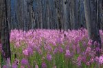
The ranger also pointed out tall, green, two to three-foot stems with multiple deep pink flowers on them that are known as "fireweed." He said those “pioneer plants” are some of the first that move in after an area gets burned over and they help hold the soil until seedling trees can take hold. Other plants that enjoy the increased sunlight in and near burned over areas where the trees haven’t grown so tall to block out the light are clumps of purple lupine (distant relative of the Texas bluebonnet), tiny clusters of stark white pearly everlasting and pink-topped Canada thistle.

We saw a few more marmots before the trail got near the thermal area but they were quite as playful as the ones at the falls had been. When we got back to the van we ate our lunch – basically just a bunch of finger foods – and that is also when I made the final decision to drop the longer hike I had planned. While Benny ate I rearranged and added stuff into our schedule.
Picture66.jpg
First it was off to Black Sand Basin which lies northwest of Old Faithful. According to the guidebooks, this hydrothermal area is often overlooked because of its close proximity to the Old Faithful Area. I agree with the books. It's a shame, because there were some really interesting and beautiful features there.

The basin is named for Black Sand Pool, which lies on the opposite side of the highway from the main section. Before the Interchange was built, visitors had to follow the spur road from Giant Geyser to Black Sand Basin passed Black Sand Pool. There is still a trail there, it just isn’t often used.

The basin straddles Iron Spring Creek. Early geologists attributed the red color on the banks of the creek to the mineral iron - it's actually red because of cyanobacteria just like in other thermal areas. Just across the creek was Cliff Geyser. The geyserite buildup next to the creek is the "cliff" that gives the geyser its name. It has changed character over the years, but most often it erupts 10 to 15 feet high in intervals of less than 3 minutes. Very cool, and we got to see it erupt several times while we walked the boardwalk which at that point passed Green Spring and crossed the creek.
Picture67.jpg
We turned left at the junction and followed the boardwalk out to see Emerald Pool. It has a unique emerald tint that is caused by the boiling blue water in the deep pool combining with the yellow bacteria growing on the sides of the bowl. We walked back to the boardwalk junction and took a left. We passed (on the right) Rainbow Pool. Its crater is nearly 100 feet across. Sunset Lake was an even larger hot spring. It was named for its intense flame-like colors.

The most famous feature of the basin, Handkerchief Pool, is dormant. From the late 1800s through the 1920s visitors were encouraged to put their handkerchief in the small pool. The water would suck it down and a few minutes later would return it to the top "nice and clean." It is thought that too many people did that and it clogged some of the subterranean mechanisms up. There was a prominent sign near the pool that warned placing objects in any hot spring or geyser is illegal and very damaging to the delicate features.

When I was researching to plan our Adventure I read an article titled, “The Embarrassing History of Crap Thrown Into Yellowstone’s Geysers.” I mean given the title how could the brain hamster pass it by. It was both interesting and educational. For instance, in 1877 an expedition party used Old Faithful as a washing machine. I mean, weird or what.[1]

We still had nearly a half day’s worth of time to fill and I decided to surprise Benny with a return to the Old Faithful area which would also give him time to turn in his Junior Ranger materials and do all of the other kid stuff in the area. It also gave us the Old Faithful Lodge to duck into when – not if – the rain got heavier.
Picture68.jpg
Boy was that last minute idea a hit. We saw Old Faithful go off a couple more times, took pictures, saw the rain make the entire area even more steamy than usual. We saw a heard of bison cross through the area. Benny earned, more than earned, his Junior Ranger badge and I got him a patch since he went so far above and beyond. We got “noticed” by a couple of rangers and some other guests heard it and we had a small audience for nearly an hour as we all waited out one of the hardest downpours of the afternoon. When the clouds parted most people made a break for the outdoors but I made a beeline to the gift shop to pick up some postcards. A bison named Bill also joined the stuffie crew. Fine. I can spoil him on occasion if I want to. So there. Besides I found a treat of my own.
Picture69.jpg
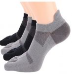
Right there staring at me in the back corner of the store where they keep the things that don’t sell well were a couple pair of “toe socks.” I hadn’t really thought about those things since middle school when Dad brought me back a pair for some goofy reason. Well, not so goofy. That summer I was on the water so much, and didn’t take care of my feet, that the skin between my toes started cracking so bad they bled. Then to add insult to injury I got foot fungus. It was a mess and took forever to heal, especially since I was hiding the condition for a long time so I wouldn’t be restricted from the water. Well Dad caught me, and I got taken to the doctor and restricted from the water and was miserable. But this lady who owned one of the houses down the bank from us, but only used it as a vacation place, was a yoga instructor and invited me to join her on her dock when she was doing yoga. And she taught me how to stretch properly and plank and all the rest of that. More to the point she used to wear these toe socks, only hers had that non-slide grip on the bottom. I never said anything to Dad about them, money was tight that summer, but he must have gotten word of it somehow. I still have those stupid socks in a box of stuff I refused to let Lawrence get rid of. I wore them until they nearly fell apart, even getting Grandma Barry to teach me to darn them. Funny how things can be so important you’ll make a huge stink about it … then suddenly you don’t think about them again. Only something will turn up down the road and you get lost in memories you forgot you had. I bought both pairs of socks and even asked if they had any more. They didn’t. I may buy a few pair online if I can find them … that’s assuming they are as comfortable as I remember them being.

At the Bear Paw Grill – Benny insisted on a picture with the sign – we picked up drinks and chips to munch on as we walked around a few more of the features that thrilled us the most and for our last time viewing Old Faithful erupting. It was like having a popcorn and soda at the movies; cost about the same too.

With both our stomach and eyes both sated, we headed to the van and back to camp. Sure, we could have kept going but we have about fifteen miles of hiking to do tomorrow if the rain lets up as forecast. We enjoyed a new ranger program, swept out and neatened the van, aired the beds, took a little extra time with our own hygiene, and in general took it easy and kept it boring. You need times like this if for no other reason than it helps you enjoy your busy schedule more.

Tomorrow night is our last day in Madison campground and then we only have one night left which we will spend in Bridge Bay. I’m both sad our time here is coming to an end but also eager to move on. The only trouble with moving on is that it reminds me I still don’t have a plan for when our Adventure comes to a complete end. I have a few ideas but none of them alone will take care of our finances, not even with Benny receiving survivor’s benefits and free healthcare. None of them are getting me any closer to deciding whether to put Benny in a traditional school setting or home school him. I do know that private school is out. Maybe I’ll just put the worry of that off a little while longer. Nothing that I can do about it right now anyway. Plus, Benny wants me to watch a documentary with him. Guess which one I am going to pick to do.


[1] The Embarrassing History of Crap Thrown Into Yellowstone's Geysers
 

Kathy in FL

Administrator
_______________
Thank you so much Kathy.

I remember when the brother and sister incident happened. Can you imagine living your life having that memory flash in your mind on occasion?

That's not the only such incident that happened in Yellowstone, it is one of the more graphic because of the body completely disintegrating.

There is a book dedicated to such deaths.


There are also some youtube videos like the one below about deaths in the park


Siskiyoumom

Veteran Member
That's not the only such incident that happened in Yellowstone, it is one of the more graphic because of the body completely disintegrating.

There is a book dedicated to such deaths.


There are also some youtube videos like the one below about deaths in the park

Dear hubby took a raft trip down the Colorado River through the Grand Canyon. Required reading was a book on how to die in the Grand Canyon. More men die there than women. The leading cause of death was men stepping over barriers to pee.
 

Kathy in FL

Administrator
_______________
July 18th – More Falls, Geysers, and a River

Weather: 73/42

Love the toe socks even if Benny does think they are weird. I have big feet for a woman – long, wide at the front and narrow at the heel – and shoes have always been a problem. I’ve lived in flip flops and sandals most of my life when I wasn’t in uniform of one type or another. My cousins used to say I didn’t have feet, I had flippers. That might be true, but it was just that, even as a little kid, I could beat them in every swim race we had. After a while they wouldn’t even go in the river any longer – unless they were with their friends which wasn’t often when I was around. Dad and Lawrence used to call me Monkey Toes because I could climb a tree barefooted and I was just as likely to pick something off the floor with my foot as I was to being over and pick it up with my hand. Dad used to laugh and say I had a flexible lazy streak a mile wide. Geez. Memories. I do not need to start having trouble living in the past at this point in my life when I need so much to find a path forward.

Benny and I had fun today. I’m trying to make the most of our remaining time here because there is a gap where hiking isn’t going to be possible, or at least not hiking like we are doing now. Not worried about it, we’ll just have to fill our time in other ways.
Picture70.jpg
First hike of the day was to Fairy Falls. The hike combined three trails off the southwestern leg of the Grand Loop Road. Not long before the first covid pandemic trail crews finished a new official trail that stretches for .5 mile, climbs 105 feet and brings you to a fantastic overlook of Grand Prismatic. Yowzer that was a cool view. The trail replaced many user-created trails that led to the unofficial “Picture Hill” off the Fairy Falls trail. It was from this view that people used to photograph, albeit unsanctioned by Yellowstone officials, the Grand Prismatic Spring from above.

Because its construction is complete, visitors can use a new trail and overlook to safely gain spectacular views of the Grand Prismatic Spring and Excelsior Geyser. To alleviate traffic congestion, safety concerns, and resource impacts, the park also made a parking area near the Fairy Falls Trailhead at Midway Geyser Basin. Parking is very limited so we had to get there first thing, especially since we weren’t there just for the view but for the remainder of the trail.

At 220-feet-high, Fairy Falls is the park’s tallest frontcountry waterfall. There are two trailheads and two different approaches to hiking to the falls. You can park 1 mile south of Midway Geyser Basin at the Fairy Falls Parking Lot. Or you can park at the end of Fountain Flat Drive. From either point you’ll walk through a lodgepole pine forest to the falls along a 5-mile round-trip route. We parked at the Fairy Falls Parking Lot.

At Fairy Falls, Fairy Creek shoots out over the edge of the Madison Plateau and plunges 197 feet. Members of the 1871 Hayden Survey named it for the “graceful beauty with which the little stream dropped down a clear descent.” It really was quite pretty even though I’m not really inclined to describe things that way.
Picture71.jpg
A little over a half-mile further down the trail, Imperial Geyser was reached. This geyser became quite active in the 1920s. Because of its size and importance, a contest was organized to give the geyser a new name. However, soon after the name “Imperial” was chosen, the geyser stopped erupting. Today, Imperial Geyser erupts again (although infrequently), sometimes reaching a height of 35 feet.
Picture72.jpg
Follow Imperial’s large runoff channel one-eighth of a mile to the east to find Spray Geyser. This geyser lies just north of the channel and erupts frequently. After getting our fill, and using no small chunk of my phone’s memory, we headed back to the van to move to our next trail.

Lone Star Geyser in Yellowstone National Park is a great, cone geyser set away from the large collection at Old Faithful. The path to it is along an old road that is bike-friendly and follows a beautiful, lazy section of the Firehole River. Lone Star Geyser erupts about every three hours. There is a logbook, located in a cache near the geyser, for observations of geyser times and types of eruptions. The trail itself is a 4.8 mile, easy there-and-back hike or bike that follows the Firehole River to the geyser.

The trailhead is east of Kepler Cascades pullout, 3.5 miles southeast of the Old Faithful overpass on Grand Loop Road. We parked there, went through the gate at the trailhead, and began walking down the road. I had thought about riding the bikes but there were too many for me to be comfortable of Benny being able to navigate it. The trail follows the Firehole River upstream along an older stand of lodgepole pines.

Lone Star erupts 30–45 feet in the air about every three hours, though timing is not exact. We got lucky and witness an eruption so got to note the time and report and our names in the log book. Safety note: Biking is not permitted beyond a barrier near the geyser.

Unlike yesterday it was a perfect sunny day with good temps. The river meandered with the trail following it despite the bends and twists. There were a few spots that we stopped just to watch the fish in the river and the plants growing in the bottom. We passed a small hydrothermal feature that was steaming and bubbling just off the road as well as a couple of nice, pocket meadows. The thermal features were a good reason to stay strictly on the trail.

The road crosses over the river on a bridge; however the road is no longer used by the public and has a few sections that have degraded, another reason for not having Benny on his bike. I watched one guy almost take a header when his front wheel hit a hole that was deeper than he expected.
Picture73.jpg
Eventually, the road led to the basin where the Lone Star Geyser sits. There were a few bikes leaning against the gate as they weren’t allowed beyond that point. The geyser’s cone was immediately visible when we entered into the basin. All around, we saw pockets of bubbling pools and steaming vents. The geyser itself was steaming and spouting when we arrived. I wasn’t sure when it was scheduled to go off and a couple of people leaving the area said that it had missed its last appointed time. Too bad they gave up and left.

The geyser started having some pretty nice spouting and steaming action going on. I almost thought that was the actual eruption. A couple standing next to us assured me that wasn’t the case so I decided to give it a few more minutes just for the heck of it. Then all of a sudden … wow. It shot high in the air and lasted quite a while. We moved out of the steam that was blowing our way and Benny pointed excitedly at a chunk of rainbow that had appeared in the mist.

I almost stayed for another show but there were other things to do and Benny and I both were getting hungry for lunch, which we ate in the parking lot before heading on to the next hike.

We came in the South Entrance of Yellowstone; gone to the North Entrance for the Roosevelt Arch. We’d be leaving through the East Entrance so that left the West Entrance and that was close to where our last hike of the day was located.

The trailhead I was looking for was down an old service road a half mile east of the West Entrance. I was tempted to go into the town called West Yellowstone until I saw the flagmen ahead directing traffic. I haven’t mentioned it much, but they are always, and I mean always, working on the roads here in Yellowstone. I’ve never seen anything like it. Since I haven’t tried to go long distances or circle the entire park in a day or two, when we’ve run into road crews it hasn’t been too bad, but if you ask almost anyone else that is their number one complaint about the park followed closely by the crowds of people.

The turnoff was on the north side of the road and led another mile to the parking area. There was a bike path that you could have used to come in from the town, but I didn’t see anyone using it as we passed by. The trail turned out to be an excellent, easy, short hike. The “official” trail was a four mile there and back, but it can be made as long or short as desired because it primarily follows game and fishermen trails along the bank of the Madison River.

The scraped gravel meadows at the end of the service road were formerly called "the Barns" in reference to their use as a staging area for livestock back to the Army days of the 1880s. It later became a dumping area (now cleaned up) and also serves as the trail exit for the Cougar Creek Trail. A little imagination was all it took for Benny and I to see how it must have been. From the parking area we basically just hiked along the edge of the Madison River, occasionally running into people fishing. I got the feeling most of them were locals out relaxing rather than a tourist on a serious mission. We found a quiet spot and I slowly pulled out the telescoping reels from my pack I had snuck in there without Benny seeing. He knows to be silent when fishing or around fishermen so as not to scare the fish, but it was a close thing to keep the Snoopy dance quiet.
Picture74.jpg
I made sure I had our temporary fishing license in an easy-to-reach pocket, and we went fishing. The only bait I had was corn kernels, but I wasn’t out to land a keeper, more catch-and-release. Surprisingly we did catch two that were big enough and an off-duty ranger who recognized the van and had come to see if we were around even agreed they were legal size.

Good thing I had a Ziploc bag big enough to hold the two fish and some river water, and it wasn’t a warm day or a long hike, or the fish wouldn’t have kept back to the van and then made it to camp. I’m an old hand at cleaning fish. My grandparents wouldn’t have allowed anything else. Dad said it was nice to come home to fresh caught fish he didn’t have to clean himself.

In camp I had a good flensing knife and even managed some boneless filets that I panfried with cherry tomatoes I hadn’t used the other night and were on their way out of date. A little dried tarragon and some salt and pepper and wham bam thank you ma’am, had my shipmates been here they’d have known they were in for a treat. I made some pilaf to go with and Benny and Gus were happy campers.

Benny was content to skip the ranger program when he found out it was another repeat so while he played with his discovery toys, I went over the schedule for tomorrow to optimize our time so we’d get everything done. Tomorrow is our last night in Yellowstone. I will miss this place, but it is time to move on. As I told Benny, there is more adventure out there waiting on us.
 

Kathy in FL

Administrator
_______________
July 19th – Last Day In Yellowstone

Weather: 75/36

Last night in Yellowstone National Park. Hard to believe yet it seems like we’ve been here so long we are starting all over again to get out on the road. We’ve been going, going, going while we were here. The rain the other day didn’t even stop us. Today was different, more relaxing and reflecting on our stay, combined with preparing for tomorrow … and the tomorrows after that.

One last hike is what I allotted us. Storm Point Trail. And it wasn’t even a long one, just under a two-mile loop and easy. But we had other things to do today and I wanted a good overview.

The trailhead was located 2.8 miles east of Lake Junction on the East Entrance Road at the Indian Pond (formerly known as Squaw Lake) parking area. I’d heard that Storm Point is a good, short, early or late day stroll to a vantage point overlooking Yellowstone Lake and shore. Mornings and evenings generally are calmer, as mid-afternoon winds from the southwest race across the lake unabated, producing choppy water with frothy white caps. The wind then funnels through Mary Bay, to the east, and becomes even more violent. Calm sounded good to me.
Picture1.jpg
As we pulled into Indian Pond, we were warned to scan the open grassland around us for bison. The huge animals frequently swarm around the area, often blocking traffic. Yeppers, we had to wait for a few to take their morning constitutional another direction before I would let Benny out of the van.

We started along the trail, heading for the forest. After a quarter mile we reached a fork and took the recommended right that starts the trail with a more dramatic build up. We continued along the flat pleasant path through the Lodgepole pine forest. I had us decked out in bear bells and told Benny he didn’t have to use his indoor voice as Grizzly bears are often seen in the area. And I had our bear mace on my side like a Colt revolver. I wasn’t scared but I was being cautious and teaching Benny wise trail skills … I hope.
Picture2.jpg
To make sure there was noise to keep the local animal population on alert to avoid us I recited what I’d read about the trail and area. During the mid-1980s, the University of Michigan explored the bottom of Mary Bay using a tethered submersible camera mounted in a small vacuum-cleaner-sized submarine. What they discovered at the bottom of the bay were hot springs bubbling through the sandy bottom and aquatic creatures nearly twice their normal size for a mountain lake. Deeper in the lake, they discovered geysers that erupt just as their land counterparts do.

The flat meadow just before the lake is renowned for its wildlife. Several dusty or muddy, dish-shaped, barren patches in the meadow are used by bison as wallows. Wallows help the bison keep off the flies and other biting insects the same way the horses we road use their tails. Grizzly bears also frequent the meadow, especially in early spring, which is why we were not trying to be quiet. We did not want to accidentally sneak up on one. Elk and occasionally moose utilize the meadow in the fall.

This is the area where on July 28, the 1871 Hayden survey arrived at Yellowstone Lake. "The entire party were filled with enthusiasm," wrote Ferdinand Hayden, the expedition leader, in his journal. The party set up camp on the quiet waters of Mary Bay and proclaimed it "one of the most beautiful scenes I have ever beheld.... The great object of all our labors had been reached, and we were amply paid for all our toils."
Picture3.jpg
After almost a mile, the forest opened up to a beautiful shoreline. There was a quarter-mile stretch of soft white beach before reaching the rocky out crop of Storm Point. Yellowstone Lake spreads out like an inland ocean with views of the Absaroka mountains to the East and Mt. Sheridan to the South. The longer we sat taking it all in, the more animals we saw. Pelicans, gulls, ducks, fish, otters, can all be found in the lake. We were surprised with brief glimpses of a wolf pack just behind the trees. Rather than more people, we were joined by a family of friendly marmots who live under the boulders. There were getting a little too curious about our back packs telling me they were used to the occasional meal provided by silly humans. Since they didn’t want to take no for an answer, Benny and I got up and continued the loop for more lake views along the forest trail on the way back.
Picture4.jpg
It was a nice trail that got our blood flowing first thing in the morning and let us see some wildlife. What it also did is let the lake warm up a bit. Benny and I were going to kayak Yellowstone Lake since it is the last time for I don’t know how long we will have such an opportunity. There’s possibilities, but no sure thing for a bit.

After a midmorning snack we just kayaked. Completely relaxing. I know people might think of it as a waste of time, but we needed it. Benny needed it. He’s been showing signs of overstimulation for nearly a week. Too much information. Too much over-achieving. Individually those things wouldn’t be a problem, but for people like Benny and I they can creep up on you and one minute you have it under control and the next a major meltdown is occurring. I’m the adult in the equation we make and I’ve been through it all before on my own. I need to teach him to recognize when he is reaching maximum capacity and how to manage better than I did. I want him to learn from my mistakes, not be the one that helps him to repeat them.
Picture5.jpg
All good things must come to an end but at least when we paddled the kayak in for the last time in Yellowstone, we were in a better place and ready to prepare for the next phase. Sure, there was a little sadness, but there was also an eagerness that hadn’t been there before. An eagerness to keep going, just in a new place.

To that end we headed to our reserved camping spot for the night that included all the hook ups … electric, water, and sewer, and access to other amenities. I hooked up the van and first thing refilled all of our freshwater containers including the big reserve tank. I also dumped the black and gray tanks though it isn’t my favorite chore. At least by lightening that load I’ll take some weight off the tires.

That accomplished I gathered all of our laundry and our shower bags and headed to the Campers Services building and spent a couple of hours getting cleaned up with something other than cold or tepid water. It took four wash and rinse cycles before my scalp felt truly clean and I made sure that Benny understood he wasn’t to exit the shower until he was sparkling or I was coming in there to “help.” That was some obvious motivation. I was surprised when he did ask me to check behind his ears because they were itchy.

Some antibiotic cream was needed. It looks like he is getting a contact rash from his sunglasses due to sweat and the lack of the haircut he had been accustomed to. I told him when we get it all cleared up, I’ll use the clippers and get the hair up off his ears.

“Good, it tickles and sticks out funny.”

Maybe a little more complaining wouldn’t be such a problem. I told him he needs to tell me these things because I can’t read his mind. I complain about my hair often enough. His response?

“But you’re a girl.”

Some things must just be genetically encoded. Hmph. Well at least someone notices. I’ve put on my daily chore list to wipe down his sunglasses with alcohol wipes. I remember Grandma Barry saying she was glad I never had the problems with rashes the way Lawrence did when he was a kid. He had everything; impetigo, fifth disease, dermatitis, rosacea, ringworm, candida, eczema, hives, you name it. He outgrew all of that once he hit puberty and didn’t even have much acne. His pedi said most of his problems were hormonal. He hated that. He said because of it he understood better than most guys why that “answer” was always such a cop out for girls to hear.

So a little more attention to hygiene is needed, and I’ll be checking his feet and other “hot spots” as well. We’ll see how that goes over and I better come up with a good explanation before he can get offended.

I gave the van a wipe down with some spray-on wash-and-wax, but it needs a good, old-fashioned bath to really get all the clean it needs. I also wiped down the inside better than I have been doing, especially the floor and head which got wet mopped and spray cleaned with some bleach. I had not realized just how groady the head was … that wasn’t shade from lack of lighting in there, that was gray from dirt. Grandfather Barry would have had me on KP duty for weeks over it. Of course, I’m the only one around here on KP duty so I’m not sure how that would work. Just another tick in my master chore list that needs a higher priority.

It was so nice to be completely clean for the first time in a while that I almost hated to put on bug repellent, but it was either that or get drained of blood during the ranger program at the amphitheater. I let Benny build a tent over his bed and have a sleepover with all the stuffies … apparently “Bill the Bison” is still finding his place and is worried what life is going to be like when he leaves Yellowstone. Little Bear’s imagination is wild, but by the time his wind up night light went out he was asleep so hard he didn’t even move when I tucked “Gus” back in where she’d flown the coop and hit the abnormally clean floor.

I was in the middle of adulting – mostly budget and schedule confirmations – and it is only now that I’m getting ready to hit the hay myself.

I’m still trying to figure out fuel expenses. I’m missing two receipts. I’ll catch up on it as soon as I can figure it out. I know I didn’t fill up as often as I thought I would but the fuel cost more so it might balance out, I’m not sure. Mileage is the same issue. My brain won’t do the maffs so I’ll have to figure that out as well. Accommodation Expenses are a bit easier … a total of $298 in Yellowstone after Gold Family discount for an overall $2371. Not doing too badly. I did buy a few more things in the park than I probably should have but I spent less on food than I budgeted for. Unless the fuel cost is way higher than I’m estimating we stayed a little under budget. Good deal Lucille.

And now it is time to go to sleep and wake up for a new adventure tomorrow. Yellowstone has been a magnificent adventure but there is more waiting over the horizon
 

Kathy in FL

Administrator
_______________
FYI, FictionPress/FanFiction ate Up On Hartford Ridge. I'll be moving it over here and try and start doing that this weekend. There are about 90 chapters, can't remember the exact number. That's not happening in one night. LOL I also need to see if any of it is left here so I might just be able to spring it to life but I can't remember if it was ever posted here or not.
 

kyrsyan

Has No Life - Lives on TB
FYI, FictionPress/FanFiction ate Up On Hartford Ridge. I'll be moving it over here and try and start doing that this weekend. There are about 90 chapters, can't remember the exact number. That's not happening in one night. LOL I also need to see if any of it is left here so I might just be able to spring it to life but I can't remember if it was ever posted here or not.
Dagnabbit. The recent computer debacle ate my saved feeds. Otherwise I'd have it for you. I saved them as you posted them but I never got around to moving them out of the feedreader.
 

Sportsman

Veteran Member
Thank you. I have no idea where they're going next. Looking forward to it, too.
I don't recall seeing On Hartford Ridge here. I rarely read fiction outside of TB2K and didn't realize you had finished it over there. I'm glad you are moving it here!
 

beaglemama

Contributing Member
FYI, FictionPress/FanFiction ate Up On Hartford Ridge. I'll be moving it over here and try and start doing that this weekend. There are about 90 chapters, can't remember the exact number. That's not happening in one night. LOL I also need to see if any of it is left here so I might just be able to spring it to life but I can't remember if it was ever posted here or not.

It's showing up for me. Maybe it's back
 

Kathy in FL

Administrator
_______________
Jul 20 – 23: Bighorn Canyon National Recreation Area (Part 1)

July 20th – Cody, WY
Weather: 90F/50F
Driving Route:
Picture1.png
Well, the cool weather has definitely been left behind. Was near 90F today. Part of me was loving it and part of me has grown spoiled. Oh well, what does a Florida girl do when the weather changes? Be thankful it isn’t a hurricane and just keep going.

We left Bridge Bay in Yellowstone by way of Sylvan Pass going due east. One of those near disasters struck but I swear the Creator must be looking after us because it was a surprisingly easy fix. The RV Camp that had taken my reservation was shut down. Apparently due to death of owner/manager. I checked my account, and the amount was refunded when we were out of touch in Yellowstone. First thing I did was check to see if there was a KOA in town and then if they had any spots. One. They had one spot that would accommodate the van. I hurried to reserve it and after they checked the discount number I gave them, they were extremely cordial. They weren’t not nice to start with, but they put a little extra shine on the bumper for whatever reason. Kids of Stella for the win even if the woman is a stepdaughter.
Picture2.png
The wallyworld was ten minutes away instead of two, but I was fine with that. About midway between the KOA and the Walmart was a municipal RV dump station that I took advantage of after realizing the gray tank had clogged at the hose valve and hadn’t emptied yesterday like I thought. Teach me to assume anything. I’m lucky it was the gray tank and not the black.

From there it was on to wallyworld where I stocked up on fresh groceries and filled in the other holes that I knew we had. We were very low on everything – dried milk, table cream, gluten free pasta, various rices, unscented cleaning products, new scrub brushes, lentils, the whole shebang. I didn’t get the whole shebang however as we’ve got enough bits and pieces that I need to use that up before adding too much more in. And to do that is going to require me getting some new recipes; I’m about burnt out on the ones I’ve been using. And after doing laundry last night I had to admit something else, Benny and I needed new socks and underwear ‘cause most of ours need to hit the trash bag from hard use and hand washing. Benny’s shirts are getting a little short on him as well. All but one will last a little longer and I pitched that one in favor of a quick-dry t-shirt I found on the clearance rack that had bears on it, so he was happy, Luckily it didn’t have a tag either and was of the correct material so his texture issues wouldn’t rear their head until I could do something about them. Less work for me. Yay me.

I was still putzing around, going over my notes, waiting for our campsite to be ready for check in when I spotted a Sierra Outlet and took care of what needed taking care of while I had the chance. One of these days I’ll need to add up all the miles Benny and I have put on our hikers. I bought his on a seconds-clearance and they’ve stood up to hard use but I’m not sure how many miles they have left so I got new (on sale) while I had the chance and the money to do it, plus a few other things. New Merrell hikers for Benny, new Merrell hiking sandals for Benny, lock and bike chain for the kayak, freeze dried fruits and veggies in a discontinued brand, a gooseneck electric tea kettle that was super cheap because it had been a return and the box was ruined but nothing wrong with it otherwise that I can tell. For me I picked up two pair of cargo capris, two pair of convertible (zip off) pants, and two of the same for Benny because I swear the kid must sleep in fertilizer, he’s just never stopped growing once he left the toddler phase. I found hydro skin pants and carpis on clearance because they weren’t the current stylish colors, but instead were my preferred muted forest green, khaki, or navy. Yellowstone proved that mine were getting old, well used, and splitting at the seams.
Picture3.png
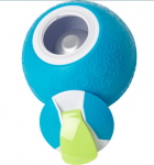
Last thing I bought was completely and totally unnecessary, and just about the funnest thing. Sorry, I know that “funnest” isn’t a word but oh well. It was a ball. But not really. You freeze it and then put some ingredients inside, close it tightly, then kick it around and wham, bam, thank you ma’am you have a pint of ice cream. They had one that made a quart of ice cream at a time, but it was three times the price and Benny and I don’t need that much to have to take up space in the freezer.

It was finally time to head to the KOA for check in and after plugging up the water, sewer, and electric I got down to some serious work while Benny was free to play and ride back and forth where I could see him. He also kicked around the ball making our dessert which he was extremely proud be in charge of. I was surprised there were no kids, but most families were in the national parks or staying in hotels that had pools. Well it didn’t break my heart though I shouldn’t say that. I’ve got to make sure that Benny can interact in a healthy way with kids his age. I don’t want it to be too big a shock to his system if I have to put him in school when the Adventure is over.

While Benny took turns giving the crew rides, I spent the remainder of the day prepping meals, catching the blog up, catching up on correspondence, and catching up with Groucho and Stella … as in they are almost done packing to permanently move to North Florida. What?! I must have burned up the Wifi trying to figure things out.

Stella is more and more convinced they need to get out of Key West. She has nightmares almost every night. They were getting so bad she was thinking of going to the doctor and getting something for her nerves. However, now that Groucho is on board the nightmares aren’t quite as ferocious but she’s still having them, just not all night long every night.

Kirkland is going with them. I’m sure that went over well with his mother. And yes, that was sarcasm. According to Stella the woman basically disowned him until he, in her words, comes to his senses. Isn’t happening as I understand it; Kirkland is just that determined.

For Groucho’s part he says he trusts Stella’s intuition. And that Key West was getting too crazy and a lot of his former customers weren’t making the trip any longer. The first offer on the shop was almost twice what he figured he would get for it. The developer that bought the BNB talked his group into buying that parcel as well and they’ve already got a place picked out up in north Florida. Groucho et al is not the only ones moving out. Lots of other conchs – native or nearly so people of Key West – are moving out. Some because the cost of living is getting prohibitive, some because the developers have changed the flavor of the islands, and some because they are aging and have no support system there. Mrs. Harden has moved to Naples and is not doing well at all. Stella says she doubts the woman will last the year. On the one hand I’m sorry to hear it, on the other … I’ll leave it to the Creator to handle.

After the large salad with all the trimmings we had for dinner – yes out of a bag but I added lots of protein and stuff to it – we took all the new clothes and our few dirty clothes and used the laundry to wash the commercial starch out and any excess dyes. We also used the showers. I love being clean.

I’ve finally reached the end of today’s to do list and I’m going to bed. Benny is already there having spent his energy with his bike and making ice cream. The bike is starting to get too small for him but I’ll have to fix that some other time. For now I’ll just raise the seat and handlebars.

It is nice to have electric tonight to keep the fan blowing. It has been warm. And now I need to stop piddling. Go to bed Gus. Tomorrow will be here soon enough.
 

Kathy in FL

Administrator
_______________
July 21st – Horseshoe Bend

Weather: 90F/50F
Driving Route:
Picture4.png
Drove 60 miles (70 minutes) to get a camp at Horseshoe Bend Campground in Bighorn Canyon National Rec Area. Nice camp too; it has electric hook up, modern Restrooms, RV dump station and drinking water available. And get this, there is a swim beach and picnic area less than a one-mile hike from the campground. What else could you need you ask? Wellllll … Horseshoe Bend Marina and boat docks are also less than a one-mile hike from the campground. I had no idea things would be so convenient when I reserved this location.

We took one of the unimproved sites but since it still had electric who cares? We didn’t need anything else but that and a place to park. Couldn’t beat the price of $8/night with our discount pass. It isn’t run by the NPS but by a concessionaire. There were no staff people on-site so I had to pay in cash using one of those “iron rangers” that are basically just a hollow, metal pole, that you slide your envelope of money into and then put the hang tag from the envelope on your dash or review mirror. I had to put a copy of the reservation form in the envelope as well.
Picture5.jpg
Benny is definitely excited we are by the water for a couple of days. The boy is nearly as big a fish as his Aunt Gus. He was just as excited to find out there was a Junior Ranger program. That was a new one on me as well. Sometimes the information is correct online and sometimes not so much.

What we did this day was first we hit the Lovell Visitor Center to get the Junior Ranger Booklet and to get info on some of the trails. Rangers were real nice, and no one recognized us which was even nicer. After hearing about all the hiking we planned to do they wanted to make sure that we took plenty of water with us when we left the van. Apparently hundred degree days are not unusual this time of year. And if I hear “it’s a dry heat” one more time I won’t be accountable.
Picture6.png
To give us time to acclimate (and kayak later in the day) we stuck to short trails. The first one was right there at the visitor center. It was barely 0.26 roundtrip in length. The Visitor Center Pond was located behind the Bighorn Canyon Visitor Center and was a simple concrete loop. The pond was originally built to reflect light on solar panels that were removed a long time ago but is now an example of how manmade environments are reclaimed by nature.
Picture7.jpg
The Mouth of the Canyon Trail was a 1.8-miles lollipop trail that if you ever get in the area you just gotta go on. The views are phenomenal. I know we are barely a hundred miles from Yellowstone, but the environment is so different. The trail was short, but the spectacular views of the Pryor and the Bighorn Mountains are not to be missed.

The hike started at the service road on the north end of loop B in Horseshoe Bend Campground near campsite number B-15. Just before reaching the water storage tank our map said veer right onto an abandoned two-track road. The we followed the two-track up and around the hills toward the canyon. When the road disappeared, we follow the trail markers along the Pryor Mountain Wild Horse Range boundary fence. From that vantage point, we could see the mouth of the canyon and its union with Crooked Creek.
Picture8.jpg
When we were about to keep going these crazy horses ran into view. One of them in particular was playing boss. Now I don’t know a whole lot about horses but one look at his nether regions more than gave the impression that he was the stallion telling all the others what to do. Signs at the trailhead had warned not to go near the fence or try and interact with the horses. Before that moment I’d given horses some respect but I gotta say wild horses are a whole different kettle of fish from what I knew. I saw some bucking broncos at a rodeo once, the wild horses were even more aggressively beautiful than that. For some reason they reminded me of sailing on rough seas. It is beautiful but can scare the crap out of you at the same time.

After the horses had run off once again, we followed the trail through a juniper-lined draw to the top of the ridge for some incredible views and photo opportunities and then back to the road and back to the trailhead.
Picture9.jpg
We got more great views on the next trail. State Line Trail was about the same length but less easy and more moderate. It was 1.52 miles round trip to get a view of Bighorn Canyon. It is called “State Line” because that’s where the trailhead is, just north of the Montana state line. Benny had fun jumping back and forth over the marker but he was getting too wound up.

“We’re in Wyoming. Now we’re in Montana. Wyoming. Montana. Wyoming. Mon …”

“We’re gonna go be in the van if you don’t knock it off. You’re kicking up almost as much dust as the wild horses did.” He got the message and we continued moving forward.

The trail led to the canyon rim through juniper scrubland above limestone plateaus, culminating in a view that nothing I had could capture though my phone camera gave it all it had. The panorama feature came close but nothing beats the human eye. The trail markers let along along the ridge for different views of the river-carved canyon.

We took a connecting trail from that point called Ranger Delight. It was less than a mile added on.
Picture10.jpg
While following the faint road cut that was the trail, it felt like we were the only people that had ever hiked the area. The scream caw of the hawks gliding on the currents above us made it seem just like an old cowboy movie right before the gun fight. The trail continued toward the canyon. At the cut-off fence post and trail marker, we turned left and hiked toward the rim.

To the left was a good view of the ledge below with a sheep trail that treacherously traces the canyon rim. I don’t know the name of that trail or if it even has one, but I wasn’t risking it either way. From there it was turn around and go back the way we’d come all the way to the original trailhead.
Picture11.jpg
There was one last trail on today’s itinerary and that one was called Sullivan’s Knob Trail. It was another one that was less than a mile and it started just north of the Devil Canyon Overlook.

Below the parking area two trails meet. One is an ancient trail known as the Bad Pass Trail. It was used by migrating Native Americans moving between the Bighorn Basin and the Northern Plains. Juniper, mountain mahogany, and sagebrush are slowly reclaiming the trail, emphasis on slowly. Things just don’t change that fast around here. The other trail is a modern one. It leads the hiker south of the hill in front of the parking area and to the canyon rim. Turns out it is a great place for making echoes. But even Little Bears get tired of funny echoes when they find out their Aunt Gus has signed them up for a free guided kayak tour.
Picture12.jpg
We hustled back to the Horsehoe Bend Marina and secured our place after proving we had our own kayak and the experience to use it. Being on the water in the canyon is cool, but it makes your feel small, especially when you are anywhere near the walls of the canyon. Our guide wasn’t especially interesting, he was a last minute replacement, so we didn’t get much in terms of information or stories. He was also a little involved keep this one couple from tipping over as their experience didn’t quite measure up to what they claimed. Didn’t take away from the enjoyment for Benny and I but only because I was determined not to let it. Soon enough, even too soon, it was time to head in and back to camp.

I’ve had enough practice getting the kayak down and putting it back up that it didn’t take as long as it could have. The lock and chain I boughtfor it gives me added peace o’ mind but I will still keep an eye on it. I fixed some of the issues of “hands free climbing” by using a bungee cord to attach the ladder at the top. Was nice to finally stop the bouncing around.

Dinner was simple … spaghetti using gluten-free noodles. Clean-up was a little messy because of the grease in the meat sauce but even that was faster than if I’d used multiple plans and dishes. Benny is slowly listing to the side in his camp chair, so it is bedtime. I’ll put away his junior ranger booklet and then put him away in his bed. I have a little more adulting to do and then I’m off to bed myself.
 

Kathy in FL

Administrator
_______________
July 22nd – Hiking around the Canyon

Weather:90s for the high/50s for the low
Picture13.jpg
We did enough hiking today that even I’m worn out, but we started with a very short one. Two Eagles Interpretive Trail is an easy quarter mile round trip that didn’t even make us bust a sweat since the morning was still cool-ish. According to the educational sign-thingies from the Visitor Center and at the trail, the site has been used by Native Americans for over 10,000 years. In the vicinity of the trail there are more than 140 stone circles. The stones were used by tribal families to hold down the edges of tipis. When they moved to their next encampment, they would simply roll the stones off and leave the rocks in place for their next visit. It is a hefty fine and criminal charge if any change/damage is made to this historic and cultural site. No fun and games; the stones need to be left in place for future generations to enjoy and learn from.

Lower Layout Creek Trail: Easy to Moderate, 3.4-miles round trip. The Lower Layout Creek trailhead is easy to miss. It is located at the cattle guard that marks the northern end of the Pryor Mountain Wild Horse Range. There isn’t a designated parking lot, but at the cattle guard, you can park on either side of the road making sure you are not blocking the flow of traffic. The trail begins by hiking the old two-track road south of Layout Creek.

Despite the name of the trail, we found the main trail never meets up with the creek. There is a junction where the two-track splits – the right option is the main trail. The road to the left leads to a barbed wire fence after crossing the creek. The trail pretty much disappears shortly after we reached the two trail markers. Finding the path that the park service had in mind was challenging, but there wasn’t really a need for a beaten path since it’s easy enough to just wander toward the canyon. Once at the canyon rim the views were spectacular.

The area around the Pryor Mountains was heavily prospected for uranium, and there were several old prospecting pits near the trail. Don’t play in those pits, rattlesnakes are a legitimate concern in the area. I’m glad Benny and I were wearing hikers built like tactical boots. They didn’t just have ankle support but ran up our legs further than our other boots. Mine are left over from one of my landside uniforms. Benny’s are from a clearance bin at a thrift store. In other words, neither pair are particularly fashionable but they serve their purpose.

The other thing is there is very little shade in the area and it can get very hot. We went through hall the water I brought even though it was a short trail. And we weren’t even hiking during the hottest part of the day. Another safety note: There are signs reminding hikers to be very careful around the rim of the canyon – there are dangerous overhangs and cracks that go down hundreds of feet.
Picture14.png Picture15.jpg
There was a lot of history in our next trail that was a three-mile roundtrip. In 1890s a man by the name of Dr. Barry began exploring Bighorn Canyon in search of gold. During his explorations, he happened upon the Trail Creek Valley. He never found enough gold to make himself rich, but the canyon offered all he needed to make another kind of fortune a “dude ranch.” He didn’t call it that, more like a tourist destination, but he used the natural opportunities of hiking, fishing, hunting, camping, and horseback riding to bring in customers.

The trail took us to the old ranch where the buildings were still there. Not all of them “intact” but close enough you could recognize them for what they were. Sign-thingies explained how the Barrys ran the Hillsboro Guest Ranch. The trail continued behind another historical site called Eddy Hulbert’s cabin. The trail also took us to the Barry’s Landing turnoff.
Picture16.png
The road we took to the Hillsborough trail and led to the start of the Barry’s Island Trail. It was a moderate, 4-miles sorta kinda lollipop trail. It started as a two-track road leading north from the Barry’s Landing parking lot. The trail goes around Chain Canyon, which was a secret escape route for cattle rustlers in the late 1800s and early 1900s. It certainly looked like something out of an old cowboy movie. At Barry’s Island, which isn’t really an island since to access it by a thin strip of land, we continued following the road northeast (clockwise) around the island. During years of high water, the trail can be covered. There is a bypass trail over the “island” but we didn’t have to take it; the water level was low.

Our remaining hike of the day took us from one type of ranch – Hillsboro – to a real working ranch – the Lockhart Ranch. The trail was easy and a loopish kind of thing beyond the Barry’s Landing junction on an unpaved road. The Lockhart Ranch is an example of how life was lived by western ranchers in the late 19th and early 20th centuries. The Davis and Cottonwood Creeks at the historical site provided the life force of the ranch. I had downloaded a trail map for this one because it had all of the educational stuff that Benny enjoys.

Ditches running from Davis Creek took advantage of the natural topography of the land by using gravity to irrigate the surrounding pastures. The trail began at the two-track road east of the corrals. We followed the road along the northern edge of Caroline Lockhart’s livestock pastures. The path led to Davis Creek. Following the two-track along Davis Creek brought us to an old metal gate and the dirt road. The trail basically stayed inside the fenced off area. The map kept mentioning fence post number this and fence post number that so it was impossible for even my dyslexic brain to get lost.

After that we drove back to the marina and kayaked for a couple of hours, but I was getting tired and told Benny it was better not to risk being on the water if you aren’t able to give one hundred percent. He understood when I explained what I meant. We were following safety rules. And I asked him to explain to the crew so they’d know why he was coming back to camp earlier than expected and wouldn’t worry.

He grinned. We both know that “the crew” isn’t real but they are part of Benny’s imaginary world. He likes me playing along. I have no problem with the game we make of it. At least not for now. He’s just a little kid, and I worry that he is a lonely little kid though he doesn’t act like it. Just the opposite. I wonder what is best to do. I know I didn’t hang out with many kids until I was forced to after I went to live with Lawrence. I don’t think I really had friends until after I went to go live with Lawrence. I preferred being with Dad or the grandparents … and the Judge and Meemo. They understood me. Not even the kids at church gave me the space I needed though only a few of them were jerks about me being different, or so I remember. I admit I didn’t really want to hang out with some of the kids I was forced to be around even after I went to live with Lawrence, and it wasn’t always the other kids’ fault. It wasn’t until I was in positions of leadership that I really forced myself to try and then it became a not horrible experience, especially as I found people that more than tolerated me right back. I could lead with things, could tell people what to do, teach them when they were newbs. But I was more than happy to have co-leaders that were better at people skills and in the end, I learned as much from those that became friends as I did from the teachers and leaders above me. Maybe I just need to stop worrying it to death. Introspection and retrospection have always given me digestion problems.
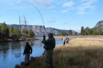
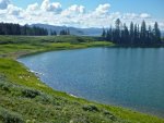
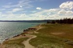
I know I keep hounding at it, but I must do this right. Lawrence is counting on me. Likely Penny was too or I’m not sure how she made the choice she did to leave Benny. I’ll probably never understand how she could just abandon Benny. When Dad and the grandparents left, I didn’t think it was fair but I always knew that they didn’t leave by choice. And I never wondered if Lawrence was doing a good job when he became my guardian. He was there for me in ways I probably still don’t know. And in hindsight I can see what a mess I was for a while and it couldn’t have been easy to be a newlywed, then have a kid on the way, all the while trying to raise a sister who has nearly an encyclopedia of things she’s been diagnosed with at various times in her life.

I never wondered if Lawrence second guessed himself. I still don’t because … well just because. He always seemed so sure, always seemed to have a plan before one was needed. I need to be that person for Benny. I must be that person for Benny. I don’t have any business thinking that I can be anything but that, failure is not an option.

Benny is young enough and he seems to be doing well. There’s time. I hope. But October will be here before I know it and I need to get a blasted plan in place. I’d even settle for a piece of a plan at this point. Something, anything, that I can build on.

I was feeling good when I started writing, not so much now. I’m going to get up and do some exercises outside and if that doesn’t do it, I’ll drink some caffeinated water. Why does the damn brain hamster have to escape its cage at the most inconvenient times?
 
Top