You are using an out of date browser. It may not display this or other websites correctly.
You should upgrade or use an alternative browser.
You should upgrade or use an alternative browser.
Story Aunt Gus & Little Bear's Great Adventure Book 1 (Complete)
- Thread starter Kathy in FL
- Start date
Sorry I've been out of the writing loop. Life is busy, busy. Will try to get another bit posted tonight or in the morning.
--------------------------
Jun 18 – 21: Zion National Park, Utah (Part 1)
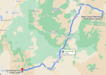
Driving Route:
June 18th
As expected, I was sore, sore enough that I had to do a little yoga to start the day. Good thing that the soreness had woken me just a little earlier than normal otherwise we would have been late. Still, it wasn’t too bad as we only had a two hour drive to get from Bryce Canyon to our new location, Zion National Park, Utah’s first national park.
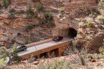
I was lucky and had let the maps program decide our route and it took us in the east entrance, also known as the Zion-Mt Carmel Highway – a 10 mile scenic drive - via the via the famous Zion-Mt. Carmel Tunnel. The road is curvy and climbs in elevation, offering great views of Zion’s rocky landscape and notable landmarks, including The Great Arch and Checkerboard Mesa.
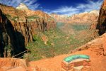
Before driving through the tunnel, we walked to the Canyon Overlook. The trail was a great introduction to hiking in Zion National Park. The one-mile loop is rated moderately difficult and arrives at a cliff-top viewpoint of Pine Creek Canyon and lower Zion Canyon. It begins with a series of steps carved into sandstone, then continues on a sandy, rocky trail above Pine Creek Canyon. Along the way there are fenced drop-offs and a shaded alcove to pass under. Little freaky but safe or they would have had the trail closed.
It didn’t take long to arrive at Canyon Overlook. There were some rocks you could sit on, so we did and I let Benny use my phone camera to take some pictures in case he needed them for his Junior Ranger program. You could see Pine Creek and lower Zion Canyon further in the distance. We could even see some of the Zion-Mount Carmel tunnel windows in the canyon walls. One landmark that wasn’t visible was The Great Arch but that was because we were standing directly above it.
Taking roughly an hour to complete, this hike was short but great to give us some idea of what we would find I the park. The only “complaint” people could have about this overlook is that there is hardly any parking at the trailhead. There’s maybe 9 spots right at the trailhead – which we got one of since we were so early – and the only other parking is a immediately on the other side of the road is it is very small as well.
As beautiful as the natural attractions are, it was a man-made tunnel that truly impressed. The 1.1-mile Zion-Mount Carmel Tunnel was the longest tunnel in the United States at the time of its completion in 1930. There are five gallery windows in the tunnel, so it was fun to get quick glimpses of Zion’s scenery as we were driving through.
We arrived in the park right at 8 am right as the visitor center opened. We weren’t the only ones, but it wasn’t as busy as it could have been. The shuttle was already running and had been since 6 am. That’s right campers, another shuttle. I know it would add some time onto our days, but at the same time it would save some fuel and mileage on the van. I was pretty sure I could live with it being like that. Especially saving the fuel $$$.
Got very lucky and was able to get our site first thing because we didn’t ask for a shaded site. In point of fact, I didn’t want a shaded site; I wanted to be able to keep the lithium batteries charged since there were no hook ups. There was a dump station and potable water but that’s it, besides the bathrooms of course. What was nice was that we got a 50% discount with our access pass. Forty bucks savings is forty bucks savings and I’m starting to count those pennies more and more despite the blog money.
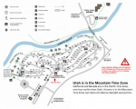
The campsite was right around the corner of the visitor center so we didn’t even have to deal with the “no vehicles on the road” stuff like we did before.
The park shuttle system is free and operates most of the year. When the shuttle is in operation, no private vehicles are allowed on Zion Canyon Scenic Drive (you can still drive on the Zion-Mount Carmel Highway which is how Benny and I entered the park). There are two different shuttle loops. The Springdale Shuttle has nine stops in the town of Springdale and delivers passengers to the park’s pedestrian entrance near the visitor center. The Zion Canyon Shuttle leaves from the visitor center and travels to the far end of Zion Canyon Scenic Drive, making nine stops along the route.
They explained at the visitor center that the shuttles run from early morning to late evening and is supposed to run about every ten minutes. I haven’t timed it to be honest, it was fast enough for what we needed it for is all I know for sure. At least today it was.
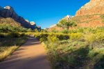
And speaking of today, Benny and I had had enough of driving once we got to the campsite so all we did was park, secure the van, and then walk to the Pa’rus Trailhead. The paved path follows alongside the Virgin River, one of the boundaries of our campground, and links the Zion Canyon Visitor Center with Canyon Junction for a round-trip of 3.5 miles (about two hours). It’s an easy, level trail, with a few bridges crossing over the river. In other words, it was perfect for warming up after yesterday. Lots of trailside exhibits for Benny to practice his reading skills on. He knows a lot of site words, can read them I mean, but writing them is another story. I’ll have to work on that with him at some point soon, but he is definitely reading “above grade level” if this website I track that sort of thing with is correct.
We stopped at the visitor center as the loop headed back to the campground area and picked up Benny’s Junior Ranger booklet at the Nature Center, did a few activities there and then headed back to the van to eat lunch and check and make sure everything was the way it should be. It was and I heated up some leftovers. All the easy-to-fix foods have been used up and I need to make plans on a big grocery trip. We can make do for the next week but after that we really do need to stock back up.
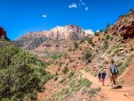
After lunch we decided to hike Watchman Trail. Having done it I can now say that it is an underrated activity and overlooked by a lot of visitors who crowd the more popular trails in the park. Too bad for them. Watchman Trail is a moderate 3.3-mile (about two hours) roundtrip hike that climbs to a plateau near the base of The Watchman, a rugged “crag” that looms over Zion’s south entrance. The trail ascends before looping around a small valley and arriving at a viewpoint near The Watchman. The views were gorgeous … West Temple, Towers of the Virgin, lower Zion Canyon, and town of Springdale.
I suppose we could have kept going but we voted to go back to camp. Benny and the Crew worked on the Junior Ranger booklet and then used Benny’s “exploring” toys to look at things and draw pictures. I’ve been spending time just enjoying the scenery and working on the remainder of this month’s and most of July’s activities. We’ll stay in Zion until we head out on the 22nd. Then we’ll be in Great Basin for a couple of days. The morning of the 25th we head into Grand Teton, and we’ll be there until the morning of the 2nd at which time we head into Yellowstone where we’ll remain until the 19th or 20th of July.
Teton and Yellowstone are why I’m working so hard on a grocery and supply list. Between the two parks we’ll be out of real towns for almost an entire month. No real opportunity to stock up except for potable water and even that might prove challenging and I’ll need to be careful. Also, unlike Bryce and Zion, I’m going to be putting a lot of miles on the van every day even if I manage to move base camp locations. So far the tires are still looking plenty good. I’m still good for oil and fluid changes. No body damage except for a ding where a semi kicked back a rock, but it didn’t mess the paint up. Nothing wrong with the charging systems (batteries and/or solar). Black, gray, and potable tanks are still fine and dandy. One of the fittings is going bad on the gray water hose but I have a spare for when it starts leaking in earnest and duct tape don’t keep it fixed. I’m running out of the treatment tabs for the black water tank so that’s made it onto the “need” list.
Also on the “need” list is a call to Groucho to make sure they are doing okay. I just have this itch between my shoulders that says something, I just don’t know what. I also got an email from my cousin Sharon, Uncle Daniel’s oldest daughter. Ugh. She and I never got along. Even cats and dogs can get along when there is a mutual goal but Sharon and I never … as in never ever … managed to find a mutual goal. It got so bad that Dad wouldn’t let me go over to my grandparents’ if it was known she would be there. When Grandfather Barry overheard some of the things she used to call me … all of them having to do with be being some flavor of crazy … he told Uncle Daniel to either deal with his daughter or find out how fast he would. Sharon and Lawrence were close in age but he couldn’t stand her either. There are just some people in this world that are toxic and she’s one of them. They said she was a lot like her mother without the sense to keep it in check long enough to have her way. Unlike her mother she could be (can be?) drop-dead gorgeous when it suited her purpose. Her sister Charlotte isn’t nearly as bad, but she is weak and usually does everything Sharon tells her to do.
All that to say that one, I was shocked at how conciliatory the email was and two, how the heck did she get the blog address to send me an email? She wasn’t even at Dad’s funeral because she was on her honeymoon (she was working on a divorce from that one which is why she wasn’t at Lawrence’s funeral). One of the reasons that Lawrence and Uncle Daniel got in a feud was because Sharon said something to the effect that Dad intentionally spoiled her honeymoon and it got back to Lawrence somehow … probably Charlotte who isn’t just weak but is a little stupid too, though she could be sweet. Charlotte is the one that helped Lawrence sneak most of Grandma Barry’s personal things out of the house rather than let Uncle Daniel or her sister trash them as being “not belonging to the family.” Or in Sharon’s case more likely to pawn them or sell them for cash for herself.
Gah, ‘nuff of that. Don’t need to loose the hamster in my head right before bed. Gives me what Grandmother Barry used to call “the green willies” – meaning the creepy crawlies – to even think of the crapola that Sharon wrote. Unless Sharon had a serious Come-to-Jesus moment she’s up to something and after something. What that something could be I have no clue. She doesn’t live in the Panhandle these days, according to her; she lives in Lakeland. Apparently she is on some kind of social assistance and can’t get away to help her father. She wants me to give serious consideration to maybe moving into the “help’s” quarters (the old guest house) and helping Uncle Daniel get back on his feet. That is assuming Uncle Daniel ever gets around to contacting me and asking me; she says his pride has taken a beating and it may take him some time to get the nerve up. Even if he doesn’t come out and ask me, she’s asking me to maybe ask him. I mean after all what is family for and I don’t have anything else to do since I can’t go into the military since I have Lawrence’s child to take care of. Someone has been talking or something. I’m not sure what. I never made what I’ve been doing a secret, the blog would pretty much have put the kibosh on that, but she knows a little too much and I’m not happy about it at all.
Okay Gus, ratchet back the tinfoil; it is starting to cut the oxygen off to your brain. Sharon works for a PI … a sleezy PI but still licensed in the state of Florida. Or she did at one time. It is how she found out her first husband was up to his ding-a-ling in gambling debt. Or so I learned from Charlotte at the funeral. TMI, but Charlotte is famous for that sort of thing. Maybe the tidbits that fell out of her mouth might have some relevance here. Who knows? Just don’t want anyone getting into my business.
Fine. Whatever. I’m done. If it is making me this fritzy just to get an email from that side of the family, it is telling me I’m not prepared to deal with them right now and need more evidence before I do. I can’t exactly respond at the moment anyway, and maybe that is a good thing. I’ll play it off as no internet access for a while (the truth) and see if anything else is forthcoming, give myself some breathing room, and go from there.
As for now I think I’ll just drink me a caffeinated water and see if that helps me sleep. Sounds like all the generators in camp are now turned off though I still hear kids somewhere. Benny is nodding off in a puppy pile with the Crew in the hammock I strung up for him. Time to hit the camp toilets and then hit the hay.
--------------------------
Jun 18 – 21: Zion National Park, Utah (Part 1)
Driving Route:

June 18th
As expected, I was sore, sore enough that I had to do a little yoga to start the day. Good thing that the soreness had woken me just a little earlier than normal otherwise we would have been late. Still, it wasn’t too bad as we only had a two hour drive to get from Bryce Canyon to our new location, Zion National Park, Utah’s first national park.
I was lucky and had let the maps program decide our route and it took us in the east entrance, also known as the Zion-Mt Carmel Highway – a 10 mile scenic drive - via the via the famous Zion-Mt. Carmel Tunnel. The road is curvy and climbs in elevation, offering great views of Zion’s rocky landscape and notable landmarks, including The Great Arch and Checkerboard Mesa.

Before driving through the tunnel, we walked to the Canyon Overlook. The trail was a great introduction to hiking in Zion National Park. The one-mile loop is rated moderately difficult and arrives at a cliff-top viewpoint of Pine Creek Canyon and lower Zion Canyon. It begins with a series of steps carved into sandstone, then continues on a sandy, rocky trail above Pine Creek Canyon. Along the way there are fenced drop-offs and a shaded alcove to pass under. Little freaky but safe or they would have had the trail closed.
It didn’t take long to arrive at Canyon Overlook. There were some rocks you could sit on, so we did and I let Benny use my phone camera to take some pictures in case he needed them for his Junior Ranger program. You could see Pine Creek and lower Zion Canyon further in the distance. We could even see some of the Zion-Mount Carmel tunnel windows in the canyon walls. One landmark that wasn’t visible was The Great Arch but that was because we were standing directly above it.

Taking roughly an hour to complete, this hike was short but great to give us some idea of what we would find I the park. The only “complaint” people could have about this overlook is that there is hardly any parking at the trailhead. There’s maybe 9 spots right at the trailhead – which we got one of since we were so early – and the only other parking is a immediately on the other side of the road is it is very small as well.
As beautiful as the natural attractions are, it was a man-made tunnel that truly impressed. The 1.1-mile Zion-Mount Carmel Tunnel was the longest tunnel in the United States at the time of its completion in 1930. There are five gallery windows in the tunnel, so it was fun to get quick glimpses of Zion’s scenery as we were driving through.
We arrived in the park right at 8 am right as the visitor center opened. We weren’t the only ones, but it wasn’t as busy as it could have been. The shuttle was already running and had been since 6 am. That’s right campers, another shuttle. I know it would add some time onto our days, but at the same time it would save some fuel and mileage on the van. I was pretty sure I could live with it being like that. Especially saving the fuel $$$.
Got very lucky and was able to get our site first thing because we didn’t ask for a shaded site. In point of fact, I didn’t want a shaded site; I wanted to be able to keep the lithium batteries charged since there were no hook ups. There was a dump station and potable water but that’s it, besides the bathrooms of course. What was nice was that we got a 50% discount with our access pass. Forty bucks savings is forty bucks savings and I’m starting to count those pennies more and more despite the blog money.

The campsite was right around the corner of the visitor center so we didn’t even have to deal with the “no vehicles on the road” stuff like we did before.
The park shuttle system is free and operates most of the year. When the shuttle is in operation, no private vehicles are allowed on Zion Canyon Scenic Drive (you can still drive on the Zion-Mount Carmel Highway which is how Benny and I entered the park). There are two different shuttle loops. The Springdale Shuttle has nine stops in the town of Springdale and delivers passengers to the park’s pedestrian entrance near the visitor center. The Zion Canyon Shuttle leaves from the visitor center and travels to the far end of Zion Canyon Scenic Drive, making nine stops along the route.
They explained at the visitor center that the shuttles run from early morning to late evening and is supposed to run about every ten minutes. I haven’t timed it to be honest, it was fast enough for what we needed it for is all I know for sure. At least today it was.

And speaking of today, Benny and I had had enough of driving once we got to the campsite so all we did was park, secure the van, and then walk to the Pa’rus Trailhead. The paved path follows alongside the Virgin River, one of the boundaries of our campground, and links the Zion Canyon Visitor Center with Canyon Junction for a round-trip of 3.5 miles (about two hours). It’s an easy, level trail, with a few bridges crossing over the river. In other words, it was perfect for warming up after yesterday. Lots of trailside exhibits for Benny to practice his reading skills on. He knows a lot of site words, can read them I mean, but writing them is another story. I’ll have to work on that with him at some point soon, but he is definitely reading “above grade level” if this website I track that sort of thing with is correct.
We stopped at the visitor center as the loop headed back to the campground area and picked up Benny’s Junior Ranger booklet at the Nature Center, did a few activities there and then headed back to the van to eat lunch and check and make sure everything was the way it should be. It was and I heated up some leftovers. All the easy-to-fix foods have been used up and I need to make plans on a big grocery trip. We can make do for the next week but after that we really do need to stock back up.

After lunch we decided to hike Watchman Trail. Having done it I can now say that it is an underrated activity and overlooked by a lot of visitors who crowd the more popular trails in the park. Too bad for them. Watchman Trail is a moderate 3.3-mile (about two hours) roundtrip hike that climbs to a plateau near the base of The Watchman, a rugged “crag” that looms over Zion’s south entrance. The trail ascends before looping around a small valley and arriving at a viewpoint near The Watchman. The views were gorgeous … West Temple, Towers of the Virgin, lower Zion Canyon, and town of Springdale.
I suppose we could have kept going but we voted to go back to camp. Benny and the Crew worked on the Junior Ranger booklet and then used Benny’s “exploring” toys to look at things and draw pictures. I’ve been spending time just enjoying the scenery and working on the remainder of this month’s and most of July’s activities. We’ll stay in Zion until we head out on the 22nd. Then we’ll be in Great Basin for a couple of days. The morning of the 25th we head into Grand Teton, and we’ll be there until the morning of the 2nd at which time we head into Yellowstone where we’ll remain until the 19th or 20th of July.
Teton and Yellowstone are why I’m working so hard on a grocery and supply list. Between the two parks we’ll be out of real towns for almost an entire month. No real opportunity to stock up except for potable water and even that might prove challenging and I’ll need to be careful. Also, unlike Bryce and Zion, I’m going to be putting a lot of miles on the van every day even if I manage to move base camp locations. So far the tires are still looking plenty good. I’m still good for oil and fluid changes. No body damage except for a ding where a semi kicked back a rock, but it didn’t mess the paint up. Nothing wrong with the charging systems (batteries and/or solar). Black, gray, and potable tanks are still fine and dandy. One of the fittings is going bad on the gray water hose but I have a spare for when it starts leaking in earnest and duct tape don’t keep it fixed. I’m running out of the treatment tabs for the black water tank so that’s made it onto the “need” list.
Also on the “need” list is a call to Groucho to make sure they are doing okay. I just have this itch between my shoulders that says something, I just don’t know what. I also got an email from my cousin Sharon, Uncle Daniel’s oldest daughter. Ugh. She and I never got along. Even cats and dogs can get along when there is a mutual goal but Sharon and I never … as in never ever … managed to find a mutual goal. It got so bad that Dad wouldn’t let me go over to my grandparents’ if it was known she would be there. When Grandfather Barry overheard some of the things she used to call me … all of them having to do with be being some flavor of crazy … he told Uncle Daniel to either deal with his daughter or find out how fast he would. Sharon and Lawrence were close in age but he couldn’t stand her either. There are just some people in this world that are toxic and she’s one of them. They said she was a lot like her mother without the sense to keep it in check long enough to have her way. Unlike her mother she could be (can be?) drop-dead gorgeous when it suited her purpose. Her sister Charlotte isn’t nearly as bad, but she is weak and usually does everything Sharon tells her to do.
All that to say that one, I was shocked at how conciliatory the email was and two, how the heck did she get the blog address to send me an email? She wasn’t even at Dad’s funeral because she was on her honeymoon (she was working on a divorce from that one which is why she wasn’t at Lawrence’s funeral). One of the reasons that Lawrence and Uncle Daniel got in a feud was because Sharon said something to the effect that Dad intentionally spoiled her honeymoon and it got back to Lawrence somehow … probably Charlotte who isn’t just weak but is a little stupid too, though she could be sweet. Charlotte is the one that helped Lawrence sneak most of Grandma Barry’s personal things out of the house rather than let Uncle Daniel or her sister trash them as being “not belonging to the family.” Or in Sharon’s case more likely to pawn them or sell them for cash for herself.
Gah, ‘nuff of that. Don’t need to loose the hamster in my head right before bed. Gives me what Grandmother Barry used to call “the green willies” – meaning the creepy crawlies – to even think of the crapola that Sharon wrote. Unless Sharon had a serious Come-to-Jesus moment she’s up to something and after something. What that something could be I have no clue. She doesn’t live in the Panhandle these days, according to her; she lives in Lakeland. Apparently she is on some kind of social assistance and can’t get away to help her father. She wants me to give serious consideration to maybe moving into the “help’s” quarters (the old guest house) and helping Uncle Daniel get back on his feet. That is assuming Uncle Daniel ever gets around to contacting me and asking me; she says his pride has taken a beating and it may take him some time to get the nerve up. Even if he doesn’t come out and ask me, she’s asking me to maybe ask him. I mean after all what is family for and I don’t have anything else to do since I can’t go into the military since I have Lawrence’s child to take care of. Someone has been talking or something. I’m not sure what. I never made what I’ve been doing a secret, the blog would pretty much have put the kibosh on that, but she knows a little too much and I’m not happy about it at all.
Okay Gus, ratchet back the tinfoil; it is starting to cut the oxygen off to your brain. Sharon works for a PI … a sleezy PI but still licensed in the state of Florida. Or she did at one time. It is how she found out her first husband was up to his ding-a-ling in gambling debt. Or so I learned from Charlotte at the funeral. TMI, but Charlotte is famous for that sort of thing. Maybe the tidbits that fell out of her mouth might have some relevance here. Who knows? Just don’t want anyone getting into my business.
Fine. Whatever. I’m done. If it is making me this fritzy just to get an email from that side of the family, it is telling me I’m not prepared to deal with them right now and need more evidence before I do. I can’t exactly respond at the moment anyway, and maybe that is a good thing. I’ll play it off as no internet access for a while (the truth) and see if anything else is forthcoming, give myself some breathing room, and go from there.
As for now I think I’ll just drink me a caffeinated water and see if that helps me sleep. Sounds like all the generators in camp are now turned off though I still hear kids somewhere. Benny is nodding off in a puppy pile with the Crew in the hammock I strung up for him. Time to hit the camp toilets and then hit the hay.
beaglemama
Contributing Member
Glad you got some time for yourself to do some writing, Kathy!
sssarawolf
Has No Life - Lives on TB
Thank you, it helps for things to calm down a bit.
Jun 18 – 21: Zion National Park, Utah (Part 2)

June 19th
We used the shuttle today and it wasn’t as bad as I was worried it would be. Kinda nice to be able to park the van and just go without having to worry about parking spots and all the rest of it. The rest of it at least a little bit about using fuel and putting miles on the van and being frustrated with traffic. Yes, there were crowds. Yes, we had to wait once for another shuttle because some people cut the line. Still, if you gotta stand in line, a national park isn’t a bad place to do it in. At least we were on the first shuttle in the morning by going to the visitor center and getting there and in line before 6 am.
The main activity of our second day in Zion National Park was hiking to Angels Landing on what turned out to be one of Zion’s most nerve-wracking trails. Nerve-wracking. Geez. Good description of it, or at least part of it. I got the term from someone that was hiking the trail the same time we were. I wish I would have used more resources than the NPS website for this one. Tonight, while I was writing up some stuff for the blog, I read a few other hiking sites which warned that “a couple of steep drop offs” was more than just a couple. Had I known what to expect, or that they don’t recommend it for young kids, I wouldn’t have been so hyper because I would have prepared myself … or even picked a different trail. It was worse than some of the summer training exercises where I did a lot of climbing on rigging.
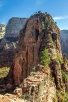
It wasn’t the distance. Five miles is five miles. It wasn’t the change in altitude because we’ve done way more than a 1,488-foot change. It isn’t that it is narrow, though that was some of it in a few locations. I suppose most of it is that the trail is framed by steep drop-offs on each side. Each. Side. There are no guardrails. Let me repeat that. No guardrails and only some chains to assist with the final scramble to Angels Landing. That is really what freaked me out a bit. I couldn’t show it however. I was Chief. I was the adult. More importantly I was Benny’s adult. But he must have sensed something, perhaps me considering just turning around, because he said, “I’ll follow the rules Aunt Gus.”
“Please,” I told him, and we proceeded rather than cause a back up on the trail.
The hike to Angels Landing is one of most popular ones in the park and has no trouble living up to its reputation as Zion’s most exciting hike. We started early in the morning to beat the crowds. Those narrow trails are not meant to hold the number of people that occasionally try to use it.
The first part of the hike follows the West Rim Trail, which is clearly identified by a sign. The trail is broad and well maintained. The first section is fairly level as it follows the river and then crosses the canyon bottom. From there switchbacks allow the trail to climb the canyon wall up to Refrigerator Canyon. The reason for the name is that it is normally pleasantly cool, scenic, and features easy terrain. The trail then climbs another series of switchbacks called Walter's Wiggles. These 21 switchbacks are very tight and hikers gain elevation rapidly, but this section is short and not too aggressive.
The Wiggles put you on top of the ridge, at Scout Lookout, where the views are truly amazing. Restrooms are available here, but no drinking water. From Scout Lookout, gaze at the ridge to the south and you'll get a good idea of the difficulty of the rest of the hike.
Scout Lookout, you cross the Saddle and then climb the ridiculously steep and narrow Hogsback, using the chains that are bolted into the stone to keep from sliding over the edge of the cliff. And no, this isn’t just my imagination talking. It has happened way more than I was comfortable with discovering.
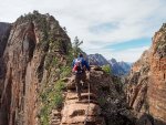
Once you've made it beyond the Hogsback, you are ready for the Landing. Or at least sort of. It is still crazy … um … exilerating for sure but at the same time I was a nervous wreck and ready to just tie Benny to me. Had I been alone it would have been fun, and yes it was fun despite my internal freak out, but at the same time it was exhausting mentally to keep him in sight and my version of safe during the trail.
I will admit that once we safely made it to Angels Landing, it was worth it. The panoramic view of Zion Canyon was nothing short of spectacular and made every hair-raising moment on the trail worth the challenge. But by the time we made it back to Refrigerator Canyon my entire digestive track was nothing but acid. I’ve been less afraid facing a shiver of sharks.
After getting back to the trailhead, the remainder of the day was low-key – including a picnic at The Grotto and a walk to Lower Emerald Pool – and that suited me just fine. The Grotto Picnic Area is the starting point of the Angels Landing hike, so it was a convenient place for Benny and me to enjoy lunch and rest before heading out for an afternoon of easy walks. I had made wraps for our main course using some gluten-free tortillas that needed using up. If I want more before the next grocery trip, I am going to have to make them from scratch. I can, I learned during a semester of home ec in the homeschool co-op which I wound up halfway teaching since Grandmother Barry and Abuela had already taught me a lot and the rest I learned in self-defense having to make do where Penny didn’t or couldn’t. However, the dough for the gluten-free version of a tortilla isn’t quite as easy to work with. I usually just buy them in the store. Easier to make gluten-free crackers and it looks like I will need to make some of them as well as we are coming to the end of all our convenience foods.
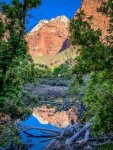
After our picnic, we strolled along The Grotto Trail to Zion Lodge, stopping in to browse the gift shop but not buying anything. Was nice to get in out of the sun and look around but at the same time … wow, most of that stuff is expensive. Kinda cool to look around the Lodge as well. They have some cabins and some hotel like rooms. I’m thinking that it might be nice to get inside a room for a night or two, but not sure when it is going to happen.
From there, we made our way to the footbridge and Emerald Pools trailhead. Lower Emerald Pool Trail won’t ever go down as one of our favorite trails. I mean it wasn’t horrible but it wasn’t all that great either. And it was crowded.
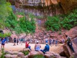
The trail is paved all the way to Lower Emerald Pool, which was a tiny pool of water that, unfortunately, didn’t live up to its name. I was expecting vibrant green waters, but instead the pool was cloudy and dark. Beyond the pool, the trail continued behind a waterfall, which was really just a trickle.
We also did some of the Kayenta Trail which was another okay trail. Oh for Pete Sake, we are getting spoiled. There wasn’t a thing wrong with either trail, I think the crowds just got to me, or maybe it is leftover whatever from that email that I am trying not to think about.
We rode the shuttle back to camp and I asked Benny if he wanted to use the solar cooker and have weenies for dinner, go to a amphitheater show, and then when we came back to camp we’d roast marshmallows. He was all over that for sure and that’s what we did. I was way passed ready to come back to camp after the show was over with. There were several kids in the audience that didn’t want to be there and the parents didn’t seem to have the courtesy for the rest of us to at least go to the back to keep their noise to a minimum. I moved Benny to the front and I sat on the ground just so that the noise wouldn’t activate our APD. Meh. It still bothered mine and made me feel fritzy, but that might not have all been about the noisy kids. I’m getting out of practice dealing with things like that. Must remind myself and practice tuning it out.
Benny is already in bed and I’m sitting here trying to decide whether just to go ahead and write up an email responding to Sharon. Something courteous but short. Maybe if I do, even if I don’t send it, it will stop being like the boogey man out in the bushes waiting to grab me.

June 19th
We used the shuttle today and it wasn’t as bad as I was worried it would be. Kinda nice to be able to park the van and just go without having to worry about parking spots and all the rest of it. The rest of it at least a little bit about using fuel and putting miles on the van and being frustrated with traffic. Yes, there were crowds. Yes, we had to wait once for another shuttle because some people cut the line. Still, if you gotta stand in line, a national park isn’t a bad place to do it in. At least we were on the first shuttle in the morning by going to the visitor center and getting there and in line before 6 am.
The main activity of our second day in Zion National Park was hiking to Angels Landing on what turned out to be one of Zion’s most nerve-wracking trails. Nerve-wracking. Geez. Good description of it, or at least part of it. I got the term from someone that was hiking the trail the same time we were. I wish I would have used more resources than the NPS website for this one. Tonight, while I was writing up some stuff for the blog, I read a few other hiking sites which warned that “a couple of steep drop offs” was more than just a couple. Had I known what to expect, or that they don’t recommend it for young kids, I wouldn’t have been so hyper because I would have prepared myself … or even picked a different trail. It was worse than some of the summer training exercises where I did a lot of climbing on rigging.

It wasn’t the distance. Five miles is five miles. It wasn’t the change in altitude because we’ve done way more than a 1,488-foot change. It isn’t that it is narrow, though that was some of it in a few locations. I suppose most of it is that the trail is framed by steep drop-offs on each side. Each. Side. There are no guardrails. Let me repeat that. No guardrails and only some chains to assist with the final scramble to Angels Landing. That is really what freaked me out a bit. I couldn’t show it however. I was Chief. I was the adult. More importantly I was Benny’s adult. But he must have sensed something, perhaps me considering just turning around, because he said, “I’ll follow the rules Aunt Gus.”
“Please,” I told him, and we proceeded rather than cause a back up on the trail.
The hike to Angels Landing is one of most popular ones in the park and has no trouble living up to its reputation as Zion’s most exciting hike. We started early in the morning to beat the crowds. Those narrow trails are not meant to hold the number of people that occasionally try to use it.
The first part of the hike follows the West Rim Trail, which is clearly identified by a sign. The trail is broad and well maintained. The first section is fairly level as it follows the river and then crosses the canyon bottom. From there switchbacks allow the trail to climb the canyon wall up to Refrigerator Canyon. The reason for the name is that it is normally pleasantly cool, scenic, and features easy terrain. The trail then climbs another series of switchbacks called Walter's Wiggles. These 21 switchbacks are very tight and hikers gain elevation rapidly, but this section is short and not too aggressive.
The Wiggles put you on top of the ridge, at Scout Lookout, where the views are truly amazing. Restrooms are available here, but no drinking water. From Scout Lookout, gaze at the ridge to the south and you'll get a good idea of the difficulty of the rest of the hike.
Scout Lookout, you cross the Saddle and then climb the ridiculously steep and narrow Hogsback, using the chains that are bolted into the stone to keep from sliding over the edge of the cliff. And no, this isn’t just my imagination talking. It has happened way more than I was comfortable with discovering.

Once you've made it beyond the Hogsback, you are ready for the Landing. Or at least sort of. It is still crazy … um … exilerating for sure but at the same time I was a nervous wreck and ready to just tie Benny to me. Had I been alone it would have been fun, and yes it was fun despite my internal freak out, but at the same time it was exhausting mentally to keep him in sight and my version of safe during the trail.
I will admit that once we safely made it to Angels Landing, it was worth it. The panoramic view of Zion Canyon was nothing short of spectacular and made every hair-raising moment on the trail worth the challenge. But by the time we made it back to Refrigerator Canyon my entire digestive track was nothing but acid. I’ve been less afraid facing a shiver of sharks.
After getting back to the trailhead, the remainder of the day was low-key – including a picnic at The Grotto and a walk to Lower Emerald Pool – and that suited me just fine. The Grotto Picnic Area is the starting point of the Angels Landing hike, so it was a convenient place for Benny and me to enjoy lunch and rest before heading out for an afternoon of easy walks. I had made wraps for our main course using some gluten-free tortillas that needed using up. If I want more before the next grocery trip, I am going to have to make them from scratch. I can, I learned during a semester of home ec in the homeschool co-op which I wound up halfway teaching since Grandmother Barry and Abuela had already taught me a lot and the rest I learned in self-defense having to make do where Penny didn’t or couldn’t. However, the dough for the gluten-free version of a tortilla isn’t quite as easy to work with. I usually just buy them in the store. Easier to make gluten-free crackers and it looks like I will need to make some of them as well as we are coming to the end of all our convenience foods.

After our picnic, we strolled along The Grotto Trail to Zion Lodge, stopping in to browse the gift shop but not buying anything. Was nice to get in out of the sun and look around but at the same time … wow, most of that stuff is expensive. Kinda cool to look around the Lodge as well. They have some cabins and some hotel like rooms. I’m thinking that it might be nice to get inside a room for a night or two, but not sure when it is going to happen.
From there, we made our way to the footbridge and Emerald Pools trailhead. Lower Emerald Pool Trail won’t ever go down as one of our favorite trails. I mean it wasn’t horrible but it wasn’t all that great either. And it was crowded.

The trail is paved all the way to Lower Emerald Pool, which was a tiny pool of water that, unfortunately, didn’t live up to its name. I was expecting vibrant green waters, but instead the pool was cloudy and dark. Beyond the pool, the trail continued behind a waterfall, which was really just a trickle.
We also did some of the Kayenta Trail which was another okay trail. Oh for Pete Sake, we are getting spoiled. There wasn’t a thing wrong with either trail, I think the crowds just got to me, or maybe it is leftover whatever from that email that I am trying not to think about.
We rode the shuttle back to camp and I asked Benny if he wanted to use the solar cooker and have weenies for dinner, go to a amphitheater show, and then when we came back to camp we’d roast marshmallows. He was all over that for sure and that’s what we did. I was way passed ready to come back to camp after the show was over with. There were several kids in the audience that didn’t want to be there and the parents didn’t seem to have the courtesy for the rest of us to at least go to the back to keep their noise to a minimum. I moved Benny to the front and I sat on the ground just so that the noise wouldn’t activate our APD. Meh. It still bothered mine and made me feel fritzy, but that might not have all been about the noisy kids. I’m getting out of practice dealing with things like that. Must remind myself and practice tuning it out.
Benny is already in bed and I’m sitting here trying to decide whether just to go ahead and write up an email responding to Sharon. Something courteous but short. Maybe if I do, even if I don’t send it, it will stop being like the boogey man out in the bushes waiting to grab me.
sssarawolf
Has No Life - Lives on TB
Thank you Kathy, today was tree trimming day here for the winter to come.
Griz3752
Retired, practising Curmudgeon
Treetrimming huh? From the ground or are you maxing out that knee of yours?Thank you Kathy, today was tree trimming day here for the winter to come.
not nagging, just wondering
Jun 18 – 21: Zion National Park, Utah (Part 3)
June 20th
Slept okay last night. I think writing the email actually did help. So did not sending it; gives me another couple of days to make any changes, or just plain change my mind about sending it. I know I need to work on Benny having a support network in case something happens to me but my experience of that part of my family doesn’t exactly lead me to think they are the ones. Maybe they’ve changed. It happens. I’m just not sure, and I’m not sure if I’m ready to figure that stuff out just yet. Sounds abysmally stupid on my part but that’s the way I feel. But enough of my stupids.
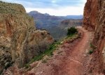
We saved our longest hike for today, spending most of our day on Observation Point Trail. Observation Point Trail is one of Zion’s classic hikes according to all of the literature I could find ahead of time. It offered a crazy variety of scenery including long drop-offs, a climb through Echo Canyon, and views of Cable Mountain, Deertrap Mountain, and East Mesa Trails. It is a very steep trail, climbing 2,148, and is rated very strenuous hike that takes most people 5-6 hours to complete. It is a there and back trail totaling 8 miles (4 there and 4 back).
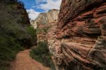
We got off at shuttle stop #7 and away we went. After some time on the trail (it was hot despite it being early morning) we arrived in the cooler and shadier section called Echo Canyon, a slot canyon that is really neat. The conditions of the hike changed quite a bit after this point; we were sheltered from the sun and the uphill ascent relaxed slightly. But once we got through that section, we began to zigzag again which indicated we were on the hike’s last ascent. This final section was mostly level, deceptively level considering how high we were climbing, and provided us with a considerably less stressful climb than Angel’s Landing had.
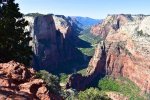
Once we made it to Observation Point, we were rewarded with a great view of Zion National Park. We even looked down on Angels Landing which was kinda crazy if you want to know the truth. During the entire hike up Benny’s been asking me to help him to “’member some obserfasions” for his Junior Ranger booklet. Uh huh. Maybe I’m not doing so bad with his academic stuff. He seems to be way ahead of the Sunshine State Standards. Some of the simple sight words he ignores or guesses at but some of the longer words he recognizes regardless of where he sees them. He doesn’t sound them out, he just flat out memorizes them. He has mastered most of the Early Learning Benchmarks. I have a list of those from his last pediatrician because of the initial regression caused by his PTSD. Other areas I know he is behind in, like socializing with peers/same age groups. It isn’t that he can’t, it is that it isn’t willingly and in fact he avoids it if at all possible.
I decided that rather than wait until we got back to the trailhead we’d eat an early lunch right there at the top. We grabbed a slab of stone and had a good ol’ time as Grandma Barry would have said. I’ve been kind of lax on Benny’s portfolio and the thinking I was doing was just poking that guilty gene. I know there is the binder of Junior Ranger activities but I better start keeping track of other things like the documentaries he watches and samples of his handwriting and stuff like that. Technically I don’t have to do that until he is six and has to be registered for school but … oh who am I kidding. Sharon’s email just worries me. I don’t want anyone in our business. I know I’m letting it get out of control so I’m hoping by doing something about it … have a defense for any possible interference or complaints and evidence to back up my defense … I can head off any potential problem.
I don’t know why I am letting Sharon’s email eat at me like this. Like one of those flaming triggers the counselors constantly warned about. It was inevitable that something from the past would come up. I can’t run and hide us from that stuff forever. I’d even gone to the trouble of coming up with a plan before we started this adventure. I’ve slacked off I admit. Benny is still Junior Ranger obsessed but I can’t leave it up to him to do the heavy lifting on this particular project. So right there I promised myself that I would adjust my nightly routine to include working on a digital portfolio for Benny.
We couldn’t stay at the top of Observation Point all day long so we started back down and eventually got back to the trail head about 2 pm and then did the barely half-mile Weeping Rock trail, one of the shortest official trails in the park. It is a little steep but nothing like what we’d just come down. And it is rock-paved and leads to a damp, concave alcove like area.
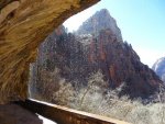
After that short trail we headed to a much easier trail called the Riverside Trail. According to the hiking information at the visitor center, while many hikes in Zion are designed with the end in mind, this one is more about what you see on the way there. The 2-mile round trip is nonstrenuous, mostly paved, fairly level, and very shaded. The reason for the name is obvious once you start walking, the trail follows along the Virgin River very closely and provides up-close views and access to the water at points. Water drips down the narrow canyon walls creating very green vegetation and cool-ish air even during summer. Wildlife sightings are also very common in this area. Formerly named “Gateway to the Narrows,” this trail takes you directly to the starting point of the famous Narrows where you can get wet if you want to. Benny was a hoot when he realized I wasn’t joking when I told him I’d brought our water shoes. There was a boy there in a wheelchair and Benny had fun running rocks back and forth to him. The boy was several years older than Benny but he had something going on that made it obvious he was developmentally challenged. The family wasn’t there long, apparently the boy was on medication that forced him to limit his time in the sun, but it certainly went a ways to making me worry less about Benny’s own development.
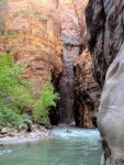
The trail was very easy, but we spent almost two hours on it because of the water fun we had. It was time to head back to camp, besides we are coming back tomorrow to do the Narrows trail.
Once back in camp we did another amphitheater program and luckily the kids who attended didn’t throw fits so I didn’t get stressed out. Benny was pretty tired and fell asleep in the middle of telling The Crew about our day. At least it was after he’d washed up for the night and gotten into his PJs. Noticed they are getting a little short in the leg. I’ll have to remedy that when the shirt starts getting uncomfortable but for now it looks more like he is growing up and not filling out yet.
To work my nerves off I did some adulting, including formatting the digital portfolio using a scrapbook program that I used to make Benny’s baby book with. Then I did some pushups and stretches. Man, I wish I had my weights. The kettle bells are okay, but I miss my weight bench. I’m just going to end this entry here so I don’t accidentally unlock the rabid hamster’s cage. I’m running low on caffeinated waters, just like everything else, and I need to save them if I can.
June 20th
Slept okay last night. I think writing the email actually did help. So did not sending it; gives me another couple of days to make any changes, or just plain change my mind about sending it. I know I need to work on Benny having a support network in case something happens to me but my experience of that part of my family doesn’t exactly lead me to think they are the ones. Maybe they’ve changed. It happens. I’m just not sure, and I’m not sure if I’m ready to figure that stuff out just yet. Sounds abysmally stupid on my part but that’s the way I feel. But enough of my stupids.

We saved our longest hike for today, spending most of our day on Observation Point Trail. Observation Point Trail is one of Zion’s classic hikes according to all of the literature I could find ahead of time. It offered a crazy variety of scenery including long drop-offs, a climb through Echo Canyon, and views of Cable Mountain, Deertrap Mountain, and East Mesa Trails. It is a very steep trail, climbing 2,148, and is rated very strenuous hike that takes most people 5-6 hours to complete. It is a there and back trail totaling 8 miles (4 there and 4 back).

We got off at shuttle stop #7 and away we went. After some time on the trail (it was hot despite it being early morning) we arrived in the cooler and shadier section called Echo Canyon, a slot canyon that is really neat. The conditions of the hike changed quite a bit after this point; we were sheltered from the sun and the uphill ascent relaxed slightly. But once we got through that section, we began to zigzag again which indicated we were on the hike’s last ascent. This final section was mostly level, deceptively level considering how high we were climbing, and provided us with a considerably less stressful climb than Angel’s Landing had.

Once we made it to Observation Point, we were rewarded with a great view of Zion National Park. We even looked down on Angels Landing which was kinda crazy if you want to know the truth. During the entire hike up Benny’s been asking me to help him to “’member some obserfasions” for his Junior Ranger booklet. Uh huh. Maybe I’m not doing so bad with his academic stuff. He seems to be way ahead of the Sunshine State Standards. Some of the simple sight words he ignores or guesses at but some of the longer words he recognizes regardless of where he sees them. He doesn’t sound them out, he just flat out memorizes them. He has mastered most of the Early Learning Benchmarks. I have a list of those from his last pediatrician because of the initial regression caused by his PTSD. Other areas I know he is behind in, like socializing with peers/same age groups. It isn’t that he can’t, it is that it isn’t willingly and in fact he avoids it if at all possible.
I decided that rather than wait until we got back to the trailhead we’d eat an early lunch right there at the top. We grabbed a slab of stone and had a good ol’ time as Grandma Barry would have said. I’ve been kind of lax on Benny’s portfolio and the thinking I was doing was just poking that guilty gene. I know there is the binder of Junior Ranger activities but I better start keeping track of other things like the documentaries he watches and samples of his handwriting and stuff like that. Technically I don’t have to do that until he is six and has to be registered for school but … oh who am I kidding. Sharon’s email just worries me. I don’t want anyone in our business. I know I’m letting it get out of control so I’m hoping by doing something about it … have a defense for any possible interference or complaints and evidence to back up my defense … I can head off any potential problem.
I don’t know why I am letting Sharon’s email eat at me like this. Like one of those flaming triggers the counselors constantly warned about. It was inevitable that something from the past would come up. I can’t run and hide us from that stuff forever. I’d even gone to the trouble of coming up with a plan before we started this adventure. I’ve slacked off I admit. Benny is still Junior Ranger obsessed but I can’t leave it up to him to do the heavy lifting on this particular project. So right there I promised myself that I would adjust my nightly routine to include working on a digital portfolio for Benny.
We couldn’t stay at the top of Observation Point all day long so we started back down and eventually got back to the trail head about 2 pm and then did the barely half-mile Weeping Rock trail, one of the shortest official trails in the park. It is a little steep but nothing like what we’d just come down. And it is rock-paved and leads to a damp, concave alcove like area.

After that short trail we headed to a much easier trail called the Riverside Trail. According to the hiking information at the visitor center, while many hikes in Zion are designed with the end in mind, this one is more about what you see on the way there. The 2-mile round trip is nonstrenuous, mostly paved, fairly level, and very shaded. The reason for the name is obvious once you start walking, the trail follows along the Virgin River very closely and provides up-close views and access to the water at points. Water drips down the narrow canyon walls creating very green vegetation and cool-ish air even during summer. Wildlife sightings are also very common in this area. Formerly named “Gateway to the Narrows,” this trail takes you directly to the starting point of the famous Narrows where you can get wet if you want to. Benny was a hoot when he realized I wasn’t joking when I told him I’d brought our water shoes. There was a boy there in a wheelchair and Benny had fun running rocks back and forth to him. The boy was several years older than Benny but he had something going on that made it obvious he was developmentally challenged. The family wasn’t there long, apparently the boy was on medication that forced him to limit his time in the sun, but it certainly went a ways to making me worry less about Benny’s own development.

The trail was very easy, but we spent almost two hours on it because of the water fun we had. It was time to head back to camp, besides we are coming back tomorrow to do the Narrows trail.
Once back in camp we did another amphitheater program and luckily the kids who attended didn’t throw fits so I didn’t get stressed out. Benny was pretty tired and fell asleep in the middle of telling The Crew about our day. At least it was after he’d washed up for the night and gotten into his PJs. Noticed they are getting a little short in the leg. I’ll have to remedy that when the shirt starts getting uncomfortable but for now it looks more like he is growing up and not filling out yet.
To work my nerves off I did some adulting, including formatting the digital portfolio using a scrapbook program that I used to make Benny’s baby book with. Then I did some pushups and stretches. Man, I wish I had my weights. The kettle bells are okay, but I miss my weight bench. I’m just going to end this entry here so I don’t accidentally unlock the rabid hamster’s cage. I’m running low on caffeinated waters, just like everything else, and I need to save them if I can.
sssarawolf
Has No Life - Lives on TB
Thank you, missed this last night as I was so tired out from going to town.
Jun 18 – 21: Zion National Park, Utah (part 4)
June 21st
Last day in Zion. I think I might miss the shuttles. There is at least one more park that uses them – Glacier – so we’ll have to see. It has just been nice to leave the van in one location and travel out and back every day.
Today we did two trails, one long and one not. We hopped on the first shuttle of the day and took it as far out as we could, to the Temple of Sinawava stop, where we started The Narrows trail.
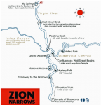
The Narrows trail is less trail and more river bottom and subject to flash floods. Lucky for us that wasn’t a threat today as there hadn’t been rain in the affected area for days. I was anxious to give it a try – it is rated one of the top five hikes in the country – but not at the risk of Benny. Rangers say no sign of flash flood weather so we were good to go.

The hike began right next to the restrooms – which we utilized gratefully since there are none on the hike. At least 60% of the hike is spent wading, walking, and sometimes swimming in the river. I packed in preparation of Benny being on my back in a few places and also put all essentials in waterproof containers … most of it in a float bag inside my backpack but also my phone inside a waterproof case on a lanyard. A few times I wound up putting it inside the float bag as well. We both had hiking poles and they definitely came in handy when trying to maintain our balance.
Travel was rough and slippery in cold, fast flowing water; there were also slippery rocks. I had us in our boots for traction and because of the rocks, but I brought our water-shoes for a few places when we were just taking a break and wading. Was just better to wear our boots since I had a dry pair in the van waiting on us when we got back. I wore wet boots on our second hike but with dry socks since I’d packed some in the dry bag. I packed dry boots for Benny. The clothes we wore were quick-dry, but we wound up having to change them when we got back to the trailhead with what I’d packed in the dry bag as well; too much grit and mud in uncomfortable places. The one great idea I had was to use our neoprene kayaking “socks.” Kept our feet a lot drier and warmer, that’s for sure.
The Narrows is one of those trails where it is about the journey, not the destination. There was no one “viewpoint” or extra spectacular spot; the entire hike was beautiful. Hiking as far as Big Spring on the trail is allowed without a permit, which is 9.4 miles, round trip.
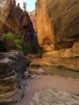
The “bottom-up” approach to the trail is the most popular with approximately 90% of all Narrows hikers using this direction. It takes you to see the famous Wall Street section of the canyon, where the walls are 1500 tall and the river is only 22 feet wide. It is the path that is suitable for most hikers, especially families with kids shorter than five feet. It can be as short as a 2-mile roundtrip if you only take it on the paved Riverside walk, or as long as nearly 10-mile roundtrip if you go to the point right before you start needing a back country permit (this is what we did).
Like I said, you start out on a paved trail called Riverside Walk. This part of the hike is mostly dry unless you want to get wet which a lot of people seemed to want to, especially with kids. We started on the trail early, earlier than most except for those that were through hiking and going into the backcountry.
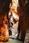
It takes about a mile to reach the gateway to the narrows, and that is also the easiest section. If we had judged the entire trail by the crowds on that section, we might not have gone further but just beyond the gateway the crowds thinned and hiking became much more enjoyable. By the time we reached Orderville Canyon we were down to about a quarter of the number of people we started with, and half that again by the time we got to Big Springs and turned around.
I know we were walking in water most of the time but I’m glad that I brought the water that I did. Since we weren’t just walking by a river but in one, it was a real exercise. And the canyons are cooler because they stay shaded most of the day, but that doesn’t mean there were a few warm stretches.
The first couple of miles are also the shallowest and we switched from side to side (zig zag pattern) in an effort to avoid the deeper parts … haha or should I say the initial deeper parts which really weren’t deep. That’s also the widest section … before the true Narrows. A few times I had Benny take a break because the water was cold and I didn’t want to risk hypothermia. That might have been a bit of a stretch but he’s five years old and small for his age. I just wanted to be careful even if that meant missing our second hike, but I didn’t explain it to him like that.
As we went along I learned that using a hiking stick was a good way to keep your balance, it was also a different set of muscles. My arm is a little sore but probably more from helping Benny stay on his feet than the walking stick, but I understood why other people were complaining of sore arms later in the day.
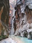
By the time we got to Wall Street the trail had significantly narrowed and by the Orderville junction it had gotten super narrow giving me some idea of why flash flooding could be so dangerous in the area. The hike through Orderville Canyon is short and was well worth taking. We went through a very narrow section of canyon and we were basically alone the entire time making it unbelievable quiet, almost eerie. The trail is mostly flat and rocky before you arrive at a small waterfall. You can meander upstream for a few hundred yards more but we turned around and went back to the main trail. At approximately 0.5 miles from the Orderville fork, you'll pass Floating Rock: a giant rock bisecting the river that you can navigate around.
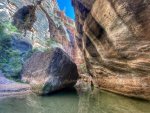
Further up the canyon, keep your eyes and ears peeled for Hiccup Springs. While it is not very visible, other than a little crack on the left side of the river, you should be able to hear the gurgling noise when approximately 0.8 miles from the Orderville fork. The downside of Wall Street is the narrowing of the walls meant the flow of the river got stronger and created a lot of deeper sections. At this point most of the dry land disappeared and there were fewer places to take a break. This was the part that was most difficult for Benny. I wound up piggy backing him in a couple of places where the water came up to my chest. Brrr. The stronger current also made it slower going and I nearly went over several times if not for the hiking pole. Most families with young children turned around before that point because of the depth. It was just me and Benny and another family where the dad-figure put a kid younger than Benny on his shoulders but even they admitted defeat a quarter of the mile further in when the Mom was struggling as well because she was of short stature.
We’d been encouraging each other, and they wished me luck. They said they’d come through the same time last year and the water wasn’t nearly as deep. I asked them if it was worth hiking on and they said definitely, so on I went.
The Boulder Pair is a set of 2 giant boulders that block the river and mark the beginning of the boulder-obstacle portion of the route. While it's not very difficult to get through this obstacle, we still had to be careful; just because there are some boulders doesn’t mean there is still water to trek through. Next up was Sipping Turtle (another gurgling noise maker) roughly 1.8 miles from the Orderville fork. The name alone was a good distraction for Benny who had grown confident for the sake of the little boy in the other family, but after becoming the only kid on the trail had grown uncomfortable and hesitant. I told him how proud I was of him and that it wasn’t quite another half mile until we reached Big Springs and the spot we would picnic before turning around and heading out. That helped for him to realize there was a stopping point not far ahead.
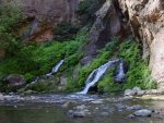
We were both starving and I’d thrown together a lot of odds and ends snack and finger foods. We ate them all and could have probably eaten more besides. And despite all the water we’d been walking in we were both thirsty as well. Problem? No bathrooms so we had to do what the backcountry campers do. I had some doggie-doo bags I still keep in whatever pack I am carrying out of habit when dirty diapers were still something I had to deal with for Benny. I didn’t remind him of that however. Catholes made and covered after use, we packed up everything we’d brought in and headed back the way we’d come.
The hike back was challenging in its own way, mostly because we were fighting the current even more sense it was going against us. It took less time to get out than come in but that’s because we didn’t do as much stopping. Don’t get me wrong, I love the water, but I was about done and done in after having to hike through it for nearly eight hours. We waited in line for the bathrooms, but we were lucky that the shuttle arrived right as we were ready to get on and since so many were getting off there was plenty of space for those of us who were waiting. I debated whether to just call it quits and head back to camp but it was barely three o’clock and as our last day in the park I wanted to make the most of it.
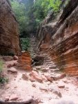
Our last hike of the day and in the park was Hidden Canyon Trail. It was about a quarter of the length of The Narrows but a lot of fun, and similar to The Narrows the hike was more about the trail than about a destination.
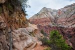
Hidden Canyon is what is called a “manufactured trail” meaning it isn’t really a natural pathway. It is located east of the Great White Throne and starts with a lot of uphill hiking. You start by going through the mouth of a narrow canyon then follows along a cliff face using switchbacks to reach a junction with East Rim Trail near the East Rim Trailhead. The higher you go the flatter the trail gets but the difficulty level doesn’t really change due to how exposed you are. It is absolutely necessary to use the chains that have been bolted to the cliff in order to keep your balance. You can keep going beyond the end of the official trail, but it was time for us to turn around. The entire trail was 2.4 miles long and took us three hours to complete.
Benny was both tired and hungry. I didn’t feel like cooking, but I was hungry as well. I’d already looked over the menu at the Zion Lodge and none of the meals were strictly gluten free and I would have been paying a high price for items Benny couldn’t eat. And I do mean high as in $$$. So Aunt Gus pulled up her big girl skivvies and got dinner going as soon as we got back to the van. Essentially it was just a stir fry of all the bits and pieces left in the frig that needed to be used up. Didn’t matter if it almost looked like dog food, we both inhaled it and I felt good that no food went to waste nor did any money.
I offered to take Benny to an amphitheater show but he just shrugged and asked if he could have some marshmallows. Good enough. He fell asleep after one minimarshmallow and I snagged the rest before they melted into his hair. I rolled him into bed with the Crew and then started my adulting tasks that never seem to end.
My grocery list is getting disgustingly long … worryingly long. I’m hoping to get a that taken care of soon; before we head into Grand Teton will be an absolute necessity. I’ve got something written up for the blog. I’ve even decided to send a short … emphasis on short … and unemotional email to Sharon because it is the right thing to do, not because I feel obligated which I don’t. We’ll see if she can hang onto her Susie Sunshine persona given that I’m not giving her what she wants.
Lastly I did some budgeting. We are doing okay. The blog is definitely helping, still leveled out at $600/month income. Benny bennies help and I try and keep those strictly for his needs; he provides the discount and I use the estate dollars to pay the remainder. I know one of these days this is going to have to change but for now it is working. If I can figure out a way to make real bank on the blog in some way I wouldn’t be so anxious every
Cumulative Fuel Expense: $3555
Cumulative Accommodation Expense: $1735
Cumulative miles: 8574
Resources:
https://www.nps.gov/zion/learn/kidsyouth/upload/Jr-Ranger-Web-508.pdf
FL Sunshine State Standards: https://www.kaplanco.com/images/content/flprek/5yearoldperfstds.pdf
Office of Early Learning - Early Learning and Developmental Standards
https://static1.squarespace.com/static/54ad4eb3e4b08dbf5e26472d/t/5ec175b60bcf3d6a67ba2b50/1589736892130/maincanyonandeastsidemap.pdf
June 21st
Last day in Zion. I think I might miss the shuttles. There is at least one more park that uses them – Glacier – so we’ll have to see. It has just been nice to leave the van in one location and travel out and back every day.
Today we did two trails, one long and one not. We hopped on the first shuttle of the day and took it as far out as we could, to the Temple of Sinawava stop, where we started The Narrows trail.

The Narrows trail is less trail and more river bottom and subject to flash floods. Lucky for us that wasn’t a threat today as there hadn’t been rain in the affected area for days. I was anxious to give it a try – it is rated one of the top five hikes in the country – but not at the risk of Benny. Rangers say no sign of flash flood weather so we were good to go.

The hike began right next to the restrooms – which we utilized gratefully since there are none on the hike. At least 60% of the hike is spent wading, walking, and sometimes swimming in the river. I packed in preparation of Benny being on my back in a few places and also put all essentials in waterproof containers … most of it in a float bag inside my backpack but also my phone inside a waterproof case on a lanyard. A few times I wound up putting it inside the float bag as well. We both had hiking poles and they definitely came in handy when trying to maintain our balance.
Travel was rough and slippery in cold, fast flowing water; there were also slippery rocks. I had us in our boots for traction and because of the rocks, but I brought our water-shoes for a few places when we were just taking a break and wading. Was just better to wear our boots since I had a dry pair in the van waiting on us when we got back. I wore wet boots on our second hike but with dry socks since I’d packed some in the dry bag. I packed dry boots for Benny. The clothes we wore were quick-dry, but we wound up having to change them when we got back to the trailhead with what I’d packed in the dry bag as well; too much grit and mud in uncomfortable places. The one great idea I had was to use our neoprene kayaking “socks.” Kept our feet a lot drier and warmer, that’s for sure.
The Narrows is one of those trails where it is about the journey, not the destination. There was no one “viewpoint” or extra spectacular spot; the entire hike was beautiful. Hiking as far as Big Spring on the trail is allowed without a permit, which is 9.4 miles, round trip.

The “bottom-up” approach to the trail is the most popular with approximately 90% of all Narrows hikers using this direction. It takes you to see the famous Wall Street section of the canyon, where the walls are 1500 tall and the river is only 22 feet wide. It is the path that is suitable for most hikers, especially families with kids shorter than five feet. It can be as short as a 2-mile roundtrip if you only take it on the paved Riverside walk, or as long as nearly 10-mile roundtrip if you go to the point right before you start needing a back country permit (this is what we did).
Like I said, you start out on a paved trail called Riverside Walk. This part of the hike is mostly dry unless you want to get wet which a lot of people seemed to want to, especially with kids. We started on the trail early, earlier than most except for those that were through hiking and going into the backcountry.

It takes about a mile to reach the gateway to the narrows, and that is also the easiest section. If we had judged the entire trail by the crowds on that section, we might not have gone further but just beyond the gateway the crowds thinned and hiking became much more enjoyable. By the time we reached Orderville Canyon we were down to about a quarter of the number of people we started with, and half that again by the time we got to Big Springs and turned around.
I know we were walking in water most of the time but I’m glad that I brought the water that I did. Since we weren’t just walking by a river but in one, it was a real exercise. And the canyons are cooler because they stay shaded most of the day, but that doesn’t mean there were a few warm stretches.
The first couple of miles are also the shallowest and we switched from side to side (zig zag pattern) in an effort to avoid the deeper parts … haha or should I say the initial deeper parts which really weren’t deep. That’s also the widest section … before the true Narrows. A few times I had Benny take a break because the water was cold and I didn’t want to risk hypothermia. That might have been a bit of a stretch but he’s five years old and small for his age. I just wanted to be careful even if that meant missing our second hike, but I didn’t explain it to him like that.
As we went along I learned that using a hiking stick was a good way to keep your balance, it was also a different set of muscles. My arm is a little sore but probably more from helping Benny stay on his feet than the walking stick, but I understood why other people were complaining of sore arms later in the day.

By the time we got to Wall Street the trail had significantly narrowed and by the Orderville junction it had gotten super narrow giving me some idea of why flash flooding could be so dangerous in the area. The hike through Orderville Canyon is short and was well worth taking. We went through a very narrow section of canyon and we were basically alone the entire time making it unbelievable quiet, almost eerie. The trail is mostly flat and rocky before you arrive at a small waterfall. You can meander upstream for a few hundred yards more but we turned around and went back to the main trail. At approximately 0.5 miles from the Orderville fork, you'll pass Floating Rock: a giant rock bisecting the river that you can navigate around.

Further up the canyon, keep your eyes and ears peeled for Hiccup Springs. While it is not very visible, other than a little crack on the left side of the river, you should be able to hear the gurgling noise when approximately 0.8 miles from the Orderville fork. The downside of Wall Street is the narrowing of the walls meant the flow of the river got stronger and created a lot of deeper sections. At this point most of the dry land disappeared and there were fewer places to take a break. This was the part that was most difficult for Benny. I wound up piggy backing him in a couple of places where the water came up to my chest. Brrr. The stronger current also made it slower going and I nearly went over several times if not for the hiking pole. Most families with young children turned around before that point because of the depth. It was just me and Benny and another family where the dad-figure put a kid younger than Benny on his shoulders but even they admitted defeat a quarter of the mile further in when the Mom was struggling as well because she was of short stature.
We’d been encouraging each other, and they wished me luck. They said they’d come through the same time last year and the water wasn’t nearly as deep. I asked them if it was worth hiking on and they said definitely, so on I went.
The Boulder Pair is a set of 2 giant boulders that block the river and mark the beginning of the boulder-obstacle portion of the route. While it's not very difficult to get through this obstacle, we still had to be careful; just because there are some boulders doesn’t mean there is still water to trek through. Next up was Sipping Turtle (another gurgling noise maker) roughly 1.8 miles from the Orderville fork. The name alone was a good distraction for Benny who had grown confident for the sake of the little boy in the other family, but after becoming the only kid on the trail had grown uncomfortable and hesitant. I told him how proud I was of him and that it wasn’t quite another half mile until we reached Big Springs and the spot we would picnic before turning around and heading out. That helped for him to realize there was a stopping point not far ahead.

We were both starving and I’d thrown together a lot of odds and ends snack and finger foods. We ate them all and could have probably eaten more besides. And despite all the water we’d been walking in we were both thirsty as well. Problem? No bathrooms so we had to do what the backcountry campers do. I had some doggie-doo bags I still keep in whatever pack I am carrying out of habit when dirty diapers were still something I had to deal with for Benny. I didn’t remind him of that however. Catholes made and covered after use, we packed up everything we’d brought in and headed back the way we’d come.
The hike back was challenging in its own way, mostly because we were fighting the current even more sense it was going against us. It took less time to get out than come in but that’s because we didn’t do as much stopping. Don’t get me wrong, I love the water, but I was about done and done in after having to hike through it for nearly eight hours. We waited in line for the bathrooms, but we were lucky that the shuttle arrived right as we were ready to get on and since so many were getting off there was plenty of space for those of us who were waiting. I debated whether to just call it quits and head back to camp but it was barely three o’clock and as our last day in the park I wanted to make the most of it.

Our last hike of the day and in the park was Hidden Canyon Trail. It was about a quarter of the length of The Narrows but a lot of fun, and similar to The Narrows the hike was more about the trail than about a destination.

Hidden Canyon is what is called a “manufactured trail” meaning it isn’t really a natural pathway. It is located east of the Great White Throne and starts with a lot of uphill hiking. You start by going through the mouth of a narrow canyon then follows along a cliff face using switchbacks to reach a junction with East Rim Trail near the East Rim Trailhead. The higher you go the flatter the trail gets but the difficulty level doesn’t really change due to how exposed you are. It is absolutely necessary to use the chains that have been bolted to the cliff in order to keep your balance. You can keep going beyond the end of the official trail, but it was time for us to turn around. The entire trail was 2.4 miles long and took us three hours to complete.
Benny was both tired and hungry. I didn’t feel like cooking, but I was hungry as well. I’d already looked over the menu at the Zion Lodge and none of the meals were strictly gluten free and I would have been paying a high price for items Benny couldn’t eat. And I do mean high as in $$$. So Aunt Gus pulled up her big girl skivvies and got dinner going as soon as we got back to the van. Essentially it was just a stir fry of all the bits and pieces left in the frig that needed to be used up. Didn’t matter if it almost looked like dog food, we both inhaled it and I felt good that no food went to waste nor did any money.
I offered to take Benny to an amphitheater show but he just shrugged and asked if he could have some marshmallows. Good enough. He fell asleep after one minimarshmallow and I snagged the rest before they melted into his hair. I rolled him into bed with the Crew and then started my adulting tasks that never seem to end.
My grocery list is getting disgustingly long … worryingly long. I’m hoping to get a that taken care of soon; before we head into Grand Teton will be an absolute necessity. I’ve got something written up for the blog. I’ve even decided to send a short … emphasis on short … and unemotional email to Sharon because it is the right thing to do, not because I feel obligated which I don’t. We’ll see if she can hang onto her Susie Sunshine persona given that I’m not giving her what she wants.
Lastly I did some budgeting. We are doing okay. The blog is definitely helping, still leveled out at $600/month income. Benny bennies help and I try and keep those strictly for his needs; he provides the discount and I use the estate dollars to pay the remainder. I know one of these days this is going to have to change but for now it is working. If I can figure out a way to make real bank on the blog in some way I wouldn’t be so anxious every
Cumulative Fuel Expense: $3555
Cumulative Accommodation Expense: $1735
Cumulative miles: 8574
Resources:
https://www.nps.gov/zion/learn/kidsyouth/upload/Jr-Ranger-Web-508.pdf
FL Sunshine State Standards: https://www.kaplanco.com/images/content/flprek/5yearoldperfstds.pdf
Office of Early Learning - Early Learning and Developmental Standards
https://static1.squarespace.com/static/54ad4eb3e4b08dbf5e26472d/t/5ec175b60bcf3d6a67ba2b50/1589736892130/maincanyonandeastsidemap.pdf
thank you! I know some people would say that there isn't enough 'action'.. but I love stories about the process of surviving--how to grow/raise enough to eat, get clean water, clothes, etc, etc.. and you cover that wonderfully!
There will be some action here and there but Book 1 is more about character development. In Book 2 there is more "action" and development. Towards the end of Book 2 there is a lot more "action." LOL
Jeepcats27
Senior Member
thank you Kathy!
sssarawolf
Has No Life - Lives on TB
Thank you, loved seeing this here this here.
beaglemama
Contributing Member
Thanks, Kathy!
Jun 22 – 24: Great Basin National Park, Nevada (Part 1)
Driving Route:
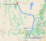
June 22nd
Almost didn’t get a campsite. There were only two left, and I took one of them. Part of me felt bad that there were several people behind me in line but on the other hand I’m glad I didn’t have to come up with another option.
It was mostly because of the ghost town. Yeah, I said ghost town, Grafton Ghost Town to be exact. We packed up last night and all I had to do was turn in my campsite sticker so they knew we’d left Zion.
Grafton was first settled in late 1859 as part of a “cotton mission” sent by Mormon leader Brigham Young. Originally called Wheeler, Grafton was about a mile downriver of where it is now. Five families homesteaded on the river’s south bank and grew cotton and crops in irrigated fields. A few years later the town’s population swelled to 168 people in 28 families and offered log cabins, a Mormon Church, post office, and adobe school and community center.
When Wheeler, as it was known then, was destroyed by the flooding of the Virgin River on January 8, 1862, the settlers rebuilt the town in its current location and renamed it after Grafton, Massachusetts. Some of the original orchards are still visible today, though in bad shape. After the outbreak of the Black Hawk War in 1866, Grafton was completely evacuated due to fear of Indian attacks. By 1890 there were only four families still living in Grafton. The nail in Grafton’s coffin was the closure of the local branch of the Church of Jesus Christ of Latter-day Saints in 1921. That’s when Grafton took on another life. As far back as 1929, Grafton was featured in the first outdoor talkie (talkie was the popular term for the first movies with sound). In 1944 the last residents of the town left. Later, Grafton appeared in the movie Butch Cassidy and the Sundance Kid.

It isn’t like there was really much there to get enthusiastic about, but it was still neat, especially with the history behind it. We probably shouldn’t have stayed as long as we did but we did and since we still managed to get a campsite I’m not going to regret it.
The next stop we made was in Stopped in Cedar City for a Walmart supercenter. I probably broke the speed limit with the buggy and in all honesty Benny and I were making a game of it. How fast could we get everything on our list and get out? We annoyed a couple of people but more because we were acting like we’d had something red when we shouldn’t have. It was still pretty early in the morning as well. I mentally apologized as I was throwing the groceries into the van and getting Benny in and going.
Had we driven straight through it would have only taken slightly over three hours, but because we stopped it was noon before we were pulling in and that’s why we almost didn’t get a site. But we did so I’m going to stop harping on it.
Great Basin is different. First off, the info online doesn’t always match what we find. I was told they didn’t have a Junior Ranger program but when we arrived it was to find that there was one. Benny was happy. I was happy because Benny was happy. It was also one less thing for me to plan for.
I’ve spent several hours this evening putting all of the groceries I picked up away in some kind of commonsense order and then trying to plan out a menu for Grant Teton and Yellowstone. There is no way around it, I’m going to need to stop in Salt Lake City before we get into Grand Teton. I don’t have to rearrange our camping days, but I do need to rearrange our itinerary. I had hoped to do a little looking around in SLC but that might not happen. I’ll work on times and such again, but I also need to take some time and go over the van. I don’t think there is any delayed maintenance, but the van needs a serious going over.
I also need to put some thinking into what was discussed in the phone call I took from Groucho and Stella. They are definitely moving to North Florida, probably just outside of Lake City. In fact, they’ve already started packing. Groucho is already getting people asking him when he will have a shop open. Lots of bikers; the hobby riders and the serious guys for whom it is a way of life. Everything is happening so fast and easy that not even Groucho can deny that it seems to be what is best and supposed to happen. Stella is still convinced there is going to be a devastating hurricane in late August or September. She also mentioned that she is worried for Groucho’s health for some reason. That freaked me out a little but Stella said that it will all work out in the end, just going to be a rough patch. She was so matter of fact that it was a little freaky.
Kirkland texted me privately and asked me what I thought about him moving with them to North Florida. I hate being put in that position. I told him he should discuss it with Groucho. He had and Groucho was on board if that is what Kirkland really wants. The problem is that Kirkland doesn’t know how to tell his mother that it may be a permanent move. I told him I couldn’t help him with that part, that’s I’d never been in the position of having parental units as an adult and having to figure out how to adult around their plans for me. I think in the end he just needed someone to talk to, not necessarily give him any advice ‘cause for sure I didn’t give him any.
And all of that before we hit the national park and lost our internet and cell connection. Not even the booster is working in camp though it did work at the visitor center.
After getting our assigned campsite our main activity of the day was the Wheeler Peak Scenic Drive. The Wheeler Peak Scenic Drive takes is a paved 12-mile, out and back road (total of 24 miles) to an elevation exceeding 10,000 feet above sea level and the the face of Wheeler Peak. Along the road we gained over 4,000 feet in elevation (one direction), and crossed through numerous ecological zones. Benny, playing wild animal bingo, “collected” mule deer, marmots, coyotes, and jackrabbits. There were birds as well but I couldn’t identify them.
We started the drive by the Lehman Caves Visitor Center. The road brochure we had stated we were already at an elevation of 7,000 feet above sea level. All around us was the eco-region that is made up of predominately
After the sagebrush the environment started to change significantly as the low shrubs were replaced by taller and taller pine trees. By 8,000 feet, we were passing through a prime example of a true Pinyon/Juniper woodland eco-zone. In his Junior Ranger book Benny had to identify the differences between those two trees as well as describe other trees in the park. Pinyon pines have sharp, round needles emerging singly from the tree stem, while juniper needles are very short and lay close together looking like scales.

At around 8,500 feet above sea level the trees change again, this time to some rough looking trees called Curleaf Mountain Mahogany that have small, waxy leaves that curl down at the edges. Human impact in this area is noticeable as large stands of mountain mahogany were cleared to support the early miners of the area so there are “bald” places.
By 9,000 feet we entered yet another eco-zone of a forest of mixed conifers. There were groves of white fir, Douglas fir, and ponderosa pine. Telling these trees apart was easy as each one had different needles. White fir has flat needles that arch upwards, Douglas fir has drooping branches with what is called three terminal buds at the end, and ponderosa pine are a large tree with reddish bark and long needles. One of the activities the Benny’s booklet suggested was for us to stick our nose in the cracks in the bark of the ponderosa pine. The point was to notice the smell and decide if it smelled of vanilla or butterscotch. To be honest I couldn’t decide; it sure didn’t smell like tree, at least to me.
By the 11th mile, we had reached an altitude of 10,000 feet above sea level. Ecologically, we had entered an eco-zone that reminded me more of Rocky Mountain national park than where we had been earlier in the day. The roadside sign said that the sub-alpine forest we were in is dominated by the white-barked aspen tree. We learned that each aspen grove we saw could be a single, living organism. Aspens reproduce through cloning by sending runners out underground that become new trees. The sign said that it is common that entire hillsides of aspens are all a single, genetically identical tree. Bizarre.
The end of the road was the Summit Trailhead. Benny and I walked down it a little ways but it was a little strenuous for him – and the altitude wasn’t doing a whole lot for me either – and there was a storm coming in from off in the distance and another hiker warned us that being out on the trail in bad weather wasn’t some place we wanted to be.
Benny and I turned around and then took the road back down, stopping at a couple of turn outs to take more pictures and then headed to the campsite. Benny enjoyed some down time just playing with the Crew and his discovery toys, something I should probably make sure he has more time for. I dealt with groceries and all of those other adulting activities there is no one else around to do.
Tomorrow we are going on a cave tour and I plan on one or two hikes but for the most part I want us both to relax. Once we hit Grand Teton and Yellowstone there is going to be a lot of driving and other activities. I think we’ve earned a bit of a break.

Oh, before I put this away, I want to say how much I appreciate the way this campground is set up. First there are only 37 sites, so it isn’t crowded in that respect. Second, the sites are spread apart so you aren’t on top of each other. It has given a sense of privacy I haven’t had for the last couple of parks due to the crowds and how closely the campsites were positioned.
The campsite is at an elevation of 7530 feet so it is cooler than I expected but it is still really nice. Very low humidity and the bugs aren’t bothering me though a few mosquitoes. I’d like to stay up and enjoy it since Benny is asleep, but I should got to bed and sleep while I can.
Driving Route:

June 22nd
Almost didn’t get a campsite. There were only two left, and I took one of them. Part of me felt bad that there were several people behind me in line but on the other hand I’m glad I didn’t have to come up with another option.
It was mostly because of the ghost town. Yeah, I said ghost town, Grafton Ghost Town to be exact. We packed up last night and all I had to do was turn in my campsite sticker so they knew we’d left Zion.
Grafton was first settled in late 1859 as part of a “cotton mission” sent by Mormon leader Brigham Young. Originally called Wheeler, Grafton was about a mile downriver of where it is now. Five families homesteaded on the river’s south bank and grew cotton and crops in irrigated fields. A few years later the town’s population swelled to 168 people in 28 families and offered log cabins, a Mormon Church, post office, and adobe school and community center.
When Wheeler, as it was known then, was destroyed by the flooding of the Virgin River on January 8, 1862, the settlers rebuilt the town in its current location and renamed it after Grafton, Massachusetts. Some of the original orchards are still visible today, though in bad shape. After the outbreak of the Black Hawk War in 1866, Grafton was completely evacuated due to fear of Indian attacks. By 1890 there were only four families still living in Grafton. The nail in Grafton’s coffin was the closure of the local branch of the Church of Jesus Christ of Latter-day Saints in 1921. That’s when Grafton took on another life. As far back as 1929, Grafton was featured in the first outdoor talkie (talkie was the popular term for the first movies with sound). In 1944 the last residents of the town left. Later, Grafton appeared in the movie Butch Cassidy and the Sundance Kid.

It isn’t like there was really much there to get enthusiastic about, but it was still neat, especially with the history behind it. We probably shouldn’t have stayed as long as we did but we did and since we still managed to get a campsite I’m not going to regret it.
The next stop we made was in Stopped in Cedar City for a Walmart supercenter. I probably broke the speed limit with the buggy and in all honesty Benny and I were making a game of it. How fast could we get everything on our list and get out? We annoyed a couple of people but more because we were acting like we’d had something red when we shouldn’t have. It was still pretty early in the morning as well. I mentally apologized as I was throwing the groceries into the van and getting Benny in and going.
Had we driven straight through it would have only taken slightly over three hours, but because we stopped it was noon before we were pulling in and that’s why we almost didn’t get a site. But we did so I’m going to stop harping on it.

Great Basin is different. First off, the info online doesn’t always match what we find. I was told they didn’t have a Junior Ranger program but when we arrived it was to find that there was one. Benny was happy. I was happy because Benny was happy. It was also one less thing for me to plan for.
I’ve spent several hours this evening putting all of the groceries I picked up away in some kind of commonsense order and then trying to plan out a menu for Grant Teton and Yellowstone. There is no way around it, I’m going to need to stop in Salt Lake City before we get into Grand Teton. I don’t have to rearrange our camping days, but I do need to rearrange our itinerary. I had hoped to do a little looking around in SLC but that might not happen. I’ll work on times and such again, but I also need to take some time and go over the van. I don’t think there is any delayed maintenance, but the van needs a serious going over.
I also need to put some thinking into what was discussed in the phone call I took from Groucho and Stella. They are definitely moving to North Florida, probably just outside of Lake City. In fact, they’ve already started packing. Groucho is already getting people asking him when he will have a shop open. Lots of bikers; the hobby riders and the serious guys for whom it is a way of life. Everything is happening so fast and easy that not even Groucho can deny that it seems to be what is best and supposed to happen. Stella is still convinced there is going to be a devastating hurricane in late August or September. She also mentioned that she is worried for Groucho’s health for some reason. That freaked me out a little but Stella said that it will all work out in the end, just going to be a rough patch. She was so matter of fact that it was a little freaky.
Kirkland texted me privately and asked me what I thought about him moving with them to North Florida. I hate being put in that position. I told him he should discuss it with Groucho. He had and Groucho was on board if that is what Kirkland really wants. The problem is that Kirkland doesn’t know how to tell his mother that it may be a permanent move. I told him I couldn’t help him with that part, that’s I’d never been in the position of having parental units as an adult and having to figure out how to adult around their plans for me. I think in the end he just needed someone to talk to, not necessarily give him any advice ‘cause for sure I didn’t give him any.
And all of that before we hit the national park and lost our internet and cell connection. Not even the booster is working in camp though it did work at the visitor center.

After getting our assigned campsite our main activity of the day was the Wheeler Peak Scenic Drive. The Wheeler Peak Scenic Drive takes is a paved 12-mile, out and back road (total of 24 miles) to an elevation exceeding 10,000 feet above sea level and the the face of Wheeler Peak. Along the road we gained over 4,000 feet in elevation (one direction), and crossed through numerous ecological zones. Benny, playing wild animal bingo, “collected” mule deer, marmots, coyotes, and jackrabbits. There were birds as well but I couldn’t identify them.
We started the drive by the Lehman Caves Visitor Center. The road brochure we had stated we were already at an elevation of 7,000 feet above sea level. All around us was the eco-region that is made up of predominately
After the sagebrush the environment started to change significantly as the low shrubs were replaced by taller and taller pine trees. By 8,000 feet, we were passing through a prime example of a true Pinyon/Juniper woodland eco-zone. In his Junior Ranger book Benny had to identify the differences between those two trees as well as describe other trees in the park. Pinyon pines have sharp, round needles emerging singly from the tree stem, while juniper needles are very short and lay close together looking like scales.

At around 8,500 feet above sea level the trees change again, this time to some rough looking trees called Curleaf Mountain Mahogany that have small, waxy leaves that curl down at the edges. Human impact in this area is noticeable as large stands of mountain mahogany were cleared to support the early miners of the area so there are “bald” places.
By 9,000 feet we entered yet another eco-zone of a forest of mixed conifers. There were groves of white fir, Douglas fir, and ponderosa pine. Telling these trees apart was easy as each one had different needles. White fir has flat needles that arch upwards, Douglas fir has drooping branches with what is called three terminal buds at the end, and ponderosa pine are a large tree with reddish bark and long needles. One of the activities the Benny’s booklet suggested was for us to stick our nose in the cracks in the bark of the ponderosa pine. The point was to notice the smell and decide if it smelled of vanilla or butterscotch. To be honest I couldn’t decide; it sure didn’t smell like tree, at least to me.

By the 11th mile, we had reached an altitude of 10,000 feet above sea level. Ecologically, we had entered an eco-zone that reminded me more of Rocky Mountain national park than where we had been earlier in the day. The roadside sign said that the sub-alpine forest we were in is dominated by the white-barked aspen tree. We learned that each aspen grove we saw could be a single, living organism. Aspens reproduce through cloning by sending runners out underground that become new trees. The sign said that it is common that entire hillsides of aspens are all a single, genetically identical tree. Bizarre.
The end of the road was the Summit Trailhead. Benny and I walked down it a little ways but it was a little strenuous for him – and the altitude wasn’t doing a whole lot for me either – and there was a storm coming in from off in the distance and another hiker warned us that being out on the trail in bad weather wasn’t some place we wanted to be.
Benny and I turned around and then took the road back down, stopping at a couple of turn outs to take more pictures and then headed to the campsite. Benny enjoyed some down time just playing with the Crew and his discovery toys, something I should probably make sure he has more time for. I dealt with groceries and all of those other adulting activities there is no one else around to do.
Tomorrow we are going on a cave tour and I plan on one or two hikes but for the most part I want us both to relax. Once we hit Grand Teton and Yellowstone there is going to be a lot of driving and other activities. I think we’ve earned a bit of a break.

Oh, before I put this away, I want to say how much I appreciate the way this campground is set up. First there are only 37 sites, so it isn’t crowded in that respect. Second, the sites are spread apart so you aren’t on top of each other. It has given a sense of privacy I haven’t had for the last couple of parks due to the crowds and how closely the campsites were positioned.
The campsite is at an elevation of 7530 feet so it is cooler than I expected but it is still really nice. Very low humidity and the bugs aren’t bothering me though a few mosquitoes. I’d like to stay up and enjoy it since Benny is asleep, but I should got to bed and sleep while I can.
sssarawolf
Has No Life - Lives on TB
Huh ah  glad I checked. Thank you.
 glad I checked. Thank you.
