Amazing Tropical Cyclone Gonu - Headed right for ME oil fields

Martin

Deceased
Amazing Tropical Cyclone Gonu
Monday, June 04, 2007
June 4, 2007

--I can say with confidence that this forecaster has never seen the likes of this:


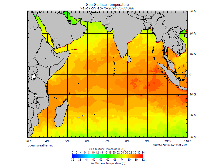
...a Category 4 (130 knots, or 240 kph) hurricane over the northern Arabian Sea. The wind speeds are estimated (as of 0600 Hours GMT) by the Joint Typhoon Warning Center (JTWC). A look at full-disk infrared imagery (from the India Met. Dept.--IMD) helps to afford better perspective on TC Gonu and South Asia:

356.jpg


There is TC Gonu, unusually powerful and unusually far to the northwest--and it is headed towards the northwest. Thus, the first land in the path of Gonu, as it is now moving, would be easternmost Oman. And this is where the latest JTWC advisory takes Gonu--ashore southeast of Masqat. As far as numerical forecast models, the GFS is still handling Gonu poorly, but the ECMWF, which has been remarkably prescient on this amazing storm, is still taking a powerful low ashore in SE Oman--and even into interior eastern Arabia. I cannot rule out extreme, unusual weather in UAE, Qatar and Saudi Arabia to at least Al Ahsa and the southern/middle Najd (Riyadh).
Hopefully, more on Gonu later today (Monday).


200702A_1H.png


http://wwwa.accuweather.com/news-blogs.asp?blog=andrews&date=2007-06-04_11:02&month=6
 

doctor_fungcool

TB Fanatic
Cyclone (Hurricane) in Arabian Sea Hikes Oil Prices

Does anyone ever remember a hurricane in the Arabian Sea........which is headed for the Persian Gulf and the Straits of Hormuz? This is a first in my book.
Can anyone say, 'Weather Wars'


I just did a search and did find that there have been other cyclones in the Arabian sea..........However, the timing of this particular cylcone is strange, to say the least......oil prices up a buck and change.....
 

Freeholder

This too shall pass.
Where are our ships?? What will happen to them if this hits them full force? Can large Navy ships ride out a hurricane of this magnitude?

Kathleen
 

maric

Short but deadly
I don't ever remember hearing of a hurricane there. But a hangnail on a camel is enough for oil prices to spike! :boohoo:
 

Worrier King

Inactive
Where are our ships?? What will happen to them if this hits them full force? Can large Navy ships ride out a hurricane of this magnitude?

Kathleen

It's tracking exactly towards where the 5th Fleet would be conducting ops, and its currently heading straight for the choke point of the Straits of Hormuz.

The carriers will be OK, could have some antenna damage, etc, but the smaller escort and support vessels could be in for a rough ride. Hopefully they can all stay north of it.

One would think the concept of weather warfare is far-fetched, but a person has to wonder sometimes. Governments have spent money on it.

The U.S. Navy and typhoons.
http://www.usatoday.com/weather/hurricane/history/typhoons-ww2-navy.htm

World War II Pacific typhoons battered U.S. Navy

Two typhoons did major damage to the U.S. Navy’s Third Fleet in the Pacific, commanded by Adm. William Halsey late in World War II.
More information


* Naval & Maritime Pages: Typhoon Cobra and the Third Fleet.
* Naval Historical Center: Dec. 18, 1944 typhoon.
* Naval Historical Center: June 1945 typhoon.
* Naval Historical Center: October 1945 typhoon
* UNISYS: 1945 typhoon archive

The first hit on Dec. 17, 1944. This typhoon, which was informally named "Cobra," had sustained winds estimated at 145 mph and probable guest to 185 mph. Three destroyers capsized and sunk, but a few men on them survived to be picked up by other ships. Numerous other ships were heavily damaged and 146 airplanes were destroyed. The storm killed 778 men

The second hit the Third Fleet with 50- to 60-foot seas, sustained winds of about 115 mph and gusts probably up to about 150 mph on June 2 and 3, 1945 east of Okinawa. This typhoon damaged 33 ships and destroyed 76 airplanes, mostly on the flight or hanger decks of aircraft carriers after the airplanes broke free of the chains holding them down. The storm killed six men on U.S. ships. It died at sea without ever hitting land.

Dr. Robert Sheets and Jack Williams discuss these two storms and their affects on the decision to begin using military airplanes to help track typhoons and hurricanes in their book, Hurricane Watch: Forecasting the Deadliest Storms on Earth, published by the Vintage Books Division of Random House in 2001.

Books about these two storms include:

* Halsey’s Typhoons by Hans C. Adamson and George F. Kosco, published by Crown in 1967.
* Typhoon, the Other Enemy: The Third Fleet and the Pacific Storm of December 1944 by Raymond C. Calhoun, published by the Naval Institute Press in 1981.

Kosco was the chief aerologist (meteorologist) for the Third Fleet and Calhoun was the skipper of the USS Dewey, a destroyer that almost rolled over in the storm. Neither book is listed as being in print, but they are available in some libraries and might be found via Internet used book searches.

After the war was over, a typhoon in October 1945 did serious damage to U.S. ships and shore facilities on Okinawa. This storm was blamed for sinking 12 U.S. ships or boats, grounded 222 ships or small craft. The storm killed 36 and injured another 100 U.S. Navy personnel.
 

CGTech

Has No Life - Lives on TB
doesn't matter what happens these days, anything out of the ordinary will cause oil prices to go up....
 

Sharon

Inactive
Martin: Thank you. This is the first I've heard of it and I've had CNN on all day. You'd think it would at least be a blurb.

Please keep us posted!!
 

Sharon

Inactive
Just saw Martin's post about this. Could get interesting for a lot of reasons!! Thanks as always!
 

Martin

Deceased
Martin: Thank you. This is the first I've heard of it and I've had CNN on all day. You'd think it would at least be a blurb.

Please keep us posted!!


I doubt very very much this will be reported on the day Paris Hilton goes in the slammer:lkick:
 

Worrier King

Inactive
Goes to show how the "markets" consist of not much more than the blind faith of the sheeple, greed, fear and speculation.
 

Martin

Deceased
Category 5 Cyclone Aimed at Strait of Hormuz
June 04, 2007 18 29 GMT


A Category 5 cyclone with winds of up to 170 knots is heading toward one of the world's most productive energy basins, threatening local devastation and global disruption at a point when oil prices are already flirting with record highs. For once, the region in question is not the Gulf of Mexico. There is cause for concern; Cyclone Gonu is headed directly for the Strait of Hormuz.


The cyclone is rotating counterclockwise -- as it would in the Gulf of Mexico -- meaning that, should it enter the Persian Gulf, the gulf's west coast would suffer the most serious damage. Along the west coast, low-lying areas are the norm, and there are few barrier islands like the ones that line the Gulf of Mexico to absorb much of the storm surge that could therefore penetrate miles inland.

Like all weather phenomena, hurricanes and cyclones are notoriously fickle, so there is (thankfully) no guarantee Gonu will enter the Persian Gulf, much less wreck it. But there are two facilities that bear specific mention: the Ras Tanura and Ras al-Juaymah oil loading platforms in Saudi Arabia. So far, the chances of either of these facilities suffering a direct hit are very slim -- Gonu is still 750 miles away from those export points -- but they collectively pump nearly 10 million barrels per day (bpd) of crude. These facilities, while critical to global energy supplies and -- due to their size -- largely immune to terrorist attacks, are not particularly hurricane resistant. After all, they were built in an area where such storms are almost unheard of. Other (hardly insignificant) energy installations dot the region in Saudi Arabia, Qatar and the United Arab Emirates -- most of them on the west coast. Luckily, there is little offshore production in the Persian Gulf -- unlike in the Gulf of Mexico -- so there is unlikely to be much permanent damage to the oil production facilities themselves.

More likely is shipping disruption. Right now, Gonu is on a collision course with the Strait of Hormuz, a major chokepoint that transits some 17 million bpd of crude. Within the next few hours, the tankers and supertankers -- not to mention the massive container ships that often visit regional hubs in the United Arab Emirates -- that ply that route will be scurrying out of the storm's way. In the Gulf of Mexico, such storm-dodging is an annual ritual that is no major concern, but in the world's "Cradle of Oil," this is a completely new sport and even a short disruption with minimal damage is sure to send the price of a barrel of crude sharply upward.

Currently the "best guess" indicates Gonu will slowly lose force to be "only" Category 3 when it makes initial landfall in Oman, forecast for June 5 at 6 p.m. local time.

http://www.stratfor.com/products/premium/read_article.php?id=289703
 

Dennis Olson

Chief Curmudgeon
_______________
130 Knots = 149.8 MPH

170 knots = 195.6 mph

BTW, got gas? Cuz you'll be paying $6 a gallon if this storm does more than LOOK in the direction of any major oil fields....
 

CGTech

Has No Life - Lives on TB
pic of the storm path
 

Attachments

  • co1127wi1118r65c26a7cd2fl.jpg
    co1127wi1118r65c26a7cd2fl.jpg
    78.1 KB · Views: 619

sirlancelot

Inactive
Very bizarre stuff, who would have expected something like this? not me, a cat5 hurricane in the straight of Homuz, and we thought it would take one in the gulf of Mexico to tumble our economy.
 

Martin

Deceased
Oil at $70 as cyclone nears Gulf

Jane Merriman and Janet McBride
Reuters


Monday, June 04, 2007


By Jane Merriman and Janet McBride

LONDON (Reuters) - Oil surged above $70 on Monday on news a cyclone was headed towards the oil-producing Arabian peninsula with a potential to disrupt shipping and output.

Top exporter Saudi Arabia said its oil facilities were expected to escape unscathed from the gathering storm. Fellow OPEC member the United Arab Emirates also appeared to be outside the path of the storm, a shipping agent said.

Minor oil producer Oman put its army and police on high alert, however, and warned the population of very high waves when winds of up to 205 km (127 miles) per hour reached land.

London Brent crude, currently seen as a better gauge of the global market than U.S. oil, was up $1.28 cents at $70.35 at 1830 GMT, off a session high of $70.63.

U.S. crude was up $1.08 cents at $66.16.

"Prices have turned around on news of a major tropical storm that has the potential to interrupt oil shipments from the Gulf," said Addison Armstrong of TFS Energy Futures in the United States.

Oman produces just 715,000 barrels per day of oil, a small fraction of Saudi Arabia's almost nine million bpd.

Earlier in the day, oil prices had drawn continued support from output disruptions in Nigeria that have tightened supplies of gasoline-rich crude during peak summer demand.

Investors also took note of a defiant statement by Iran's Supreme Leader Ayatollah Ali Khamenei. He said Iran, the world's fourth biggest oil exporter, would not retreat from the "field of danger" to protect its right to develop nuclear technology.

In fellow OPEC member Nigeria, militants have called a one-month truce in attacks on oil installations in the Niger Delta. But analysts saw little to suggest an end to 18 months of violence that has shut about a third of Nigeria's oil output.

"Nigeria is keeping the market quite tight," said Helen Henton, head of commodity research at Standard Chartered Bank.

She noted the International Energy Agency has repeatedly called for the Organization of the Petroleum Exporting Countries to increase production. "But OPEC is being quite strident about it being a U.S. refinery problem," she said.

A series of outages at oil refineries in top oil consumer the United States have contributed to a supply bottleneck in U.S. gasoline supplies, which are lower than usual.

Some refineries are now coming back onstream.

Oil had surged to a nine month high above $71 on May 24, partly on concerns about Nigeria and U.S. gasoline.

Dealers will remain on alert for any sign of hurricanes in the U.S. Gulf of Mexico after the Atlantic basin storm season began on June 1, although the first system of the season to approach the region -- Tropical Storm Barry -- weakened by the weekend, pouring rain on Florida.


http://www.canada.com/components/print.aspx?id=83772d59-1239-4de8-88b2-c95e73ea0b8e&k=6517
 

Hfcomms

EN66iq
Wow can you imagine the sand storm that would cause?? And I had not heard about it on the snews either. Again if you want to poop you almost have to get it on the internet. I would imagine the ships with "unass the AO" real quick. Theres no manuevering room to speak of in the gulf and with a storm that big you need real estate to manuever in to get around it.

Talk about the unexpected. You would expect a hurricane in the gulf to jack up fuel prices...who would of thunk about a cane/cyclone in the Persian gulf?? A direct hit by a strong Cat 4 or Cat 5 would be incredible. Yee Hah!!! Going to be an interesting summer!!!
 

Fisher

Has No Life - Lives on TB
Tropical cyclonic storm to strike eastern coast of Oman

Fair use
http://www.gulfnews.com/region/Oman/10129969.html

04_rg_oman_4.jpg

Cars were swept into the river during the last major storm to hit Oman in March.

Published: 04/06/2007 12:00 AM (UAE)
By Sunil K. Vaidya, Bureau Chief

Muscat: Oman is gearing up on a war footing to cope with the possible disaster from the brewing tropical cyclonic storm - Gonu - that is expected to strike the eastern coast of the country near Masirah Island by Wednesday night or on early Thursday morning.

“A contingency plan has been drawn up to brace with the expected natural disaster,” said Inspector General of Police and Customs Lt. General Malik Bin Suleiman Al Maamari, who is also the Chairman of the National Committee for Civil Defence (NCCD).

“The topical storm has been named Gonu and it is at the moment 700 kms (377.96 nautical miles) off Masirah Island,” Ahmed Al Harthi, Director at the Department of Meteorology, told Gulf News on Monday on the sidelines of a meeting of the NCCD at the Royal Oman Police headquarters.

The coastal area in the east of Oman will have to bear the triple fury of wind, wave and rain as Gonu strikes Oman anytime after Wednesday night. “As we speak the category for Gonu has been upgraded to 5.5 from 4.5,” he warned.

According to data supplied by the US Navy and Air Force Joint Typhoon Warning, Gonu could whip up maximum sustained winds to the region of around 185 km/h (114 mph) for a minute.

“We expect the wind to be anything above 70-80 knots per hours,” Al Harthi predicted and said that the tidal waves could rise up to ten metres height. He also pointed out that the country could receive over 150mm of rains in the 24-hours during the storm. Predicting heavy destruction expected to be caused by the rains, accompanying the tropical storm, Al Harthy said: “The rains will be damaging.”

“We have had a similar storm hitting Masirah Island in 1977 when 400mm of rain fell in 24 hours,” he recalled. The worse, he said, was in 1890 when tropical storm claimed nearly 700 lives.

Al Harthy said that the storm will continue to move north-west after hitting Oman and could reach a neighbouring country. “The current location of the storm is latitude 18.5 degree north and 65 degree east,” he revealed.

Talking about the contingency plans, a member of the NCCD, Lt. Colonel Azhar Al Kindy told Gulf News: “ the Army is on the standby and 7,000 personnel from reserve forces, police academy and other back up personnel are on guard to swing into action in the aftermath of the storm.”

He said that all leave have been cancelled.

Regarding distribution of rescue work, he said: “A ‘Work Order’ has been distributed to undersecretaries from 17 ministries (who are members of NCCD).”
 

Housecarl

On TB every waking moment
http://www.stratfor.com/products/premium/read_article.php?id=289703

Category 5 Cyclone Aimed at Strait of Hormuz
June 04, 2007 18 29 GMT

A Category 5 cyclone with winds of up to 195 miles per hour is heading toward one of the world's most productive energy basins, threatening local devastation and global disruption at a point at which oil prices are already flirting with record highs. For once, the region in question is not the Gulf of Mexico. There is cause for concern; Cyclone Gonu is headed directly for the Strait of Hormuz.

The cyclone is rotating counterclockwise -- as it would in the Gulf of Mexico -- meaning that, should it enter the Persian Gulf, the gulf's west coast would suffer the most serious damage. Along the west coast, low-lying areas are the norm, and there are few barrier islands like the ones that line the Gulf of Mexico to absorb much of the storm surge that could therefore penetrate miles inland.

Like all weather phenomena, hurricanes and cyclones are notoriously fickle, so there is (thankfully) no guarantee Gonu will enter the Persian Gulf, much less wreck it. But there are two facilities that bear specific mention: the Ras Tanura and Ras al-Juaymah oil loading platforms in Saudi Arabia. So far, the chances of either of these facilities suffering a direct hit are very slim -- Gonu is still 750 miles away from those export points -- but they collectively pump nearly 10 million barrels per day (bpd) of crude. These facilities, while critical to global energy supplies and -- due to their size -- largely immune to terrorist attacks, are not particularly hurricane resistant. After all, they were built in an area where such storms are almost unheard of. Other (hardly insignificant) energy installations dot the region in Saudi Arabia, Qatar and the United Arab Emirates -- most of them on the west coast. Luckily, there is little offshore production in the Persian Gulf -- unlike in the Gulf of Mexico -- so there is unlikely to be much permanent damage to the oil production facilities themselves.

More likely is shipping disruption. Right now, Gonu is on a collision course with the Strait of Hormuz, a major chokepoint that transits some 17 million bpd of crude. Within the next few hours, the tankers and supertankers -- not to mention the massive container ships that often visit regional hubs in the United Arab Emirates -- that ply that route will be scurrying out of the storm's way. In the Gulf of Mexico, such storm-dodging is an annual ritual that is no major concern, but in the world's "Cradle of Oil," this is a completely new sport, and even a short disruption with minimal damage is sure to send the price of a barrel of crude sharply upward.

Currently the "best guess" indicates Gonu will slowly lose force to be "only" Category 3 when it makes initial landfall in Oman, forecast for June 5 at 6 p.m. local time.
 

Attachments

  • 6_4_persian_gulf_hurricane_150.jpg
    6_4_persian_gulf_hurricane_150.jpg
    28.9 KB · Views: 558

Fisher

Has No Life - Lives on TB
Super cyclonic storm Gonu

Fair use
http://www.alertnet.org/thefacts/reliefresources/TSR/200702A_02A.htm

04 Jun 2007 14:53:00 GMT
Source: Tropical Storm Risk
Mark Saunders
Website: http://www.tropicalstormrisk.com
Reuters and AlertNet are not responsible for the content of this article or for any external internet sites. The views expressed are the author's alone.

Super cyclonic storm Gonu is forecast to strike Oman at about 00:00 GMT on 6 June. Data supplied by the US Navy and Air Force Joint Typhoon Warning Center suggest that the point of landfall will be near 22.1 N, 60.2 E. Gonu is expected to bring 1-minute maximum sustained winds to the region of around 212 km/h (132 mph). Wind gusts in the area may be considerably higher.

According to the Saffir-Simpson damage scale the potential property damage and flooding from a storm of Gonu's strength (category 4) at landfall includes:

Storm surge generally 4.0-5.5 metres (13-18 feet) above normal.

Curtainwall failures with some complete roof structure failures on small residences.

Shrubs, trees, and all signs are blown down.

Complete destruction of mobile homes.

Extensive damage to doors and windows.

Low-lying escape routes may be cut by rising water 3-5 hours before arrival of the centre of the storm.
Major damage to lower floors of structures near the shore.

Terrain lower than 3 metres (10 feet) above sea level may be flooded requiring massive evacuation of residential areas as far inland as 10 km (6 miles).

There is also the potential for flooding further inland due to heavy rain.

The information above is provided for guidance only and should not be used to make life or death decisions or decisions relating to property. Anyone in the region who is concerned for their personal safety or property should contact their official national weather agency or warning centre for advice.

This alert is provided by Tropical Storm Risk (TSR) which is sponsored by Benfield, Royal & SunAlliance, Crawford & Company and University College London (UCL). TSR acknowledges the support of the UK Met Office.
 

Martin

Deceased
The price of oil surged above $US70/b on Monday on news a cyclone was headed towards the Arabian peninsula.

Saudi Arabia said its oil facilities were expected to escape unscathed from the storm. A shipping agent said the United Arab Emirates also appeared to be outside the path of the storm. However, Oman put its army and police on high alert.

Oman produces only 715,000 barrels per day of oil, a small fraction of Saudi Arabia's output of almost nine million bpd.

London Brent crude, which is currently seen as a better gauge of the global market than US oil, was up $US1.28 cents at $US70.35 at 1830 GMT, off a session high of $US70.63. US crude was up $US1.08 cents at $US66.16.

A series of outages at oil refineries in top oil consumer the United States have contributed to a supply bottleneck in gasoline supplies, which are lower than usual. Some refineries are now coming back onstream.

Oil reached a nine month high above $US71 on 24 May.

http://www.radionz.co.nz/news/latest/200706050712/price_of_oil_at_$us70b
 

Martin

Deceased
Evacuations after Oman cyclone warning

From correspondents in Muscat, Oman

June 05, 2007 04:44am
Article from: Agence France-Press

OMAN has evacuated 7000 people from coastal areas amid warnings that a cyclone with winds of up to 176km/h is headed for the Gulf sultanate, police said overnight.

Residents of the island of Masirah in the Arabian Sea as well as of Oman's eastern coastline have sought refuge on higher ground after meteorologists warned that the storm was expected to make landfall in the next 30 hours, Inspector General of Police and Customs Malik al-Maamari said.

The cyclone originated in the Arabian Sea and is moving at a rate of seven to 10km/h, Mr Maamari said in the capital Muscat.

He said the storm was expected to be accompanied by high waves as well as heavy rains.

http://www.news.com.au/heraldsun/story/0,21985,21851316-5005961,00.html#
 

Martin

Deceased
Oil stocks soar to new highs
Posted Jun 4th 2007 4:10PM by Michael Fowlkes


Oil futures are trading up nicely today. The front month oil futures have traded up $1 to $66.08 and adding to gains made late last week. Today's surge comes with news that a cyclone is headed toward the oil-producing Arabian peninsula.

As the area braces itself for heavy storms and winds in excess of 120 miles per hour, traders showed concerns over possible production disruptions which has in turn pushed prices higher. Saudi Arabia has issued a statement that it would not be affected by the upcoming storm, but they may prove to be the lucky ones.

Also putting upward pressure on oil prices is, once again, Iran. As our readers are well aware, Iran and the West have been in a heated battle of words lately over the country's pursuit of nuclear power. The West is sure that Iran is seeking technology needed to develop nuclear weapons, while Iran firmly asserts that it is just looking to develop a nuclear energy technology. No matter which side you tend to believe, as long as the debate lingers oil prices will remain volatile.

In his most recent statement directed to the West, Iran's Supreme Leader Ayatollah Ali Khamenei stated that his country had no plans of backing away from the "field of danger" to protect its right to develop nuclear technology. This situation is bound to last for a while with neither side willing to back down. Let's just hope this can be solved diplomatically, another war in the Middle East is not something that anyone needs right now.

So, both of the above situations are helping push oil prices higher, and another "force" is helping lift prices of oil stocks higher on Wall Street. What is this force you ask? This is the force known as Jim Cramer. As Brent Archer pointed out earlier today, Cramer came out late Friday afternoon and told listeners that oil stocks were a great place to be right now. Love him, or hate him, when Cramer talks people do listen and that is almost definitely contributing to the oil sector seeing several new 52 week highs in today's market.

Let's close by taking a look at a handful of oil stocks that have traded up to new 52 week highs in today's market:

Exxon Mobil (NYSE: XOM) - currently flat at $84.22 and set a new 52 week high today of $84.44,
ConocoPhillips (NYSE: COP) - currently trading up 0.4% to $79.19 and set a new 52 week high of $79.91,
Oil Service Holders (NYSE: OIH) - currently trading 2.2% higher at $173.55 and set new 52 week high of $173.86,
Sunoco Inc (NYSE: SUN) - currently up 3.2% to $83.70 and set new 52 week high of $84.52.

http://www.bloggingstocks.com/2007/06/04/oil-stocks-soar-to-new-highs/
 

Dollar Short

Veteran Member
A Record Breaker Already...

From Weather Underground...

Super Cyclonic Storm Gonu has broken two records, well one record was broken and one was tied. I added a new section to the 2007 worldwide tropical cyclone season section, records broken. Gonu is the only storm there. Also, Gonu is the strongest storm of the year surpassing the four way tie between Favio, George, Indlala, and Yutu by 15mph.


Strongest Storm-
Super Cyclonic Storm Gonu 160mph 898mb


Records Broken-

Strongest Storm in the Arabian Sea- Super Cyclonic Storm Gonu 160ph 898mb (old record: [tie] VSCS 01_A [2001], VSCS 02_A (1999), and VSCS 05_B {crossed into Arabian Sea after landfall in India} (1977).
(Tie) Strongest storm in the Northern Indian Ocean- Super Cyclonic Storm Gonu 160mph 898mb, Super Cyclonic Storm 05_B 160mph 898mb (1999), and Super Cyclonic Storm Gay 160mph 898mb (1989)

http://www.wunderground.com/blog/Hurricaneblast/comment.html?entrynum=151&tstamp=200705
 

maric

Short but deadly
Did anybody notice in the enlarged pic of the 'head' it looks like 2 snakes at the side of it? ~shiver!~
 

Martin

Deceased
Category 5, Tropical Cyclone Gonu

Surfersvillage Global Surf News, 4 June, 2007 : - - As of Monday morning, EDT, powerful Tropical Cyclone Gonu was centered near 20.1 north and 63.7 east; roughly 440 miles southeast of Muscat, Oman. Winds were sustained near 160 mph and movement was to the northwest at around 12 mph.

Gonu is expected to be near the northeastern tip of Oman late Wednesday (U. S. time). It should be somewhat weaker by then with maximum sustained winds down to 115 mph, but still equivalent to a category three hurricane. Maximum significant wave height at 041200Z is 40 feet.

After that, the cyclone is forecast to swirl northeastward along the northern coast of Oman and move into the Gulf of Oman as a tropical storm. While tropical storms have hit Oman in the past, they are rare, and there is no record of a hurricane-strength cyclone striking the country.

The last tropical storm to smack the nation was in June 1996.


http://www.globalsurfnews.com/news.asp?Id_news=28244
 

brandyh29

Inactive
Category 5, Tropical Cyclone Gonu

Surfersvillage Global Surf News, 4 June, 2007 : - - As of Monday morning, EDT, powerful Tropical Cyclone Gonu was centered near 20.1 north and 63.7 east; roughly 440 miles southeast of Muscat, Oman. Winds were sustained near 160 mph and movement was to the northwest at around 12 mph.

Gonu is expected to be near the northeastern tip of Oman late Wednesday (U. S. time). It should be somewhat weaker by then with maximum sustained winds down to 115 mph, but still equivalent to a category three hurricane. Maximum significant wave height at 041200Z is 40 feet.

After that, the cyclone is forecast to swirl northeastward along the northern coast of Oman and move into the Gulf of Oman as a tropical storm. While tropical storms have hit Oman in the past, they are rare, and there is no record of a hurricane-strength cyclone striking the country.

The last tropical storm to smack the nation was in June 1996.


http://www.globalsurfnews.com/news.asp?Id_news=28244


The last tropical storm to smack the nation was in June 1996.

Oh wow, 11 years ago to the date.
 
Top