
Melodi
Disaster Cat
OK this one is bad enough and strange enough I'm starting a thread for it - the strongest jet stream every recorded is set to bring two severe storms to the UK and Ireland with possible tornadoes in Ireland for Friday! - Melodi
http://www.theweatherspace.com/2013...this-week-with-possible-tornadoes-in-ireland/
Strongest Jet Stream Ever Recorded To Bring Two Super Storms To United Kingdom Region This Week With Possible Tornadoes In Ireland
December 22, 2013 | Posted by Senior Meteorologist | 0 comments
(TheWeatherSpace.com) – A massive storm system is moving out of the United States today, which went through Canada yesterday … carries with it the strongest jet stream now ever recorded that will cause two super storms in the United Kingdom region this week.
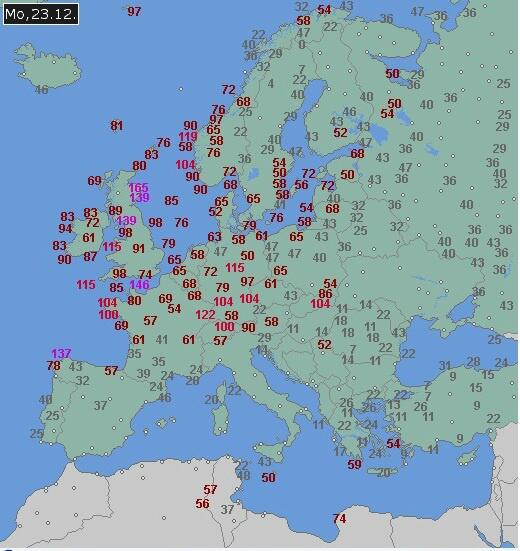
122213aAs if engineered, this never before seen jet stream of 275 mph in the upper levels is exiting Canada. This jet stream will move across the Northern Atlantic and deepen a surface low that is only 1004mb at this moment. This jet stream will act as a vacuum, sucking the air from the center of the storm and dropping the pressure within it to an impressive 930mb low. This is a pressure fall over over 50mb by Tuesday morning for the United Kingdom region. It will cause problems, with the initial concern will be the amount of rain for Wales, Central and Southern England where 20-40mm of rainfall will fall. Double that over the hills. The rain will fall on already saturated ground which will lead to flooding.
Very windy on Monday with the system, about 70 mph gusts likely in the South. On Christmas Eve expect 70-80 mph wind gusts in Northern Ireland and Western Scotland … with heavy snow in the Scottish Mountains. Weakening winds across Northern Scotland on Christmas day with winds relaxing … for the most part it looks nice on Christmas.
But we’re not done yet. This powerful jet will deepen yet another low pressure system on Friday and this warm front will sweep across Ireland with tornadic dynamics. It’s very likely that with this surface low being much further south than the first one that shear and warm air advection through Ireland will cause a tornado scenario there so be exceptionally alert.
To e-mail the CEO and Senior Meteorologist of TheWeatherSpace.com, use admin@TheWeatherSpace.com

http://www.theweatherspace.com/2013...this-week-with-possible-tornadoes-in-ireland/
Strongest Jet Stream Ever Recorded To Bring Two Super Storms To United Kingdom Region This Week With Possible Tornadoes In Ireland
December 22, 2013 | Posted by Senior Meteorologist | 0 comments
(TheWeatherSpace.com) – A massive storm system is moving out of the United States today, which went through Canada yesterday … carries with it the strongest jet stream now ever recorded that will cause two super storms in the United Kingdom region this week.
122213aAs if engineered, this never before seen jet stream of 275 mph in the upper levels is exiting Canada. This jet stream will move across the Northern Atlantic and deepen a surface low that is only 1004mb at this moment. This jet stream will act as a vacuum, sucking the air from the center of the storm and dropping the pressure within it to an impressive 930mb low. This is a pressure fall over over 50mb by Tuesday morning for the United Kingdom region. It will cause problems, with the initial concern will be the amount of rain for Wales, Central and Southern England where 20-40mm of rainfall will fall. Double that over the hills. The rain will fall on already saturated ground which will lead to flooding.
Very windy on Monday with the system, about 70 mph gusts likely in the South. On Christmas Eve expect 70-80 mph wind gusts in Northern Ireland and Western Scotland … with heavy snow in the Scottish Mountains. Weakening winds across Northern Scotland on Christmas day with winds relaxing … for the most part it looks nice on Christmas.
But we’re not done yet. This powerful jet will deepen yet another low pressure system on Friday and this warm front will sweep across Ireland with tornadic dynamics. It’s very likely that with this surface low being much further south than the first one that shear and warm air advection through Ireland will cause a tornado scenario there so be exceptionally alert.
To e-mail the CEO and Senior Meteorologist of TheWeatherSpace.com, use admin@TheWeatherSpace.com


")
