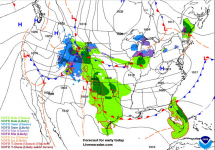
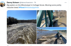
And I look outside this morning and see nothing but white. There's a lot more still locked in the snowpack up here.
Looking for barge traffic to be seriously munged until the first of June. (WT.)
PUBLISHED: April 21, 2023 at 5:34 p.m. | UPDATED: April 23, 2023 at 6:47 p.m.

 www.twincities.com
Rising flood waters are expected to plateau, then crest at 18.8 feet - not far below top 10 status - on Friday
The National Weather Service has repeatedly revised forecasts for the river’s crest, with the latest estimates calling for the river waters to plateau by Monday before rising again to peak at 18.8 feet next Friday, April 28. The river would have to surpass 19.02 feet — recorded on March 29, 2011 — to reach a historic top 10 crest level.
In 2014 and 2019, the river surpassed 20 feet downtown, touching the bottom of the swings within the Harriet Island playground. The highest crest ever recorded in downtown St. Paul was 26.01 feet on April 16, 1965.
A winter for the record books brought more than 90 inches of snow followed by rapid melt, previously leading the National Weather Service to predict the Mississippi River to crest around April 17, but the date was repeatedly revised outward given more than an inch of rainfall since Tuesday afternoon.
Both St. Paul and Ramsey County recently declared precautionary flood emergencies, triggering their emergency response authority, coordination with key partners such as the state of Minnesota and the U.S. Department of Homeland Security, and the potential to qualify for federal reimbursement down the line if a federal emergency is declared.
In a lengthy social media thread featuring some 35 photos and videos, St. Paul City Council Member Mitra Jalali on Monday chronicled city flood preparations at Harriet Island, Raspberry Island and the Watergate Marina.
Among precautionary steps, city workers hoisted an elevator from its mechanicals inside the Wigington Pavilion and removed additional machinery from the building. During flooding in 2014, a large, decorative clamshell about the height of a child floated away down the river from the smaller of the two Harriet Island playgrounds. This time, it’s been secured to a nearby tree with a sturdy safety line.
Crews have deployed and extended a temporary floodwall at Holman Field, St. Paul’s downtown municipal airport.
With Childs Road shut down for flooding across the river from the airport, the Metropolitan Council recently constructed a temporary elevated road so essential staff can safely reach its wastewater treatment plant, which sits at one of the lowest points in the Twin Cities. The gravity-fed plant, which treats 75% of the wastewater generated in the seven-county metro, is surrounded by a wall designed to protect it from a 500-year flood.
More information about St. Paul’s flood response is available online at stpaul.gov/flood.
Meanwhile, in Stillwater, the St. Croix River was just below major flood stage of 89 feet late Friday night.
The St. Croix is expected to crest Monday at 89.7 feet. That would equal the sixth highest crest in the river’s recorded history. The all-time record remains 94.1 feet on April 18, 1965.
Looking for barge traffic to be seriously munged until the first of June. (WT.)
Mississippi in Downtown (St. Paul, MN) Reaches Major Flood Stage; Crest Due Friday
By FREDERICK MELO | fmelo@pioneerpress.com | Pioneer PressPUBLISHED: April 21, 2023 at 5:34 p.m. | UPDATED: April 23, 2023 at 6:47 p.m.

Mississippi in downtown reaches major flood stage; crest due Friday
Rising flood waters are expected to plateau, then crest at 18.8 feet — not far below top 10 status — on Friday.
Rising flood waters are expected to plateau, then crest at 18.8 feet - not far below top 10 status - on Friday
-

-

-

-

Minnesota Department of Transportation crews work to clear debris from around the Stillwater Lift Bridge as the flood-swollen St. Croix River passes the historic bridge in Stillwater on Friday, April 21, 2023. (John Autey / Pioneer Press)
The National Weather Service has repeatedly revised forecasts for the river’s crest, with the latest estimates calling for the river waters to plateau by Monday before rising again to peak at 18.8 feet next Friday, April 28. The river would have to surpass 19.02 feet — recorded on March 29, 2011 — to reach a historic top 10 crest level.
In 2014 and 2019, the river surpassed 20 feet downtown, touching the bottom of the swings within the Harriet Island playground. The highest crest ever recorded in downtown St. Paul was 26.01 feet on April 16, 1965.
A winter for the record books brought more than 90 inches of snow followed by rapid melt, previously leading the National Weather Service to predict the Mississippi River to crest around April 17, but the date was repeatedly revised outward given more than an inch of rainfall since Tuesday afternoon.
Both St. Paul and Ramsey County recently declared precautionary flood emergencies, triggering their emergency response authority, coordination with key partners such as the state of Minnesota and the U.S. Department of Homeland Security, and the potential to qualify for federal reimbursement down the line if a federal emergency is declared.
In a lengthy social media thread featuring some 35 photos and videos, St. Paul City Council Member Mitra Jalali on Monday chronicled city flood preparations at Harriet Island, Raspberry Island and the Watergate Marina.
Among precautionary steps, city workers hoisted an elevator from its mechanicals inside the Wigington Pavilion and removed additional machinery from the building. During flooding in 2014, a large, decorative clamshell about the height of a child floated away down the river from the smaller of the two Harriet Island playgrounds. This time, it’s been secured to a nearby tree with a sturdy safety line.
Crews have deployed and extended a temporary floodwall at Holman Field, St. Paul’s downtown municipal airport.
With Childs Road shut down for flooding across the river from the airport, the Metropolitan Council recently constructed a temporary elevated road so essential staff can safely reach its wastewater treatment plant, which sits at one of the lowest points in the Twin Cities. The gravity-fed plant, which treats 75% of the wastewater generated in the seven-county metro, is surrounded by a wall designed to protect it from a 500-year flood.
More information about St. Paul’s flood response is available online at stpaul.gov/flood.
Meanwhile, in Stillwater, the St. Croix River was just below major flood stage of 89 feet late Friday night.
The St. Croix is expected to crest Monday at 89.7 feet. That would equal the sixth highest crest in the river’s recorded history. The all-time record remains 94.1 feet on April 18, 1965.
Last edited:

