Solar Grand Solar Minimum part deux

TxGal

Day by day

Record snowfall in Washington state
October 24, 2020 by Robert

Snowiest October day ever in Spokane. Shatters old daily record.

RECORD EVENT REPORT
NATIONAL WEATHER SERVICE SPOKANE WA
0133 AM PDT SAT OCT 24 2020

RECORD DAILY MAXIMUM SNOWFALL SET AT SPOKANE WA AIRPORT AS WELL AS THE SNOWIEST OCTOBER DAY ON RECORD…

A RECORD SNOWFALL OF 6.9 WAS SET AT SPOKANE WA AIRPORT YESTERDAY. THIS BREAKS (shatters) THE OLD RECORD OF 0.2 SET IN 1957.

IT WAS ALSO THESNOWIEST DAY EVER RECORDED IN THE MONTH OF OCTOBER.

THE PREVIOUS RECORD WAS 5.9 INCHES SET ON OCTOBER 22 1957.

National Weather Service Text Product Display
 

TxGal

Day by day

Blizzard warning for Montana – Major WINTER storm
October 24, 2020 by Robert

Total snow accumulations of 8 to 16 inches. Some areas up to 20 inches. Possible power outages. Near white-out conditions.

Travel could be very difficult to impossible. Wind temps to minus 25F (-31.7C).

National Weather Service Great Falls MT
151 PM MDT Fri Oct 23 2020

Northern Rocky Mountain Front-Eastern Glacier-Eastern Pondera-Southern Rocky Mountain Front-Eastern Teton

Including Logan Pass, Browning, Heart Butte, Cut Bank, Brady, Conrad, Bynum, Choteau, Augusta, Fairfield, and Dutton

…BLIZZARD WARNING UNTIL 9 PM SATURDAY…

* WHAT… Total snow accumulations of 8 to 16 inches, with isolated amounts approaching 20 inches in the mountains.. Winds gusting as high as 40 mph.

* WHERE…Northern Rocky Mountain Front, Eastern Glacier, Eastern Pondera, Southern Rocky Mountain Front and Eastern Teton.

* WHEN…Until 9 PM MDT Saturday.

* IMPACTS…Travel could be very difficult to impossible, especially through early Saturday afternoon. Widespread blowing snow could significantly reduce
visibility. The cold wind chills as low as 25 below zero could cause frostbite on exposed skin in as little as 30 minutes.

………….

Heavy snow headed for Montana – some areas getting up to 20 inches, possible blizzard conditions and wind chills 25 below zero.

National Weather Service Great Falls MT
300 AM MDT Fri Oct 23 2020

Central and Southern Lewis and Clark-Eastern Pondera-
Southern Rocky Mountain Front-Eastern Teton-Judith Basin-Fergus-Jefferson-Broadwater-Meagher-
Including Logan Pass, Browning, Heart Butte, Cut Bank, Great Falls, Cascade, Belt, Kings Hill Pass, Fort Benton, Carter, Big Sandy, Helena, Flesher Pass, Lincoln, MacDonald Pass,
Rogers Pass, Brady, Conrad, Bynum, Choteau, Augusta, Fairfield, Dutton, Raynesford, Stanford, Hobson, Lewistown, Winifred, Lewistown Divide, Grass Range, Montana City, Boulder, Boulder Hill, Elk Park Pass, Homestake Pass, Whitehall, Toston, Townsend, Winston, Martinsdale, Deep Creek Pass and White Sulphur Springs

…WINTER STORM WARNING TO 9 PM SATURDAY…

* WHAT…Heavy snow expected. Total snow accumulations of 7 to 15 inches, with isolated amounts approaching 20 inches in the mountains. Winds gusting as high as 35 mph.

* WHERE…Portions of central, north central, southwest and west central Montana.

* IMPACTS…Travel could be very difficult to impossible. Widespread blowing snow could significantly reduce visibility. The cold wind chills as low as 20 below zero could cause frostbite on exposed skin in as little as 30 minutes.

* ADDITIONAL DETAILS…Near-whiteout conditions are possible tonight through Saturday afternoon. Western facing slopes of the island ranges could see locally reduced snowfall totals due to downsloping.
——————————————————————————————
National Weather Service Missoula MT
404 AM MDT Fri Oct 23 2020
Lower Clark Fork Region-

…WINTER STORM WARNING TO NOON SATURDAY…

* WHAT…Heavy snow expected. Total snow accumulations of 6 to 12 inches, with 12 to 18 inches above 4,000 feet, including Lookout Pass on I-90.

* WHERE…Evaro Hill, Highway 200 Thompson Falls to Plains, Highway 200 Trout Creek to Heron, and I-90 Lookout Pass to Haugan.

* IMPACTS…Travel will be very difficult. The combination of heavy snow and wind may lead to power outages. Blowing snow will significantly reduce visibility.
—————————————————————————————–
National Weather Service Missoula MT
404 AM MDT Fri Oct 23 2020

Northern Clearwater Mountains-Southern Clearwater Mountains-Bitterroot/Sapphire Mountains-

…WINTER STORM WARNING TO NOON SATURDAY…

* WHAT…Heavy snow expected. Total snow accumulations of 12 to 18 inches above 5000 feet. Below 5000 feet expect 5 to 10 inches in western Montana and 3 to 8 inches in the Clearwater Mountains of Idaho.

* WHERE…In Montana, the Bitterroot/Sapphire Mountains. In Idaho, Northern Clearwater Mountains and Southern Clearwater Mountains.

* IMPACTS…Travel will be very difficult. Blowing snow will significantly reduce visibility.
——————————————————————————————
National Weather Service Missoula MT
404 AM MDT Fri Oct 23 2020
Butte/Blackfoot Region-

…WINTER STORM WARNING TO 6 PM SATURDAY…

* WHAT…Heavy snow expected. Total snow accumulations of 9 to 14 inches at pass level, while valleys receive 6 to 10 inches. Winds gusting to 35 mph may cause whiteout conditions.

* WHERE…Butte, Georgetown Lake, Highway 12 Garrison to Elliston, Homestake Pass, and MacDonald Pass.

* IMPACTS…Travel will be very difficult to impossible. Blowing snow will significantly reduce visibility. Cold wind chills, as low as 20 below zero, could cause frostbite on exposed skin in as little as 30 minutes.
—————————————————————————————-
National Weather Service Missoula MT
404 AM MDT Fri Oct 23 2020
Missoula/Bitterroot Valleys-

…WINTER STORM WARNING TO NOON MDT SATURDAY…

* WHAT…Heavy snow expected. Total snow accumulations of 6 to 10 inches. Widespread wind gusts up to 30 mph, with locally higher wind gusts near the mouth of Hellgate Canyon. From 3 am to noon, blizzard-like conditions may occur in downtown Missoula, Rattlesnake Canyon, and in the northern Bitterroot valley.

* WHERE…Missoula/Bitterroot Valleys.

* IMPACTS…Travel will be very difficult to impossible. Areas of
blowing snow will significantly reduce visibility.

——————————————————————————————
National Weather Service Missoula MT
404 AM MDT Fri Oct 23 2020
West Glacier Region-

…WINTER STORM WARNING TO NOON MDT SATURDAY…

* WHAT…Heavy snow expected. Total snow accumulations of 3 to 7 inches in valley areas with 7 to 11 inches between Essex and Marias Pass on US Highway 2. Wind gusts up to 40 mph will create localized blizzard conditions in Bad Rock Canyon between 9 pm and 3 am MDT.

* WHERE…Bad Rock Canyon, Essex, Highway 83 Bigfork to Swan Lake, Marias Pass, and Polebridge.

* IMPACTS…Travel will be difficult. Areas of blowing snow will significantly reduce visibility. The cold wind chills as low as 25 below zero will cause frostbite on exposed skin in as little
as 30 minutes.
————————————————————————————–
National Weather Service Missoula MT
404 AM MDT Fri Oct 23 2020
Potomac/Seeley Lake Region-

…WINTER STORM WARNING TO NOON MDT SATURDAY…

* WHAT…Heavy snow expected. Total snow accumulations of 8 to 12 inches, with 12 to 20 inches above 5000 feet. Winds gusting as high as 35 mph.

* WHERE…Highway 200 Bonner to Greenough, Highway 83 Seeley Lake to Condon, and I-90 East Missoula to Bearmouth.

* WHEN…From noon Friday to noon MDT Saturday.

* IMPACTS…Travel will be very difficult. Areas of blowing snow will significantly reduce visibility. Cold wind chills, as low as 20 below zero, could result in hypothermia if precautions are not taken.
——————————————————————————————
National Weather Service Missoula MT
404 AM MDT Fri Oct 23 2020
Flathead/Mission Valleys-

…WINTER STORM WARNING TO NOON MDT SATURDAY…

* WHAT…Heavy snow expected. Total snow accumulations of 4 to 8 inches in the Flathead valley and along Flathead lake. Total snow accumulations of 6 to 12 inches in the Mission valley. Winds gusting as high as 40 mph will cause periods of blizzard-like conditions and could produce freezing spray on the southern end of Flathead Lake.

* WHERE…Flathead Lake, Flathead Valley, Mission Valley, and Polson.

* IMPACTS…Travel will be very difficult. Areas of blowing snow will significantly reduce visibility.
—————————————————————————————-
National Weather Service Billings MT
358 AM MDT Fri Oct 23 2020
Southern Big Horn-Bighorn Canyon-
Including the locations of Lodge Grass, Pryor, and Wyola

…WINTER STORM WARNING TO NOON MDT SUNDAY…

* WHAT…Heavy snow expected. Total snow accumulations of 6 to 10 inches.

* WHERE…Southern Big Horn and Bighorn Canyon.

* IMPACTS…Blowing snow and poor visibility will make travel very difficult. Expect wind chills to fall below zero by Saturday night.
——————————————————————————————
National Weather Service Billings MT
358 AM MDT Fri Oct 23 2020
Pryor/Northern Bighorn Mountains-

…WINTER STORM WARNING IN EFFECT FROM 9 PM THIS EVENING TO NOON MDT SUNDAY…

* WHAT…Heavy snow expected. Total snow accumulations of 10 to 15 inches. Winds gusting as high as 35 mph.

* WHERE…Pryor/Northern Bighorn Mountains.

* IMPACTS…Blowing snow and poor visibility will make travel very difficult. Expect wind chills to fall below zero by Saturday night.

—————————————————————————————-
National Weather Service Billings MT
358 AM MDT Fri Oct 23 2020

Musselshell-Northern Stillwater-Northern Park-Golden Valley-
Red Lodge Foothills-Judith Gap-Livingston Area-
Beartooth Foothills-Northern Sweet Grass-Northern Carbon-
Melville Foothills-Southern Wheatland-
Including the locations of Roundup, Melstone, Musselshell,
Columbus, Absarokee, Park City, Rapelje, Clyde Park, Wilsall,
Ryegate, Lavina, Red Lodge, Roberts, Roscoe, Judith Gap,
Livingston, Springdale, Fishtail, McLeod, Nye, Big Timber,
Joliet, Fromberg, Melville, Harlowton, Twodot, and Shawmut

…WINTER STORM WARNING TO NOON MDT SUNDAY…

* WHAT…Heavy snow expected. Total snow accumulations of 8 to 12 inches.

* WHERE…Portions of Central and South Central Montana.

* WHEN…From 6 PM this evening to noon MDT Sunday.

* IMPACTS…Blowing snow and poor visibility could make travel very difficult. Expect wind chills to fall below zero by Saturday night.

—————————————————————————————–
National Weather Service Billings MT
358 AM MDT Fri Oct 23 2020

Absaroka/Beartooth Mountains-Crazy Mountains-
Including the locations of Cooke City

…WINTER STORM WARNING TO 9 AM MDT SUNDAY…

* WHAT…Heavy snow expected. Total snow accumulations of 10 to 18 inches. Winds gusting as high as 35 mph.

* WHERE…Absaroka/Beartooth Mountains and Crazy Mountains.

* IMPACTS…Travel will become very difficult to impossible. Blowing snow and wind chills below zero will make outdoor activities dangerous.

—————————————————————————————-
National Weather Service Billings MT
358 AM MDT Fri Oct 23 2020

Northern Big Horn-Northeastern Yellowstone-
Southwestern Yellowstone-
Including the locations of Hardin, Crow Agency, Busby,
Pompeys Pillar, Custer, Billings, Laurel, Huntley, and Broadview

…WINTER STORM WARNING TO NOON MDT SUNDAY…

* WHAT…Snow expected. Heaviest late tonight through Saturday evening. Total snowfall accumulations of 6 to 10 inches.

* WHERE…Northern Big Horn and Yellowstone Counties.

* IMPACTS…Blowing snow and poor visibility on snowpacked roads will make travel very difficult. Expect wind chills to fall below zero by Saturday night.

—————————————————————————————–
National Weather Service Glasgow MT
256 AM MDT Fri Oct 23 2020

…SIGNIFICANT SNOW ACCUMULATIONS POSSIBLE THIS EVENING THROUGH SATURDAY EVENING…

A major winter storm will impact the area this evening through Saturday evening with significant accumulations of snow possible, particularly in Petroleum County.

Petroleum-Southwest Phillips-
Including the cities of Winnett and Zortman

…WINTER STORM WARNING TO 9 PM MDT SATURDAY…

* WHAT…Heavy snow expected. Total snow accumulations of 6 to 13 inches.

* WHERE…Petroleum and Southwest Phillips Counties.

* IMPACTS…Travel could be very difficult to impossible.

* ADDITIONAL DETAILS…Temperatures with this winter storm will be in the teens with wind chills dropping below zero at times. Frostbite can occur within 30 minutes in these conditions.
 

TxGal

Day by day

mickey-mouse-mockeries-e1603458460868.jpg


ANOTHER CLIMATE SCIENTIST WITH IMPECCABLE CREDENTIALS BREAKS RANKS: “OUR MODELS ARE MICKEY-MOUSE MOCKERIES OF THE REAL WORLD”
OCTOBER 25, 2020 CAP ALLON

Dr. Mototaka Nakamura received a Doctorate of Science from the Massachusetts Institute of Technology (MIT), and for nearly 25 years specialized in abnormal weather and climate change at prestigious institutions that included MIT, Georgia Institute of Technology, NASA, Jet Propulsion Laboratory, California Institute of Technology, JAMSTEC and Duke University.

In his book The Global Warming Hypothesis is an Unproven Hypothesis, Dr. Nakamura explains why the data foundation underpinning global warming science is “untrustworthy” and cannot be relied on:

“Global mean temperatures before 1980 are based on untrustworthy data,” writes Nakamura. “Before full planet surface observation by satellite began in 1980, only a small part of the Earth had been observed for temperatures with only a certain amount of accuracy and frequency. Across the globe, only North America and Western Europe have trustworthy temperature data dating back to the 19th century.”

From 1990 to 2014, Nakamura worked on cloud dynamics and forces mixing atmospheric and ocean flows on medium to planetary scales. His bases were MIT (for a Doctor of Science in meteorology), Georgia Institute of Technology, Goddard Space Flight Center, Jet Propulsion Laboratory, Duke and Hawaii Universities and the Japan Agency for Marine-Earth Science and Technology.

He’s published 20+ climate papers on fluid dynamics.

There is no questioning his credibility or knowledge.

Today’s ‘global warming science’ is akin to an upside down pyramid which is built on the work of a few climate modelers. These AGW pioneers claim to have demonstrated human-derived CO2 emissions as the cause of recently rising temperatures and have then simply projected that warming forward. Every climate researcher thereafter has taken the results of these original models as a given, and we’re even at the stage now where merely testing their validity is regarded as heresy.

Here in Nakamura, we have a highly qualified and experienced climate modeler with impeccable credentials rejecting the unscientific bases of the climate crisis claims. But he’s up against it — activists are winning at the moment, and they’re fronted by scared, crying children; an unstoppable combination, one that’s tricky to discredit without looking like a heartless bastard (I’ve tried).


Mototaka.png

Climate scientist Dr. Mototaka Nakamura’s recent book blasts global warming data as “untrustworthy” and “falsified”.

DATA FALSIFICATION

When arguing against global warming, the hardest thing I find is convincing people of data falsification, namely temperature fudging. If you don’t pick your words carefully, forget some of the facts, or get your tone wrong then it’s very easy to sound like a conspiracy crank (I’ve been there, too).

But now we have Nakamura.

The good doctor has accused the orthodox scientists of “data falsification” in the form adjusting historical temperature data down to inflate today’s subtle warming trend — something Tony Heller has been proving for years on his website realclimatescience.com.

Nakamura writes: “The global surface mean temperature-change data no longer have any scientific value and are nothing except a propaganda tool to the public.”

The climate models are useful tools for academic studies, he admits. However: “The models just become useless pieces of junk or worse (as they can produce gravely misleading output) when they are used for climate forecasting.”

Climate forecasting is simply not possible, Nakamura concludes, and the impacts of human-caused CO2 can’t be judged with the knowledge and technology we currently possess.

The models grossly simplify the way the climate works.

As well as ignoring the sun, they also drastically simplify large and small-scale ocean dynamics, aerosol changes that generate clouds (cloud cover is one of the key factors determining whether we have global warming or global cooling), the drivers of ice-albedo: “Without a reasonably accurate representation, it is impossible to make any meaningful predictions of climate variations and changes in the middle and high latitudes and thus the entire planet,” and water vapor.

The climate forecasts also suffer from arbitrary “tunings” of key parameters that are simply not understood.

NAKAMURA ON CO2

He writes: “The real or realistically-simulated climate system is far more complex than an absurdly simple system simulated by the toys that have been used for climate predictions to date, and will be insurmountably difficult for those naive climate researchers who have zero or very limited understanding of geophysical fluid dynamics. The dynamics of the atmosphere and oceans are absolutely critical facets of the climate system if one hopes to ever make any meaningful prediction of climate variation.”

Solar input is modeled as a “never changing quantity,” which is absurd.

“It has only been several decades since we acquired an ability to accurately monitor the incoming solar energy. In these several decades only, it has varied by one to two watts per square meter. Is it reasonable to assume that it will not vary any more than that in the next hundred years or longer for forecasting purposes? I would say, No.”

You can read Mototaka Nakamura’s book for free on Kindle. Arm yourself with the facts, and then spread them — facts such as those highlighted below (all lifted from the book):

“[The models have] no understanding of cloud formation/forcing.”

“Assumptions are made, then adjustments are made to support a narrative.”

“Our models are mickey-mouse mockeries of the real world.”


SOLAR FORCING

Solar output isn’t constant, IPCC. And the modulation of cloud nucleation is a key consequence. During solar minima, like the one we’re entering now, the sun’s magnetic field weakens and the outward pressure of the solar wind decreases. This allows more Cosmic Rays from deep space to penetrate our planet’s atmosphere. These CRs have been found to nucleate clouds (Svensmark et al). And clouds are a crucial player earth’s climate.

As Roy Spencer, PhD. eloquently writes:

“Clouds are the Earth’s sunshade, and if cloud cover changes for any reason, you have global warming — or global cooling.”

The COLD TIMES are returning, the mid-latitudes are REFREEZING in line with historically low solar activity, cloud-nucleating Cosmic Rays, and a meridional jet stream flow.

Both NOAA and NASA appear to agree, if you read between the lines, with NOAA saying we’re entering a ‘full-blown’ Grand Solar Minimum in the late-2020s, and NASA seeing this upcoming solar cycle (25) as “the weakest of the past 200 years”, with the agency correlating previous solar shutdowns to prolonged periods of global cooling here.

Furthermore, we can’t ignore the slew of new scientific papers stating the immense impact The Beaufort Gyre could have on the Gulf Stream, and therefore the climate overall.


Prepare accordinglylearn the facts, relocate if need be, and grow your own.
 

TxGal

Day by day
The Oppenheimer Ranch Project has a new podcast out (it has more 'other' information in it that likely doesn't fit with the GSM subject matter, but the Iowa corn situation is serious):

View: https://www.youtube.com/watch?v=_2KzqePxdyU


IOWA DAMAGED CORN WILL NOT BE HARVESTED - AND MORE STUFF THE MAIN STEAM MEDIA WILL NOT REPORT
2,464 views • Premiered 5 hours ago

Run time is 20:42

Synopsis provided:

IOWA DAMAGED CORN WILL NOT BE HARVESTED https://bit.ly/3jrCNDH
“Dark Winter”: Bio Warfare Simulation Predicts Vaccine Deaths, Martial Law, And Threats to Civil Liberty in Viral Outbreak Scenario Your account has been locked https://twitter.com/account/access
RAW 60 Minutes Interview with President Trump: Lesley Stahl is SHOCKING! https://bit.ly/2Tnge8r
PATREON ONLY EXCLUSIVE - SNEAK PEEK - BEHIND THE SCENES https://www.patreon.com/posts/43125697
Lesley Stahl Is A Threat To Democracy! = Net Worth: $40 Million https://bit.ly/3dX0ClO
Council on Foreign Relations = Vaccines https://www.cfr.org/
The breakdown of sources for CFR’s $76 million annual revenue is as follows = ROCKEFELLER https://on.cfr.org/3kr3mKA
Roxy Pets Full-Spectrum CBD for Dogs Tincture https://hemplucid.com/products/roxy-p... - Coupon Code BOOM for HUGE savings...
 

TxGal

Day by day

Record snowfall in many, many cities – Facebook Twitter Flag as irrelevant
October 25, 2020 by Robert

Hiding the decline – Both Facebook and Twitter have flagged these as irrelevant, says reader Clay Olson. Record snowfall or record cold in British Columbia, Minnesota, South Dakota and Washington.

Duluth – Snowiest October on record
“Snow totals are still coming in, but the National Weather Service in Duluth measured 4.1″ as of 1 a.m. This brings our monthly total to 11.9″, officially earning the title of the snowiest October on record in Duluth.”
A calm weekend ahead after reaching record snowfall totals | Duluth News Tribune
Facebook Twitter Flag as irrelevant
…..

Record snowfall creates havoc on interior BC highways, woman killed in east Kootenay crash
“As Catherine Urquhart reports, the record snowfall could be just a hint of what’s to come. A snowfall warning remains in effect …
Record snowfall creates havoc on interior BC highways, woman killed in east Kootenay crash | Watch News Videos Online
Facebook Twitter Flag as irrelevant
…..

Weekend storm to bring heavy snow, record cold

The National Weather Service meteorologist John Chamberlain said “Snow will develop Friday night in northwest South Dakota and expand through the night into Saturday….Areas in the northern plains and northern Black Hills could see anywhere between 5-12 inches, with some of the higher amounts likely in upper elevations.”

“… the snow that has already fallen this month with the weekend storm, Chamberlain said October 2020 will likely be in the top five for record snowfall.”

“Our record low temperature in downtown Rapid City and at the airport for Sunday night and Monday morning is 2 degrees, set back in 1919,” Chamberlain said. “As of Friday afternoon, we are forecasting a low temperature of minus 2, which would be the new record for that date. If we get clearing skies Sunday night, we could go lower than that.”
Weekend storm to bring heavy snow, record cold temperatures
Facebook Twitter Flag as irrelevant
…..

Record snowfall blankets Penticton
Until this morning, there had been very little snow ever recorded in the Valley on an October 23. The record, such as it was, was 0.8 cm, set in Penticton in 1957.

Accumulations have already exceeded that this morning and as much as 10 cm of snow is forecast at lake level, Environment Canada says. As much as 15 cm is expected at higher elevations in the Valley. A drive to Vancouver could be treacherous with snowfall accumulations of up to 20 cm expected on both the Okanagan Connector and the Coquihalla Highway.

Kelowna and Penticton normally receive less than one centimetre of snow in October.
Record snowfall blankets Penticton
Facebook Twitter Flag as irrelevant
…..

Snowiest October on record in parts of Minnesota
Some areas, such as part of Minnesota, saw record snowfall this week in what has been the snowiest October on record. Hurricane Epsilon continues …
More snowfall in the West, Hurricane Epsilon stirs up conditions in the East
Facebook Twitter Flag as irrelevant
…..

Weekend forecast: Snow returns Saturday evening, lingers through Sunday
Minnesota Public Radio News
After record snowfall, more snow on the way for northern Minn. Next winter storm targets central Minnesota Thursday. Providing Support for MPR. Learn…
Snow returns Saturday evening, lingers through Sunday
Facebook Twitter Flag as irrelevant
…..

Pierre, Fort Pierre due for more snow, more cold this weekend and beyond before a warm-up
The Capital Journal
Pierre saw a record snowfall for the date on Wednesday, Oct. 21 and it might see record low temperatures this weekend, according to Aaron Dye of the …
The unusually early wintery weather began on Wednesday…
Pierre, Fort Pierre due for more snow, more cold this weekend and beyond before a warm-up
Facebook Twitter Flag as irrelevant
…..

Weekend snowstorm to pummel Northwest, Rockies, Midwest (with forecast video)
FreightWaves

Some places in this region have been slammed with daily record snowfall this week, including the following cities Thursday (in inches):

• Aberdeen, South Dakota, 7.2
• Duluth, Minnesota 4.1
• Fargo, North Dakota, 2.7
• Bismarck, North Dakota, 2.2

Weekend snowstorm to pummel Northwest, Rockies, Midwest (with forecast video) - FreightWaves
Facebook Twitter Flag as irrelevant

…..

End of Octoburrr downright bitter cold this weekend
KOIN.com
A RECORD SNOWFALL OF 6.9 WAS SET AT SPOKANE WA AIRPORT YESTERDAY. THIS BREAKS THE OLD RECORD OF 0.2 SET IN 1957.
https://www.koin.com/weather/weather-blog/end-of-octoburrr-downright-bitter-cold-this-weekend/
Facebook Twitter Flag as irrelevant

…..

Jordan’s photo of the week
SW News Media
Jordan Independent reader Jenn Beuch-Bohlsen sent in this photo of a snowman built after last week’s record snowfall. The Jordan Independent …
https://www.swnewsmedia.com/jordan_...cle_7fb65f11-7c6f-531d-903d-04836bc7ea2d.html
Facebook Twitter Flag as irrelevant

…..

THE DAKOTA BOYS BATTLE IT OUT AGAINST MOTHER NATURE IN BRAND-NEW SEASON OF
The Futon Critic
But, a late start to the season has shortened their mining window and record snowfall has the rivers raging creating the most dangerous mining …
Facebook Twitter Flag as irrelevant
http://www.thefutoncritic.com/news/...discovery-channel-727412/20201023discovery01/

WEB

KFYR-TV – Snowfall Update: Bismarck set a daily record…
Facebook
Snowfall Update: Bismarck set a daily record snowfall Thursday of 2.1″, breaking the previous record of 1.0″ set in 1950.
View: https://www.facebook.com/KFYRtv/posts/10157779997844103
 

TxGal

Day by day
The Oppenheimer Ranch Project has a new podcast out:

View: https://www.youtube.com/watch?v=f-ukBKaxKD0


From Record Breaking Snow to Century Old Record Crushing Cold = Grand Solar Minimum Much? Prepare!
3,161 views • Premiered 6 hours ago

Run time is 15:50

Synopsis provided:

From Record Breaking Snow to Possible Record Breaking Cold https://bit.ly/35zffaR
Heavy snow, near record low temperatures blanket Bozeman https://bit.ly/3mo6irP
Potomac, MT dipped down to -29°F this morning https://bit.ly/3osO8Hm
Billings expected to finish about 3 inches shy of 1949 October snowfall record https://bit.ly/2Hy48ak
Record Snow and Record Cold for October in Missoula https://bit.ly/3jx6S4C
October snowfall in Great Falls buries 95-year-old record https://bit.ly/3dW24ER
Record Cold and Snow Pound Northern US Aiding Firefighters https://bit.ly/2HpQLsT
Fire and Ice: Latest on the fires burning in Colorado as a snowstorm moves through https://bit.ly/34t54pb
Tropical storm Zeta forms, could reach US Gulf Coast by midweek https://cnn.it/3jvb2ds
National Hurricane Center https://www.nhc.noaa.gov/
Winter Storm for south-central U.S.; Critical Fire Weather in the West; Tracking Zeta https://www.weather.gov/
GFS Model https://bit.ly/35zgdnv
CMC Model https://bit.ly/2TrBE4i
Deluge triggers landslide in Sydney as La Nina weather system takes hold https://bit.ly/2HzezKL
Extreme storms with golf ball-sized hail lash Queensland and NSW https://bit.ly/2Hxex5V
Earthquake activity along west-east fault on Reykjanes peninsula in Reykjanes volcano https://bit.ly/313mSWn
Sinabung volcano (Sumatra, Indonesia): pyroclastic flow today https://bit.ly/3mnImoE
Facebook Prepares Measures for Possible Election Unrest
https://on.wsj.com/34uLQPK
 

TxGal

Day by day

record-snow-e1603708770309.jpg


HUNDREDS OF ALL-TIME RECORDS FALL ACROSS NORTH AMERICA: “THIS COLD WEATHER IS NOT NORMAL!”
OCTOBER 26, 2020 CAP ALLON

It’s beginning to look a lot like the Grand Solar Minimum across large parts of Canada and the United States as winter targets tens of millions of North Americans–in the month of October. Arctic conditions are breaking all-time records as far south as Texas and New Mexico, states that typically don’t pick up snow until much later in the season.

SNOW RECORDS

Spokane, Washington, shattered a snowfall record on Saturday after nearly 8 inches of snow beat-out the previous record of 0.2 inches from 1957 (solar minimum of cycle 18).

Even more impressively, October, 2020 is now Spokane’s snowiest October in recorded history.

View: https://twitter.com/BenjaminJurkovi/status/1319801204642250753


It’s also been the snowiest October on record in Great Falls, Montana, too.

Over the weekend, another fall snowstorm covered the city with 11.2 inches of fresh powder, breaking the previous record set 95 years ago and bringing Oct, 2020’s total to 27.7 inches. This smashes the previous October record of 18.5 inches set back in 1925 (solar minimum of cycle 15). To put it into context, the average for this stage of October is just 3 inches.

View: https://www.facebook.com/NWSGreatFalls/photos/a.197469093628648/4638068326235347/?type=3


Rapid City, South Dakota also broke a snowfall record over the weekend — Sunday’s 4.5 inches of snow busted the previous record of 4.1 inches set way back in 1898 (solar minimum of cycle 13). Downtown Rapid City saw a total of 6.5 inches of snow this weekend, and the Rapid City Airport saw 7.8 inches.

View: https://twitter.com/NWSRapidCity/status/1320285339395616768


Missoula, Montana, hasn’t seen this kind of winter weather this early in the season in over 100 years, according to the National Weather Service.

“We ended up with 13.8 inches of snow here at our office out at the airport,” said local meteorologist Kitzmiller of the weekend’s accumulations. “That actually puts us at number two for the most snowfall we’ve ever had in October for a two day event”–with the number one spot taken by the 15 inches that fell back in 1914 (solar minimum of cycle 14).

Kitzmiller added that as much as 19 inches settled in Potomac to Avon over the weekend, with most surrounding areas seeing a foot+.

“We’ve just never had this much snow on the ground this time of year, at least in the last 100 years,” he said. “So that affects a lot of things. And since each day we’re losing a little bit of our sun angle it makes it a little harder to overcome that cold that’s in place.”

Indeed, once the sky began to clear, temperatures plummeted to record lows.

LOW TEMPERATURE RECORDS

Staying in Missoula: “We just currently broke our all-time October cold record here at the airport,” continued Kitzmiller. “We’ve reached negative seven for now but it’s been fluctuating between negative seven and negative four. It’s cold everywhere, and we have more cold daytimes, another cold night tonight and into tomorrow.”

Unprecedented low temperatures have gripped many other regions, too.

Billings, Montana, fell to 16F on Saturday morning, comfortably busting the previous record of 19F set back in 1976 (solar minimum of cycle 20). On Friday, Idaho Fall, Idaho, fell to 13F, breaking the old record of 16F set in 1980. Casper, Wyoming, annihilated its previous low of 11F from 1984 (solar minimum of cycle 21) with a new reading of –5F. While Downtown Rapid City’s 14F last night pipped the old record of 15F set back in 1919.

These are just a handful of examples by the way — in total, hundreds of low temperature records have fallen across the U.S. over the past 24hrs alone, as visualized by the below animation from coolwx.com:


Only cities having an NCDC GSOD recorded history of at least 35 years are shown here. The records are defined here using GMT, with the day resetting at 00GMT (7PM EST;8PM EDT).

“This cold weather is not normal!” the National Weather Service tweeted Saturday regarding the bone-chilling temps sweeping Minnesota and Wisconsin. “Three locations have set or tied records for the coldest high temperature on record today: Twin Cities 32F (broke record of 33F from 1887), Eau Claire 35F (tied record of 35F from 1981), St Cloud 30F (broke record of 35F from 1981).”

View: https://twitter.com/NWSTwinCities/status/1320176012869599232


And looking forward: “Cold air will continue to steadily march southward through the early part of the week,” AccuWeather Meteorologist Maxwell Gawryla said. “As significantly below-average temperatures remain in place, many more records will likely be broken through the first half of the week.”

Monday is looking particularly cold, as an all encompassing mass of Arctic air engulfs the majority of the North American continent plunging temperatures more than 20C below the seasonal average:


GFS 2m Temp Anomalies (C) Oct 26 [tropicaltidbits.com].

Unprecedented volumes of snow are also on the card for many before the month of October is even through:


GFS Total Snowfall (inches) Oct 26 – Oct 31 [tropicaltidbits.com].

The COLD TIMES are returning, the mid-latitudes are REFREEZING in line with historically low solar activity, cloud-nucleating Cosmic Rays, and a meridional jet stream flow.

Both NOAA and NASA appear to agree, if you read between the lines, with NOAA saying we’re entering a ‘full-blown’ Grand Solar Minimum in the late-2020s, and NASA seeing this upcoming solar cycle (25) as “the weakest of the past 200 years”, with the agency correlating previous solar shutdowns to prolonged periods of global cooling here.

Furthermore, we can’t ignore the slew of new scientific papers stating the immense impact The Beaufort Gyre could have on the Gulf Stream, and therefore the climate overall.


Prepare accordinglylearn the facts, relocate if need be, and grow your own.
 

TxGal

Day by day

Kamloops-Oct-24-e1603712186413.jpg


LOW TEMPERATURE RECORDS SMASHED ACROSS THE THOMPSON-OKANAGAN REGIONS OF B.C.
OCTOBER 26, 2020 CAP ALLON

Sunday morning set new records for coldest temperatures ever recorded across the Thompson-Okanagan regions of British Columbia, Canada.

Kamloops
blew past the previous record for coldest October 25th in history, reports castanet.net, smashing the -7.8C (18F) set way back in 1954 (solar minimum of cycle 18).

“We recorded temperatures of -11.2C (11.8F) this morning in Kamloops,” says Environment Canada meteorologist Lisa Erven, adding that it hit the low at around 7AM.

The bone-chilling cold allowed the recent heavy snowfall to stick around:

View: https://twitter.com/HoganBCMJ/status/1319857133223989248


A little farther south, Vernon also shattered its previous low temperature record for the date, one that had stood for more than 100 years.

“We recorded -10.1C (13.8F) in Vernon, which beat the previous record [of] -5.6C (21.9F) set back in 1919,” said Erven.

“It kind of knocked the old record out of the park.”

Record lows fell ACROSS British Columbia over the weekend.

As reported by vancouversun.com, the chilly temperatures being felt across Metro Vancouver this weekend really have been unusual. And according to GlobalTV, more than 20 record low temperatures were broken across the province

Many of these new records aren’t just pipping the old marks, they’re wiping the floor with them — further evidence that the climatic era we’re entering is one of COOLING, arriving in line with historically low solar activity, cloud-nucleating Cosmic Rays, and a meridional jet stream flow.

Both NOAA and NASA appear to agree, if you read between the lines, with NOAA saying we’re entering a ‘full-blown’ Grand Solar Minimum in the late-2020s, and NASA seeing this upcoming solar cycle (25) as “the weakest of the past 200 years”, with the agency correlating previous solar shutdowns to prolonged periods of global cooling here.

Furthermore, we can’t ignore the slew of new scientific papers stating the immense impact The Beaufort Gyre could have on the Gulf Stream, and therefore the climate overall.


Prepare accordinglylearn the facts, relocate if need be, and grow your own.
 

TxGal

Day by day


snow-train-e1603716832616.jpg


NORTHERN HEMISPHERE TOTAL SNOW MASS IS ALREADY 300 GIGATONS ABOVE THE 1982-2012 AVERAGE
OCTOBER 26, 2020 CAP ALLON

Data from the Finnish Meteorological Institute (FMI) reveals that the “Total Snow Mass for the Northern Hemisphere” has been consistently above the 30 year average over the past few years, and now, 2020 is actually INCREASING that rate of growth.

Feel free to shovel this chart down the throats of those still insisting the world is burning up and that snowfall is a thing of the past, as clear for all to see —and impossible for alarmists to ignore— Total Snow Mass for the Northern Hemisphere is running approx. 300 gigatons above the 1982-2012 average:


FMI data [courtesy of globalcryospherewatch.org].

According to the latest observation (plotted Oct 24, 2020), the hemisphere is ALREADY running well-ahead of schedule–and that’s BEFORE the inclusion of the recent record volumes of snow witnessed in North America and Russia. To put it into context, such hefty snow accumulations across the Northern Hemisphere would not have usually amassed until the second week of November.

Data from the Rutgers Global Snow Lab (shown below) supports this.

The lab’s latest data point is for day 299 (or Oct 25), and when comparing this date with the snow cover of all previous years it quickly becomes obvious how anomalous the start of the 2020 snow season has been.

[Feel free to check this out yourself here in data stretching back to 1999].


Rutgers University Global Snow Lab.

In addition, Greenland continues to build snow and ice at levels comfortably above the 1981-2010 mean–data from the Danish Meteorological Institute (DMI):


DMI data [courtesy of polarportal.dk].

Don’t fall for bogus political agendas.

Trends change, a fact the IPCC is deliberately hiding from you: climate is cyclic, after all — never linear, and the COLD TIMES are now returning, the mid-latitudes are clearly REFREEZING in line with historically low solar activity, cloud-nucleating Cosmic Rays, and a meridional jet stream flow.

Both NOAA and NASA appear to agree, if you read between the lines, with NOAA saying we’re entering a ‘full-blown’ Grand Solar Minimum in the late-2020s, and NASA seeing this upcoming solar cycle (25) as “the weakest of the past 200 years”, with the agency correlating previous solar shutdowns to prolonged periods of global cooling here.

Furthermore, we can’t ignore the slew of new scientific papers stating the immense impact The Beaufort Gyre could have on the Gulf Stream, and therefore the climate overall.


Prepare accordinglylearn the facts, relocate if need be, and grow your own.
 

TxGal

Day by day

Record low temps from Idaho to Montana to Wyoming to Colorado to South Dakota
October 26, 2020 by Robert

Casper, Wyoming and Denver annihilate previous records.

____________

“Denver’s Monday high expected around 17F (-8.3C),” says reader Pieter. “That would be 14 degrees beneath the prior record for lowest high for the date, per Denver Post. That’s a pretty good indication of how freaky this storm is given the wide boundaries for Colorado’s ‘normal’ weather variability.”

Meanwhile, according to reader Adoni, “Billings, Montana, fell to 16F on Saturday morning, comfortably busting the previous record of 19F set back in 1976 (solar minimum of cycle 20).”

“On Friday,” Adoni continues, “Idaho Fall, Idaho, fell to 13F (-10.6C), breaking the old record of 16F set in 1980.

“Casper, Wyoming, annihilated its previous low of 11F from 1984 (solar minimum of cycle 21) with a new reading of –5F (-20.6).

“Downtown Rapid City’s 14F last night pipped the old record of 15F set back in 1919.”

Wouldn’t this be a great time to have no natural gas or heating oil, as Joe Biden so cleverly wants to impose on us?
(See The Biden Family Green New Swindle Deal)
 

TxGal

Day by day
The Oppenheimer Ranch Project has a new podcast out:

View: https://www.youtube.com/watch?v=Ah25S1CV-r0


Record Snow Blankets The US - 140 mph gust recorded - Fire and Ice - MSM Silent! - JFK Was Correct!
2,519 views • Premiered 6 hours ago


Run time is 46:24

Synopsis provided:

Colorado State Patrol warning about bad road conditions in southern Colorado https://bit.ly/33RzeRc
140 mph gust recorded as incredible winds rake California https://bit.ly/3kyVxCq
Dangerous winds set off precautionary power shutoffs https://bit.ly/2JdIZTv
Wildfire risk in California prompts PG&E power cuts to 361,000 customers https://fxn.ws/2TtlI1K
Power Outage USA https://poweroutage.us/
Zeta To Crush The Yucatan! https://bit.ly/3jxwxdt
HURRICANE ZETA https://bit.ly/3dBiAt0
Accumulating Snowfall Mostly Done On Colorado’s Front Range, See Monday a.m. Snow Totals https://cbsloc.al/2TpHRhc
Winter storm causing widespread impacts https://bit.ly/35GmT3g
Salt Lake City's 142-year-old cold temperature record snapped Monday https://bit.ly/2Ja6U69
When Aspen’s fir st major snowstorm collides with a widespread power outage, mountain folks make do https://bit.ly/3mpDcIz
23 inches of snow reported in Colorado town https://bit.ly/3kymXZl
Change in weather to bring freezing temps, snow to Southern Arizona h ttps://bit.ly/35zSqUA
SNOWFALL ANALYSIS FROM THE LAST 72 HOURS http://bit.ly/37ZQHZh
Snow & Ice for the Southern Rockies & Plains; Hurricane Zeta Heading Toward the Northern Gulf Coast https://www.weather.gov/
GFS Model https://bit.ly/37IJHC9 CMC Model https://bit.ly/34v7W4F
NASA says there is definitely water on the moon https://bit.ly/31NFOIn
NASA telescope uncovers definitive evidence of water on the moon https://cnet.co/37Kyile
Which National Park Are You Most Likely to Die Visiting? https://bit.ly/2HGozlk
Group thinks it has found proof of 10,000-year-old, Ice Age culture in Straits of Mackinac https://bit.ly/2TuJCdc
Rare, 2-headed snake discovered by Florida house cat https://bit.ly/3kyXaQy
With the Rare Full Blue Moon in Taurus on Halloween, You Can Expect Intense and Spooky Energy all Week https://bit.ly/3kJOXcg
 

TxGal

Day by day
And another from The Oppenheimer Ranch Project:

View: https://www.youtube.com/watch?v=x2CZHK-9l3s


Record Snow Across The Country - Southern Colorado Snow Exposed + A New Gimble - Record Cold Follows
3,362 views • Premiered 8 hours ago

Run time is 4:25

Synopsis provided:

Took a quick hike up in the backyard to test the new gimble. Let me know your thoughts?
Take A Break From Life - Shinrin-Yoku 森林浴 on YouTube https://bit.ly/2FTzWoW
Oppenheimer Ranch Project on Patreon - Three Channels No Commercials
https://bit.ly/3cVV2Q0
 

TxGal

Day by day

sun-and-icicles.jpg


DENVER OBLITERATES ALL-TIME LOW TEMPERATURE RECORDS IN WEATHER BOOKS DATING BACK 148 YEARS
OCTOBER 27, 2020 CAP ALLON

The GRAND SOLAR MINIMUM has taken out multiple low temperature records in Denver, Colorado of late, as a weak and wavy “meridional” jet stream sends Arctic air anomalously-far south.

Denver has detailed weather books dating all the way back to 1872. One thing they reveal is that on each and every October day in those past 148 years, the thermometer has never failed to reach at least 18F… until yesterday, that is.

On Monday, October 26, the mercury struggled to a high of just 16F — a new record for the coldest October high temperature ever recorded in Denver.

Yesterday’s reading, of course, also toppled the previous daily Oct 26 record: in fact it obliterated it, almost halving 1923’s comparatively “balmy” 31F.

View: https://twitter.com/doomalert19/status/1320865073003417603


Looking to today, the current record low temperature in Denver for Oct 27 is 11 degrees. “That record is also going to get smashed,” reports denverpost.com, “as temperatures at Denver International Airport are expected to flirt with zero early Tuesday morning.”

That would mark three consecutive days with single-digit lows in the metro, which is a very impressive feat for October standards. In 148 years of record keeping it has only happened one other time — Oct 29 to Oct 31 of last year!

This serves as yet more evidence that the COLD TIMES are returning, that the mid-latitudes are REFREEZING, in line with historically low solar activity, cloud-nucleating Cosmic Rays, and a meridional jet stream flow.

Both NOAA and NASA appear to agree, if you read between the lines, with NOAA saying we’re entering a ‘full-blown’ Grand Solar Minimum in the late-2020s, and NASA seeing this upcoming solar cycle (25) as “the weakest of the past 200 years”, with the agency correlating previous solar shutdowns to prolonged periods of global cooling here.

Furthermore, we can’t ignore the slew of new scientific papers stating the immense impact The Beaufort Gyre could have on the Gulf Stream, and therefore the climate overall.


Prepare accordinglylearn the facts, relocate if need be, and grow your own.
 

TxGal

Day by day

cold-us-oct-25-e1603796246565.jpg


THE UNITED STATES (LOWER-48) JUST SET ITS COLDEST TEMPERATURE EVER RECORDED THIS EARLY IN THE SEASON
OCTOBER 27, 2020 CAP ALLON

Winter is coming in hard and strong this year, and it’s taking names ACROSS the Lower-48. Hundreds of new low temperature records have been set over the past few days alone, but all have been eclipsed by the “biggie” set Sunday in Montana.

HUNDREDS of cold and snow records have fallen of late: from Texas to Montana, many of the lowest temperatures and the highest snowfall totals ever recorded at this time of year are not only being broken, they’re being SMASHED.

Serving as just a few examples:

The National Weather Service reported two broken snowfall records at their Marquette office: “We recorded 8.3 inches [on Sunday], which breaks the old record of 3.1 inches set in 1976 [solar minimum of cycle 20]! This recent snowfall also established a new monthly snowfall record for the month of October at our office. Total snowfall recorded for the month stands at 19.2 inches! This breaks the old record of 18.6 inches set in 1979.”

Eastern Idahoans woke to bone-chilling weather Monday morning, reports eastidahonews.com. According to NWS data, Idaho Falls saw a low of just 1F, utterly shattering the previous record of 17F. In addition, Pocatello reached 3F, smashing its previous record low of 13F. The previous day, Sunday, also saw new record lows of 8 degrees in Idaho falls and 11 degrees in Pocatello.

For more:


And:


As detailed within links above, the record books have been rewritten from Texas to Montana–but it’s that latter state which claimed the “biggie” during the early hours of Sunday morning, October 25, 2020.

According to NWS data, and as reported by ABCnews.com (one of only a few MSM outlets covering this, but even they bury it under the Cali wildfires): “The temperature in Montana fell to a record breaking 29 degrees below zero, the lowest temperature measured at an official climate station anywhere in the lower 48 states so early in the season in any year.”

That’s a rather ugly, long-winded sentence — so I’ll break it down for you: “the Grand Solar Minimum is upon us, so get your s**t together already!”

The Washington Post has since covered it too, to be fair (though they don’t run it as the headline), writing late Monday evening: “Temperatures throughout much of the Rockies dipped below zero to start the week, falling as low as minus-29.2 in Potomac, Mont., early Sunday — the coldest temperature ever observed this early in the season across the Lower 48.”

View: https://twitter.com/NWSMissoula/status/1320410493115191297


The WP calls the ongoing cold “off the charts, with an air mass more typical of December or January than late October.”

Corby Dickerson, a meteorologist at the NWS in Missoula, notes that the U.S. historical temperature database contains 14.5 million observations from Oct 1 to Oct 25, and that Potomac’s reading on Sunday morning was the coldest!

“It’s truly remarkable,” said Dickerson. “There’s no other way to describe it.”

View: https://twitter.com/NWSMissoula/status/1320389586615365637


A slew of other all-time benchmarks have come crashing down.

Two out of the past three mornings have been among Missoula’s coldest three in October in recorded history, and more records are expected to fall later in the week.

“I’ve been describing it as a once-in-a-century event,” concluded Dickerson. But I’m not so sure it’ll be another 100 years before the return of such extreme LOW TEMPERATURES. Evidence is building to suggest the mid-latitudes are now REFREEZING in line with historically low solar activity, cloud-nucleating Cosmic Rays, and a meridional jet stream flow.

Both NOAA and NASA appear to agree, if you read between the lines, with NOAA saying we’re entering a ‘full-blown’ Grand Solar Minimum in the late-2020s, and NASA seeing this upcoming solar cycle (25) as “the weakest of the past 200 years”, with the agency correlating previous solar shutdowns to prolonged periods of global cooling here.

Furthermore, we can’t ignore the new scientific papers stating the immense impact The Beaufort Gyre could have on the Gulf Stream, and therefore the climate overall.


Prepare accordinglylearn the facts, relocate if need be, and grow your own.
 

TxGal

Day by day


snow-oct-record-kansas-crop.png


“KILLING FREEZE” HITS KANSAS AS ALL-TIME COLD AND SNOW RECORDS FALL
OCTOBER 27, 2020 CAP ALLON

NWS Kansas meteorologists warn of a “widespread killing freeze” after unprecedented October cold and snow laid waste to the record books.

As reported by kansas.com, the National Weather Service (NWS) in Wichita issued a winter weather advisory on Sunday running through 1 a.m. Tuesday for central, south-central and southeast Kansas. The forecast called for snow, sleet and freezing rain: “Plan on slippery road conditions,” reads the advisory. “The hazardous conditions will impact the morning and evening commutes.”

The city wasn’t able to pre-treat its roads with salt on Sunday due to wet conditions, but efforts belatedly began in the early hours of Monday: “We did activate our full response as of midnight,” Ben Nelson, a city public works administrator, said Monday morning. “Once our crews got on scene, we deployed all 60 of our trucks and began to apply the salt and the sand mix across all 1,500 lane miles of arterial (roads) and the 300 lane miles of our secondary and school routes,” Nelson said.

The flakes started falling early Monday morning, as forecast. However, that original NWS advisory vastly underestimated the volume — the snow continued throughout the morning, to levels far greater than city crews had expected.

So much snow fell that city workers needed to use the plows on the front of the dump trucks to clear the roads, something crews try to avoid because 1) it significantly slows down the trucks, and 2) it runs the risk of scraping the already applied salt off the road.

View: https://twitter.com/CRgreenside/status/1320796161851203587


After initially forecasting just a trace, NWS “officially” measured 1.3 inches of snow as of 10:50 a.m. Monday–although the scene on the ground looked far worse in places. Still, that official reading of 1.3 inches almost tripled the previous Oct 26 record of 0.5 inches set way back in 1913 (solar minimum of cycle 14).

Monday’s snow also set another, even more impressive record. According to an NWS tweet, Monday saw “the most snow Wichita has ever received this early in the season.”

View: https://twitter.com/NWSWichita/status/1320754636656181249


This beat-out the previous earliest 1+inch of snow, set on Oct 28, 1905:


Note Wichita’s average date for first 1+inch of snow: Dec, 19th!

Record cold accompanied the record snow, further hampering city clearing efforts. Monday morning’s low of 24F broke the Wichita record for coldest ever low for the date — the old mark being the 25F set in 1957.

View: https://twitter.com/NWSWichita/status/1320781892908511232


The city also broke its lowest-max for Oct 26, busting the 32F, also set in 1957 — though this record has yet to be officially logged.

Looking forward, the NWS Wichita hazardous weather outlook predicts “a widespread killing freeze” Monday night, to be followed by a wintry mix of precipitation across much of the area on Tuesday, continuing into early Wednesday morning.

Additional snow and ice accumulations are possible through Wednesday afternoon, and as kansas.com points out: “Any measurable snowfall on Tuesday in Wichita would set a record, as the weather service has never recorded snow accumulations on Oct 27. The record low temperature of 23 degrees, set in 1957, and the coolest high of 37 degrees, set in 1911, are both in jeopardy.”

The COLD TIMES are returning, the mid-latitudes are REFREEZING in line with historically low solar activity, cloud-nucleating Cosmic Rays, and a meridional jet stream flow.

Both NOAA and NASA appear to agree, if you read between the lines, with NOAA saying we’re entering a ‘full-blown’ Grand Solar Minimum in the late-2020s, and NASA seeing this upcoming solar cycle (25) as “the weakest of the past 200 years”, with the agency correlating previous solar shutdowns to prolonged periods of global cooling here.

Furthermore, we can’t ignore the slew of new scientific papers stating the immense impact The Beaufort Gyre could have on the Gulf Stream, and therefore the climate overall.


Prepare accordinglylearn the facts, relocate if need be, and grow your own.
 

TxGal

Day by day
Thank you TxGal for all your posts!!

You're welcome! I kind of figured GSM news would pick up as we entered Fall/early Winter, but this pace is surprising me.

We're in the low 40s today with fog/mist/light rain and a north breeze. We're not supposed to warm up at all until Thursday. Not at all comfortable outside even with layers on, and the cattle have been on the round bales of hay since last evening...they still don't have their winter coats - it's too early!
 

Carlyblue

Veteran Member
Southern WI here. It was 32 degrees here this morning. We did get a dusting of snow yesterday morning. I think I saw where Saturday it could be in the high 40's or low 50's. So far, nothing super unusual.
 

Faroe

Un-spun
Snow here in NM. Thirty-something? temps. WAY too early. My hoop house roofs are collapsed, and since the snow is sticky, I wasn't just able to spring them back up, and shake off the weight. Chickens ok, so will wait to deal with it later in the day. Power was out when I got up. Found a red ant infestation (kinda big ants, too) swarming all over the toilet in my bathroom. Yikes, not peeing anywhere THAT.

Gah. So, GSM and red ants go together. Who knew?
 

Martinhouse

Deceased
It was 40 when I woke this morning and the ten day forecast shows most of our lows for the next week or more are going to be in the mid to upper 30s. That means that out here in the country where I am we will likely be getting several frosts.

I hate it when it's time to put away the garden hose and cover up the outdoor faucet!
 

LucyT

Senior Member
From eMail:

Space Weather News for Oct. 27, 2020
https://spaceweather.com
https://www.spaceweatheralerts.com

BIG SUNSPOT ALERT: There's a new sunspot on the sun--and it's a big one. AR2778 contains a dozen dark cores sprawling nearly 100,000 km across the solar surface. Earlier today, it began to strobe Earth with minor C-class solar flares, activity which could intensify if the sunspot's rapid growth continues apace.

Visit Spaceweather.com for updates and more information.
 

TxGal

Day by day

Arctic Blast Sweeping Across The US
October 27, 2020 by Robert

Late-October Arctic blast makes temperatures feel like winter for millions of Americans across the Plains.

Temperatures dipped to single digits in Denver on Tuesday morning and Albuquerque, New Mexico, recorded 15 degrees (-9.4C) as bitterly cold air poured in from the Arctic.

Arctic-Blast-27-Oct-2020.jpg


Colder weather will expand to the Northeast Wednesday.

Note that temperatures plunged to 30F as far south as Dallas and southern Arizona; even into Mexico.

Where’s all that global warming that the Green New Swindle Deal wants to alleviate?

See more:
Map Shows Arctic Blast Sweeping Across The US
 

TxGal

Day by day

Up to 32 inches more snowfall in the Alps

Patrick Thorne
Inthesnow.com
Mon, 26 Oct 2020 14:22 UTC

snow
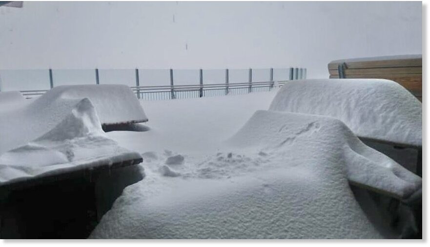
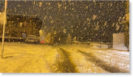
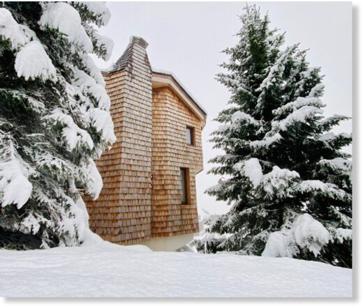
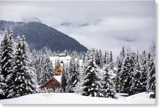
Ski areas in the Alps and Pyrenees have reported another pre-main-season snowfall to start this week, with the snow falling down to resort level at many areas. There was heavy snowfall in the Western Alps and Pyrenees on Monday and then heavier snow further East by Tuesday morning.

Although few are publishing official snowfall stats yet, numbers varying from 5-20cm (2-8 inches) were widely reported although some said they had had 80cm (32″) by Tuesday morning.

About 25 ski areas are now open in the Alps and Scandinavia and the first ski areas have also opened in Canada and the US for 20-21, where widespread snowfall across the continent has also been reported.

The biggest accumulation so far was reported by Austria's Stubai glacier which says it has had 80cm (32″) of fresh snowfall. They posted video here. Hintertux says it has had 75cm (2.5 feet) Quite low lying resorts like Mayrhofen, also in Austria's Tirol region reported heavy snow down to resort level.

Ski slopes are already open at Banff, Engelberg, Gstaad (Glacier 3000), Hintertux, Kaprun, Kitzbuhel, Les 2 Alpes, Levi, Pitztal, Ruka, Saas Fee, St Moritz (Diavolezza glacier), Stubai, Tignes and Zermatt, among others. More are due to open this coming weekend, including Andermatt.

Avoriaz is pictured below yesterday, Meribel at the bottom.

Avoriaz
Avoriaz

In Italy new restrictions that came in today led to Cervinia, which only opened for the season on Saturday, closing again, until November 24th. The Italian government hopes that their new 'fire-break-lockdown' curtailing most group activities, will stop their growing virus infection numbers and allow for ski areas to be open in the winter.

Almost all countries containing ski resorts are currently not on the UK nation's safe travel corridors list and currently require anyone still travelling to them to quarantine for two weeks upon their return to the UK. Some insurance policies may also not be valid for travel in these circumstances.

Meribel
Meribel

View: https://twitter.com/StormchaserUKEU/status/1320845547692036096
 

TxGal

Day by day

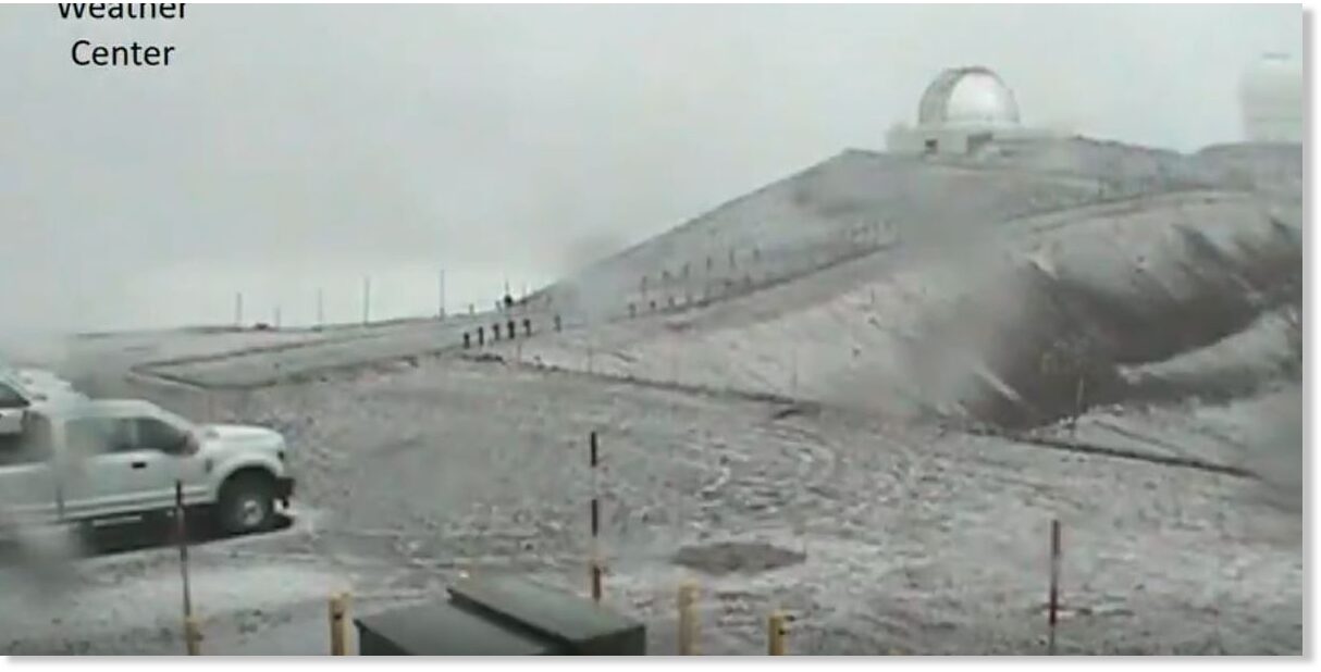
It's only October, but the snow is already falling atop Mauna Kea, Hawaii

Dillon Ancheta
Hawaii News Now
Mon, 26 Oct 2020 14:11 UTC

Snow on Mauna Kea was seen around 4 p.m. Monday
© Mauna Kea Weather Center
Snow on Mauna Kea was seen around 4 p.m. Monday

Some wet and unstable weather brought thunderstorms and heavy rain to the western half of the state this week.

But over on Hawaii Island, it was a different scene as snow fell atop Mauna Kea.

A light dusting was captured by cameras at the Mauna Kea Weather Center on Monday around 4 p.m. It's believed to be the first snowfall of the winter season.

The Mauna Kea Visitor Information Station said the road was closed Monday night, which is often a result of snowy or icy conditions making travel up the mountain unsafe.

More snow could be possible in the coming days as temperatures are set to linger near freezing.
 

TxGal

Day by day

Mexico – Snowfall in the middle of October
October 27, 2020 by Robert

For the city of Chihuahua, it is expected that the thermometer will drop to -1C tonight. And record “snow water.”
In the middle of autumn.

Mexico-snow-water-27-Oct-2020.jpg

Mexico – “Snow water” – 27 Oct 2020

Tuesday, 27 Oct 2020 – An atypical end of October, with record precipitation of freezing rain (commonly known as snow water), snow and hail; with temperatures down to -2 degrees, all due to cold front number 9. The cold front was forecast to reach Chihuahua Capital today with temperatures down to -1C.

This was reported by Tiempo Severo Chihuahua, which said the rainfall on Monday night and early Tuesday in Ciudad Juárez was is part of a rare meteorological phenomenon.

According to Meteored, at the Abraham González Airport meteorological station, the low temperature of -2C, with a wind-chill of -9, was atypical for the month of October, in the middle of autumn.

Frente frío número 9 deja nevadas en pleno octubre

https://www.elheraldodechihuahua.com.mx/local/q1hmat-frio.jpg/alternates/FREE_560/Frio.jpg
 

TxGal

Day by day

Temperatures 40 degrees F below average – Cold records toppled far and wide
October 27, 2020 by Robert

Even the Washington Post admits to this one.
“The ongoing cold is off the charts, with an air mass more typical of December or January than late October,” the Post admits.

26 Oct 2020 – Arctic blast brings minus-29 degree (-33.9) cold to Montana as snow and ice plaster central U.S.

The blast of frigid Arctic air that descended over the Western United States toppled records far and wide as readings plummeted to some 40 degrees F below average for this time of year.

Potomac, Montana — the coldest temperature ever observed this early in the season across the Lower 48

Temperatures throughout much of the Rockies dipped below zero (-17.8C) to start the week, falling as low as minus-29.2 in Potomac, Montana., early Sunday — the coldest temperature ever observed this early in the season across the Lower 48.

Winter storm and ice storm warnings are up for most of Colorado, New Mexico, the Texas Panhandle and Oklahoma, while winter weather advisories stretch northeast into Kansas City toward Iowa. Behind the system, wind chills were expected to drop to minus-25 in the Intermountain West on Monday night.

Montana cold records shattered

In addition to Sunday’s reading of nearly 30 below, a slew of other records have come crashing down courtesy of the early-season Arctic outbreak. Missoula set a record for its earliest zero-degree reading observed, hitting minus-7 on Monday morning. Anaconda, a town of 9,000 in western Montana, was forecast to drop to minus-23 degrees Monday morning; its previous record was 5 degrees.

“I talked with a climatologist in Alaska,” said Corby Dickerson, a meteorologist at the National Weather Service in Missoula. “He said that there are 14.5 million observations [across the country] in the database between October 1 and October 25, and Potomac was the coldest. It’s truly remarkable. There’s no other way to describe it.”

A once-in-a-century event

Two out of the past three mornings have been among Missoula’s coldest three ever recorded in October, and more records will probably fall later in the week.
“I’ve been describing it as a once-in-a-century event,” Dickerson said.

Missoula also logged its eighth-biggest snowstorm on record, with a hefty 13.8 inches falling in just two days.

It’s not just the Northern Tier that’s been dealing with record cold. Boulder, Colo., snagged a record Monday morning when it dipped to 5 degrees; the previous record for the date, set in 1997, was 13 degrees.

The core of the cold — some 40 to 45 degrees below average in spots — should diminish in intensity and shift south and east mid- to late week.

See more:
https://www.washingtonpost.com/weather/2020/10/26/snow-ice-storm-plains-rockies/
 

TxGal

Day by day

Underwater volcanoes melting Arctic Ice, says geologist
October 28, 2020 by Robert

Massive amounts of heat pulsing from the earth
_______________________________________________________________

Note: I posted this four years ago, but I think it deserves a repeat.

Powerful deep Arctic Ocean geological heat flow forces are melting the ice, says geologist James Edward Kamis.

In an article entitled “Heat From Deep Ocean Fault Punches Hole in Arctic Ice Sheet,” Kamis punches his own holes in the “humans-are-melting-the-ice” chorus.

October 2015 sea-ice-melt location above Gakkel Ridge

October 2015 sea-ice-melt location above Gakkel Ridge


“A very interesting high temperature and low salinity hole has just been punched in the sea ice … directly above the deep ocean Gakkel Ridge Rift / Fault System,” wrote Kamis in early November. (Kamis is referring to an event that took place on October 12, 2015.)

Massive amounts of heat pulsing from the earth

The Gakkel ridge is a gigantic chain of underwater volcanoes snaking 1,800 kilometers (1,100 miles) beneath the Arctic Ocean from the northern tip of Greenland to Siberia.

With its deep valleys plummeting 5,500 meters (3.4 miles) beneath the sea surface and its summits rising 5,000 meters (3.1-miles) above the seafloor (but still a third of a mile beneath the sea surface), the Gakkel ridge is far mightier than the Alps.

The Gakkel Ridge has in the recent past pulsed massive amounts of heat into the overlying ocean and thereby melted large portions of the ice that floats above the heated ocean column, says Kamis.

Climate scientists who favor the theory of man-made global warming maintain that the higher melt rate of Arctic sea ice from 1999 to 2007 was entirely due to man-made CO2 emissions, Kamis continues.

Natural forces play dominate role in sea ice extent

However, it is clear to most scientists, he continues, that non-atmospheric natural forces play the dominate role in sea ice extent and thickness.

These natural forces include variations in the Earth’s orbit, long-term cyclic changes in deep-ocean currents, and most importantly geologically induced heat and chemically charged fluid flow from deep ocean faults and volcanoes.

Even though the October 12 event was associated with an extensive earthquake swarm, a huge methane release, and a significant series of volcanic eruptions along the Gakkel Ridge, “it was, and still is dismissed as insignificant by most climate scientists advocating the theory of man-made global warming,” says Kamis

But many scientists now realize that the 1999-2007 Gakkel Ridge heat and chemically charged fluid flow event was the root cause of accelerated the Arctic sea ice melting rate.

Heat From Deep Ocean Fault Punches Hole in Arctic Ice Sheet | Climate Dispatch

Thanks to George Martinez for this link

NOTE: This story reinforces my own contention that our oceans are being heated by underwater volcanoes, not humans. See Not by Fire but by Ice, chapter 10, “Fish Stew.”

Also, I’ve posted many articles about underwater volcanic activity on the Gakkel Ridge over the years:

* Underwater Volcanoes Heating the Arctic Ocean
* Arctic seafloor afire with lava-spewing volcanoes
* Volcanoes in Arctic Ocean
* Eruptions as big as Pompeii under Arctic ice
* Map showing location of the Gakkel and other ridges:
 

TxGal

Day by day
Adapt 2030 has a new podcast out:

View: https://www.youtube.com/watch?v=3cTrqLLKXT4


Apocalyptic Ice Storm Slams Into Hurricane Zeta
28,931 views • Premiered 9 hours ago

Run time is 17:22

Synopsis provided:

With the coldest October temperatures ever recorded in any year smashing thousands of historic all time cold records back to 1879, winter storm Betty is now colliding with the incoming front of Hurricane Zeta. Ice accumulations are forecast up to 1.5 inches in areas across the Midwest USA.
 

TxGal

Day by day

snow-alps-oct-2020-e1603882121194.jpg


FOURTH! “PRE-MAIN-SEASON” SNOWFALL EVENT BURIES THE ALPS UNDER ANOTHER 3-FEET
OCTOBER 28, 2020 CAP ALLON

Ski areas across the Alps and the Pyrenees have reported yet another pre-main-season snowfall event to start this week, with the snow falling down to resort level in many parts, reports inthesnow.com.

There was heavy snowfall in the Western Alps and the Pyrenees on Monday, and then heavier snow was registered further east on Tuesday–falls that add to the incredible early-season snowpack building over the higher elevations of Europe:


Official snowfall stats aren’t usually reported this early into the season, but numbers of up to 20cm (8 inches) were widely registered across the Austrian and Italian peaks, with some areas saying they had received 80+cm (nearing 3 feet) by Tuesday morning.

Austria’s Stubai glacier was one such area, with the resort’s official Facebook account posting this video:

blob:https://www.facebook.com/7bbb170f-e799-4743-b520-f1a21d58cf3c
Run time is 0:18

Hintertux, also located in Austria, rivaled Stubai’s totals, reporting 75cm (2.5 feet) early Tuesday:

View: https://twitter.com/LanderVanTricht/status/1321056782874222592


Even low lying areas such as Mayrhofen witnessed heavy snow to start the week, all the way down to resort level, reports inthesnow.com.

In total, around 25 ski areas are already open in the Alps and Scandinavia, and the first ski areas have also opened in U.S. and Canada where recent vast accumulations of record-smashing snow has helped drive the Northern Hemisphere Total Snow Mass to a staggering 300 gigatons above the 1982-2012 average:


The COLD TIMES are returning, the mid-latitudes are REFREEZING in line with historically low solar activity, cloud-nucleating Cosmic Rays, and a meridional jet stream flow.

Both NOAA and NASA appear to agree, if you read between the lines, with NOAA saying we’re entering a ‘full-blown’ Grand Solar Minimum in the late-2020s, and NASA seeing this upcoming solar cycle (25) as “the weakest of the past 200 years”, with the agency correlating previous solar shutdowns to prolonged periods of global cooling here.

Furthermore, we can’t ignore the slew of new scientific papers stating the immense impact The Beaufort Gyre could have on the Gulf Stream, and therefore the climate overall.


Prepare accordinglylearn the facts, relocate if need be, and grow your own.
 
Top