Solar Grand Solar Minimum part deux

TxGal

Day by day

Record St Helena snow
October 21, 2020 by Robert

Helena and surrounding areas remained under a winter storm watch after a storm dumped a heavy blanket of snow overnight last Friday.

The advisory issued by the Great Falls National Weather Service covered Helena, Flesher Pass, Rogers Pass, Montana City, Boulder Hill, Battle Ridge Pass, and Bozeman Pass. Another 2 to 6 inches of snow accumulation was expected Sunday through Monday morning.

The snowfall set a record, says reader Clay Olson. Clay included this link Keeping You Safe but I still can’t figure out where he got that info.

However, here’s a link showing that Helena definitely did get a large covering of snow.

https://helenair.com/photos-october-storm- -helena-in-snow/collection_0f57c8c6-2103-5cc9-a557-81d91d3a2c0f.html#7
 

TxGal

Day by day
The Oppenheimer Ranch Project has a new podcast out:

View: https://www.youtube.com/watch?v=Qj4mxtcTfb8


Record Snow Blankets Northern U.S., With Much More On The Way = GSM - NASA Lands On Asteroid Bennu!
1,688 views • Premiered 5 hours ago

Run time is 22:44

Synopsis provided:

Record snow blankets northern U.S., with more on the way https://wapo.st/35fk2hu
After record snowfall, more snow on the way for northern Minn. https://bit.ly/2TjtiLW
Next winter storm targets central Minnesota Thursday https://bit.ly/2Tf6soV
More Snow and Unseasonal Cold for the Upper Midwest and Upper Michigan https://bit.ly/35leSki
Snow, extreme cold to impact Montana https://bit.ly/3klz5wG
Up to a foot of snow possible in northern South Dakota on Thursday https://bit.ly/35lWEPt
First big mountain snow amid autumn cold snap could cause travel headaches Friday https://bit.ly/3man39J
2 feet of snow could fall on Cameron Peak Fire Sunday https://bit.ly/37HLWpB
Winter Storm Watch issued for Spokane this Friday https://bit.ly/37vf7vG
Forecasters call for at least 10 times as much snow in Washington this winter compared to last https://wapo.st/34j59eY
GFS Model Total Snow For The US https://bit.ly/3obNQ7w
Heavy Snow for the North-Central U.S.; Bitter Cold and a Second Storm to Follow http://bit.ly/2p2GER3
Earthquake activity slowly reducing since Mw5,6 earthquake yesterday (20-October-2020) https://icelandgeology.net/
HMI Continuum= Sunspots LIVE https://go.nasa.gov/35TpFBd
Solar Han Sunspot Assessment https://www.solarham.net/regions/2776...
Solar Ham https://www.solarham.net/
Turbulent era sparked leap in human behavior, adaptability 320,000 years ago https://bit.ly/3manK2P
NASA teases ‘exciting new discovery’ coming about the moon next week https://bit.ly/3dPxjRK
NASA to Announce New Science Results About Moon https://go.nasa.gov/2IOJ5At
First NASA Osiris-Rex images = incredible touchdown on asteroid Bennu https://cnet.co/37r8quN
NASA just landed on asteroid Bennu. What you need to know about the mission https://cnet.co/3maYY2J
 

TxGal

Day by day

Rayann-Elzein-2010172252_RE5_9345_1603011316_lg-e1603358628877.jpg


MORE UNEXPLAINED “STRANGE RED AURORAS” — DR TONY PHILLIPS
OCTOBER 22, 2020 CAP ALLON

For much of mid-October, Earth’s magnetic field has been very quiet, reports Dr Tony Phillips over at spaceweather.com. Extremely quiet. No sunspots. No solar flares. No CMEs. No gust of solar wind.

Such calm space weather conditions should have produced no auroras at all, yet around the Arctic Circle, photographers have been capturing stunning scenes such as this:


Utsjoki, Finland on Oct 13 — Rayann Elzein.

Photographer Rayann Elzein of Utsjoki, Finland says he captured similar displays all last week AND through the weekend: “On each occasion geomagnetic activity was very low (with K-indices no greater than 0 or 1).”

Red auroras appear when particles from space strike oxygen atoms near the top of Earth’s atmosphere. However, as Les Cowley explains, the very slow atomic transitions which produce red photons in the aurora zone are easily interrupted — even experienced observers rarely see them.

Elzein has been chasing auroras in Finland for 10 years. He prides himself on going out in all conditions–even when geomagnetic activity is nominally low.

“I can’t recall ever seeing so much red on top of the green layer before,” he says.

In Tromsø, Norway, aurora tour guide Markus Varik had a similar experience.

“Activity was extremely low on Oct 17 when pink and red colors appeared,” says Varik. “After years of guiding, I have never seen anything similar to this.”


Tromsø, Norway on Oct — Markus Varik.

The common denominator appears to be … quiet.

“It seems that the red was most apparent during the lowest geomagnetic activity–that is, when Bz was positive and the solar wind speed was slow (at or below 300 km/s),” notes Elzein. “The solar wind was also dense, with proton densities above 15 p/cm3.”

It remains something of a mystery, writes Dr Phillips.

Aurora experts are urged to submit their “red” explanations here.

In the meantime, click the link below for a brief look at how Earth’s waning Magnetic Field (due to a GSM and Pole Shift) could ultimately be the cause of these new space weather phenomena.

The COLD TIMES are returning, the mid-latitudes are REFREEZING in line with historically low solar activity, cloud-nucleating Cosmic Rays, and a meridional jet stream flow.

Both NOAA and NASA appear to agree, if you read between the lines, with NOAA saying we’re entering a ‘full-blown’ Grand Solar Minimum in the late-2020s, and NASA seeing this upcoming solar cycle (25) as “the weakest of the past 200 years”, with the agency correlating previous solar shutdowns to prolonged periods of global cooling here.

Furthermore, we can’t ignore the slew of new scientific papers stating the immense impact The Beaufort Gyre could have on the Gulf Stream, and therefore the climate overall.


Prepare accordinglylearn the facts, relocate if need be, and grow your own.
 

TxGal

Day by day
Uh-oh, another volcano sent a very high ash plume. This should be high on the VEI index, and it isn't good going forward:


bezymianny2210-e1603356918501.jpg


BEZYMIANNY VOLCANO, KAMCHATKA ERUPTS FIRING A “DARK ASH PLUME” TO [AT LEAST] 32,800FT/10KM
OCTOBER 22, 2020 CAP ALLON

As reported last week, scientists are growing increasingly concerned with the unusual behavior of volcanoes in Russia’s Kamchatka Peninsula. Today comes the news that Bezymianny has just popped-off in “vigorous” fashion.

According to a spokesman for the Kamchatka branch of the geophysical service, the eruption of Bezymianny began at 08:22 local time (23:22 Moscow time, Wednesday).

“According to preliminary estimates, the volcano spewed ash to an altitude of ten kilometres (32,800 feet). An autonomous video surveillance camera at the Kirishev station recorded the beginning of the eruption. Since the volcano is currently partially covered by clouds, more exact information about the eruption will be available when we receive data from satellites,” the spokesman said Thursday — the final altitude could well have been higher.

Below is the Kirishev station surveillance footage capturing the beginning of the eruption:

View: https://youtu.be/LFOSJtGRON8


The footage was also used in this NMG news report:

View: https://youtu.be/XPH19WmkBzs


As reported by volcanodiscovery.com, the Volcanic Ash Advisory Center (VAAC) Tokyo documented: “a vigorous eruption at the volcano today characterized by vulcanian-type explosion [and] a dense dark ash plume”. The Center added that the ash drifted south in the high-altitude winds where, as reported by sputniknews.com, the larger particulates fell and covered two settlements in Kamchatka Territory.

Back in mid-September of this year, KVERT reported that a new lava dome was growing in Bezymianny’s inner summit crater: “During 28-31 August and on 4, 8 and 10 September a thermal anomaly was detected in satellite images (shown below) — this recent eruption looks to have been a release of this building pressure.


Thermal anomaly at Bezymianny volcano visible from satellite (image: Sentinel 2).

Volcanic eruptions are one of the key forcings driving Earth into its next bout of global cooling. Volcanic ash (particulates) fired above 32,800ft (10km) –and so into the stratosphere– shade sunlight and reduce terrestrial temperatures. The smaller particulates from an eruption can linger in the upper atmosphere for years, or even decades+ at a time.

BEZYMIANNY

Bezymianny is located in the central part of the Klyuchevskaya group, on the southeast slope of the extinct volcano Kamen. It is a tall stratovolcano, with an eruptive history peppered with VEI 2s and 3s.

Information provided by tass.com reveals that “Bezymianny” actually means “nameless,” and that the volcano was considered extinct before its powerful VEI 5 eruption back in 1955 — an event that lowered the top of the mountain by 280m/920ft (from 3,080 to 2,800 meters).

UPTICK

Seismic and Volcanic activity has been correlated to changes in the Sun.

Their worldwide uptick (along with a seismic uptick) is tied to low solar activity, coronal holes, a waning magnetosphere, and the influx of Cosmic Rays penetrating silica-rich magma.

The recent worldwide volcanic uptick is thought to be tied to low solar activity, coronal holes, a waning magnetosphere, and the influx of Cosmic Rays penetrating silica-rich magma.

Check out these link for more info:

https://principia-scientific.org

https://www.researchgate.net

GLOBAL COOLING

The COLD TIMES are returning, the mid-latitudes are REFREEZING, in line with historically low solar activity, cloud-nucleating Cosmic Rays, and a meridional jet stream flow.

Both NOAA and NASA appear to agree, if you read between the lines, with NOAA saying we’re entering a ‘full-blown’ Grand Solar Minimum in the late-2020s, and NASA seeing this upcoming solar cycle (25) as “the weakest of the past 200 years”, with the agency correlating previous solar shutdowns to prolonged periods of global cooling here.

Furthermore, we can’t ignore the slew of new scientific papers stating the immense impact The Beaufort Gyre could have on the Gulf Stream, and therefore the climate overall.


Prepare accordinglylearn the facts, relocate if need be, and grow your own.
 

TxGal

Day by day


BB1aezVD-e1603353344487.jpg


MINNESOTA JUST SUFFERED ITS LARGEST EARLY-SEASON SNOWSTORM IN RECORDED HISTORY
OCTOBER 22, 2020 CAP ALLON

By the close of Tues, Oct 20, many Minnesotans had received a taste of what the Grand Solar Minimum has to offer, as a record-busting early-season shot of polar cold and snow blasted the Midwestern U.S. state.

As of late Tuesday evening, the Minnesota State Patrol reported that 1,100 crashes and spinouts had occurred amidst the unseasonable conditions: between 11AM and 8:30PM, there had been 493 crashes, 614 spinouts, and 22 jackknifed semi-trucks — all resulting in 48 injuries.

View: https://youtu.be/xxYUG5qJpXg

Whiteout conditions along Interstate 94 around the Sauk Centre, MN (Oct 20).

View: https://youtu.be/h2yuQCi_jO4

Chanhassen, MN — clean up following Record Breaking October Snow.

The wintry storm system, which dropped up to 9 inches of snow in parts of metro, has officially gone down as Minnesota’s largest early-season snowstorm in recorded history, in books dating back around 140 years.

As reported minnesota.cbslocal.com, 9 inches were reported in Lakeville; 8.9 inches in Ellsworth, Wisconsin; 8 inches in Granite Falls; 8 inches in Red Wing, 7.4 inches at MSP Airport; and 7.1 inches in Woodbury.

In addition to this being the largest early-season accumulations in history, Tuesday’s dumping was also the second largest October snowstorm on record, coming a close second to 1991’s historic Halloween blizzard.

View: https://twitter.com/ManoDestra777/status/1318612484991946754


All this fresh powder only adds to the heavy falls witnessed in MN over the past week-or-so, it also contributes to an already above average start to the Northern Hemisphere’s 2020-21 snowpack season.

And just look at what’s on course to hit starting this weekend (linked below). There’s every chance this next round of early-season snow could break the all time October record held by the historic Halloween blizzard of 1991.

The COLD TIMES are returning, the mid-latitudes are REFREEZING in line with historically low solar activity, cloud-nucleating Cosmic Rays, and a meridional jet stream flow.

Both NOAA and NASA appear to agree, if you read between the lines, with NOAA saying we’re entering a ‘full-blown’ Grand Solar Minimum in the late-2020s, and NASA seeing this upcoming solar cycle (25) as “the weakest of the past 200 years”, with the agency correlating previous solar shutdowns to prolonged periods of global cooling here.

Furthermore, we can’t ignore the slew of new scientific papers stating the immense impact The Beaufort Gyre could have on the Gulf Stream, and therefore the climate overall.


Prepare accordinglylearn the facts, relocate if need be, and grow your own.
 

TxGal

Day by day

Bezymianny volcano eruption news and activity updates:

Bezymianny Volcano Volcanic Ash Advisory: VA EMISSIONS CONTINUING OBS VA DTG: 22/0220Z to 31000 ft (9400 m)

Thursday Oct 22, 2020 03:15 AM | BY: VN

Explosive activity continues. Volcanic Ash Advisory Center (VAAC) Tokyo warned about a volcanic ash plume that rose up to estimated 31000 ft (9400 m) altitude or flight level 310 and is moving at 30 kts in S direction.
The full report is as follows:

FVFE01 at 03:00 UTC, 22/10/20 from RJTD
VA ADVISORY
DTG: 20201022/0300Z
VAAC: TOKYO
VOLCANO: BEZYMIANNY 300250
PSN: N5558 E16036
AREA: RUSSIA
SUMMIT ELEV: 2882M
ADVISORY NR: 2020/4
INFO SOURCE: HIMAWARI-8
AVIATION COLOUR CODE: NIL
ERUPTION DETAILS: VA EMISSIONS CONTINUING
OBS VA DTG: 22/0220Z
OBS VA CLD: SFC/FL310 N5744 E16035 - N5527 E16239 - N5258 E16056 -
N5519 E15928 MOV S 30KT
FCST VA CLD +6 HR: 22/0820Z SFC/FL320 N4932 E16430 - N5303 E15857 -
N5506 E15835 - N5849 E16031
FCST VA CLD +12 HR: 22/1420Z SFC/FL320 N4629 E16751 - N5142 E15852 -

N5618 E15818 - N5943 E16059 - N5343 E16316
FCST VA CLD +18 HR: 22/2020Z SFC/FL310 N4334 E17213 - N4945 E16013 -

N5631 E15835 - N6006 E16125 - N5244 E16442
RMK: EASTERN PART OF VA OBSCURED BY MET CLOUD.
NXT ADVISORY: 20201022/0600Z=


TxGal

Day by day

Bezymyanny volcano on Russia's Kamchatka peninsula begins to erupt

TASS
Thu, 22 Oct 2020 00:18 UTC

Russia volcano eruption
© YouTube/Пятый канал Новости (screen capture)

The eruption of the Bezymyanny volcano on Russia's Kamchatka peninsula began at 08:22 local time (23:22 Moscow time on Wednesday), a spokesman for the Kamchatka branch of the geophysical service of the Russian Academy of Sciences told TASS on Thursday.

"According to preliminary estimates, the volcano spewed ash to an altitude of ten kilometers. An autonomous video surveillance camera at the Kirishev station recorded the beginning of the eruption. Since the volcano is currently partially covered by clouds, more exact information about the eruption will be available when we receive data from satellites," the spokesman said.

According to the spokesman, the eruption began as was anticipated by the Kamchatka branch of the Russian expert council on earthquake prediction. The intensification of the giant mount's activity began in early October.

Bezymyanny is one of 29 active volcanoes of Kamchatka. Its height is about 2,800 metres above sea level. Its eruptions are explosive. They occur one or two times a year and may last from several hours to several days. In recent years scientists have managed to predict the periods of its activity intensification rather correctly. Its previous powerful eruption occurred on March 15, 2019.

View: https://youtu.be/XPH19WmkBzs


The volcano's name means "nameless," and it was considered to be extinct before the 1955 eruption. Bezymyanny is located on the southeast slope of the extinct volcano Kamen. Its greatest eruption happened in 1956 and lowered the top of the mountain by 280 meters from 3,080 to 2,800 meters. The volcano is located in the central part of the Klyuchevskaya group 385 kilometres northeast of Petropavlovsk-Kamchatsky. The nearest populated localities are Klyuchi and Kozyrevsk.
 

TxGal

Day by day

More mysterious red auroras captured around the Arctic Circle

Spaceweather.com
Thu, 22 Oct 2020 03:52 UTC

Auroras are still glowing red @ Utsjoki, Finnish Lapland
© Rayann Elzein
Taken on October 17, 2020 @ Utsjoki, Finnish Lapland

Spoiler alert: We do not know the answer to this question. Where did all the red auroras come from? For much of mid-October, Earth's magnetic field has been very quiet. Extremely quiet. There should have been no auroras at all, yet around the Arctic Circle, photographers recorded scenes like this.

Photographer Rayann Elzein of Utsjoki, Finland, took the picture on Oct. 17th. "I photographed similar displays on Oct. 12th, 13th, 14th, and 15th," says Elzein. "On each occasion, geomagnetic activity was very low (with K-indices no greater than 0 or 1)."

Red auroras appear when particles from space strike oxygen atoms near the top of Earth's atmosphere. However, as Les Cowley explains, the very slow atomic transitions which produce red photons in the aurora zone are easily interrupted. Even experienced observers rarely see them.

Elzein has been chasing auroras in Finland for 10 years. He prides himself on going out in all conditions--even when geomagnetic activity is nominally low. "I can't recall ever seeing so much red on top of the green layer before," he says.

In Tromsø, Norway, aurora tour guide Markus Varik had a similar experience. "Activity was extremely low on Oct. 17th when pink and red colors appeared. After years of guiding, I have never seen anything similar to this."

auroras @ Tromsø Norway
© Markus Varik
Taken on October 17, 2020 @ Tromsø Norway

"It appeared white to the naked eye, but on the camera it was vivid pink," says Varik.

The common denominator seems to be ... quiet. "It seems that the red was most apparent during the lowest geomagnetic activity--that is, when Bz was positive and the solar wind speed was slow (at or below 300 km/s)," notes Elzein. "The solar wind was also dense, with proton densities above 15 p/cm3."

It's a mystery. Aurora experts with bright (red) ideas may submit their explanations here.
 

TxGal

Day by day
From the blog Rural Revolution by Patrice Lewis:


Wednesday, October 21, 2020
Winter's a-coming!

Whoo-whee, do we have a cold snap on the way!


Not only is nearly seven inches of snow predicted for Friday, but then temperatures absolutely plunge to 1F late Sunday/early Monday. Whee.


To this end, Older Daughter and I have been frantically harvesting the garden. We tucked the potatoes, peppers, and carrots indoors so they won't freeze.


Dried beans are out in the barn. The cold won't affect them.


The cold snap isn't supposed to last long, and with luck all the snow will have melted by Wednesday or Thursday of next week. But wow, temperatures like that this early in the season? Are we in for a hard winter?
 

TxGal

Day by day

Heavy snow for Cascades
October 22, 2020 by Robert

Urgent – Early season Winter Storm Watch – Up to 12 inches of heavy wet snow may lead to broken tree limbs and power outages. Could affect travel over Cascade passes.

___________

URGENT – WINTER WEATHER MESSAGE
National Weather Service Seattle WA
404 AM PDT Thu Oct 22 2020

WINTER STORM WATCH FROM FRIDAY MORNING THROUGH LATE FRIDAY NIGHT ABOVE 2000 FEET…

Heavy snow possible above 2000 feet. Total snow accumulations of up to 9 inches possible. Heaviest amounts expected north of Interstate 90.

WHERE…Cascade mountains of Whatcom, Skagit, Snohomish and King Counties, including Newhalem, the Mount Baker Ski Area, Stevens Pass, and Snoqualmie Pass.

Snow-covered roads and travel delays possible.

PRECAUTIONARY/PREPAREDNESS ACTIONS…
Monitor the latest forecasts for updates on this situation.
www.weather.gov/seattle

A storm system will move across the Pacific northwest Friday and Friday night bringing a surge of much colder air and lowering snow levels. With abundant Pacific moisture moving into the Washington Cascades, expect moderate to heavy snowfall for a time late Friday into Saturday with the potential for substantial travel impacts.

East Slopes of the Washington Cascades-Including the cities of Cle Elum and Cliffdell

Moderate to heavy snow possible. Total snow accumulations of 4 to 6 inches possible above 2500 feet, with 6 to 12 inches above 4000 feet.

East Slopes of the Washington Cascades along and north of the I-90 corridor, including Snoqualmie Pass.

Travel could be very difficult. Hazardous conditions could impact travelers through the Cascade Passes.

URGENT – WINTER WEATHER MESSAGE
National Weather Service Spokane WA
802 PM PDT Wed Oct 21 2020

STRONG EARLY SEASON STORM FRIDAY – POTENTIAL FOR MODERATE TO HEAVY SNOW…

East Slopes Northern Cascades-

Heavy snow possible. Total snow accumulations of 6 to 12 inches possible in Leavenworth, Mazama, Twisp, Winthrop, Stehekin, Conconully, Blewett Pass, Loup Loup Pass, Stevens Pass, Plain, and Holden Village.

Travel could be very difficult. Heavy wet snow may lead to broken tree limbs and power outages.

National Weather Service Watch Warning Advisory Summary
 

TxGal

Day by day

St-Cloud-Snow.jpg


ST. CLOUD BREAKS ALL-TIME DAILY AND MONTHLY SNOWFALL RECORDS
OCTOBER 22, 2020 CAP ALLON

St. Cloud, MN has seen multiple all-time snowfall records fall this week, with additional records expected to tumble as the weekend approaches.

St. Cloud State University professor Bob Weisman said he measured 7 inches of snow on Oct. 20th, a total that was matched by official National Weather Service (NWS) measurements. As a result, Tuesday’s snowfall is now the new daily Oct. 20th benchmark as well as the new monthly October record–in weather books dating back to the late 1880s.

As noted by Prof Weisman on his blog, the previous record for Oct. 20th was the 5.8 inches set back in 1936 (solar minimum of cycle 16), with the old monthly record being the 6.8 inches, also set in 1936. According to Weisman, so far 7.2 inches of snow has been logged this October, an accumulation that has comfortably surpassed the all-time record with 10 days left to run in the month!

View: https://twitter.com/NickEischens00/status/1318705603724910592


Substantial totals were received across Minnesota, with Eau Claire also breaking its all-time October snowfall record:

View: https://twitter.com/CodyMatzFox9/status/1318888750705971206


Furthermore, the recent powder led to MN busting a statewide record:


Another even more powerful and wide-reaching Arctic plunge is forecast to hit the North American continent this weekend. Minnesotans will be one of the first to cop the freeze, starting Thursday. As reported by sctimes.com, “the next storm is expected to be a more direct hit on Central Minnesota, according to forecasters, with up to 8 more inches of snow possible.”

The NWS issued a Winter Storm Watch for Central Minnesota: “Snow rates of 1 inch per hour are possible, especially late tonight and early Thursday,” reads the watch released late on Wednesday. As noted by Weisman: “Thursday’s daily snowfall record of 0.5 inch, set in 1897, is likely to fall” — it’s actually likely to be annihilated.

Looking further ahead, and past the weekend, additional record-smashing totals are on the cards before the month is out. October, 2020 is truly one for the ages: St Cloud could end up with 20 inches of snow this month, which would beat 1936’s all-time record by more than 13 inches!

The COLD TIMES are returning, the mid-latitudes are REFREEZING in line with historically low solar activity, cloud-nucleating Cosmic Rays, and a meridional jet stream flow.

Both NOAA and NASA appear to agree, if you read between the lines, with NOAA saying we’re entering a ‘full-blown’ Grand Solar Minimum in the late-2020s, and NASA seeing this upcoming solar cycle (25) as “the weakest of the past 200 years”, with the agency correlating previous solar shutdowns to prolonged periods of global cooling here.

Furthermore, we can’t ignore the slew of new scientific papers stating the immense impact The Beaufort Gyre could have on the Gulf Stream, and therefore the climate overall.


Prepare accordinglylearn the facts, relocate if need be, and grow your own.
 

TxGal

Day by day

Devastating fungal pathogen wheat blast arrives in Zambia, first time detected in Africa

Munyaradzi Makoni
The Scientist
Mon, 19 Oct 2020 12:00 UTC

Zambia wheat
© BATISEBA TEMBO
Symptoms of wheat blast were first seen in experimental plots and small-scale farms in the Mpika district of Muchinga province in northern Zambia during the 2018 rainy season.

It could have been blown in by wind or transported by infected crop residue and maybe seeds — the exact mode of introduction remains debated. But the evidence for the presence of wheat blast is indisputable: the devastating fungal pathogen is now in Zambia, its first appearance in Africa.

"The detection of the disease in Africa is alarming," Tarekegn Terefe, a wheat pathologist at South Africa's Agriculture Research Council - Small Grain Institute, tells The Scientist. The disease is so deadly it can cause yield losses of more than 70 percent on susceptible cultivars, he says.

"The detection of the disease in Zambia puts southern African wheat-producing countries — South Africa, Zimbabwe, and Malawi — at high risk," Terefe explains. Previous studies have documented the occurrence of similar wheat fungal diseases in Zambia, Zimbabwe, and South Africa, "indicating the possibility of inoculum exchange between these countries."

It was during the 2018 rainy season, which occurs from November to March, when symptoms of wheat blast first appeared in experimental plots and small-scale farms in the Mpika district of Muchinga province in northern Zambia. Farmers observed that the infected wheat heads, or spikes, failed to produce grain or yielded stunted grain. Some diseased leaves had gray or tan necrotic lesions with dark borders that often looked similar to lesions caused by other plant diseases.

Scientists were certain it could not have been Fusarium head blight (FHB), which already exists in Zambia and whose symptoms — bleached spikes with green tips — are very different, says Batiseba Tembo, a wheat breeder at the Mt. Makulu Central Research Station, run by Zambia Agriculture Research Institute (ZARI). "This triggered the suspicion of involvement of pathogens other than Fusarium graminearum," she adds.

Tembo's team collected samples for further investigation at ZARI's laboratory. "We had to make sure what it was," she says.

Now, Tembo and her colleagues are certain. Through pathological and molecular tests in Zambia and at the US Department of Agriculture, they confirmed that wheat blast, caused by the fungus Magnaporthe oryzae pathotype Triticum (MoT), is now a disease in Africa. They published their results in PLOS ONE on September 21.

Research is now underway to determine how the fungus came to Zambia and how it might make its way to other African countries in the near future.

wheat
© batiseba tembo
Batiseba Tembo (foreground), assisted by an intern, evaluates wheat blast occurrence in an experimental field in Mpika when the disease first hit Zambia.

Africa's vulnerability

Wheat blast was first reported in Parana, Brazil, in 1985. The disease gradually spread to other South American countries including Bolivia in 1996, Paraguay in 2002, and Argentina in 2007. It later surfaced in Bangladesh in 2016 where it affected 15,000 hectares of wheat and destroyed 90 percent of the yields.

The Bangladesh Agricultural Research Institute (BARI) collaborated with the International Maize and Wheat Improvement Center (CIMMYT) and researchers from nearly a dozen institutions worldwide to develop a long-term, sustainable solution. In 2017, they released BARI Gom 33, a blast-resistant, high-yielding, zinc-fortified wheat variety.

"It is encouraging a resistant cultivar was found and being adopted in Bangladesh, but, finding one or a few resistant cultivars will not bring a lasting solution because the blast pathogen is variable," says Terefe. Already, a highly aggressive isolate of MoT, called B-71, collected in 2012 from Okinawa, Bolivia, can bypass the resistance of BARI Gom 33, which is conferred by a gene called 2NS, Terefe says, citing a recent study chronicling the evolution of wheat blast. Searching for new resistance sources and using them in breeding is a continuous process, he adds.

This year, Bangladesh released another wheat blast-resistant variety, WMRI Gom 3, which also relies upon 2NS for wheat blast resistance. To increase the durability of resistant cultivars, says Terefe, a combination of two or more resistant genes in one cultivar is recommended.

Areas where wheat production is done in warm and humid conditions, such as Zambia and Ethiopia, Africa's main wheat producer, are vulnerable to wheat blast, says Pawan Singh, a coauthor of the study and a senior scientist and the head of wheat pathology at CIMMYT.

"Several varieties with wheat blast resistance developed in countries with similar wheat growing conditions as Zambia can be a possible temporary solution, but local testing of germplasm needs to be performed to identify the best-bet variety," he tells The Scientist.

He adds that other strategies are also available. Wheat blast occurs during warm and humid weather, so "if you change the date of planting your crops, heading time may not be at the same time when maximum vulnerability for wheat blast exists," says Singh.

For crop rotation, if farmers switch between plants that are host to MoT, such as wheat, barley, and triticale (a hybrid of wheat and rye), then inoculum build-up will continue, but if they cycle between wheat and invulnerable crops, such as chickpea and rice, they can help manage the disease development, Singh says.

Bateno Kabeto Leramo, crop production expert at the United Nation's Food and Agriculture Organization in Ethiopia, says there have not been any reports of wheat blast in east Africa, including in Ethiopia.

"This is a new disease and it calls for an immediate brainstorming meeting with wheat stakeholders to identify long-term and sustainable control measures to alleviate the blast problem," says Tembo.
B. Tembo et al., "Detection and characterization of fungus (Magnaporthe oryzae pathotype Triticum) causing wheat blast disease on rain-fed grown wheat (Triticum aestivum L.) in Zambia," PLOS ONE, doi:10.1371/journal.pone.0238724, 2020.
 

Martinhouse

Deceased
Wow! Lots of wintery things happening for sure!

The first ten years I lived in Arkansas, we had cold snowy winters and we'd have usually had our first good frost by now. It hasn't been that way for quite a while, but it looks like those times are returning, plus even worse.

I might be getting the plastic up on my greenhouse after all. I hope so, as it will really help make more heat for me here indoors, since it's attached to the south end of my house and there's a connecting door in the living room.
 

packyderms_wife

Neither here nor there.

sun-ice-BG-e1601287138487.jpg
Articles Extreme Weather GSM
THE ARCTIC’S “TICKING CLIMATE BOMB”: LITTLE ICE AGE IMMINENT
SEPTEMBER 28, 2020 CAP ALLON

The record-early Arctic Sea Ice growth witnessed this season may actually be good news, but not for the same reasons the hordes of mindless climate alarmists believe. Contradicting EVERYTHING those warmists have ever been told, a loss of ice at the poles is now thought to be the trigger for GLOBAL COOLING and ICE AGES.

For two decades now, NASA has told us that during bouts of otherwise “global” cooling the poles actually warm — this is likely due to a GSM-induced meridional (wavy) jet stream flow that diverts tropical warmth anomalously-far north AND/OR a depletion of the ozone layer high-above the poles that allows-in extra solar/cosmic radiation–including ultraviolet. But regardless of the exact mechanism –a field of study that remains poorly understood– Arctic sea ice has been in a natural decline in recent decades, an occurrence that is now threatening to set into motion a genuine and inevitable catastrophe: a threat that is often labelled a “ticking climate bomb”.

The Beaufort Gyre is a massive wind-driven current in the Arctic Ocean. The region has been regulating climate and sea ice formation at the top of the world for millennia. Recently, however, something has gone amiss.


The Beaufort Gyre is a wind-driven circulation system that traps and pushes freshwater and ice around the Arctic Ocean. NSIDC/AMAP


The Gyre influences climate. Credit: Eric S. Taylor (Woods Hole Oceanographic Institution)

During the second half of the 20th century the gyre adhered to a cyclical pattern in which it would shift gears every five to seven years and temporarily spin in a counter-clockwise direction, expelling ice and freshwater into the eastern Arctic Ocean and the North Atlantic. But for more than 17 years now, this carousel of ice and freshwater has been spinning faster in its usual clockwise direction, all the while collecting more and more freshwater from three sources: melting sea ice, runoff flowing into the Arctic Ocean from Russian and North American rivers, and the relatively fresh water streaming in from the Bering Sea.

As reported by e360.yale.edu: Today, the Beaufort Gyre now holds as much freshwater as all of the Great Lakes combined, and its continuing clockwise swirl is preventing this enormous volume of ice and cold-freshwater from flushing into the North Atlantic Ocean. Scientists say the gyre will inevitably weaken and reverse direction, and when it does it could expel a massive amount of icy fresh water into the North Atlantic.

Polar oceanographer Andrey Proshutinsky of the Woods Hole Oceanographic Institution has labeled this anticipated surge of water a “ticking climate bomb,” noting that even a partial flush of that growing reservoir –a mere 5 percent– could temporarily cool the climate of Iceland and northern Europe. A larger outflow would actually threaten to shutdown the Gulf Stream, an event that would see ice age conditions sweep Northern and Western Europe almost overnight.

gulf-stream.jpg


The Gulf Stream is key to Europe having the mild, habitable climate that it does.

We know this occurs, and have detailed records of a relatively recent event: during the 1960s and 1970s, a surge of fresh Arctic water was released that cooled the top half-mile of parts of the North Atlantic. Known as the Great Salinity Anomaly, British oceanographer Robert R. Dickson said the event represented one of the most persistent and extreme variations in global ocean climate observed during the past century. The surge of ice and freshwater cooled Northern Europe dramatically and disrupted the North Atlantic food chain. Between 1951 and 2010, many of Europe’s exceptionally cold winters occurred during the period of the Great Salinity Anomaly.

The discussed mechanism is believed, by many, to be the ice age trigger, and a newly published scientific paper only adds further support. Entitled, “Evidence for extreme export of Arctic sea ice leading the abrupt onset of the Little Ice Age, the new study combines marine sediment cores drilled from the Arctic Ocean to the North Atlantic. These records reveal that an abrupt increase in Arctic sea ice and cold freshwater exported to the North Atlantic starting around 1300, peaking in mid-century, and ending abruptly in the late 1300s. Crucially, the paper concludes that external forcing from volcanoes or any other cause may not be necessary for large swings in climate to occur — a previously widely held assumption: “These results strongly suggest that these things can occur out of the blue due to internal variability in the climate system,” said Dr. Martin Miles, researcher in the Institute of Arctic and Alpine Research at the University of Colorado.

The climate jigsaw continues, albeit slowly, to be pieced together.

The next bout of severe cooling is due –climate is cyclic, never linear– and the release of the Beaufort Gyre, in line with a rapidly waning magnetosphere and an intensifying Grand Solar Minimum, hold all the keys necessary.

The COLD TIMES are returning, the mid-latitudes are REFREEZING.

The “ticking climate bomb” is about to go off.

Prepare accordinglylearn the threats, relocate if need be, and grow your own.
 

TxGal

Day by day
Adapt 2030 has a new podcast out:

View: https://www.youtube.com/watch?v=6YXgdoYniQk


Here's Why Food Prices Will Double then Triple, Are You Ready?
2,966 views • Premiered 70 minutes ago

Run time is 15:09

Synopsis provided:

The Chicago Mercantile Exchange (CME) has raised the allowable limits before suspending trading in the futures market, for ALL commodities, more than double last years wild up and down prices. These traders know what is coming and not to send red flags to the populace absurd allowances for price swings upward are being now in place. Record cold about teh sweep N. America with temperatures 40F below normal as the winter wheat crop is emerging.
 

TxGal

Day by day
The Oppenheimer Ranch project has a new podcast out:

View: https://www.youtube.com/watch?v=b16XvYgj698


Researchers Provide The Most Detailed And Complete Record Yet of Earth's Last Magnetic Reversal?
1,312 views • Premiered 4 hours ago

Run time is 7:26

Synopsis provided:

Researchers provide the most detailed and complete record yet of Earth's last magnetic reversal https://bit.ly/2TiBbBr
A full sequence of the Matuyama–Brunhes geomagnetic reversal in the Chiba composite section, Central Japan https://bit.ly/35o51Kx
 

TxGal

Day by day
And another from The Oppenheimer Ranch Project:

View: https://www.youtube.com/watch?v=OvNB1OXGfro


Bezymianny Volcano (Kamchatka): Emissions to 31,000 ft - Largest Eruption In Months - Cosmic Rays
1,570 views • Premiered 3 hours ago

Run time is 2:41

Synopsis provided:

Bezymianny Volcano Volcanic Ash Advisory: VA EMISSIONS CONTINUING OBS VA DTG: 22/0220Z to 31000 ft (9400 m) https://www.volcanodiscovery.com/bezy...
Bezymianny volcano (Kamchatka): emissions to 31,000 ft https://www.volcanodiscovery.com/bezy...
 

TxGal

Day by day

cold-and-snowy-Cheyenne-e1603441565602.jpg


ARCTIC FREEZE SET TO BREAK 142-YEAR-OLD LOW TEMPERATURE RECORD IN CHEYENNE, WY
OCTOBER 23, 2020 CAP ALLON

In what we’re we’re led to believe is catastrophically warming world on the brink of disaster, this coming Monday could-well be the coldest Oct. 26 in Cheyenne’s recorded history.

Beginning Friday, a mass of brutal Arctic air will ride usually far south –all the way down to the southern Texas, in fact!– on the back of a meridional (wavy) jet stream flow. According to the NWS, this coming front is set to tear-up the record books ACROSS the United States and Canada over the next 7-10 days.

The city of Cheyenne, WY, for example, is on track to bust a low temperature record set a whopping 142 years ago — the -5F (-20.6C) set on Oct 26, 1878.

As reported by kgab.com, Laramie as well as Scottsbluff, Chadron, Alliance and Sidney could also see record low temperatures, similar to the all-time records set back in 1997 (solar minimum of cycle 22).


GFS 2m Temp Anomalies (C): Sat, Oct 24 – Mon, Nov 2 [tropicaltidbits.com].

Accompanying the record cold will be unprecedented accumulations of snow:


gfs_asnow_namer_fh24-210.gif

GFS Total Snowfall (inches): Sat, Oct 24 – Sat, Oct 31 [tropicaltidbits.com].

HISTORIC CHEYENNE SNOW

Back in 1997 (solar minimum of cycle 22), a memorable October storm blasted the front range with over two feet of snow, closing Interstate 25 from Wyoming to New Mexico.

In 2009 (solar minimum of cycle 23), Cheyenne broke a 137-year-old record when 28 inches of snow had settled by Halloween. Cold fronts came early and often that fall, reports kgab.com. On October 10th, a blizzard dumped ten inches on the Capital City. Later in the month, another storm left six more inches. It was also the coldest October on record in Cheyenne.

And in 2017 (solar minimum of cycle 24), an October 8th blizzard closed Interstate 80 from Cheyenne to Rawlins and dropped over eight inches of snow in southeastern Wyoming.

Climate is cyclic, never linear — driven, mainly, by the activity of the sun.

October, 2020 is looking to threaten many of Cheyenne’s all-time wintry records–as well as those up and down the North American continent. This should come as no surprise though: solar output is rapidly diminishing, on track to reach its lowest levels in centuries within the next few years.

The COLD TIMES are returning, the mid-latitudes are REFREEZING in line with historically low solar activity, cloud-nucleating Cosmic Rays, and a meridional jet stream flow.

Both NOAA and NASA appear to agree, if you read between the lines, with NOAA saying we’re entering a ‘full-blown’ Grand Solar Minimum in the late-2020s, and NASA seeing this upcoming solar cycle (25) as “the weakest of the past 200 years”, with the agency correlating previous solar shutdowns to prolonged periods of global cooling here.

Furthermore, we can’t ignore the slew of new scientific papers stating the immense impact The Beaufort Gyre could have on the Gulf Stream, and therefore the climate overall.


Prepare accordinglylearn the facts, relocate if need be, and grow your own.
 

TxGal

Day by day

SnowyStreetAlexandria.jpg


OCTOBER 2020 IS ALREADY ALEXANDRIA’S SNOWIEST ON RECORD–ALMOST DOUBLING THE PREVIOUS MARK
OCTOBER 23, 2020 CAP ALLON

Out of season snow is continuing to pile up in Alexandria, MN in what is now officially the areas snowiest October in recorded history.

Eric Ahasic, a meteorologist with the National Weather Service, said approx. 5 inches (13 cm) of snow blanketed the area on Tuesday, Oct 20, with more powder building Wednesday and Thursday. Looking ahead, the weekend is on course to deliver yet more flurries as the well-documented Arctic plunge hits:


By Thursday morning in Alexandria, an extra 8.2 inches (20.8 cm) had been added to Tuesday’s falls, taking October’s monthly totals to 13.2 inches (33.5 cm) — and it kept snowing throughout the day, too.

“This is … the snowiest October on record as well as the most snow this early in the year,” said Ahasic, adding that for this area, the only Octobers coming anywhere close were in 1951, with 7.1 inches, and 1995, with 6 inches.

View: https://twitter.com/MnDOTcentral/status/1319261908810289157


With snowfall inching toward the two-foot mark, Tom Anderson, owner of the ski hill near Kensington (located about 16 miles west of Alexandria), said the plan is to open up on Saturday, October 24. As reported by echopress.com, this is the first time that the hill will open in October — previously, the earliest-ever opening date was November 2.

“It sounds like we are going to have a long season,” said an excited Anderson.

“We have the potential to be open for 23 straight weeks.”

That would break the ski hill’s record of 22 straight weeks, he said, adding that 2019 was also rated as one of the best winters in recent years.

The COLD TIMES are returning, the mid-latitudes are REFREEZING in line with historically low solar activity, cloud-nucleating Cosmic Rays, and a meridional jet stream flow.

Both NOAA and NASA appear to agree, if you read between the lines, with NOAA saying we’re entering a ‘full-blown’ Grand Solar Minimum in the late-2020s, and NASA seeing this upcoming solar cycle (25) as “the weakest of the past 200 years”, with the agency correlating previous solar shutdowns to prolonged periods of global cooling here.

Furthermore, we can’t ignore the slew of new scientific papers stating the immense impact The Beaufort Gyre could have on the Gulf Stream, and therefore the climate overall.


Prepare accordinglylearn the facts, relocate if need be, and grow your own.
 

summerthyme

Administrator
_______________
Wow! Lots of wintery things happening for sure!

The first ten years I lived in Arkansas, we had cold snowy winters and we'd have usually had our first good frost by now. It hasn't been that way for quite a while, but it looks like those times are returning, plus even worse.

I might be getting the plastic up on my greenhouse after all. I hope so, as it will really help make more heat for me here indoors, since it's attached to the south end of my house and there's a connecting door in the living room.
I haven't had time to do much more than scan, but I've been praying that you could find a way to get that done...

Summerthyme
 

Martinhouse

Deceased
Thanks, Summerthyme. The plastic did get hung on Thursday evening, enough that I can finish the rest myself as soon as this present cold system eases up a little. I can't do much of anything during weather changes these days. I just have to wait it out and then get as much done as I can on the days when I can actually function. I can never get it all done any more, so I just make sure I do the most important things first.
 

TxGal

Day by day

Antarctica-1-e1603455446834.jpg


NSIDC: 2020 POLAR ICE DOING JUST FINE
OCTOBER 24, 2020 CAP ALLON

According to the latest October report from the National Snow and Ice Data Center (NSIDC), the ice locked at Earth’s poles is, overall, GROWING.

ANTARCTIC ICE

By volume, Antarctica contains 90% of Earth’s ice, and volume is a far better metric to use when judging the state of an ice sheet than sea ice extent. Extent is prone to wild and unpredictable fluctuations due to natural changes in ocean currents and wind patterns, etc–though these fluctuations are of a much lesser degree in Antarctica than in its northern cousin, the Arctic.

According to the latest NSIDC report, Antarctic sea ice extent reached a whopping 18.95 million square kilometers (7.32 million square miles) on September 28. Mid to late Sept would usually give us the year’s maximum extent, but given the favorable conditions in October, the maximum may well be higher. “As is typical this time of year, there are wide swings caused by winds and storms along the extensive ice edge,” writes the NSIDC.

Ice extent around Antarctica is now “well above the 1981 to 2020 median extent,” the NSIDC informs us. “Ice extent is above the median extent along a broad area off the Wilkes Land coast and western Ross Sea, near the median extent from the Amundsen Sea clockwise to the Weddell Sea and above the median north of Dronning Maud Land, Enderby Land, and the Cosmonaut Sea. The only major area of below the median extent is in the Indian Ocean sector near the Amery Ice Shelf and eastward.”


The magenta line shows the 1981 to 2010 average extent for the month of Sept. NSIDC.

ARCTIC ICE

Arctic sea ice extent averaged for September 2020 was 3.92 million square kilometers (1.51 million square miles), the second lowest in the 42-year satellite record, behind only September 2012 (though comfortably above it).

However, and as noted above, year to year sea ice extent is incredibly variable, and data from the Danish Meteorological Institute reveal that annual Arctic sea ice VOLUME has tracked the average EVERY year of the past 20 (excluding 2012 and 2020–but given that 2020 isn’t over yet, and that winter ice growth began on a record-early date this year, 2020 may well finish within the mean).

Regarding the age of the Arctic sea ice (one clue for the volume/thickness), the NSIDC writes: “With the minimum [recently] reached, the remaining sea ice has had its birthday, aging one year. Assessing the ice age just before this birthday gives an indication of the health of the ice at the end of the melt season. The extent of the oldest ice (4+ years old) at that time in 2020 was 230,000 square kilometers (89,000 square miles). This is considerably higher compared to last year, when the 4+ year old ice extent stood at 55,000 square kilometers (21,000 square miles) at the 2019 minimum.”

The increase in 4+ year old ice in 2020 was compensated slightly by a small decrease in 2-to-4-year old ice, but the overall trend reveals nothing untoward is going on.

The COLD TIMES are returning, the mid-latitudes are REFREEZING in line with historically low solar activity, cloud-nucleating Cosmic Rays, and a meridional jet stream flow.

Both NOAA and NASA appear to agree, if you read between the lines, with NOAA saying we’re entering a ‘full-blown’ Grand Solar Minimum in the late-2020s, and NASA seeing this upcoming solar cycle (25) as “the weakest of the past 200 years”, with the agency correlating previous solar shutdowns to prolonged periods of global cooling here.

Furthermore, we can’t ignore the slew of new scientific papers stating the immense impact The Beaufort Gyre could have on the Gulf Stream, and therefore the climate overall.


Prepare accordinglylearn the facts, relocate if need be, and grow your own.
 

TxGal

Day by day

Floods, drought are destroying crops and sparking food inflation

Fabiana Batista, Agnieszka de Sousa and Mai Ngoc Chau
Claims Journal
Fri, 23 Oct 2020 16:24 UTC

Wheat harvest

Wild weather is wreaking havoc on crops around the world, sending their prices skyrocketing.

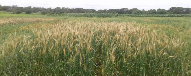
On wheat farms in the U.S. and Russia, it's a drought that's ruining harvests. The soybean fields of Brazil are bone dry too, touched by little more than the occasional shower. In Vietnam, Malaysia and Indonesia, the problem is the exact opposite. Torrential downpours are causing flooding in rice fields and stands of oil palm trees.

The sudden emergence of these supply strains is a big blow to a global economy that has been struggling to regain its footing after the shock of the Covid-19 lockdowns. As prices soar on everything from sugar to cooking oil, millions of working-class families that had already been forced to scale back food purchases in the pandemic are being thrust deeper into financial distress.

What's more, these increases threaten to push up broader inflation indexes in some countries and could make it harder for central bankers to keep providing monetary stimulus to shore up growth.

The Bloomberg Agriculture Spot Index, a gauge of nine crop prices, has risen 28% since late April to its highest level in more than four years. Wheat earlier this week was the most expensive since 2014.

"The fundamentals have changed dramatically since May," said Don Roose, president of brokerage U.S. Commodities in Iowa. "The weather is bubbling to the top, and we have demand chugging in a bull market."

The fallout from the pandemic means that the United Nations was already warning of a worst-case scenario in which about a tenth of the world's population would go hungry this year. Things could become more dire if grocery costs keep rising and even more people can't afford to eat.

"It's looking very bleak," said David Beasley, executive director at the World Food Programme, the hunger-fighting group that won the 2020 Nobel Peace Prize. Declining currencies in food-importing nations, the threat of more economic shutdowns and struggles for farmers to expand production could all compound the problem, he said.

"You start adding all these things together and you begin to almost run around like, 'The sky is falling, the sky is falling,' but it ain't chicken little," Beasley said.

Mangled supply chains and a flood of buying already sent food prices higher in many countries earlier this year as Covid-19 lockdowns disrupted global trade. But even then, there was an ample cushion of grain stockpiles and Northern Hemisphere harvests were expected to be bountiful. Then came the dry weather.

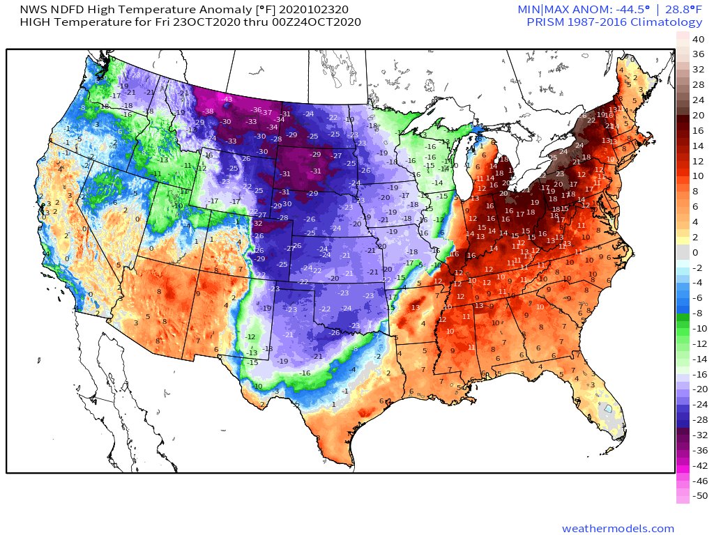
Climate scientists have long warned that an increase in unpredictable and extreme weather patterns would be a growing threat to crop production and food security. Now, we are experiencing what it means to be living in a climate-disrupted world as wildfires blaze across the U.S. West, hurricane season grows more ferocious and forecasters say that 2020 could be the world's hottest year on record.


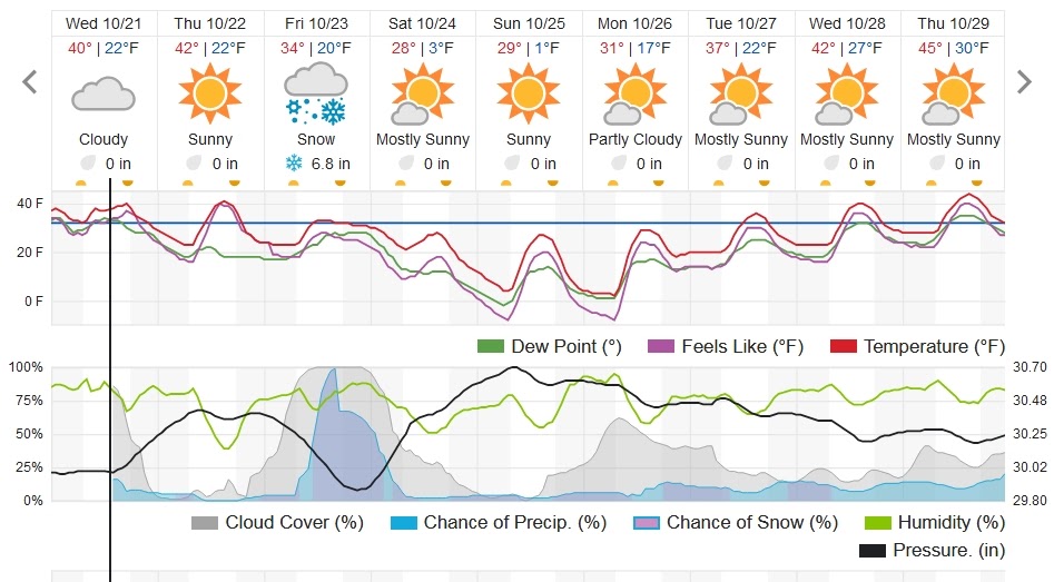
Comment: Yet earlier this year 'Arctic April' gripped North America breaking hundreds of all-time cold records.


Antonio Carlos Simoneti, a fourth-generation orange grower in Brazil, is seeing the change firsthand. With drought and heat plaguing his lands in Sao Paulo state, the world's top region for orange juice production, the river that usually snakes across his property has vanished. That's the first time that's happened since his family acquired the farm 36 years ago. Oranges on his 500-hectare (1,236-acre) grove are drying up inside and becoming crystallized, as the trees suck all the water from the fruit to try to survive the parched conditions.

After making some sales earlier in the season, "I don't have more fruits to sell," said Simoneti, who expects his harvest to drop about 50% this year because of the weather. "What remains on the trees are dried, without water inside."

Shopping Spree

It's not just the weather sparking higher crop prices.

Agricultural commodity buyers from Cairo to Islamabad have been on a shopping spree as nations try to protect themselves from more disruptions to supply chains, like those seen earlier this year when lockdowns left food stranded at ports, sparked trucking delays and created logjams at warehouses.

Residents pick tangerines out of a waste bucket
Residents pick tangerines out of a waste bucket at the CEASA market and distribution center in Rio de Janeiro, Brazil, on Monday.

A weaker real is boosting prices even further in agriculture superpower Brazil, where soybeans are up 81% and corn 56% this year, also raising costs for chicken and pork production. As an emergency measure, local government has temporarily removed import tariffs for soybeans, corn, rice and wheat to control food inflation.

Jordan has built up record wheat reserves while Egypt, the world's top buyer of the grain, took the unusual step of tapping international markets during its local harvest and has boosted purchases by more than 50% since April. Taiwan said it will increase strategic food stockpiles and China has been buying to feed its growing hog herd.

The last protracted runup in food prices back in 2011 helped contribute to uprisings in the Arab Spring. That said, prices have a long way to climb before reaching those levels. Also, a bumper crop in Australia may help to fill the supply gap.

That growth in demand helps to explain why prices are moving higher despite a still-hefty inventory cushion. Global reserves of wheat, for example, are forecast to reach a record this year. Those supplies could eventually help to bring food inflation back in check if concerns over weather problems start to die down.

That would be welcome relief for people like Doan Cam Chi, a Ho Chi Minh City working mom. She estimated she's spent about 30% more on food bills this year for her 5-member family. She's seen pork prices decrease this month, but things like rice, cereals and fruits are still up from last year.

"I just can't trim food expenses as my kids are in their growing years," she said.

Meanwhile, at a market in the city, 50-year-old produce seller Le Thi Giang was just an hour away from closing on a recent morning, but her stall was still full of unsold spinach, pineapples, pumpkins, green beans and carrots. Ongoing torrential rains and flooding in key growing areas mean that prices for fruit and vegetables are fetching as much as double what they were pre-pandemic. At these higher costs, many people can't afford to buy what they need for a healthy diet, she said.

"I have to call and invite people into my stall, something I had never done before," said Giang, who has been selling at the market for two decades.

The recovery in prices after years in the doldrums has been welcome news for farmers in the U.S., who have relied more on government aid to balance the loss of income due to tariffs and trade wars.

"To see demand be so strong right now for a lot of commodities is a welcome sign," Kevin Ross, an Iowa farmer and chairman of the National Corn Growers Association, who grows corn and soybeans in southwest Iowa, said Tuesday in a telephone interview. "Right now exports are just on fire."

-With assistance from Michael Hirtzer, Isis Almeida, Niu Shuping, Souhail Karam, Ruth Olurounbi, Sybilla Gross, Dominic Carey and Kim Chipman.

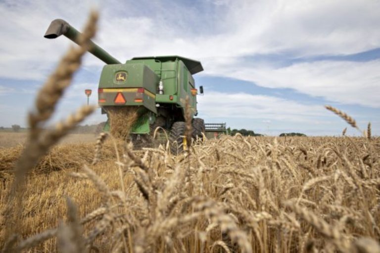
About the photo: A Deere & Co. combine harvester is used to harvest soft red winter wheat in Kirkland, Illinois, U.S., on Friday, July 17, 2020. U.S. winter wheat production is forecast at 1.22 billion bushels, down 4% from the June 1 forecast and 7% below 2019.


Comment: See related articles:
 

TxGal

Day by day

Snowstorm breaks 120-year-old record for most snow in October in the Okanagan region, British Columbia

Darrian Matassa-Fung
Global News
Fri, 23 Oct 2020 12:39 UTC

Snow
Snow in Kelowna

A 120-year-old record for most snowfall on an October day has been broken in Kelowna.

The previous record was 12.7 cm in 1899, according to Environment Canada.

Kelowna is currently sitting at around 13 cm of snowfall for the day.

And in Penticton, the South Okanagan city matched a 95 year-old record at 11 cm of snowfall.


View: https://youtu.be/DBIfCEh9Iq0


Residents were up bright and early, shovelling and just enjoying the early wintery day.

"The first time you wake up to this is awesome. I think it's awesome," said West Kelowna resident Ivo Damme.

Damme and his son were out walking their dog, and he says the early winter weather is not a problem for him.

"No, just slow down a bit (when driving), and enjoy the weather. This is gorgeous," said Damme.

Global Okanagan meteorologist Peter Quinlan gave us an update on the region's snow storm.

"We've got this moisture-laden low pressure system passing by the south of the region, and an arctic front pushing in from the north," explained Quinlan.

"The moisture associated with that system is being squeezed out as snow because temperatures from the ground level right up into the mid-levels of the atmosphere are below freezing."

The City of Kelowna has issued a warning, cautioning that the heavy snowfall can lead to hazards such as snow-laden branches and even entire trees that could fall.

That's because fall leaves are still left on trees.
 

TxGal

Day by day
Adapt 2030 has a new podcast out:

View: https://www.youtube.com/watch?v=qtbkhYSy7R0


How is Corporate Media Missing This ?
12,185 views • Premiered 7 hours ago

Run time is 12:16

Synopsis provided:

40F below normal temperatures with record doubling snowfalls expected and already occurring across N. America. USA passes new legislation focused on "Space Weather" and protecting electrical infrastructure and the USDA already indicating this years harvest totals are incorrect and the agency will adjust next year.
 
Top