
You are using an out of date browser. It may not display this or other websites correctly.
You should upgrade or use an alternative browser.
You should upgrade or use an alternative browser.
Solar Grand Solar Minimum part deux
- Thread starter Dennis Olson
- Start date
-
- Tags
- grand solar minimum
TxGal
Day by day

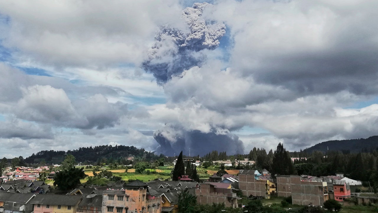
Sinabung Volcano Fires Thick Ash 30,000 ft (9.1 km) a.s.l., turning the sky BLACK in the middle of the day - Electroverse
Particulates ejected to around these levels -and so into the stratosphere- can have a direct cooling effect on our planet. #GSM
SINABUNG VOLCANO FIRES THICK ASH 30,000 FT (9.1 KM) A.S.L., TURNING THE SKY BLACK IN THE MIDDLE OF THE DAY
AUGUST 10, 2020 CAP ALLON
Sumatra’s highly active Sinabung Volcano has exploded again today, Aug 10, firing volcanic ash into the atmosphere.
The Volcanic Ash Advisory Center (VAAC) Darwin is warning of a thick ash plume rising to at least 30,000 feet (9.1 km) — particulates ejected to around these levels –and so into the stratosphere– can have a direct cooling effect on our planet.
View: https://twitter.com/SVNewsAlerts/status/1292681511045603328
View: https://twitter.com/nowletmetellya/status/1292721789643169792
Videos are emerging across social media showing the thick ash completely blocking the Sun’s light — the below footage was apparently shot at midday:
View: https://twitter.com/mozzaic_/status/1292688412835745792
“It was very dark, it felt like the night was due to dust, until now the house lights are still on,” said Teran Sembiring, a resident of Naman Village.
“Because of the eruption, our village was dark and residents did not dare to leave the house,” he continued.
SV News reports that these plumes of ash are “insanely massive”.
Adding that just before the volcano erupted locals said that it “rained dust”:
View: https://twitter.com/SVNewsAlerts/status/1292681511045603328
Monday’s eruption follows the moderate phreatic explosion which occurred at 01:58 local time on Aug 8, in which alerts were issued warning ballistic impacts of volcanic bombs and pyroclastic flows could impact an area up to 5km from the volcano.
Sinabung woke in 2010 after centuries of quiescence, according to volcano.si.edu, with it’s eruptive phase that year registering as a 2 on the Volcanic Explosivity Index (VEI). However, 2010’s phase turned out to be just a precursor to the long, powerful episode which began on Sept 5, 2013 and didn’t end until Jul 15, 2018 — qualifying as a VEI 4.
View: https://twitter.com/nuicemedia/status/1292666021057241098
Mount Sinabung re-exploded back into life in early May, 2019, with this latest eruption ranking as the largest in years, and coming just 2 weeks after the previous 50,000+ feet ejection, on May 25.
Sinabung is certainly one to watch as we continue our descent into this next Grand Solar Minimum — it appears more than capable of producing a powerful VEI 6+, which would result in a dramatic cooling of the planet, almost overnight.
BACKGROUND
Stratovolcano: 2460 m / 8,071 ft
Sumatra, Indonesia: 3.17°N / 98.39°E
Current status: ERUPTION WARNING
Eruption list: 0810 ± 70 years, 2010, 2013-2018, 2019-ongoing
For more see VolcanoDiscovery.com
Seismic and Volcanic activity has been correlated to changes in the Sun.
The recent global uptick in earthquakes and volcanic eruptions is likely attributed to the drop-off in solar activity, coronal holes, a waning magnetosphere, and the increase in Galactic Cosmic Rays penetrating silica-rich magma.
Check out these link for more info:
https://principia-scientific.org
https://www.researchgate.net
TxGal
Day by day

Largest Earthquake in 104 Years Strikes North Carolina - Grand Solar Minimum - Electroverse
The 5.1 magnitude registered by the USGS on Sun, Aug 9 has officially gone down as NC's biggest rocking since 1916 (the Centennial Minimum).
LARGEST EARTHQUAKE IN 104 YEARS STRIKES NORTH CAROLINA — GRAND SOLAR MINIMUM
AUGUST 10, 2020 CAP ALLON
With all that’s going on in 2020, it’s easy to understand how our ancestors prescribed every Earthly doing to myth and superstition (AGW much?). No doubt, North Carolina’s recent M5.1 earthquake would have brought about the hasty-sacrifice of a goat or two.
The 5.1 magnitude registered by the USGS on Sun, Aug 9 has officially gone down as NC’s biggest rocking since 1916 (the Centennial Minimum).
And today, just as was the case 104 years ago, the Sun’s output is at historically low levels, meaning Cosmic Rays are at historically high levels–“the highest in thousands of years,” according to Diamond from the OPR.
As long-predicted by Diamond, “more and more cratonic earthquakes [are occurring] in stranger and stranger places … as we descend deeper, and deeper into Grand Solar Minimum territory.”
View: https://twitter.com/IRIS_EPO/status/1292498723323424768
Sunday’s powerful quake fell on the Appalachian Fault Zone, which is directly connected to the New Madrid Zone — the likely home of the next city-crumbling biggie.
View: https://twitter.com/business/status/1292688170790912002
Seismic and Volcanic activity has been correlated to changes in our sun.
The recent global uptick in earthquakes and volcanic eruptions is likely attributed to the drop-off in solar activity, the increase in coronal holes, a waning magnetosphere, and the influx of Cosmic Rays penetrating silica-rich magma.
Check out these link for more info:
https://principia-scientific.org
https://www.researchgate.net
TxGal
Day by day
SOTT Earth Changes Summary - July 2020: Extreme Weather, Planetary Upheaval, Meteor Fireballs -- Sott.net
July 2020 saw record volumes of rainfall, killing hundreds of people, leaving millions displaced or homeless, and destroying crops around the world. Asia seemed to get the worst of it, with extreme monsoon rain and consequential flooding killing...
 www.sott.net
SOTT Earth Changes Summary - July 2020: Extreme Weather, Planetary Upheaval, Meteor Fireballs
Sott.net
Sun, 09 Aug 2020 17:12 UTC
As the solar minimum deepens, all the electrical phenomena are increasing in amount and intensity, and we had another month of record amounts of water pouring down affecting millions and destroying crops around the world.
East Asia got the worst in July, extreme monsoon rain and the consequential floods and landslides affected tens of millions, displaced thousands and killed hundreds of people in China, Nepal, Bangladesh and India.
China continues to battle the worst floods in decades as the water level of 433 rivers is above the flood control line with 33 of them reaching record highs. Heavy rains lashed 27 of the country's 31 provinces, affecting more than 37 million people and leaving 141 dead or missing so far.

South Korea continues to suffer its wettest monsoon in recent history, at least 15 people died and more than 1,500 have been evacuated. About 1,300 houses are reported to have been submerged or buried in landslides across the country, and 1,000 roads and bridges have been destroyed or damaged.
Heavy rain and floods continue to ravage Assam, India since May, affecting 2 to 3 million in 27 districts, claiming the lives of more than 100 people and destroying crops. Over 2,400 villages submerged.
After two weeks of heavy rains, flash floods washed away houses, farms, roads and electricity and water lines in Yemen. Thousands have been left homeless and at least 14 have died.
Heavy rains and floods also affected parts of the US Midwest and Southeast, meanwhile, the tornado season has been prolonged another month, with cases of multiple tornadoes at the same time. Ontario, Alberta and Saskatoon, Canada, also experienced multiple tornadoes, something that is becoming more common, even in places where they are supposedly rare.
Snow continues with its off-season displays, 1 foot of snow and -7C degrees temperatures chilled Noway, and China got a fair share despite it being summer.
In the Southern hemisphere, the Andes recorded a historic record of 17 feet of snow; The Snowy Mountains in Australia reported 40 inches and South Africa experienced a rare snowfall, something new to many locals.
Meteor fireballs gave us a very bright display this month, reminding us that we need to pay attention to the skies and "cosmic intentions".
At the same time, noctilucent clouds are becoming a common sight, perhaps indicating a more significant accumulation of charged particles in the upper atmosphere.
As a reminder:
Extreme weather continues to impact food production all over the world, and we can expect an increase in food prices sooner than later.The unbelievable amount of precipitation during the past months can be explained with the increasing amount of charged particles in the upper layers of the atmosphere.[...]
[...]Charged particles influence weather much more than has been appreciated.
All that and more in our SOTT Earth Changes Summary for July 2020:
Watch it also on Sott.net's Vimeo channel:
To understand what's going on, check out our book explaining how all these events are part of a natural climate shift, and why it is taking place now: Earth Changes and the Human-Cosmic Connection
Check out previous installments in this series - now translated into multiple languages - and more videos from SOTT Media here, here, or here.
TxGal
Day by day

Florida ocean current weakest in over a century -- Sott.net
A key component of the Gulf Stream has markedly slowed over the past century — that's the conclusion of a new research paper in Nature Communications published on August 7. The study develops a method of tracking the strength of near-shore ocean...
www.sott.net
Florida ocean current weakest in over a century
Woods Hole Oceanographic Institution
Fri, 07 Aug 2020 12:00 UTC
© Carol Anne Clayson, Woods Hole Oceanographic Institution
The new study uses a method of tracking the strength of near-shore ocean currents from a distance via measurements of coastal sea level.
A key component of the Gulf Stream has markedly slowed over the past century — that's the conclusion of a new research paper in Nature Communications published on August 7. The study develops a method of tracking the strength of near-shore ocean currents using measurements made at the coast, offering the potential to reduce one of the biggest uncertainties related to observations of climate change over the past century.
"In the ocean, almost everything is connected," said Christopher Piecuch, an assistant scientist in the Physical Oceanography Department at the Woods Hole Oceanographic Institution (WHOI) and author of the study. "We can use those connections to look at things in the past or far from shore, giving us a more complete view of the ocean and how it changes across space and time."
Piecuch, who specializes in coastal and regional sea level change, used a connection between coastal sea level and the strength of near-shore currents to trace the evolution of the Florida Current, which forms the beginning of the Gulf Stream. The Gulf Stream flows north along the Southeast Atlantic Coast of the United States and eventually east into the North Atlantic Ocean, carrying heat, salt, momentum, and other properties that influence Earth's climate. Because nearly continuous records of sea level stretch back more than a century along Florida's Atlantic Coast and in some parts of the Caribbean, he was able to use mathematical models and simple physics to extend the reach of direct measurements of the Gulf Stream to conclude that it has weakened steadily and is weaker now than at any other point in the past 110 years.
One of the biggest uncertainties in climate models is the behavior of ocean currents either leading to or responding to changes in Earth's climate. Of these, one of the most important is the Atlantic Meridional Overturning Circulation, or AMOC, which is a large system or "conveyor belt" of ocean currents in the Atlantic that includes the Gulf Stream and that helps regulate global climate. Piecuch's analysis agrees with relationships seen in models between the deeper branches of the AMOC and the Gulf Stream, and it corroborates studies suggesting that the deeper branches of AMOC have slowed in recent years. His method also offers the potential to monitor ocean currents like the Gulf Stream from the coast, complementing existing but difficult-to-maintain moored instruments and expensive research cruises.
"If we can monitor something over the horizon by making measurements from shore, then that's a win for science and potentially for society," said Piecuch.
Comment: See also:
- Gulf Stream is 15% weaker, region south of Greenland coldest in 1,000 years
- Scientists say a fluctuating jet stream may be causing extreme weather events
- Professor Valentina Zharkova explains and confirms why a "Super" Grand Solar Minimum is upon us
- Is the Gulf Stream about to collapse and is the new ice age coming sooner than scientists think?
- Extreme winter storms and wave heights have been increasing over the last 70 years in the Western Europe
- Mysterious, massive and deadly algae bloom 'whirlpool' discovered in the Baltic Sea
- Scientists warn of suffocating oceans as huge dead zones quadruple since 1950
BenIan
Veteran Member
Mount Sinabung volcano in Indonesia erupts, sends column of ash more than 3 miles into the sky
A rumbling volcano in Indonesia erupted Monday, sending a towering column of ash more than 3 miles into the sky and raining down on nearby villages.
 www.foxnews.com
TxGal
Day by day
Many cold records broken in Russian Far East - Ice Age Now
“Summer is over in the Khabarovsk Territory” 10 Aug 2020 – In Chukotka in the early morning hours in Markovo the temperature dropped to -1.1°C, the new record low for the day. The previous record of -0.9°C was set in 1945. A record low temperature was also recorded in Kurilsk (Sakhalin Oblast)...
www.iceagenow.info
Many cold records broken in Russian Far East
August 10, 2020 by Robert
“Summer is over in the Khabarovsk Territory”
10 Aug 2020 – In Chukotka in the early morning hours in Markovo the temperature dropped to -1.1°C, the new record low for the day. The previous record of -0.9°C was set in 1945.
A record low temperature was also recorded in Kurilsk (Sakhalin Oblast). On August 9, the thermometer dropped to 5.9°C (I assume they mean minus 5.9C), down from the previous record of 0.7 degrees, observed in 1954.
There were also records in the Khabarovsk Territory. On August 9, with 7,9°C (Agaain, I assume they mean minus 9.9C) were recorded at Sovetskaya Gavan, the lowest of the previous absolute minimum of just 0.1 degrees, which has been maintained for 80 years since 1940.
“Summer is over in the Khabarovsk Territory”
9 Aug 2020 – In Khabarovsk in June, only 2-3 days were warm and, on average, the temperature of the month was almost 3 degrees below normal.
Next came August: In the last days the temperature dropped below from normal by 5-6 degrees. On August 9 in the Shantar Islands area the temperature dropped to -0.9°C, a new daily record. The last time it was so cold was 30 years ago, but even in 1990 the temperature did not go above zero, stopping at +0.6 degrees.
Новости погоды
Дальневосточная погода бьет рекорды по температуре: Метеоновости о погоде
TxGal
Day by day
Ice Age Farmer has a new podcast out this morning:
View: https://www.youtube.com/watch?v=P3O-lDvZTOI
DERECHO: Corn Crop Catastrophe, Grain Stores Destroyed, Food Prices (Developing)
11,438 views • Premiered 5 hours ago
Run time is 8:39
Massive "derecho" devastates US corn crop, with tens of millions of acres of corn affected. As well, many grain silos and elevators were destroyed, and with them tons of "on farm storage" -- what remains of the US Strategic Grain Reserve. Yields will be reduced for ALL of those acres, particularly where damage was severe or irrigation was destroyed.
TxGal
Day by day
View: https://twitter.com/Ethanol_Joe/status/1292918567252484096
View: https://twitter.com/SamSagnella/status/1293015166037229568
View: https://twitter.com/IceAgeFarmer/status/1293059431014391810
View: https://twitter.com/IceAgeFarmer/status/1293062229386878977
View: https://twitter.com/IceAgeFarmer/status/1293104810569302019
View: https://twitter.com/LeahYehudah_/status/1293059932829487105
TxGal
Day by day

Cold-Records Fall Across Far-Eastern Russia - Electroverse
The COLD TIMES are returning in line with historically low solar activity, cloud-nucleating Cosmic Rays, and a meridional jet stream flow.
COLD-RECORDS FALL ACROSS FAR-EASTERN RUSSIA
AUGUST 11, 2020 CAP ALLON
Record COLD has gripped far-eastern Russia since the beginning of August.
The early hours of Monday, August 10, 2020 saw the mercury in Markovo, Chutotka tumble to a frigid -1.1C (30.2F). This reading set a new record low for the day, pipping the previous record of -0.9C (30.4F) from 1945.
Note, the year 1945 lands within the depths of the solar minimum of cycle 17:

The year 1945 falls within solar min of cycle 17.
Climate is cyclic, never linear.
Furthermore, and preceding Monday’s record low in Markovo, the remote Russian town of Kurilsk, Sakhalin Oblast set a new all-time minimum temperature for the day on Sunday, August 9. According to hmn.ru, the thermometer in Kurilsk dropped to 5.9C (42.6F) which comfortably ousted the old record of 6.6C (43.9F) set back in 1954.
And again, after checking with the historical sunspot data (a great barometer for solar activity), we find the year 1954 also falls within a solar minimum, this time of cycle 18:
Adding to Markovo’s and Kurilsk’s, cold records were also set across the Khabarovsk Territory. On Aug 9, a chilly 7.9C (46.2F) was logged in Sovetskaya Gavan–the coldest August temperature taken here since records began 80 years ago.
And staying in Khabarovsk, it’s been a historically cold summer across the territory. In June, only 2 days saw a temperature reading above average, and by the end of the month, June came out at a whopping 3C below normal.
That Khabarovsk cold has persisted into August, too. Since the start of the month, the mercury has held some 5-6C below the norm across the region.
And finally, on Aug 9, Khabarovsk’s Shantar Islands suffered a minimum of -0.9C (30.4F)–a new daily record. The last time it got anywhere near this cold was 30 years ago, back in 1990–but even then, the mercury didn’t drop below zero, resting at comparatively mild at 0.6C (33.1F), reports hmn.ru.
The COLD TIMES are returning, the mid-latitudes are refreezing, in line with historically low solar activity, cloud-nucleating Cosmic Rays, and a meridional jet stream flow.
Even NASA agrees, in part at least, with their forecast for this upcoming solar cycle (25) seeing it as “the weakest of the past 200 years,” and the agency correlating previous solar shutdowns to prolonged periods of global cooling here.


Don’t fall for bogus, warm-mongering political agendas — prepare for the COLD — learn the facts, relocate if need be, and grow your own.
TxGal
Day by day

Yesterday, in the middle of Summer, Greenland Gained a Record-Smashing 4 Gigatons of Snow and Ice - Electroverse
Usually in mid-August, Greenland LOSES 4 Gts of snow & ice a day. Not yesterday, however -- on Aug 10, 2020, the ice sheet GAINED a record-smashing 4 Gts.
YESTERDAY, IN THE MIDDLE OF SUMMER, GREENLAND GAINED A RECORD-SMASHING 4 GIGATONS OF SNOW AND ICE
AUGUST 11, 2020 CAP ALLON
Usually in mid-August, Greenland’s surface mass balance (SMB) is LOSING 4 Gigatons of snow & ice a day. Not yesterday, however — on Aug 10, 2020, the ice sheet GAINED a record-smashing 4 Gigatons of global warming goodness (and just listen to the silence coming from the MSM, it has so much to say).
Before this year, the Greenland ice sheet had never grown anywhere-close to 4 Gigatons in any of the months of June, July, or August, according to DMI records (which go back to 1981). In addition, the DMI record books also reveal that yesterday’s 4 Gt GAIN smashed the previous mid-Aug record by over 2 full Gigatons.
Here are the latest (Aug 10, 2020) measurements:

[polarportal.dk]
Crucial to the survival of a glacier is its surface mass balance (SMB)–the difference between accumulation and ablation (sublimation and melting). Changes in SMB control a glacier’s long-term behavior, and are its most sensitive climate indicators (wikipedia.org).
Yesterday, Greenland’s SMB hit truly-historic levels for the time of year:

Blue line (Gt/day): total daily contribution to the SMB from the entire ice sheet. Grey line: mean value from 1981-2010 (DMI).
These astonishing gains add to those witnessed over the past few years.
The tide has turned in Greenland.
And that trend of GROWTH has ACCELERATED in 2020 — this is BIG news.
This is how GLACIERS build.
This is also how ICE AGES begin.
The COLD TIMES are returning, the lower-latitudes are refreezing, in line with historically low solar activity, cloud-nucleating Cosmic Rays, and a meridional jet stream flow. Even NASA agrees, in part at least, with their forecast for this upcoming solar cycle (25) seeing it as “the weakest of the past 200 years,” with the agency correlating previous solar shutdowns to prolonged periods of global cooling here.

Don’t fall for bogus, warm-mongering political agendas — prepare for the COLD — learn the facts, relocate if need be, and grow your own.
TxGal
Day by day

Powerful derecho storm wreaks havoc across US Midwest leaving 1.1 million without power -- Sott.net
A rare storm packing 100 mph winds has left more than 1.1 million Americans without power across the Midwest as it caused widespread destruction with blown over trees, flipped vehicles, property damage and several severe weather warnings as it...
www.sott.net
Powerful derecho storm wreaks havoc across US Midwest leaving 1.1 million without power
Lauren Edmonds
Daily Mail
Mon, 10 Aug 2020 21:01 UTC
© AP
A person surveys the damage from the roof of College Church in Wheaton, Illinois, after a severe storm toppled the church steeple on the campus of Wheaton College on Monday
A rare storm packing 100 mph winds has left more than 1.1 million Americans without power across the Midwest as it caused widespread destruction with blown over trees, flipped vehicles, property damage and several severe weather warnings as it turned toward embattled Chicago.
The derecho, a widespread weather system with a long line of storms packing high winds, descended upon the Central U.S. on Monday with wind speeds comparable to a major hurricane as it spent several hours tearing through parts of Iowa, Nebraska and Wisconsin.
The storm likely caused more widespread damage than a normal tornado, said Patrick Marsh, science support chief at the National Weather Service´s Storm Prediction Center in Norman, Oklahoma.
It´s not quite a hurricane. It has no eye and its winds come across in a line. But the damage it is likely to spread over such a large area is more like an inland hurricane than a quick more powerful tornado, Marsh said.
He compared it to a devastating Super Derecho of 2009, which was one of the strongest on record and traveled more than 1,000 miles in 24 hours, causing $500 million in damage, widespread power outages and several deaths.
The weather service´s Marsh said there´s a huge concern about power outages that will be widespread across several states and long lasting. Add high heat, people with medical conditions that require power and the pandemic, 'it becomes dire pretty quickly.'
In Iowa, roadways were littered with downed power lines as semi-trailer trucks were blown over and entire grain elevators demolished in the agriculture-heavy state.
Wind speeds in Nebraska topped 70 mph as massive trees crashed into residential homes.
Special Marine Warnings were issued in Wisconsin as the potential for water spouts was discovered in Lake Michigan.
The National Weather Service has issued a vast number of severe weather warnings throughout Monday to a number of cities.
View: https://twitter.com/BanhammersWrath/status/1292901476419895302
From 6 to 7pm, the agency released more than 20 of such warnings in at least four states, including Missouri, Illinois, Kansas, Oklahoma, Indiana and Michigan.
PowerOutage.us reports that more than 1,130,505 Americans are without power due to the powerful derecho as of Monday at 7pm.
Illinois has the highest number of customers without power at 570,756, while Iowa followed closely behind with 491,260.
'This is our version of a hurricane,' Northern Illinois University meteorology professor Victor Gensini said in an interview from his home about 15 minutes before the storm was about to hit.
Minutes later he headed to his basement for safety as the storm took aim at Chicago, starting with its suburbs.
Gensini said this derecho will go down as one of the strongest in recent history and be one of the nation's worst weather events of 2020.
'They are basically self-sustaining amoebas of thunderstorms,' Gensini said. 'Once they get going like they did across Iowa, it's really hard to stop these suckers.'
View: https://twitter.com/WeatherNation/status/1292921732341420032
'It ramped up pretty quick' around 7 a.m. Central time in Eastern Nebraska. I don't think anybody expected widespread winds approaching 100, 110 mph,' Patrick Marsh said.
Several people were injured and widespread property damage was reported in Marshall County in central Iowa after 100 mph winds swept through the area, said its homeland security coordinator Kim Elder.
She said the winds blew over trees, ripped road signs out of the ground and tore roofs off of buildings, including the roof of a hockey arena in Des Moines.
'We had quite a few people trapped in buildings and cars,' she said. She said the extent of injuries is unknown and that no fatalities have been reported.
Elder said some people reported their cars flipping over from the wind, having power lines fall on them and getting injured when hit by flying debris. Dozens of cars at one factory had their windshields blown out. Buildings have also caught on fire, she said.
'We´re in life-saving mode right now,' Elder said.
Photos shared by Des Moines residents show a city inundated by powerful gusts of winds that leveled several buildings and structures.
View: https://twitter.com/TylerJRoney/status/1292879388359327745
Vehicles and entire RVs were capsized onto their sides, a wooden outdoor patio was reduced to nothing more than wooden planks and a number of farms sustained damage.
A video shared by one Iowa resident showed a downed semi-trailer truck on a highway slick with rain. The truck, which was downed by mighty gusts of wind, had its emergency lights flashing as only a handful Iowans who braved the storm drove by.
The resident said her son and father helped the truck driver out of the vehicle and waited at the scene until emergency crews arrived. The driver is okay and no severe injuries were reported.
The Iowa Department of Transportation shared another photo of the semi-trailer truck and cautioned residents to avoid traveling during the derecho.
Farmers reported that some grain bins were destroyed and fields were flattened, but the extent of damage to Iowa's agriculture industry wasn´t immediately clear.
One farm door that measured 24'x18' was reportedly ripped off its hinges during the storm and was found more than 200 yards away.
In Collins, one woman's farm was pulled apart as two grain bins and seven hoop buildings were hit. She added that she would need to round up 800 farm pigs and find them new homes.
Marshalltown Mayor Joel Greer declared a civil emergency, telling residents to stay home and off the streets so that first responders can respond to calls.
Travel advisories were issued in the cities of Ankeny, Johnston, Boone and Perry, as well.

Social media photos shared by a Iowa resident showed part of a home's roof torn off, what appeared to be a damaged patio and debris littered everywhere
MidAmerican Energy said nearly 101,000 customers in the Des Moines area were without power after the storm moved through the area. Reports from spotters filed with the National Weather Service in Des Moines had winds in excess of 70 mph.
MidAmerican spokeswoman Tina Hoffman said downed trees are making it difficult in some locations for workers to get to the power lines. In some cases power line poles were snapped off.
'It´s a lot of tree damage. Very high winds. It will be a significant effort to get through it all and get everybody back on,' she said. 'It was a big front that went all the way through the state.'
Cedar Rapids, Iowa, has 'both significant and widespread damage throughout the city,' said public safety spokesman Greg Buelow.
'We have damage to homes and businesses, including siding and roofs damaged,' he said. 'Trees and power lines are down throughout the entire city.'
Buelow said residents should stay home so crews can respond to 'potentially life-threatening calls.' Tens of thousands of people in the metro area were without power.
In Nebraska, the storms raced east before 9am, dropping heavy rains and high winds. Strong straight-line winds pushed south into areas that include Lincoln and Omaha, National Weather Service meteorologist Brian Barjenbruch said.
'Once that rain-cooled air hit the ground, it surged over 100 miles, sending incredibly strong winds over the area,' Barjenbruch said.
Omaha Public Power District reported more than 55,500 customers without power in Omaha and surrounding communities. Several cities are still under Hazardous Weather Outlook advisories.
'There is a slight chance for an isolated storm in the overnight hours tonight in far southeast Nebraska. Localized heavy rain would be the primary threat,' the National Weather Service wrote.
From Tuesday to Sunday, 'There is a chance for storm activity on Wednesday and Thursday. Severe potential will be limited,' in Nebraska.
A summary of the derecho's affect on Nebraska showed that the city of Bennington had the highest wind speeds at 77mph, followed by Little Sioux at 70mph.
Much of the area experienced widespread tree damage, especially in 'orange shaded areas.'
A severe thunderstorm warning was issued in Omaha, but it was dismissed later in the day as the storm rolled out of the state and into Illinois.
What makes a derecho worse than a tornado is how long it can hover one place and how large an area the high winds hit, Marsh said. He said winds of 80 mph or even 100 mph can stretch for '20, 30, 40 or God forbid 100 miles.'
'Right now, it´s making a beeline for Chicago,' Marsh said Monday mid-afternoon. 'Whether or not it will hold its intensity as it reaches Chicago remains to be seen.'
But the environmental conditions between the storm and Chicago are the type that won´t likely diminish the storm, Marsh said. It will likely dissipate over central or eastern Indiana, he said.
View: https://twitter.com/NStewCBS2/status/1292912898277244929
But as of Monday evening, Chicago has been inundated with strong winds, persistent rain and several instances of property damage.
The damage that came with the derecho followed vandalism from Sunday night as scores of Chicagoans looted stores downtown.
The long night saw more than 100 arrests, attacks on 13 police officers and widespread unrest.
Cars plowed through storefronts to give the crowds easy access and despite there being 400 officers dispatched to the area, the cops struggled to keep up with the crowds.
One officer was attacked with a bottle, another had his nose broken and a group of different officers were shot at by drive-by assailants while trying to arrest other looters. On Monday morning, police were still arresting people at a Best Buy which was among the stores that had been ransacked. Some of the city's bridges were raised and tunnels were closed while police tried to regain control of the situation.
'It was still a rather impressive storm,' weather service meteorologist Bryan Leatherwood told the Chicago Tribune.
'We're getting tons of reports of downed large trees and power lines down, and debris thrown through the walls of houses.'
Footage shared by the agency showed wind lifting pieces of debris into the air at a Chicago park after a tornado warning was implemented.
One Chicago resident shared a photo of the storm floating over the city, with ominous dark clouds shrouding downtown buildings.
View: https://twitter.com/ChiPhotoGuy/status/1292944586730610688
Winds up to 100mph sent debris and trees from a Chicago farm 200 to 300 yards into the field.
A building under construction partially collapsed during the storm and a steeple on College Church, near Wheaton College, collapsed.
In Lincoln Park, a large tree was pushed over by the wind and fell atop a parked van.
Lucas Seiler told the Chicago Tribune he had just arrived home and views a tornado warning on his phone when the incident happened.
'I heard this crackling noise, and down came a huge tree which I loved,' said Seiler. 'It's massive. You can see the roots tore up the brick that was on the ground.'
In Naperville, more than than 300 homes had to be restored with power and the city's transportation lines were having service disruptions.
At 4pm, the National Weather Service warned residents that wind gusts speeds were increasing in several areas. The Aurora Airport in Sugar Grove recorded 54 mph and DuPage Airport found gusting up to 60mph.
A forecast predicts that the rain will disappear mid-week before returning on Friday and Saturday for the weekend.
Associated Press
Comment: Severe storms bring tennis ball-size hail, damaging winds, torrential rain to Minneapolis - Saint Paul
http://www.addthis.com/bookmark.php
TxGal
Day by day
All, there are many more articles on massive flooding throughout the world, far too many to post. Please go to the Sott.net link to read them:
www.sott.net
Earth Changes -- Sott.net
News category 'Earth Changes' on Signs of the Times: The World for People who Think
www.sott.net
TxGal
Day by day
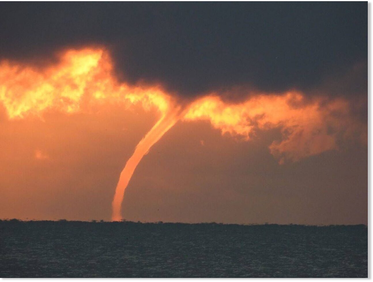
Record outbreak of 84 waterspouts last week over the Great Lakes -- Sott.net
In the Great Lakes region we can get set for what I call waterspout season. The summer weather leading up to today could lead us into a banner waterspout season. As of last week, we've already seen a record amount of waterspouts. The waterspout...
www.sott.net
Record outbreak of 84 waterspouts last week over the Great Lakes
Mark Torregrossa
MLive
Mon, 10 Aug 2020 13:24 UTC
© Jeffrey Paul
Waterspout over Lake Erie, off of Lorain, Ohio on Wednesday, August 5, 2020.
In the Great Lakes region we can get set for what I call waterspout season. The summer weather leading up to today could lead us into a banner waterspout season. As of last week, we've already seen a record amount of waterspouts.
The waterspout set-up is pretty simple, and very similar to a lake-effect snow situation. Cold air aloft blowing over warm water surfaces, with some added switching of wind directions, and we have the makings of a waterspout outbreak.
This happened last week over the Great Lakes. The cold air aloft is heavy. The warm air rises off the Great Lakes surfaces. If a wind shift line blows through an area, some rotation is started. A waterspout is born.
The International Centre For Waterspout Research (ICWR) has reported seven days in a row of waterspouts on the Great Lakes. They have been calling this past week "the Great Waterspout Outbreak of 2020." Today the ICWR has declared a record number of waterspouts for last week. There were 84 waterspouts last week, with the old record being 67 waterspouts in 2013.
The outbreak of waterspouts is winding down for now, since warmer temperatures aloft are on the way. Again it's exactly the same as when lake-effect snow diminishes as warmer air moves in.
The International Centre For Waterspout Research runs a forecast model. Here is the model run from last Friday showing a small area of western Lake Erie would be the place for waterspouts. The modeling worked out to be accurate.
On Wednesday, August 5, 2020, the ICWR counted 42 waterspouts, mostly on Lake Erie and one over Lake Ontario. The ICWR says their daily record tally of waterspouts is 67 back in October of 2013. There have also been waterspouts on Lake Michigan this week.
TxGal
Day by day
Adapt 2030 has a new podcast out:
View: https://www.youtube.com/watch?v=apjKgJfIps4
The Australia Anomaly (1026)
13,061 views • Premiered 9 hours ago
Run time is 14:38
Tasmania records coldest ever recorded temperature but it was colder that day in Tasmania than Antarctica, during winter. Third Atmospheric river sweeps the continent bringing overtopping dams, record cold and repeating snow cycles from 1882. In the Andes mountains 13 feet of snow fell which was beyond anything ever seen as South Africa piled on hundreds of new all time record cold events.
TxGal
Day by day
All this is a MUST WATCH podcast!! I finally got to listen to it for the second time to be sure I was understanding what he said. It is BAD.
Ice Age Farmer has a new podcast out:
View: https://www.youtube.com/watch?v=3r5ZLq6QYOc
States Secretly Stockpiling Food for Need Ahead - "To the Roof!"
14,465 views • Aug 11, 2020
Run time is 8:34
Washington State has been stocking away millions of dollars of non-perishable food -- so have other US states, and the federal government -- in anticipation of "the need ahead." If states are preparing, so too must you be today. And spread the word.
Ice Age Farmer has a new podcast out:
States Secretly Stockpiling Food for Need Ahead - "To the Roof!"
14,465 views • Aug 11, 2020
Run time is 8:34
Washington State has been stocking away millions of dollars of non-perishable food -- so have other US states, and the federal government -- in anticipation of "the need ahead." If states are preparing, so too must you be today. And spread the word.
Last edited:
TxGal
Day by day
The Oppenheimer Ranch Project has a new podcast out:
View: https://www.youtube.com/watch?v=_-pQSD-bioE
The “Flat Corn” Derecho of August 10, 2020 - Crop Loss, Tornadoes, Solar Uptick - Stromboli Boom!
3,522 views • Premiered 7 hours ago
Run time is 19:32
Derecho leaves more than 1 million without power in Midwest https://cnn.it/2DRyWAO
The “Flat Corn” Derecho of August 10, 2020 https://bit.ly/2PM5YEU
7 tornadoes touched down in Chicagoland area https://bit.ly/31DfOP6
Power Outage US https://poweroutage.us/
Derecho leaves 2 dead, heavy crop damage in Midwest https://bit.ly/2DJkFX1
This is just a sampling of many cornfields across Iowa after the derecho moved through today. https://twitter.com/TylerJRoney/statu...
Critical Fire Weather Threats in the West; Storms in the High Plains; Flash Flood Risk in the Mid-Atlantic https://www.weather.gov/
TROPICAL DEPRESSION ELEVEN https://bit.ly/3gQrnZJ
Worldwide Volcano News https://www.volcanodiscovery.com/volc...
Etna volcano - eruption update https://www.volcanodiscovery.com/etna...
Space Weather Update https://services.swpc.noaa.gov/text/d...
Solar Flares - GOES X-Ray Flux https://www.swpc.noaa.gov/products/go...
Solar Ham HMI https://www.solarham.net/regions/ch_a...
Arctic Ice Thickness https://bit.ly/2Chyawi YESTERDAY, IN THE MIDDLE OF SUMMER, GREENLAND GAINED A RECORD-SMASHING 4 GIGATONS OF SNOW AND ICE https://bit.ly/3kDCSGf
Greenland SMB https://bit.ly/3kvyo4p
Stronger Rains in Warmer Climate Could Lessen Heat Damage to Crops https://bit.ly/3ipL0rU
Past evidence supports complete loss of Arctic sea-ice by 2035 https://bit.ly/3kEHrzR
Dwarf planet Ceres is an 'ocean world' with sea water beneath surface https://bit.ly/2DVinE5
TxGal
Day by day

[VIDEO] New South Wales Kangaroos go Toe-to-Toe in the Snow during Record-Breaking Antarctic Blast - Electroverse
An Antarctic blast has brought record-breaking low temps and blizzard conditions to Australia this August -- and there's much more where that came from.
[VIDEO] NEW SOUTH WALES KANGAROOS GO TOE-TO-TOE IN THE SNOW DURING RECORD-BREAKING ANTARCTIC BLAST
AUGUST 12, 2020 CAP ALLON
An Antarctic blast has brought record-breaking low temperatures and blizzard conditions across much of Australia this August, according to the Bureau of Meteorology — and even the kangas appear to have had their fill of it.
The heavy snowfall in New South Wales over recent days led to one lucky local capturing a pair of kangaroos going toe-to-toe in the driving snow:
Runtime is 2:19
Wendy Lindsey described her video –shot at Mount Jerrong, just west of Sydney– as a “magical moment” and a “unique Aussie experience.”
She told Storyful that while male kangaroos are known to fight during mating season, the length of this bout –and in-particular it occurring during a heavy bout of snow– made it a particularly special sight.
“Nothing beats a good kanga fight when there’s nothing on the tele,” said Wendy.
MUCH MORE WHERE THAT CAME FROM
Looking forward, another blast of polar cold is expected to engulf the western half of Australia on Aug 18, and is set to shift east over the following days:

GFS 2m Temp Anomalies (C) — Aug 18 [tropicaltidbits.com]

GFS 2m Temp Anomalies (C) — Aug 19 [tropicaltidbits.com]
Then, to close-out the month, another more-intense mass of Antarctic air is forecast to grip the Aussie continent during the final week August:

GFS 2m Temp Anomalies (C) — Aug 27 [tropicaltidbits.com]
The COLD TIMES are returning, the mid-latitudes are refreezing, the kangaroos are fighting, all in line with historically low solar activity, cloud-nucleating Cosmic Rays, and a meridional jet stream flow.
Even NASA agrees, in part at least, with their forecast for this upcoming solar cycle (25) seeing it as “the weakest of the past 200 years,” with the agency correlating previous solar shutdowns to prolonged periods of global cooling here.
Don’t fall for bogus, warm-mongering political agendas.
Prepare for the COLD — learn the facts, relocate if need be, and grow your own.
TxGal
Day by day
Brazil - Historical cold three days in a row - Ice Age Now
The month of August continues to surprise mainly for those who like very cold, as it registered frosts in negative temperatures every day of this month. In South Brazil High Mountains (Serra Catarinense) registers historical cold (record cold) with three consecutive days at the -8º mark. In Bom...
www.iceagenow.info
Brazil – Historical cold three days in a row
August 12, 2020 by Robert
The month of August continues to surprise mainly for those who like very cold, as it registered frosts in negative temperatures every day of this month.
In South Brazil High Mountains (Serra Catarinense) registers historical cold (record cold) with three consecutive days at the -8º mark.
In Bom Jardim da Serra the Keizer stations network scored -8.8°C.
In fact Serra Catarinense has been registering negative temperatures since June 29th consecutively.
“Intense cold in the coldest cities of the Serra Catarinense like São Joaquim, Bom Jardim, Urupema.”
Serra Catarinense registra frio histórico com três dias seguidos na marca de -8º
Thanks to Martin Siebert for this link
Martinhouse
Deceased
I just listened to Ice Age Farmer's latest short video a couple more times and, TxGal, bad isn't the word for it! It got worse each time I listened, and it was awful the first time.
Now, after the third listen, I'm wondering how I might afford to expand my greenhouse!
Now, after the third listen, I'm wondering how I might afford to expand my greenhouse!
Last edited:
TxGal
Day by day
I just listened to Ice Age Farmer's latest short video a couple more times and, TxGal, bad isn't the word for it! It got worse each time I listened, and it was awful the first time.
Now, after the third listen, I'm wondering how I might afford to expand my greenhouse!
That was a shocker for me, too, but it sure does explain a lot. I also posted about the podcast on the food shortages thread with a link to this thread....it might answer some questions for members who don't spend time on the GSM thread.
I haven't forgotten about you!! Beyond crazy busy (health, both good here, but you know what's going on; refrigerator that died months after we bought it and our joys of dealing with GE; having pasture work done for us; etc...). We lost an older chicken over the weekend, I think due to the heat. Our heat index must be near 110+, despite all we do to help maintain coolness, we've been this hot for a while. I have one chicken in the house now trying to get her to recover from the heat (exhaustion, I think)...not sure she'll make it. Several others I got to the front porch in the shade with cool water and a good breeze, they are doing better. In all our years, this stretch of weather has been the hardest on the hens.
Garden is playing out now, the heat is doing everything in. Trying to keep the fruit trees alive now. They just bake in the heat.
Last edited:
Martinhouse
Deceased
TxGal, my fridge died a few weeks ago but the upper freezer was still freezing and the blower was still working. With the summer humidity, I had to scrape off frost about every third day and then the freezer still made ice and kept other stuff frozen. That changed about two or three days ago. The freezing stopped, and then yesterday the whole thing started drooling all over the floor. I believe that frost built up inside of the works and when the unit stopped working entirely, all that frost began to thaw. I'd given up cleaning the lower part, as it became totally infested with breeding fruit flies. So all that melt water smelled as bad as the fruit flies and their offspring did in the lower poart of the fridge.
I did get it all mopped up today and it seems to be nearly done drooling. I'll be glad when I can get it hauled out of here, but that will be a while yet. Thank goodness for the little dorm fridge loaner which keeps a few things cold and is making ice cubes for me!
I just spent the last week canning and dehydrating the meat from my chest freezers and after I rest for a day, I'll start canning fruit and then juice. After that I won't worry so much about losing power if the worst should happen. If I have the time and energy, I might make some split pea soup and also some chili bean soup. I don't mind canning since I don't seem to feel the heat much any more. And it is always nice to have food that just requires opening a jar and heating. In cold weather I can heat it by placing it in front of my space heater.
Tomorrow needs to be catch-up day. Canning makes me neglect daily chores. And I think I'd best see if the feed store has corn. If they do, I'd probably best go get enough to last the winter for my chickens.
Thanks, as always, for posting all the great videos and articles on this thread. I haven't been keeping up with them like I used to and hope to get back to my more normal routine soon.
TxGal
Day by day
Oh my gosh, I totally feel your pain about the fridge!
You've been pretty darn crazy busy yourself :-) A lot of the things you're thinking of/doing are things that I am, too. There isn't enough time in the day, and the heat makes it harder. I have a bit of a routine in posting, it does help, but honestly sometimes I have to read/listen to things several times throughout the day before the message truly sinks in, just a lot going on here. Throw in the craziness of the world around us all, and it's just strength and conviction that is keeping us all going.
I'm going to be a little late in posting tomorrow morning, but I'll get to it ASAP.
Martinhouse
Deceased
Firebird, the trees around my house have been dropping their leaves all summer, one type more so than the other. I've been noticing this for about three years now. My sis about a mile up the road from me is seeing the same thing in her yard.
We are in the north western part of central Arkansas, just a little above I-40.
We are in the north western part of central Arkansas, just a little above I-40.
All this is a MUST WATCH podcast!! I finally got to listen to it for the second time to be sure I was understanding what he said. It is BAD.
Ice Age Farmer has a new podcast out:
View: https://www.youtube.com/watch?v=3r5ZLq6QYOc
States Secretly Stockpiling Food for Need Ahead - "To the Roof!"
14,465 views • Aug 11, 2020
Run time is 8:34
Washington State has been stocking away millions of dollars of non-perishable food -- so have other US states, and the federal government -- in anticipation of "the need ahead." If states are preparing, so too must you be today. And spread the word.
That video explains a lot and really it deserves it's own thread on the main here with a proper header explaining what's it's about. Some time after 9-11 word got out that FEMA was stockpiling tons of MRE meals and stashing it away in warehouses and old underground mines that the government uses to storage.
Zahra
Veteran Member
I have plum trees and my neighbor has cherry, apple, and pear trees. This year they produced an amazing amount of fruit, but my neighbor and I both noticed that everything ripened almost a full month earlier than they normally do. I think that indicates winter is going to come sooner than normal this year (in Boise, Idaho).
With all the info you've shared about the extent of corn crop losses around the country I think I'll go buy my daughter some extra bags of feed for the chickens she keeps. This shortage of corn & silage is going to drive meat prices up further isn't it?
With all the info you've shared about the extent of corn crop losses around the country I think I'll go buy my daughter some extra bags of feed for the chickens she keeps. This shortage of corn & silage is going to drive meat prices up further isn't it?
Spoke with my buddy that does a fair amount of haying. In a normal year their first cutting is normally 12-14000 bales. This year they were at about 8-9000. Second cutting is normally 4-5000 bales. He said his lawn is longer than his fields and they wont get much of anything for a second cut this year. So they are going to be at half their average this year. Going to be some expensive hay up here this winter.
Martinhouse
Deceased
I just noticed a bunch of little pears hanging on the pear tree way out front where I never go any more. There are probably more on and under the other two trees as well.
Just what I need. More canning to do! After I find time to go pick up all the fallen pears and find enough pans and cookie sheets to spread them out to finish ripening.
Actually, this is just about the right timing. If I can add a bunch of my own little pears to the canned ones I'd planned to puree and get into little half-pints, I will have a lot more fruit from this canning session and it won't cost anything more than my time and effort.
I wish my nephew was already here working on my greenhouse again. His kids come with him and get bored. I could have them gather all the pears for me, every day that they'd be here. Oh, well.
TxGal
Day by day
That video explains a lot and really it deserves it's own thread on the main here with a proper header explaining what's it's about. Some time after 9-11 word got out that FEMA was stockpiling tons of MRE meals and stashing it away in warehouses and old underground mines that the government uses to storage.
Thanks, Publius, I wondered about doing that. I'll get to it in a bit and see if the Mods will let it stay on the Main since it's in two places already.
20Gauge
TB Fanatic
Heat and constant rain and insects are killing our garden this year. It feels (records say differently) like one of the hottest summers we have had in the last 20 years.That was a shocker for me, too, but it sure does explain a lot. I also posted about the podcast on the food shortages thread with a link to this thread....it might answer some questions for members who don't spend time on the GSM thread.
I haven't forgotten about you!! Beyond crazy busy (health, both good here, but you know what's going on; refrigerator that died months after we bought it and our joys of dealing with GE; having pasture work done for us; etc...). We lost an older chicken over the weekend, I think due to the heat. Our heat index must be near 110+, despite all we do to help maintain coolness, we've been this hot for a while. I have one chicken in the house now trying to get her to recover from the heat (exhaustion, I think)...not sure she'll make it. Several others I got to the front porch in the shade with cool water and a good breeze, they are doing better. In all our years, this stretch of weather has been the hardest on the hens.
Garden is playing out now, the heat is doing everything in. Trying to keep the fruit trees alive now. They just bake in the heat.
TxGal
Day by day

Historic August Cold Ravages Brazil + Another "Deadly" Antarctic Blast Forecast for Next Week - Electroverse
Bom Jardim registered -8.8C last Thurs - that made it the third consecutive day with a reading below -8C, the first time that's occurred anywhere in Brazil.
HISTORIC AUGUST COLD RAVAGES BRAZIL + ANOTHER “DEADLY” ANTARCTIC BLAST FORECAST FOR NEXT WEEK
AUGUST 13, 2020 CAP ALLON
Vast areas of Brazil are suffering a historically cold August thus far. In fact, Serra Catarinense (SE Brazil) has been registering consecutive negative temperatures since June 29, with no end to the run in sight.
All-time cold records have been busted in the southern municipality of Bom Jardim da Serra of late. The locals here are used to a chill –the city is one of the coldest in Brazil– but these past few days have been something else.
According to the Keizer station network, Bom Jardim registered a Brazil-nut-freezing -8.8C (16F) last Thursday. That made it the third consecutive day with a reading below -8C (17F), the first time that’s occurred anywhere in Brazil since record-keeping began, reports saojoaquimonline.com.br.
Click the link above for images of the intense frost, which has swept the cities of the Serra Catarinense, including São Joaquim, Bom Jardim, and Urupema.
Freezing conditions also hit the Vale dos Vinhedos, and the Vale da Invernadinha. Here, ponds and lakes froze, water pipes burst, and a considerable portion of the vegetation was blanketed in a thick frost.
blob:https://www.facebook.com/8b7cb9b5-e84a-461c-88c6-273e3bb3b872
“Cold — 10 days with sunrise below 0C in Serra Catarinense”
(Run time is 1:12)
Looking forward, the GFS reveals another extreme blast of Antarctic cold will kick northwards up the South American continent next week.
This one is shaping up to be even more intense than last week’s, and as ti stands is forecast to sink temperature a staggering 30 degrees Celsius below the seasonal average:

GFS 2m Temp Anomalies (C) Aug 20 – Aug 24 [tropicaltidbits.com]
By Weds/Thurs next week (Aug 19-20), much of Argentina will be hit, as will all of Uruguay, Paraguay, Bolivia, Peru, and a large section of southern Brazil.
These is a dangerous, potentially deadly setup.
Temperatures some 30C below the winter averages are a serious concern.
To all livestock farmers in the affected regions, heed the warnings, shed your sheep and cattle. To everyone else, wrap up and light the fire, for the COLD TIMES are returning, the mid-latitudes are refreezing, in line with historically low solar activity, cloud-nucleating Cosmic Rays, and a meridional jet stream flow.
Even NASA agrees, if you read between the lines, with their forecast for this upcoming solar cycle (25) revealing it will be “the weakest of the past 200 years,” with the agency correlating previous solar shutdowns to prolonged periods of global cooling here.
Don’t fall for bogus, warm-mongering political agendas.
Prepare for the COLD — learn the facts, relocate if need be, and grow your own.
20Gauge
TB Fanatic
The older lemon tree is having a bumper crop, but the other small younger trees have not held their fruit or blossums.I have plum trees and my neighbor has cherry, apple, and pear trees. This year they produced an amazing amount of fruit, but my neighbor and I both noticed that everything ripened almost a full month earlier than they normally do. I think that indicates winter is going to come sooner than normal this year (in Boise, Idaho).
With all the info you've shared about the extent of corn crop losses around the country I think I'll go buy my daughter some extra bags of feed for the chickens she keeps. This shortage of corn & silage is going to drive meat prices up further isn't it?
TxGal
Day by day

Millions of acres of crops in the central US have been destroyed by a series of historic natural disasters -- Sott.net
While the mainstream media focuses on the upcoming election, COVID-19 and the endless protests going on in our major cities, another great tragedy is unfolding all across the middle of the country. A nightmarish drought, horrific flooding along...
www.sott.net
Millions of acres of crops in the central US have been destroyed by a series of historic natural disasters
Michael Snyder
The Economic Collapse Blog
Wed, 12 Aug 2020 14:19 UTC
(Can't bring the pic over, please go to the link to see it)
While the mainstream media focuses on the upcoming election, COVID-19 and the endless protests going on in our major cities, another great tragedy is unfolding all across the middle of the country. A nightmarish drought, horrific flooding along the Mississippi River and a giant "derecho" that just hit the farm belt have combined to make this one of the toughest years for farmers ever. And this comes at a particularly bad time, because the stress that the COVID-19 pandemic has put on food distribution systems has already created periodic shortages of certain items around the nation. We definitely could have used an uneventful growing season this year, and unfortunately we didn't get it.
On Monday, an absolutely massive "derecho" roared through the Midwest. According to USA Today, the storm had winds of up to 112 miles per hour...
Most hurricanes don't have winds that high once they finally reach shore, and I have personally never experienced wind speeds of such magnitude.The storm had winds of up to 112 mph near Cedar Rapids, Iowa - as powerful as an inland hurricane - as it tore from eastern Nebraska across Iowa and parts of Wisconsin, Indiana and Illinois, including Chicago and its suburbs.
Needless to say, this very unusual storm caused immense devastation. According to Iowa Governor Kim Reynolds, approximately 10 million acres of crops were destroyed in Iowa alone...
I can't remember a storm ever causing this much damage in the middle of the summer.Early estimates say the derecho flattened at least one-third of Iowa's crops - about 10 million acres, according to Iowa Gov. Kim Reynolds. In addition, tens of millions of bushels of grain that were stored at co-ops and on farms were damaged or destroyed as bins blew away.
And it rocked Marshalltown, Iowa, where an EF-3 tornado destroyed the town's business district just two years ago. With winds of 99 mph, Monday's storm damaged some businesses that had recently recovered, even damaging the scaffolding being used to repair the historic courthouse dome.
If about 10 million acres were flattened just in Iowa, how many more acres did this storm destroy in Nebraska, Wisconsin, Indiana and Illinois?
Sadly, this one storm is going to completely financially ruin some farmers. For example, Iowa farmer Tim Bardole is facing losses that could potentially exceed one million dollars...
How would you feel if you lost a million dollars because of one storm?Corn that used to stand upright on Bardole's farm is now laying on its side. Some stalks snapped off, others ripped out of the ground at the roots.
Bardole estimated he'll be out $200 an acre, which is $500,000 total.
Worst-case scenario, that could go up to $500 per acre. That would equate to $1.25 million.
Further south, many farmers along the southern Mississippi Delta have already had their growing seasons wiped out by historic flooding for the second year in a row...
This wasn't supposed to happen.The southern Mississippi Delta is home to some of the most fertile farmland in the United States.
But not a single crop of soybeans, cotton, corn, or rice has been planted at many farms in the region — one of the poorest in the country.
The flooding of 2019 was a complete and utter nightmare, and this was the year when the recovery was supposed to begin. But instead, "hundreds of thousands of acres" are currently entirely buried by water...
Meanwhile, countless other farmers are having their growing seasons ruined by a crippling drought.For the second year in a row, widespread flooding has left hundreds of thousands of acres of farmland underwater, ruining entire harvests. And now, with their fields submerged, farmers are bracing for another year of no income.
I know that many of you are reading this article and are thinking that what I am saying sounds contradictory.
After all, how can there be severe flooding and severe drought at the same time?
I know that this sounds very strange, but it is actually happening. We are witnessing severe flooding right along the Mississippi River, and at the same time historic drought conditions are creating massive problems across much of the western half of the nation.
In fact, we are being told that drought conditions in some areas have already become the worst "in almost a decade"...
Things are particularly bad in the Southwest, and this is making life very difficult for many ranchers...Drought conditions throughout the country are reaching their worst levels in almost a decade.
This summer, drought has hit large portions of the United States, especially slamming key pasture and ranges for ranchers. But crops are also seeing downward trends in quality thanks to the hot, dry weather.
If you look at the latest U.S. Drought Monitor map, you will see that the drought is the worst in the areas where the original "Dust Bowl" developed back in the 1930s. Those that follow my work regularly know that I have been warning about a return of "the Dust Bowl" for many years, and now it is starting to happen.The worst-hit section of the country, with the highest levels of drought, are in cattle country: West Texas, New Mexico, Oklahoma, Colorado, and Kansas. That's led to really damaged, dry topsoil and grazing land, which could force ranchers to invest in other feeding options for livestock. Only 36 percent of the country's pasture and range land is rated good or excellent; 30 percent is rated poor or very poor, reports FarmFutures.
2020 seems to be a year when the bad news never ends. First we were hit by the worst public health crisis in 100 years, then the U.S. economy collapsed, then massive riots erupted in our major cities, and now farms are being absolutely devastated all across the United States.
All throughout 2019 I warned that a "perfect storm" was coming, and what we have experienced so far is just the leading edge of that storm.
So I would encourage you to use the relative tranquility of the month of August to get prepared for what is ahead, because the month of September is almost here, and the presidential election is right around the corner.
TxGal
Day by day
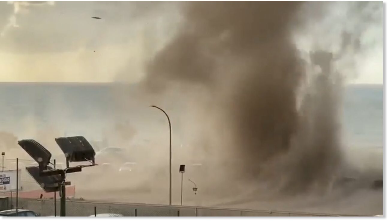
Week of wild weather around the world
From summertime flooding, to a dangerous derecho sweeping across the Midwest, this week has been a busy week of weather. But what weather events have been happening around the world? We start our trip on the largest island in the Mediterranean,...
www.sott.net
Week of wild weather around the world
Devon Lucie
Weather Nation
Wed, 12 Aug 2020 12:38 UTC
Waterspout hits Cefalù, Sicily, Italy
From summertime flooding, to a dangerous derecho sweeping across the Midwest, this week has been a busy week of weather. But what weather events have been happening around the world?
We start our trip on the largest island in the Mediterranean, Sicily. A waterspout whipped up sand and debris and sent beach-goers running as it pushed on shore. Thankfully, no one was injured.
Our week was full of waterspouts and tornadoes, and Canada was no different. We head to the province of Manitoba where a deadly tornado ripped through the countryside. Canadian officials rated this tornado an EF-2.
Our final tornado this week comes from the Inner Mongolia region of China. This storm ripped through a tourist site injuring at least 33 people and destroying 150 yurts.
Heavy rainfall proved to be problematic in the UK this week. The torrential rain caused devastating flooding and sparked a landslide that is believed to have derailed a passenger train in Scotland. Three people are reported dead after the derailing.
Let's end our trip in Australia where the eastern coast received more than 14 inches of rain. In New South Wales flooding forced evacuations...while windy conditions blasted the coast with sea foam.
Southern Australia's weather has also been...a little cuckoo. These kookaburras didn't seem to mind a blast of cold air from Antarctica that brought a rare snow to South Australia. The snow turned the red desert into a winter wonderland.
http://www.addthis.com/bookmark.php
Martinhouse
Deceased
The way the weather seems to be acting worse and worse,I'm starting to think I should forget about gardening for a while and just keep stocking up as long as I can, with the things that I KNOW I will need for myself and my animals!
I still have to see how well fine chopped scrambled eggs will rehydrate if I cook them up and then dehydrate them.
I still have to see how well fine chopped scrambled eggs will rehydrate if I cook them up and then dehydrate them.