Solar Grand Solar Minimum part deux

TxGal

Day by day
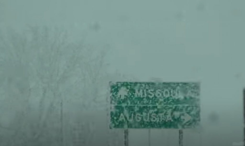
February in mid May for California - Ice Age Now

February in mid May for California
May 21, 2021 by Robert

“High temperatures will be more reminiscent of what we might see in February or early March,” National Weather Service warns. Yet more snowfall on the way.

Unusually strong cold front

An unusually strong cold front will dive into the region today bringing a round of strong winds and numerous rain and snow showers.

Snow: Rain and snow showers are expected to develop over most areas by this afternoon, with even isolated thunderstorms
possible, producing pellets and lightning. Heavier snow showers, especially those in the mountains, could result in sudden slick roadways and traffic incidents. This rain and snow shower pattern will likely occur again Friday and Saturday. Even overnight snow showers cannot be ruled out and these may produce a dusting of snow even at lower elevations.

Temperatures will plummet

* Chill: Temperatures will plummet to well below normal today through Saturday. This combined with breezy winds and showers will make it feel rather unpleasant for those outside for extended periods of time. High temperatures will be more reminiscent of what we might see in February or early March.

Freezes likely

Freezes are likely Friday morning and possibly again Saturday morning, so ensure your early plants and irrigation are
prepared.

Reno, NV

Thanks to Kenneth Lund for this link
 

TxGal

Day by day
Adapt 2030 has a new podcast out this morning. This one seems to have some relevance to the GSM:

Distraction from Destruction - YouTube

Distraction from Destruction
5,019 views • May 21, 2021

View: https://youtu.be/3ACfVgSR_kw
Run time is 14:23

Synopsis provided:

It seems the closer our world comes to natural cycles affecting the fabric of society, the more distractions are thrown at humanity when realizations are reached. Are we at Peak Distraction before crumble, lets look and you decide.
 

TxGal

Day by day
The Oppenheimer Ranch Project has a new podcast out:

Unusual May Snowstorm Is A Preview Of What’s To Come - Cascadia Analysis - Microtektite's Tell All - YouTube

Unusual May Snowstorm Is A Preview Of What’s To Come - Cascadia Analysis - Microtektite's Tell All
4,168 views • Premiered 8 hours ago

View: https://youtu.be/D6dj26Sxuds
Run time is 33:48

Synopsis provided:

Unusual May snowstorm could be a preview of what’s to come https://bit.ly/3bLdJX3
U.S. Highway 20 north of Island Park closed due to snow, road blockage https://bit.ly/344JuWO
Spring snow covers Bozeman; another round of wet weather on the way https://bit.ly/3bMQdJj
Snowfall 'fast and furious' on Colorado's 'most dangerous highway https://bit.ly/343wlxk
Montana Storm Produces Record Snow & Cold https://bit.ly/3hMnKr4
Sierra Nevada Gets Late Dusting of Snow After Dry Winter https://bit.ly/3hMutBc
Wet weekend ahead including heavy mountain snow on Sunday https://bit.ly/3bMEBWH
No drought in nearly half of Colorado-major drought in some areas https://bit.ly/3f9N9cj
Eight tornadoes confirmed near Twin Cities metro, but little damage http://strib.mn/2QLfOLC
Hurricane forecasters tracking two disturbances ahead of season https://fxn.ws/3oF3sB8
Hurricane Center https://www.nhc.noaa.gov/
SNOWFALL ANALYSIS FROM THE LAST 48 HOURS https://www.weather.gov/crh/snowfall
GFS Model Total Snowfall US https://bit.ly/3v5sLPb
GFS Model Total Accumulated Precipitation US https://bit.ly/3wjXUP0
Tropical Disturbance in the Gulf of Mexico; Severe Weather in the Plains https://www.weather.gov/
Two Chinese provinces hit by earthquakes, with two reported dead https://bit.ly/3wpZ8se
China hit with two earthquakes in one night, rescue operations underway https://bit.ly/3ytCKzZ
GOES X-RAY FLUX https://www.swpc.noaa.gov/products/go...
Solar prediction https://www.solarham.net/
Scientists seek clues on last eruption at Glacier Peak, Washington’s 2nd most active volcano https://bit.ly/3valiyd
4000 Years Of Cascadia Eruptions GRAPH https://bit.ly/38kbPLA
PNAS Earthquakes https://pnsn.org/volcanoes
Kilauea volcano update: Lava Lake Almost Fully Crusted After 5-Months of Eruption https://bit.ly/345VWpr
Worldwide Volcano News https://bit.ly/3y58XgJ
Multi-collector 40Ar/39Ar dating of microtektites from Transantarctic Mountains (Antarctica): A definitive link with the Australasian tektite/microtektite strewn field https://bit.ly/3wriJby
Microtektites and glassy cosmic spherules from new sites in the Transantarctic Mountains, Antarctica https://bit.ly/3hHn8Tz
Geochemistry of aerodynamically distorted Australasian microtektites: Implications for ejecta on Mars and Venus https://bit.ly/3u4jmWQ
Australian tektites https://bit.ly/3bOdfiW
Immediate temperature response in northern Iberia to last deglacial changes in the North Atlantic https://bit.ly/3fFmR0v
Climate change, not human population growth, correlates with Late Quaternary megafauna declines in North America https://go.nature.com/3ww2kmd
Astronomers Detect Nickel in Coma of Interstellar Comet 2I/Borisov https://bit.ly/3yvd5XB
NASA traces source of mysterious fast radio bursts sending signals to Earth https://cbsn.ws/3bMG8fp
and more
 

TxGal

Day by day
Snow hits Mongolia's capital as summer nears -- Earth Changes -- Sott.net

Snow hits Mongolia's capital as summer nears

China.org.cn
Sat, 22 May 2021 10:25 UTC

snow

Heavy snowfall hit Mongolia's capital early Saturday morning, despite summertime approaching.

The air temperature in Ulan Bator, which was around 20 degrees Celsius midday Friday, has dropped to 1 degree Celsius by Saturday noon.

In Mongolia, March, April and May are spring months, with weather conditions changing widely day-to-day or hour-to-hour.

Source: Xinhua

View: https://youtu.be/ZWJI5EZflv0
Run time is 1:43
 

TxGal

Day by day
Giant May snowstorm will unload feet of snow in Montana in videos, maps and photos - Strange Sounds

Massive May snowstorm to unload feet of snow and break many records in Montana
By Strange Sounds
May 20, 2021

It may have been just one month away from the official start of summer, but on May 20 people across western Montana woke up to a winter wonderland.

Extreme snow storm in Montana, Extreme snow storm in Montana may 2021, Extreme snow storm in Montana may 19-20 2021, Extreme snow storm in Montana video, Extreme snow storm in Montana map Extreme snow storm in Montana photo
Extreme snow storm in Montana on May 19-20, 2021. Picture via Youtube video

Residents in western Montana were greeted by scenes of a winter wonderland in May on Thursday. Snow began piling up fast in some communities, and Mother Nature is ready to dish out more winter weather in the coming days.

A long-duration snowstorm is underway with the potential to unleash several feel of snow on the higher elevations of Montana
, but also several inches of snow in not-so-high elevations of Big Sky Country.

View: https://youtu.be/CkBs7NvnqOg
Run time is 2:41

Even though snow this late in the season isn’t unheard of, the extensive area of the northern Rockies in the crosshairs of winter weather will be quite unusual.

Winter storm warnings remained in effect for parts of Montana on Thursday as the wintry blast followed just days after near-record heat with highs in the 80s F for parts of the region.

View: https://twitter.com/ErinWx/status/1394446141463293952

High temperatures were slashed by 40-60 degrees Fahrenheit from their peak on Monday to Thursday. The temperature in Helena, Montana, soared to 86 degrees on Monday, and by Friday, the high will only climb into the upper 30s.

MicrosoftTeams-image-23.jpg

The above image shows Greenough Hill on Route 22 in Montana, with trees and non-paved surfaces covered in snow on Thursday morning, May 20 (Photo/MontanaDOT)

Cattle rancher Justin Iverson explained how the snow, which piled up three inches high in Potomac, Montana, on Thursday morning, was effecting his herd.

The cows have started to shed their winter coat, but still have a little left to go. They should handle this weather just fine. The larger concern is respiratory disease due to the stress from the cold,” Iverson told AccuWeather.

MicrosoftTeams-image-24.jpg

About three inches of snow fell across the fields in Potomic, Montana on the morning of Thursday, May 20 (Photo/Justin Iverson).

Iverson also said that the snow had damaged some barely they had planted just recently.

Heavy snowfall is no stranger to Montana and the northern Rockies during May. There have even been snowstorms in June across the region. For instance, the latest accumulating snow on record in Great Falls, Montana, was 5.1 inches on June 12, 1969.

However, during the middle to late spring, the areal coverage of snowstorms tends to shrink in size with nearly perfect conditions needed to produce accumulating snow in the first place.

The average date of the last 0.1 of an inch of snow or more in Great Falls is May 10. With an AccuWeather prediction of 4-8 inches of snow in the city more than a week past this date, it is not a very common event.

hd27-12.jpg


Since 1920, there have been only five years with storms of 8 inches or more in Great Falls, AccuWeather Senior Storm Warning Meteorologist Brian Wimer said.

The biggest of these storms spanned May 28-29, 1989, and that system brought 11.6 inches of snow to the city,” Wimer stated. “The other years with storms that brought 8 inches or more of snow during May in the city were in 1956, 1967, 1983 and 2000.

The storm has all the bells and whistles going for it to be not only a whopper of a snowstorm for some locations, but also a large one as well in terms of overall coverage of accumulating snow.

View: https://youtu.be/bjAtSC05iJc
Run time is 2:31

Snow levels with this storm are likely to dip as low as 3,000 feet in parts of central Montana as the combination of fresh cold air moving in and the action of wind blowing uphill and squeezing out moisture will make for a substantial snowfall,” AccuWeather Senior Meteorologist Brett Anderson said.

Accumulating snow is expected to fall on an area more than 70,000 square miles in central and western Montana alone from Wednesday to Saturday.

Snow is also forecast to fall and accumulate in portions of northern and central Idaho, northwestern Wyoming and even into the southern parts of British Columbia, Alberta and Saskatchewan in Canada.

Farther to the west, a few inches of snow are expected to fall on the Cascades of Washington and Oregon into Thursday. Since freezing levels can periodically dip to the passes, a small slushy accumulation can occur at times over the crests.

The storm could join the ranks of the top 10 greatest impact snowfalls for the region, according to AccuWeather forecasters. The NWS ranks snowstorms on a scale called MontSIS, which takes into accounts snowstorms that unleash more than 7 inches and factors in the area impacted. For comparison, the May 9-13, 1983, storm that dropped up to 35 inches of snow is ranked 11th of all-time for the state, according to the National Weather Service in Great Falls.

SnowTime.jpg


Small-scale storms, such as one that unfolded May 28-30, 1982, dropped as much as 66 inches of snow on Montana. That same storm unleashed 25.9 inches of snow in far-northern Havre, Montana, with 27.7 inches falling on Lewistown, Montana, a city in the middle of the state.

Other Montana cities have been smacked by May snowstorms as well over the past 100 years or more.

Butte, which is Montana’s fifth biggest city with a population of more than 33,000 people, was buried under 30.5 inches of snow in 24 hours from a storm spanning May 27-28, 1927.

From May 20-22, 1908, Glendive was hit with a foot of snow. The city sits in the eastern part of the state and is located between the Badlands and Yellowstone River.

More recently, in 1965, Bozeman, a city situated in southern Montana in the Rocky Mountains, was slammed with 21.7 inches of snow spanning May 5-7.

This will be a long-duration snowstorm for the northern Rockies with the heaviest snow in central and western Montana likely to fall from Wednesday evening to Thursday evening,” Anderson said. “During this period, snowfall rates of 1-3 inches per hour are highly probable just east of the Continental Divide.

The heaviest snowfall is likely to be in the Glacier National Park area of Montana, along and just east of the Divide, with 2-3 feet likely in the higher elevations of the park and locally greater amounts possible,” added Anderson.

hd26-3.jpg


An AccuWeather Local StormMax™ of 48 inches is expected with this storm over the higher elevations of west-central Montana.

In Canada, heavy snowfall will also likely impact the Waterton Lakes National Park area, located in extreme southwestern Alberta and along the eastern slopes of the Divide.

A few inches of snow are expected to fall on the higher elevations of Yellowstone National Park in northwestern Wyoming Thursday evening into Friday.

These parks are popular tourist destinations and people planning on venturing into area could be turned away or possibly face the risk of being stranded,” Anderson said.

hd14-25.jpg


Spring snowstorms are almost always a problem as leaves begin to emerge on the trees at low and intermediate elevations.

The heavy and wet nature of the snow from this storm is likely to lead to breaking branches and falling trees, and when that occurs there is the likelihood of power outages,” Anderson warned.

At lower elevations, periods of snow and rain are likely to occur. Most roads at lower elevations during much of the storm are expected to be just wet as enough of the sun’s energy has made these surfaces relatively warm, and enough energy from the sun will continue to warm paved areas during the daytime, even as the storm gets underway.

Higher sections, including the passes, of I-90 and I-15 may be snow- covered and slippery, especially Wednesday night through Thursday morning and again Thursday night,” Anderson said.

West of the Divide, where winds blow downhill and allow some natural drying and warming of the air during the storm, much less snow is forecast to fall.

Because of the downsloping wind, Kalispell, Montana, is likely to only receive a small amount of snow from the storm,” Anderson said.

View: https://youtu.be/xWGnkmKrWCw
Run time is 2:08

The same storm is forecast to spread some moisture in the form of rain and wet snowflakes to parts of eastern Montana, the Dakotas and southern Manitoba. There is the potential for 0.50 of an inch to 1 inch of rainfall in this area from late this week through this weekend. Local amounts of 2 inches are possible.

Much of this area has been hit by extreme drought with rainfall and melted snow less than 50% of average since Jan. 1, 2021.

hd10-2.jpg


Minot, North Dakota, has only received 0.50 of an inch of rain or 12% of average since the start of the year. Normal rainfall for the period is 4.20 inches. At this point, even a few tenths of an inch of rain would be welcomed with open arms.

The extended drought has resulted in many days of critical wildfire danger, a lack of soil moisture, dwindling water supply and poor pasture conditions for livestock.
[Accuweather]
 

ktrapper

Veteran Member
Still in the teens this morning when I woke at 4 am. We may have gotten a tad more snow last night. Hard to tell with the wind blowing. All total maybe 6 inches. We are in the Greenough, Missoula forecasting areas like in the above pictures but a bit further west. We should see some melting today. The way we look at it, it’s good for the mountain grass here. Killed the first crop of gnats and flies that emerged and we could unplug the freezer from the solar system for a couple days. One thing we learned living 20 years in AK is we gotta make use of what we are given.
 

TxGal

Day by day
Adapt 2030 has a new podcast out (appears to have some GSM relevance):

Will You Be Able to Retire Comfortably ? - YouTube

Will You Be Able to Retire Comfortably ?
3,719 views • May 22, 2021

View: https://youtu.be/ZrPmtdZnN_k
Run time is 8:12

Synopsis provided:

With food and life prices going through the roof and and organizations in Australia pushing for rats having more rights than humans, and Earth changes beginning with unusual animal behavior. How will our retirement years be?
 

TxGal

Day by day
The Oppenheimer Ranch Project has a new podcast out. This is a huge eruption with climate-affecting potential (VEI scale):

Mount Nyiragongo Volcano In Eastern Congo Erupts To 45,000ft With Massive Lava Flows - YouTube

Mount Nyiragongo Volcano In Eastern Congo Erupts To 45,000ft With Massive Lava Flows
8,141 views • Premiered 14 hours ago

View: https://youtu.be/c61N4THM7aw
Run time is 5:02

Synopsis provided:

Mount Nyiragongo volcano in eastern Congo erupts https://cnn.it/2ScQIWd
Volcano in eastern Congo erupts, triggering panic in nearby Goma https://nbcnews.to/3fbIXc3
Nyiragongo Volcano Volcanic Ash Advisory: ERUPTION AT 20210522/1800Z ONGOING ERUPTION OBS VA DTG: 22/2100Z to 45000 ft (13700 m) https://bit.ly/3yvs7MY
Breaking News: Nyiragongo Volcano In DR Congo Erupts | locals flee city | Volcano Eruption https://bit.ly/3vevaHd
Nyiragongo Historical Data
https://s.si.edu/2Na3SRN
 
Last edited:

TxGal

Day by day
Nyiragongo Volcano Erupts to 45,000 feet: DR Congo Orders Citywide Evacuations - Electroverse

NYIRAGONGO-e1621754852717.png

GSM Volcanic & Seismic Activity
NYIRAGONGO VOLCANO ERUPTS TO 45,000 FEET: DR CONGO ORDERS CITYWIDE EVACUATIONS
MAY 23, 2021 CAP ALLON

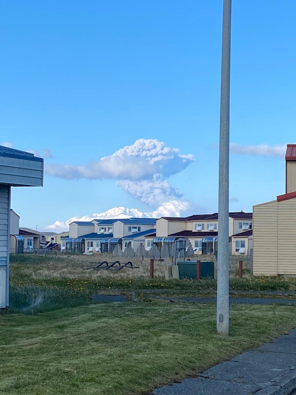
The government in the Democratic Republic of Congo has launched an evacuation plan for the eastern city of Goma following May 22’s stratospheric eruption of Nyiragongo volcano.

The volcano, located approximately 10 km (6 miles) from Goma, last erupted in 2002 killing 250 people — that eruption was logged as a VEI 2, according to volcano.si.edu.

Nyiragongo’s deadliest eruption in history was that of 1977 (during the weak solar minimum of cycle 20) — this event went down as a VEI 1, according to historical observations, yet still managed to kill more than 600 people.
Saturday evening’s eruption looks bigger.

This was likely the volcano’s strongest eruption in recorded history.

View: https://twitter.com/NewTimesRwanda/status/1396158713040355340
Run time is 0:18

Fountains of high lava burst from the Mount Nyiragongo into the night sky forming a thick orange cloud over Goma, which has a population of two million.

View: https://twitter.com/MONUSCO/status/1396217834850689029
Run time is 0:04

View: https://twitter.com/paulakahumbu/status/1396179858238156806
Run time is 0:22

A new fracture opened up on the volcano, enabling lava to flow south towards Goma and reach the airport.

Electricity was out across large areas, and one highway that connects Goma with the city of Beni had already been engulfed by the lava.

Thousands of panic-stricken residents were seen fleeing, many on foot.

“There is a smell of sulphur. In the distance you can see giant flames coming out of the mountain,” resident Carine Mbala told AFP news agency.

View: https://twitter.com/Tom_Peyre_Costa/status/1396250219252158464
Run time is 0:12

Rwandan authorities said about 3,000 people already had officially crossed from Goma, so far.

The country’s state media said they would be accommodated in schools and places of worship.

Other residents fled to higher grounds to the west of the city.

“We’re already in a total psychosis,” resident Zacharie Paluku told the Associated Press (AP) news agency.

“Everyone is afraid; people are running away. We really don’t know what to do.”

View: https://twitter.com/MongiMarguerite/status/1396237715180490758
Run time is 0:45

Nyiragongo was not on the “Grand Solar Minimum” watch list.

There is no evidence of the volcano doing anything prior to 1884, and its first and only VEI 2 was observed as recently as 2002.

Saturday evening’s eruption will likely go down as another VEI 2–maybe even a VEI 3: the volcano’s strongest eruption in recorded history.

And while those destructive lava flows pose a significant risk to all those in close proximity, a violent stratospheric eruption –such as this– has major implications for the rest us, too.

The Volcanic Ash Advisory Center (VAAC) Toulouse said the ash plume climbed to 45,000 ft (13.7 km).

Particulates ejected above 10km (and so into the stratosphere) shade sunlight and reduce terrestrial temperatures. Smaller particulates can linger in the upper atmosphere for years or even decades+ at a time.

As documented, Earth’s average temperature was already falling off a cliff.

A global volcanic uptick is the last thing we need.

But it’s exactly what we’re getting.

Prepare for the Grand Solar Minimum.

BACKGROUND

Stratovolcano: 3470 m / 11,384 ft
DRCongo: -1.52°S / 29.25°E
Current status: ERUPTING
Eruption list: 1884, 1894, 1898, 1899, 1900, 1901, 1902, 1905, 1906, 1908(?), 1911, 1918, 1920-21, 1927-77, 1977, 1982, 1994-96, 2002, 2021–(22 May-ongoing, flank eruption).

A large stratovolcano near Lake Kivut, Nyiragongo is one of the world’s most beautiful and active volcanoes.

It has a 1.2 km diameter summit caldera containing the world’s most active and largest lava lake.

Nyiragongo is infamous for its extremely fluid lava that runs as water when the lake drains.

During the January 17, 2002 eruption, Nyiragongo’s lava lake drained from fissures on its western flanks. The city center of Goma, the capital of the East Virunga province, was destroyed by voluninous flows. 200,000 people were left homeless, adding to the human disaster caused by frequent civil wars.

A repeat of 2002 is ongoing.

Stay tuned for updates.

For more, see volcanodiscovery.com.

UPTICK

Seismic and Volcanic activity has been correlated to changes in the Sun.

The recent global uptick in earthquakes and volcanic eruptions is likely attributed to the drop-off in solar activity, coronal holes, a waning magnetosphere, and the increase in Galactic Cosmic Rays penetrating silica-rich magma.

The COLD TIMES are returning, the mid-latitudes are REFREEZING, in line with a volcanic uptick, the great conjunction, historically low solar activity, cloud-nucleating Cosmic Rays, and a meridional jet stream flow (among other forcings).

Both NOAA and NASA appear to agree, if you read between the lines, with NOAA saying we’re entering a ‘full-blown’ Grand Solar Minimum in the late-2020s, and NASA seeing this upcoming solar cycle (25) as “the weakest of the past 200 years”, with the agency correlating previous solar shutdowns to prolonged periods of global cooling here.

Furthermore, we can’t ignore the slew of new scientific papers stating the immense impact The Beaufort Gyre could have on the Gulf Stream, and therefore the climate overall.


Prepare accordinglylearn the facts, relocate if need be, and grow your own.
 

TxGal

Day by day
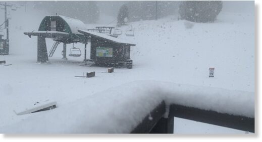
Rare late May snowfall hits Mount Charleston near Las Vegas -- Earth Changes -- Sott.net

Rare late May snowfall hits Mount Charleston near Las Vegas

Jason Dinant
ktnv.com
Sat, 22 May 2021 10:47 UTC

snow
© Lee Canyon
The ski and snow season at Lee Canyon on Mount Charleston is over but no one told Mother Nature.

The National Weather Service reported snowflakes falling on the mountain this morning on their Twitter feed.

SNOW ALERT: The ski and snow season at Lee Canyon on Mount Charleston near #Las Vegas is over but no one told Mother Nature. Rare late May snowfall hits Mount Charleston near Las Vegas (Video: Lee Canyon) pic.twitter.com/hErz0fplIP
— KTNV 13 Action News (@KTNV) May 22, 2021
Light snow/rain showers developing over Mount Charleston this morning as seen on the @AllegiantWxSTEM cam!

Watch out for these showers today to kick up some gusty west winds this afternoon! Maybe up to 40 mph! #vegasweather pic.twitter.com/XXUHk0ocu7
— NWS Las Vegas (@NWSVegas) May 22, 2021
It did not take long for the accumulation to build and Lee Canyon Ski and Snowboard Resort sent video and photos of the slopes looking ready for people to enjoy.
 

TxGal

Day by day
German cows delayed annual trip to the Alps because thick layers of snow are still blanketing pastures -- Earth Changes -- Sott.net

Scotland shivering through coldest May in 40 years as snow falls in some areas

Paul Drury
Daily Record
Sun, 23 May 2021 11:02 UTC

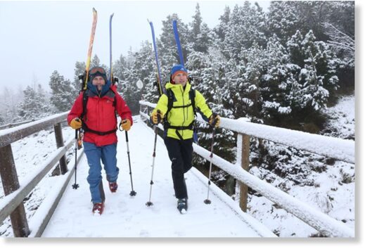
Nick and Patrick Matheson, from Northumbria, went skiing at Cairngorm mountain, where fresh snow fell yesterday.
© Northpix.

Nick and Patrick Matheson, from Northumbria, went skiing at Cairngorm mountain, where fresh snow fell yesterday.

Don't look out the shorts and sun cream just yet...

With just days left until the start of June, Scotland was hit by snow.

And while we all wait for summer to finally arrive, forecasters have warned we're on course for the coldest May in more than 40 years.

Srdjan Lulic found himself a bit exposed at the Cairngorm National Park, near Aviemore, Inverness-shire, as he headed out for a stroll with girlfriend Catherine Stewart, of Edinburgh.

Another driver had to clear a mound of snow from his windscreen, which had built up overnight.

Catherine said: "We'd planned on going for a walk to the summit of Ben Macdui but I think we will be limited to the lower slopes as there looks like there is a lot of snow on the higher ground.

Srdjan Lulic and Catherine Stewart were surprised by yesterday's snowfall at Cairngorm National Park.
© Northpix

Srdjan Lulic and Catherine Stewart were surprised by yesterday's snowfall at Cairngorm National Park.

"It's snowing at the car park and Srdjan is only wearing shorts."

But Evie, the Bavarian Mountain Hound, was having plenty of fun.

Owner Ben Clough said: "Evie is bred for this type of weather and terrain and she just loves the snow."

Brothers Nick and Patrick Matheson from Northumbria headed to the hills for a bit of skiing.

Nick said: "We've been coming here since the 1980s and I can't ever remember there being this much snow in May.

"We got a shock when we opened our campervan door this morning."

Patrick added: "It's a long walk up the hill but the ski back down will definitely make it worthwhile."

You have to go back 25 years to find as cold a May in Scotland.

So far this month, the average temperature has been 10.7C.

In 1996 and before that, in 1983, the maximum temperature for the whole of May was 10.8C.

If the mercury drops even marginally below the current figure, it will be the coldest May since Margaret Thatcher became prime minister in 1979, when it was 10.6C.

Sarah Kent, of the Met Office, said: "Not only has it been a cold May, it's been a cold spring generally.

"The wind has routinely been coming from the north, which is always a cold direction."
 

TxGal

Day by day
German cows delayed annual trip to the Alps because thick layers of snow are still blanketing pastures -- Earth Changes -- Sott.net

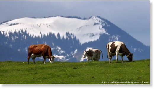
German cows delayed annual trip to the Alps because thick layers of snow are still blanketing pastures

Rebecca Staudenmaier
Deutsche Welle
Sun, 23 May 2021 11:43 UTC

By this time, farmers normally start bringing their cows into the mountains

By this time, farmers normally start bringing their cows into the mountains

For tens of thousands of cows, their summer grazing in the Bavarian Alps will have to wait. Thick layers of snow are still blanketing their pastures — but the cold and wet aren't all bad, say experts.

Cows in southern Germany will have to stay in their stalls a little longer, as their grazing pastures in the Alps are still covered in snow, German media reported on Sunday.

At this time of year, farmers traditionally begin transporting tens of thousands of cattle up into the Alps for the summer, before driving them back down into the valleys in autumn.

What is the situation?

With pastures covered and mountain roads tricky to navigate, the traditional cattle drive will have to wait, news agency dpa reported.

Local business associations in the regions of Allgäu and Upper Bavaria said most farmers will need to wait another two weeks before releasing their cows into the mountainous pastures.

For areas that are even higher up — some farmers might have to wait until mid-June, the associations said.

View: https://youtu.be/ylpPxTkGA7c
Run time is 4:34

Not necessarily a bad thing

The delay to the grazing season isn't necessarily cause for concern, experts say.

"The snow doesn't have to be a downside," Michael Honisch, the head of the Allgäu Economic Association (AVA) told news agency dpa.

"After all, the water supply for the cattle is relatively well secured for the time being," he said. The slowly melting snow also will help the grass grow in the pastures.

Grazing delays also aren't expected to have an impact on the number of births.

In the Allgäü, the Alpine region where the famous fairytale Neuschwanstein Castle is located, the AVA expects around 30,000 calves to be born this summer — on par with the year before.

A pasture 'is not a petting zoo'

In Upper Bavaria, the head of the local economic association AVO, experts say there's enough room for grazing cows in the pastures where snow has already melted away — but farmers still aren't bringing them there.

"The problem is, many larger valley farms don't want to go to the effort of taking young cattle up to the pastures for a few months," said AVO head Stöckl.

Cows that aren't used to being out in the open and grazing in pastures can lead to larger problems later in the summer, particularly when they come in contact with humans.

The sudden attention from hikers or mountain bikers who zip through the pastures can spook cows who aren't used to the action — leading to injuries for human and animal alike.

Local farmers also strongly caution visitors in the Alps against approaching or petting grazing cattle.

"An Alpine pasture is not a petting zoo," said the AVA's Honisch.

What is the Alpine cattle drive?

During the spring, farmers take their cattle up into the mountains for months of hillside grazing.

The big event comes in September and October when farms bring their cows back down into the valleys.

Cows are adorned with flower wreathes and ceremonial bells, proudly displayed in local villages and towns.

The event, known as "Veihscheid" or "Almabtrieb," is accompanied with music, dancing and feasts packed with local specialties.

The region of Upper Bavaria boasts the largest number of cattle in the southern German state. In May last year, over 13,500 were logged in the region, including nearly 9,000 dairy cows, according to Bavaria's state Statistics Office.

This article was written with material from news agency dpa.

Comment: A video of the snowy, wintry conditions in the nearby Austrian Alps on May 19:
View: https://youtu.be/VXmu-xgNNO0
Run time is 1:46
 

TxGal

Day by day
Sunspot awakes from slumber to douse Earth in radiation which downed radio signals -- Science & Technology -- Sott.net

Sunspot awakes from slumber to douse Earth in radiation which downed radio signals

Sean Martin
Daily Express (UK)
Sat, 22 May 2021 09:07 UTC

Sunspot awakes from slumber to douse Earth in radiation which downs radio signals
© SPACE WEATHER

Sunspot awakes from slumber to douse Earth in radiation which downs radio signals

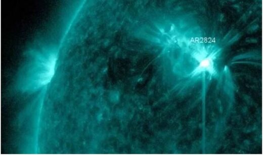
NASA satellites have spotted a sunspot on the Sun which is ploughing ultraviolet radiation into the solar system. A few waves of the radiation have glanced Earth, leaving some parts of the globe without radio frequencies below 20MHz.

Solar flares can be detrimental to radio waves as when they hit the atmosphere, ionisation occurs which saps energy from radio waves.

The sunspot in question has been dubbed AR2824 which was first found last week.

However, it went quiet for a few days before waking up and blasting solar flares into the cosmos.

Dr Tony Philips of astronomy site Space Weather wrote on his blog: "After nearly a week of somnolent quiet, sunspot AR2824 is flaring again.

"An impulsive C4.8-class flare during the late hours of May 21st (1928 UT) was followed by an even stronger C6.1-flare on May 22nd (0256 UT).

"AR2824 is now strobing Earth with pulses of ultraviolet radiation.

"Waves of ionisation rippling through Earth's upper atmosphere have caused shortwave radio blackouts over North America on May 21st and southeast Asia on May 22nd.

"Ham radio operators, aviators and mariners might have noticed unusual propagation at frequencies below ~20 MHz."

Sunspots are dark patches on the Sun which are typically cooler than the rest of the star.

When experts say they are 'cooler', the average temperature of a sunspot still exceeds 3,500 degrees Celsius - although this is a drop from the average Sun surface of 5,500C.

They are typically cooler as sunspots are areas of strong magnetic fields.

The magnetism is so strong that it actually keeps some of the heat from escaping.

However, as the magnetic field builds, it increases pressure in the sunspot which can erupt as a solar flare.

For the most part, sunspots and the resulting solar flares are relatively harmless.

Aside from downing lower radio frequencies, this current sunspot is not expected to inflict much damage on Earth.

Dr Philips continued on Space Weather: "So far there is no sign of Earth-directed CMEs from these explosions; no geomagnetic storms are in the offing. However, stay tuned for updates."

Comment: The effects of solar flares on Earth's magnetosphere
 

TxGal

Day by day
The Oppenheimer Ranch Project has two new podcasts out, here's one:

Rare Late May snowfall Hits Near Las Vegas - Deadly Mount Nyiragongo - Etna Paroxysm - Space Weather - YouTube

Rare Late May snowfall Hits Near Las Vegas - Deadly Mount Nyiragongo - Etna Paroxysm - Space Weather
2,843 views • Premiered 6 hours ago

View: https://youtu.be/ml99wz7gMrg
Run time is 20:49

Synopsis provided:

Rare late May snowfall hits Mount Charleston near Las Vegas https://bit.ly/2SoXtEj
‘We learn to roll with it’: Residents, visitors react to spring Sierra snow https://bit.ly/2T34kUj
Rain and snow to continue, travel impacts at pass level https://bit.ly/3bNYD3o
MELTING SNOW USUALLY MEANS WATER FOR THE WEST. BUT THIS https://bit.ly/3ywzvHT
At Least A Dozen Tornadoes Spotted In Two Days As Severe Weather Kicks Up In Colorado https://bit.ly/34cvSZY
National Hurricane Center https://www.nhc.noaa.gov/
Severe Storms in the Plains; Heavy Rain Continues for the Texas Gulf Coast. https://www.weather.gov/
GFS Model Total Snowfall US https://bit.ly/3ueAKbm
21 die in extreme weather in China ultramarathon https://bit.ly/2T9rBnD
New research sheds light on recent Pāhala earthquake swarms https://on.doi.gov/2TeEf4X
Mount Nyiragongo: At least 15 dead, over 170 children missing after volcano erupts in eastern Congo https://bit.ly/3fFnd7A
Worldwide Volcano News https://www.volcanodiscovery.com/volc...
Update on the eruption in Fagradalsfjall mountain on 21-May-2021 https://icelandgeology.net/
Fagradalsfjall volcano update: Lava overflows dam, enters valley towards southern Ring Road now in dager being cut https://bit.ly/3c78uBx
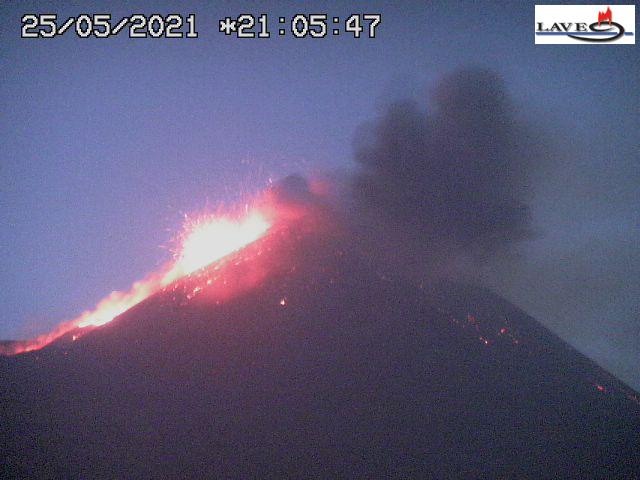
Etna volcano update: Lava fountains light up Sicily's sky during Etna's 3rd paroxysm in May 2021 https://bit.ly/2T35orh
A Minor (G1) to Moderate (G2) geomagnetic storm watch has been added for beginning on May 25th and into the 26th when a coronal mass ejection (CME) observed leaving the Sun on Saturday is expected to deliver at least a glancing blow to Earths geomagnetic field. https://www.solarham.net/
A 5000 Year Old Aboriginal Cave Painting of The “Wandjina.” Known As ‘The Sky Beings’ http://bit.ly/3bNgo18
Incredible Microscope Sees Atoms at Record Resolution https://bit.ly/3veApXu
Divergent evolution of glaciation across High-Mountain Asia during the last four glacial-interglacial cycles https://bit.ly/2RKcYGW
 

TxGal

Day by day
Here's the 2nd new Oppenheimer Ranch Project podcast:

SPACE WEATHER NEWS UPDATE: Multiple M-Flares Over The Last 48hrs = CME's Earthbound! - Full Analysis - YouTube

SPACE WEATHER NEWS UPDATE: Multiple M-Flares Over The Last 48hrs = CME's Earthbound! - Full Analysis
3,031 views •Premiered 7 hours ago

View: https://youtu.be/mpOZ5wHesvs
Run time is 4:21

Synopsis provided:

A Minor (G1) to Moderate (G2) geomagnetic storm watch has been added for beginning on May 25th and into the 26th when a coronal mass ejection (CME) observed leaving the Sun on Saturday is expected to deliver at least a glancing blow to Earths geomagnetic field. https://www.solarham.net/
GOES X-Ray Flux https://www.swpc.noaa.gov/products/go...
ISWA Cygnet Streamer https://go.nasa.gov/2R8QL1h
WSA-ENLIL SPIRAL (Solar Wind Prediction) https://bit.ly/3rIEYrV https://spaceweathernews.com/
A 5000 Year Old Aboriginal Cave Painting of The “Wandjina.” Known As ‘The Sky Beings’ http://bit.ly/3bNgo18
 

TxGal

Day by day
Decades of Failed "Tipping-Point" Prophesies - Electroverse

strings-e1621843522964.jpg
Articles
DECADES OF FAILED “TIPPING-POINT” PROPHESIES
MAY 24, 2021 CAP ALLON

Fear prevents us from thinking.

The emotional panic that accompanies fear actually shuts down the prefrontal cortex, or the rational thinking part, of our brains.

A populace that stops thinking for itself is a populace that is easily led, easily manipulated and easily controlled.
Our leaders
–those unseen, which reside high-above the puppets in elected office– rule by fear.

“Do exactly as we say, or the world could end.”

NOEL BROWN, 1989

Noel Brown, director of the New York office of the U.N. Environment Program (UNEP), said back in 1989 that governments had just a 10-year window of opportunity to solve the greenhouse effect before it goes beyond human control.

He said that entire nations could be wiped off the face of the Earth by rising sea levels if the global warming trend is not reversed by the year 2000.

Also according to Brown, who was quoting eminent scientists of the time, coastal flooding and crop failures would create an exodus of ″eco- refugees,” threatening political chaos.

Excess carbon dioxide is pouring into the atmosphere because of humanity’s use of fossil fuels and burning of rain forests, said Brown. The atmosphere is retaining more heat than it radiates, much like a greenhouse. The most conservative scientific estimate that the Earth’s temperature will rise 1 to 7 degrees in the next 30 years, he claimed.

Well, Brown, it’s now been a full 32 years since you made those prophesies, and global temperatures, as measured by the satellites, have actually fallen below the levels they were in the late-1980s.


[Dr Roy Spencer]

Brown finished by saying that even the most conservative scientists ″already tell us there’s nothing we can do now to stop a change″ of about 3 degrees, and he concluded with a scripted oration about how all nations need to reduce the use of fossil fuels and slash their emissions of carbon dioxide–you know the one…

JAMES HANSEN, 2006

Often described as the father of the global warming, NASA’s James Hansen has made many a catastrophic climate claim over the decades.

“The greenhouse effect is here,” he confidently pronounced back on June 23, 1988 during his Congressional testimony on man-made global warming.

During that testimony, Hansen told the Senate Energy and Natural Resources Committee there is only a “1 percent chance” that he is wrong in blaming rising temperatures around the world on the buildup of man-made gases in the atmosphere.
And when asked in an interview in New York City in 1989, “If what you’re saying about the greenhouse effect is true, is anything going to look different down there in 20 years?” Hansen replied, “The West Side Highway will be under water. And there will be tape across the windows across the street because of high winds. And the same birds won’t be there. The trees in the median strip will change.”

By 2006, instead of admitting he maybe overegged the catastrophe a little, Hansen actually doubled-down.

As alarmists often do, Hansen simply pushed the doomsday date back a few years in the hope that no one would notice. He said in September, 2006 that the world now had a 10-year window of opportunity to take decisive action on global warming and avert a catastrophe.

Hansen pleaded with governments, imploring that they adopt an alternative scenario to keep carbon dioxide emission growth in check and limit the increase in global temperatures to 1 degree Celsius (1.8F).

“I think we have a very brief window of opportunity to deal with climate change … no longer than a decade, at the most,” he said at the Climate Change Research Conference in California’s state capital.

If the world continues with a “business as usual” scenario, Hansen said temperatures will rise by 2 to 3 degrees Celsius (3.6 to 7.2F) and “we will be producing a different planet.”

On that warmer planet, ice sheets would melt quickly, causing a rise in sea levels that would put most of Manhattan under water. Hansen used the old tricks of melting Arctic sea ice and a reduction in polar bear numbers to try and pile pressure on world governments: “It is not too late to save the Arctic, but it requires that we begin to slow carbon dioxide emissions this decade,” he said.

Two years later, in 2008, Hansen was still at it, now claiming that the Arctic would be ice free by 2018.
Within just “5 to 10 years, the Arctic will be free of sea ice in the summer,” he announced.


Suffice it to say, Hansen was spouting more nonsense, and 10 years after he made his ice-free claim, Arctic sea ice volume was up 7 percent, and melting at the slowest rate on record:


[DMI]


[DMI]

And even today, as we approach the summer of 2021, Arctic Sea Ice volume today is doing just fine.

Levels are actually above those of the past few years, and the latest data point (May 23) shows thickness is holding at 5 meters across vast areas:


[DMI]

Hansen is considered the father of global warming.

And somehow, despite his decades of failed predictions, the man still holds credibility, he still has sway and say within the anthropgenic global warming field, and is still the poster child (or at least was until Greta Chunderberg came along) for rags such as The Guardian.

How anyone proved so wrong for so long can still garner the praise and accolades James Hansen does is testament to the agenda at play.

The political tool that is AGW will keep on rolling, for as long it’s needed, and the ever growing line of the poor and ill informed will continue following that Pied Piper into the Hamelin cave, where their self-respect and ability to think critically will never be seen again.

Hansen hasn’t been thrown under the bus because he is still tows the line, he still spouts the scripted narrative.
What do these guys have on him?

Or is it that he’s simply too proud to admit he got it wrong?

However, there is still time to save face, Hansen — but at 80 years old, you probably only have a 5 to 10 year window of opportunity to take decisive action.


Reject the manufactured fear.

Live free.
 

TxGal

Day by day
Heavy snowfall hits the Kaghan valley in Pakistan in late May -- Earth Changes -- Sott.net

Heavy snowfall hits the Kaghan valley in Pakistan in late May

Dawn
Mon, 24 May 2021 11:16 UTC

Heavy snowfall in the scenic Kaghan valley on Sunday turned the weather extremely cold. It started snowing at noon and continued intermittently throughout the day.

"While people in rest of the country are suffering the scorching heat but here we are having severe cold in this heavenly valley," Mohammad Sami, a tourist from Islamabad, told reporters in Naran.

Mr Sami said as the tourism activities were set to resume from Monday (today) the nature lovers from rest of the country would rush here to enjoy the cold weather.

He, however, asked the visitors to follow the Covid-19-induced standard operating procedures so the government was not forced to impose restrictions on their movement.

View: https://youtu.be/4qP4lRf374A
Run time is 0:30
 

northern watch

TB Fanatic
21 die in Chinese ultramarathon suddenly struck by plunging temperatures, wind and hail

imrs.php

Rescue workers carry a stretcher at the site where extreme cold weather killed participants of an ultramarathon in Baiyin, China. (CNS Photo/Reuters) (Stringer/Via Reuters)

By Des Bieler
Washington Post
May 23, 2021 at 12:59 p.m. PDT

Twenty-one people died Saturday in China while participating in an ultramarathon that was struck by drastic changes in weather, according to multiple reports.

Rescue work ended Sunday, per state-run Xinhua News Agency, after all 172 participants were accounted for, including eight who were treated with minor injuries.

The 100-kilometer (62-mile) cross-country event was held in high altitude at Yellow River Stone Forest Park in Gansu province. The ultramarathon began in pleasant conditions and many participants were lightly attired, according to reports, but soon the temperature plunged amid strong wind, freezing rain and hail.

“At 1 p.m. on Saturday, the wind got stronger. It was hard to stand up straight and move forward. When the wind was the strongest, I had to grasp the ground with both my hands to avoid being blown over,” said a survivor, who requested anonymity.

“I felt nothing but cold at the time,” the participant said. “I just ran about 30 kilometers and quit the race ahead of the third checkpoint. I fainted halfway down the mountain.”

The race was called off after several hours, by which point a number of runners reached a particularly challenging stretch that climbed to upward of 6,500 feet above sea level. Hundreds of rescue personnel who reportedly took part in search operations found their efforts were impeded at times by the rugged terrain, a landslide and falling temperatures overnight.

Among the reported dead were two acclaimed distance runners: Liang Jing, a 31-year-old ultramarathon champion, and Huang Guanjun, who won the men’s hearing-impaired marathon at China’s 2019 National Paralympic Games.

“As the organizer of the event, we feel a deep sense of guilt and remorse. We express our deep condolences and sympathies to the bereaved families and the victims,” said Zhang Xuchen, the mayor of host city Baiyin, who fired the starting pistol.

The deaths reportedly sparked outrage on Chinese social media, with questions about whether organizers paid enough attention to differing forecasts or made sufficient contingency plans.

“At around noon, the high-altitude section of the race between 20 and 31 kilometers was suddenly affected by disastrous weather,” Zhang said at a briefing. “In a short period of time, hailstones and ice rain suddenly fell in the local area, and there were strong winds. The temperature sharply dropped.”

Six participants were aided by a local shepherd who guided them to a cave dwelling, per the Paper of Shanghai. Other local villagers brought quilted blankets to help warm runners, many of whom were suffering from hypothermia.

“The rain was getting heavier and heavier,” runner Mao Shuzhi, who said she turned back after approximately 24 kilometers because she feared the prospect of hypothermia, told Reuters.

“At first I was a bit regretful, thinking it might have just been a passing shower,” she said, “but when I saw the strong winds and rains later through my hotel room window, I felt so lucky that I made the decision.”

21 die in Chinese ultramarathon suddenly struck by plunging temperatures, wind and hail - The Washington Post
 

TxGal

Day by day
"Solar Flare Frenzy"- Impact Expected May 25 - Electroverse

solar-storm-2-e1621851061559.jpg

Articles
“SOLAR FLARE FRENZY”– IMPACT EXPECTED MAY 25
MAY 24, 2021 CAP ALLON

Solar Cycle 25 is waking up while Earth’s magnetic field is waning: this spells bad news for our electrical grid.

On May 22, sunspot AR2824 unleashed a sequence of solar flares unlike anything we’ve seen in years, writes Dr Tony Phillips of spaceweather.com, who labelled the event a “solar flare frenzy.”


NOAA

In only 24 hours, NASA’s Solar Dynamics Observatory recorded 10 C-flares and 2 M-flares:


The rapidfire explosions hurled multiple overlapping Coronal Mass Ejections (CMEs) into space.

According to NOAA models, a combined CME will hit Earth’s magnetic field during the late hours of May 25, potentially sparking G2-class geomagnetic storms.

However, given Earth’s ever-waning magnetic field the effects will likely be even stronger, and could potentially lead to minor/moderate electrical disturbances (more on that below).

During the May 22 “frenzy,” the Sun emitted a shortwave radio burst.

The burst was so loud that “it drowned out lightning static from a severe local thunderstorm,” reports Thomas Ashcraft, who recorded the noisy signal using a radio telescope in rural New Mexico.

Below is a sample of the sounds emerging from Ashcraft’s loudspeaker:

Run time is 1:39 for this audio (if it doesn't post, please go to the article link above)

The radio burst coincided with an M1.4-class solar flare at 21:30 UT.

“This was a very hot and dynamic flare for sure,” says Ashcraft.

“I was recording audio at 22 MHz and 21 MHz, and my radio spectrograph was operating from 30 MHz down to 15 MHz. Strong solar radio emissions were present at all frequencies.”

This event was so intense, radio operators in the Arctic heard it at midnight.

Rob Stammes chart-recorded the outburst from the Polarlightcenter in Lofoten, Norway:


“Normally, solar radio bursts can only be received during daylight hours,” says Stammes.

“This one was different. The sun was just below the horizon at local midnight when the outburst occurred, and my instruments picked it up.”

Astronomers classify solar radio bursts into 5 types.

Using his radio spectrograph, Ashcraft was able to determine which ones were present on May 22: “It was a mixture of Type II and Type V,” he says — these are caused, respectively, by shock waves and electron beams moving through the sun’s atmosphere in the aftermath of strong flares.

When the Sun is flaring almost non-stop, it’s easy to catch a sunspot in mid-eruption.

Jozef Cukas photographed AR2824 from his backyard observatory in Frauenfeld, Switzerland:

spit_strip.gif


SOLAR CYCLE 25 IS WAKING UP

…and while SC25 is forecast to be another historically weak one, similar to that of SC24, its ramp-up coinciding with the depletion of our Earth’s magnetosphere is of great cause for concern.

Last week, our planet’s magnetic field failed to handle two minor perturbations:


In the year 2000, we knew the magnetic field had lost 10 percent of its strength since the 1800s.

Another 5 percent was lost by 2010.

Further accelerations occurred in recent years, 2015 and 2017–though we laymen were not privy to any additional loss data. But given the last solid data point we have –that of 2010– our magnetic field should have handled these past two events far better — the field is obviously far weaker than we’ve all realized.

What happens when that X-class solar flare is launched in our direction?–An event which is a matter of “when” not “if.” Well, the grid will fail, instantly. This means a return to growing your own food, and relying on wood-burning stoves and kerosene lamps for the prepared few, while it’s fighting on the streets for government rations for the purblind masses.

My advice is to learn the off-grid skills required to survive and thrive now, while the pressure is somewhat off.

The threat of a civilization-resetting X-flare only increases as Solar Cycle 25 continues its intensification, to its solar maximum expected around 2024-25.

There is a non-negligible chance –I put it as high as 25-30 percent– that we have only a few years left to prep.

And do not underestimate the size of the task at hand.

We live in a world where everything is provided for us. We are mollycoddled babies wholly dependent on the state’s teat, and have allowed ourselves to be stripped of any and all useful, real-world knowledge.

The natural world is an inhospitable place — but many have forgotten this.

Growing food is not a case of throwing seeds in the ground.

Clean drinking water is not necessarily easy to come by.

Off-grid power is not the plugging in of a few solar panels and you’re good to go.


Learning the essential skills required to survive an X-flare takes time.

Regain all that useful, real-world knowledge the modern system has been so keen to strip from us.

Learn those skills now before we’re sent back to the Stone Age, before the X-flare forces your hand. And while you’re at it, brace for the Grand Solar Minimum that will descend soon after, during Solar Cycles 26/27.

Fun times ahead.

solar-storm-2-1.jpg

Credit: Anthony Artese

The COLD TIMES are returning, the mid-latitudes are REFREEZING, in line with the great conjunction, historically low solar activity, cloud-nucleating Cosmic Rays, and a meridional jet stream flow (among other forcings).

Both NOAA and NASA appear to agree, if you read between the lines, with NOAA saying we’re entering a ‘full-blown’ Grand Solar Minimum in the late-2020s, and NASA seeing this upcoming solar cycle (25) as “the weakest of the past 200 years”, with the agency correlating previous solar shutdowns to prolonged periods of global cooling here.

Furthermore, we can’t ignore the slew of new scientific papers stating the immense impact The Beaufort Gyre could have on the Gulf Stream, and therefore the climate overall.


Prepare accordinglylearn the facts, relocate if need be, and grow your own.
 

TxGal

Day by day
More on northern watch's post above:


Nightmare marathon: 21 dead after extreme cold upends 100-km cross-country race in China
May 24, 2021 by Robert

The original headline said “extreme weather” without mentioning the cold. I have change that headline for honesty’s sake.

Global warming fraud, anyone? (The BBC and Yahoo also labeled it “severe weather” instead of severe cold.) Cover-up, anyone?

Here are excerpts from the article:
____________

Nightmare marathon: 21 dead after extreme weather upends 100-km cross-country race in China
23 May 2021

A marathon in northwestern China’s Gansu Province turned into a fight for survival after hail, freezing rain, and strong winds lashed a high-altitude stage of the race, leaving 21 people dead.

The race kicked off Saturday morning in Jingtai Yellow River Stone Forest, a popular tourist attraction and park covering around 50 square kilometers, located southeast of Jingtai County in Gansu Province.

Around 1pm on Saturday, things started going awry in the 100-km (62-mile) cross-country ultramarathon, Xinhua reported.

Participants who reached the stage 20 to 31 kilometers out were subjected to freezing rain, hail, and extremely strong
gusts of wind. The sudden change in the weather reportedly resulted in hypothermia for several participants of the 172-person marathon. The event was ultimately suspended after the organizers lost contact with several members of the race.
Over 1,200 rescuers have been involved in the search for missing people. Heavy machinery and multiple vehicles were spotted at the scene.

The effort has been hindered by the rocky terrain and the weather. Making matters worse, a landslide hit the area shortly after the drop in temperature, further complicating the search.

Over 1,200 rescuers have been involved in the search for missing people. Heavy machinery and multiple vehicles were spotted at the scene.

Nightmare marathon: 21 dead after extreme weather upends 100-km cross-country race in China

China ultramarathon: Severe weather kills 21 runners

21 runners dead as extreme weather hits China ultramarathon

Thanks to Ryan, Alexey Parkhomenko, Laurel, Don Wilkening and David Johnson for these links
 

TxGal

Day by day
The Oppenheimer Ranch Project has a new podcast out:

Pole Shift - Weakening Magnetic Field - Magnetic Excursion - Pole Shift - End of Days - YouTube

Pole Shift - Weakening Magnetic Field - Magnetic Excursion - Pole Shift - End of Days
4,183 views • Premiered 8 hours ago

View: https://youtu.be/iOm9y2MBGd8
Run time is 5:35

Synopsis provided:

Vostock Data https://bit.ly/3hSy6pg
MAGNETICREVERSAL.org - Weakening of Earth's Magnetic Field https://bit.ly/2Tcg7zL
MAGNETICREVERSAL.org - N/S Magnetic Pole Shift
http://bit.ly/34nxs8E
 

TxGal

Day by day
Rare and Heavy Late-May Snowfall hits Kashmir, India and Kaghan, Pakistan - Electroverse

E2KK0VSVgAERJat.jpg

Extreme Weather GSM
RARE AND HEAVY LATE-MAY SNOWFALL HITS KASHMIR, INDIA AND KAGHAN, PAKISTAN
MAY 25, 2021 CAP ALLON

While northern Russia’s anomalous warmth is dominating the MSM headlines, the intense cold-blasts and unusually fierce snow-dumps currently ravaging vast portions of the planet are of far greater concern.

Northern Russia is long overdue for some heat — the region is coming off the back of an exceptionally cold and prolonged winter where record-breaking lows (often in the -50C to -60C range) persisted from mid-December all the way through April.

As a result, researchers on the ground noted “an increase in periodic glaciation in the region.”

Russia’s pocket of warmth may have the obfuscating mainstream media in another EOTW tizzy, but the ‘bigger picture,’ as always, paints a different story: low solar activity is continuing to weaken the jet streams, and it is this setup, and this setup alone, that is responsible or the swings between extremes we’re currently seeing (i.e. the pushing of warm tropical air unusually-far north and the dragging of cold polar air unusually-far south).


[More on the bigger picture below]

Over the weekend, twenty-one runners tackling a mountain ultramarathon in northwest China perished after freezing conditions hit the high-altitude race.

Rescuers were only able to save 151 out of a total of 172 participants.

According to the official Xinhua News Agency, the twenty-one died from “the sudden drop in temperature.”

The extreme freeze caught everyone off guard.

“I ran 2 kilometres before the starting gun fired to warm up,” said one competitor; “but the trouble was, after running these 2 kilometres, my body still had not heated up.”

View: https://twitter.com/TRTWorldNow/status/1396634552651685893
Run time is 0:18

KASHMIR, INDIA RECEIVES RARE MAY SNOWFALL

On Sunday, central Kashmir received what thekashmirwalla.com called “rare summer snowfall” and “extreme cold weather conditions.

Some of the heaviest accumulations were received in central Kashmir’s Sonamarg Resort.

This was the scene as the snowfall began:

View: https://twitter.com/Kashmir_Weather/status/1396412791678902272
Run time is 0:38

Nearby Minimarg also copped impressive flakes.

While the higher elevations received even larger totals.

Below was the scene along the infamous ‘Mughal Road‘ which climbs to an elevation of 3000+m (9,840+ft) [sound required!].

View: https://youtu.be/isRmSgsB_6Q
Run time is 0:29

It also snowed across the peaks in and around ZojiLa yesterday, May 24, according to DD News Ladakh:

View: https://twitter.com/ddnewsladakh/status/1396684355011940352

Snowfall in Kashmir is usually received during the core winter months, between December to February, continues the thekashmirwalla.com article — “snowfall in the last half of May is incredibly rare in the region.”

KAGHAN, PAKISTAN HIT BY HEAVY SNOW

Crossing India’s northern border, and into Pakistan, flurries of heavy snowfall have also been reported.

According to dawn.com, the scenic Kaghan Valley was transformed into a winter wonderland on Sunday as extreme cold set it.

It started snowing at noon and continued throughout the entire day.

The below footage was shot in Battakundi, Kaghan on May 23 [again, volume up!]:

View: https://youtu.be/4qP4lRf374A
Run time is 0:30

Many mountain passes remain blanketed in winter snows.

“The Mansehra-Naran-Jalkhad Road has been cleared of snow up to Battakundi,” said Matiuallah; however, the remaining stretch up to Babusar Top is still being worked on, even as we approach the month of June.


To finish, that pocket of anomalous warmth currently being enjoyed by northern Russians is already showing signs of a breakdown. In fact, before the end of May things look set to turn decidedly chilly.

Additionally, below is a representation of that ‘bigger picture’ the MSM routinely obfuscates away from:


GFS 2m Temperature Anomalies [tropicaltidbits.com].

As we can see, alongside that pocket of heat in northern Russia an equally-large and equally-anomalous blob of cold has been engulfing eastern Russia, ALL of Mongolia, vast areas of China (responsible for the tragic marathon deaths), as well as ALL of India and Pakistan (responsible for the late-season snows highlighted above).

Oh, and if the Asian continent isn’t a big-enough representation for you, then here’s the entire planet:


The COLD TIMES are returning, the mid-latitudes are REFREEZING, in line with the great conjunction, historically low solar activity, cloud-nucleating Cosmic Rays, and a meridional jet stream flow (among other forcings).

Both NOAA and NASA appear to agree, if you read between the lines, with NOAA saying we’re entering a ‘full-blown’ Grand Solar Minimum in the late-2020s, and NASA seeing this upcoming solar cycle (25) as “the weakest of the past 200 years”, with the agency correlating previous solar shutdowns to prolonged periods of global cooling here.

Furthermore, we can’t ignore the slew of new scientific papers stating the immense impact The Beaufort Gyre could have on the Gulf Stream, and therefore the climate overall.


Prepare accordinglylearn the facts, relocate if need be, and grow your own.
 

TxGal

Day by day
Snow blankets Qilian Mountains, China in early summer -- Earth Changes -- Sott.net

Snow blankets Qilian Mountains, China in early summer

Global Times
Tue, 25 May 2021 12:26 UTC

The photo captured on May 23, 2021 shows a snowfall on the Qilian Mountains,
© China News Service/Cheng Lin

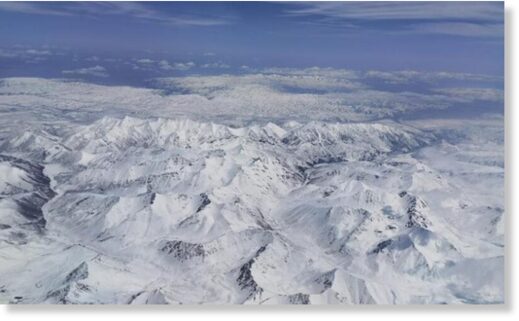
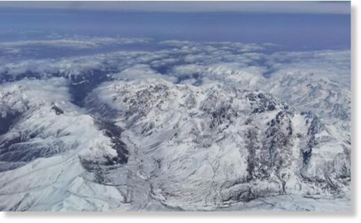
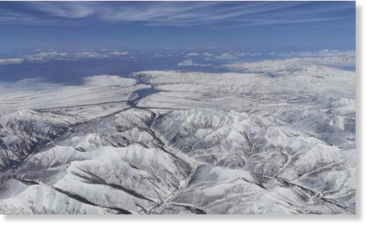
The photo captured on May 23, 2021 shows a snowfall on the Qilian Mountains, on the border of Qinghai and Gansu provinces. Qilian Mountains have an average altitude of 3,500 meters above sea level, renowned by rugged landscape.

View: https://youtu.be/r0xSBVuunzs
Run time is 3:58

snow
© China News Service/Cheng Lin

snow
© China News Service/Cheng Lin

Source: China News Service
 

TxGal

Day by day
It's not winter, but Mauna Kea, Hawaii is dusted white with snow -- Earth Changes -- Sott.net

It's not winter, but Mauna Kea, Hawaii is dusted white with snow

Hawaii News Now
Mon, 24 May 2021 12:18 UTC

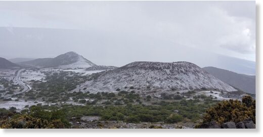
A light snowfall brushed Mauna Kea white over the weekend.
© CMS Rangers / University of Hawaii
A light snowfall brushed Mauna Kea white over the weekend.

Even though summer is nearing and the days are getting hotter, snow is still present in Hawaii.

Officials say on Saturday night, a severe thunderstorm swept over the mountain and dropped snow along with quarter-inch-sized hail.

This time, rather than just the summit, the snow fell in the mid-level section,
which has an elevation of about 9,000 feet. The towering clouds mixed with orographic lift led to favorable conditions for the snow and hail, meteorologists said.

The hazardous conditions prompted officials to urge caution for those traversing the area.

Monday afternoon, the Mauna Kea Visitor Information Station reported weather conditions to be 2.11 °C, or about 35 degrees °F.

View: https://youtu.be/SLEL2EiNyDw
Run time is 0:28
 

TxGal

Day by day
Violent Late-Spring Snowstorm Blasts Scotland, Buries the Higher Elevations - Electroverse

Scottarctica-1-e1621936516616.jpg

Extreme Weather GSM
VIOLENT LATE-SPRING SNOWSTORM BLASTS SCOTLAND, BURIES THE HIGHER ELEVATIONS
MAY 25, 2021 CAP ALLON

Scots are suffering a rare late-spring Arctic blast this week as an unusual chill continues to engulf the majority of the European continent.

Inches upon inches of rare and record-breaking late-May snow settled across the higher parts of Scotland, with additional and exceptionally rare flurries descending on low-lying areas, too.

The UK Met Office issued weather warnings for the north and central areas of the country as this meridional jet stream induced weather –caused by low solar activity– continues to dominate (links on that below).

More than 4 inches is estimated to have fallen over a vast area during a seven hour blast of inclement weather.

While a warning on the Met Office website yesterday read: “An area of snow is currently extending southwards from the Highlands to reach the Central Belt towards dawn … accumulations of snow of 3 cm (1.2 inches) below 150 m (492 ft) is possible.”

Traffic Scotland Twitter reported whiteout conditions across some Scottish roads.

While this was the scene at Cairngorm National Park:

Visitors were greeted by snowy scenes on Saturday morning in the national park
Snow at Cairngorm National Park, late-May, 2021.

This ‘global warming goodness’ is Scotland’s latest extreme cold event in what has been a bitterly chilly first 5 months of the year.

Winter delivered consistent sub-zero temperatures and prolific bouts of heavy snow in what inthesnow.com called “one of the longest spells of cold snowy weather this century.”

And even now, with summer just around the corner, the record cold and snow is persisting.

Britain remains on track to log one of its coldest May’s in recorded history, while the month has already gone down as the snowiest ever, busting the old benchmark set in 1979.

As we approach June, forecasters are anticipating yet more Arctic outbreaks.

Next week, the Met Office is predicting “snow, hail and thunder” to rock Scotland. This is the same Met Office that recently claimed extreme cold was a thing of the past, and also that snow will vanish from Britain by 2040 due to the “climate emergency/crisis/breakdown” aka “global heating” aka “terrifying terra firma broiling.”

According to the Met Office, UK snow will be a thing of the past by 2040.

This is a ludicrous, fear-mongering statement — a claim which history will deem just as stupid as that made by senior climatologist Dr David Viner of the Climate Research Unit (CRU) of the University of East Anglia.

Back in 2000, reported at the time by the Telegraph (since deleted), Viner said: within a few years winter snowfall will become “a very rare and exciting event,” adding that “children just aren’t going to know what snow is.”

Well, here is some UK snow for you, Viner, in late-spring of the year 2021, no less:

E1tmfJpWYAIaJyG.jpg

May snow, Scotland.

While below is Ian Innes pictured on the Scottish slopes.

A baffled Innes writes on Facebook: “Powder skiing in May!? In Scotland!?!?”

View: https://www.facebook.com/iainskier/photos/a.2561638537473577/2609471332690297/?type=3

Frustratingly, hacks such as Viner are never called to task.

Their mistakes and dud-research are seldom analysed or investigated.

Instead, the cycle is simply one of rinse and repeat: the global warming cabal call-up their next set of “higher-educated” brainwashees who go on to use the exact same flawed upside down pyramid built on the work of just a few climate modelers to make the exact same tired-old doomsday predictions.

Global snowpack is actually increasing.

According to NASA, it has been increasing for the past 40 years.

Data analyst Zoe Phin was curious to know what the global snowfall trend was in this era of extreme global warming. “Luckily,” she writes, “NASA covertly provides us with all the necessary data to figure this out.”


‘End of Snow’ prophesies are just more AGW propaganda, plain and simple — they are not based in fact.

As is the Met Office claim, Britain is supposed to be devoid of snow in just 19 short years.

Yet this (shown below) was the scene at Scotland’s Ben Nevis Summit Plateau yesterday, May 24, 2021:


Ben Nevis Summit Plateau (Scotland, late-May, 2021).

The anthropogenic global warming theory is falling apart.

There was never a good correlation between CO2 and global temperatures to begin with, and now that correlation is getting weaker and weaker with each and every passing day as our planet continues to cool.

Conversely though, the “climate crisis” propaganda appears to be growing stronger as the elites ramp-up the narrative.

To the masses, the illogical scrawlings published by The Guardian rule over data and real-world observations.

This is the depressing nature of humans.

We’re easily led.

We’re far too trusting of authority.

And as has been the way for time immemorial, for every past civilization, these traits will once again prove our downfall.

To finish, below are Europe’s temperature anomalies for today, Tuesday, May 25.

Enjoy!


GFS 2m Temp Anomalies — My 25 [tropicaltidbits.com].

The COLD TIMES are returning, the mid-latitudes are REFREEZING, in line with the great conjunction, historically low solar activity, cloud-nucleating Cosmic Rays, and a meridional jet stream flow (among other forcings).

Both NOAA and NASA appear to agree, if you read between the lines, with NOAA saying we’re entering a ‘full-blown’ Grand Solar Minimum in the late-2020s, and NASA seeing this upcoming solar cycle (25) as “the weakest of the past 200 years”, with the agency correlating previous solar shutdowns to prolonged periods of global cooling here.

Furthermore, we can’t ignore the slew of new scientific papers stating the immense impact The Beaufort Gyre could have on the Gulf Stream, and therefore the climate overall.


Prepare accordinglylearn the facts, relocate if need be, and grow your own.
 

TxGal

Day by day
Interesting podcast from Adapt 2030 this morning:

Same Exact Event Separated by 150 Years - YouTube

Same Exact Event Separated by 150 Years
8,501 views • Premiered 9 hours ago

View: https://youtu.be/iJgWNcdq8bM
Run time is 10:30

Synopsis provided:

Ever heard of the Children's Blizzard? How does this connect to the recent events during the Ultramarathon in China where unexpected storms took down the most fit and mentally prepared of our entire species.
 

TxGal

Day by day
Greenland just GAINED a Record-Smashing amount of Snow and Ice - Electroverse

SMB_curves_LA_EN_20210525.png

Articles Extreme Weather GSM
GREENLAND JUST GAINED A RECORD-SMASHING AMOUNT OF SNOW AND ICE
MAY 26, 2021 CAP ALLON

According to data provided by the Danish Meteorological Institute (DMI), Greenland is currently GAINING snow and ice at a level never before seen this late into the season.

Using the daily output from a weather forecasting model combined with a model that calculates the melt of snow and ice, the DMI calculate the “surface mass budget” (SMB) of the ice sheet.

Crucial to the survival of a glacier is its SMB, which is the difference between accumulation and ablation (sublimation and melting).

The budget takes into account the balance between snow that is added to the ice sheet vs melting snow and glacier ice that runs off into the ocean.

The budget is totaled over the course of a season, from September 1 to August 31.

Last season’s SMB totaled 349bn tonnes, which was “normal,” according to the DMI.

Changes in this mass-balance control a glacier’s long-term behavior, and are its most sensitive climate indicators.

Ice sheets can also lose ice by the breaking off (aka “calving”) of icebergs from its edge, but that is not included in this type of budget. Calving events usually occur when an ice sheet is expanding, not shrinking. In addition, an icebergs that breaks off a glacier –such as Antarctica’s A-76– aren’t “lost” to the ocean, they continue existing like some island extension to the sheet.

On the back of substantial SMB gains over the past few years, the Greenland Ice Sheet looks set to continue that trend in 2021. Despite decades of doom-and-gloom prophecies, the sheet is currently GAINING record-smashing amounts of “mass” — a whopping 8 gigatons yesterday alone (May 25, 2021).

After an admittedly slow start to the month (but during an impressive season overall), the world’s largest island logged an unprecedented accumulation on Tuesday: an 8 gigaton SMB gain has never been documented at this time of year, not since DMI records began way back in 1981.

A gain of this magnitude would be big news in November through February, let alone late-May.

According to climate alarmists, Greenland should have melted into oblivion by now.

Yet here we are:


Greenland SMB [DMI].

Since September, 2020 –the official start of the season– SMB spikes above the 2/2.5 gigaton daily average have been a regular occurrence.

In early-November, the sheet gained a whopping 10 Gts in a single day.

While spikes above 5 Gts mark have been common.

SMB_curves_LA_EN_20210525.png

Greenland SMB [DMI]

This season’s gains continue the impressive growth trend witnessed since 2016:

2016-17

For the 2016-17 SMB season, the Greenland ice sheet gained 544 billion tonnes of ice (compared to the 1981-2010 average of 368bn tonnes) .

This is the fifth highest in books dating back to 1981 (with the highest being the 619bn tonnes gained in 1995-96 — solar minimum of cycle 22).

2017-18:

The DMI calculated a total SMB of 517bn tonnes for the 201-18 season.

This is almost 150bn tonnes above the 1981-2010 average, and puts it just behind the 2016-17 season as the sixth highest on record (by contrast, the lowest SMB in the record was 2011-2012 with just 38bn tonnes).

2018-19 + 2019-20:

DMI estimates that the surface of the ice sheet gained 169bn tonnes during 2018-19.

And while this is on the low end, it still falls within the 1981-2010 average–and comfortably above 2011-12’s paltry 38bn tonnes.

The 2019-20 SMB lookes to have reversed the lower gains of 2018-19, with 349bn tonnes added to the sheet.

These were levels very close to the 1981-2010 average of 368bn tonnes.

The DMI described the year as “normal,” and the gains look to have gotten things back on track to the post 2016 trend of growth.

Also note: the period 2003-2011 saw ice sheet losses on Greenland average 234bn tonnes each year. Since then though, the tide has clearly started turning, the trend is changing to one of growth: climate is cyclic, after all — never linear.

NORTHERN HEMISPHERE SNOW MASS

Furthermore, the Total Snow Mass for the Northern Hemisphere chart (shown below) reveals that accumulating snow continued to track well-above the 1982-2012 average this season.

At its peak (early-March) northern hemisphere snow was sitting at some 500+ gigatons above the norm (another “impossible” real-world reality according to the IPCC: “Milder winter temperatures will decrease heavy snowstorms”).


[FMI].

This is how glaciers form.

This is how ice ages begin.

Ocean currents are also stalling.

This all points to cooler times ahead.

Prepare.

The COLD TIMES are returning, the mid-latitudes are REFREEZING, in line with the great conjunction, historically low solar activity, cloud-nucleating Cosmic Rays, and a meridional jet stream flow (among other forcings).

Both NOAA and NASA appear to agree, if you read between the lines, with NOAA saying we’re entering a ‘full-blown’ Grand Solar Minimum in the late-2020s, and NASA seeing this upcoming solar cycle (25) as “the weakest of the past 200 years”, with the agency correlating previous solar shutdowns to prolonged periods of global cooling here.

Furthermore, we can’t ignore the slew of new scientific papers stating the immense impact The Beaufort Gyre could have on the Gulf Stream, and therefore the climate overall.


Prepare accordinglylearn the facts, relocate if need be, and grow your own.
 

jed turtle

a brother in the Lord
Greenland just GAINED a Record-Smashing amount of Snow and Ice - Electroverse

SMB_curves_LA_EN_20210525.png

Articles Extreme Weather GSM
GREENLAND JUST GAINED A RECORD-SMASHING AMOUNT OF SNOW AND ICE
MAY 26, 2021 CAP ALLON

According to data provided by the Danish Meteorological Institute (DMI), Greenland is currently GAINING snow and ice at a level never before seen this late into the season.

Using the daily output from a weather forecasting model combined with a model that calculates the melt of snow and ice, the DMI calculate the “surface mass budget” (SMB) of the ice sheet.

Crucial to the survival of a glacier is its SMB, which is the difference between accumulation and ablation (sublimation and melting).

The budget takes into account the balance between snow that is added to the ice sheet vs melting snow and glacier ice that runs off into the ocean.

The budget is totaled over the course of a season, from September 1 to August 31.

Last season’s SMB totaled 349bn tonnes, which was “normal,” according to the DMI.

Changes in this mass-balance control a glacier’s long-term behavior, and are its most sensitive climate indicators.

Ice sheets can also lose ice by the breaking off (aka “calving”) of icebergs from its edge, but that is not included in this type of budget. Calving events usually occur when an ice sheet is expanding, not shrinking. In addition, an icebergs that breaks off a glacier –such as Antarctica’s A-76– aren’t “lost” to the ocean, they continue existing like some island extension to the sheet.

On the back of substantial SMB gains over the past few years, the Greenland Ice Sheet looks set to continue that trend in 2021. Despite decades of doom-and-gloom prophecies, the sheet is currently GAINING record-smashing amounts of “mass” — a whopping 8 gigatons yesterday alone (May 25, 2021).

After an admittedly slow start to the month (but during an impressive season overall), the world’s largest island logged an unprecedented accumulation on Tuesday: an 8 gigaton SMB gain has never been documented at this time of year, not since DMI records began way back in 1981.

A gain of this magnitude would be big news in November through February, let alone late-May.

According to climate alarmists, Greenland should have melted into oblivion by now.

Yet here we are:


Greenland SMB [DMI].

Since September, 2020 –the official start of the season– SMB spikes above the 2/2.5 gigaton daily average have been a regular occurrence.

In early-November, the sheet gained a whopping 10 Gts in a single day.

While spikes above 5 Gts mark have been common.

SMB_curves_LA_EN_20210525.png

Greenland SMB [DMI]

This season’s gains continue the impressive growth trend witnessed since 2016:

2016-17

For the 2016-17 SMB season, the Greenland ice sheet gained 544 billion tonnes of ice (compared to the 1981-2010 average of 368bn tonnes) .

This is the fifth highest in books dating back to 1981 (with the highest being the 619bn tonnes gained in 1995-96 — solar minimum of cycle 22).

2017-18:

The DMI calculated a total SMB of 517bn tonnes for the 201-18 season.

This is almost 150bn tonnes above the 1981-2010 average, and puts it just behind the 2016-17 season as the sixth highest on record (by contrast, the lowest SMB in the record was 2011-2012 with just 38bn tonnes).

2018-19 + 2019-20:

DMI estimates that the surface of the ice sheet gained 169bn tonnes during 2018-19.

And while this is on the low end, it still falls within the 1981-2010 average–and comfortably above 2011-12’s paltry 38bn tonnes.

The 2019-20 SMB lookes to have reversed the lower gains of 2018-19, with 349bn tonnes added to the sheet.

These were levels very close to the 1981-2010 average of 368bn tonnes.

The DMI described the year as “normal,” and the gains look to have gotten things back on track to the post 2016 trend of growth.

Also note: the period 2003-2011 saw ice sheet losses on Greenland average 234bn tonnes each year. Since then though, the tide has clearly started turning, the trend is changing to one of growth: climate is cyclic, after all — never linear.

NORTHERN HEMISPHERE SNOW MASS

Furthermore, the Total Snow Mass for the Northern Hemisphere chart (shown below) reveals that accumulating snow continued to track well-above the 1982-2012 average this season.

At its peak (early-March) northern hemisphere snow was sitting at some 500+ gigatons above the norm (another “impossible” real-world reality according to the IPCC: “Milder winter temperatures will decrease heavy snowstorms”).


[FMI].

This is how glaciers form.

This is how ice ages begin.

Ocean currents are also stalling.

This all points to cooler times ahead.

Prepare.

The COLD TIMES are returning, the mid-latitudes are REFREEZING, in line with the great conjunction, historically low solar activity, cloud-nucleating Cosmic Rays, and a meridional jet stream flow (among other forcings).

Both NOAA and NASA appear to agree, if you read between the lines, with NOAA saying we’re entering a ‘full-blown’ Grand Solar Minimum in the late-2020s, and NASA seeing this upcoming solar cycle (25) as “the weakest of the past 200 years”, with the agency correlating previous solar shutdowns to prolonged periods of global cooling here.

Furthermore, we can’t ignore the slew of new scientific papers stating the immense impact The Beaufort Gyre could have on the Gulf Stream, and therefore the climate overall.


Prepare accordinglylearn the facts, relocate if need be, and grow your own.
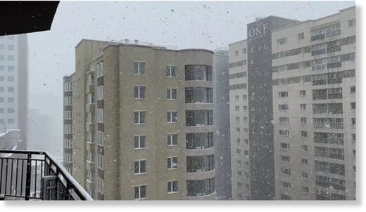
Changes like this are the BIG news on Earth - similar to the rapidly increasing magnetic pole migration at both poles, and the rapidly decreasing strength of the suns’s heliosphere, and the rapidly decreasing Earth’s magnetosphere - news that doesn’t make it to the top of the news cycle...yet...

These Earth Changes taken together are giving us the clues that something very big is about to change on Earth in a very big way, much bigger than the cultural and political and military events that are currently center stage in our daily news feeds. Most of us here are thinking that it has something to do with certain cycles in the Sun, but, there are other cycles that may be one of the actual triggers:
perhaps an approaching binary star on its 3600 year orbit, as suggested by ancient texts, or perhaps as likely as cyclical “galactic wave” emitted periodically about every 12000 years from the center of the galaxy, for example. The scenario that should disturb everyone the most -at least it does me- is the scenario laid out in Douglas Vogt’s “God’s Day of Judgement” (2007) in which he lays out the evidence for a mini-nova of our sun every 12,068 years...
 

TxGal

Day by day
Volcano news: reports and updates on volcanic activity woldwide / 1-26 May, 2021 / VolcanoDiscovery

Worldwide Volcano News and Updates

latest (May 2021) | Apr 2021 | Mar 2021 | archive

Volcanoes Today, 26 May 2021: Etna volcano, Stromboli, Fuego, Merapi, Dukono, Reventador, Nyiragongo, Sangay
Wed, 26 May 2021, 12:00
Sangay Volcano Volcanic Ash Advisory: NEW VA EMS ARND 26/1020Z to 18000 ft (5500 m)
Wed, 26 May 2021, 11:45
Dukono Volcano Volcanic Ash Advisory: VA TO FL070 EXT NE LAST PARTIAL OBS AT 26/0600Z to 7000 ft (2100 m)
Wed, 26 May 2021, 10:00
Nyiragongo Volcano Volcanic Ash Advisory: ERUPTION AT 20210522/1630Z PROBABLY STILL SOME LOW EMISSION to 20000 ft (6100 m)
Wed, 26 May 2021, 09:30
Etna volcano (Italy): another short violent phase of lava fountain this morning
Wed, 26 May 2021, 08:57


Lava fountain from Etna's New SE crater this morning (image: INGV webcam on Montagnola)

A third, brief phase of lava fountaining occurred this morning between around 9.30-10 am this morning. A dense ash plume drifted eastwards. Read all
Etna Volcano Volcanic Ash Advisory: ERUPTION AT 20210526/0745Z EXPLOSIVE ACTIVITY WITH ASH EMISSION. to 16000 ft (4900 m)
Wed, 26 May 2021, 08:15
Great Sitkin volcano (Aleutian Islands): new explosion today
Wed, 26 May 2021, 08:06


Eruption column from today's explosion at Great Sitkin volcano (image: AVO)

A new short-lived (1-2 minutes) explosive eruption started at the volcano at 21:04 local time (05:04 UTC) and the activity is still continuing at the time of this update as confirmed by geophysical data. Read all
Merapi volcano (Java, Indonesia): continuing glowing avalanches
Wed, 26 May 2021, 07:57


Glowing rockfalls from the active lava dome yesterday (image: PVMBG)

The activity of the volcano remains essentially unchanged characterized by the actively growing lava dome. Read all
Stromboli volcano (Eolian Islands, Italy) activity update
Wed, 26 May 2021, 07:16


View of Stromboli's Sciara this morning.

It seems the lava flow from the northeastern vent that had been the result of overflow from the crater after its partial collapse last week is no longer active this morning.
Etna volcano update: Intense fireworks - two lava fountain episodes over night
Wed, 26 May 2021, 07:13


Activity at Etna's New SE crater last night

After the rather surprising onset of a new intense phase of activity in the late afternoon, the New SE crater produced not only one, but two paroxysms during the night, marking them the 26th and 27th such episodes for 2021 so far. Read all

(Much more at the website)
 

TxGal

Day by day
(Fair use cited)

Alaska Volcano Eruption at Great Sitkin Island Sparks Red Warning (newsweek.com)

TECH & SCIENCE
Alaska Volcano Eruption at Great Sitkin Island Sparks Red Warning
BY ED BROWNE ON 5/26/21 AT 3:57 AM EDT

Avolcanic eruption from the Alaskan volcano of Great Sitkin has launched ash high into the air and further explosions are possible, according to the authorities.

The Alaska Volcano Observatory (AVO) has issued a red aviation alert for Great Sitkin, meaning "significant emission" of volcanic ash into the atmosphere is likely. The eruption does not appear to have sparked any evacuation warnings.

The observatory issued a notice for aircraft at around 6 a.m. UTC Wednesday morning in which it warned an "explosive eruption" occurred about an hour prior, sending up a cloud of volcanic ash. The eruption is thought to have lasted between one and two minutes.

Initial reports suggested the cloud from the eruption was 15,000ft high. Since that explosion the cloud has detached from the volcano and is moving eastward.

AVO has warned additional explosions are possible. The Aviation Color Code warning remains red, and the Volcano Alert Level remains at "Warning."

It is unclear at the time of writing how the eruption may affect or has affected flights over the region. Newsweek has contacted the United States Geological Survey (USGS) for comment.

Volcanic ash is known to have damaging effects on aircraft because it can erode crucial components such as turbine blades in the engine and scratch landing lights and windscreens.

It can also block fuel nozzles and air filters, set off fire alarms in the cabin, interfere with radio communication systems, and block sensors that let the pilots know how fast the aircraft is going.

The continuous monitoring of airspace helps airline companies avoid volcanic ash clouds.

Great Sitkin is a volcano that occupies most of the northern half of Great Sitkin Island, which is part of the Aleutian Islands chain. The volcano is oval-shaped, eight by 11 kilometers at its base, and 5,709ft tall.

It is about 26 miles east of the community of Adak, and around 1,167 miles away from Anchorage, Alaska's most populous city, which is to the north east.

The last time Great Sitkin erupted was in 1974, marking at least the third time it had done so during the 20th century.

That eruption caused a cloud of ash that is thought to have probably risen to an altitude of more than 25,000ft above sea level. It also produced a lava dome in the center of the volcano's crater.

To monitor the volcano, AVO uses a combination of satellite, seismic, and sound data.

Great Sitkin

The crater of Great Sitkin smoulders in this photo taken in around 1955. The volcano is thought to have erupted at least three time during the 20th century, according to the Alaska Volcano Observatory.TED BANK JR/THREE LIONS / HULTON ARCHIVE / GETTY
 

ktrapper

Veteran Member
Snowing here again this morning.
I talked to our neighbor rancher yesterday, he said this snow fall should not be happening this late that we should have plenty of green grass by now for the cows.

We went to the cattle sale yesterday to take some for the ranch my daughter works for and I saw some cows come through that looked like they had a really rough winter. I don’t know if it’s normal to see them that thin come through. Maybe the owner fell on a rough winter. The rest looked pretty good.
I was comparing auction prices to Feeder Cattle and reg Cattle Futures. Auction prices were not coming close.
I did see where I can just go buy young steers at auction and raise them off and butcher them myself for way way cheaper than buying from the locker so as soon as we have the fencing done that’s what I will do so that they will be grass fed and organic.
 

TxGal

Day by day
Snowing here again this morning.
I talked to our neighbor rancher yesterday, he said this snow fall should not be happening this late that we should have plenty of green grass by now for the cows.

We went to the cattle sale yesterday to take some for the ranch my daughter works for and I saw some cows come through that looked like they had a really rough winter. I don’t know if it’s normal to see them that thin come through. Maybe the owner fell on a rough winter. The rest looked pretty good.
I was comparing auction prices to Feeder Cattle and reg Cattle Futures. Auction prices were not coming close.
I did see where I can just go buy young steers at auction and raise them off and butcher them myself for way way cheaper than buying from the locker so as soon as we have the fencing done that’s what I will do so that they will be grass fed and organic.

The weather is off from 'normal' in so many places. The older farmers and ranchers really, really know the weather...they are the ones to pay attention to.

By now the hay folks down here should have had their first cut done and in...pastures are just too wet for that, it's been raining pretty much for two weeks. Not normal....We have fungi/mushrooms growing that we have never seen before. Otherworldly-looking things.

We raised our own beef for over 10 yrs. If you can do it, even with some protein tubs as a supplement and even some hay if pastures ultimately go dry, you will save a bundle from store beef prices and have excellent beef. If you don't have a chest freezer or two, you'll need to be looking for them.

The next few years are going to be 'interesting' in terms of food availability and/or pricing.
 

ktrapper

Veteran Member
The weather is off from 'normal' in so many places. The older farmers and ranchers really, really know the weather...they are the ones to pay attention to.

By now the hay folks down here should have had their first cut done and in...pastures are just too wet for that, it's been raining pretty much for two weeks. Not normal....We have fungi/mushrooms growing that we have never seen before. Otherworldly-looking things.

We raised our own beef for over 10 yrs. If you can do it, even with some protein tubs as a supplement and even some hay if pastures ultimately go dry, you will save a bundle from store beef prices and have excellent beef. If you don't have a chest freezer or two, you'll need to be looking for them.

The next few years are going to be 'interesting' in terms of food availability and/or pricing.
I have 22 cubic foot freezer. We have always processed our own everything. Moose, caribou, deer, and beef.

We have about 30 acres of good grass and a close by source for Alfalfa- Alfalfa grass mix hay for winter.

My son from AK is planning to move down to MT, here, in July. He’s a meat cutter so I do have help.
 
Top