Mumbai's Coldest Temp In a Decade; Record Snow Leads to 38 Avalanches Around Snoqualmie; And No, The "Climate Crisis" Isn't Causing An Uptick In Arctic Lightening, Cosmic Rays Are - Electroverse
Articles Extreme Weather GSM
MUMBAI’S COLDEST TEMP IN A DECADE; RECORD SNOW LEADS TO 38 AVALANCHES AROUND SNOQUALMIE; AND NO, THE “CLIMATE CRISIS” ISN’T CAUSING AN UPTICK IN ARCTIC LIGHTENING, COSMIC RAYS ARE
JANUARY 11, 2022 CAP ALLON
MUMBAI’S COLDEST TEMP IN A DECADE
Mumbai, India woke to a cold Monday morning this week with minimum temperatures, as logged by the India Meteorological Department (IMD) Santacruz observatory, hitting 13.2C (55.7F) — the lowest of the season so far.
The unusual chill persisted throughout the day, with Mumbai reaching a high of
just 25.1C (77F) — a reading that may seem mild to most, but one that went down as the city’s
lowest January max for a decade, reports
timesofindia.com.
A low of
12C (53.6C) is on the cards Tuesday night, as much of India
continues to shiver through an anomalous cold spell.
As explained by one IMD official: “The associated cyclonic circulation of western disturbance over northwest India is pulling the moisture from the Arabian sea. Also, the prevalence of the northerly cold winds over the region is leading to this chill.”
Those northerly winds have had an extra bite of late, as they are having to traverse record snowpack in Northern India,
Pakistan and Nepal on their way south. Tens of people perished in unprecedented Pakistan blizzards over the weekend, while in Nepal, more than
3 meters (10 feet) of snow recently accumulated on the mountains, including on Manaslu.
“[Of all my] 21 winter expeditions, this one is proving to be particularly hard,” said Manaslu climber Simone Moro, pictured below with two other climbers navigating a tricky section of the mountain on Jan 5–so before the latest snowstorm.

Below is Moro (in red) and a Nepali team member working on their buried tents:


Buried tent on Manaslu, Nepal.
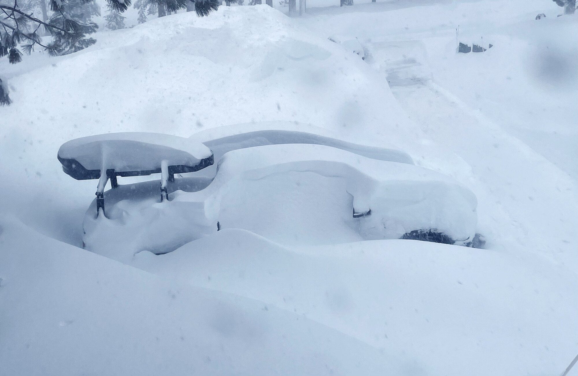
RECORD SNOW LEADS TO 38 AVALANCHES AROUND SNOQUALMIE
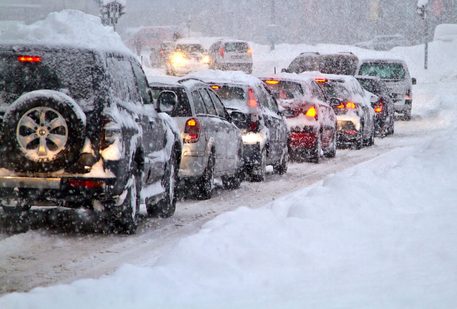
Washington State’s department of transportation is still conducting clearing operations after 38 avalanches came down onto roadways in and around Snoqualmie, located just outside Seattle.
A record 236 inches of snow besieged the region, breaking the previous record of 229 inches from Jan 3, 2006.

The state has been dealing with inclement wintry weather for weeks.
Gov. Jay Inslee declared a state of emergency on Friday after “a series of severe winter storms” that started December 17, caused record snow, flooding, evacuations and road closures.
The historic falls haven’t just been confined to WA, either. Looking south, at Nevada: “We have almost twice as much as normal,” said Hydrologist Jeff Anderson of NRCS — the snowpack is sitting at 185% or normal.
Likewise in neighboring California, snowpack is holding at record high levels. The state
enjoyed its snowiest month of December in history last month: An unprecedented
214 inches (5.44m) was logged by the UC Berkeley Central Sierra Snow Lab, while the
171 inches (4.43m) observed at central California’s Yosemite National Park (at Tuolumne Meadows) smashed the area’s previous all-time record of 143 inches (3.63m) set back in 1996 (solar minimum of cycle 22).
Record snow accumulations have been building in locales out east, too — including in New York State:
View: https://twitter.com/nowthisnews/status/1480726908526546947
Run time is 0:46
All of which have added to the T
otal Snow Mass for the Northern Hemisphere, which continues to push on, now fast approaching 500 Gigatons
above the 1982-2012 average:

[FMI]
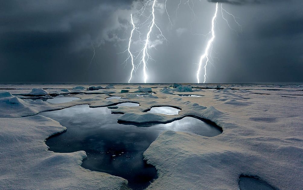
THE “CLIMATE CRISIS” ISN’T CAUSING AN UPTICK IN ARCTIC LIGHTENING, COSMIC RAYS ARE
A new phenomenon has been observed, and so, of course, the old scapegoat has been dragged to the fore. But once again, the correlation (this time, global warming and Arctic lightening) is driven predominantly by the media, rather than the science.
In a
2021 Annual Lightning Report, the World Meteorological Organization stated that lightning was an Essential Climate Variable, because understanding where and how frequently it happens can offer insights into climate change. According to a
2021 study, an increase in the number of lightning strikes between 2010 and 2020 occurred in the Arctic, which
seemed to correlate with global temperature anomalies. While back in 2019, scientists observed the furthest-north lightning on record — roughly 32 miles from the North Pole.
Of course, the media has managed to find researchers willing to tie these observations to the AGW Party narrative: “Scientists affirmed that as recent years showed strong evidence that the Arctic is warming at a faster rate than expected, causing sea ice to melt along with permafrost, reports of multiple lightning strikes had also been detected within just a few hundred miles from the North Pole,” reported
thehill.com this week. But as we discussed just yesterday, Arctic sea ice has been performing well in recent years — particularly this year, with extent currently sitting at its highest level since 2004 (see below).
Correlating decreasing sea ice with increased lightening already has the alarmists on shaky ground.

[
NSIDC]
The Hill go on to fear-monger about wildfires, lightening being a key contributor to those. And they also quote Chris Vagasky, a meteorologist for Vaisala (a Finnish environmental firm): “Changes in the Arctic can mean changes in the weather at home. All weather is local, but what happens at your house depends on how the atmosphere is behaving elsewhere throughout the world. Changes to conditions in the Arctic could cause more extreme cold outbreaks, more heatwaves, or extreme changes in precipitation to Europe,” said Vagasky, who also added this: “Scientists can’t tie a lightning strike from one day to the changes in our climate, but monitoring trends of lightning in the Arctic is especially important and something that will need to be studied now and in the future,” which is a prime example of a scientist covering their back, i.e.,
“I’ve told you what you want to hear, but let me include just enough doubt so that I don’t look like a total stooge years down the line when the AGW fraud is exposed.”
But a stooge you are, Vagasky, because the observed influx of
cosmic rays is capable of FULLY explaining the observed uptick in Arctic lightening — no boogeyman (aka CO2 scapegoat) required.
As early as 1933
a connection between cosmic rays and lightening was noted. But it wasn’t until decades later that the phenomenon was properly investigated. Still, that 1933 paper was asking the right questions — below is its abstract:
In order to explain the curious behaviour of lightning flashes the possibility should be kept in mind of a connexion between a lightning discharge and the cosmic rays. When penetrating particles from cosmic rays move through the atmosphere—in this case through electrically loaded clouds—they are ionising the air, making conducting paths for the lightning. The twisted or irregular shapes of lightning flashes may find a natural explanation, if we think of a discharge path following the variable network of ion-tracks, such as are assumed to be present in the air at any moment, caused by nuclear disintegration of atoms and other processes in conjunction with the cosmic rays, causing emission of protons, neutrons and negative or positive electrons.
In recent years, the ideas postulated back in 1933 have been found to be bang on the money.
Just as they do with clouds,
cosmic rays can seed lightening.
Serving as a brief recap, cosmic rays are a mixture of high-energy photons and sub-atomic particles accelerated toward Earth by supernova explosions and other violent events in the cosmos. During solar minimums –the low point of the 11 solar cycle– the Sun’s magnetic field weakens and the outward pressure of the solar wind decreases. This allows more cosmic rays to penetrate the inner solar system, including Earth’s atmosphere. The correlation is clear —
as solar activity decreases, the cosmic ray count increases:

As noted by
Dr Tony Phillips, who points to the study
Galactic Cosmic Radiation in Interplanetary Space Through a Modern Secular Minimum, “cosmic rays are bad–and they’re going to get worse” as the Grand Solar Minimum (a prolonged spell of low solar output) persists.
“During the next solar cycle, we could see cosmic ray dose rates increase by as much as 75%,” says lead author of the study Fatemeh Rahmanifard of the University of New Hampshire’s Space Science Center. “This will limit the amount of time astronauts can work safely in interplanetary space.”
Back in the 1990s, astronauts could travel through space for
as much as 1000 days before they hit NASA safety limits on radiation exposure. Not anymore, writes Dr Phillips. According to the new research, cosmic rays threaten to limit trips to as little as 290 days for 45-year old male astronauts, and 204 days for females.
So, cosmic rays
are increasing. A fact widely accepted. However, it’s their impact that is still being ignored, swept under the rug in favor of the better paying narrative that is anthropogenic global warming.
When cosmic rays hit the top of Earth’s atmosphere they produce a spray of secondary particles and photons that rain down on Earth’s surface, and these particles, as touched on above, have been found to
seed clouds (
Svensmark et al). Cloud cover plays perhaps the most crucial role in our planet’s short-term climate change: “Clouds are the Earth’s sunshade,” writes Dr. Roy Spencer, “and if cloud cover changes for any reason, you have global warming — or global cooling.” Therefore, it makes sense that the upshot of the historically weak solar cycles we’ve been experiencing in recent years (cycles 24 and 25–the weakest of the past 200+ years) will be a
cooling of the planet.
Adding increased lightening to the mix spices things up. And it also offers the AGW Party an appropriately apocalyptic visualization to go with their ‘End Of Days’ rhetoric. Lightening is scary. But the science just isn’t there. Sorry, Vagasky. Increased lightening, like increased cloud cover, is caused by increased cosmic rays
(papers easily googleable — here’s one).
Below is the observed uptick in Arctic lightening:

Guardian graphic. Source: Vaisala.
And below is the increase in cosmic rays hitting Earth (graphic lifted from the paper cited by Dr Tony Phillips above).
Note how the rates of lightning increase in line with the higher levels of in cosmic rays (from 2017 onward).

Activist scientists discovered a round peg (a climatic anomaly) and have tried desperately to jam it into AGW’s decidedly square hole, offering no real scientific explanation for the phenomenon — not that the likes of the The Hill and The Guardian are interested in genuine scientific debate. They made that clear decades ago. This is more their level:
 AGW ‘devil lightening’.
There is, of course, a ulterior motive to all this AGW fear-mongering — and that is
control.
After dismissing climate lockdowns as
another conspiracy theory, there is now increasing talk of them being rolled out, modeled after
COVID lockdowns, and under what’s being labelled
environmental authoritarianism, in which your right to drive a car, fly on a plane or own a big house could be suspended by the government in order to fight the ‘climate crisis’.
A
recent article in the influential magazine
Foreign Policy suggested Democracy may not be compatible with reaching climate goals. This is where we’re headed. This is where we were always headed. The question is, will the gullible masses awake in time?
The
COLD TIMES are returning, the mid-latitudes are
REFREEZING in line with
historically low solar activity,
cloud-nucleating Cosmic Rays, and a
meridional jet stream flow (among many other forcings, including the impending release of
the Beaufort Gyre).
Prepare accordingly — learn the facts, relocate if need be and
grow your own.


")
")