packyderms_wife
Neither here nor there.
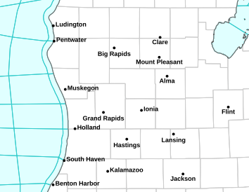
Michigan
Go to the NOAA Homepage
NWS Homepage
Local weather forecast by "City, St" or zip code
City, St
Tornado Warning
Severe Weather Statement
National Weather Service Grand Rapids MI
558 PM EDT Tue May 7 2024
MIC077-072245-
/O.CON.KGRR.TO.W.0008.000000T0000Z-240507T2245Z/
Kalamazoo MI-
558 PM EDT Tue May 7 2024
...A TORNADO WARNING REMAINS IN EFFECT UNTIL 645 PM EDT FOR KALAMAZOO
COUNTY...
At 557 PM EDT, a large and extremely dangerous tornado was located
near Portage, moving northeast at 35 mph.
This is a PARTICULARLY DANGEROUS SITUATION. TAKE COVER NOW!
HAZARD...Damaging tornado.
SOURCE...Radar indicated rotation.
IMPACT...You are in a life-threatening situation. Flying debris may
be deadly to those caught without shelter. Mobile homes
will be destroyed. Considerable damage to homes,
businesses, and vehicles is likely and complete destruction
is possible.
The tornado will be near...
Kalamazoo, Portage, Comstock Northwest, and Westwood around 605 PM
EDT.
Other locations impacted by this tornadic thunderstorm include
Fulton, Comstock, Scotts, and Oshtemo.
PRECAUTIONARY/PREPAREDNESS ACTIONS...
Motorists should not take shelter under highway overpasses. If you
cannot safely drive away from the tornado, as a last resort, either
park your vehicle and stay put, or abandon your vehicle and lie down
in a low lying area and protect yourself from flying debris.
&&
LAT...LON 4228 8577 4229 8576 4238 8557 4212 8529
4207 8530 4207 8576
TIME...MOT...LOC 2157Z 234DEG 30KT 4221 8565
TORNADO...RADAR INDICATED
TORNADO DAMAGE THREAT...CONSIDERABLE
MAX HAIL SIZE...1.75 IN
$$
MJS
Tornado Warning
MIC023-149-072230-
/O.NEW.KIWX.TO.W.0011.240507T2157Z-240507T2230Z/
BULLETIN - EAS ACTIVATION REQUESTED
Tornado Warning
National Weather Service Northern Indiana
557 PM EDT Tue May 7 2024
The National Weather Service in Northern Indiana has issued a
* Tornado Warning for...
Northeastern St. Joseph County in southwestern Michigan...
Northern Branch County in southwestern Michigan...
* Until 630 PM EDT.
* At 557 PM EDT, a confirmed large and extremely dangerous tornado
was located over Colon, or 13 miles north of Sturgis, moving
northeast at 45 mph.
This is a PARTICULARLY DANGEROUS SITUATION. TAKE COVER NOW!
HAZARD...Damaging tornado.
SOURCE...Weather spotters confirmed tornado.
IMPACT...You are in a life-threatening situation. Flying debris
may be deadly to those caught without shelter. Mobile
homes will be destroyed. Considerable damage to homes,
businesses, and vehicles is likely and complete
destruction is possible.
* The tornado will be near...
Union City around 605 PM EDT.
Other locations impacted by this tornadic thunderstorm include
Leonidas, Hodunk, Sherwood, South Butler, Girard, and Mendon.
This includes Interstate 69 in Michigan between mile markers 16 and
21.
PRECAUTIONARY/PREPAREDNESS ACTIONS...
To repeat, a large, extremely dangerous and potentially deadly
tornado is on the ground. To protect your life, TAKE COVER NOW! Move
to a basement or an interior room on the lowest floor of a sturdy
building. Avoid windows. If you are outdoors, in a mobile home, or in
a vehicle, move to the closest substantial shelter and protect
yourself from flying debris.
A large and extremely dangerous tornado is on the ground. Take
immediate tornado precautions. This is an emergency situation.
&&
LAT...LON 4198 8483 4195 8535 4203 8548 4207 8516
4207 8483
TIME...MOT...LOC 2157Z 247DEG 37KT 4199 8533
TORNADO...OBSERVED
TORNADO DAMAGE THREAT...CONSIDERABLE
MAX HAIL SIZE...2.00 IN
$$
MJ