WEATHER Severe Weather the Week of April 22md, 2024 - MODERATE RISK! Saturday 4/27/24

Status
Not open for further replies.

1911user

Veteran Member
Major outbreak.

Several major tornadoes.

Following Ryan hall.

Supercells forming west of Tulsa.

Just left Muskogee, spooky skies.
Great Idea! This post has the link to watch Ryan Hall on youtube.


packyderms_wife

Neither here nor there.
IOWA

Severe Weather Statement
National Weather Service Omaha/Valley Nebraska
604 PM CDT Fri Apr 26 2024

IAC165-262345-
/O.CON.KOAX.TO.W.0044.000000T0000Z-240426T2345Z/
Shelby IA-
604 PM CDT Fri Apr 26 2024

...TORNADO EMERGENCY FOR Harlan...

...A TORNADO WARNING REMAINS IN EFFECT UNTIL 645 PM CDT FOR CENTRAL
SHELBY COUNTY...


At 604 PM CDT, a confirmed large and destructive tornado was located
3 miles west of Harlan, moving northeast at 40 mph.

TORNADO EMERGENCY for Harlan. This is a PARTICULARLY DANGEROUS
SITUATION. TAKE COVER NOW!

HAZARD...Deadly tornado.

SOURCE...Weather spotters confirmed a very large tornado moving
toward Harlan.

IMPACT...You are in a life-threatening situation. Flying debris may
be deadly to those caught without shelter. Mobile homes
will be destroyed. Considerable damage to homes,
businesses, and vehicles is likely and complete destruction
is possible.

The tornado will be near...
Harlan around 610 PM CDT.

Other locations in the path of this tornadic thunderstorm include
Irwin.

PRECAUTIONARY/PREPAREDNESS ACTIONS...

To repeat, a large, extremely dangerous, and potentially deadly
tornado is on the ground. To protect your life, TAKE COVER NOW! Move
to an interior room on the lowest floor of a sturdy building. Avoid
windows. If in a mobile home, a vehicle or outdoors, move to the
closest substantial shelter and protect yourself from flying debris.

&&

LAT...LON 4173 9546 4186 9538 4186 9510 4180 9509
4156 9536 4156 9544 4164 9550
TIME...MOT...LOC 2304Z 216DEG 33KT 4163 9539

TORNADO...OBSERVED
TORNADO DAMAGE THREAT...CATASTROPHIC
MAX HAIL SIZE...1.75 IN

$$

BLB
 

packyderms_wife

Neither here nor there.
Severe Weather Statement
National Weather Service Omaha/Valley Nebraska
610 PM CDT Fri Apr 26 2024

IAC145-262330-
/O.CON.KOAX.TO.W.0046.000000T0000Z-240426T2330Z/
Page IA-
610 PM CDT Fri Apr 26 2024

...A TORNADO WARNING REMAINS IN EFFECT UNTIL 630 PM CDT FOR EASTERN
PAGE COUNTY...

At 610 PM CDT, a severe thunderstorm capable of producing a tornado
was located 3 miles north of Clarinda, moving northeast at 45 mph.

HAZARD...Tornado and golf ball size hail.

SOURCE...Radar indicated rotation.

IMPACT...Flying debris will be dangerous to those caught without
shelter. Mobile homes will be damaged or destroyed. Damage
to roofs, windows, and vehicles will occur. Tree damage is
likely.

This tornadic thunderstorm will remain over mainly rural areas of
eastern Page County, including the following locations... Hepburn.

PRECAUTIONARY/PREPAREDNESS ACTIONS...

TAKE COVER NOW! Move to a basement or an interior room on the lowest
floor of a sturdy building. Avoid windows. If you are outdoors, in a
mobile home, or in a vehicle, move to the closest substantial shelter
and protect yourself from flying debris.

&&

LAT...LON 4063 9504 4070 9515 4091 9497 4090 9494
4085 9493 4073 9493
TIME...MOT...LOC 2310Z 212DEG 37KT 4078 9505

TORNADO...RADAR INDICATED
MAX HAIL SIZE...1.75 IN

$$

Nicolaisen
 

packyderms_wife

Neither here nor there.
Missouri

Tornado Warning
MOC005-087-147-262330-
/O.NEW.KEAX.TO.W.0003.240426T2304Z-240426T2330Z/

BULLETIN - EAS ACTIVATION REQUESTED
Tornado Warning
National Weather Service Kansas City/Pleasant Hill MO
604 PM CDT Fri Apr 26 2024

The National Weather Service in Pleasant Hill has issued a

* Tornado Warning for...
Southeastern Atchison County in northwestern Missouri...
Northeastern Holt County in northwestern Missouri...
Western Nodaway County in northwestern Missouri...

* Until 630 PM CDT.

* At 604 PM CDT, a severe thunderstorm capable of producing a tornado
was located near Mound City, moving northeast at 55 mph.

HAZARD...Tornado and ping pong ball size hail.

SOURCE...Radar indicated rotation.

IMPACT...Flying debris will be dangerous to those caught without
shelter. Mobile homes will be damaged or destroyed.
Damage to roofs, windows, and vehicles will occur. Tree
damage is likely.

* Locations impacted include...
Maryville, Burlington Junction, Maitland, Skidmore, and Quitman.

PRECAUTIONARY/PREPAREDNESS ACTIONS...

TAKE COVER NOW! Move to a basement or an interior room on the lowest
floor of a sturdy building. Avoid windows. If you are outdoors, in a
mobile home, or in a vehicle, move to the closest substantial shelter
and protect yourself from flying debris.

&&

LAT...LON 4012 9519 4022 9531 4052 9498 4034 9482
TIME...MOT...LOC 2304Z 226DEG 47KT 4019 9520

TORNADO...RADAR INDICATED
MAX HAIL SIZE...1.50 IN

$$

Blair
 

packyderms_wife

Neither here nor there.
Missouri

Tornado Warning
MOC013-262345-
/O.NEW.KEAX.TO.W.0004.240426T2312Z-240426T2345Z/

BULLETIN - EAS ACTIVATION REQUESTED
Tornado Warning
National Weather Service Kansas City/Pleasant Hill MO
612 PM CDT Fri Apr 26 2024

The National Weather Service in Pleasant Hill has issued a

* Tornado Warning for...
Southeastern Bates County in west central Missouri...

* Until 645 PM CDT.

* At 611 PM CDT, a severe thunderstorm capable of producing a tornado
was located 7 miles southwest of Rich Hill, moving east at 40 mph.

HAZARD...Tornado and golf ball size hail.

SOURCE...Radar indicated rotation.

IMPACT...Flying debris will be dangerous to those caught without
shelter. Mobile homes will be damaged or destroyed.
Damage to roofs, windows, and vehicles will occur. Tree
damage is likely.

* Locations impacted include...
Rich Hill and Rockville.

PRECAUTIONARY/PREPAREDNESS ACTIONS...

TAKE COVER NOW! Move to a basement or an interior room on the lowest
floor of a sturdy building. Avoid windows. If you are outdoors, in a
mobile home, or in a vehicle, move to the closest substantial shelter
and protect yourself from flying debris.

&&

LAT...LON 3804 9424 3805 9425 3806 9450 3808 9449
3819 9405 3803 9406 3803 9409 3805 9410
3804 9411 3806 9413 3804 9420 3805 9420
3805 9421 3804 9422 3803 9424
TIME...MOT...LOC 2311Z 249DEG 33KT 3803 9447

TORNADO...RADAR INDICATED
MAX HAIL SIZE...1.75 IN

$$

Blair
 

packyderms_wife

Neither here nor there.
Iowa


Tornado Warning
IAC003-173-270000-
/O.NEW.KDMX.TO.W.0007.240426T2315Z-240427T0000Z/

BULLETIN - EAS ACTIVATION REQUESTED
Tornado Warning
National Weather Service Des Moines IA
615 PM CDT Fri Apr 26 2024

The National Weather Service in Des Moines has issued a

* Tornado Warning for...
Adams County in southwestern Iowa...
Northwestern Taylor County in southwestern Iowa...

* Until 700 PM CDT.

* At 615 PM CDT, a severe thunderstorm capable of producing a tornado
was located near Hepburn, or 6 miles northeast of Clarinda, moving
northeast at 45 mph.

HAZARD...Tornado and quarter size hail.

SOURCE...Radar indicated rotation.

IMPACT...Flying debris will be dangerous to those caught without
shelter. Mobile homes will be damaged or destroyed.
Damage to roofs, windows, and vehicles will occur. Tree
damage is likely.

* Locations impacted include...
Corning, Lake Icaria, Prescott, Nodaway, Carbon, Lake Icaria State
Park, and Corning Municipal Airport.

PRECAUTIONARY/PREPAREDNESS ACTIONS...

TAKE COVER NOW! Move to a basement or an interior room on the lowest
floor of a sturdy building. Avoid windows. If you are outdoors, in a
mobile home, or in a vehicle, move to the closest substantial shelter
and protect yourself from flying debris.

&&

LAT...LON 4116 9492 4116 9447 4105 9447 4073 9493
TIME...MOT...LOC 2315Z 214DEG 41KT 4080 9495

TORNADO...RADAR INDICATED
MAX HAIL SIZE...1.00 IN

$$

Small
 

packyderms_wife

Neither here nor there.
Iowa

Tornado Warning
IAC085-165-262345-
/O.NEW.KOAX.TO.W.0047.240426T2317Z-240426T2345Z/

BULLETIN - EAS ACTIVATION REQUESTED
Tornado Warning
National Weather Service Omaha/Valley Nebraska
617 PM CDT Fri Apr 26 2024

The National Weather Service in Omaha has issued a

* Tornado Warning for...
Eastern Harrison County in southwestern Iowa...
Northwestern Shelby County in southwestern Iowa...

* Until 645 PM CDT.

* At 617 PM CDT, a severe thunderstorm capable of producing a tornado
was located 6 miles southeast of Woodbine, or 14 miles west of
Harlan, moving northeast at 50 mph.

HAZARD...Tornado and quarter size hail.

SOURCE...Radar indicated rotation.

IMPACT...Flying debris will be dangerous to those caught without
shelter. Mobile homes will be damaged or destroyed.
Damage to roofs, windows, and vehicles will occur. Tree
damage is likely.

* This dangerous storm will be near...
Panama around 625 PM CDT.

PRECAUTIONARY/PREPAREDNESS ACTIONS...

TAKE COVER NOW! Move to a basement or an interior room on the lowest
floor of a sturdy building. Avoid windows. If you are outdoors, in a
mobile home, or in a vehicle, move to the closest substantial shelter
and protect yourself from flying debris.

&&

LAT...LON 4164 9550 4151 9565 4154 9579 4186 9563
4186 9536
TIME...MOT...LOC 2317Z 212DEG 44KT 4169 9560

TORNADO...RADAR INDICATED
MAX HAIL SIZE...1.00 IN

$$

BD
 

packyderms_wife

Neither here nor there.
Iowa


Tornado Warning
IAC145-262330-
/O.NEW.KOAX.TO.W.0048.240426T2319Z-240426T2330Z/

BULLETIN - EAS ACTIVATION REQUESTED
Tornado Warning
National Weather Service Omaha/Valley Nebraska
619 PM CDT Fri Apr 26 2024

The National Weather Service in Omaha has issued a

* Tornado Warning for...
Southeastern Page County in southwestern Iowa...

* Until 630 PM CDT.

* At 619 PM CDT, a severe thunderstorm capable of producing a tornado
was located 3 miles east of Braddyville, or 12 miles south of
Clarinda, moving northeast at 45 mph.

HAZARD...Tornado and golf ball size hail.

SOURCE...Radar indicated rotation.

IMPACT...Flying debris will be dangerous to those caught without
shelter. Mobile homes will be damaged or destroyed.
Damage to roofs, windows, and vehicles will occur. Tree
damage is likely.

* This tornadic thunderstorm will remain over mainly rural areas of
southeastern Page County.

PRECAUTIONARY/PREPAREDNESS ACTIONS...

TAKE COVER NOW! Move to a basement or an interior room on the lowest
floor of a sturdy building. Avoid windows. If you are outdoors, in a
mobile home, or in a vehicle, move to the closest substantial shelter
and protect yourself from flying debris.

&&

LAT...LON 4057 9501 4073 9493 4073 9491 4058 9491
4057 9492
TIME...MOT...LOC 2319Z 211DEG 37KT 4057 9496

TORNADO...RADAR INDICATED
MAX HAIL SIZE...1.75 IN

$$

Nicolaisen
 

1911user

Veteran Member
validww.png

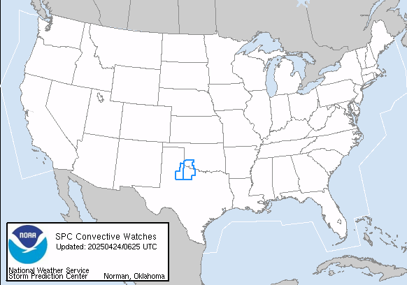
Current tornado watches. This looks like it is auto-updating the map.
 
Last edited:

packyderms_wife

Neither here nor there.
For those of us in western and central Iowa, if you are having connectivity issues, especially with local tv channels or your radio, they’ve cranked the Doppler radar field north of Ankeny, IA, to full throttle. Radar coverage in western Iowa isn’t the best, so be patient.
 

Reasonable Rascal

Veteran Member
Sitting pretty and calmly here at the gun show on the east side of council bluffs.

My brother Works in Omaha and was headed home to Harlan and effectively followed the tornado down i-80. He sent us a picture of minden, iowa. Yes the devastation is severe there.

He sent one picture that shows what appears to be a tree growing out of the inner shoulder along the interstate. And just a bit farther along there is a semi laying on its side in the median. And what looks like vehicle debris caught on the posts for the Guard railing cables that go down the center of the interstate over in that area.

Sorry, but I don't know how to post the pictures on my phone. But they sent some to me that show extremely wide tornado on the ground just west of harlan. They said the reports coming in of houses and Farms that were hit out there.

RR
 

packyderms_wife

Neither here nor there.
Sitting pretty and calmly here at the gun show on the east side of council bluffs.

My brother Works in Omaha and was headed home to Harlan and effectively followed the tornado down i-80. He sent us a picture of minden, iowa. Yes the devastation is severe there.

He sent one picture that shows what appears to be a tree growing out of the inner shoulder along the interstate. And just a bit farther along there is a semi laying on its side in the median. And what looks like vehicle debris caught on the posts for the Guard railing cables that go down the center of the interstate over in that area.

Sorry, but I don't know how to post the pictures on my phone. But they sent some to me that show extremely wide tornado on the ground just west of harlan. They said the reports coming in of houses and Farms that were hit out there.

RR

That tornado was easily a mile and a half wide, with multiple vortices.
 

anna43

Veteran Member
Tornado watch and severe thunderstorm warning here. Area is considered northwest central Iowa. Weather feels extremely creepy like a tornado is going to appear any moment. We're at the north edge of the tornado watch but with a severe thunderstorm warning it can quickly morph into a tornado. Praying no one will die in this outbreak.
 

Meemur

Voice on the Prairie / FJB!
Ed Wilson on ch 13 is concerned that 5he tornado chasers are not properly trained . :xpnd:

The chaser in question is a news anchor, Ellis Johnson, not one of the regular spotters. I'd be a bit concerned, too. I know we make fun of those guys, but it really does take a little bit of experience and attention to the radar to keep safe. I think he's out there alone, although I hope one of the camera guys is along for the ride.
 
Status
Not open for further replies.
Top