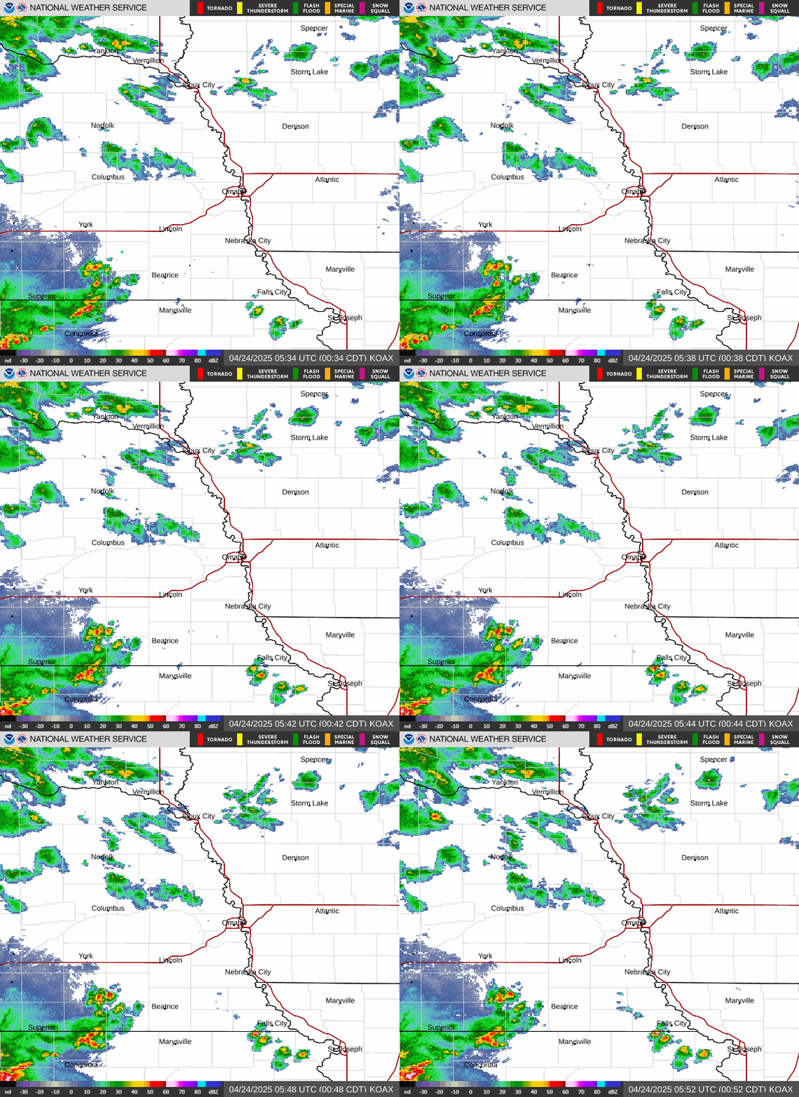
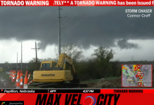
WEATHER Severe Weather the Week of April 22md, 2024 - MODERATE RISK! Saturday 4/27/24

Status
Not open for further replies.

packyderms_wife

Neither here nor there.
Checking in in case power goes out. Its already gusting up here on the bluffs and tore my ziptied solar lantern, blew it into the street

So we have a long evening of radar watch ahead.

Thanks again for all your work on breaking weather news. AM Radio is iffy up here on a good day. Better at night off a low cloud celing.

Hawkeye folks get ready, we're up next.

Where are you located?
 

packyderms_wife

Neither here nor there.
Tornado Warning
NEC025-131-153-262145-
/O.NEW.KOAX.TO.W.0024.240426T2059Z-240426T2145Z/

BULLETIN - EAS ACTIVATION REQUESTED
Tornado Warning
National Weather Service Omaha/Valley Nebraska
359 PM CDT Fri Apr 26 2024

The National Weather Service in Omaha has issued a

* Tornado Warning for...
Southwestern Sarpy County in east central Nebraska...
Northwestern Otoe County in southeastern Nebraska...
Central Cass County in southeastern Nebraska...

* Until 445 PM CDT.

* At 359 PM CDT, a severe thunderstorm capable of producing a tornado
was located 4 miles south of Elmwood, or 19 miles east of Lincoln,
moving northeast at 30 mph.

HAZARD...Tornado.

SOURCE...Radar indicated rotation.

IMPACT...Flying debris will be dangerous to those caught without
shelter. Mobile homes will be damaged or destroyed.
Damage to roofs, windows, and vehicles will occur. Tree
damage is likely.

* This dangerous storm will be near...
Elmwood around 405 PM CDT.
Murdock around 415 PM CDT.

Other locations in the path of this tornadic thunderstorm include
Louisville and Cedar Creek.

PRECAUTIONARY/PREPAREDNESS ACTIONS...

TAKE COVER NOW! Move to a basement or an interior room on the lowest
floor of a sturdy building. Avoid windows. If you are outdoors, in a
mobile home, or in a vehicle, move to the closest substantial shelter
and protect yourself from flying debris.

&&

LAT...LON 4072 9630 4075 9638 4110 9623 4100 9593
TIME...MOT...LOC 2059Z 203DEG 28KT 4077 9631

TORNADO...RADAR INDICATED
MAX HAIL SIZE...<.75 IN

$$

McCoy
 

packyderms_wife

Neither here nor there.
Tornado Warning
NEC037-141-262145-
/O.NEW.KOAX.TO.W.0025.240426T2105Z-240426T2145Z/

BULLETIN - EAS ACTIVATION REQUESTED
Tornado Warning
National Weather Service Omaha/Valley Nebraska
405 PM CDT Fri Apr 26 2024

The National Weather Service in Omaha has issued a

* Tornado Warning for...
Northwestern Colfax County in northeastern Nebraska...
Northeastern Platte County in northeastern Nebraska...

* Until 445 PM CDT.

* At 405 PM CDT, a severe thunderstorm capable of producing a tornado
was located 7 miles north of Lakeview, or 11 miles north of
Columbus, moving north at 25 mph.

HAZARD...Tornado and golf ball size hail.

SOURCE...Radar indicated rotation.

IMPACT...Flying debris will be dangerous to those caught without
shelter. Mobile homes will be damaged or destroyed.
Damage to roofs, windows, and vehicles will occur. Tree
damage is likely.

* This dangerous storm will be near...
Creston around 415 PM CDT.

PRECAUTIONARY/PREPAREDNESS ACTIONS...

TAKE COVER NOW! Move to a basement or an interior room on the lowest
floor of a sturdy building. Avoid windows. If you are outdoors, in a
mobile home, or in a vehicle, move to the closest substantial shelter
and protect yourself from flying debris.

&&

LAT...LON 4175 9739 4174 9715 4151 9734 4154 9745
TIME...MOT...LOC 2105Z 199DEG 20KT 4160 9738

TORNADO...RADAR INDICATED
MAX HAIL SIZE...1.75 IN

$$

Nicolaisen
 

packyderms_wife

Neither here nor there.
Tornado Warning
NEC097-127-131-133-262200-
/O.NEW.KOAX.TO.W.0026.240426T2108Z-240426T2200Z/

BULLETIN - EAS ACTIVATION REQUESTED
Tornado Warning
National Weather Service Omaha/Valley Nebraska
408 PM CDT Fri Apr 26 2024

The National Weather Service in Omaha has issued a

* Tornado Warning for...
Eastern Johnson County in southeastern Nebraska...
Western Nemaha County in southeastern Nebraska...
Southeastern Otoe County in southeastern Nebraska...
Northeastern Pawnee County in southeastern Nebraska...

* Until 500 PM CDT.

* At 408 PM CDT, a severe thunderstorm capable of producing a tornado
was located 4 miles northwest of Table Rock, or 7 miles north of
Pawnee City, moving north at 35 mph.

HAZARD...Tornado and golf ball size hail.

SOURCE...Radar indicated rotation.

IMPACT...Flying debris will be dangerous to those caught without
shelter. Mobile homes will be damaged or destroyed.
Damage to roofs, windows, and vehicles will occur. Tree
damage is likely.

* This dangerous storm will be near...
Elk Creek around 415 PM CDT.

Other locations in the path of this tornadic thunderstorm include
Johnson, Talmage and Lorton.

PRECAUTIONARY/PREPAREDNESS ACTIONS...

TAKE COVER NOW! Move to a basement or an interior room on the lowest
floor of a sturdy building. Avoid windows. If you are outdoors, in a
mobile home, or in a vehicle, move to the closest substantial shelter
and protect yourself from flying debris.

&&

LAT...LON 4016 9606 4018 9626 4063 9615 4062 9581
TIME...MOT...LOC 2108Z 198DEG 29KT 4021 9617

TORNADO...RADAR INDICATED
MAX HAIL SIZE...1.75 IN

$$

BD
 

packyderms_wife

Neither here nor there.
Severe Weather Statement
National Weather Service Omaha/Valley Nebraska
415 PM CDT Fri Apr 26 2024

IAC085-NEC177-262130-
/O.CON.KOAX.TO.W.0022.000000T0000Z-240426T2130Z/
Harrison IA-Washington NE-
415 PM CDT Fri Apr 26 2024

...TORNADO EMERGENCY FOR far southeast and eastern Blair...

...A TORNADO WARNING REMAINS IN EFFECT UNTIL 430 PM CDT FOR
SOUTHWESTERN HARRISON AND CENTRAL WASHINGTON COUNTIES...

At 414 PM CDT, a confirmed large and destructive tornado was located
approximately 3 miles south of Blair, moving northeast at 30 mph.

TORNADO EMERGENCY for far southeast and eastern Blair. This is a
PARTICULARLY DANGEROUS SITUATION. TAKE COVER NOW
!

HAZARD...Deadly tornado.

SOURCE...Emergency management confirmed tornado.

IMPACT...You are in a life-threatening situation. Flying debris may
be deadly to those caught without shelter. Mobile homes
will be destroyed. Considerable damage to homes,
businesses, and vehicles is likely and complete destruction
is possible.

The tornado will be near...
Blair and Modale around 420 PM CDT.

PRECAUTIONARY/PREPAREDNESS ACTIONS...

To repeat, a large, extremely dangerous, and potentially deadly
tornado is on the ground. To protect your life, TAKE COVER NOW! Move
to an interior room on the lowest floor of a sturdy building. Avoid
windows. If in a mobile home, a vehicle or outdoors, move to the
closest substantial shelter and protect yourself from flying debris.

A large and extremely dangerous tornado is on the ground. Take
immediate tornado precautions. This is an emergency situation.

&&

LAT...LON 4150 9596 4151 9599 4149 9602 4148 9601
4144 9607 4146 9616 4152 9621 4170 9611
4170 9608 4172 9608 4158 9585
TIME...MOT...LOC 2114Z 205DEG 27KT 4152 9611

TORNADO...OBSERVED
TORNADO DAMAGE THREAT...CATASTROPHIC
MAX HAIL SIZE...2.00 IN

$$

BLB
 

packyderms_wife

Neither here nor there.
This tornado is now PDS Warned! If you're in it's path get under ground NOW!!!

Tornado Warning
IAC071-129-NEC025-131-262200-
/O.NEW.KOAX.TO.W.0027.240426T2119Z-240426T2200Z/

BULLETIN - EAS ACTIVATION REQUESTED
Tornado Warning
National Weather Service Omaha/Valley Nebraska
419 PM CDT Fri Apr 26 2024

The National Weather Service in Omaha has issued a

* Tornado Warning for...
Northwestern Fremont County in southwestern Iowa...
Western Mills County in southwestern Iowa...
Northeastern Otoe County in southeastern Nebraska...
Eastern Cass County in southeastern Nebraska...


* Until 500 PM CDT.

* At 419 PM CDT, a severe thunderstorm capable of producing a tornado
was located 4 miles south of Union, or 6 miles northwest of
Nebraska City, moving north at 45 mph.

HAZARD...Tornado and golf ball size hail.

SOURCE...Radar indicated rotation.

IMPACT...Flying debris will be dangerous to those caught without
shelter. Mobile homes will be damaged or destroyed.
Damage to roofs, windows, and vehicles will occur. Tree
damage is likely.

* This dangerous storm will be near...
Union around 425 PM CDT.
Murray and Beaver Lake around 430 PM CDT.

Other locations in the path of this tornadic thunderstorm include
Plattsmouth, Pacific Junction and Glenwood.

PRECAUTIONARY/PREPAREDNESS ACTIONS...

TAKE COVER NOW! Move to a basement or an interior room on the lowest
floor of a sturdy building. Avoid windows. If you are outdoors, in a
mobile home, or in a vehicle, move to the closest substantial shelter
and protect yourself from flying debris.

&&

LAT...LON 4064 9584 4070 9607 4106 9593 4106 9588
4108 9587 4112 9586 4115 9588 4115 9554
TIME...MOT...LOC 2119Z 199DEG 40KT 4075 9593

TORNADO...RADAR INDICATED
MAX HAIL SIZE...1.75 IN

$$

Nicolaisen
 

packyderms_wife

Neither here nor there.
Iowa
Tornado Warning
IAC085-262200-
/O.NEW.KOAX.TO.W.0028.240426T2122Z-240426T2200Z/

BULLETIN - EAS ACTIVATION REQUESTED
Tornado Warning
National Weather Service Omaha/Valley Nebraska
422 PM CDT Fri Apr 26 2024

The National Weather Service in Omaha has issued a

* Tornado Warning for...
Western Harrison County in southwestern Iowa...

* Until 500 PM CDT.

* At 422 PM CDT, a confirmed large and extremely dangerous tornado
was located 4 miles east northeast of Blair, moving northeast at
30 mph.

This is a PARTICULARLY DANGEROUS SITUATION. TAKE COVER NOW!

HAZARD...Damaging tornado.

SOURCE...Weather spotters confirmed tornado.

IMPACT...You are in a life-threatening situation. Flying debris
may be deadly to those caught without shelter. Mobile
homes will be destroyed. Considerable damage to homes,
businesses, and vehicles is likely and complete
destruction is possible.

* The tornado will be near...
Modale around 425 PM CDT.
Mondamin around 435 PM CDT.

Other locations in the path of this tornadic thunderstorm include
Pisgah.

PRECAUTIONARY/PREPAREDNESS ACTIONS...

To repeat, a large, extremely dangerous and potentially deadly
tornado is on the ground. To protect your life, TAKE COVER NOW! Move
to a basement or an interior room on the lowest floor of a sturdy
building. Avoid windows. If you are outdoors, in a mobile home, or in
a vehicle, move to the closest substantial shelter and protect
yourself from flying debris.

&&

LAT...LON 4151 9595 4151 9599 4155 9601 4154 9603
4151 9604 4153 9608 4158 9608 4161 9612
4164 9610 4166 9610 4170 9607 4186 9600
4186 9566
TIME...MOT...LOC 2122Z 206DEG 27KT 4157 9606

TORNADO...OBSERVED
TORNADO DAMAGE THREAT...CONSIDERABLE
MAX HAIL SIZE...1.75 IN

$$

BLB
 

packyderms_wife

Neither here nor there.
Nebraska
Tornado Warning
NEC127-133-147-262215-
/O.NEW.KOAX.TO.W.0029.240426T2123Z-240426T2215Z/

BULLETIN - EAS ACTIVATION REQUESTED
Tornado Warning
National Weather Service Omaha/Valley Nebraska
423 PM CDT Fri Apr 26 2024

The National Weather Service in Omaha has issued a

* Tornado Warning for...
Southern Nemaha County in southeastern Nebraska...
Western Richardson County in southeastern Nebraska...
Southeastern Pawnee County in southeastern Nebraska...

* Until 515 PM CDT.

* At 422 PM CDT, a severe thunderstorm capable of producing a tornado
was located 4 miles southwest of Bern, or 6 miles north of Seneca,
moving northeast at 35 mph. A second area of possible rotation in
a storm 6 miles south of Humboldt.

HAZARD...Tornado and hail up to two inches in diameter.

SOURCE...Radar indicated rotation.

IMPACT...Flying debris will be dangerous to those caught without
shelter. Mobile homes will be damaged or destroyed.
Damage to roofs, windows, and vehicles will occur. Tree
damage is likely.

* This dangerous storm will be near...
Du Bois around 430 PM CDT.

Other locations in the path of this tornadic thunderstorm include
Humboldt and Stella.

PRECAUTIONARY/PREPAREDNESS ACTIONS...

TAKE COVER NOW! Move to a basement or an interior room on the lowest
floor of a sturdy building. Avoid windows. If you are outdoors, in a
mobile home, or in a vehicle, move to the closest substantial shelter
and protect yourself from flying debris.

&&

LAT...LON 4046 9589 4045 9564 4043 9564 4042 9566
4034 9562 4031 9566 4031 9564 4032 9561
4030 9558 4000 9582 4000 9613 4001 9613
TIME...MOT...LOC 2122Z 205DEG 31KT 3993 9605

TORNADO...RADAR INDICATED
MAX HAIL SIZE...2.00 IN

$$

BD
 

packyderms_wife

Neither here nor there.
Nebraska

Tornado Warning
NEC037-141-167-262215-
/O.NEW.KOAX.TO.W.0030.240426T2124Z-240426T2215Z/

BULLETIN - EAS ACTIVATION REQUESTED
Tornado Warning
National Weather Service Omaha/Valley Nebraska
424 PM CDT Fri Apr 26 2024

The National Weather Service in Omaha has issued a

* Tornado Warning for...
Northwestern Colfax County in northeastern Nebraska...
Northeastern Platte County in northeastern Nebraska...
Southern Stanton County in northeastern Nebraska...

* Until 515 PM CDT.

* At 424 PM CDT, a confirmed tornado was located near Creston, or 16
miles north of Columbus, moving north at 25 mph.

HAZARD...Damaging tornado and ping pong ball size hail.

SOURCE...Emergency management confirmed tornado.

IMPACT...Flying debris will be dangerous to those caught without
shelter. Mobile homes will be damaged or destroyed.
Damage to roofs, windows, and vehicles will occur. Tree
damage is likely.

* The tornado will be near...
Leigh and Creston around 430 PM CDT.

PRECAUTIONARY/PREPAREDNESS ACTIONS...

To repeat, a tornado is on the ground. TAKE COVER NOW! Move to a
basement or an interior room on the lowest floor of a sturdy
building. Avoid windows. If you are outdoors, in a mobile home, or in
a vehicle, move to the closest substantial shelter and protect
yourself from flying debris.

&&

LAT...LON 4194 9733 4186 9704 4171 9719 4164 9727
4166 9738
TIME...MOT...LOC 2124Z 198DEG 21KT 4168 9733

TORNADO...OBSERVED
MAX HAIL SIZE...1.50 IN

$$

Petersen
 

packyderms_wife

Neither here nor there.
Texas

Tornado Warning
TXC257-467-262200-
/O.NEW.KFWD.TO.W.0016.240426T2120Z-240426T2200Z/

BULLETIN - EAS ACTIVATION REQUESTED
Tornado Warning
National Weather Service Fort Worth TX
420 PM CDT Fri Apr 26 2024

The National Weather Service in Fort Worth has issued a

* Tornado Warning for...
Southeastern Kaufman County in north central Texas...
Southwestern Van Zandt County in north central Texas...

* Until 500 PM CDT.

* At 420 PM CDT, a severe thunderstorm capable of producing a tornado
was located over Kemp, or 9 miles northwest of Gun Barrel City,
moving east at 35 mph.

HAZARD...Tornado.

SOURCE...Radar indicated rotation.

IMPACT...Flying debris will be dangerous to those caught without
shelter. Mobile homes will be damaged or destroyed.
Damage to roofs, windows, and vehicles will occur. Tree
damage is likely.

* This dangerous storm will be near...
Canton around 445 PM CDT.

Other locations impacted by this tornadic thunderstorm include
Prairieville, Myrtle Springs, Whitton, Rand, Becker, Phalba, Tolosa,
Roddy, Jackson, and Wise.

This includes Interstate 20 between mile markers 518 and 527.

PRECAUTIONARY/PREPAREDNESS ACTIONS...

TAKE COVER NOW! Move to an interior room on the lowest floor of a
sturdy building. Avoid windows. If you are outdoors, in a mobile
home, or in a vehicle, move to the closest substantial shelter and
protect yourself from flying debris.

Torrential rainfall is occurring with this storm, and may lead to
flash flooding. Do not drive your vehicle through flooded roadways.

&&

LAT...LON 3236 9625 3250 9628 3269 9584 3236 9584
TIME...MOT...LOC 2120Z 249DEG 29KT 3246 9620

TORNADO...RADAR INDICATED
MAX HAIL SIZE...<.75 IN

$$

Dunn
 

packyderms_wife

Neither here nor there.
oax.png


Iowa

KOAX_loop.gif
 

packyderms_wife

Neither here nor there.
Tornado Warning
IAC155-NEC025-055-153-262215-
/O.NEW.KOAX.TO.W.0031.240426T2126Z-240426T2215Z/

BULLETIN - EAS ACTIVATION REQUESTED
Tornado Warning
National Weather Service Omaha/Valley Nebraska
426 PM CDT Fri Apr 26 2024

The National Weather Service in Omaha has issued a

* Tornado Warning for...
Southwestern Pottawattamie County in southwestern Iowa...
Eastern Sarpy County in east central Nebraska...
Eastern Douglas County in east central Nebraska...
North central Cass County in southeastern Nebraska...

* Until 515 PM CDT.

* At 425 PM CDT, a severe thunderstorm capable of producing a tornado
was located near Louisville, or 11 miles southeast of Gretna,
moving northeast at 35 mph.

HAZARD...Tornado and hail up to two inches in diameter.

SOURCE...Radar indicated rotation.

IMPACT...Flying debris will be dangerous to those caught without
shelter. Mobile homes will be damaged or destroyed.
Damage to roofs, windows, and vehicles will occur. Tree
damage is likely.

* This dangerous storm will be near...
Springfield and Cedar Creek around 430 PM CDT.
Papillion and Walnut Creek Recreation Area around 435 PM CDT.
Eastern Omaha, Bellevue, Ralston, Offutt AFB, La Vista, and
Prairie Queen Recreation Area around 440 PM CDT.
South Omaha around 445 PM CDT.

Other locations in the path of this tornadic thunderstorm include
western Council Bluffs, Midtown, Aksarben, Carter Lake, Benson,
Eppley Airfield and Florence.

PRECAUTIONARY/PREPAREDNESS ACTIONS...

TAKE COVER NOW! Move to a basement or an interior room on the lowest
floor of a sturdy building. Avoid windows. If you are outdoors, in a
mobile home, or in a vehicle, move to the closest substantial shelter
and protect yourself from flying debris.

&&

LAT...LON 4116 9586 4116 9588 4114 9588 4096 9612
4099 9620 4137 9603 4125 9574
TIME...MOT...LOC 2125Z 206DEG 30KT 4101 9612

TORNADO...RADAR INDICATED
MAX HAIL SIZE...2.00 IN

$$

McCoy
 

packyderms_wife

Neither here nor there.
Kansas

Tornado Warning
KSC001-133-205-262230-
/O.NEW.KICT.TO.W.0010.240426T2128Z-240426T2230Z/

BULLETIN - EAS ACTIVATION REQUESTED
Tornado Warning
National Weather Service Wichita KS
428 PM CDT Fri Apr 26 2024

The National Weather Service in Wichita has issued a

* Tornado Warning for...
Northeastern Wilson County in southeastern Kansas...
Northwestern Neosho County in southeastern Kansas...
Southwestern Allen County in southeastern Kansas...

* Until 530 PM CDT.

* At 427 PM CDT, a severe thunderstorm capable of producing a tornado
was located 9 miles west of Chanute, moving east at 20 mph.

HAZARD...Tornado and golf ball size hail.

SOURCE...Radar indicated rotation.

IMPACT...Flying debris will be dangerous to those caught without
shelter. Mobile homes will be damaged or destroyed.
Damage to roofs, windows, and vehicles will occur. Tree
damage is likely.

* This dangerous storm will be near...
Chanute around 440 PM CDT.

Other locations impacted by this tornadic thunderstorm include
Earlton, Petrolia, Benedict, and Chanute Airport.

This tornado warning replaces the previous warnings in effect for
the warned area.

PRECAUTIONARY/PREPAREDNESS ACTIONS...

TAKE COVER NOW! Move to a basement or an interior room on the lowest
floor of a sturdy building. Avoid windows. If you are outdoors, in a
mobile home, or in a vehicle, move to the closest substantial shelter
and protect yourself from flying debris.

&&

LAT...LON 3760 9529 3754 9573 3768 9577 3774 9565
3773 9553 3779 9552 3786 9538
TIME...MOT...LOC 2127Z 250DEG 17KT 3766 9563

TORNADO...RADAR INDICATED
MAX HAIL SIZE...1.75 IN

$$

JAKUB
 

packyderms_wife

Neither here nor there.
Tornado Warning
IAC085-NEC021-177-262215-
/O.NEW.KOAX.TO.W.0032.240426T2134Z-240426T2215Z/

BULLETIN - EAS ACTIVATION REQUESTED
Tornado Warning
National Weather Service Omaha/Valley Nebraska
434 PM CDT Fri Apr 26 2024

The National Weather Service in Omaha has issued a

* Tornado Warning for...
Southwestern Harrison County in southwestern Iowa...
Southeastern Burt County in east central Nebraska...
Central Washington County in east central Nebraska...

* Until 515 PM CDT.

* At 434 PM CDT, a severe thunderstorm capable of producing a tornado
was located 3 miles southwest of Kennard, or 5 miles northwest of
Bennington, moving northeast at 30 mph. A second area of rotation
was located near Kennard, also moving northeast at 30 mph.

HAZARD...Tornado and ping pong ball size hail.

SOURCE...Radar indicated rotation.

IMPACT...Flying debris will be dangerous to those caught without
shelter. Mobile homes will be damaged or destroyed.
Damage to roofs, windows, and vehicles will occur. Tree
damage is likely.

* This dangerous storm will be near...
Blair and Kennard around 440 PM CDT.

PRECAUTIONARY/PREPAREDNESS ACTIONS...

TAKE COVER NOW! Move to a basement or an interior room on the lowest
floor of a sturdy building. Avoid windows. If you are outdoors, in a
mobile home, or in a vehicle, move to the closest substantial shelter
and protect yourself from flying debris.

&&

LAT...LON 4139 9619 4139 9628 4141 9633 4178 9614
4168 9591
TIME...MOT...LOC 2134Z 205DEG 26KT 4144 9623

TORNADO...RADAR INDICATED
MAX HAIL SIZE...1.50 IN

$$

BLB
 

packyderms_wife

Neither here nor there.
Tornado Warning
NEC127-147-262230-
/O.NEW.KOAX.TO.W.0033.240426T2142Z-240426T2230Z/

BULLETIN - EAS ACTIVATION REQUESTED
Tornado Warning
National Weather Service Omaha/Valley Nebraska
442 PM CDT Fri Apr 26 2024

The National Weather Service in Omaha has issued a

* Tornado Warning for...
Southeastern Nemaha County in southeastern Nebraska...
North central Richardson County in southeastern Nebraska...

* Until 530 PM CDT.

* At 442 PM CDT, a severe thunderstorm capable of producing a tornado
was located near Dawson, or 10 miles west of Falls City, moving
northeast at 55 mph.

HAZARD...Tornado and half dollar size hail.

SOURCE...Radar indicated rotation.

IMPACT...Flying debris will be dangerous to those caught without
shelter. Mobile homes will be damaged or destroyed.
Damage to roofs, windows, and vehicles will occur. Tree
damage is likely.

* This tornadic thunderstorm will remain over mainly rural areas of
southeastern Nemaha and north central Richardson Counties,
including the following locations... Indian Cave State Park and
Barada.

PRECAUTIONARY/PREPAREDNESS ACTIONS...

TAKE COVER NOW! Move to a basement or an interior room on the lowest
floor of a sturdy building. Avoid windows. If you are outdoors, in a
mobile home, or in a vehicle, move to the closest substantial shelter
and protect yourself from flying debris.

&&

LAT...LON 4009 9575 4030 9558 4030 9557 4029 9555
4026 9555 4025 9552 4025 9549 4024 9548
4012 9566
TIME...MOT...LOC 2142Z 227DEG 48KT 4010 9579

TORNADO...RADAR INDICATED
MAX HAIL SIZE...1.25 IN

$$

BD
 

packyderms_wife

Neither here nor there.
Tornado Warning
IAC085-155-NEC055-153-177-262245-
/O.NEW.KOAX.TO.W.0034.240426T2154Z-240426T2245Z/

BULLETIN - EAS ACTIVATION REQUESTED
Tornado Warning
National Weather Service Omaha/Valley Nebraska
454 PM CDT Fri Apr 26 2024

The National Weather Service in Omaha has issued a

* Tornado Warning for...
Western Pottawattamie County in southwestern Iowa...
South central Harrison County in southwestern Iowa...
Northern Sarpy County in east central Nebraska...
Southeastern Washington County in east central Nebraska...
Eastern Douglas County in east central Nebraska...

* Until 545 PM CDT.

* At 454 PM CDT, a severe thunderstorm capable of producing a tornado
was located over southeastern Omaha, moving northeast at 35 mph.

HAZARD...Tornado and golf ball size hail.

SOURCE...Radar indicated rotation.

IMPACT...Flying debris will be dangerous to those caught without
shelter. Mobile homes will be damaged or destroyed.
Damage to roofs, windows, and vehicles will occur. Tree
damage is likely.

* This dangerous storm will be near...
Eastern Omaha, northern Council Bluffs, Carter Lake, Crescent, and
Eppley Airfield around 500 PM CDT.

PRECAUTIONARY/PREPAREDNESS ACTIONS...

TAKE COVER NOW! Move to a basement or an interior room on the lowest
floor of a sturdy building. Avoid windows. If you are outdoors, in a
mobile home, or in a vehicle, move to the closest substantial shelter
and protect yourself from flying debris.

&&

LAT...LON 4116 9593 4121 9606 4163 9588 4150 9553
TIME...MOT...LOC 2154Z 208DEG 31KT 4125 9592

TORNADO...RADAR INDICATED
MAX HAIL SIZE...1.75 IN

$$
 

packyderms_wife

Neither here nor there.
Texas
Tornado Warning
TXC467-262215-
/O.NEW.KFWD.TO.W.0017.240426T2148Z-240426T2215Z/

BULLETIN - EAS ACTIVATION REQUESTED
Tornado Warning
National Weather Service Fort Worth TX
448 PM CDT Fri Apr 26 2024

The National Weather Service in Fort Worth has issued a

* Tornado Warning for...
Central Van Zandt County in north central Texas...

* Until 515 PM CDT.

* At 447 PM CDT, a severe thunderstorm capable of producing a tornado
was located over Canton, moving east at 50 mph.

HAZARD...Tornado.

SOURCE...Radar indicated rotation.

IMPACT...Flying debris will be dangerous to those caught without
shelter. Mobile homes will be damaged or destroyed.
Damage to roofs, windows, and vehicles will occur. Tree
damage is likely.

* This tornadic thunderstorm will remain over mainly rural areas of
central Van Zandt County, including the following locations...
Jones, Oakland, Pruitt, and Colfax.

This includes Interstate 20 between mile markers 523 and 538.

PRECAUTIONARY/PREPAREDNESS ACTIONS...

Heavy rainfall may hide this tornado. Do not wait to see or hear the
tornado. TAKE COVER NOW!

Torrential rainfall is occurring with this storm, and may lead to
flash flooding. Do not drive your vehicle through flooded roadways.

&&

LAT...LON 3247 9590 3261 9591 3272 9564 3271 9562
3268 9559 3252 9560
TIME...MOT...LOC 2147Z 250DEG 44KT 3255 9584

TORNADO...RADAR INDICATED
MAX HAIL SIZE...<.75 IN

$$

Dunn
 

packyderms_wife

Neither here nor there.
Iowa
Tornado Warning
IAC085-133-262300-
/O.NEW.KOAX.TO.W.0035.240426T2155Z-240426T2300Z/

BULLETIN - EAS ACTIVATION REQUESTED
Tornado Warning
National Weather Service Omaha/Valley Nebraska
455 PM CDT Fri Apr 26 2024

The National Weather Service in Omaha has issued a

* Tornado Warning for...
Eastern Monona County in west central Iowa...
Northwestern Harrison County in southwestern Iowa...

* Until 600 PM CDT.

* At 455 PM CDT, a severe thunderstorm capable of producing a tornado
was located 4 miles south of Pisgah, or 15 miles east of Tekamah,
moving northeast at 30 mph.

HAZARD...Tornado and golf ball size hail.

SOURCE...Radar indicated rotation.

IMPACT...Flying debris will be dangerous to those caught without
shelter. Mobile homes will be damaged or destroyed.
Damage to roofs, windows, and vehicles will occur. Tree
damage is likely.

* This dangerous storm will be near...
Pisgah around 500 PM CDT.
Moorhead around 510 PM CDT.

Other locations in the path of this tornadic thunderstorm include
Soldier and Ute.

PRECAUTIONARY/PREPAREDNESS ACTIONS...

TAKE COVER NOW! Move to a basement or an interior room on the lowest
floor of a sturdy building. Avoid windows. If you are outdoors, in a
mobile home, or in a vehicle, move to the closest substantial shelter
and protect yourself from flying debris.

&&

LAT...LON 4170 9590 4177 9601 4221 9576 4221 9567
4190 9567
TIME...MOT...LOC 2155Z 208DEG 27KT 4177 9591

TORNADO...RADAR INDICATED
MAX HAIL SIZE...1.75 IN

$$

BLB
 

packyderms_wife

Neither here nor there.
Kansas

Tornado Warning
KSC001-262245-
/O.NEW.KICT.TO.W.0011.240426T2153Z-240426T2245Z/

BULLETIN - EAS ACTIVATION REQUESTED
Tornado Warning
National Weather Service Wichita KS
453 PM CDT Fri Apr 26 2024

The National Weather Service in Wichita has issued a

* Tornado Warning for...
Southeastern Allen County in southeastern Kansas...

* Until 545 PM CDT.

* At 452 PM CDT, a severe thunderstorm capable of producing a tornado
was located 6 miles east of Humboldt, moving northeast at 40 mph.

HAZARD...Tornado and ping pong ball size hail.

SOURCE...Radar indicated rotation.

IMPACT...Flying debris will be dangerous to those caught without
shelter. Mobile homes will be damaged or destroyed.
Damage to roofs, windows, and vehicles will occur. Tree
damage is likely.

* This tornadic thunderstorm will remain over mainly rural areas of
southeastern Allen County, including the following locations...
Elsmore and Savonburg.

PRECAUTIONARY/PREPAREDNESS ACTIONS...

TAKE COVER NOW! Move to a basement or an interior room on the lowest
floor of a sturdy building. Avoid windows. If you are outdoors, in a
mobile home, or in a vehicle, move to the closest substantial shelter
and protect yourself from flying debris.

&&

LAT...LON 3774 9509 3773 9514 3773 9534 3786 9539
3799 9508
TIME...MOT...LOC 2152Z 245DEG 36KT 3778 9533

TORNADO...RADAR INDICATED
MAX HAIL SIZE...1.50 IN

$$

JAKUB
 

packyderms_wife

Neither here nor there.
Tornado Warning
NEC127-147-262245-
/O.NEW.KOAX.TO.W.0037.240426T2159Z-240426T2245Z/

BULLETIN - EAS ACTIVATION REQUESTED
Tornado Warning
National Weather Service Omaha/Valley Nebraska
459 PM CDT Fri Apr 26 2024

The National Weather Service in Omaha has issued a

* Tornado Warning for...
Southeastern Nemaha County in southeastern Nebraska...
Central Richardson County in southeastern Nebraska...

* Until 545 PM CDT.

* At 458 PM CDT, a severe thunderstorm capable of producing a tornado
was located 6 miles north of Sabetha, moving northeast at 50 mph.

HAZARD...Tornado and hail up to two inches in diameter.

SOURCE...Radar indicated rotation.

IMPACT...Flying debris will be dangerous to those caught without
shelter. Mobile homes will be damaged or destroyed.
Damage to roofs, windows, and vehicles will occur. Tree
damage is likely.

* This dangerous storm will be near...
Salem around 505 PM CDT.
Verdon around 510 PM CDT.

PRECAUTIONARY/PREPAREDNESS ACTIONS...

TAKE COVER NOW! Move to a basement or an interior room on the lowest
floor of a sturdy building. Avoid windows. If you are outdoors, in a
mobile home, or in a vehicle, move to the closest substantial shelter
and protect yourself from flying debris.

&&

LAT...LON 4008 9590 4031 9563 4030 9557 4029 9555
4026 9555 4025 9552 4025 9549 4023 9547
4019 9548 4017 9545 4000 9571 4000 9590
TIME...MOT...LOC 2158Z 223DEG 45KT 4000 9584

TORNADO...RADAR INDICATED
MAX HAIL SIZE...2.00 IN

$$

BD
 

packyderms_wife

Neither here nor there.
Iowa

Tornado Warning
IAC129-155-262300-
/O.NEW.KOAX.TO.W.0038.240426T2159Z-240426T2300Z/

BULLETIN - EAS ACTIVATION REQUESTED
Tornado Warning
National Weather Service Omaha/Valley Nebraska
459 PM CDT Fri Apr 26 2024

The National Weather Service in Omaha has issued a

* Tornado Warning for...
Northwestern Mills County in southwestern Iowa...
Central Pottawattamie County in southwestern Iowa...

* Until 600 PM CDT.

* At 458 PM CDT, a confirmed tornado was located 3 miles northwest
of Glenwood, or 7 miles southeast of Offutt AFB, near I-29, moving
north at 45 mph.

HAZARD...Damaging tornado and ping pong ball size hail.

SOURCE...Weather spotters confirmed tornado.

IMPACT...Flying debris will be dangerous to those caught without
shelter. Mobile homes will be damaged or destroyed.
Damage to roofs, windows, and vehicles will occur. Tree
damage is likely.

* The tornado will be near...
East Council Bluffs Airport around 510 PM CDT.
Treynor around 515 PM CDT.

Other locations in the path of this tornadic thunderstorm include
Underwood, Neola and Minden.

PRECAUTIONARY/PREPAREDNESS ACTIONS...

To repeat, a tornado is on the ground. TAKE COVER NOW! Move to a
basement or an interior room on the lowest floor of a sturdy
building. Avoid windows. If you are outdoors, in a mobile home, or in
a vehicle, move to the closest substantial shelter and protect
yourself from flying debris.

&&

LAT...LON 4100 9578 4105 9585 4151 9568 4150 9541
TIME...MOT...LOC 2158Z 201DEG 38KT 4107 9579

TORNADO...OBSERVED
MAX HAIL SIZE...1.50 IN

$$

BLB
 
Status
Not open for further replies.
Top